|
| The roadways of Interstate 70 separate beyond Exit 190 and Wilder Gulch. Waters of the West Tenmile Creek flow between the two directions. 08/11/16 |
|
| Jacque Peak, Tucker Mountain and Copper Mountain rise to the south as the freeway gradually turns east toward Wheeler Flats. 08/11/16 |
|
| Interstate 70 lowers over 900 feet in elevation from Vail Pass Summit to Exit 195. 08/11/16 |
|
| Semi trucks are directed to use Exit 195 during closures of Interstate 70 east to the Eisenhower Tunnel due to inclement weather. 08/11/16 |
|
| SH 91 concludes a 22.61 mile route north from Leadville at Interstate 70 at Exit 195. 08/11/16 |
|
| Copper Mountain ski resort lies south of I-70 and west of SH 91 at Exit 195. 08/11/16 |
|
| A chain station lines the eastbound lanes just after the trumpet interchange (Exit 195) with SH 91 south. 08/11/16 |
|
| Heading south from Exit 195, SH 91 travels between Tenmile and Gore Ranges to Lake County and Fremont Pass. The state highway follows the East Fork of the Arkansas River southwest around Prospect Mountain to end at U.S. 24. 08/11/16 |
|
| Variable speed limits are in use along I-70 from Copper Mountain northeast to the Eisenhower Tunnel. 08/11/16 |
|
| Motorists pass by this confirming marker for I-70 east beside the Curtain Ponds. 08/11/16 |
|
| Interstate 70 parallels Tenmile Creek northward six miles into Frisco. Silverthorne, located ten miles to the north, is located at the north end of Dillon Reservoir. 08/11/16 |
|
| The freeway makes a series of S-curves northward through a valley along the Tenmile Range. 08/11/16 |
|
| A diamond interchange (Exit 198) serves recreation areas at Officers Gulch in one half mile. 08/11/16 |
|
| Out of view just west of Exit 198 is Officers Gulf Pond and a short frontage road north to a trail for Uneva Lake. 08/11/16 |
|
| Interstate 70 continues northward by Tenmile Peak toward the first of two exits for the town of Frisco. 08/11/16 |
|
| Gradually lowering from 9,439 feet above sea level at the Officers Gulch interchange, I-70 circles around a 10,062 foot hill at milepost 199. 08/11/16 |
|
| Wichita Mountain comes into view on this S-curve preceding Frisco. The freeway is 9,202 feet above sea level just ahead. 08/11/16 |
|
| Main Street stems east from forthcoming Exit 201 to the Frisco town center. 08/11/16 |
|
| Main Street provides a cut off to SH 9 south from Frisco to the town of Breckenridge and Breckenridge ski area. 08/11/16 |
|
| Main Street east and SH 9 (Summit Boulevard) north were formerly a part of Business Loop I-70 (Route 070J). Main Street is locally maintained. 08/11/16 |
|
| Travelers along I-70 east enter the diamond interchange (Exit 201) with Main Street in Frisco. SH 9 circumvents Ophir Mountain south from Main Street in Frisco 5.4 miles to the Breckenridge town limits. 08/11/16 |
|
| SH 9 (Summit Boulevard) extends 1.1 miles north from Main Street in Frisco to a dumbbell interchange (Exit 203) with Interstate 70. 08/11/16 |
|
| 2015 traffic counts range from 27,000 vehicles per day (vpd) at Copper Mountain to 28,000 vpd at Frisco. 08/11/16 |
|
| The Williams Fork Mountains rise on the northern horizon, foreshadowing the climb along Interstate 70 east to the Eisenhower Tunnel. 08/11/16 |
|
| Home to over 2,500, Frisco is a popular destination for skiers due to its close proximity to several area resorts and I-70. The community lies at the west end of Dillon Reservoir off Frisco Bay. 08/11/16 |
|
| SH 9 travels 97.23 miles from Exit 203 to Breckenridge, Fairplay, Hartsel and U.S. 50 near Canon City. Dillon Dam Road stems east from Summit Boulevard nearby as the old alignment of U.S. 6 along Gilberson Bay to Dillon. 08/11/16 |
|
| Scenic overlooks line both directions of Interstate 70 at milepost 203. 08/11/16 |
|
| With increasing traffic to Denver, ramp meters operate at the eastbound entrance ramp to Interstate 70 from SH 9 in Frisco. 08/11/16 |
|
| The scenic area provides a stopping point to gaze eastward at Dillon Reservoir and the Rocky Mountains. The reservoir was formed by construction of an earthen dam on the Blue River between 1961 and 1963.1 08/11/16 |
|
| SH 9 overlaps with Interstate 70 east to the succeeding exit in Silverthorne. Travelers continuing east on the freeway reach the next rest area in 24 miles. 08/11/16 |
|
| U.S. 6 emerges from I-70 at Exit 205. Segment F of U.S. 6 measures 21.24 miles in length as it circles south through Dillon and east to Loveland Pass and I-70 at Exit 216. 08/11/16 |
|
| East from Dillon, U.S. 6 passes by both Keystone and Arapaho Basin ski areas en route to Loveland Pass. 08/11/16 |
|
| Over height trucks heading east to Denver must navigate U.S. 6 along its winding course across Loveland Pass. 08/11/16 |
|
| Interstate 70 briefly enters the Silverthorne town limits at the 1971-bridges across Stephens Way and the Blue River. 08/11/16 |
|
| A two lane off-ramp leads SH 9 north and U.S. 6 east away from Interstate 70 east at Exit 205. SH 9 follows Blue River Parkway north from the diamond interchange to the Silverthorne town center. The state highway ventures 38.39 miles north to U.S. 40 at Kremmling. 08/11/16 |
|
| Interstate 70 gains a truck climbing lane from Silverthorne to the truck brake check station at the Eisenhower Tunnel. 08/11/16 |
|
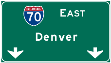
| The Clear Creek County seat of Georgetown is the next destination along Interstate 70 east in 21 miles. Denver is 67 miles away. 08/11/16 |
|
| The Colorado Department of Transportation (CDOT) meters traffic at the Eisenhower Tunnel when volume exceeds capacity, or when an accident or inclement weather brings traffic to a standstill. Due to the lack of shoulders within the tunnel system, drivers may be halted for 15 to 20 minutes as traffic further ahead clears. This scenario takes place to keep traffic moving, so that emergency vehicles can respond to incidents.2 08/11/16 |
|
| Interstate 70 ascends above 9,000 feet above sea level after milepost 207. 08/11/16 |
|
| Continuing east alongside Straight Creek and north of Tenderfoot Mountain, I-70 climbs to 10,000 feet by milepost 210.50. 08/11/16 |
|
| Turning more east, I-70 passes south of Hamilton Gulch. 08/11/16 |
|
| The truck climbing lane ends just ahead of the truck brake check station. The station was formerly signed as a parking area. It also provides a place for motorists to pull off in case of overheating. 08/11/16 |
|
| The left lane restriction for commercial trucks concludes as Interstate 70 reduces to two eastbound lanes. 08/11/16 |
|
| Brake Check stations line both sides of Interstate 70 by the west portal of the Eisenhower Tunnel. A restricted access road links the two above the tunnel entrance. 08/11/16 |
|
| CDOT implements continuous flow metering during periods of heavy traffic at the Eisenhower Tunnel. When necessary, traffic signals will regulate traffic by alternating four lanes of traffic in four to eight second cycles.2 08/11/16 |
|
| A second set of signals operate at the Eisenhower Tunnel truck brake check station exit, and for Hazmat based transporters reentering Interstate 70 east under escort. 08/11/16 |
|
| Officially named the Dwight Eisenhower - Edwin C. Johnson Memorial Tunnel, the Eisenhower Tunnel is the highest point on any part of the Interstate highway system at 11,158 feet above sea level. 08/11/16 |
|
| The eastbound tunnel is named after Edwin C. Johnson, who served as Governor of Colorado and in the U.S. Senate. The older westbound tunnel was originally known as the Straight Creek Tunnel. It was renamed for President Dwight Eisenhower.3 08/11/16 |
|
| The 8,941 foot long Eisenhower Tunnel opened initially with two lanes on March 8, 1973. Construction on the second (eastbound) bore commenced on August 18, 1975. The $102.8 million project was completed in 1979.3 08/11/16 |
|
| Speed limits are set at 50 miles per hour during optimal travel conditions through the Eisenhower Tunnel. 08/11/16 |
|
| Travelers along Interstate 70 east cross the Clear Creek County line, which follows the Continental Divide, a half mile into the Eisenhower Tunnel. 08/11/16 |
|
| The Eisenhower Tunnel accommodates four lanes of traffic on 13 foot lanes without shoulders. A two and a half foot walkway accompanies each bore. The vertical clearance is just 13 feet, 11 inches due to the low ceiling of the exhaust system and various lane control signals and dynamic message signs.3 08/11/16 |
|
| Interstate 70 gradually lowers through the Eisenhower Tunnel, exiting the east portal at 11,013 feet above sea level.3 32,000 vpd used the tunnel on average in 2015. 08/11/16 |
Page Updated 04-07-2017.


 East
East


 North
North