|
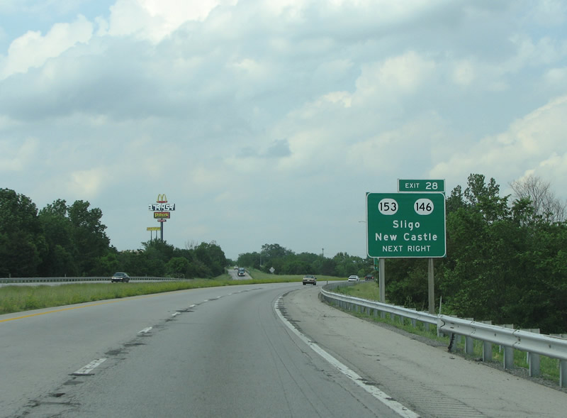
| I-71 meets KY 153 as the first interchange in Henry County. To this point, the road opened in 1969. After KY 153 it was open in the early 70s. 06/04/08 |
|
| KY 153 runs north to US 42 and the community of Pendletown. To the south, it continues south to Smithfield. 06/04/08 |
|
| This distance sign points to the next population center at Bedford. 06/04/08 |
|
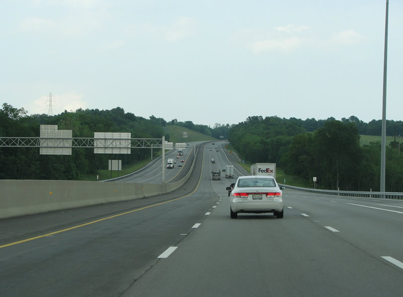
| US 421 is the next exit. US 421 runs 941 miles from Lake Michigan to the Atlantic Ocean. Northbound traffic will get a bridge on the Ohio River into Indiana from here, one of two crossings between Louisville and Cincinnati. 06/04/08 |
|
| Immediately east of I-71 along US 421 and KY 55 is the town of Campbellsburg, which has about 700 residents. 06/04/08 |
|
| I-71 crosses into Trimble County for only a few hundred feet. The county sits along the Ohio River and has about 8,100 inhabitants. 06/04/08 |
|
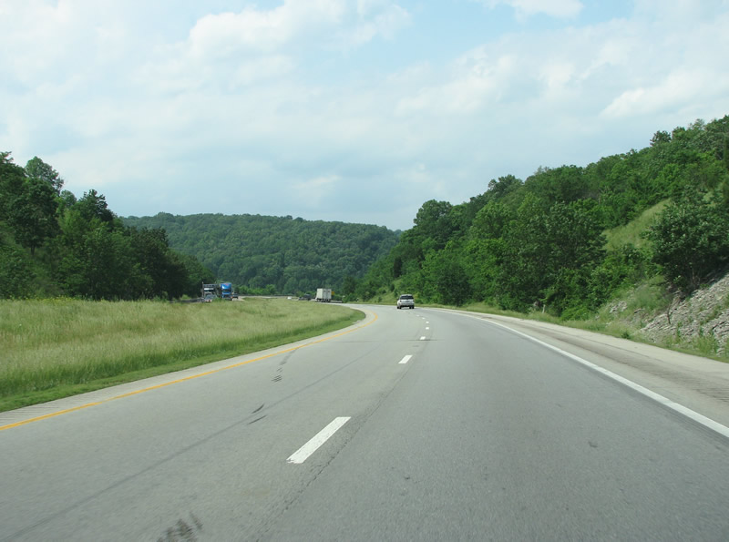
| As this view indicates, eastern Trimble County is hilly. 06/04/08 |
|
| Carroll County comes after Trimble, and also sits along the river. The county was founded in 1838 and honors Charles Carroll, the last living signer of the Declaration of Independence. 06/04/08 |
|
| Carroll County is hilly with beautiful vistas to each side of the freeway. 06/04/08 |
|
| KY 389 is the first exit in Carroll County and sits just west of the Kentucky River. KY 389 runs along the river north to the town of Carrollton, the county seat. Southbound motorists will find great views and eventually, KY 22. 06/04/08 |
|
| Take KY 389 here to get to Prestonville and English, both small rural settlements in the hills. 06/04/08 |
|
| I-71 runs through an extensive series of knobs and canyons cut by the Kentucky River through this area. The Kentucky River drains much of the eastern portion of the state and runs through Frankfort, the capital, just to the south. The scenery is dramatic and provides for an interesting drive. 06/04/08 |
|
| Just after the Kentucky River, I-71 has an exit at KY 227. Carroll County was the site of one of the deadliest bus crashes in US history. The crash occurred May 14, 1988 when a drunk driver drove the wrong way down I-71 and collided with a bus resulting in the deaths of 27 people. 06/04/08 |
|
| Warsaw, on the Ohio River, is shown here as being just 18 miles up the road. The town sits along US 42. 06/04/08 |
|
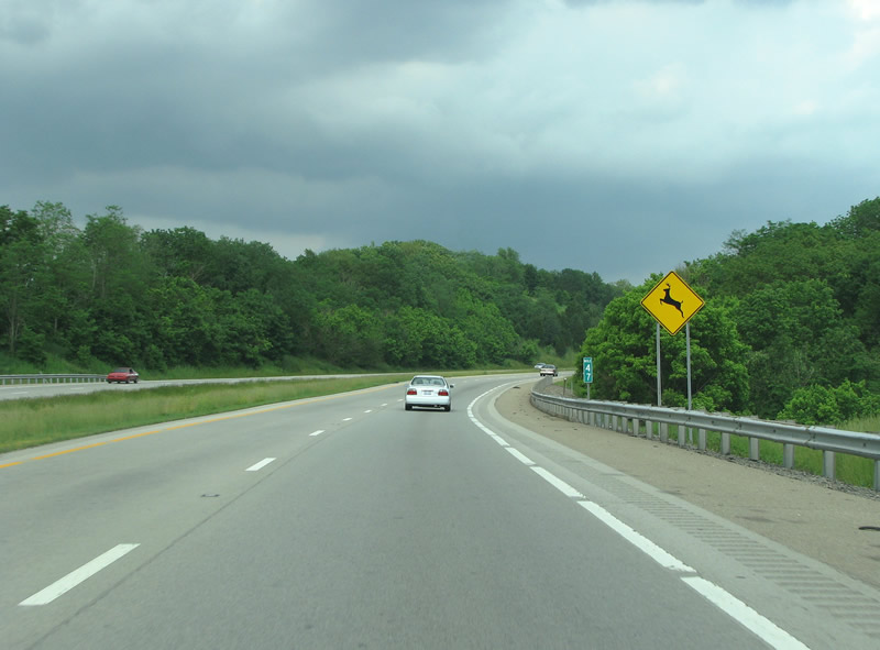
| I-71 has a lot of deer warning signs. The road has a reputation for being deadly to both deer and people after dark. 06/04/08 |
|
| Gallatin County, formed in 1799, was named for early statesman Albert Gallatin. 06/04/08 |
|
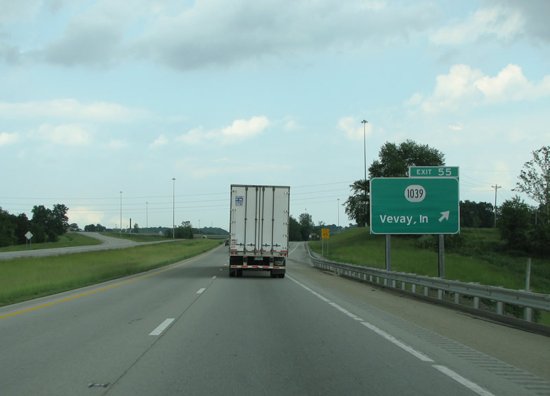
| KY 1039 is a short connector route from the interstate up to the Ohio River and over it to Vevay, Indiana. Vevay was founded by Swiss immigrants who named it after their hometown of Vevey, Switzerland. The town has a reputation as being a fine wine producing area. When Switzerland County was formed in 1814 Vevay was named the county seat. 06/04/08 |
|
| KY 1039 is the next exit, and is a newer exit meant to serve the Kentucky Speedway. The speedway is a 1.5 mile NASCAR track that sees such races as the KY 300 and the Quaker State 400. 06/04/08 |
|
| KY 35 ends 7 miles north at Warsaw, the county seat, and the Ohio River. The state route continues south 6.3 miles from here to US 127. 06/04/08 |
|
| A $23 million project reconstructing the bridges of I-71 over KY 35 was undertaken in 2006/07. I-71 was widened to three lanes at the KY 35 interchange and for 3.2 miles north of the junction. In 2004, KY 35's southbound exit ramp from I-71 was widened to two lanes. This was done to ease traffic before and after NASCAR races at the adjacent speedway. The Kentucky Speedway sits about halfway between Cincinnati and Louisville, and 70 miles north of Lexington. 06/04/08 |
|
| I-71 marks the northern end of Kentucky's Golden Triangle, an area which contains over 50% of the state's population but less than a quarter of its land area. 06/04/08 |
|
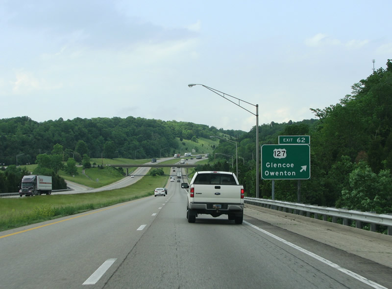
| US 127 is an important route through Kentucky, and runs from the Ohio River south to Tennessee and eventually to Chattanooga. The US route runs north into Michigan where it forms an important north/south artery and is a freeway in several locations. 06/04/08 |
|
| Owen County and the town of Glencoe sit just south of the junction at US 127, however Owen County never touches I-71. County collectors must exit here and drive a scant 2 miles south. Glencoe has about 250 people and started as a stop on the (now CSX) railroad. 06/04/08 |
|
| I-71 remains stunning and green throughout eastern Gallatin County. Grant County comes within a few hundred feet of the interstate through here, but never reaches it. 06/04/08 |
|
| Boone County is the first encountered in the Cincinnati metropolitan area. The county was named for Daniel Boone and has about 115,000 people. It contains the Cincinnati/Northern Kentucky International Airport, and as a result at least half of the rental cars in the state have Boone County plates. 06/04/08 |
|
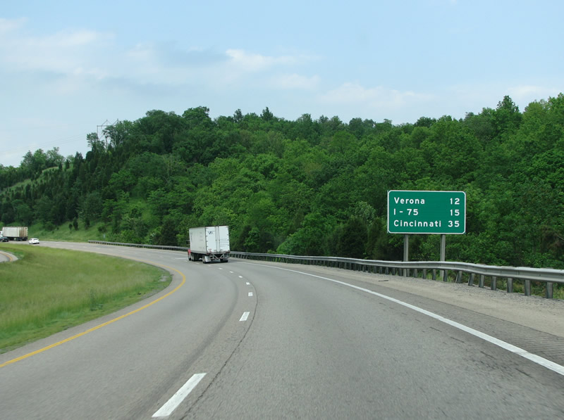
| Verona, reached by KY 14, is the first town reached in Boone County. Cincinnati's sprawl means that new housing developments are being constructed even way out here. 06/04/08 |
|
| Verona was settled by a huge influx of Irish immigrants fleeing the potato famine in their country. Irish laborers constructed many old stone fences that are still seen today. KY 14 is the only Boone County exit before I-75 is encountered. 06/04/08 |
|
| From this sign, it is only four more miles to I-75. 06/04/08 |
|
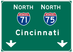
| I-75 meets I-71 at its second interstate multiplex in Kentucky, the other one is further south in the Lexington area where I-64 and I-75 have an overlap. 06/04/08 |
|
| I-75 and I-71 meet at a trumpet interchange. I-71's northbound lanes remain at two until merging with I-75 when the merge lanes reduce it down. 06/04/08 |
|
| Kentucky's Transportation Cabinet set out a goal in the 1990s to widen I-75 to at least six lanes from Lexington to Cincinnati. In May of 2000, a $29 million project was completed that saw the interstate widened from two to eight lanes from this point where I-71 hits to the Richwood exit a few miles north. The roadwork had started in the summer of 1998. 06/04/08 |
Page Updated 03-11-2012.

 North
North