|
| State named shields for I-64/75 north posted by 2010. Interstate 75 has overlaps with I-85, I-40, I-64, and I-71 along its 1,786 mile long course, Interstate 64 also combines with I-55, I-57, I-75, I-77, I-81 and I-95. 11/03/11 |
|
| The first of two interchanges along the I-64/75 overlap joins the freeway with U.S. 27/68 (Broadway / Paris Pike) at Exit 113. I-64/75 was widened to six lanes in 2001-2002. 05/01/05 |
|
| The University of Kentucky put Lexington on the map, it was founded in 1865. Rupp Arena is home to the UK Men's Basketball team in addition to many concerts and entertainment shows. Lexington is also home to Transylvania University, a liberal arts college. 05/01/05 |
|
| US 27 largely follows I-75 from Florida to Michigan, and Lexington is no exception. US 68 is a relatively short US highway that runs from US 62 in Western Kentucky to I-75 in Findlay, Ohio. 11/03/11 |
|
| A CSX Railroad line parallels U.S. 27/68 through east Lexington, necessitating a folded diamond interchange with I-64/75 at Exit 113. U.S. 27/68 north share pavement 13 miles northeast from I-64/75 to Paris and southwest into downtown Lexington. 05/01/05 |
|
| I-64/75 was completed through Lexington on November 25, 1963 when the road opened from US 62 at Georgetown to Ironworks Pike on the north side of Lexington. 11/03/11 |
|
| Hard to read and rather nondescript is the general norm of Kentucky Parkway trailblazers used throughout the state. Signs for the Bluegrass Parkway are no exception. This sign is posted ahead of the Exit 115 parclo interchange. 11/03/11 |
|
| One mile southeast of the Exit 115 off-ramp to KY 922 (Newtown Pike) at the KY 353 (Russell Cave Road) overpass. KY 922 represents the last Lexington exit. 11/03/11 |
|
| KY 922 runs south to New Circle Road, Lexington's partial freeway loop. The Bluegrass Parkway forms an important limited access route west to Bardstown, Interstate 65 and Elizabethtown. It begins near Versailles from U.S. 60 six miles west of New Circle Road. 11/03/11 |
|
| KY 922 (Newtown Pike) provides a four lane route to KY 4 (New Circle Road). The junction with New Circle road is where the expressway began life in 1951, and headed east, however the interchange dates from 1964. Newtown Pike was extended into downtown Lexington in 2003, diffusing a long time traffic snarl. 11/03/11 |
|
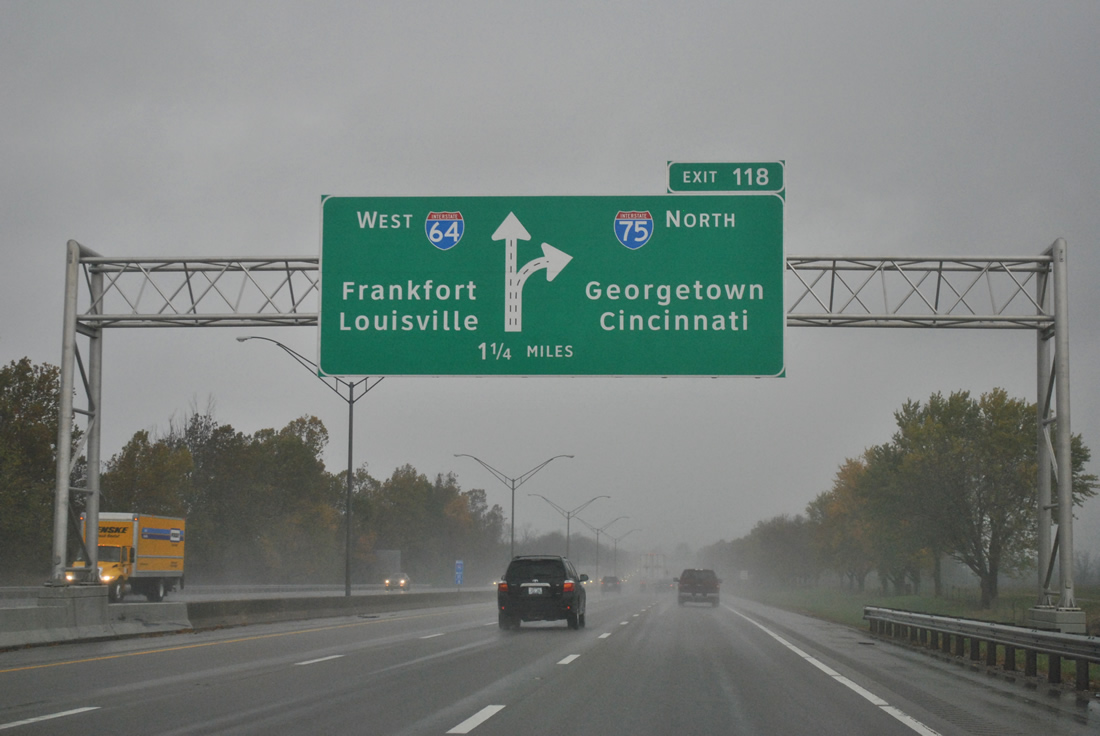
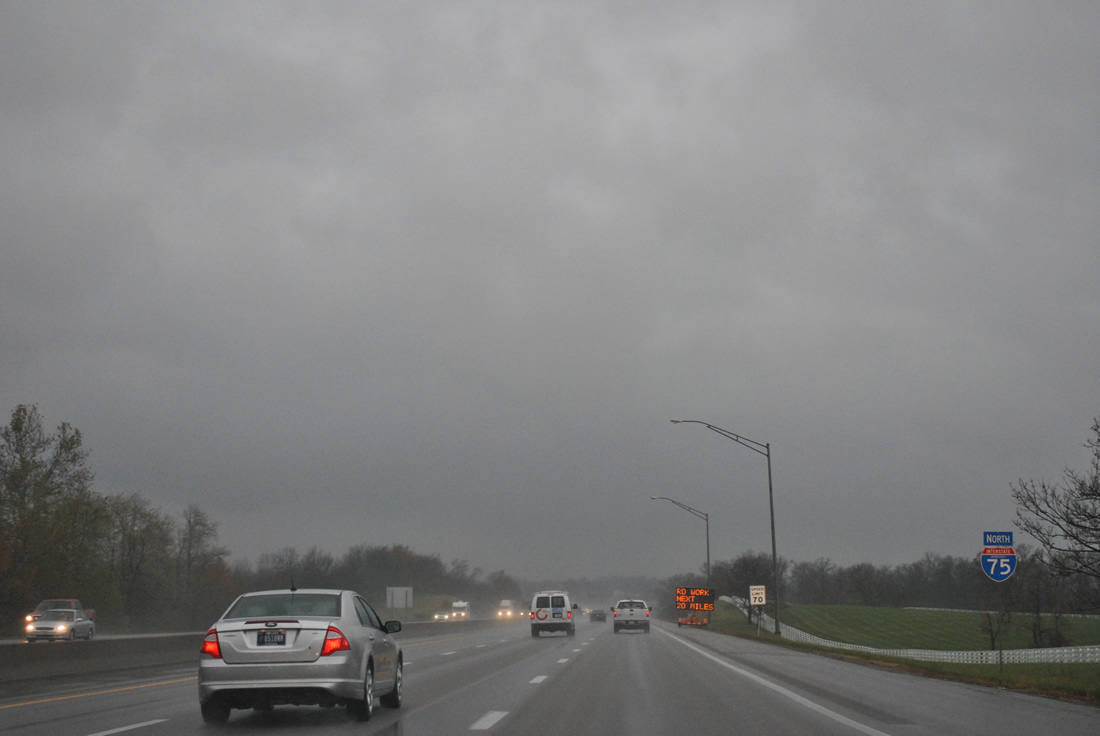
| The final shield assembly posted along the 6.3 mile concurrency of I-64/75 north. All signs leading to the Exit 118 split were replaced with Clearview-font based panels by 2010. 11/03/11 |
|
| I-64 west to Frankfort and I-75 north to Georgetown form sides of Kentucky's "Golden Triangle". 11/03/11 |
|
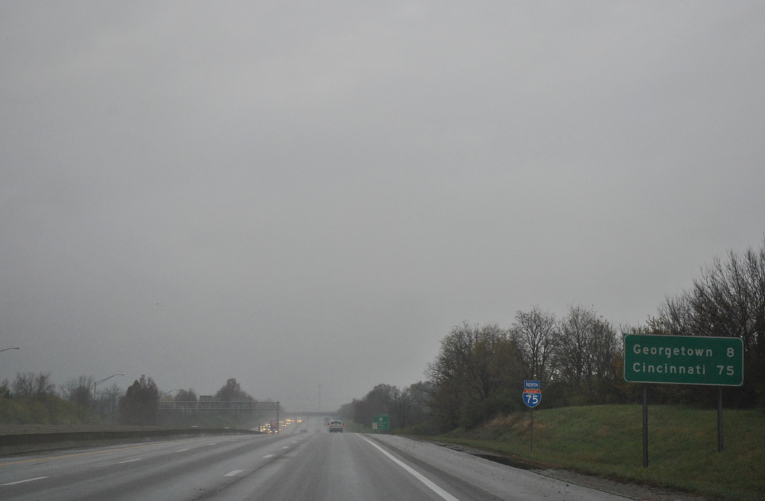
| I-64/75 separate at a wide trumpet interchange. Interstate 64 travels 20 miles to Kentucky's capital city and 70 miles to Kentucky's largest city. Interstate 75 meets Georgetown at the next two exits on the 74 miles to Cincinnati. 11/03/11 |
|
| Interstate 64 runs west through northern reaches of bourbon country between Lexington and Frankfort. Many distilleries are located in the region between Lexington and Bardstown referenced as the Bourbon Trail.
Kentucky Horse Park lies north off of the succeeding exit from Interstate 75. 11/03/11 |
|
| U.S. 25 (Georgetown Road) crosses the exchange at Exit 118 where I-64/75 split. Interstate 75 was completed through Kentucky on December 5, 1969 with a stretch from London to Mount Vernon. I-75 is referred to in Lexington as "Kentucky's Main Street". 11/03/11 |
|
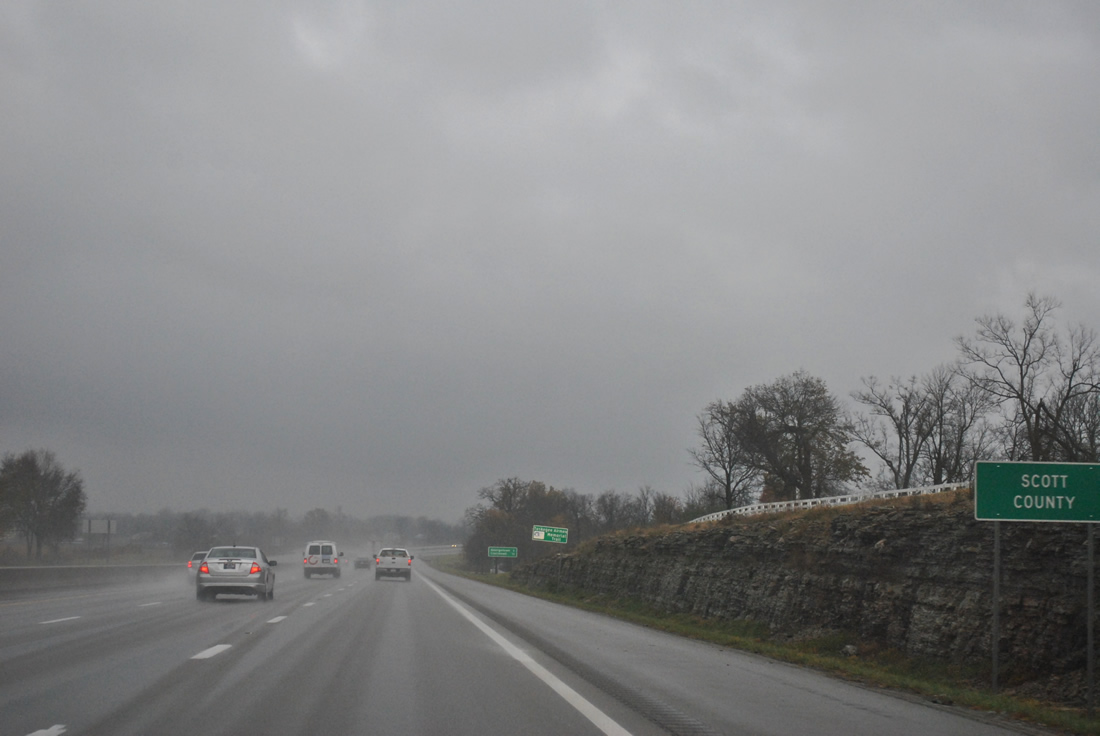
| Leaving the Lexington area, Interstate 75 continues eight miles to the Scott County seat of Georgetown and 75 miles to Cincinnati, Ohio. 11/03/11 |
|
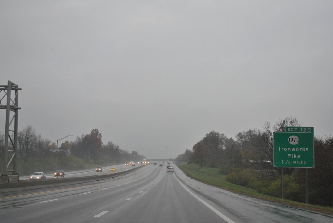
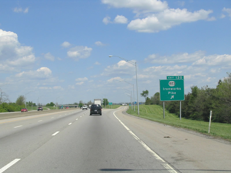
| KY 1973 (Ironworks Pike) ties Interstate 75 in with adjacent U.S. 25 (Georgetown Road) at Exit 120. Exit 120 serves the adjacent Kentucky Horse Park. 11/03/11 |
|
| Interstate 75 veers east and bypasses Georgetown. Exit 120 provides a route to the south side of the growing bedroom community via U.S. 25 north to U.S. 62 & 460 Bypass (McClelland Circle). KY 1973 (Ironworks Pike) otherwise continues southeast to U.S. 27/68 (Paris Pike). 05/01/05 |
|
| Kentucky Horse Park lines the eastern frontage of Interstate 75 as the freeway exits Fayette County for Scott County. 11/03/11 |
|
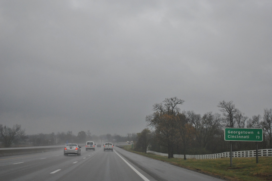
| Georgetown lies six miles north and is served by two of the four interchanges within Scott County. Cincinnati is just over an hour's drive away. 11/03/11 |
|
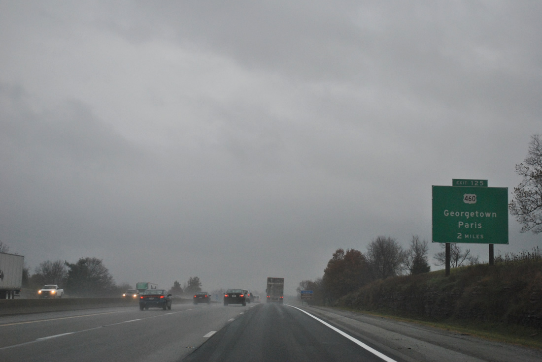
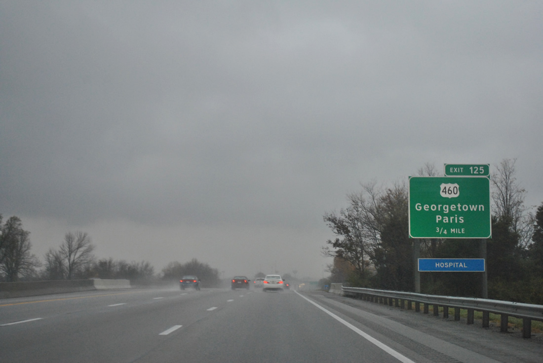
| U.S. 460 (Paris Pike) meets Interstate 75 at a half diamond interchange (Exit 125) in two miles. The US Highway follows Main Street west into the downtown Georgetown, joining the county seat with Newtown, Centerville and Paris to the east. 11/03/11 |
|
| U.S. 460 west from Paris to Georgetown travels a portion of what was U.S. 227. U.S. 227 traveled in an arc south to Richmond (via KY 627 from Paris) and northwest to Carrollton (via KY 227 from Great Crossing). 11/03/11 |
|
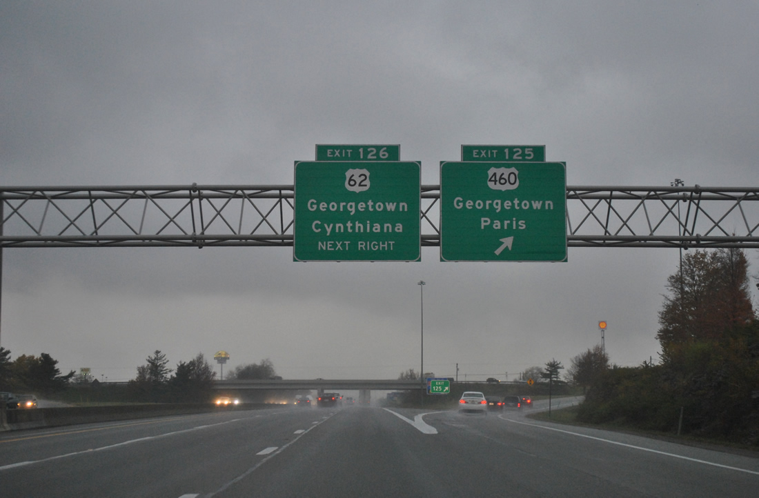
| Exit 125 leaves Interstate 75 north for U.S. 460 (Paris Pike). Much of the area surrounding both Exit 125 and the adjacent Exit 126 diamond interchange is built up with retail and cookie cutter subdivisions. U.S. 460 and U.S. 62 intersect nearby at McClelland Circle otherwise, with McClelland Circle carrying both U.S. 62 and U.S. 460 Bypass around the south side of Georgetown. 11/03/11 |
|
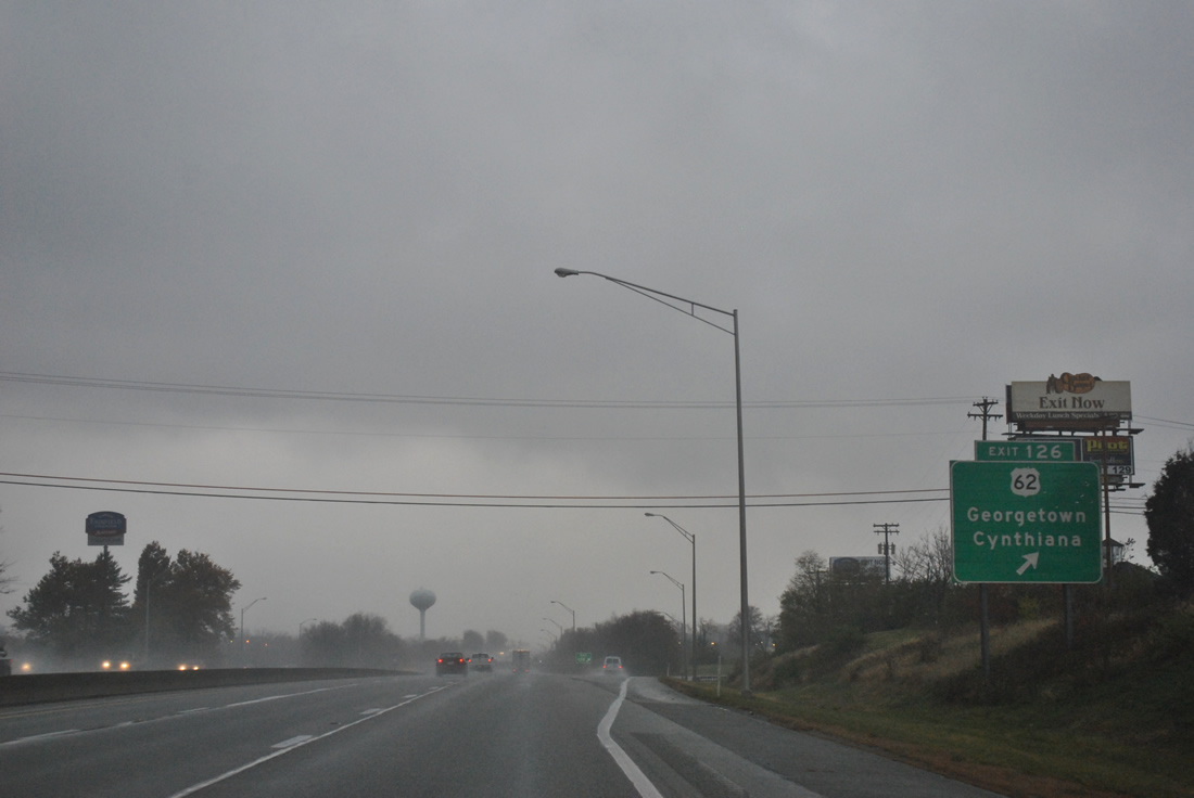
| Travelers bound for U.S. 62 (Cherry Blossom Way) north to Oxford, Leesburg and the Harrison County seat of Cynthiana depart Interstate 75 next. U.S. 62 continues northeast from Cynthiana toward Maysville and the Ohio River bridge to Aberdeen, Ohio and overall to Niagara Falls, New York. 11/03/11 |
|
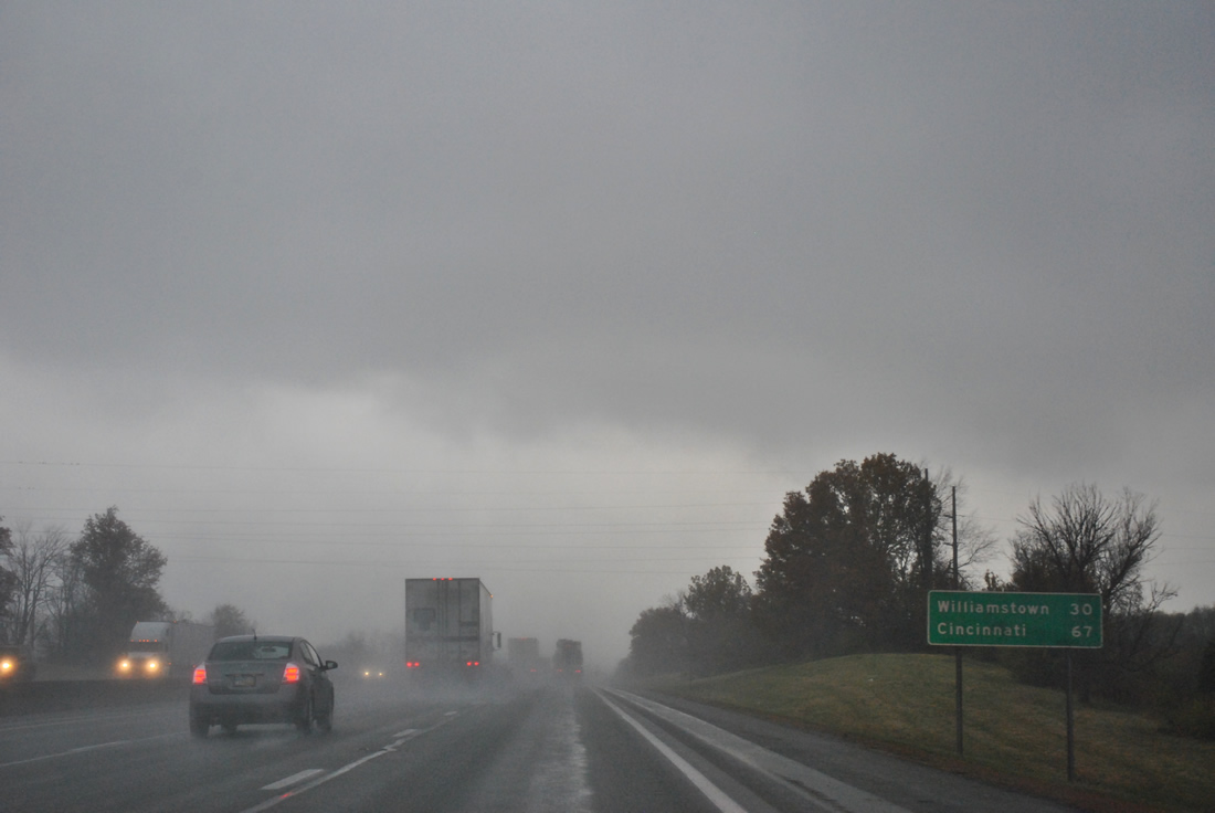
| Williamstown, the seat of Grant County, is the next city along Interstate 75 northbound in 30 miles. The Queen City follows in 67 miles. 11/03/11 |
|
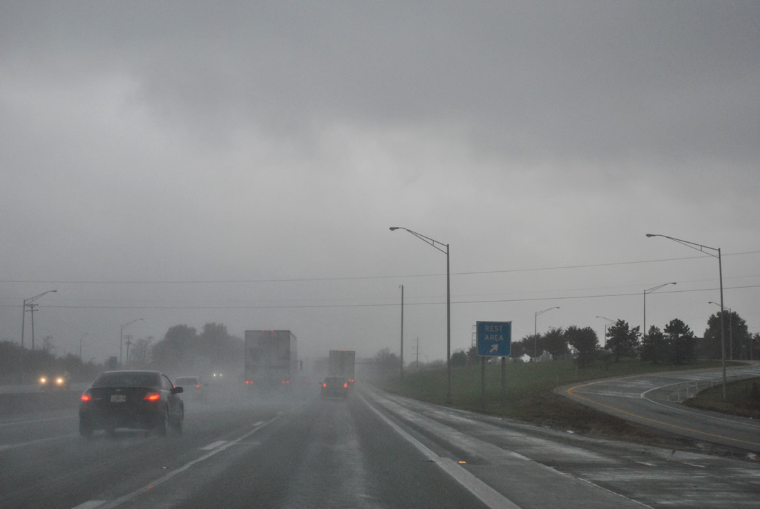
| A set of rest areas reside along Interstate 75 just west of the Georgetown Toyota Plant off of U.S. 62 (Cherry Blossom Way). 11/03/11 |
|
| KY 620 continues Cherry Blossom Way westward from KY 3487, which links U.S. 62 with KY 620 along the east side of the Toyota plant. Cherry Blossom Way constitutes a multi-lane arterial encircling the manufacturing plant between Delaplain and Georgetown. 11/03/11 |
|
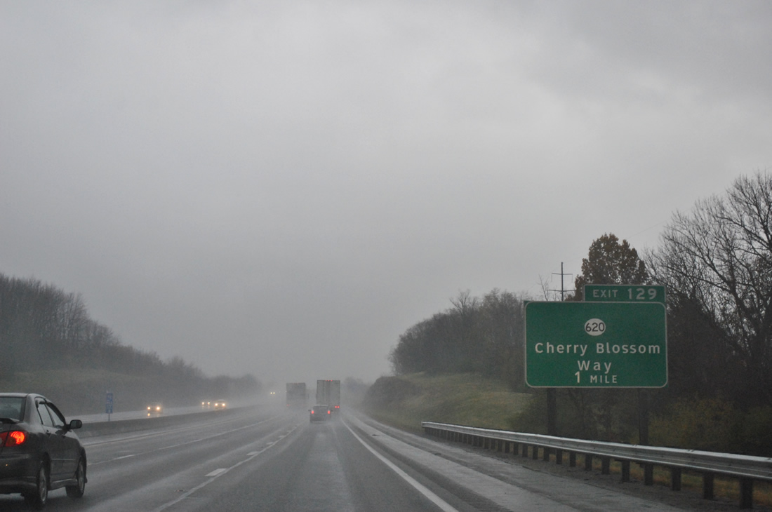
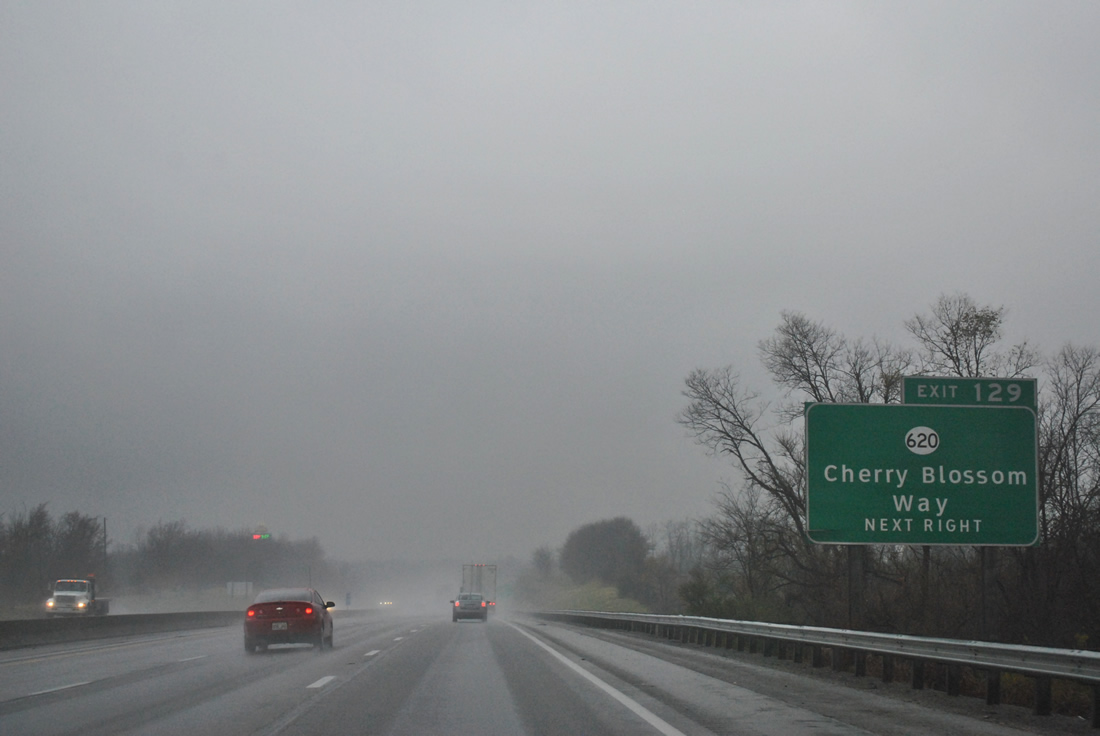
| One mile south of the Exit 129 diamond interchange with KY 620 (Cherry Blossom Way). KY 620 totals 19.05 miles in a loop beginning at KY 3487 nearby and leading northwest to Biddle and east to Double Culvert and Turkey Foot. 11/03/11 |
|
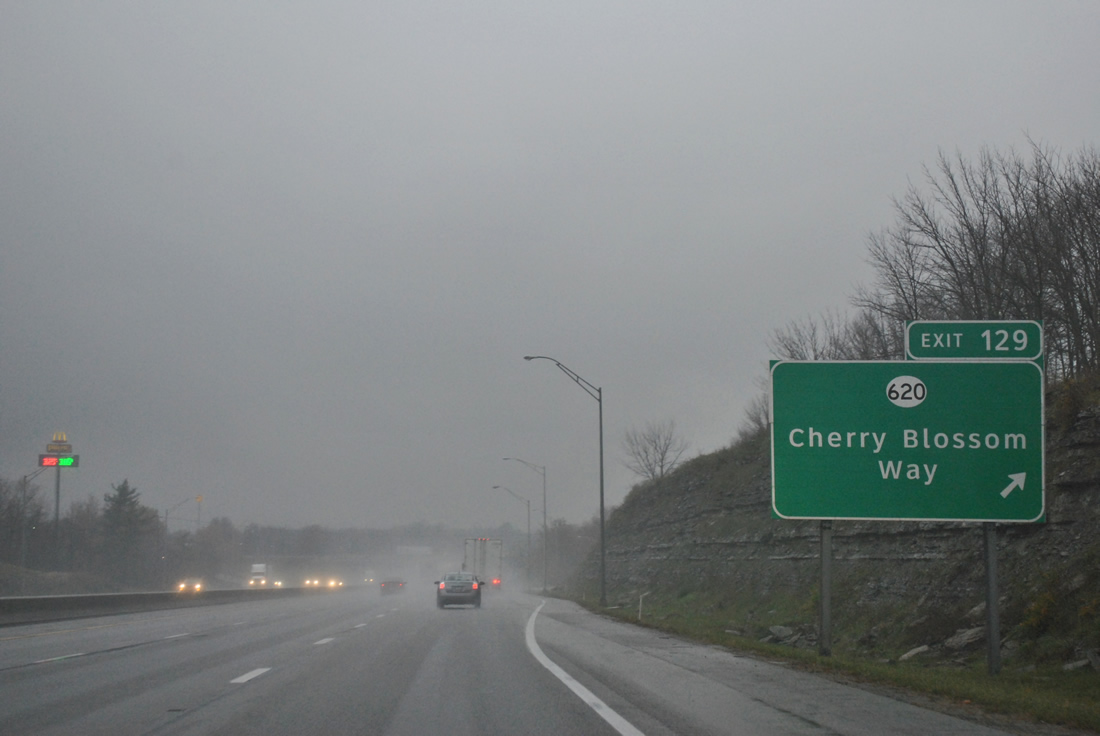
| Northbound at the Exit 129 off-ramp to KY 620 (Cherry Blossom Way). KY 620 shares a brief overlap with U.S. 25 (Cincinnati Road) to the west before continuing north along rural Burton Pike to Biddle. KY 620 originally ended at U.S. 62 (Cynthiana Road) to the east, but that portion along Delaplain Road was decommissioned. 11/03/11 |
|
| Leaving the Georgetown area along Interstate 75 north, drivers continues into the forested hills of northern Scott County. 11/03/11 |
|
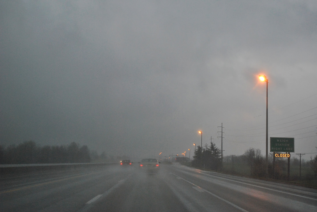
| A northbound side weigh station follows Delaplain along Interstate 75. The original southbound facility was dismantled. 11/03/11 |
|
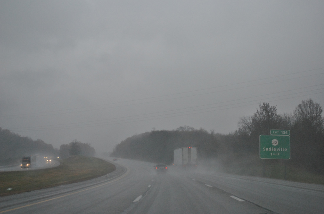
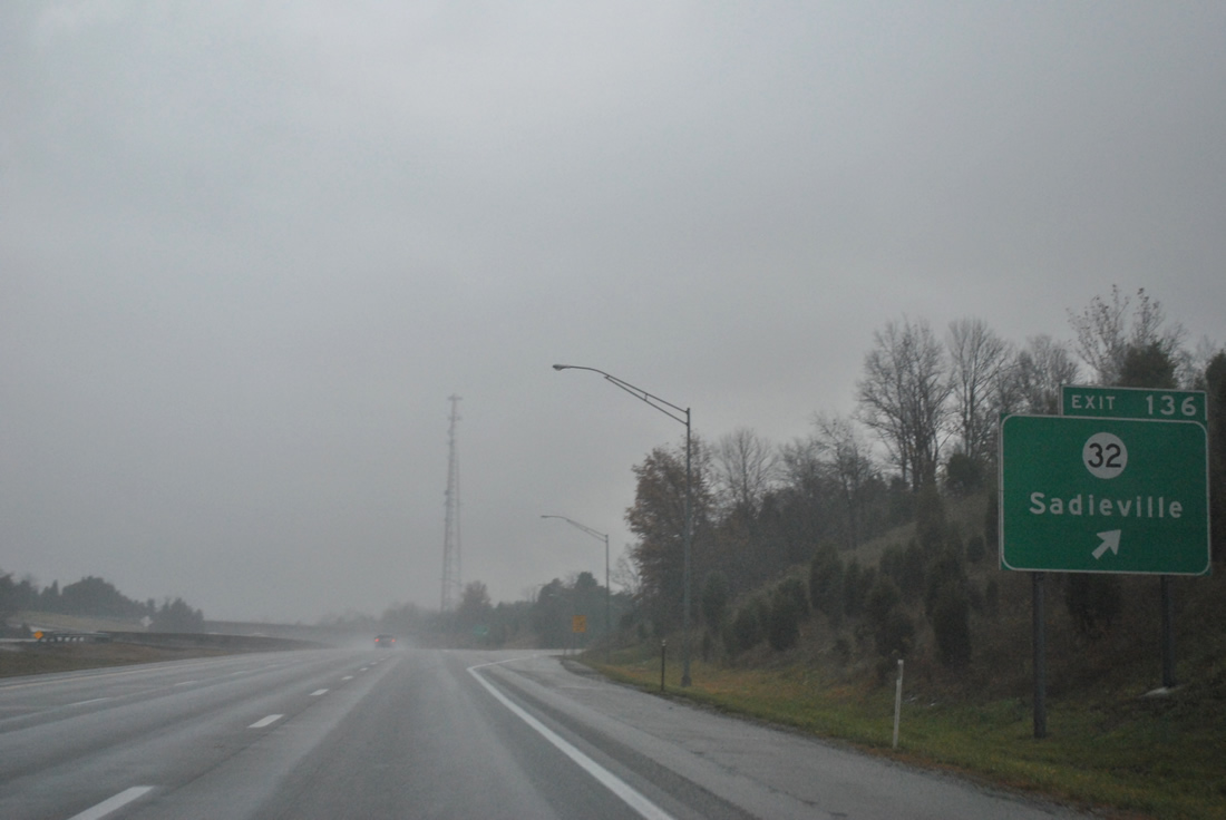
| U.S. 25 (Cincinnati Road) switches sides with Interstate 75 from the west to the east to Double Culvert on the two mile approach of I-75 to Exit 136 with KY 32 (Porter Road). 11/03/11 |
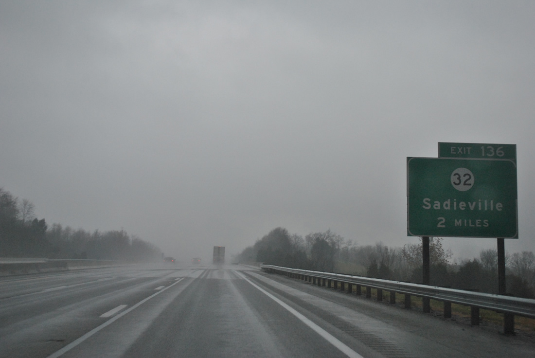
|
| One mile south of the Exit 136 diamond interchange with KY 32 (Porter Road). KY 32 travels west to Porter and Josephine before turning south to Longlick, Skinnersburg and the north side of Georgetown. 11/03/11 |
|
| East from Exit 136 and adjacent U.S. 25 (Cincinnati Road), KY 36 continues a short distance into Sadieville on the 15 mile drive to U.S. 62 at Cynthiana. 11/03/11 |
|
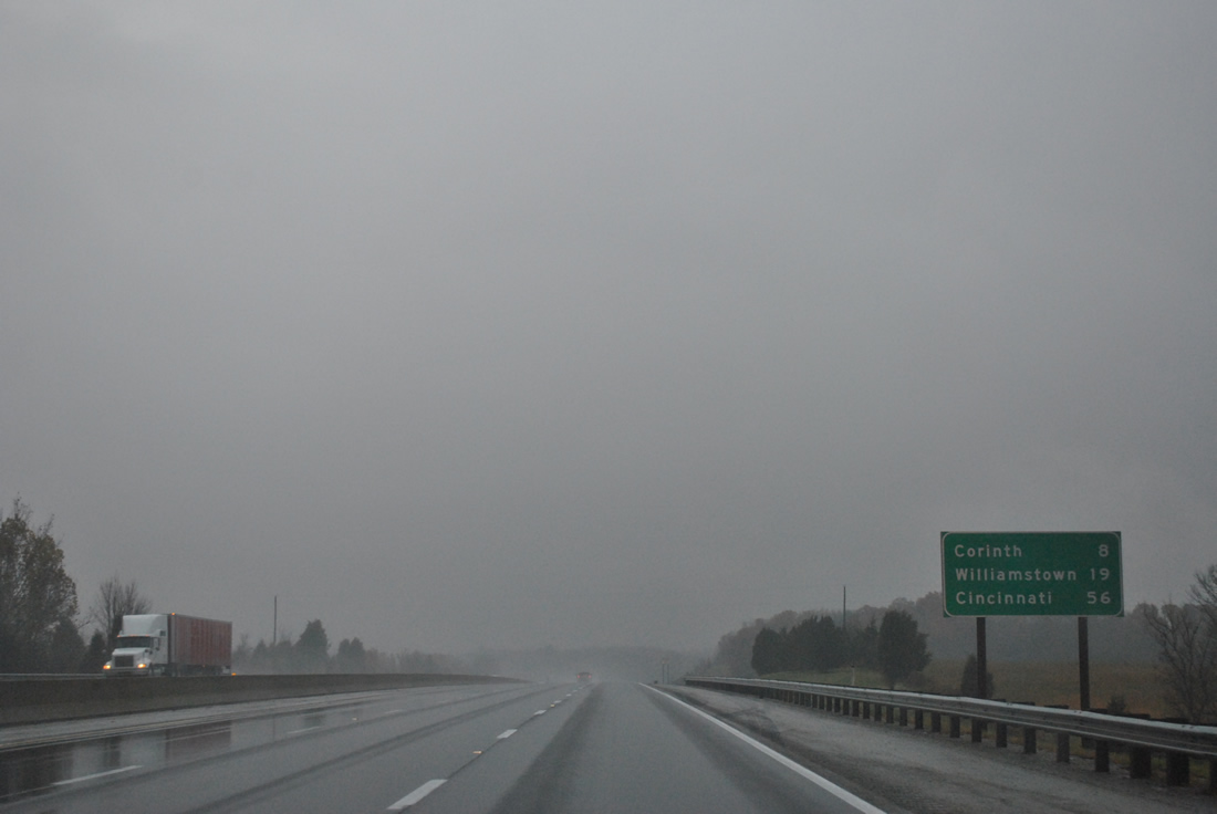
| The hamlet of Corinth is next along Interstate 75 in eight miles. Williamstown follows in 19 miles and Downtown Cincinnati at 56 miles. 11/03/11 |
|
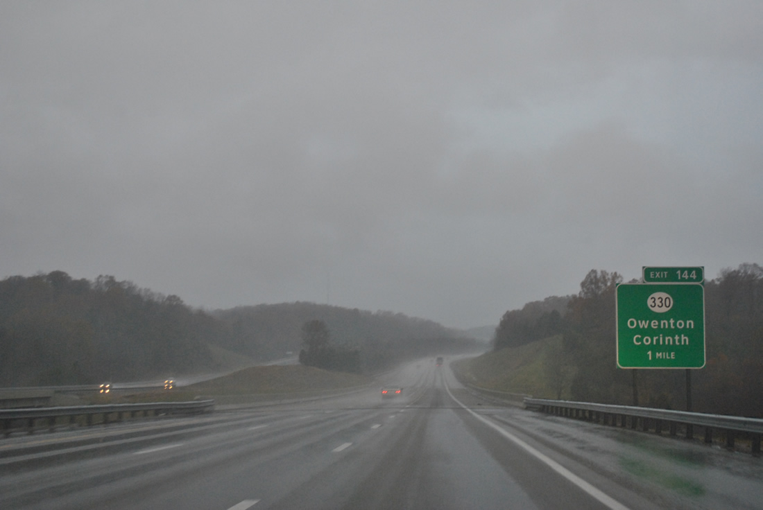
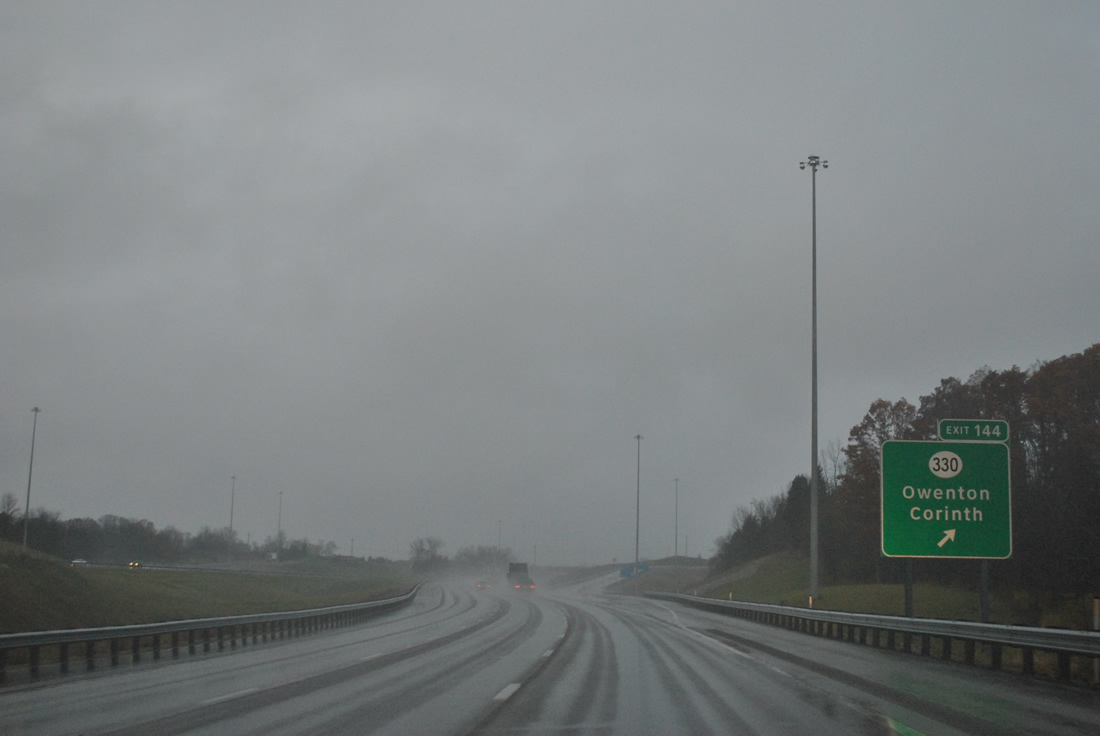
| Spanning North Rays Fork on the one mile approach to the Exit 144 diamond interchange with KY 330 (Owenton Road). 11/03/11 |
|
| Interstate 75 enters the southern tip of Grant County, just east of the Owen County line. 11/03/11 |
|
| KY 330 merges with U.S. 25 (Dixie Highway) through Corinth just east of Exit 144. The state route joins southern Grant County with Morgan and Falmouth (U.S. 27) to the northeast. Westward, KY 330 straddles the Owen County line briefly on a circuitous route to KY 227 southeast of Owenton. 11/03/11 |
|
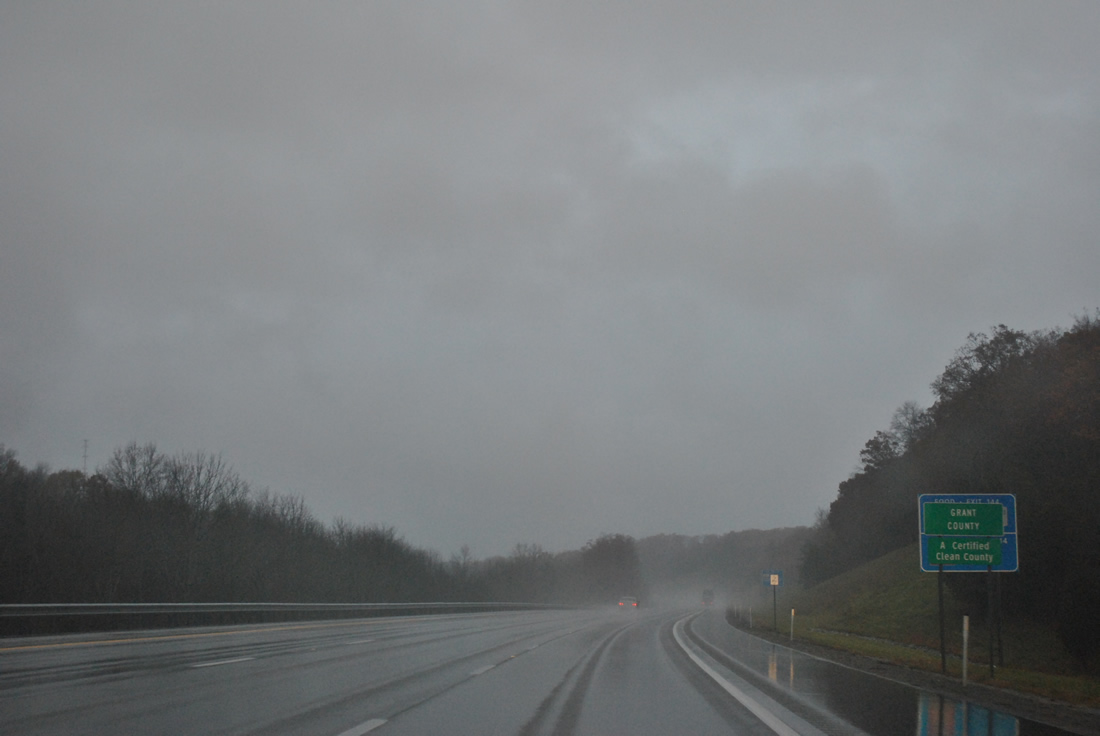
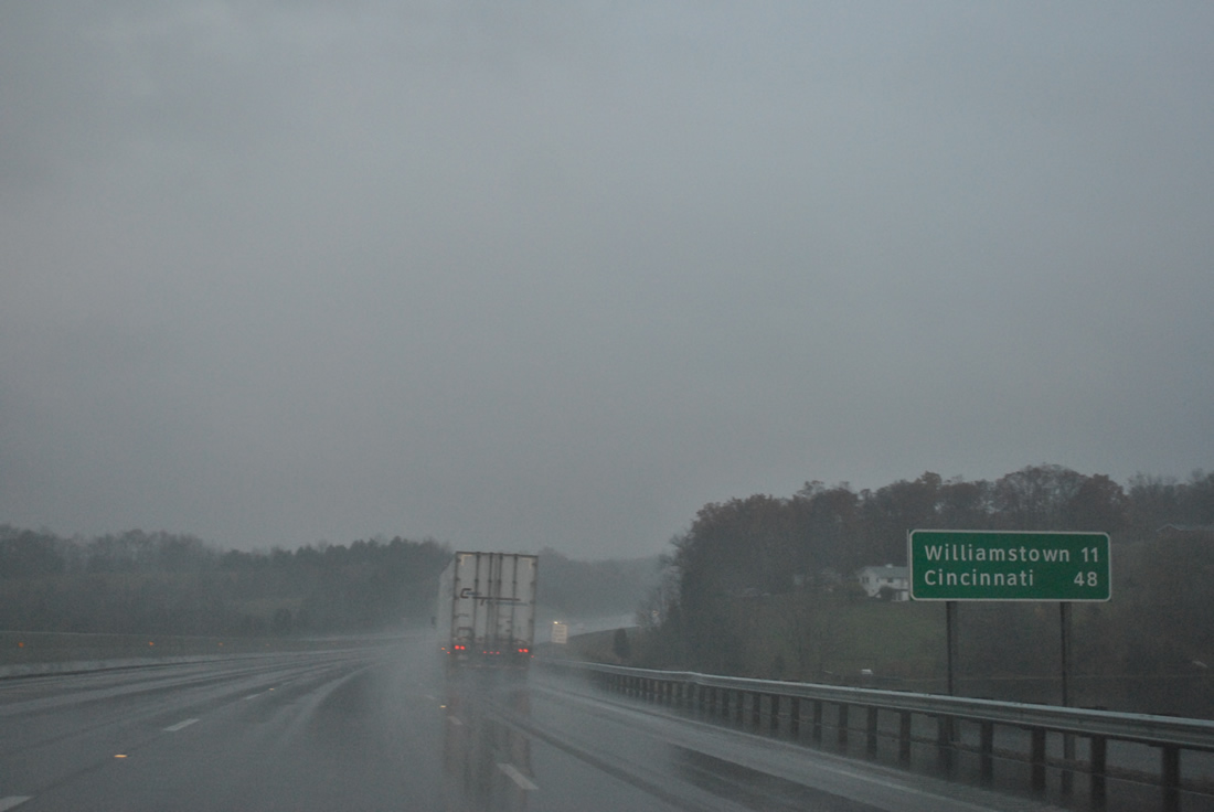
| Passing by Corinth Lake, Interstate 75 is now 11 miles south of Williamstown and 48 miles from Cincinnati, Ohio. When the roadways of I-75 are not separated, the six lane freeway sees a jersey barrier. 11/03/11 |
|
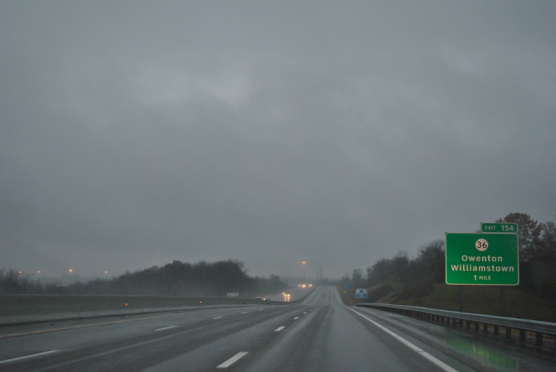
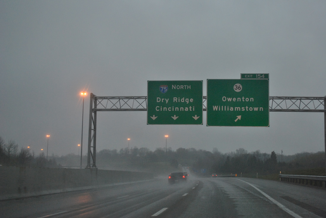
| The second of five Grant County exits joins Interstate 75 with KY 36 within the city of Williamstown in one mile. KY 36 (Stewartsville Road) meanders west from an overlap with U.S. 25 (Main Street) to Exit 154, Stewartsville and KY 22 at Fort Corners. 11/03/11 |
|
| Dry Ridge, the adjacent city from Williamstown, is featured on the pull through panel of Interstate 75 north at the Exit 154 diamond interchange with KY 36. A 120 mile route, KY 36 meanders west to Carrollton and Milton along the Ohio River and east to Cynthiana, Carlisle, Owingsville and Frenchburg. 11/03/11 |
|
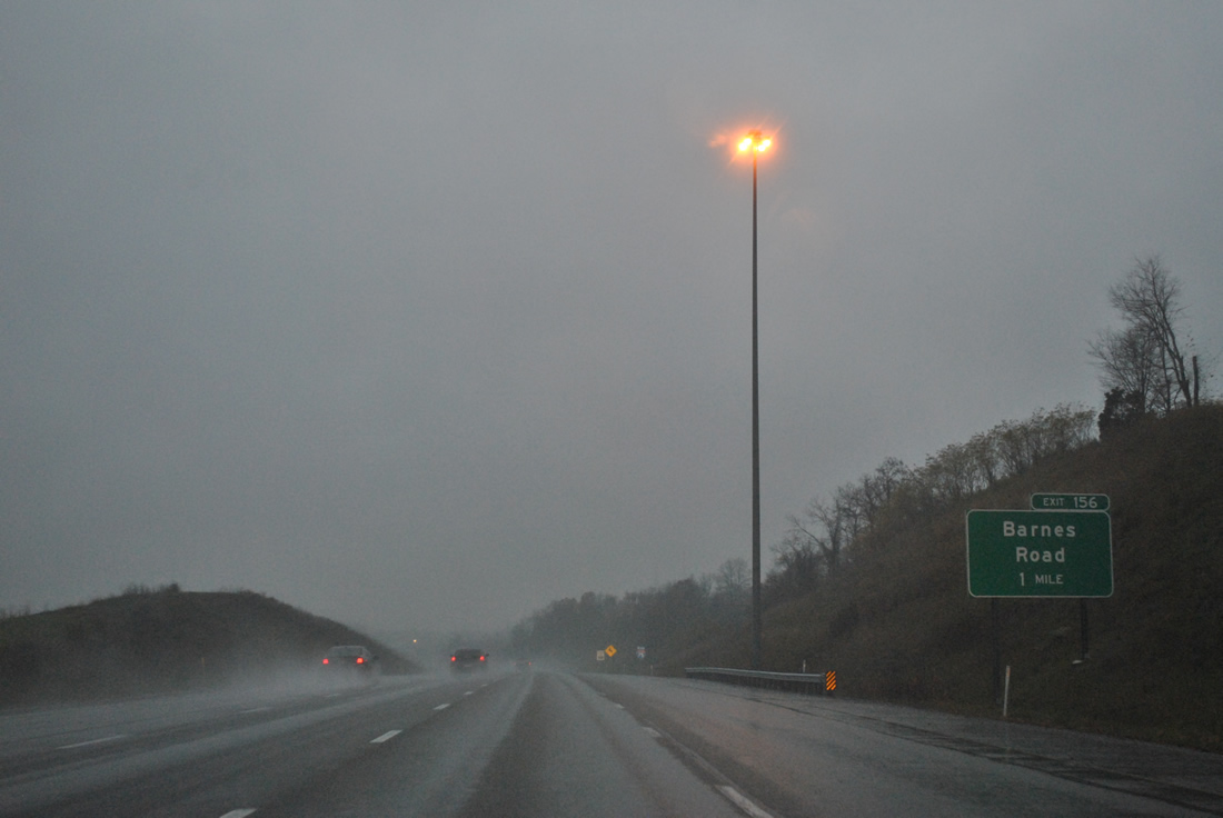
| A diamond interchange (Exit 156) with Barnes Road follows in one mile, serving northern areas of Williamstown. This exit opened on October 7, 2003.1 11/03/11 |
|
| Barnes Road ventures east to U.S. 25 & KY 22 (Main Street) and west from Exit 156 to an isolated agricultural area. 11/03/11 |
|
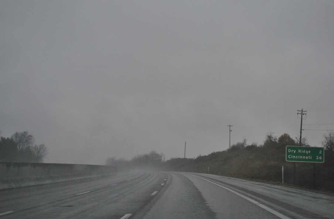
| A two mile drive brings Interstate 75 travelers into the city of Dry Ridge. The 36 mile drive to Cincinnati sees an increase in area development and traffic. 11/03/11 |
|
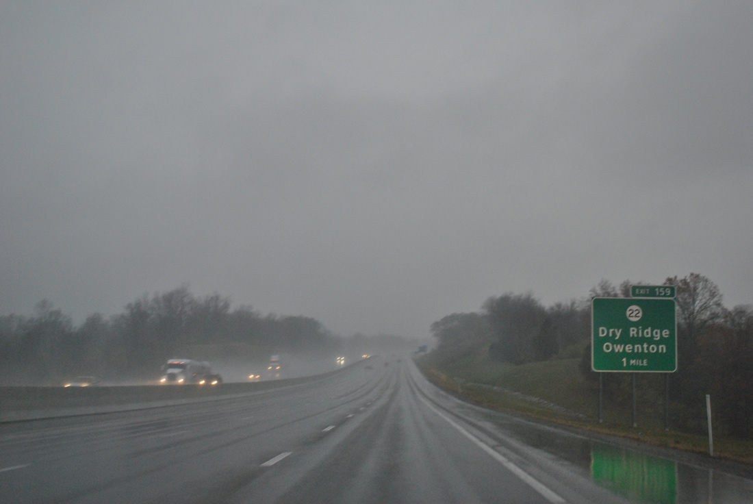
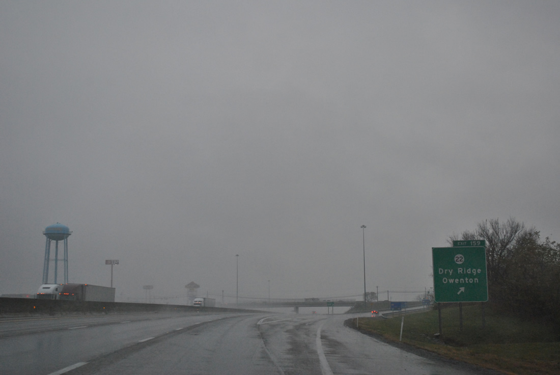
| KY 22 (Broadway Street) meets Interstate 75 west of downtown Dry Ridge at the Exit 159 diamond interchange. Traveling almost 101 miles, KY 22 joins Dry Ridge with Owenton to the southwest on a path that concludes in Louisville. 11/03/11 |
|
| Exit 159 leaves Interstate 75 north for KY 22. East of Exit 159, the state route joins the Dry Ridge Connector, a 2005-opened facility that bypasses downtown. U.S. 25 joins the bypass from North Main Street along the east side of town, with both routes continuing south to Williamstown where KY 22 branches eastward to Falmouth and an end at KY 10, west of Brooksville. 11/03/11 |
|
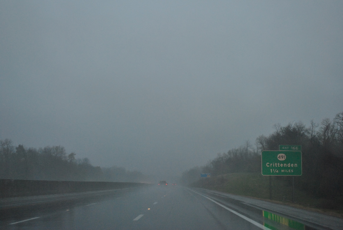
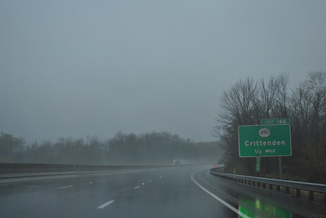
| One mile south of the Exit 166 diamond interchange with KY 491 (Violet Road) at Crittenden. 11/03/11 |
|
| KY 491 stems west from adjacent U.S. 25 (Main Street) to Bullock Pen Lake and KY 14 at Verona. 11/03/11 |
|
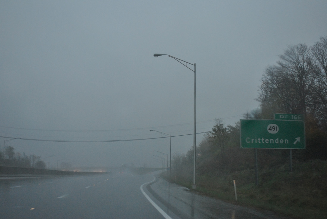
| Interstate 75 northbound reaches the Exit 166 off-ramp to KY 491 (Violet Road). East from Crittenden and U.S. 25 (Main Street), KY 491 ventures to Flingville, Gardnersville and KY 17. 11/03/11 |
|
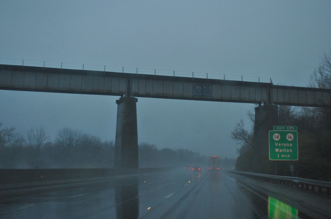
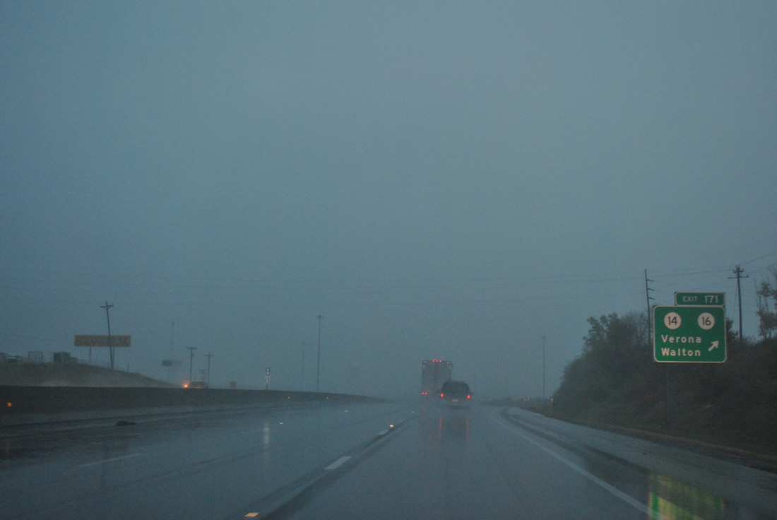
| Passing under the high level CSX Railroad Bridge over Interstate 75 and McCoys Fork, northbound drivers advance one mile to a diamond interchange (Exit 171) with KY 14 & 16 (Mary Grubbs Highway). The two share pavement northeast from Verona to U.S. 25 (Main Street) at Walton. 11/03/11 |
|
| Entering the diamond interchange (Exit 171) with KY 14/16 (Mary Grubbs Highway) on I-75 north. The state routes comprise a commercial arterial east by the new Walton Towne Center to U.S. 25. Once at U.S. 25 (Main Street), KY 16 east joins U.S. 25 north to Walton-Nicholson Road east on an eventual path to Newport. KY 14 joins U.S. 25 south to Bracht before resuming an eastward course to Piner and Morning View. 11/03/11 |
|
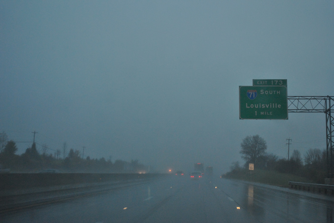
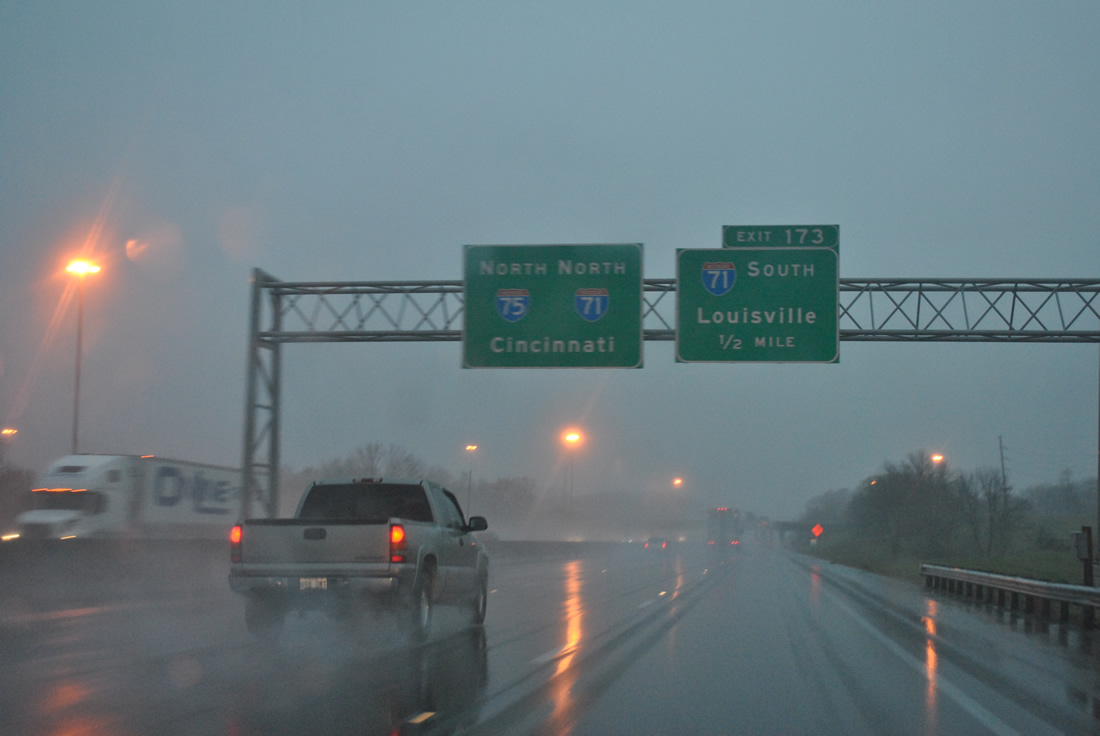
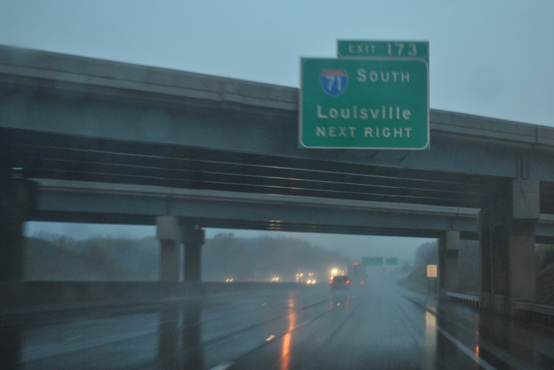
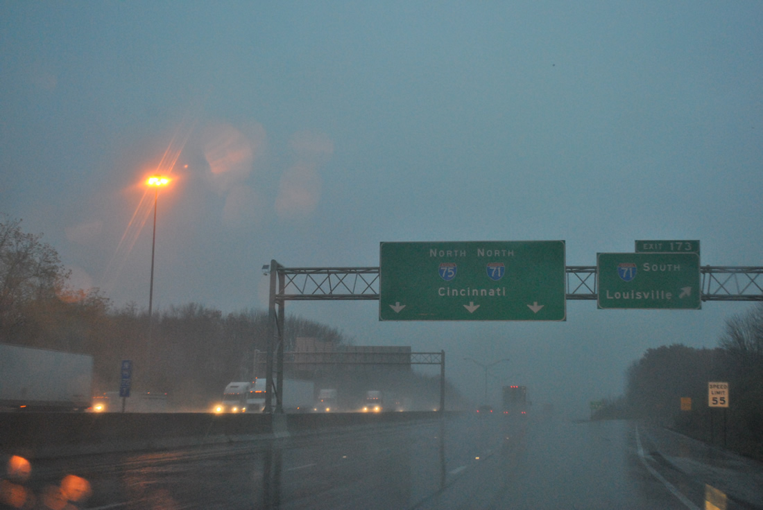
| Interstate 75 merges with Interstate 71 north at the Exit 173 trumpet interchange in one mile. 11/03/11 |
|
| Interstate 71 enters Northern Kentucky from Louisville, 77 miles to the north of the freeway beginning. Interstate 71 travels 345 miles overall, joining the Bluegrass State with Columbus and Cleveland, Ohio. 11/03/11 |
|
| Passing under the Interstate 71 mainline, Exit 173 loops onto the southward freeway ahead. Much of the drive to Louisville is rural in nature. La Grange and Kentucky Speedway near Sparta are the main built up areas along the freeway. 11/03/11 |
|
| Interstate 71 north joins Interstate 75 north for 19.92 miles from Walton to the Brent Spence Bridge into downtown Cincinnati. I-71 was completed in Kentucky by July 1969. 11/03/11 |
Page Updated 03-08-2012.

 West
West  North
North