|
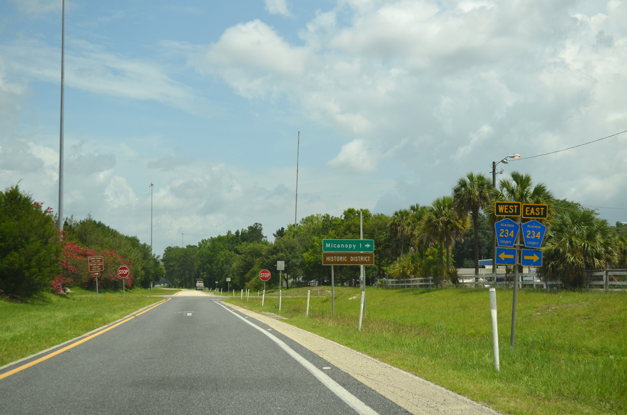
| Entering the diamond interchange (Exit 374) with CR 234 along I-75 north. Alachua County Road 234 constitutes a rural highway traveling 18.1 miles from Marion County Road 329 north to Micanopy, Rochelle, Windsor and SR 26 west of Orange Heights. 07/24/22 |
|
| The Micanopy historic district lies 1.25 miles to the northeast from Exit 374 at Seminary Avenue and Cholokka Boulevard. Micanopy is locally famous for its small town charm and antique shops. 06/16/16 |
|
| Continuing northwest, I-75 passes between Levy Lake and southern reaches of Paynes Prairie Preserve State Park over the ensuing two miles beyond Exit 374. 05/02/20 |
|
| Lake City debuts at 52 miles out in neighboring Columbia County while Downtown Gainesville lies 18 miles ahead. 05/02/20 |
|
| The freeway traverses Paynes Prairie State Preserve ahead of the Gainesville area rest areas. Paynes Prairie encompasses nearly 21,000 acres of savanna along both I-75 and parallel U.S. 441. 08/16/18 |
|
| Travelers can view Paynes Prairie from the adjacent rest area. The next four exits along I-75 north serve the city of Gainesville. 07/24/22 |
|
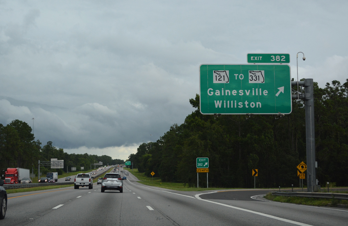
| SR 121 is a multi state route originating at U.S. 19/98 near Lebanon Station and traveling north through Florida, Georgia, and South Carolina to I-77/U.S. 21 near Rock Hill. The initial guide sign for Exit 382 was removed sometime after July 2019. 08/16/18 |
|
| SR 121 (Williston Road) is the first of three exits from Interstate 75 north for the University of Florida (UF). 07/24/22 |
|
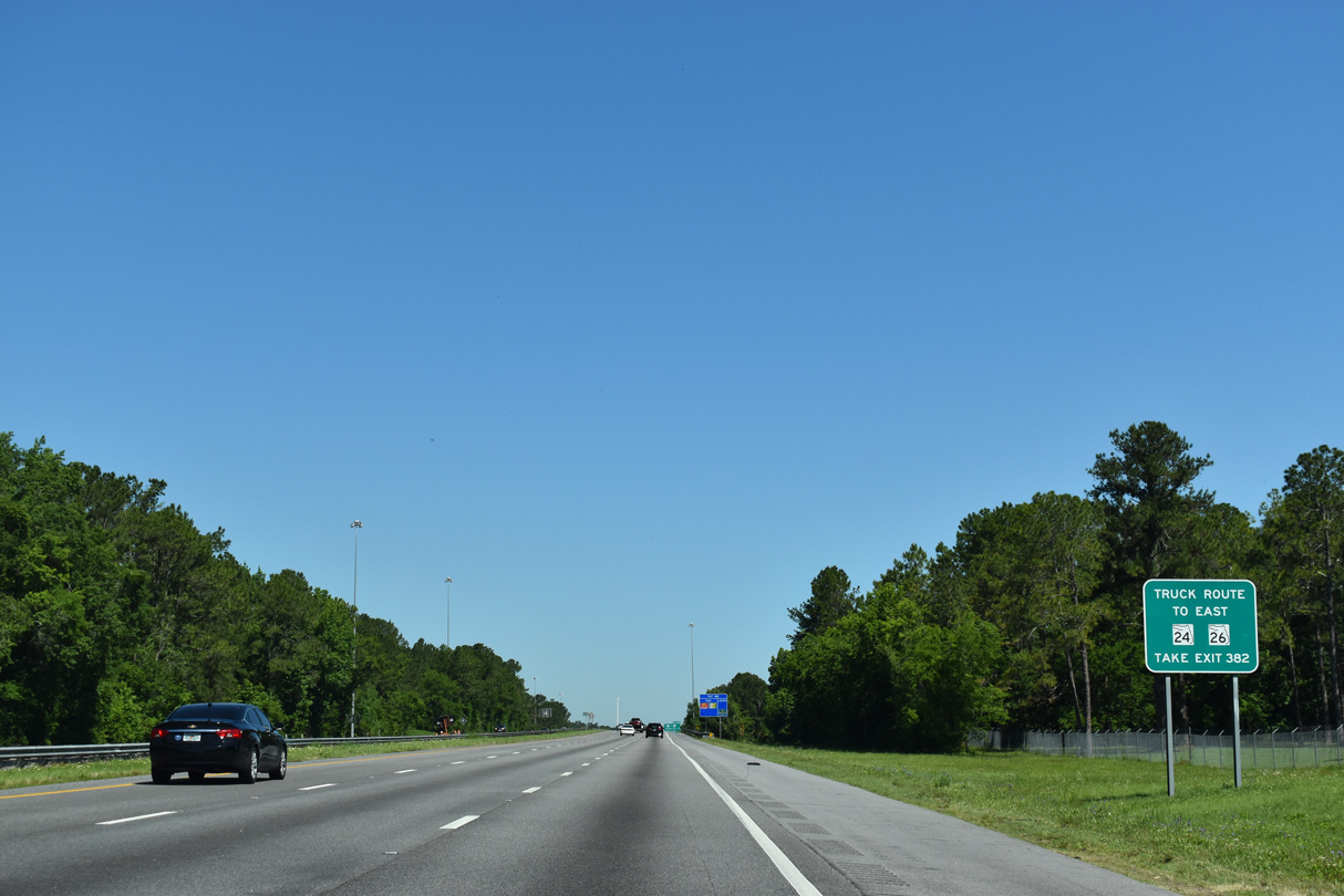
| SR 331 (Williston Road) forms part of a truck bypass for Gainesville for SR 24 and SR 26 east from I-75 at Exit 382 and SR 121. 05/02/20 |
|
| Interstate 75 enters the folded diamond interchange with State Road 121 (Williston Road). 07/24/22 |
|
| Williston Road leads SR 121 southward to Levy County and the city of Williston. East of Exit 382, SR 121 turns north across Gainesville at the adjacent intersection with SW 34th Street. 07/28/18 |
|
| A 5.4 mile long route, SR 331 encircles the south side of Gainesville from SW 34th Street (SR 121) to SR 20, SR 24 and SR 26 east of Downtown. 07/28/18 |
|
| Confirming marker posted beyond the entrance ramp from SR 121 (Williston Road). 08/16/18 |
|
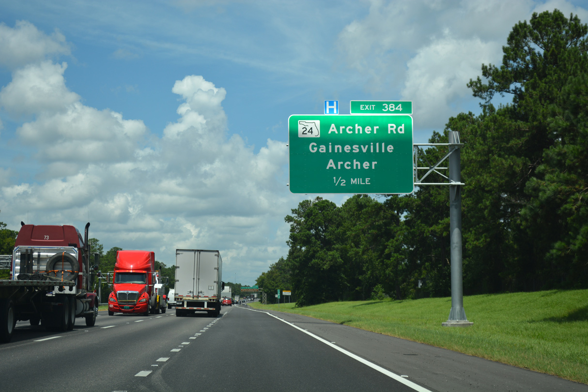
| A diamond interchange with SR 24 (Archer Road) follows in the next half mile along I-75 north. SR 24 is a 71.5 mile long highway connecting Cedar Key on the Gulf of Mexico with Gainesville and Waldo. 08/16/18 |
|
| Through Gainesville, Archer Road (SR 24) forms the southern border of the University of Florida main campus. Archer Road links I-75 with the UF Medical Center and Museum of Natural History. 08/16/18 |
|
| Exit 384 parts ways with I-75 northbound for SR 24. The state road angles southwest 9.7 miles to Archer. 08/16/18 |
|
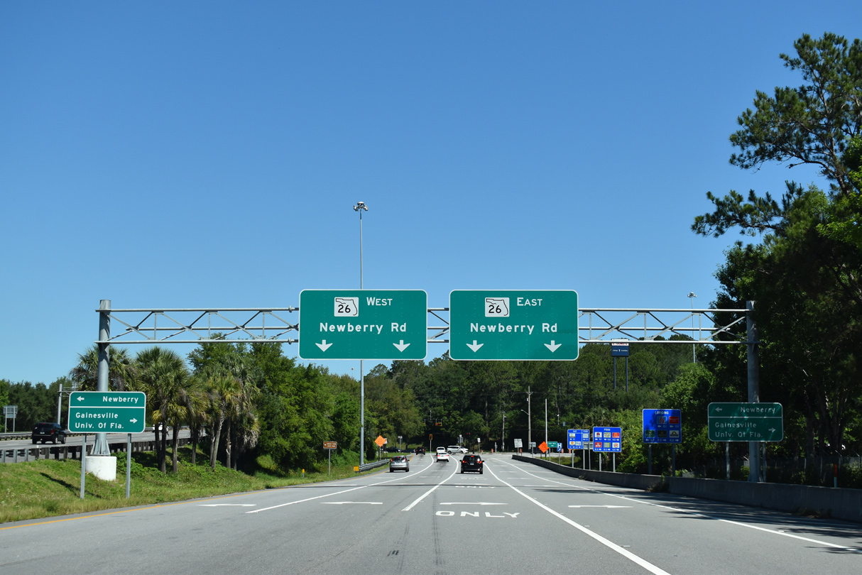
| Interstate 75 continues northwest along the west side of Gainesville three miles to SR 26 (Newberry Road). 05/02/20 |
|
| Crossing over Hogtown Creek, I-75 briefly enters Gainesville city limits. 05/02/20 |
|
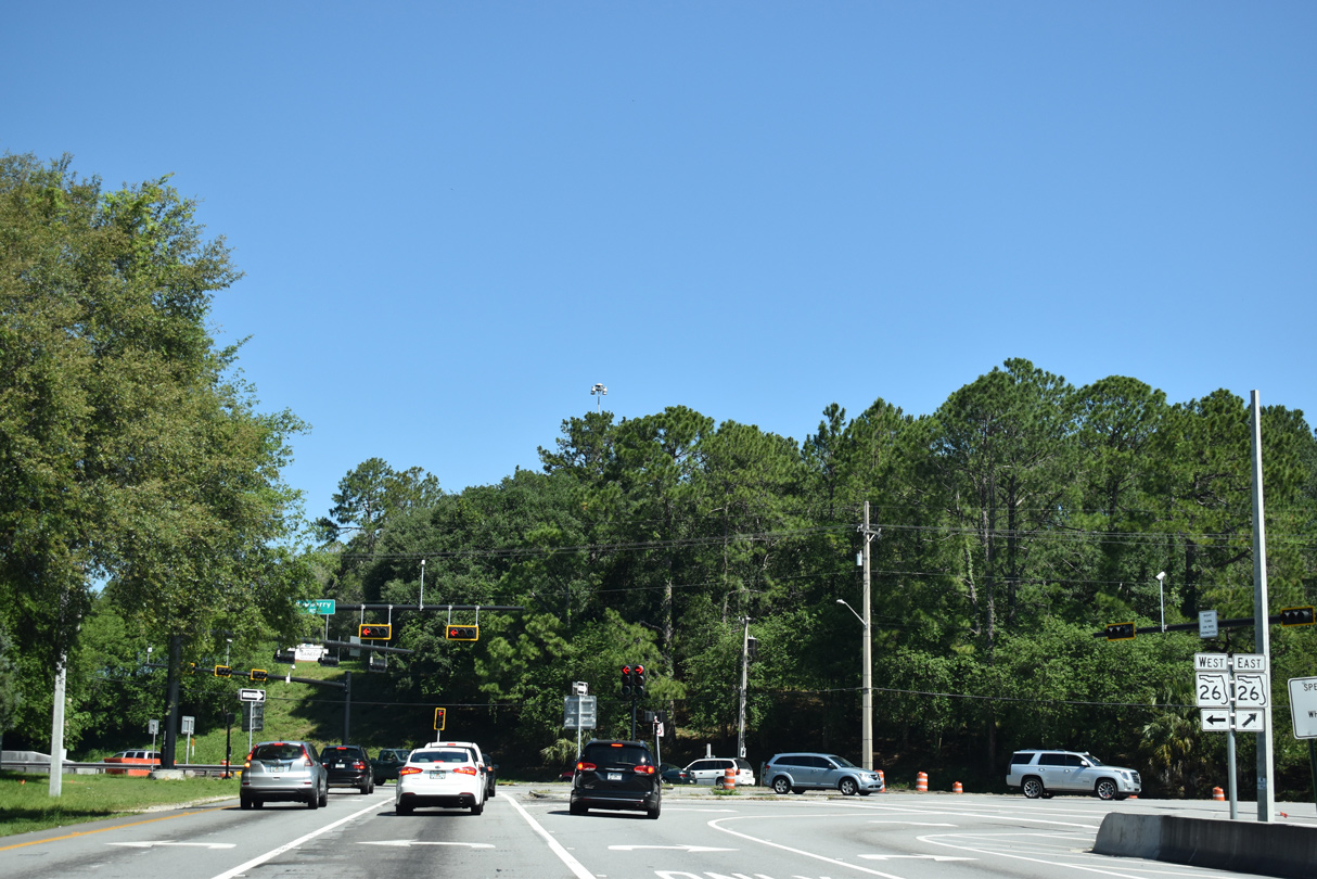
| SR 26 (Newberry Road) enters Gainesville from the west and crosses under Interstate 75 at Exit 387 in one mile. 05/02/20 |
|
| East from Exit 387, Newberry Road transitions into University Avenue as it carries SR 26 east to the University of Florida (UF) and Downtown Gainesville. 05/02/20 |
|
| SR 26 (Newberry Road) connects the freeway with the towns of Newberry and Trenton to the west and Melrose to the east. 05/02/20 |
|
| University Avenue also carries SR 20/24 with SR 26 through Downtown before all three state roads split for their respective destinations. 05/02/20 |
|
| Interstate 75 advances northwest by Santa Fe College through unincorporated areas northwest of the Gainesville city line. 05/02/20 |
|
| Lake City lies 39 miles to the north northwest from Gainesville. The city of Alachua is next along I-75 north in 13 miles. 05/02/20 |
|
| A parclo interchange (Exit 390) joins Interstate 75 with SR 222 (NW 39th Avenue) in one mile. SR 222 runs across the north side of Gainesville 14 miles to SR 24 near Gainsville Regional Airport (GNV) and SR 26 at Gum Root Swamp. 05/02/20 |
|
| Modifications to Exit 390 in 2003 expanded SR 222 (NW 39th Avenue) with added lanes and improved traffic flow. Further work in 2016 expanded the off-ramp to offset routine back ups that extended onto the I-75 mainline. West from I-75, CR 222 continues NW 39th Avenue to CR 241 (NW 143rd Street). 05/02/20 |
|
| Advancing north, I-75 navigates across a series of hills along San Felasco Hammock State Preserve. 12/14/16 |
|
| Exit 399 with U.S. 441 to Alachua lies nine miles to the north. 36 miles remain to Columbia County seat of Lake City. 05/02/20 |
|
| Interstate 75 ventures north through rural areas of the Alachua city limits, passing below CR 241 (NW 143rd Street) and across CR 235 and a CSX Railroad line. 05/02/20 |
|
| The freeway bends eastward on the one mile approach to the folded diamond interchange (Exit 399) with U.S. 441. 05/02/20 |
|
| U.S. 441 travels 5.3 miles northwest into the city of High Springs, where it combines with U.S. 41 northward toward Lake City. Heading southeast U.S. 441 crosses the Alachua city center en route to Gainesville. 05/02/20 |
|
| North from U.S. 441 and Alachua, I-75 parallels Mill Creek to Spring Hill. 05/02/20 |
|
| Interstate 75 north parallels County Road 235A four miles to CR 236 at Traxler. Lake City is a half hour away. 05/02/20 |
|
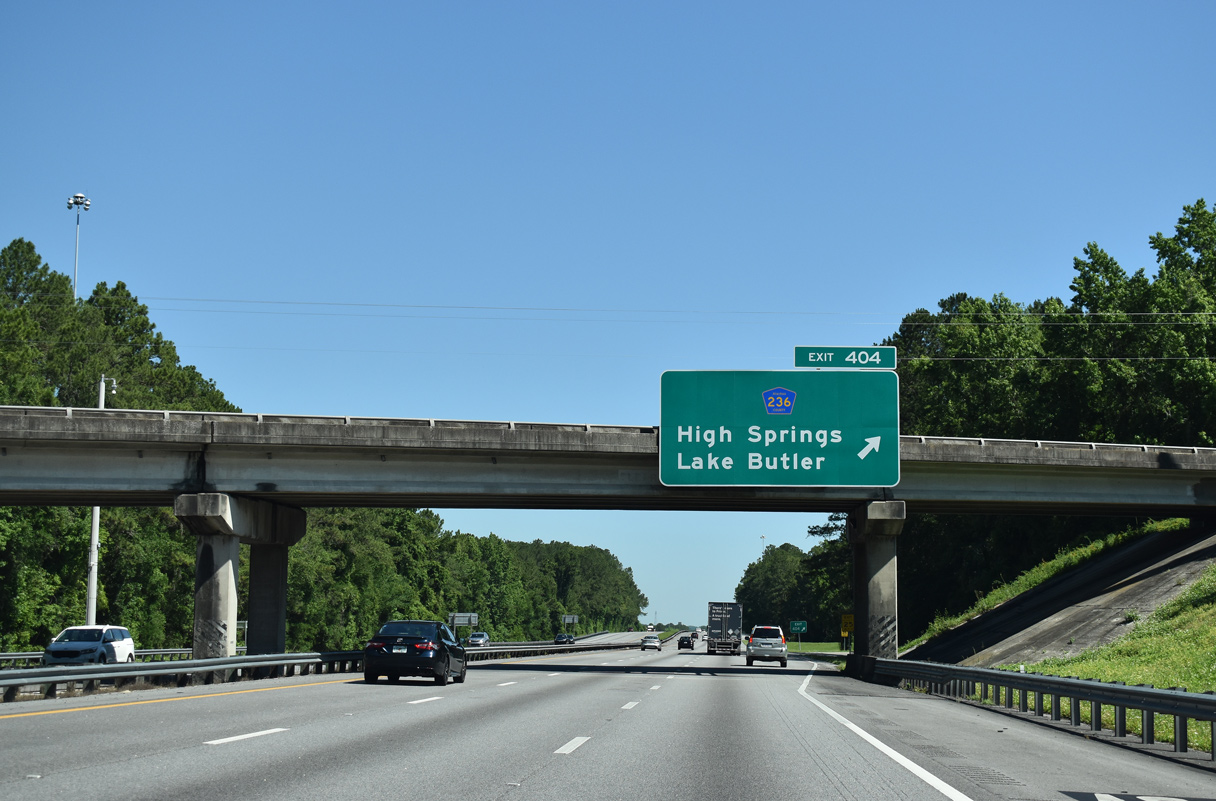
| One mile guide sign for the parclo B2 interchange (Exit 404) with Alachua County Road 236 to High Springs and Lake Butler. 05/02/20 |
|
| Exit 404 loops away from I-75 north to CR 236. The county road goes 4.7 miles southwest to High Springs and 7.3 miles east to SR 121 near Santa Fe. Lake Butler lies 18 miles to the northeast along SR 121. 05/02/20 |
|
| A rural stretch east of River Rise Preserve State Park leads I-75 north toward Columbia County. 05/02/20 |
|
| U.S. 41/441 meet I-75 again at the succeeding interchange in eight miles. Lake City follows in another 16. 06/29/17 |
|
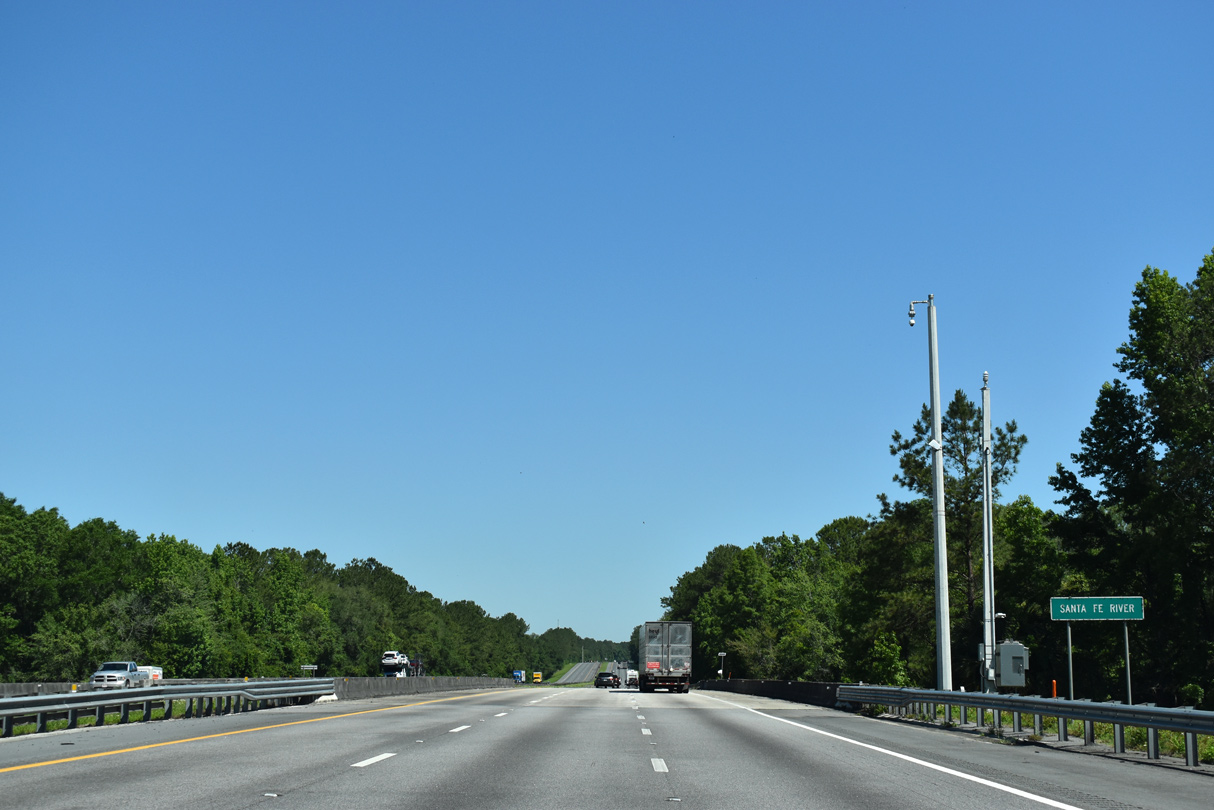
| Interstate 75 crosses the Santa Fe River into Columbia County. 05/02/20 |
|
| The slow-moving Santa Fe River flows 75 miles from the headwaters of Santa Fe Lake near Keystone Heights to the Suwannee River southeast of Branford. 05/02/20 |
|
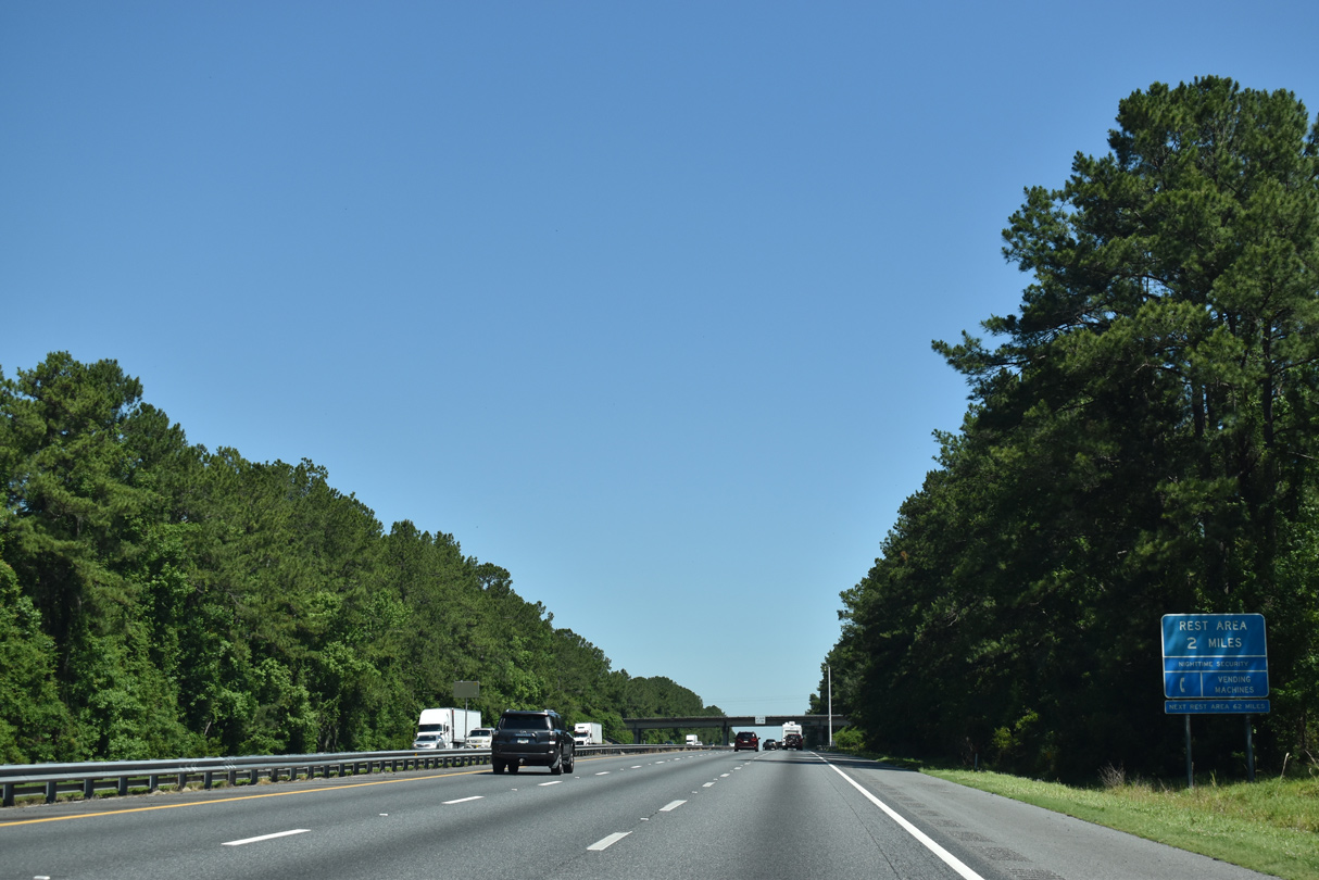
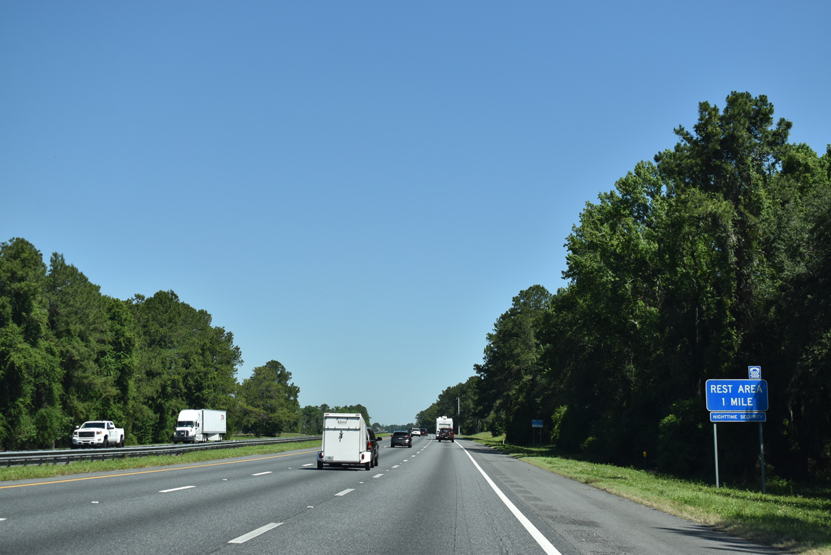
| County Road 18 spans I-75 within two miles of the Columbia County rest area. The next northbound facility is the Georgia welcome center. 05/02/20 |
|
| Offering picnic tables and ample commercial truck & RV parking, the Columbia County rest area lies between Interstate 75 north and October Road. 05/02/20, 07/24/22 |
|
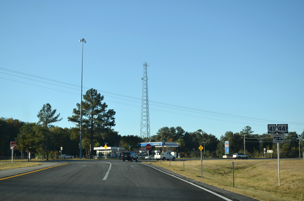
| The forthcoming diamond interchange (Exit 414) with U.S. 41/441 is the first of three exits from I-75 north to Lake City. 05/02/20 |
|
| U.S. 41/441 run concurrent for 22.8 miles between High Springs and Lake City. Beyond Lake City, U.S. 41 parallels Interstate 75 into Georgia toward Valdosta while U.S. 441 enters the Peach State south of Fargo. 05/02/20 |
|
| Points of interest for Exit 414 include O'Leno State Park, located south along the Santa Fe River. SR 238 stems east from U.S. 41/441 nearby to Lake Butler. 11/25/12 |
Page Updated 08-26-2022.

 North
North