
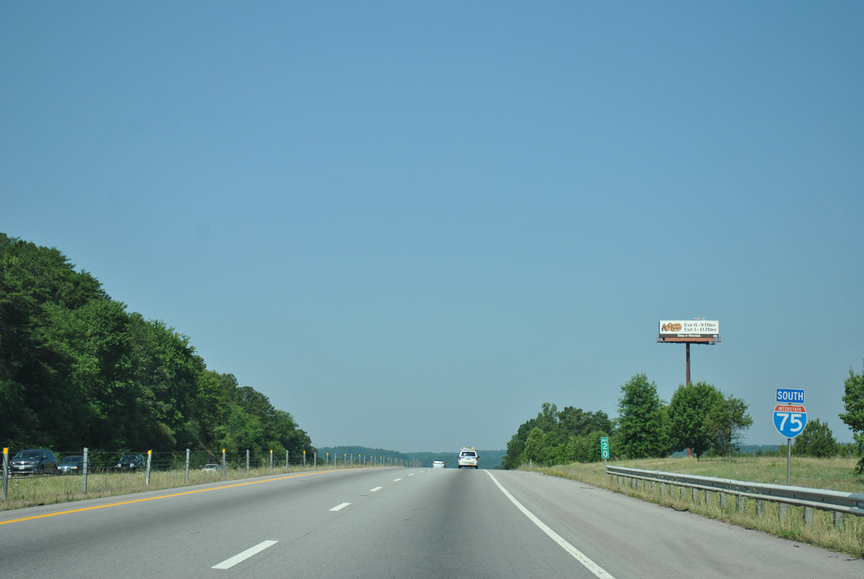
Dynamic message signs posted south along Interstate 75 from Exit 42 are part of a fog advisory area. Utilizing Intelligent Transportation System (ITS), these safety features were installed after a catastrophic car pile up on December 11, 1990. Occurring at 9:10 AM, the event involved 99 vehicles, claimed 12 lives and caused 42 injuries near the town of Calhoun (Exit 36). Due to the proximity to the Appalachian Mountains to the east, dense fog developing within the region of southeastern Tennessee can reduce visibility to zero miles.
 South
South
Leading away from I-40, Interstate 75 runs southwest from Hines Valley across Blackoak Ridge and U.S. 70 (Kingston Pike).
06/25/12

U.S. 321/SR 95 overlap northwest along a commercial arterial within Lenoir City to I-75 at a diamond interchange (Exit 81) near Eaton Crossroads and Pleasant View.
06/25/12
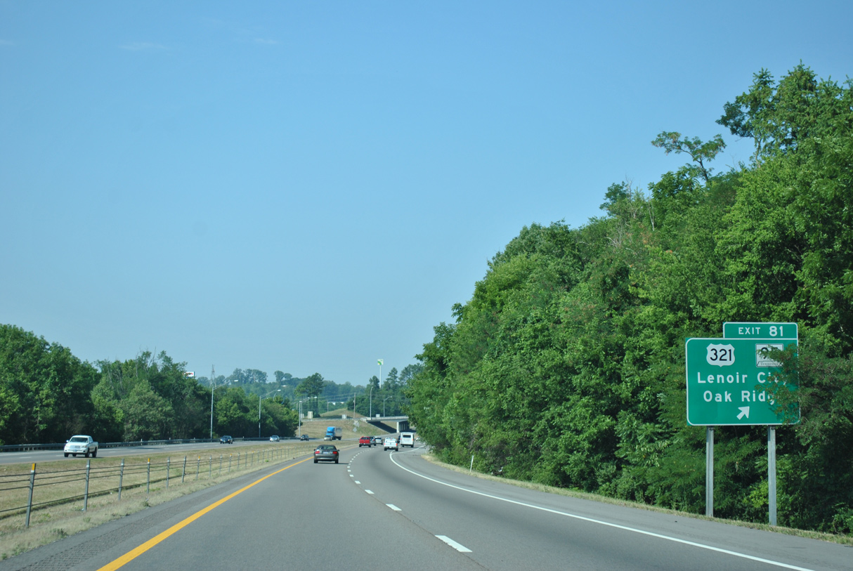
U.S. 321/SR 95 overlap southeast to Tellico Lake and separate for Maryville and Greenback respectively. Northwest, the pair continue to I-40 at Exit 364, where U.S. 321 ends. U.S. 321 is a 517 mile long route that travels east to Gatlinburg, Newport, Johnson City and Boone, North Carolina before turning south to Hickory, Gastonia, Columbia and ultimately Hardeville, South Carolina.
06/25/12

06/25/12

06/25/12

Advancing southwest through Hotchkiss Valley, I-75 next meets SR 324 (Sugar Limb Road) at a diamond interchange (Exit 76) by New Providence.
06/25/12

SR 324 (Sugar Limb Road) traverses Chestnut Ridge southeast from I-75, 2.175 miles to U.S. 11 (Lee Highway) at Sugarlimb. Sugar Limb Road north spurs to parallel Hotchkiss Valley Road.
06/25/12

06/25/12

SR 72 converges with I-75 in western reaches of the Loudon city limits. The diamond interchange at Exit 72 represents a numbering oddity where the exit number matches the intersecting route number. Among other examples are Exit 52/U.S. 52 along I-77 in Virginia and Exit 57/Mississippi Highway 57 along I-10.
06/25/12

Sweetwater and Matlock Islands come into view across Watts Bar Lake on the Tennessee River. I-75 spans the lake on bridges built in 1977.
11/08/09

SR 72 arcs 16.23 miles southeast from SR 58 near Kingston to U.S. 11 at Loudon and another 13.09 miles south to U.S. 411 at Vonore.
06/25/12

06/25/12

06/25/12

Exit 68 joins I-75 with SR 323 (Pond Creek Road). SR 323 (Pond Creek Road) runs 2.14 miles east from Interstate 75 to U.S. 11 (Lee Highway).
06/25/12

Exit 68 leaves I-75 south for SR 323 (Pond Creek Road) east to the city of Philadelphia. West of the diamond interchange, Pond Creek Road extends to Galyon Gap and Stockton Valley Road.
06/25/12

06/25/12

Interstate 75 crosses the Monroe County line at the Old Washington Pike over crossing.
06/25/12

The first of two exits for the city of Sweetwater connects I-75 with SR 322 (Oakland Road). SR 322 meanders 2.48 miles southeast to U.S. 11 (Main Street) and 14.72 miles to SR 72 and Lakeside beyond Bat Creek Knobs.
06/25/12

A diamond interchange (Exit 62) joins I-75 with SR 332 (Oakland Road) west of Watson Ridge. SR 332 concludes 11.14 miles to the north at SR 72 and Paint Rock.
06/25/12

06/25/12

Meeting Interstate 75 at a diamond interchange (Exit 60), SR 68 travels between U.S. 27 near Spring City and U.S. 411 at Madisonville.
06/25/12

Exit 60 parts ways with I-75 south for SR 68 east toward Downtown Sweetwater and the Lost Sea at Craighead Caverns, the largest underground lake in the United States.1 The caverns lie within The Knobs off SR 68 near Christiansburg.
06/25/12

Spring City lies 26 miles to the west of Exit 60. Overall SR 68 runs south to Copperhill and Georgia State Route 5 and northwest to Crossville.
11/08/09

Interstate 75 continues along Watson Ridge southwest into McMinn County.
06/25/12

06/25/12

The diamond interchange at Exit 56 links Interstate 75 with the north end of SR 309 (Union Grove Road) at Acme Mill.
06/25/12

SR 309 (Union Grove Road) leads 2.47 miles south from Exit 56 to Sweetwater Valley and U.S. 11 (Wilson Street) in the city of Niota.
06/25/12

06/25/12

SR 305 (Mt. Verd Road) runs 2.00 miles northwest from U.S. 11 (Lee Highway) in the city of Athens to Interstate 75 at Exit 52.
06/25/12

North from the diamond interchange (Exit 52) with I-75, SR 305 ventures 8.89 miles across Spring Ridge to SR 68 in Meigs County. SR 305 (Ingleside Avenue) loops 2.85 miles south from U.S. 11 to Tellico Hills and SR 30 (Green Street) at SR 39 (Washington Avenue) in Downtown Athens.
06/25/12

SR 30 extends west from Green Street at Downtown Athens along Decatur Pike to the diamond interchange at Exit 49.
06/25/12

SR 30 (Decatur Pike) travels 9.40 miles west from Interstate 75 to SR 58 in the Meigs County seat of Decatur. Nine miles south of Athens, SR 30 combines with U.S. 411 at Etowah.
06/25/12

06/25/12

06/25/12

Located 3.8 miles south of SR 30, the McMinn County Rest Areas are the lone facilities excluding the state welcome centers along Interstate 75 in Tennessee.
06/25/12

The McMinn County Rest Area lies between Coile Road and Underwood Branch.
06/25/12

SR 39 (Riceville Road) branches 1.66 miles west from U.S. 11 (Lee Highway) at Riceville to Interstate 75 at Exit 42.
06/25/12

Entering the diamond interchange (Exit 42) with SR 39 east to Riceville and County Road 100 north to Spring Creek. SR 39 is part of a longer route to Athens, Englewood and Tellico Plains.
06/25/12

06/25/12

06/25/12

06/25/12

06/25/12

06/25/12

06/25/12

06/25/12

06/25/12

06/25/12

06/25/12

06/25/12

06/25/12

06/25/12
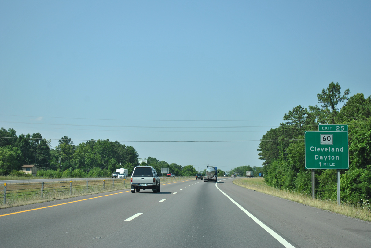
SR 60 along 25th Street forms the northern half of an arterial beltway encircling the city of Cleveland. U.S. 74/64 Bypass follows the southern half of the loop.
06/25/12
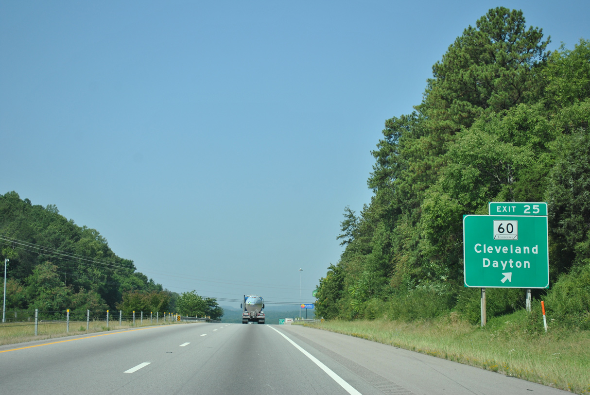
SR 60 extends north along Georgetown Road from the parclo B2 interchange (Exit 25) with I-75.
06/25/12

SR 60 heads north from Cleveland to Hopewell, Georgetown and Birchwood. The state route concludes 23.7 miles to the northwest at U.S. 27 in the Rhea County seat of Dayton.
06/25/12

06/25/12

06/25/12

U.S. 64 Bypass extends 1.50 miles west from U.S. 11/64 alongside U.S. 74 on an expressway to Interstate 75.
06/25/12

U.S. 74 encircles Cleveland east to SR 60 at Inman Street, where it combines with U.S. 64. U.S. 64/74 overlap to Ocoee, Ducktown and into Western North Carolina.
06/25/12
U.S. 74 accompanies Interstate 75 south along an unmarked overlap to U.S. 11/64 at Collegedale.
06/25/12

06/25/12

06/25/12

06/25/12

Interstate 75 enters Hamilton County across White Oak Mountain.
06/25/12

Sources:
- Craighead Caverns. Wikipedia.
Photo Credits:
11/08/09, 06/25/12 by AARoads
Page Updated 06-28-2021.