|
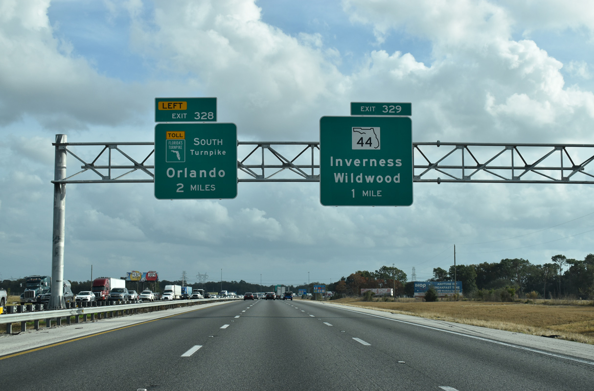
| SR 44 and I-75 converge 4.4 miles west of Downtown Wildwood at forthcoming Exit 329. The state road runs 15 miles west to Inverness and U.S. 41 near the shores of Henderson Lake in Citrus County. Following a short concurrency with U.S. 41, SR 44 resumes a westward heading to Crystal River and U.S. 19/98. 04/29/19 |
|
| I-75 splits with Florida's Turnpike one mile beyond SR 44. SR 44 measures 115.2 miles in length as it crosses the Florida Peninsula. 01/02/21 |
|
| East of Exit 329, SR 44 progresses toward Leesburg and U.S. 441. SR 44 emerges from an implied overlap with U.S. 441 at Eustis and extends northeast to DeLand and New Smyrna Beach. 01/02/21 |
|
| Beginning in Crystal River, State Road 44 stretches east through Lecanto and Inverness before reaching Sumter County and I-75. 01/02/21 |
|
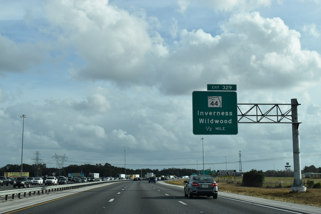
| Exit 329 separates with two lanes for SR 44 and adjacent fuel services at Wildwood. Florida's Turnpike provides fuel options at eight service plazas strategically placed along the tolled facility. 01/02/21 |
|
| A $68.5 million project through Spring 2019 January 2020 addressed the weaving traffic pattern between SR 44 at Wildwood and the southbound split with Florida's Turnpike. Previously anticipated to start in 2015, the three year project added a distributor roadway from the SR 44 entrance ramp.1 10/16/22 |
|
| I-75 advances a half mile south from SR 44 into the wye interchange (Exit 328) with Florida's Turnpike (SR 91). The toll road branches southeast to the greater Orlando area and South Florida. I-75 stays to the west en route to Tampa Bay and to Southwest Florida. 01/02/21 |
|
| Traffic partitions along the distributor roadway from SR 44 for the I-75 southbound mainline and a flyover with the Turnpike south. 10/16/22 |
|
| Florida's Turnpike travels 53 miles southeast to Orlando, while I-75 continues 54 miles to split with I-275 at the Hillsborough county line. 01/02/21 |
|
| Left Exit 328 separates from I-75 south with two lanes for Florida's Turnpike. 01/02/21 |
|
| Leading away from Wildwood, Interstate 75 traverses areas of wetlands east of Lake Panasoffkee. 07/22/20 |
|
| South of the split with Florida's Turnpike, Interstate 75 travels seven miles to SR 470 / CR 470 and 53 miles to the apex with I-275 south into the Tampa Bay area. 01/20/20 |
|
| I-75 runs along the east side of Lake Panasoffkee ahead of the modified diamond interchange (Exit 321) with SR 470 east and CR 470 west. 7.59 miles of the freeway was expanded south to Exit 321 from four to six lanes during a $43.1 million project. Work ran from Spring 2015 to Summer 2018.2 04/29/19 |
|
| Completed in 2002, the Florida Veterans Memorial Bridge spans Lake Panasoffkee and adjacent swamp land on the approach to SR 470 east and CR 470 west. 01/05/19 |
|
| Due to frequent accidents that caused long delays on this portion of I-75, the viaduct over Lake Panasoffkee wetlands was rebuilt from a pair of narrow bridges with no shoulders to an interstate-standard crossing with provisions for six lanes. 04/29/19 |
|
| Exit 321 parts ways with Interstate 75 south. Sumterville lies 2.9 miles to the southeast via SR 470 east and U.S. 301 south. The community of Lake Panasoffkee lies 2.9 miles to the northwest along CR 470. CR 475 also stems south from nearby, paralleling the freeway six miles to CR 48 in Bushnell. 04/29/19 |
|
| Trending southwest, Interstate 75 advances six miles to County Road 48 at the city of Bushnell. The $77.0 million widening of the southern 13.08 mile section of I-75 in Sumter County was completed in Spring 2018.3 04/29/19 |
|
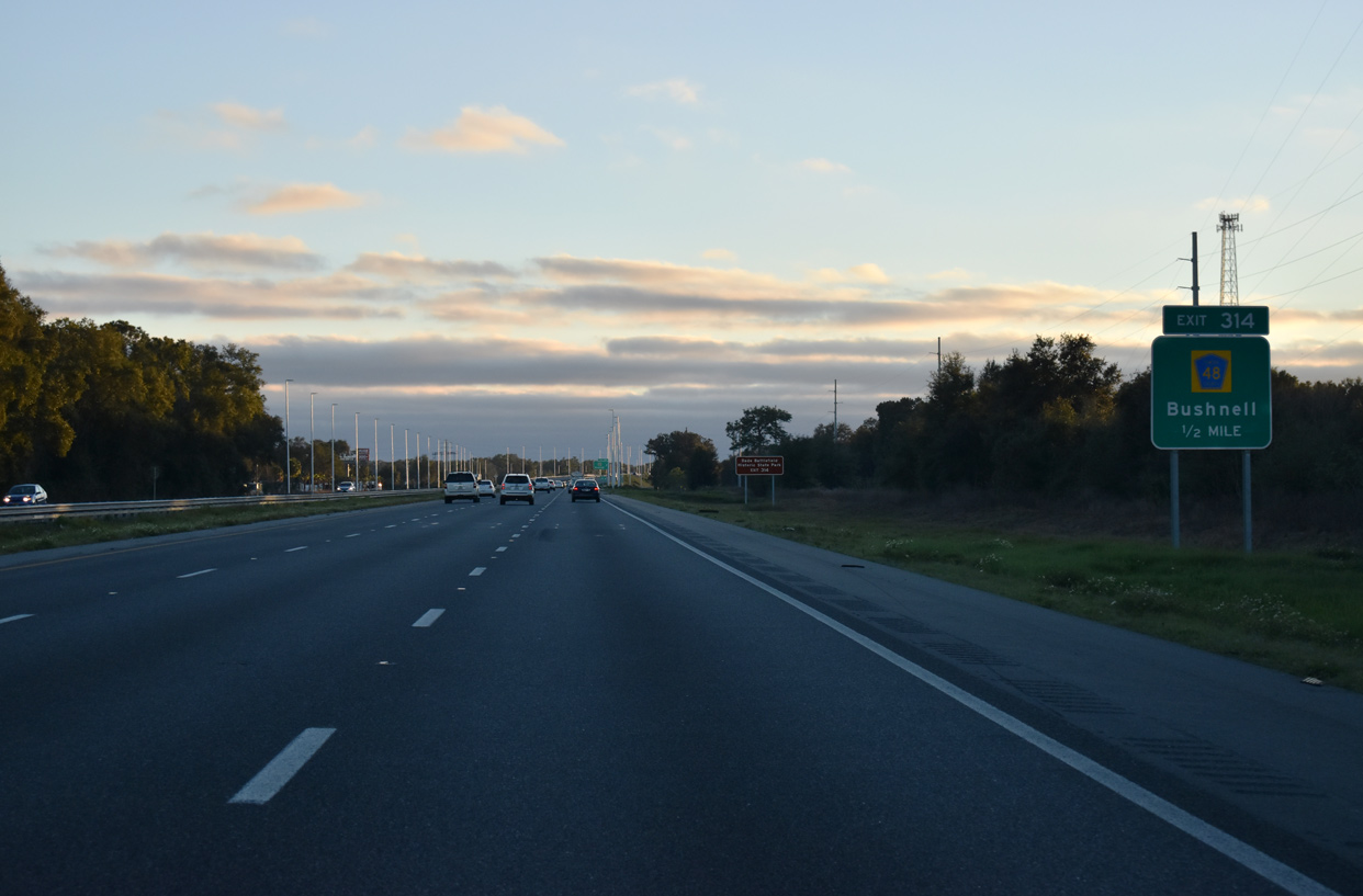
| State Road 48 was turned over from FDOT to Sumter County during a mileage exchange with CR 470 east from I-75 in 2016. SR 48 formally ran 2.1 miles east to U.S. 301 at Downtown Bushnell. CR 48 west extends 12.2 miles to U.S. 41 in Floral City. 01/05/19 |
|
| Entering the diamond interchange (Exit 314) with County Road 48 along I-75 southbound. CR 48 runs along a commercial strip across the west side of Bushnell. East from U.S. 301, CR 48 travels through Center Hill and Okahumpka to SR 19 at Howey-In-The-Hills, 29.4 miles away. 01/05/19 |
|
| Leading away from Bushnell, Interstate 75 progress southwest through a mixture of agricultural and timber land. 11/21/16 |
|
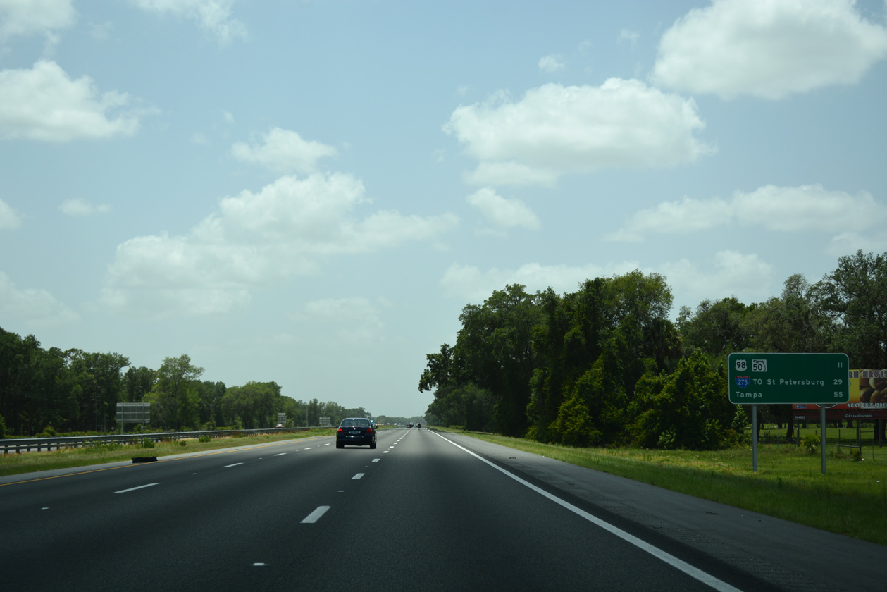
| The succeeding interchange is with CR 476B and CR 673 in 4.5 miles. This distance sign design predates the addition of Exit 309, instead listing the lone Hernando County exit with U.S. 98/SR 50 (Cortez Boulevard) in 11 miles. The split with I-275 south follows in 39 miles. 05/29/17 |
|
| Digital sign displaying the available truck parking spaces for the rest area located ahead at mile marker 307. 01/05/19 |
|
| Interstate 75 spans Gum Slough midway between the CR 476 over crossing and Exit 309 to Webster. 11/21/16 |
|
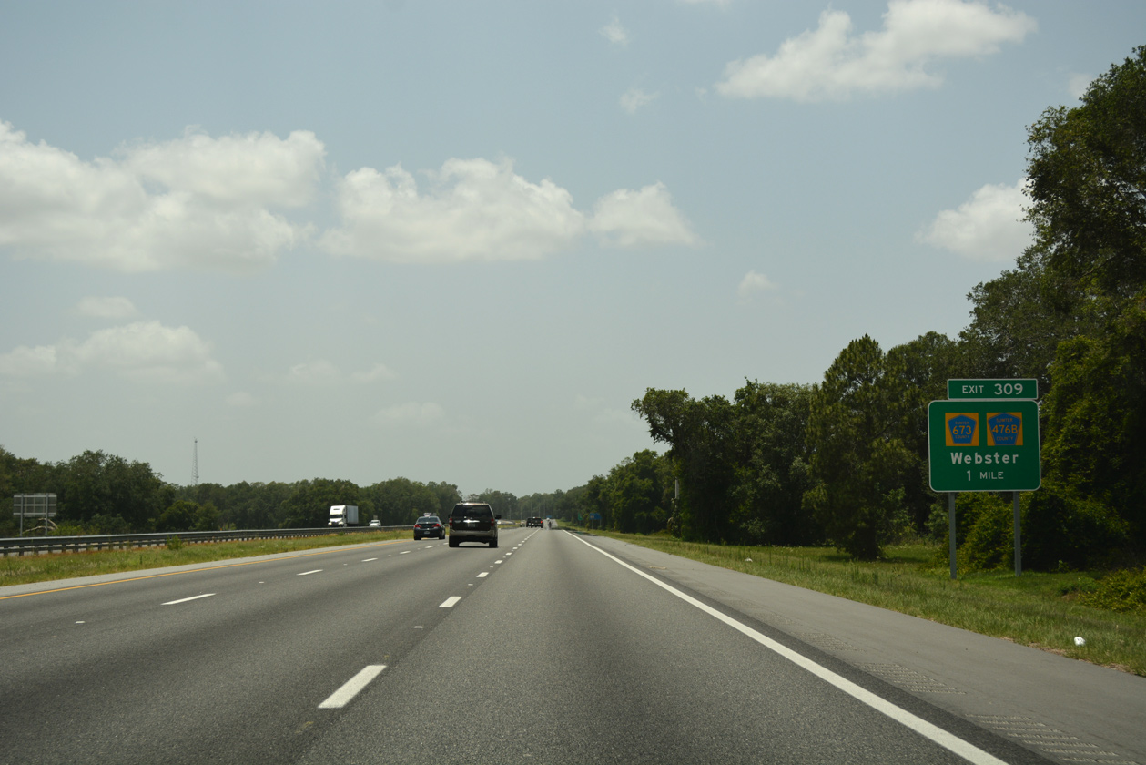
| One mile north of the parclo interchange (Exit 309) with CR 476B west and CR 673 east on I-75 southbound. 05/29/17 |
|
| CR 476B stems 3.2 miles south from CR 476 to Florida National Cemetery and Interstate 75. CR 476B becomes CR 673 east from Exit 309 four miles to U.S. 301. 05/29/17 |
|
| Prior to 2016-17 widening of I-75 in southern Sumter County, guide signs for Exit 309 referenced County Road 476 for Webster. CR 476 crossed over I-75 on the outskirts of Bushnell without direct access. Webster lies 9.5 miles to the east of Exit 309 via a combination of CR 673, U.S. 301 and CR 478. 11/21/16 |
|
| Pentagons for CR 673 north and CR 476B west appear along the off-ramp at Exit 309. The rural city of Webster is home of the Webster Westside Flea Market. Located by the intersection of SR 471 and Sumter County Road 478, the flea market is one of the largest in the state. 09/02/13 |
|
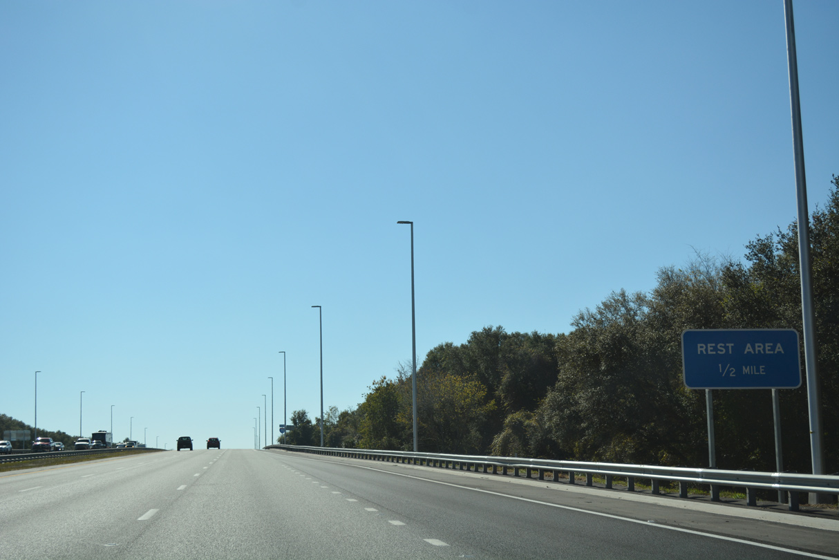
| South from Exit 309, Interstate 75 enters the Croom Wildlife Management Area of Withlacoochee State Forest. Rest areas line both sides of the freeway along this stretch. 05/29/17, 11/21/16 |
|
| Reassurance marker posted at the SW 113th Place underpass. 11/21/16 |
|
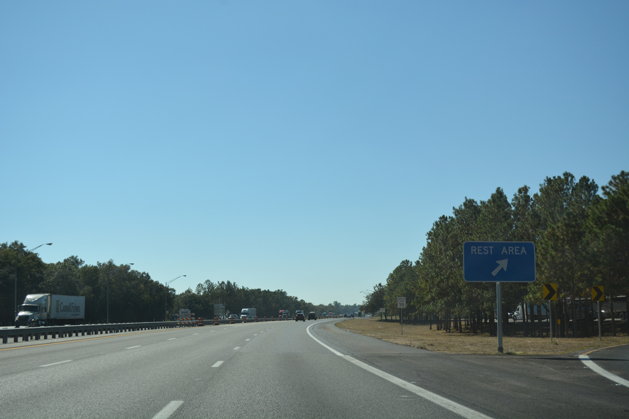
| Motorists depart for the Sumter County rest area. The ensuing rest area along Interstate 75 southbound is between Pasco County Road 54 / Exit 279) and SR 56 / Exit 275 in 29.4 miles. 11/21/16 |
|
| I-75 south enters Hernando County between mile markers 306 and 307 crosses the northern end of Silver Lake. The lake is part of the Withlacoochee River system, which meanders 141 miles from the Green Swamp east of Polk City northwest to the Gulf of Mexico near Yankeetown. 09/17/19 |
09/02/13, 11/21/16, 05/29/17, 01/05/19, 04/29/19, 09/17/19, 01/20/20, 07/22/20, 01/02/21, 10/16/22 by AARoads
Page Updated 10-17-2022.

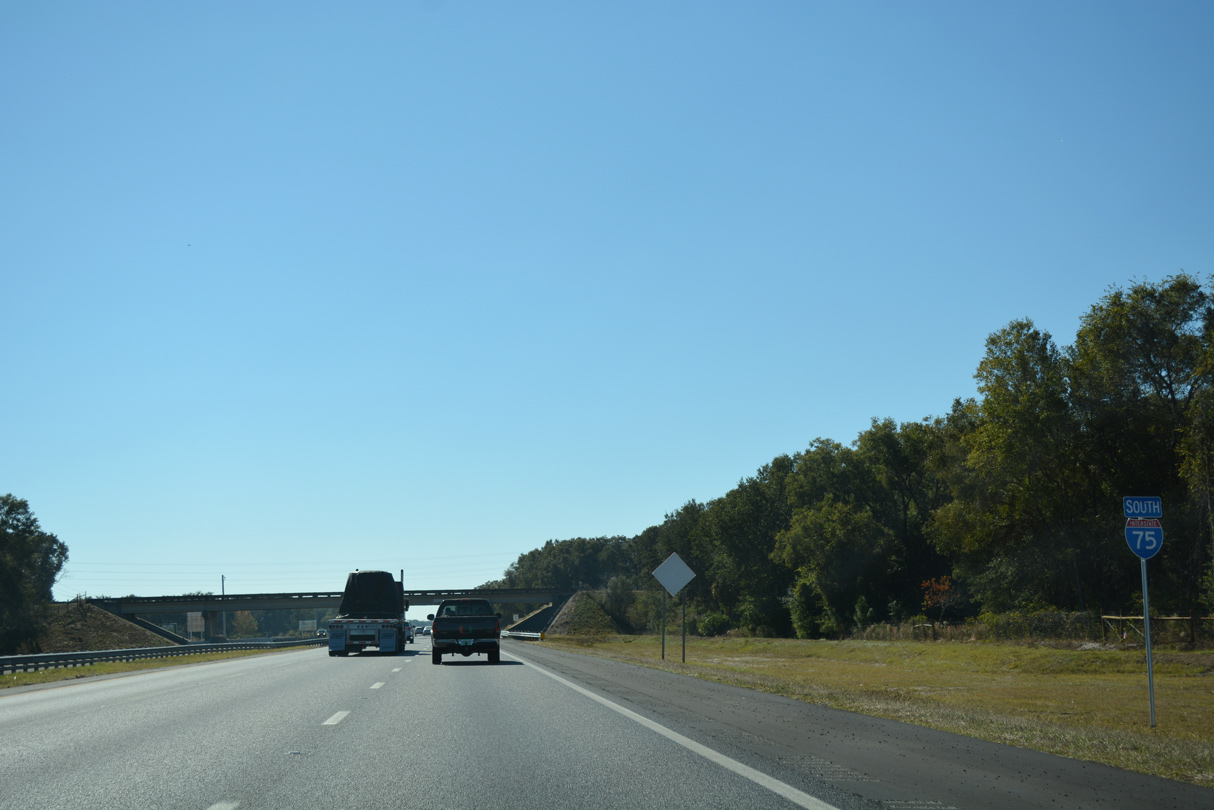
 South
South