|
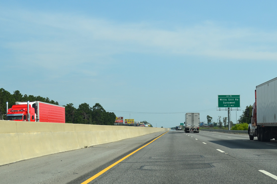
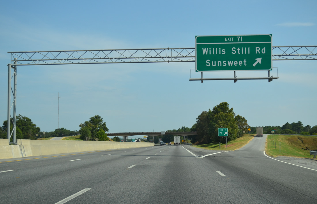
| The rural diamond interchange (Exit 71) with Willis Still Road is the first of 11 exits along I-75 south in Tift County. 08/07/13 |
|
| Willis Still Road travels 3.8 miles west from the Irwin County line to U.S. 41/SR 7 at the settlement of Sunsweet. 08/07/13 |
|
| Exit 71 departs Interstate 75 south for Willis Still Road. Academy Drive stems from the exchange 1.40 miles to U.S. 41/SR 7 at the unincorporated community of Chula. 08/07/13 |
|
| I-75 advances one mile south from Willis Still Road to the diamond interchange (Exit 69) with Chula-Brookfield Road. 08/07/13 |
|
| Chula-Brookfield Road stems 4.31 miles east from adjacent U.S. 41/SR 7 at Chula to Whitewater Road in Irwin County. 08/07/13 |
|
| Southbound at the Exit 69 to Chula-Brookfield Road. 08/07/13 |
|
| Progressing toward Tifton, Interstate 75 remains rural alongside farm land. GDOT recorded 35,910 vehicles per day on this stretch in 2012. 08/07/13 |
|
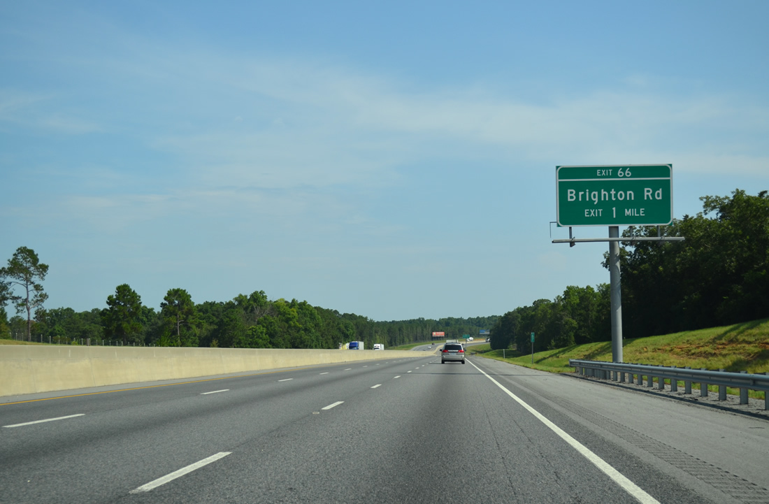
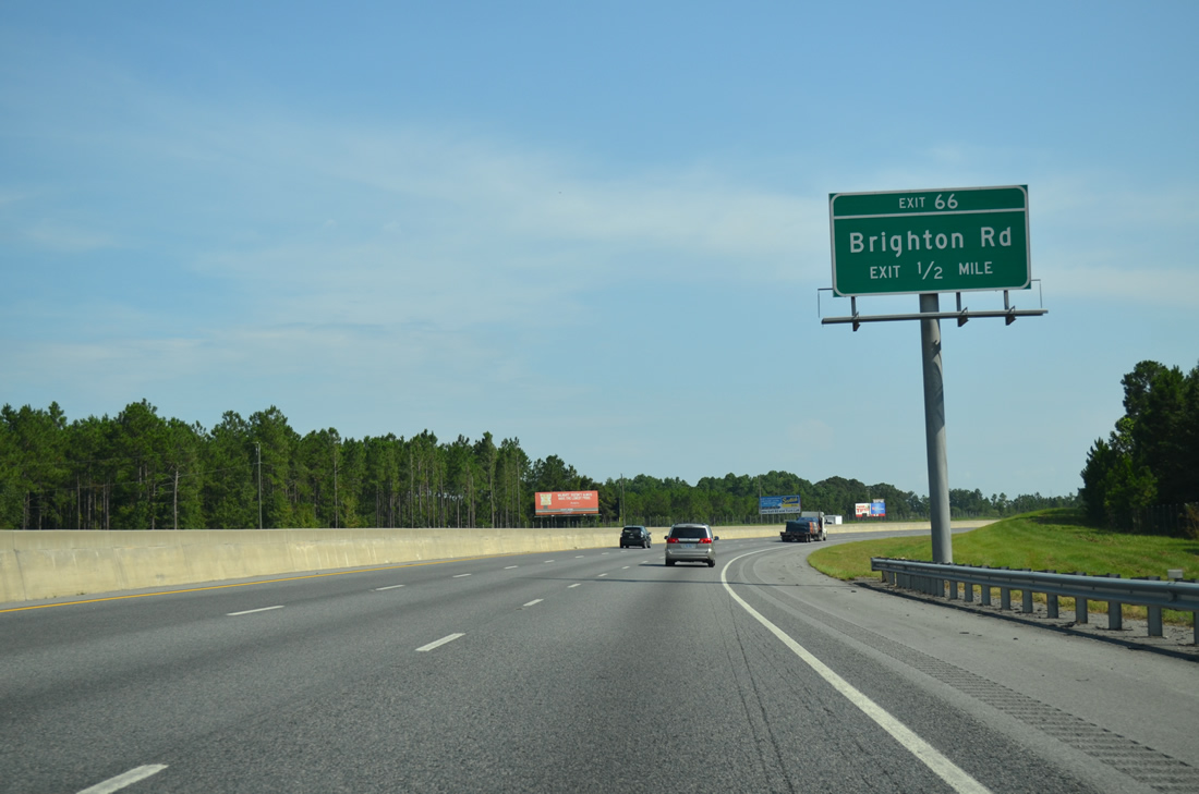
| Brighton Road links Interstate 75 with U.S. 41/SR 7 to the west and SR 125 to the east. 08/07/13 |
|
| East from Exit 66 and SR 125, Brighton Road advances another 2.69 miles to Old Ocilla Road and the outlying suburbs of Tifton. 08/07/13 |
|
| $15.1 million in construction started in 2014 rebuild the compact exchange at Exit 66 into a wide parclo interchange. The overpass for Brighton Road built in 1959 was also replaced.1 08/07/13 |
|
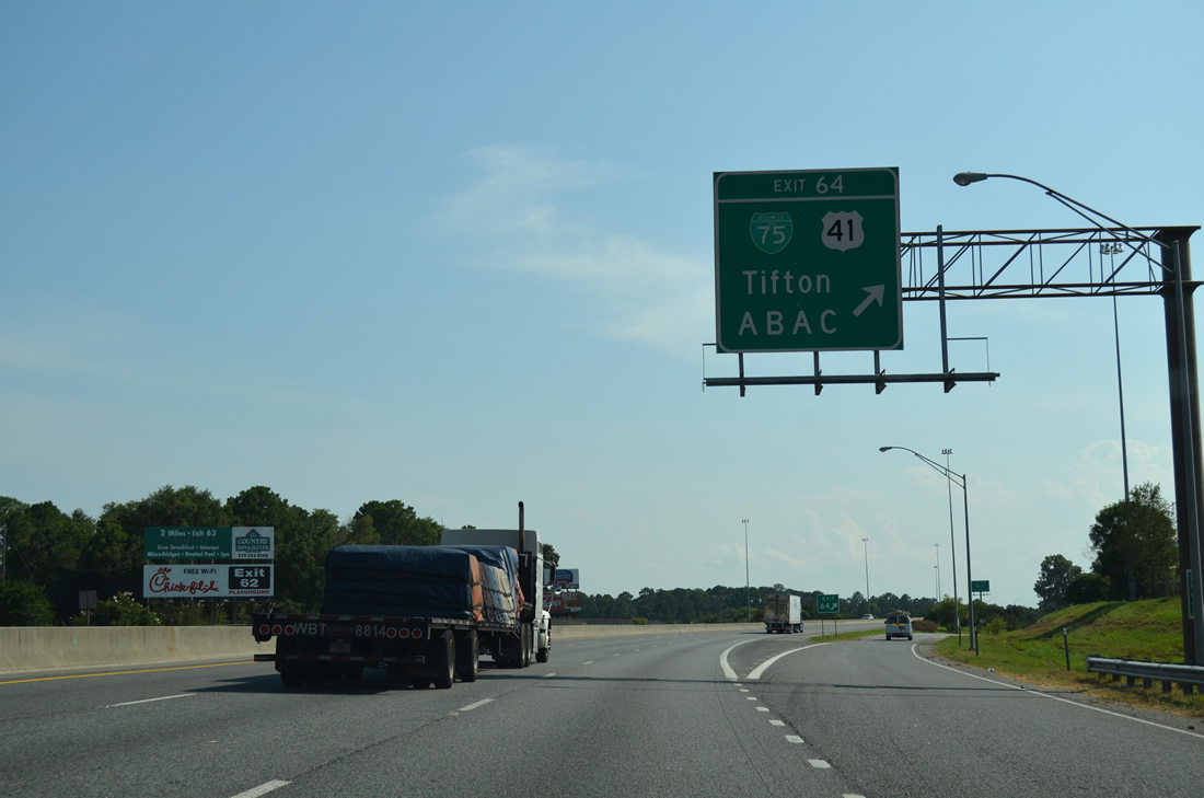
| Having last met the freeway directly at Unadilla, U.S. 41/SR 7 converge with I-75 again at Exit 64. U.S. 41 through Tifton was Business Loop I-75, The only remaining signs for the business route are the overheads for Exit 64 southbound and Exit 59 northbound. 08/07/13 |
|
| The diamond interchange with Business Loop I-75 south, U.S. 41 and SR 7 lies just east the Abraham Baldwin Agricultural College (ABAC) campus. 08/07/13 |
|
| Exit 64 is the first of five for the city of Tifton. Business Loop I-75 ran concurrent with U.S. 41/SR 7 along 12th Street and Love Avenue to Downtown. The business route returned to I-75 via Southwell Boulevard at Exit 59. 08/07/13 |
|
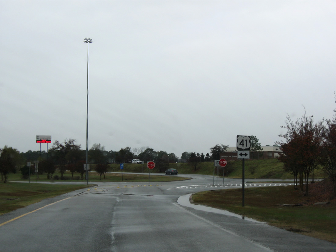
| A lone U.S. 41 shield stands along the off-ramp at Exit 64. Some Business Loop I-75 signs for U.S. 41 remained posted until 2005. 11/26/10 |
|
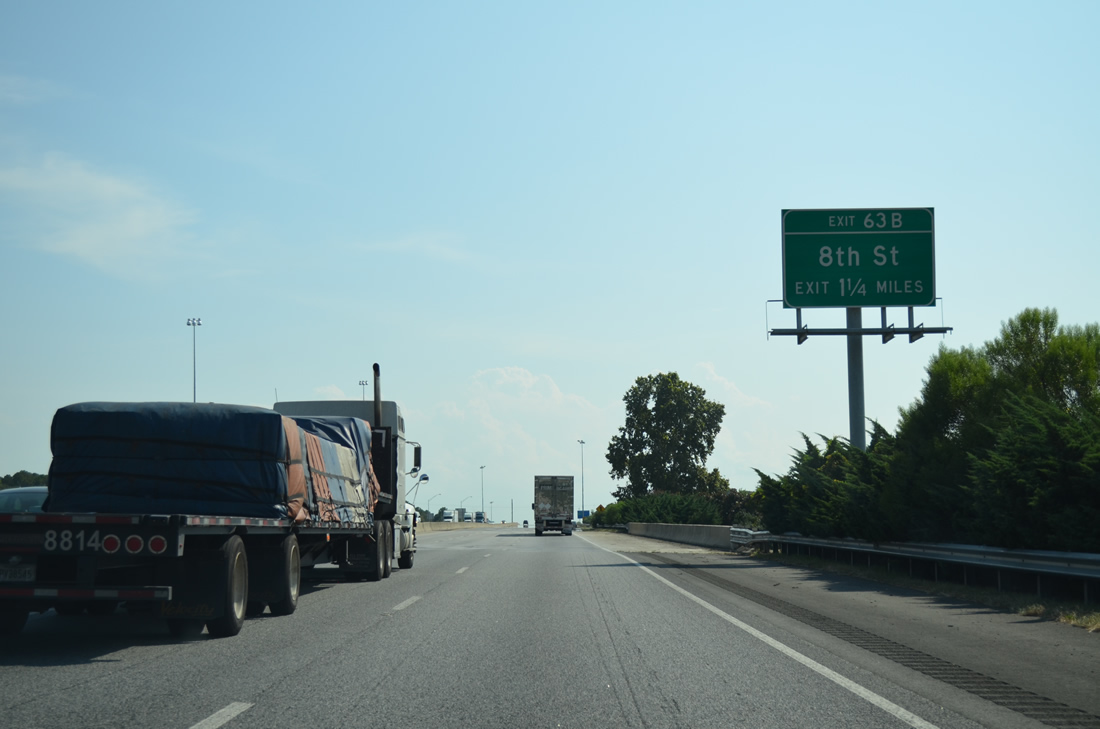
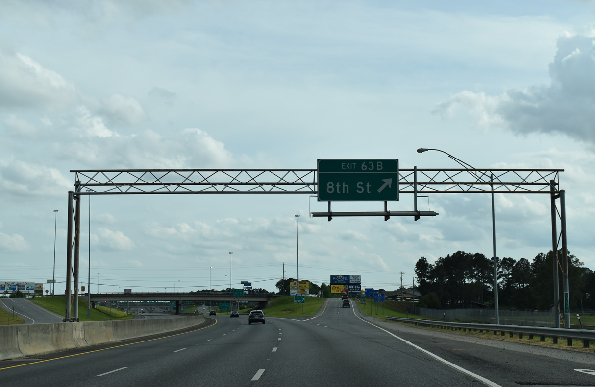
| I-75 spans a Norfolk Southern Railroad line and Baldwin Drive 1.25 miles from Exit 63B to 8th Street east and Whiddon Mill Road west. 08/07/13 |
|
| Curving southwest, I-75 proceeds toward the split diamond interchange (Exit 63) with 8th and 2nd Streets. 04/18/20 |
|
| 8th Street lines the north end of a retail corridor alongside I-75 east to the residential street grid north of Downtown Tifton. Whiddon Mill Road extends northwest from Exit 63B to the western suburbs and Whiddons Millpond. 04/18/20 |
|
| Exit 63A comprises a slip ramp onto the service road linking 8th and 2nd Streets. 2nd Street runs through the retail corridor east of I-75 to Downtown. 04/18/20 |
|
| 2nd Street becomes King Road west of Interstate 75 to E.B. Hamilton Drive and Friendly City Park. 04/18/20 |
|
| SR 520 (Corridor Z) overlays a number of routes from the Alabama state line at Columbus to Jekyll Island on the Atlantic Coast. Joining U.S. 280 south from Columbus to Richland, replacing SR 55 south to Dawson, and supplementing U.S. 82 east to Waycross, SR 520 was commissioned in 1988.2 09/11/20 |
|
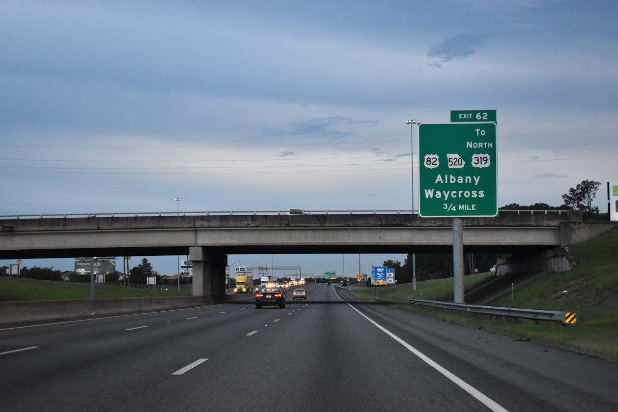
| A folded diamond interchange (Exit 62) joins I-75 south with U.S. 82/SR 520 (7th Street W) beyond the underpass for the former Seaboard Coast Line railroad. 04/18/20 |
|
| U.S. 82/SR 520 (7th Street W) advance westward from Exit 62, 7.6 miles to Ty Ty, 19 miles to Sylvester and 37 miles to Albany. U.S. 82/319-SR 35/520 combine east through Downtown to split for Pearson and Ocilla respectively. 04/18/20 |
|
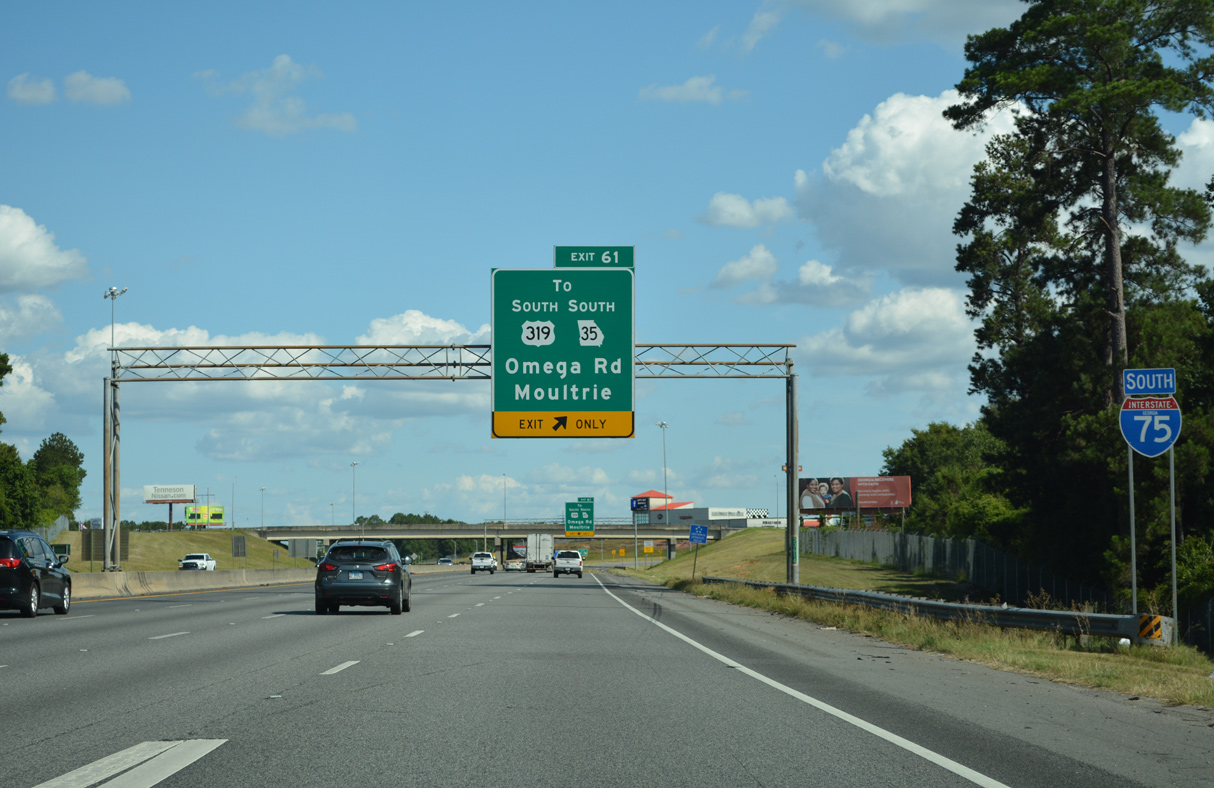
| Interstate 75 next meets Old Omega Road (SR 35CO) at what was originally a diamond interchange (Exit 61). 06/26/22 |
|
| An auxiliary lane accompanies I-75 to the folded diamond interchange (Exit 61) with SR 35CO (Old Omega Road). U.S. 319/SR 35 branches south from U.S. 82/SR 520 (7th Street W) to Moultrie and Thomasville. 06/26/22 |
|
| Signed from Exit 61 as Omega Road, Old Omega Road heads 1.05 miles east from U.S. 319/SR 35 to Park Avenue in the Tifton street grid. U.S. 319 leads south from SR 35CO (Old Omega Road) 8.3 miles to the city of Omega. 06/26/22 |
|
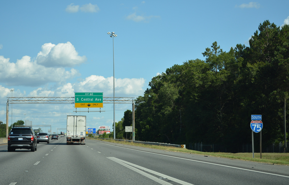
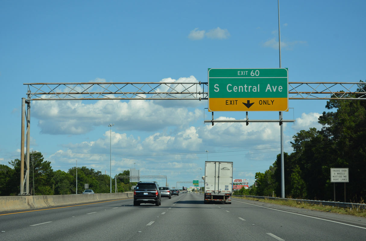
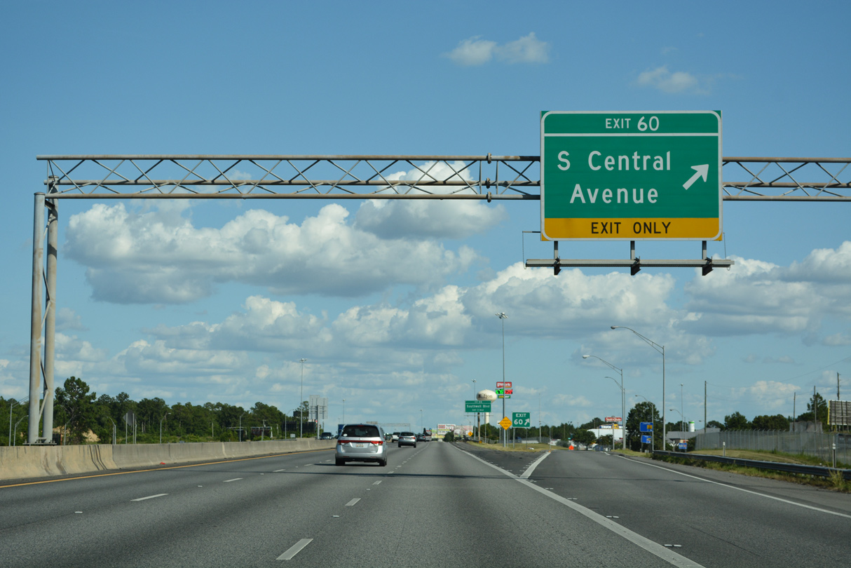
| Curving back to the southeast, Interstate 75 spans a railroad spur ahead of Exit 60 with S Central Avenue at Phillipsburg. 06/26/22 |
|
| S Central Avenue runs 1.37 miles south from U.S. 82/319 (7th Street) outside Downtown Tifton to a diamond interchange (Exit 60) with Interstate 75 opposite Union Road. 06/26/22 |
|
| Union Road extends S Central Avenue from Exit 60 to a Target distributor center nearby, Lake Larry and Old Union Road north of Lenox. 06/26/22 |
|
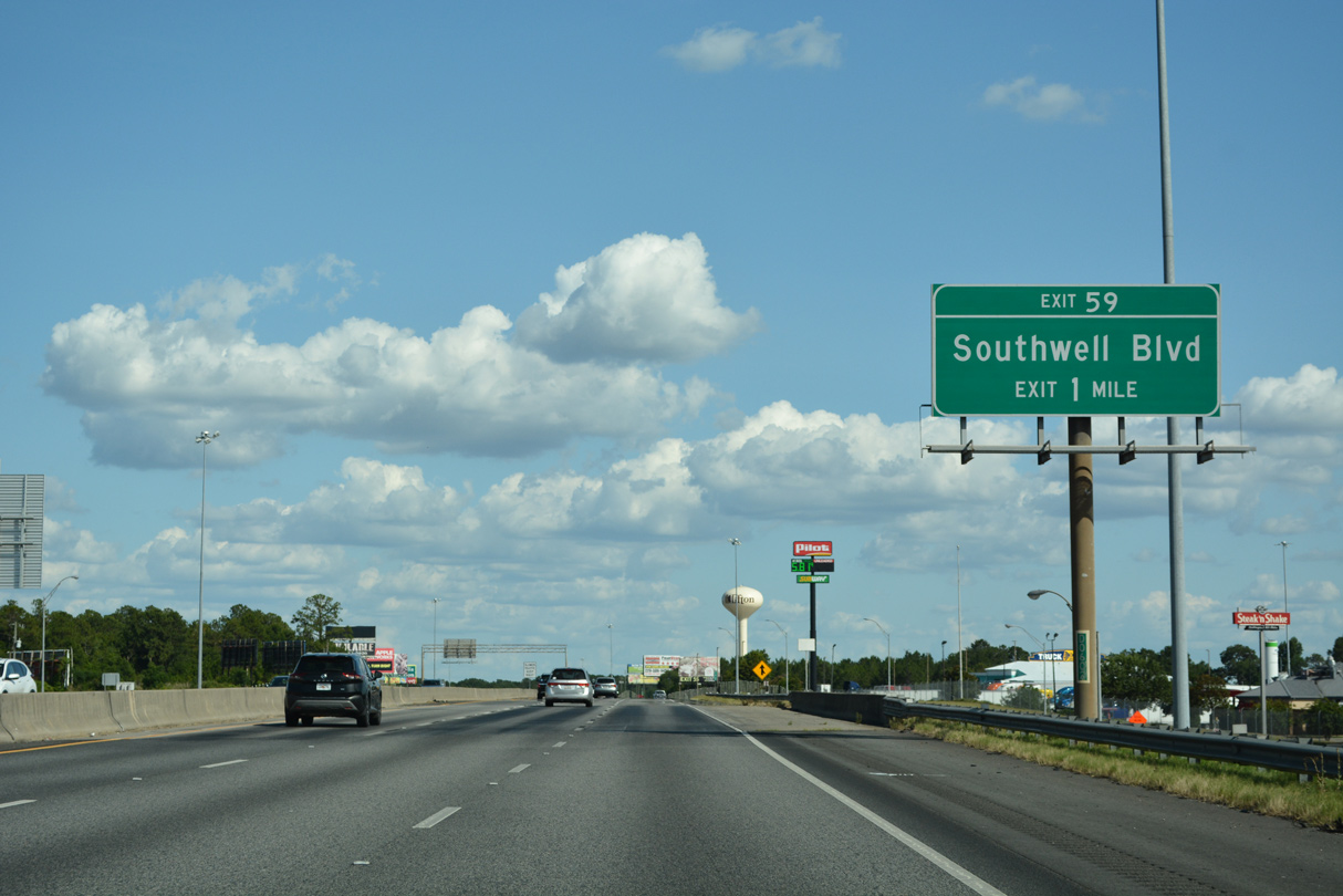
| U.S. 41/SR 7 arc south from Tifton and the community of Unionville by Henry Tift Myers Airport (TMA) to Southwell Boulevard. Southwell Boulevard returned Business Loop I-75 west 0.22 miles to I-75 at Exit 59. 06/26/22 |
|
| Interstate 75 continues beyond Unionville to the diamond interchange (Exit 59) with Southwell Boulevard by Southern Regional Technical College. 06/26/22 |
|
| Exit 59 leaves Interstate 75 south for Southwell Boulevard west to Union Road and east to an industrial area between U.S. 41/SR 7 and SR 125. 06/26/22 |
|
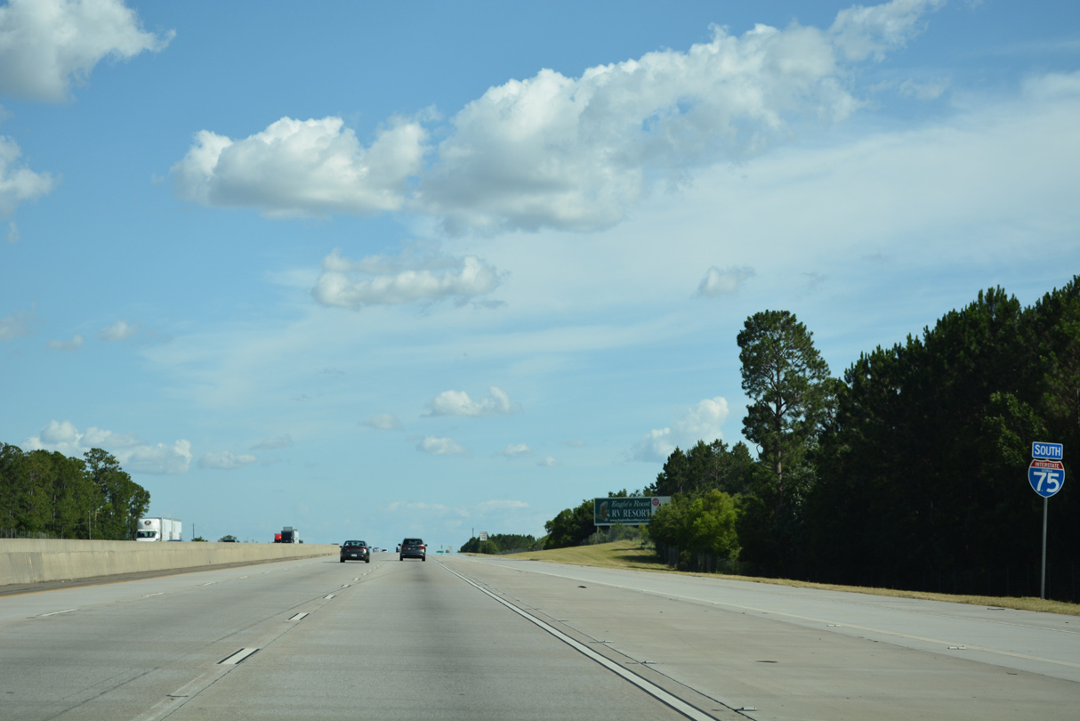
| Interstate 75 leaves an area of industrial businesses south of Tifton south to Valdosta in 44 miles. 06/26/22 |
|
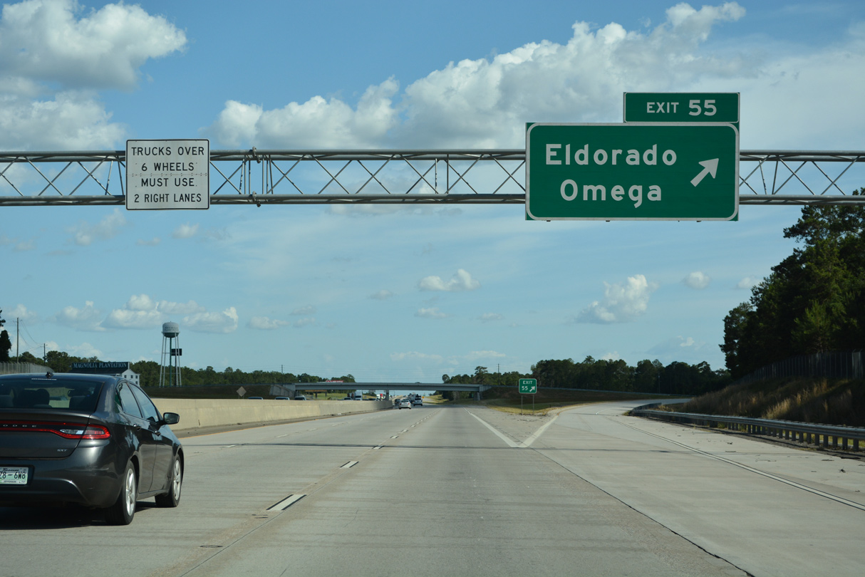
| A diamond interchange (Exit 55) connects Interstate 75 with Omega Eldorado Road in one mile. 06/26/22 |
|
| The exchange at Exit 55 with Omega Eldorado Road was rebuilt with longer ramps during road work in 2013. 06/26/22 |
|
| The unincorporated community of Eldorado lies along adjacent U.S. 41/SR 7. Omega is 7.2 miles to the west along the stair stepped route of Eldorado Omega Road. 06/26/22 |
|
| I-75 continues south parallel to U.S. 41/SR 7 and a Norfolk Southern Railroad line five miles to Lenox. 06/26/22 |
|
| Crossing into Cook County along Interstate 75 south, midway between the Little River and New River. 06/26/22 |
|
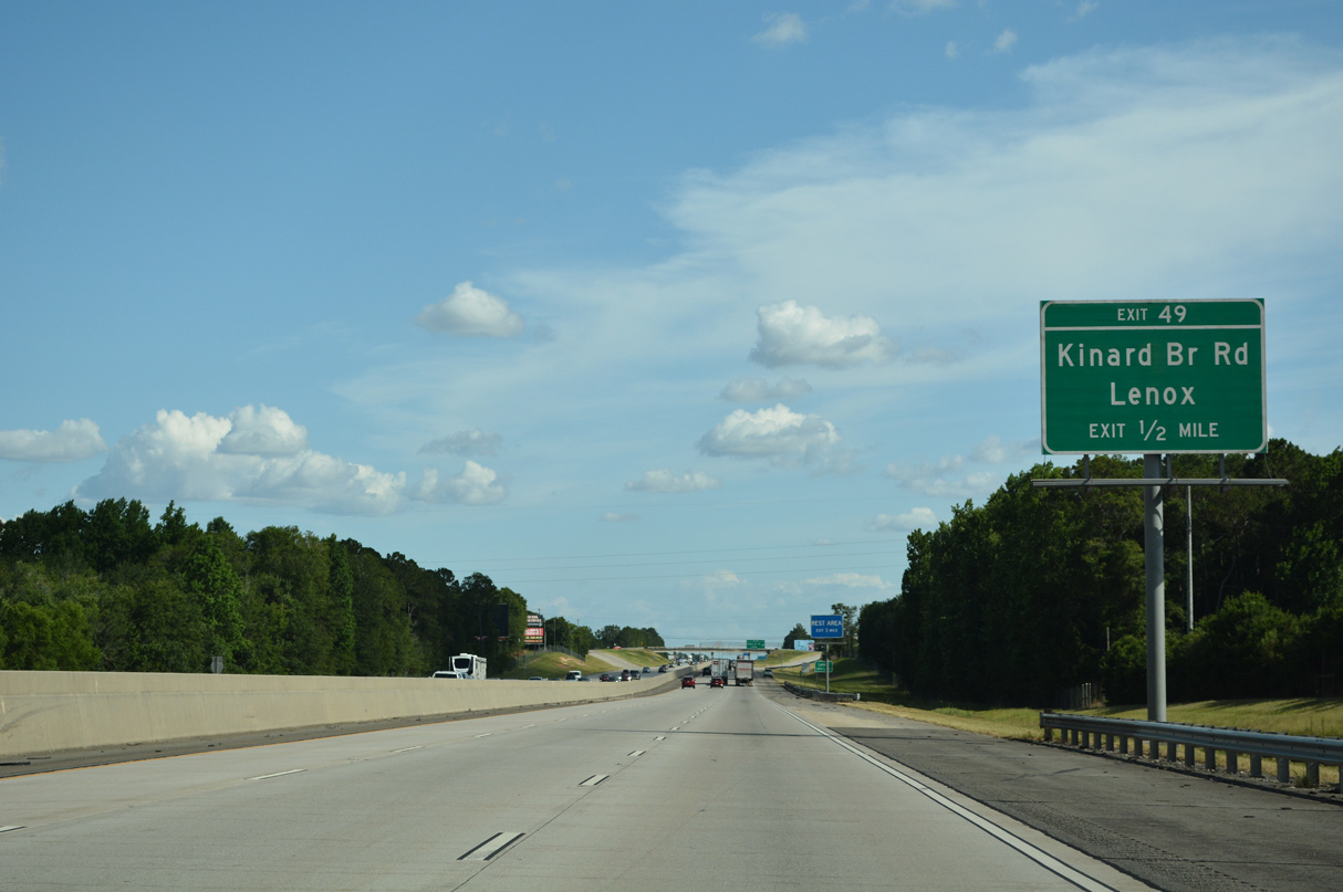
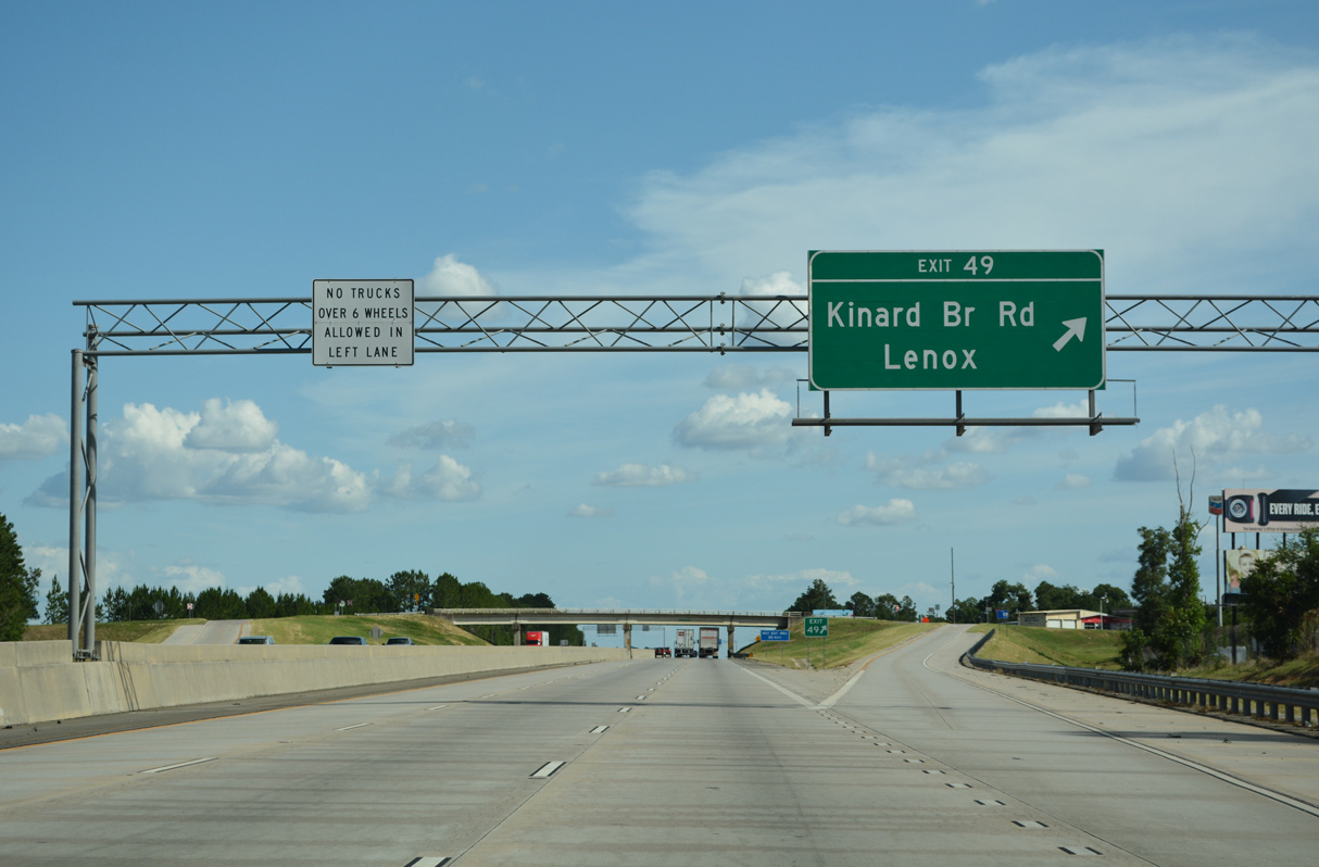
| The first of six Cook County exits joins Interstate 75 south with Kinard Bridge Road west and Central Avenue east at the city of Lenox. 06/26/22 |
|
| Kinard Bridge Road meanders 2.5 miles west from Central Avenue at Exit 49 to span the Little River into Colquitt County as Moultrie-Lenox Road. 06/26/22 |
|
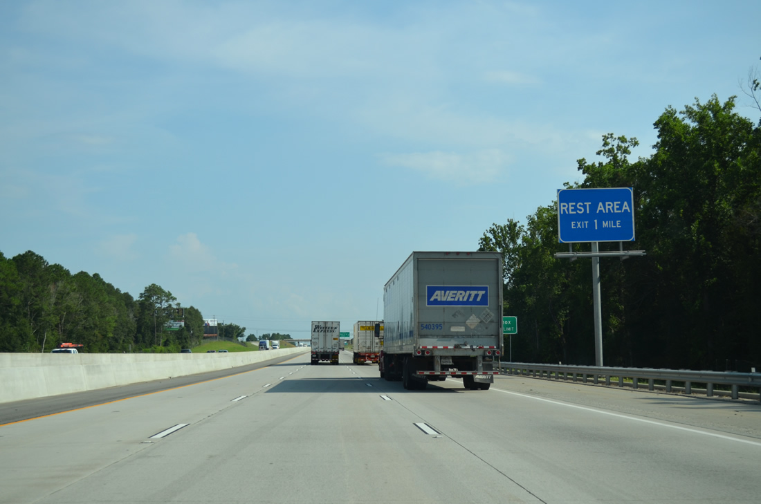
| The last Georgia rest area on I-75 south is just outside Lenox beyond Exit 49. 08/07/13 |
|
| East from the diamond interchange (Exit 49) with I-75, Central Avenue crosses the Lenox business district en route to Judge Lott Road, which extends east to the Berrien County line along the New River. 06/26/22 |
|
| Rest Area #6 lines I-75 south at milepost 48.0. Located at milepost 46.7, the northbound facility is Rest Area #5. The next area southbound is the Florida Welcome Center. 06/26/22 |
|
| Rural Interstate 75 continues south by Wagon Wheel. GDOT recorded 34,660 vehicles per day (vpd) here in 2012 and 48,200 vpd in 2019. 06/26/22 |
|
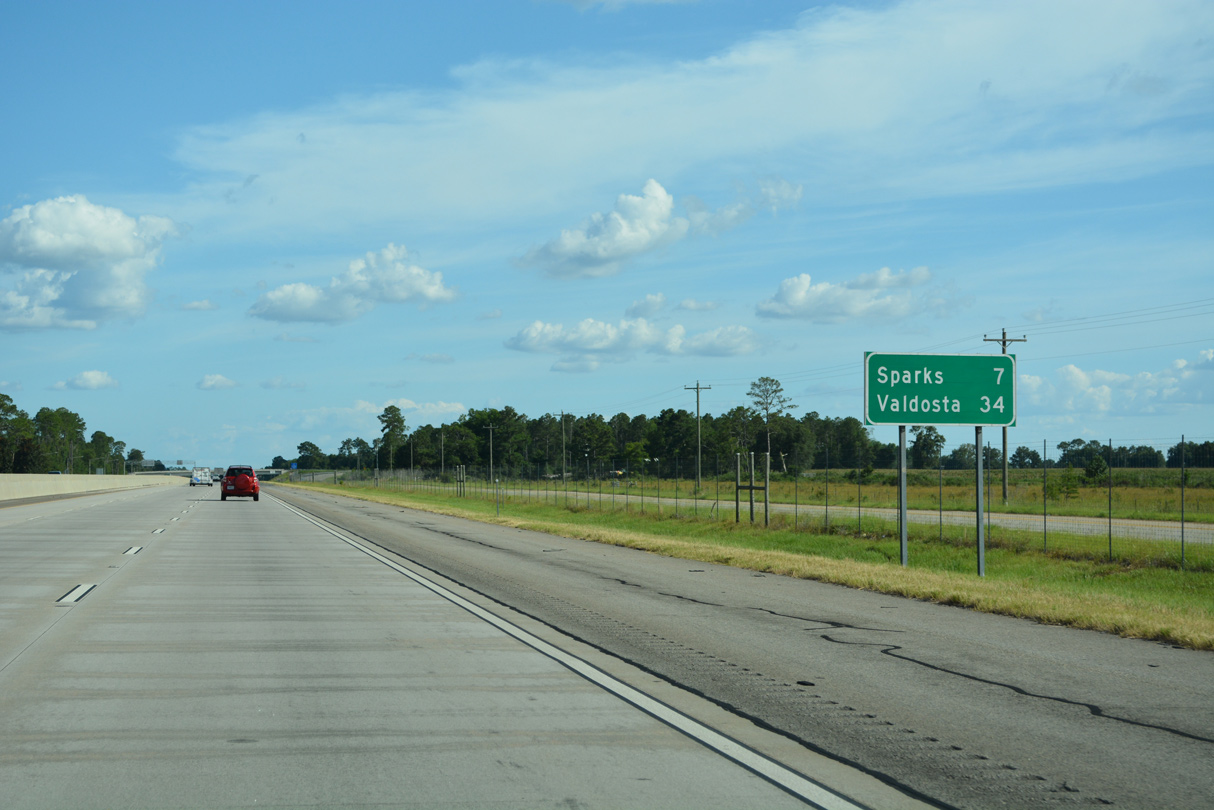
| Sparks, a town of around 2,000, is next along I-75 south in seven miles. Valdosta is a half hour away. 06/26/22 |
|
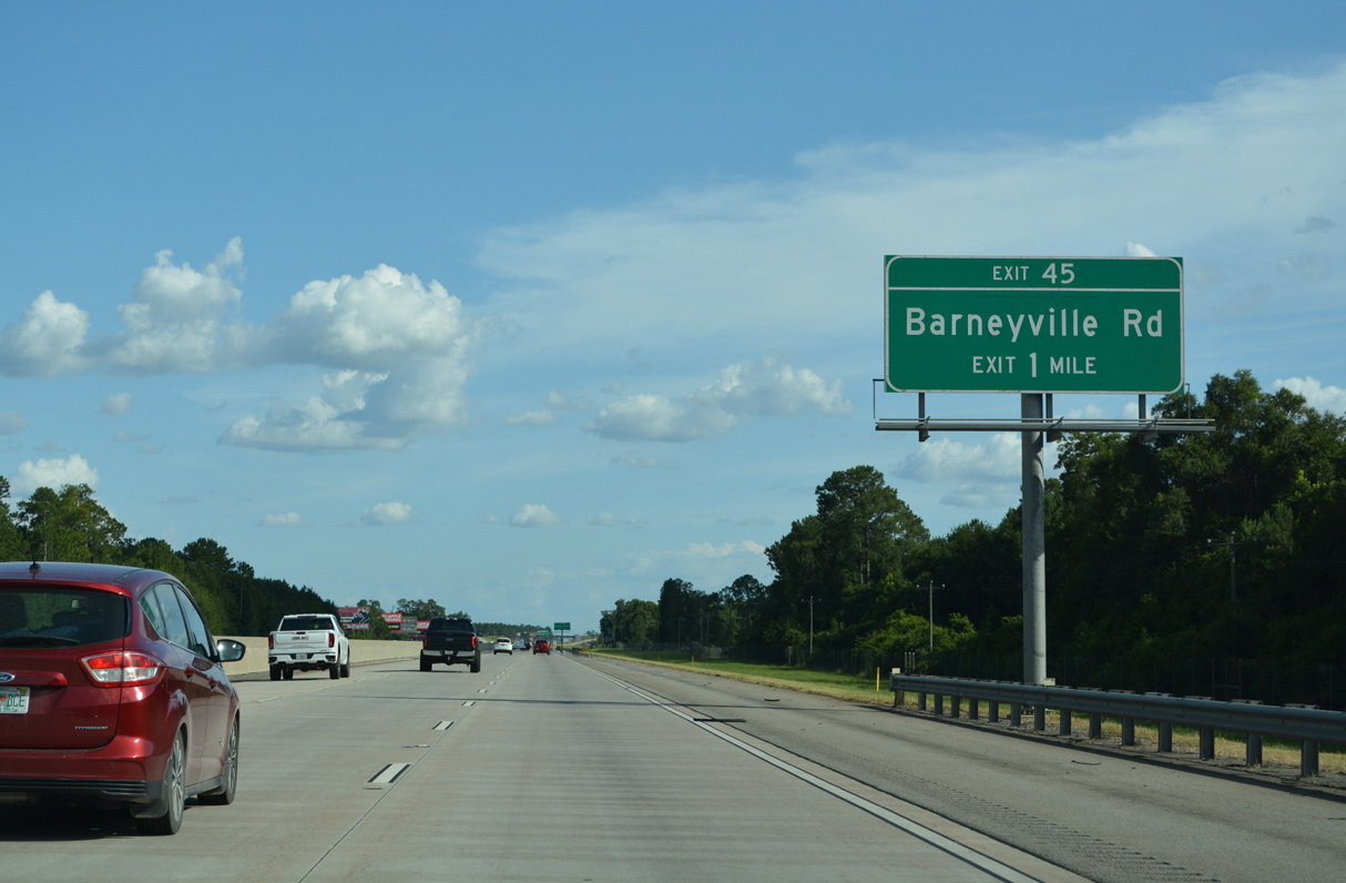
| Barneyville Road angles 4.02 miles southeast from Kinard Bridge Road near the Colquitt County line to the diamond interchange at Exit 45. 06/26/22 |
|
| Barneyville Road links Interstate 75 south with U.S. 41/SR 7 at Barneyville. 06/26/22 |
|
| Barnevyille Road continues 7.64 miles east from Exit 45 to the Norfolk Southern Railroad siding of Laconte, Chaserville and the Berrien County line. Chaserville Road extends the rural highway 3.55 miles east to SR 125 near the city of Nashville. 06/26/22 |
Page Updated 09-18-2022.

 South
South