|
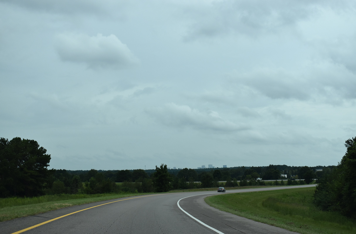
| Ramps from both directions of Interstate 26 and U.S. 21-176-321 (Charleston Highway) come together at a systems interchange near Dixiana. The Columbia skyline appears on the northern horizon here. 09/16/21 |
|
| Interstate 77 spans a CSX Railroad a half mile from Exit 2 for S.C. 35 (12th Street Extension). 09/16/21 |
|
| S.C. 35 leads north on the 12th Street Extension, a five lane arterial completed in October 2003, between I-77 and S.C. 2 (Frink Street) in Cayce. Further lengthening of 12th Street pushed the road south to Old Wire Road. 09/16/21 |
|
| S.C. 35 runs 5.63 miles north from Interstate 77 to U.S. 378 (Sunset Boulevard) in West Columbia. 09/16/21 |
|
| The diamond interchange at Exit 2 opened initially with a connector to Saxe Gotha Road, a service road linking S.C. 35 west 1.08 miles to Dixiana Road. 05/26/19 |
|
| The first shield for Interstate 77 north precedes Congaree Creek. The Southeastern Beltway traverses an area of wetlands between Exit 2 and the Congaree River. 09/16/21 |
|
| I-77 next spans the Congaree River across the Alex Sanders Bridge into Richland County. The Congaree flows southward from the confluence of the Broad and Saluda Rivers in Columbia 47 miles to the Wateree River at Lake Marion. 09/16/21 |
|
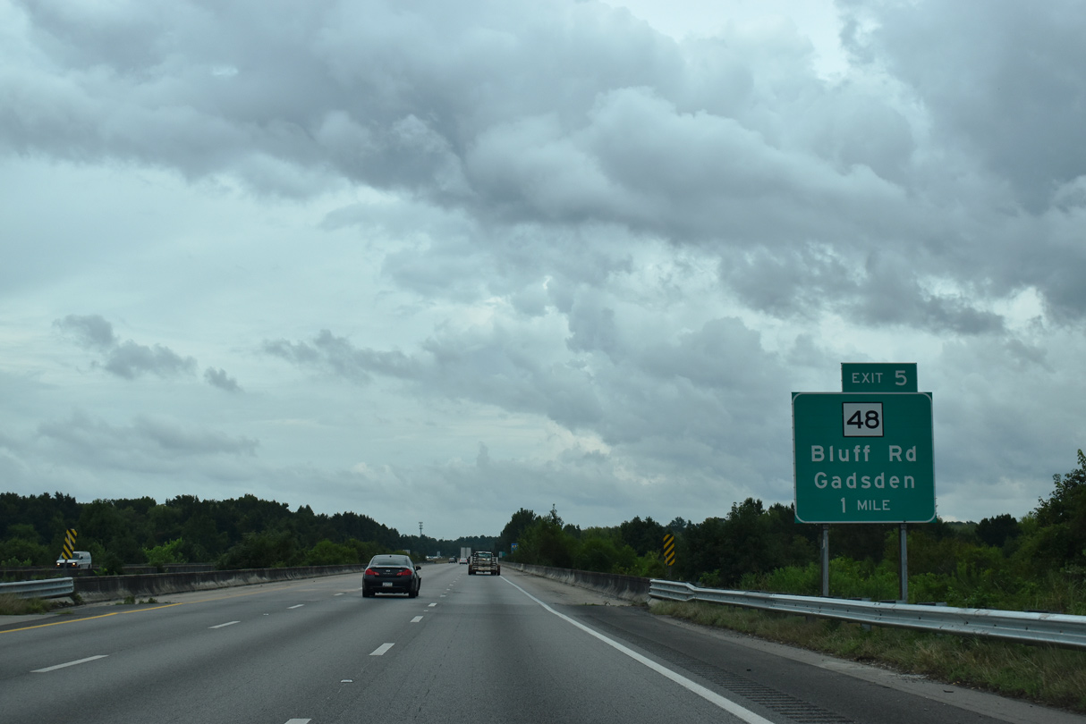
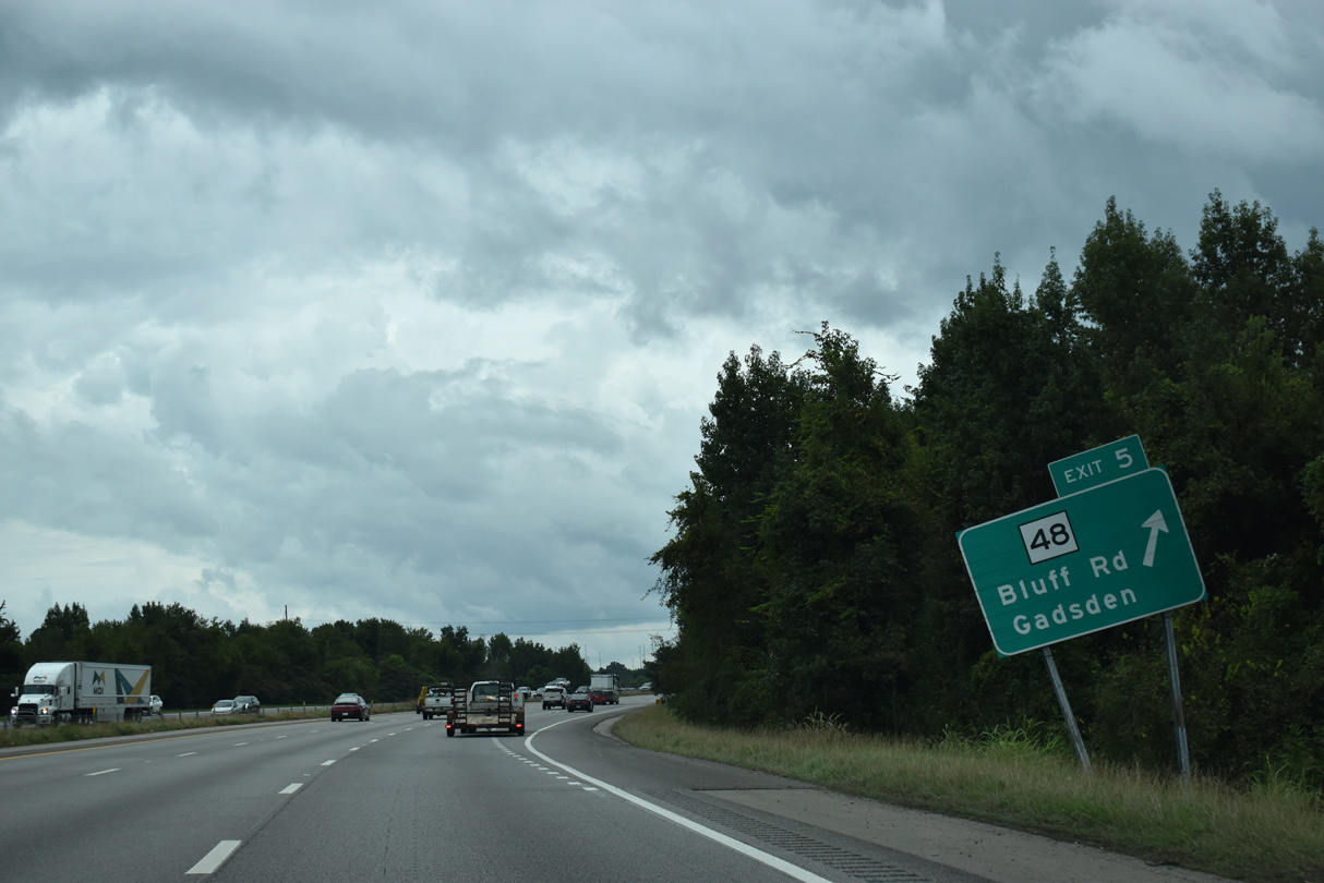
| Bending northeast, Interstate 77 advances one mile to Exit 5 with S.C. 48 (Bluff Road) near Arthurtown. A 28.98 mile long highway, S.C. 48 travels southeast from Columbia to Gadsden and U.S. 601 at Wateree. 09/16/21 |
|
| Williams Brice Stadium, home of the University of South Carolina Gamecocks, and the State Fairgrounds lie 2.3 miles north of I-77 along S.C. 48 (Bluff Road). 09/16/21 |
|
| Congaree National Park lies southeast of Columbia and south of Gadsden and S.C. 48. 09/16/21 |
|
| S.C. 48 (Bluff Road) heads 5.66 miles from the diamond interchange at Exit 5 to U.S. 21-76-176-321 (Elmwood Avenue) north of the State Capitol and Downtown Columbia. 09/16/21 |
|
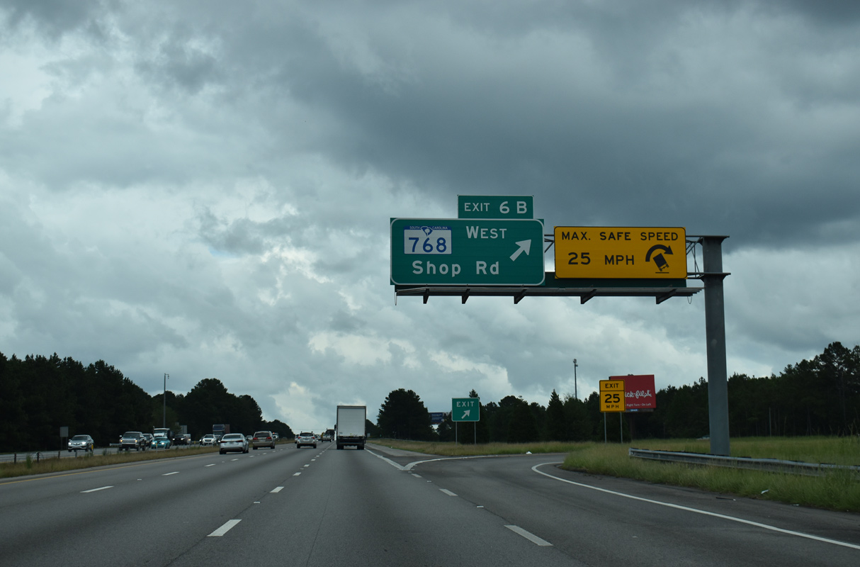
| A three quarter cloverleaf interchange (Exits 6A/B) with S.C. 768 (Shop Road) lies one mile east of S.C. 48 on I-77 north. 09/16/21 |
|
| An auxiliary lane opens along I-77 north to Exit 6A for S.C. 768 (Shop Road) east. S.C. 768 comprises a 4.87 mile long route from S.C. 48 (Bluff Road) along S Beltline Boulevard to U.S. 76/378 (Garners Ferry Road) along Pineview Drive. 09/16/21 |
|
| Exit 6A departs Interstate 77 north for S.C. 768 (Shop Road) east. Serving industrial areas, Shop Road is a four lane arterial southeast from S Beltline Boulevard to Longwood Road (Road 960). 09/16/21 |
|
| Exit 6B loops onto S.C. 768 (Shop Road) west. 09/16/21 |
|
| Shop Road (Road 727) continues northwest from S.C. 768 at S Beltline Boulevard to George Rogers Boulevard near Williams Brice Stadium as an alternate route to S.C. 48 (Bluff Road). 09/16/21 |
|
| Curving northward by the Heritage Woods subdivision, Interstate 77 converges with U.S. 76-378 (Garners Ferry Road) and S.C. 262 (Leesburg Road) at Exit 9. 09/16/21 |
|
| U.S. 76/378 overlap 44.8 miles east from Bull Street in Downtown Columbia to U.S. 76 Business (Liberty Street) at Sumter. A folded diamond interchange joins I-77 with U.S. 76/378 on Garners Ferry Road by the USC School of Medicine and WJB Dorn VA Medical Center. 09/16/21 |
|
| Exit 9A departs from a c/d roadway for U.S. 76/378 (Garners Ferry Road). U.S. 76/378 continue 4.2 miles northwest to combine with U.S. 1 along Gervais Street west toward Downtown Columbia. 09/16/21 |
|
| S.C. 262 (Leesburg Road) stems east from U.S. 76/378 (Garners Ferry Road) adjacent to the parclo interchange at Exit 9B. S.C. 262 lines the southern boundary of Fort Jackson along a 14.71 mile long course east to U.S. 601. 09/16/21 |
|
| S.C. 760 (Fort Jackson Boulevard) provides one of two routes from Interstate 77 into Fort Jackson at forthcoming Exit 10. 09/16/21 |
|
| Strom Thurmond Boulevard east from Exit 12 leads to the main gate for Fort Jackson. Gate 4 for the Army Base is located south of I-77 along Boyden Arbor Road between Exit 13 and 15B. 09/16/21 |
|
| A diamond interchange links I-77 with S.C. 760 (Fort Jackson Boulevard) at Exit 10. 09/16/21 |
|
| S.C. 760 runs 1.19 miles west from the Gate 1 for Fort Jackson to U.S. 76/378 (Garners Ferry Road) and U.S. 76 Connector (Cross Hill Road) near the Beltline Campus of Midlands Technical College. 04/14/12 |
|
| Interstate 77 straddles the western boundary of Fort Jackson northeast from Exit 10 north to Exit 15 with S.C. 12. 09/16/21 |
|
| A diamond interchange joins I-77 with Forest Drive (S.C. 12 Spur) west and Strom Thurmond Boulevard (formerly Imboden Street) east at Exit 12. Construction of the Southeastern Beltway replaced Forest Drive as the entry point to Fort Jackson. The arterial was realigned to meet Strom Thurmond Boulevard. 09/16/21 |
|
| Unmarked, S.C. 12 Spur (Forest Drive) is a 0.47 mile long route from the Fort Jackson gate to S.C. 12 (Percival Road) at the city of Forest Acres. 09/16/21 |
|
| S.C. 12 parallels Interstate 77 northeast from Exit 12 to Woodfield. 09/16/21 |
|
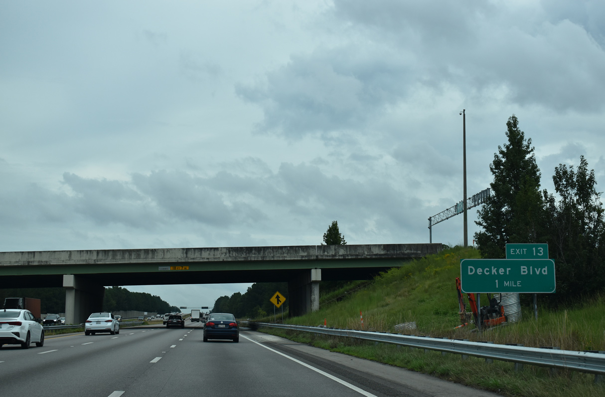
| Decker Boulevard (Road 151) branches 1.98 miles northwest from the wye interchange at Exit 13 to U.S. 1 (Two Notch Road) at Dentsville. 09/16/21 |
|
| Reassurance marker for Interstate 77 north posted after Exit 12. 04/14/12 |
|
| Decker Boulevard heads northwest past the town of Arcadia Lakes to become Parklane Road at U.S. 1 (Two Notch Road) by Columbia Place Mall. 09/16/21 |
|
| S.C. 12 (Percival Road) crosses paths with Interstate 77 at a parclo interchange (Exits 15A/B) in one mile. 09/16/21 |
|
| Boyden Arbor Road passes over I-77 north 1.5 miles from the systems interchange (Exit 16) with Interstate 20. 09/16/21 |
|
| S.C. 12 (Percival Road) west connects I-77 with Gate 4 to Fort Jackson via Boyden Arbor Road. S.C. 12 east lines the north boundary of Fort Jackson to Spears Creek Church Road and Screaming Eagle Road. 09/16/21 |
|
| Originating at West Columbia, S.C. 12 measures 28.25 miles in length east to U.S. 601 south of Lugoff. 09/16/21 |
|
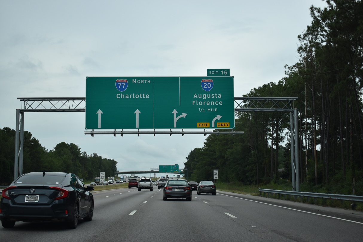
| Exit 15B loops onto S.C. 12 (Percival Road) west at the community of Woodfield. A lane drop follows at Exit 16 for Interstate 20 west to Lexington and Augusta, Georgia and east to Camden and Florence. 09/16/21 |
|
| Turning north, I-77 continues along a section of the Southeastern Beltway opened in 1987 to the multi level exchange (Exit 16) with Interstate 20. 09/16/21 |
|
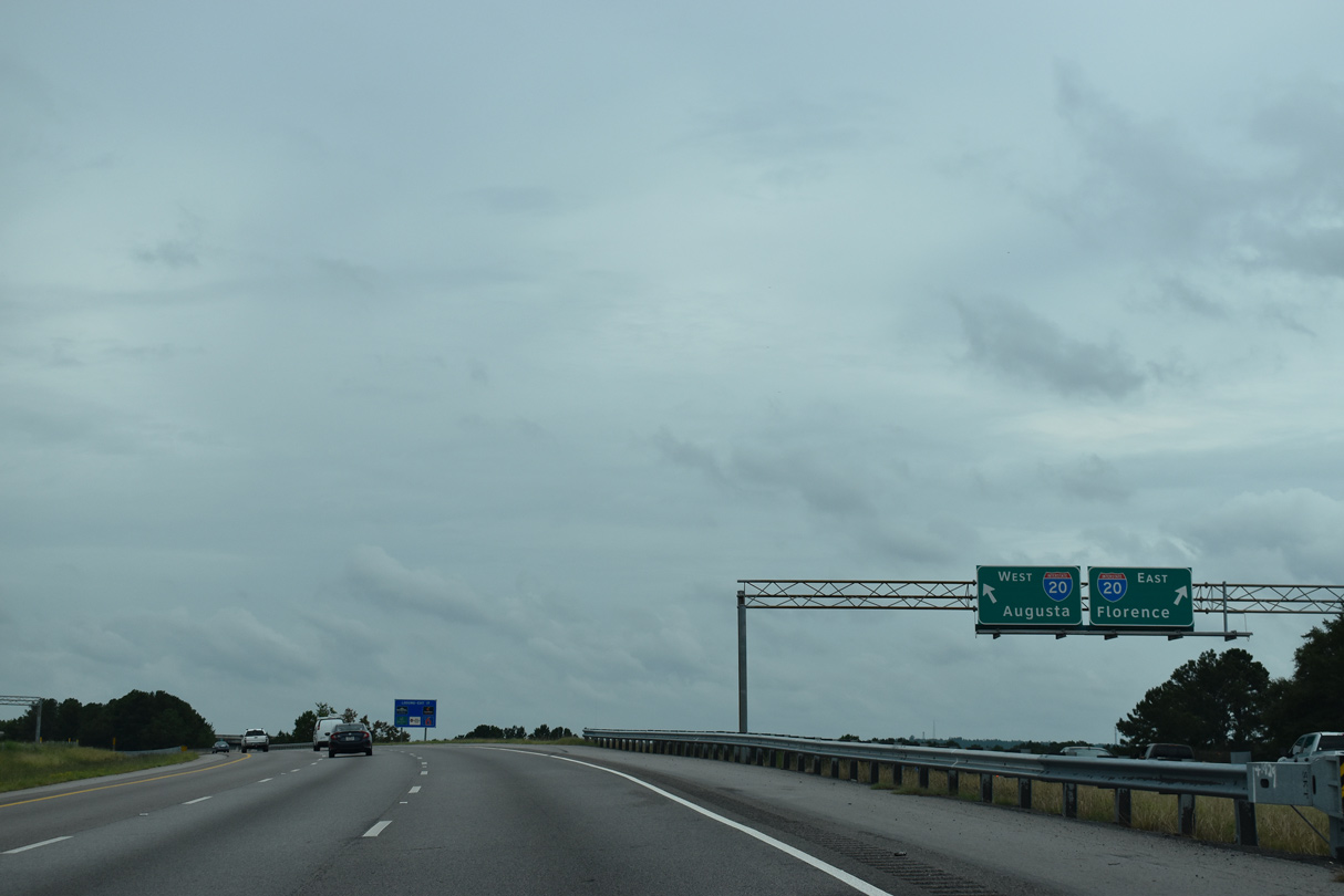
| Interstate 20 travels 141 miles across the Palmetto State from North Augusta to I-95/Business Spur I-20 at Florence. 09/16/21 |
|
| 1,539 miles in length, Interstate 20 joins the Deep South region with West Texas. 09/16/21 |
|
| Exit 16 partitions into a high flyover for I-20 west and a c/d roadway east to the adjacent diamond interchange linking I-20 with Alpine Road (Road 63). 09/16/21 |
|
| Bending northwest, Interstate 77 spans Windsor Lake ahead of the parclo interchange (Exit 17) with U.S. 1 (Two Notch Road). 09/16/21 |
|
| Sesquicentennial State Park lies east of parallel Alpine Road (Road 63) and south of U.S. 1 (Two Notch Road). 09/16/21 |
|
| Exit 17 parts ways from I-77 north to U.S. 1 (Two Notch Road) at the Trenholm Road (Road 33) overpass. Two Notch Road is an older commercial arterial leading southwest from Dentsville into Columbia. 09/16/21 |
|
| U.S. 1 (Two Notch Road) continues east along a heavily commercialized route to the sprawling Village at Sandhill retail center and Pontiac. 12/20/13 |
|
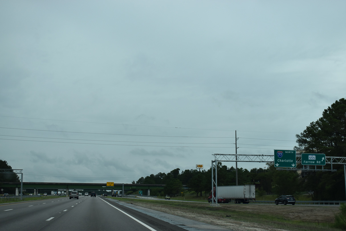
| Interstate 77 converges with the north end of S.C. 277 (Northeastern Expressway) just ahead of the folded diamond interchange with S.C. 555 (Farrow Road) at Exit 19. 09/16/21 |
|
| Interstate 77 crosses Jackson Creek and Edgewater Drive ahead of the wye interchange with the north end of S.C. 277. A 14.90 mile long route, S.C. 555 parallels S.C. 277 southwest to U.S. 1-76-378 (Gervais Street) at Waverly in Columbia. 09/16/21 |
|
| The wye interchange joining S.C. 277 north to I-77 north falls between the ramps with S.C. 555 (Farrow Road) at Exit 19. 09/16/21 |
|
| S.C. 555 (Farrow Road) serves interests to Carolina Research Park, the S.C. Archives & History Center and Midlands Technical College. The state highway north concludes at U.S. 21 near Blythewood. 04/15/12 |
|
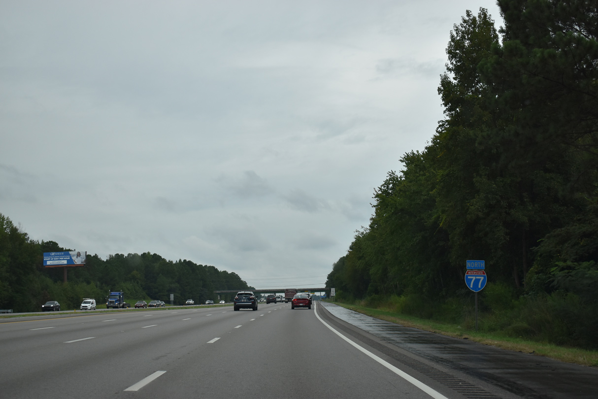
| Leading away from Columbia, Interstate 77 continues seven miles to Blythewood in northern Richland County and 85 miles to Downtown Charlotte. 09/16/21 |
|
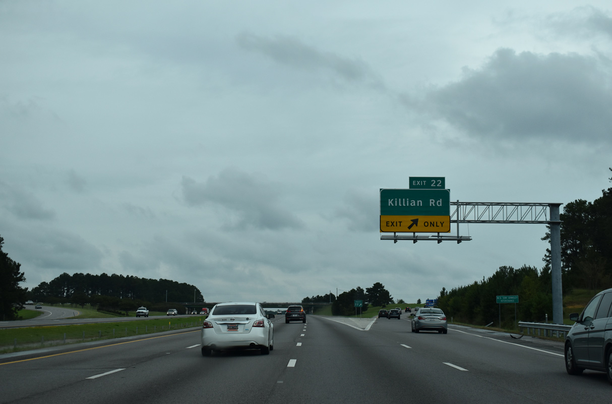
| Killian Road (Road 52) meets Interstate 77 at a commercialized diamond interchange (Exit 22) in one mile. 09/16/21 |
|
| Killian Road along with Clemson Road (Road 52) form an arterial belt route from I-77 and S.C. 555 (Farrow Road) at Killian southeast to U.S. 1 (Two Notch Road) near Pontiac and Interstate 20 at Exit 80. 09/16/21 |
|
| West from Exit 22, Killen Road (Road 52) leads 1.59 miles between Crescent and Stevensons Lake to U.S. 21 (Wilson Boulevard). 09/16/21 |
|
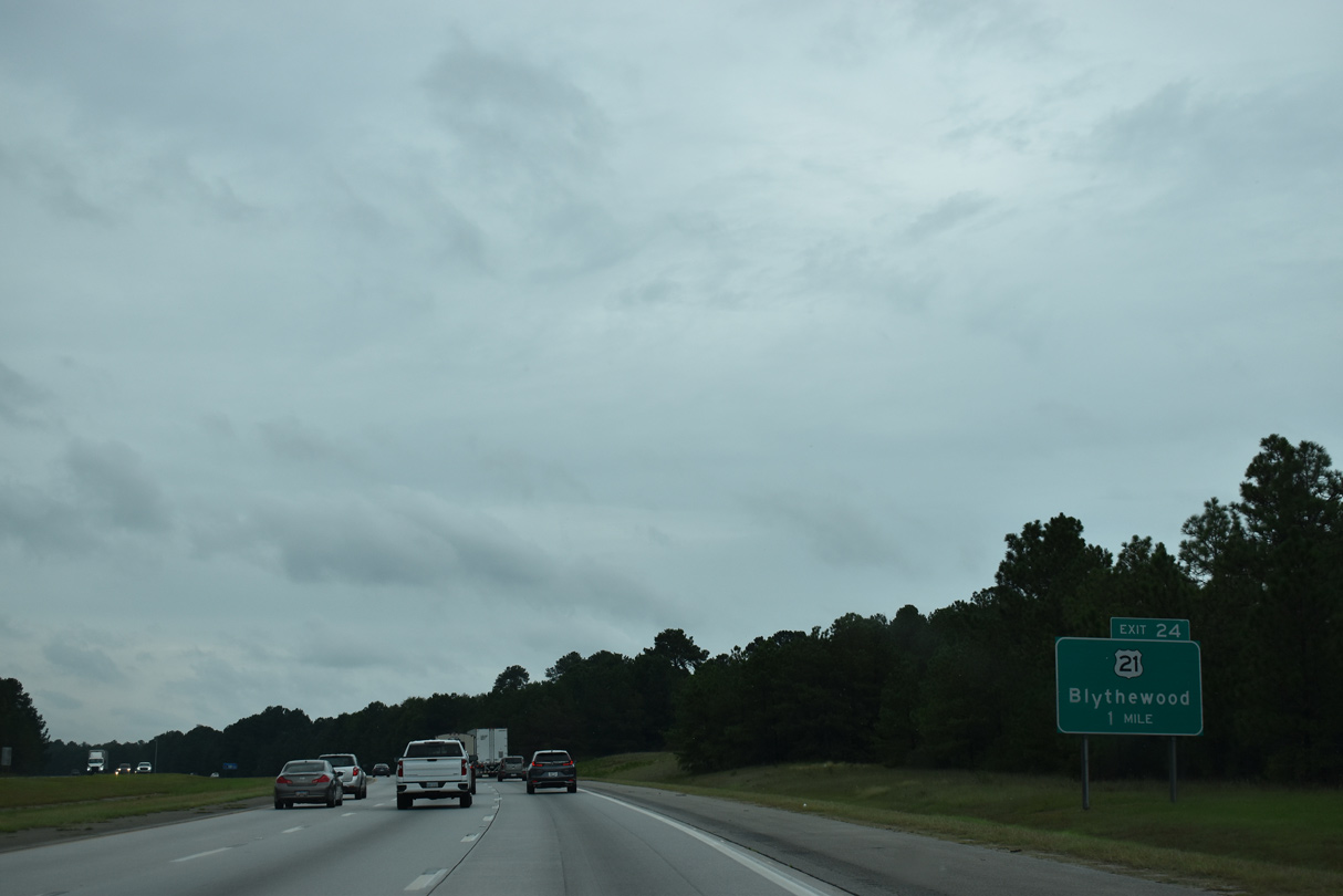
| Having last met Interstate 77 at the south end in Cayce, U.S. 21 returns to the freeway at the succeeding exit near Blythewood. 09/16/21 |
|
| U.S. 21 (Wilson Boulevard) shifts east of Interstate 77 from Exit 24 and Blythewood to Exit 77. I-77 and U.S. 21 generally parallel one another north to Wytheville, Virginia. 09/16/21 |
|
| Interstate 77 reduces from six to four lanes north ahead of mile marker 26. 06/01/12 |
|
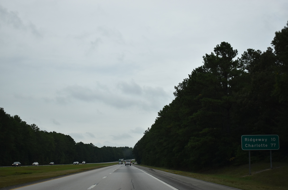
| The succeeding two exits connect Interstate 77 with the town of Ridgeway, located ten miles ahead. Charlotte is 77 miles away. 09/16/21 |
|
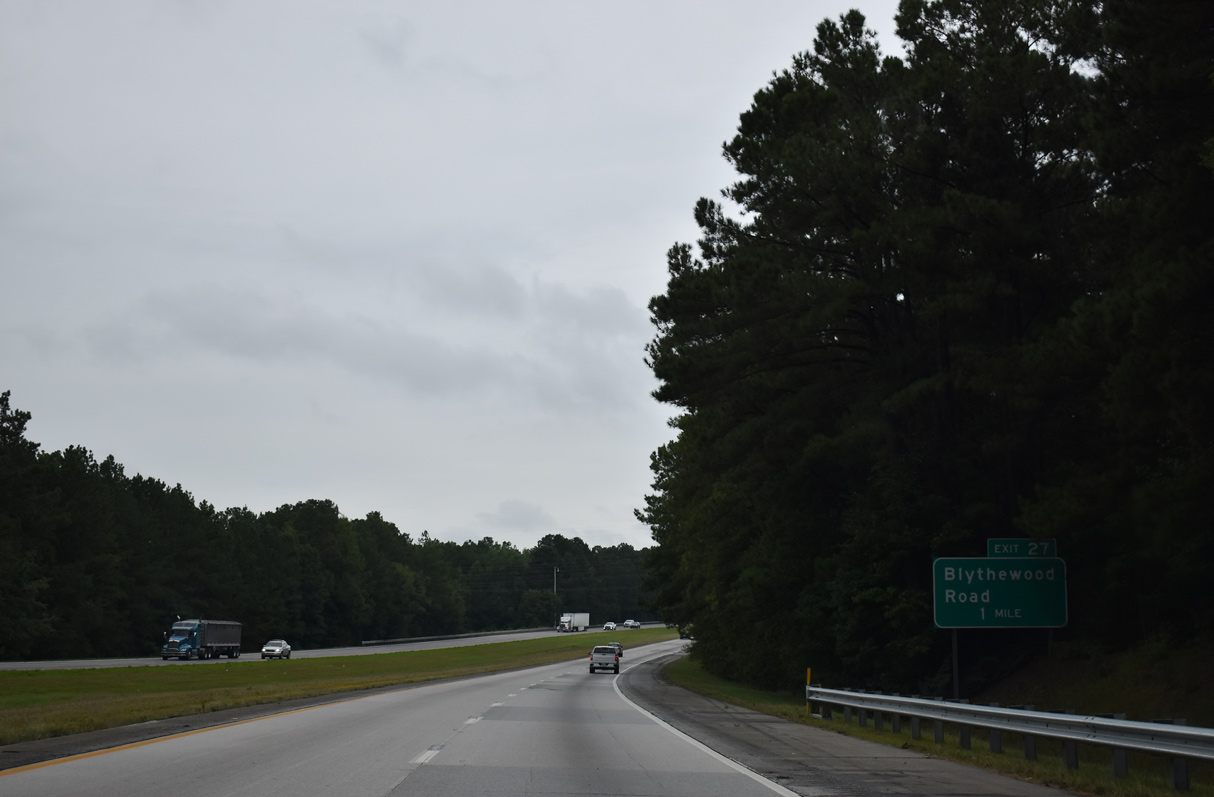
| A diamond interchange (Exit 27) joins Interstate 77 with Blythewood Road (Road 59) in one mile. 09/16/21 |
|
| Blythewood Road meanders 4.88 miles west from nearby U.S. 21 (Main Street) at Blythewood to U.S. 321 (Winnsboro Road). 09/16/21 |
|
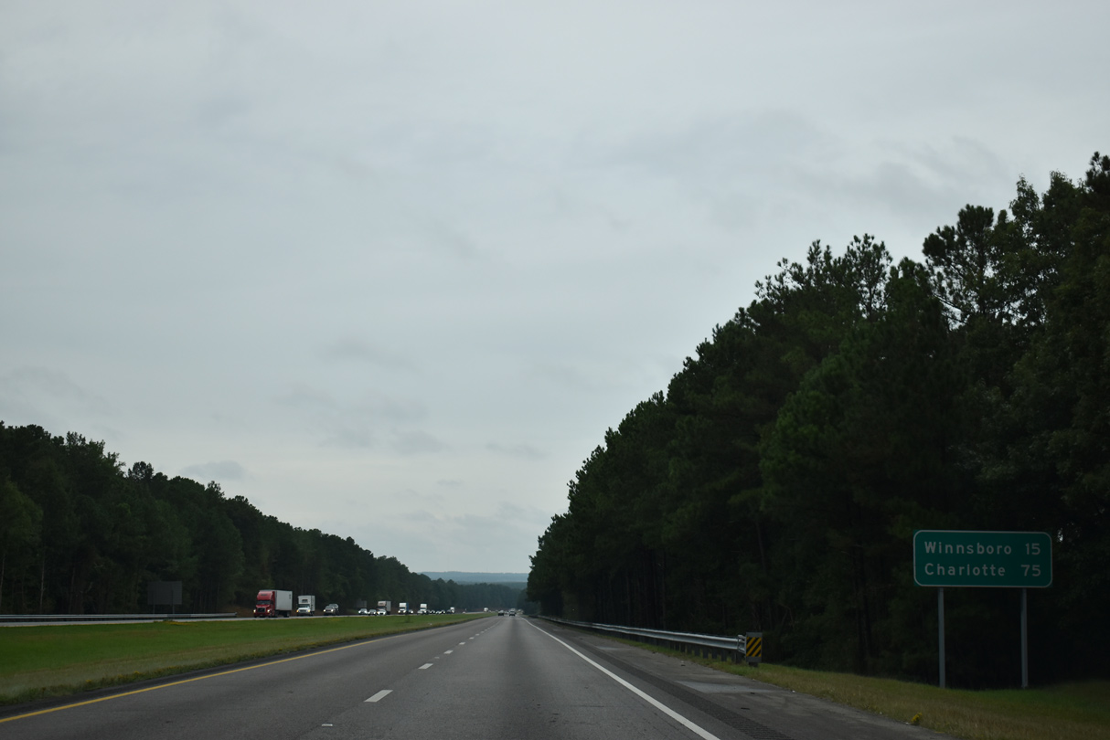
| The town of Winnsboro lies 15 miles to the northwest from Exit 27 via I-77, S.C. 34, U.S. 321 and U.S. 321 Business. 09/16/21 |
|
| Interstate 77 travels 29.43 miles north in Richland County to Fairfield County. 09/16/21 |
Page Updated 11-17-2021.

 North
North