|
| Interstate 77 southbound leaves Interstate 64 east and the Beckley area on a rather remote drive southward through Raleigh County. The first thing southbound drivers encounter from Exit 40 is the main line toll plaza near Flat Top Lake. 06/17/05, 0000 |
|
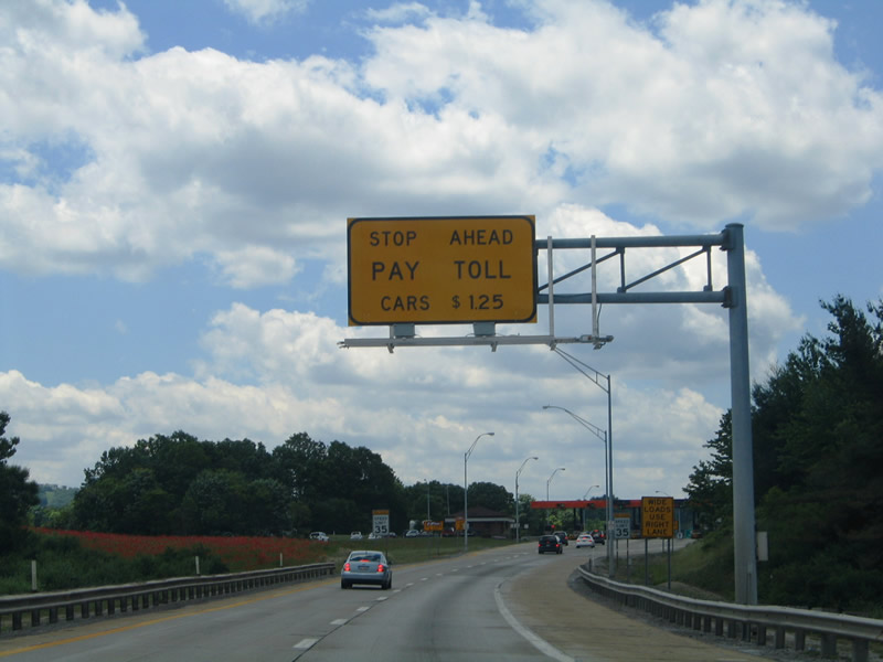
| Large medians separate the roadways of Interstate 77 from Interstate 64 southward to Flat Top Lake, wide enough so that the opposite side is not in view at times. The forthcoming mainline plaza incurs a $1.25 toll for all passenger vehicles. West Virginia Turnpike facilities are payable with E-ZPass transponder. See a list of toll rates here. 06/17/05, 0000 |
|
| Entering the small main line toll plaza of Interstate 77 southbound near Flat Top Lake. A small plaza lies along northbound as well. 06/17/05 |
|
| Beyond the toll plaza, Interstate 77 meets CR 48 (Odd Ghent Road) west of its end at U.S. 19 near Flat Top Lake. 06/17/05 |
|
| Southbound Interstate 77 at the diamond interchange (Exit 28) with CR 48 (Odd Ghent Road). Ghent, a small community along parallel U.S. 19, lies nearby. CR 48 otherwise meanders west five miles into the adjacent mountains to Odd and CR 33 (Amigo-Odd Road). U.S. 19 (Flat Top Road) continues south 2.75 miles to Flat Top. 06/17/05 |
|
| Interstate 77 enters Mercer County on the approach to Flat Top, elevation 3,252 feet. U.S. 19 (Beckley Road) crosses the West Virginia Turnpike here and follows the southbound side of the freeway to Dunns. 06/17/05, 0000 |
|
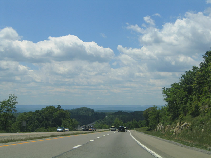
| The West Virginia Turnpike gradually descends from Flat Top east of Sams Ridge. 06/17/05, 0000 |
|
| Adjacent U.S. 19 comes into view at the base of the hill leading from Flat Top. A 5% grade lies ahead, as Interstate 77 lowers toward Camp Creep west of Farley Ridge. 06/17/05, 0000 |
|
| Interstate 77 and U.S. 19 circumvent Pisgah Ridge on their respective descents to Camp Creek. A sharper curve carries motorists southeast into the Camp Creek valley. 06/17/05, 0000 |
|
| U.S. 19 and the West Virginia Turnpike meet directly for the first time at Exit 120 near Camp Creek. The US highway enters the parclo interchange from east of Pisgah Ridge before ascending southwest to the Stovall Ridge. Interstate 77 remains parallel to the Camp Creek to Eads Mill. 06/17/05 |
|
| One mile north of Exit 20 to U.S. 19 (Beckley Road) on Interstate 77 south. The settlement of Camp Creek is located nearby at the intersection of CR 19 (Camp Creek Road). 06/17/05 |
|
| Pisgah Ridge rises along the northbound side of Interstate 77 as the West Virginia Turnpike nears Exit 20. U.S. 19 winds southwest 6.2 miles to Spanishburg and ten miles to WV 10. CR 19 joins Camp Creek with Camp Creek State Forest and Park to the northwest. 06/17/05, 0000 |
|
| A weigh station doubles as a rest area with scenic overlook just south of Exit 20. Interstate 77 crosses the Bluestone River ahead at Eads Mill; Eads Mill is accessible from Eads Mill Road southeast from Camp Creek. 06/17/05, 0000 |
|
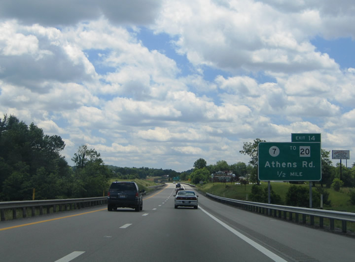
| CR 7 (Athens Road) intersects Interstate 77 (West Virginia Turnpike) at a diamond interchange (Exit 14). The east-west road joins the turnpike with U.S. 19 to the west and WV 20. 06/17/05 |
|
| One half mile north of the off-ramp (Exit 14) to CR 7 (Athens Road). Athens Road meets CR 16 (Gardner-Princeton Road) in 0.4 miles with Gardner-Princeton Road heading southwest to Thorton Avenue in Princeton. Along the east side, CR 14 leads south from Athens Road parallel to the freeway to WV 20 at Melrose. There is no direct access to the state route from the freeway. 06/17/05 |
|
| Southbound I-77 at Exit 14 to CR 7 (Athens Road). Athens Road ends 3.6 miles west at U.S. 19; CR 7 east meanders 2.9 miles to WV 20 near Athens, home of Concord University, whose Marsh Hall includes a 48-bell carillon. WV 20 travels southward from Hinton, the Bluestone Lake area, and Pipestem Resort State Park, to Princeton and north Bluefield. 06/17/05 |
|
| Continuing downward to the city of Princeton and U.S. 460 (Veterans Memorial Highway). U.S. 460 constitutes a four lane divided highway linking Princeton with Bluefield to the southwest and Pearlsburg and Blacksburg, Virginia to the east. 06/17/05, 0000 |
|
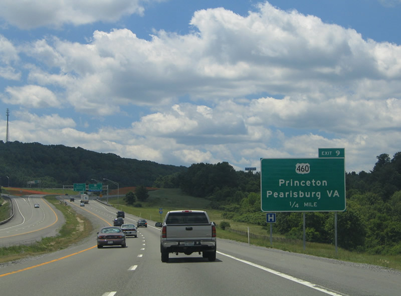
| A diamond interchange joins Interstate 77 (West Virginia Turnpike) with U.S. 460 (Veterans Memorial Highway) at Exit 9 in east Princeton. U.S. 460 primarily bypasses the Mercer County seat to the south with WV 104 (Oakvale Road) and U.S. 19 (Bluefield / Court House Roads) acting as a business loop through downtown. U.S. 460 east travels a rural route 11.5 miles east to Glen Lyn, Virginia. 06/17/05 |
|
| 0.25 miles out from the Exit 9 ramp departure to U.S. 460 at Princeton. U.S. 460 merges with U.S. 19 (Court House Road) in 4.7 miles; the two split in ten miles for separate routes into Bluefield. A West Virginia Welcome Center resides adjacent to Interstate 77 at U.S. 460 and Greasy Ridge Road. 06/17/05 |
|
| The West Virginia Turnpike ends at U.S. 460 (Exit 9) with Interstate 77 continuing as a free route to the Virginia state line. U.S. 460 continues east 23 miles to Pearlsburg, Virginia and 45 miles to Blacksburg. 06/17/05 |
|
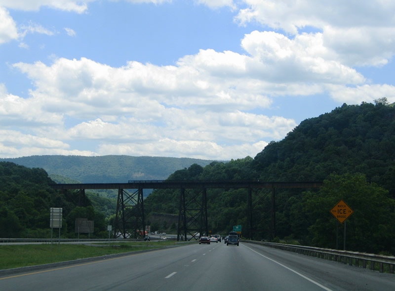
| A trestle carries the Norfolk Southern Railroad line high above Interstate 77 as the freeway descends along Rocky Hollow. Just south of the railroad bridge is the wye interchange (Exit 7) with Ingleside Road (County Route 27). 06/17/05 |
|
| Interstate 77 winds its way southward to Ingleside and Spangler Valley where it meets WV 112 (Exit 5). 06/17/05, 0000 |
|
| Interstate 77 and WV 112 parallel one another westward through the Spangler and Mill Valleys south of Stony Ridge. A clearance of 10' 6" restricts most truck traffic from using the state highway east beyond Ingleside. 06/17/05 |
|
| Southbound travelers pass over WV 112 ahead of the Exit 5 ramp departure to the state highway. There is no return ramp onto southbound, nor access from northbound. 06/17/05 |
|
| Two miles east of the folded diamond interchange (Exit 1) with U.S. 52 north and County Route 290/1 (Ind Center Road). Interstate 77 south spans the East River, Norfolk Southern Railroad and Blake Road and then straddles the south end of Pine Ridge to U.S. 52. 06/17/05 |
|
| U.S. 52 follows Cumberland Road west 2.5 miles to its merge with U.S. 460 outside of Bluefield. Bluefield lies in both West Virginia and Virginia and is home to Bluefield State College and Bluefield College. 06/17/05 |
|
| Interstate 77 and U.S. 52 merge just north of East River Mountain Tunnel at the Virginia state line. 06/17/05 |
|
| U.S. 52 travels seven miles southwest into downtown Bluefield near U.S. 19 (Princeton Avenue). County Route 290/1 (Ind Center Road) spurs east from Exit 1 to an industrial park area from the interchange. 06/17/05 |
|
| Exit 1 departs Interstate 77 south for U.S. 52 north to Bluefield. U.S. 52 joins the Bluefield area with Welch, Williamson and Huntington in far western reaches of the state. Within Bluefield, U.S. 52 merges with U.S. 460 and U.S. 19 separately before those highways combine in Bluefield, Virginia en route to Tazewell, Virginia. 06/17/05 |
|
| East River Mountain rises to over 3,400 feet along the West Virginia and Virginia state line south of Bluefield and Ingleside. 06/17/05 |
|
| Attached to the U.S. 52 over crossing at Exit 1 is a pull through panel referencing the Interstate 77 & U.S. 52 southbound overlap. The tandem share just 1.4 miles through the East River Mountain Tunnel that is also designated the H. Edward Steele Memorial Tunnel after the former Bluefield Chamber of Commerce manager and newspaperman. 06/17/05 |
|
| A pair of two lane bores carry Interstate 77 & U.S. 52 5,400 feet through the East River Mountain tunnel east of Bluefield. The tunnel opened in 1974 after five years and $40 million in construction costs. 06/17/05 |
|
| Passing is permitted through the East River Mountain Tunnel. The state line, unmarked within the tubes, lies approximately halfway between the tunnel portals. 06/17/05, 10/02/10 |
Page Updated 11-13-2007.

 South
South