|
| Welcome to Utah sign posted within the half diamond interchange (Exit 1 on westbound) with Aria Boulevard. 08/05/13 |
|
| The second of three Wendover on-ramps joins Interstate 80 east from Aria Boulevard. 08/05/13 |
|
| SR 58 ties into Interstate 80 on the east side of Wendover in one half mile. SR 58 is the counterpart to Business Loop I-80 through Wendover, Utah. 08/05/13 |
|
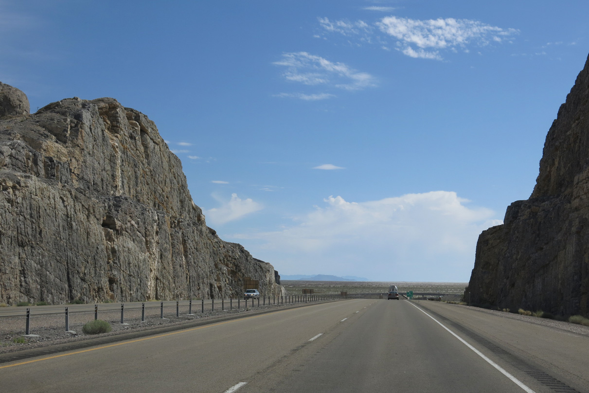
| A pronounced rock cut takes I-80 north of Business Loop I-80 (old U.S. 40) through east Wendover. The hill here rose to 4,400 feet. 08/05/13 |
|
| Rocky cliffs rise abruptly just to the north of Exit 2 as part of Wendover Peak (el. 5,046 ft). 08/05/13 |
|
| An eastbound ramp joins a westbound wye interchange (Exit 2) to provide the third exit for Wendover from I-80 east. SR 58 overlays Business Loop I-80 for 1.363 miles west back to the state line. 08/05/13 |
|
| Ports of entry (weigh stations) operate on both sides of Interstate 80 between Exits 2 and 4. 08/05/13 |
|
| All commercial trucks, buses and vehicles with livestock must enter the port of entry when they are open. 08/05/13 |
|
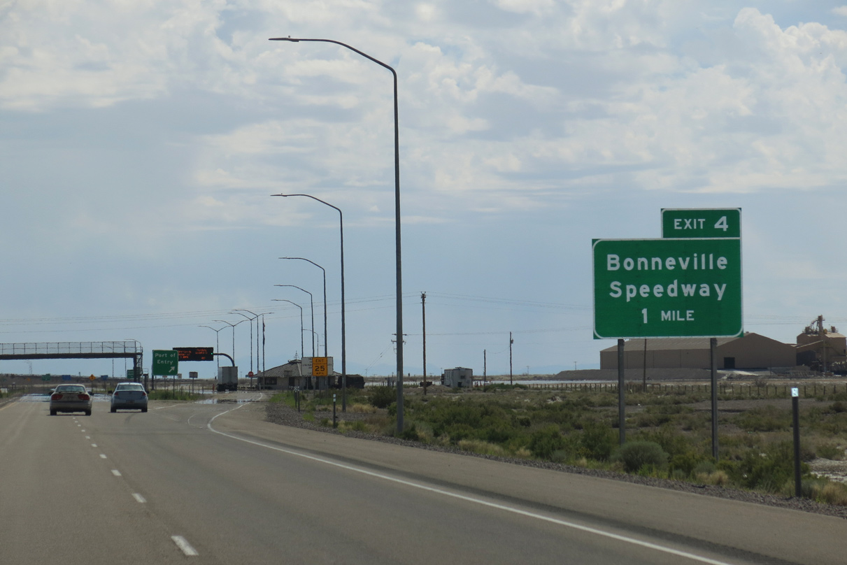
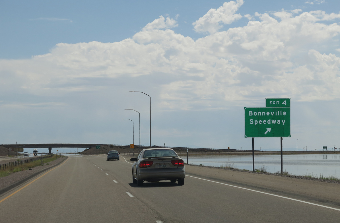
| A diamond interchange (Exit 4) follows the weigh station with Leppy Pass Road to Bonneville Salt Flats International Speedway. 08/05/13 |
|
| Leppy Pass Road stems north from old U.S. 40 (Frontage Road) to Leppy Pass across the Silver Island Mountain range. Bonneville Speedway Road spurs east from nearby to the racetrack on the Bonneville Salt Flats. 08/05/13 |
|
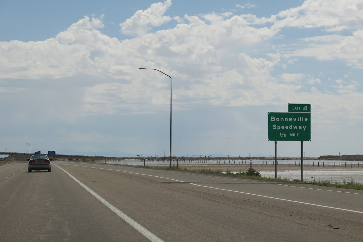
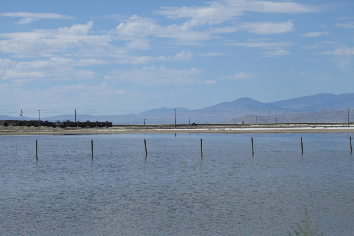
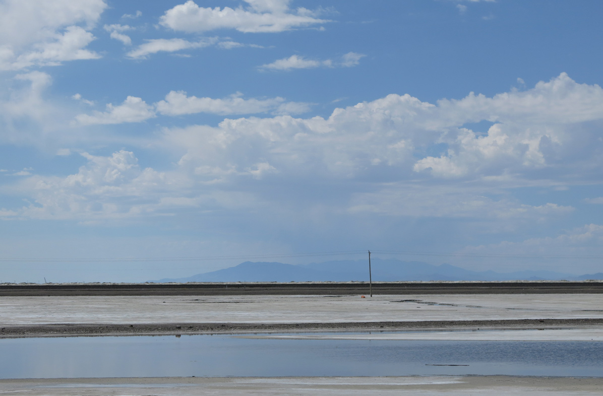
| Shallow pools of standing water appear on the south side of I-80 ahead of Exit 4. The areawide coverage of water on the salt flats varies depending upon time of year and long term rainfall. 08/05/13 |
|
| Exit 4 departs Interstate 80 east for Leppy Pass Road and Bonneville Speedway. Bonneville Salt Flats International Speedway is home to several land speed records, where speeds have exceeded 600 miles per hour. 08/05/13 |
|
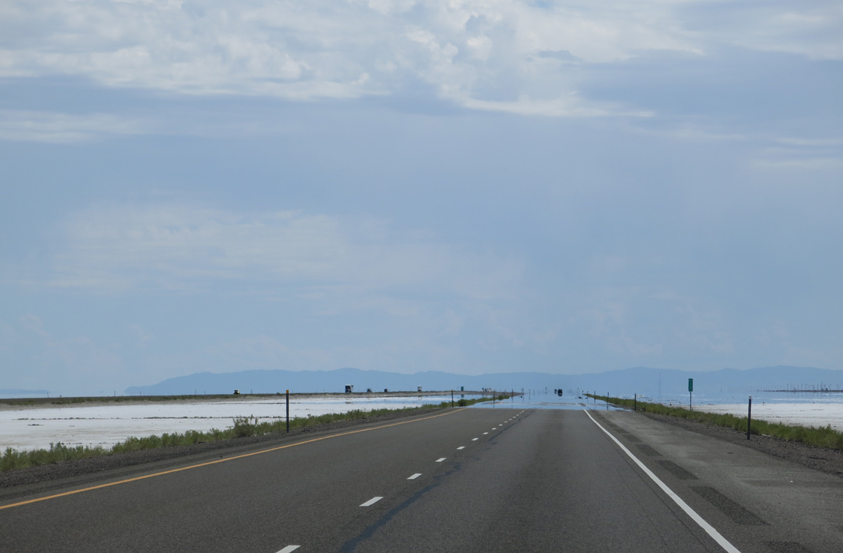
| The longest exit less stretch for the transcontinental route of Interstate 80 ensues east from Bonneville Speedway. 08/05/13 |
|
| The freeway bee lines east across the Bonneville Salt Flats and Great Salt Lake Desert for the next 36.6 miles. 08/05/13 |
|
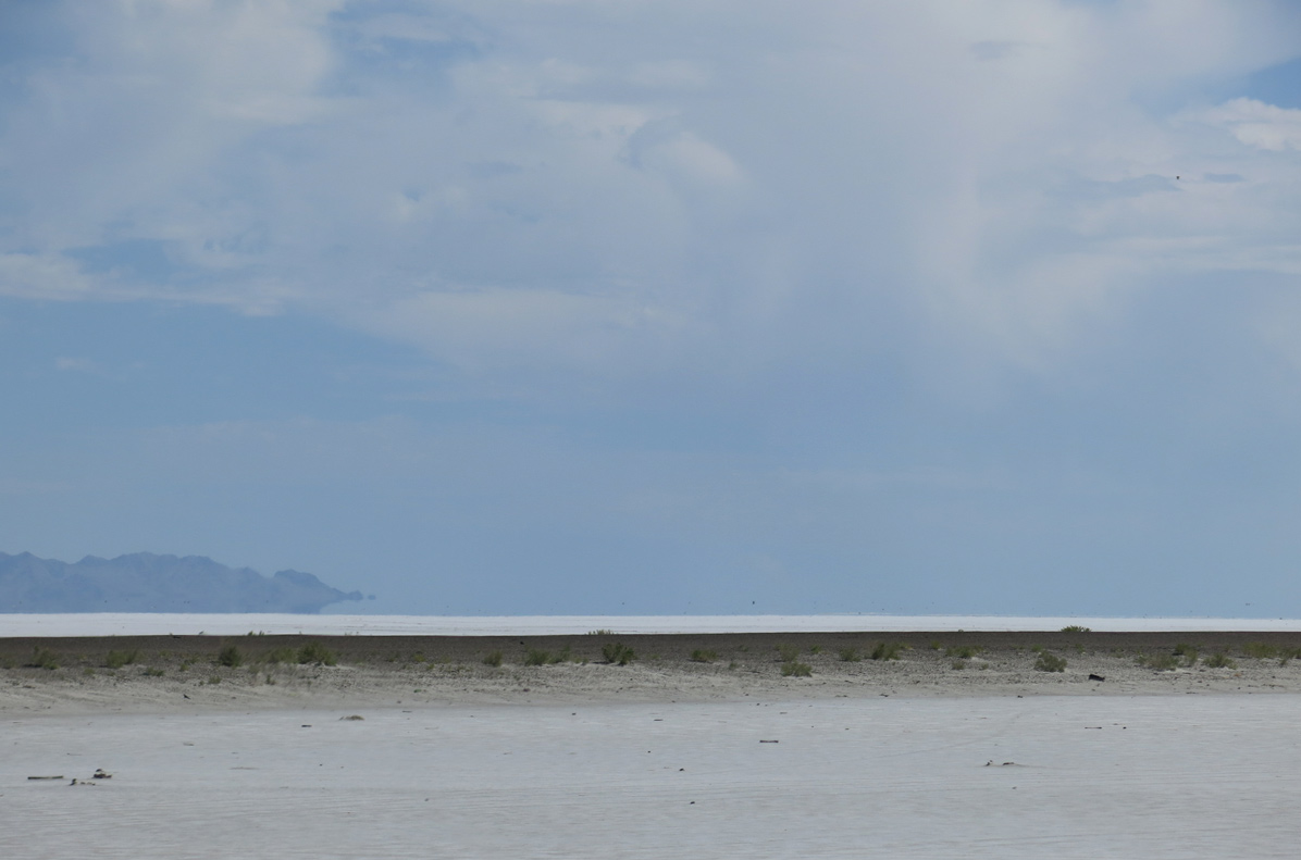
| Motorists catch a glimpse of Bonneville Salt Flats International Speedway to the northeast. Floating Island, with a peak of 4,967 feet, rises beyond the racetrack overrun. 08/05/13 |
|
| Old Highway 40 and a Union Pacific Railroad line parallel Interstate 80 just to the south. 08/05/13 |
|
| A pair of rest areas serve travelers in both directions of Interstate 80 at milepost ten. 08/05/13 |
|
| The next rest area along I-80 eastbound is located another 44 miles away near Aragonite. 08/05/13 |
|
| A reassurance marker for Interstate 80 east posted after the rest area. 08/05/13 |
|
| Knolls remains 32 miles ahead while Salt Lake City is 111 miles away. There are no services until Exit 70. 08/05/13 |
|
| Pilot Peak (el. 10,614 ft) rises to the far northwest beyond the Silver Island Mountains. 08/05/13 |
|
| Interstate 80 east ahead of milepost 14. 7,225 vehicles per day (vpd) were recorded on I-80 between Bonneville Speedway and Knolls by UDOT in 2014. 08/05/13 |
|
| The Great Salt Lake Desert spreads far to the south from Interstate 80. Much of the area east of distant Dutch Peak is part of Dugway Proving Ground. The facility is a US Army test range for biological and chemical weapon defense systems, a training ground for US Army Reserve and National Guard units, and a flight test area for the US Air Force. 08/05/13 |
|
| The curvature of the earth appears along the northern horizon. The mud flat west of the Newfoundland Mountains is the site of the Newfoundland Evaporation Basin. 08/05/13 |
|
| Passing by milepost 17 along I-80 east. The Cedar Mountains line the eastern horizon. 08/05/13 |
|
| Another view toward the distant Silver and Floating Islands to the north of Interstate 80. 08/05/13 |
|
| This reassurance marker for Interstate 80 east stands east of milepost 20. 08/05/13 |
|
| Another distance sign breaks up the relatively unchanging landscape of the Great Salt Lake Desert landscape and gives motorists an indication of progress toward Knolls. 08/05/13 |
|
| Coming into view along Interstate 80 east next is the Tree of Life Sculpture near milepost 26. 08/05/13 |
|
| The 87-foot tall Metaphor: The Tree of Utah sculpture was created by Swedish artist Karl Momen between 1982 and 1986. His vision for the art was to bring color and beauty to the stark landscape of the salt flats. 08/05/13 |
|
| A series of signs preceding milepost 27 advise motorists of how far to the next freeway off-ramp. These signs encourage weary drivers to pull off the freeway and rest versus continuing onward while impaired. They were installed statewide as part of a safety campaign and appear in remote areas or on long straight aways where higher probabilities of drowsy driving occur. 08/05/13 |
|
| Low rise hills south of Knolls appears as travelers pass by the railroad siding of Barro. Areas north and south of the freeway are part of the Utah Test and Training Range. This US Air Force testing area is used for supersonic flight training. 08/05/13 |
|
| Knolls lies ten miles further along I-80 east from this distance sign. Tooele, seat of Tooele County, appears at 79 miles out. 08/05/13 |
|
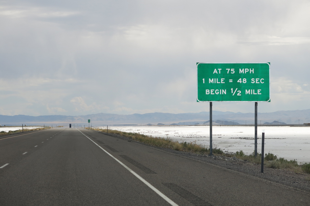
| Speedometer checks along western Interstates allow drivers to check their vehicle's speedometer for accuracy. The checks require a constant speed between the mile markers and a stop watch to determine how long it takes to travel one mile. The observed time is then divided by 3600 to determine the speed. 08/05/13 |
|
| Speedometer check signs indicate how long to travel one mile at the posted speed limit. This sign referenced the previous 75 mile per hour maximum speed limit in Utah. The state Legislature increase the statewide maximum to 80 MPH in July 2013. 08/05/13 |
|
| Mile zero commences the five mile speedometer check for eastbound motorists along Interstate 80. Speed limits along the first 99 miles of the freeway in Utah were increased to 80 MPH in August 2013. 08/05/13 |
|
| The Grassy Mountains appear in the foreground as Interstate 80 advances closer to the northerly turn around the Cedar Mountains. 08/05/13 |
|
| Old Highway 40 parallels the south side of Interstate 80 to forthcoming Exit 41 at Knolls. The adjacent road is not maintained and drivers are advised to travel it at their own risk. 08/05/13 |
|
| Knolls consists of a railroad siding along Old Highway 40 to the west of Exit 41. The siding is located near an off-roadding / all terrain vehicle site. 08/05/13 |
|
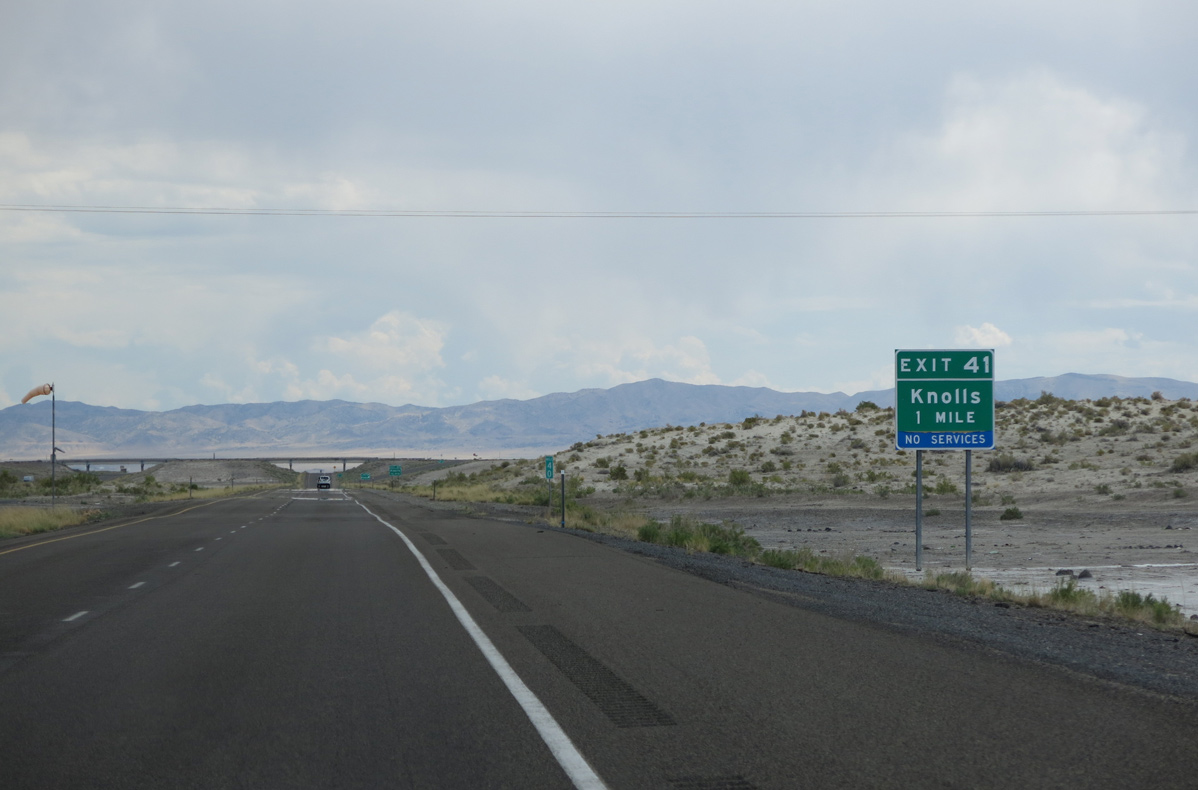
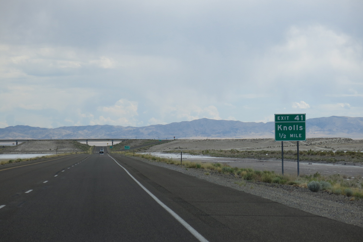
| Entering the diamond interchange (Exit 41) with Old Highway 40 on Interstate 80 east. I-80 Frontage Road accompanies the freeway east from the north end of Exit 41 to Exit 49. 08/05/13 |
|
| Leading away from Knolls, the white salt flats of the Great Salt Lake Desert disappear from the landscape along Interstate 80 east. 07/03/16 |
|
| Delle, location of the first gas station since Wendover, is another 27 miles to the east along Interstate 80. Salt Lake City is just over an hour away. 07/03/16 |
|
| Interstate 80 bends northeast by the Grayback Hills to enter Ripple Valley beyond Exit 49. 08/05/13 |
|
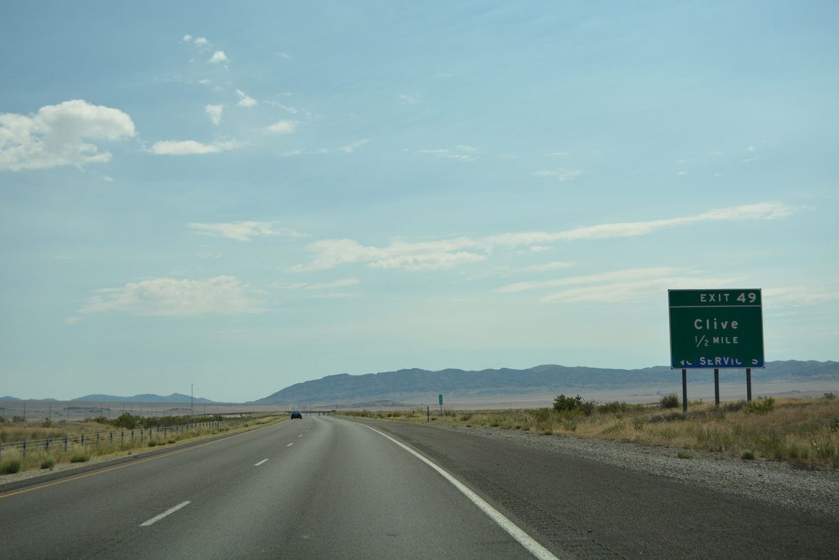
| A diamond interchange (Exit 49) joins I-80 with Clive Road in one mile. Clive is a siding along the Union Pacific Railroad. 07/03/16 |
|
| Clive Road connects Interstate 80 with Clive Complex Road and a railroad facility outside the Utah Test and Training Range South. The road is unpaved as it leads north from I-80 Frontage Road to Swan Wall Road along the Grayback Hills. 07/03/16 |
|
| Exit 49 departs Interstate 80 eastbound for Clive Road. No services are available here. Motorists instead must continue to Exit 70 for gas and food. 07/03/16 |
|
| A 6.4 mile straight away takes Interstate 80 across Ripple Valley to Exit 56. A series of drowsy drivers safety signs lines this stretch. 07/03/16 |
|
| The west slopes of the Cedar Mountains rise to the southeast of Interstate 80 and a Union Pacific Railroad line. 07/03/16 |
|
| Nearing the Grassy Mountain rest area along Interstate 80 east. 07/03/16 |
|
| Motorists reach the rest area at milepost 54. The facility accommodates 24 cars and 15 trucks or recreational vehicles. 07/03/16 |
|
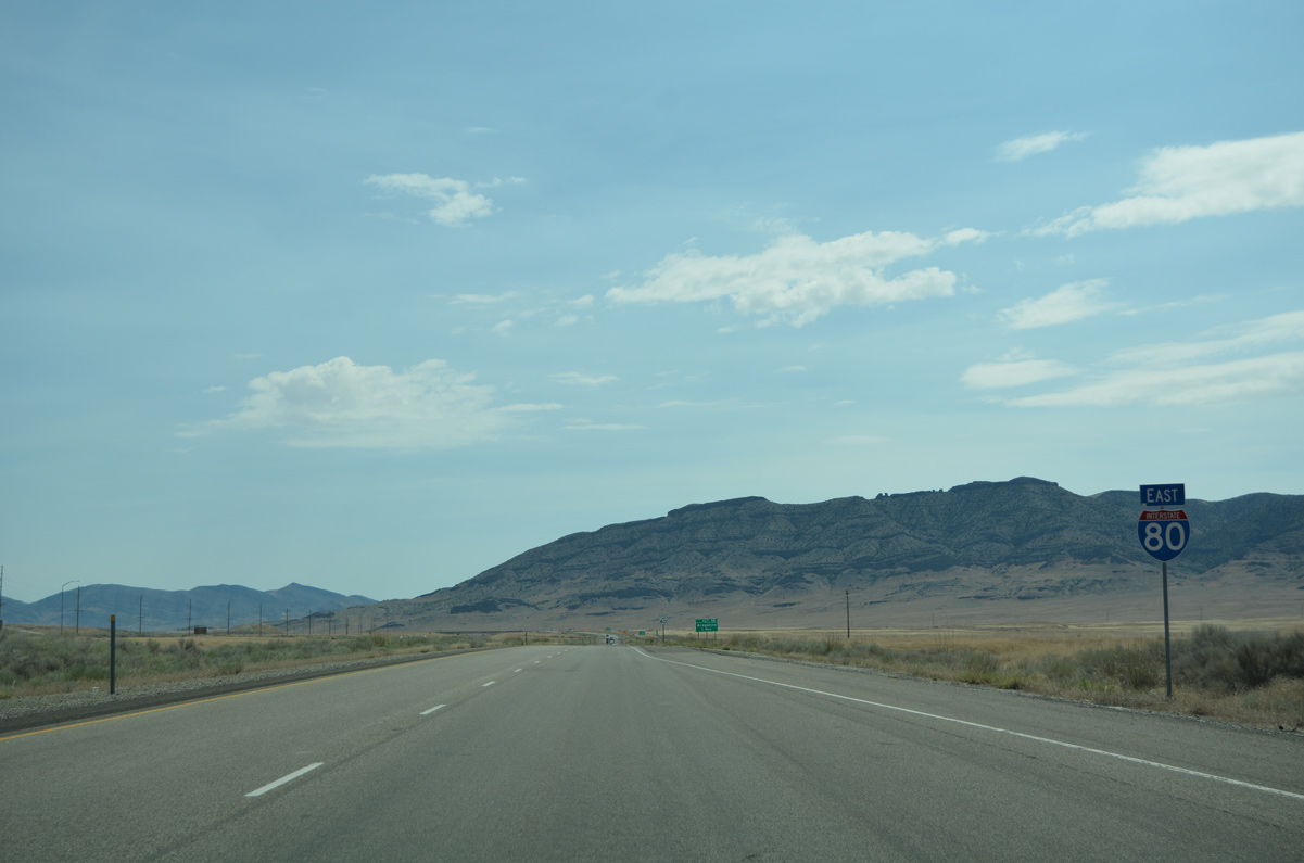
| A reassurance marker for I-80 east stands between the rest area on-ramp and upcoming Exit 56. 07/03/16 |
|
| Aragonite represents yet another siding along the Union Pacific Railroad. The site is 3.1 miles to the southwest of Exit 56. 07/03/16 |
|
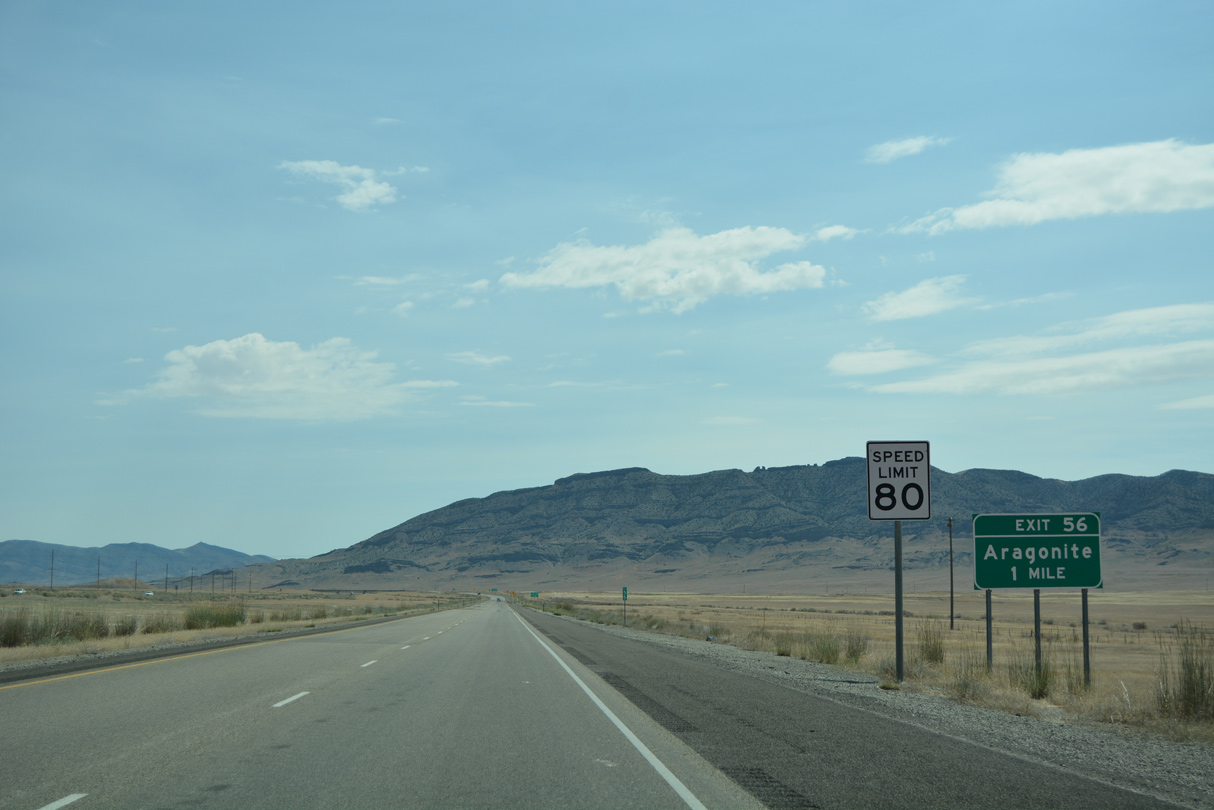
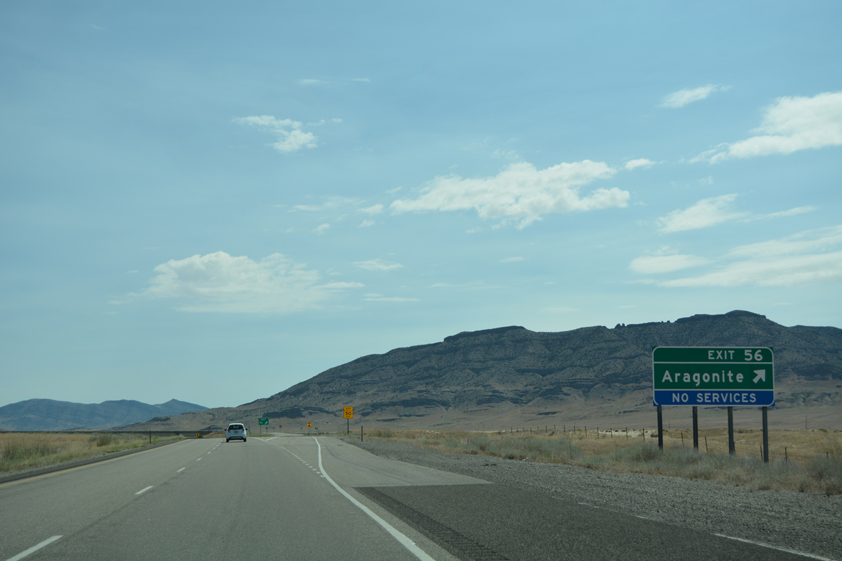
| One half mile ahead of the diamond interchange (Exit 56) with Aragonite Road on I-80 east. 07/03/16 |
|
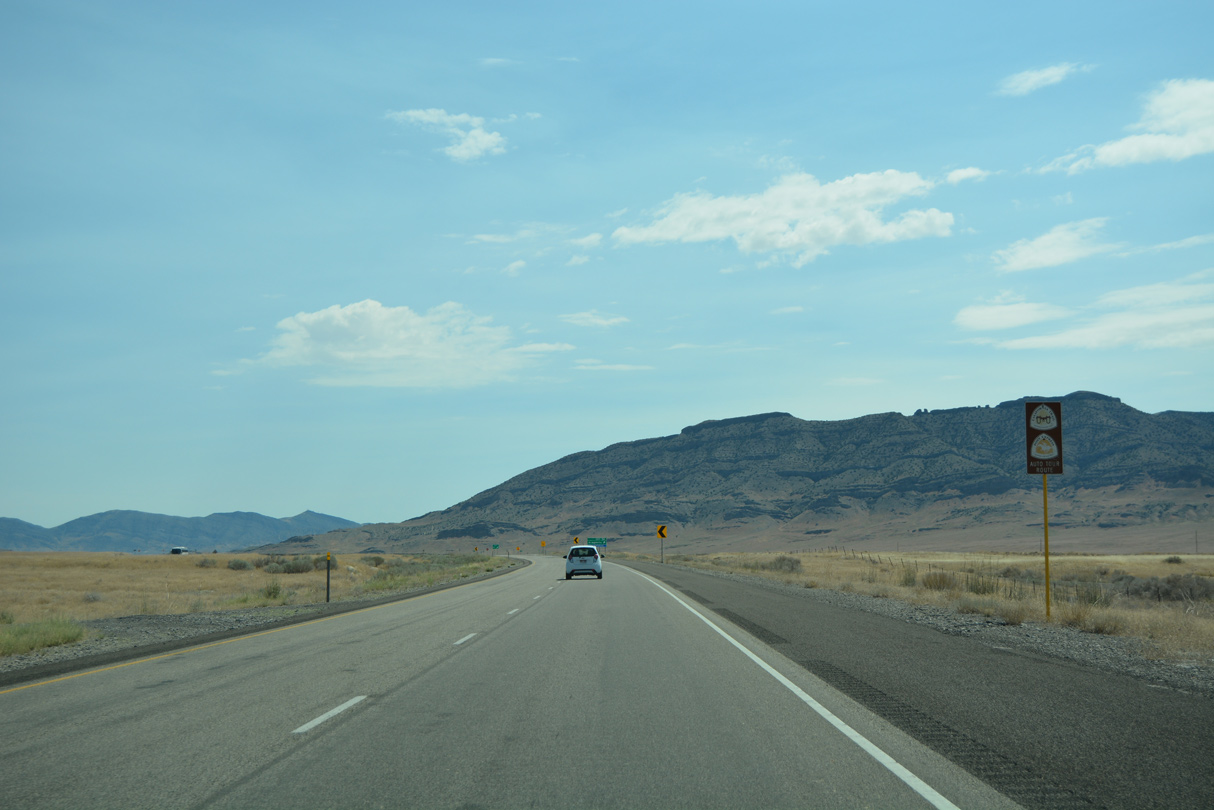
| Interstate 80 across western Utah is a part of both the California Trail and Pony Express auto tour routes. Signs are posted periodically along the freeway. 07/03/16 |
|
| Aragonite Road stems south from old U.S. 40 (I-80 Frontage Road) and Exit 56 to Hastings Pass road and a plant entrance. Gravel Site Road winds northward onto the Grassy Mountains from near Exit 56 as well. 07/03/16 |
|
| Turning more north, Interstate 80 circumvents the northern slopes of the Cedar Mountains to Skull Valley. 07/03/16 |
|
| This distance sign along Interstate 80 east provides the distance to Grantville (35 miles via Exit 84 and SR 138) and Salt Lake City (64 miles). 07/03/16 |
|
| The Union Pacific Railroad line converges with Interstate 80 ahead of the distant Skunk Ridge. 07/03/16 |
|
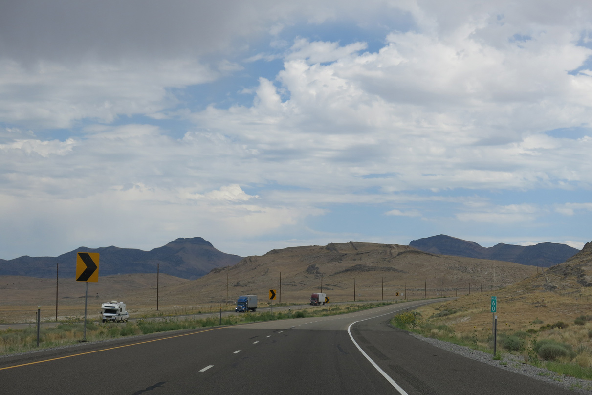
| Chevrons line the curve of Interstate 80 east as it enters the gap between Skunk Ridge and the Cedar Mountains. 08/05/13 |
|
| Puddle Valley Highway overtakes old U.S. 40 along the north side of Interstate 80 to the diamond interchange (Exit 62) with Interstate 80. 07/03/16 |
|
| Peering south from Interstate 80 at the adjacent Union Pacific Railroad line and peaks of the north Cedar Mountains. 07/03/16 |
|
| Puddle Valley Highway runs north from Exit 62 through Puddle Valley to Box Elder County. Lakeside Road extends the road north from there to the Utah Test and Training Range North military area and Lakeside, a railroad siding along Great Salt Lake. 07/03/16 |
|
| Continuing east from Exit 62, Interstate 80 turns south to bypass the distant Lakeside Mountains. 10/28/11 |
Page Updated 07-30-2016.

 East
East