|
| Drivers from Interstate 215 north merge onto I-80 east beyond the distant overpass. The eastern prong of I-215 constitutes a two lane roadway (former SR 171) taking motorists from the Belt Route north to I-80 east and I-80 west to Interstate 215 south. 08/05/13 |
|
| Interstate 80 east through Parleys Canyon directly overlaid old U.S. 40 east out of Salt Lake Valley. U.S. 40 through the canyon was widened to a four lane highway in the mid 1950s. 07/08/16 |
|
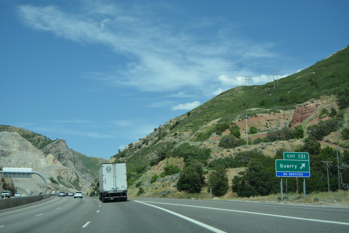
| Interstate 80 increases in elevation from 4,600 to 7,000 feet above sea level to Parleys Summit. A chain up area precedes the Quarry interchange at Exit 131. 07/08/16 |
|
| Park City and its associated ski resorts lie 22 miles to the east via Interstate 80. Cheyenne, capital city of Wyoming, is located 422 miles away at the crossroads with I-25. 07/08/16 |
|
| The Parleys Canyon chain up area was rebuilt during 2013 reconstruction of Interstate 80. The area lies just ahead of the half diamond interchange at Exit 131. 07/08/16 |
|
| Exit 131 serves the west entrance to a quarry along the north side of I-80. Motorists taking this exit pass through a narrow underpass with a low clearance below Interstate 80. 07/08/16 |
|
| A second half diamond interchange (Exit 131 for I-80 west) serves the east entrance to the quarry at Pharaohs Glen. East from there, I-80 advances a half mile to Exit 132 with Mt. Aire Road. 08/05/13 |
|
| Mt. Aire Road spurs east from the diamond interchange (Exit 132) with Interstate 80 upwards through Mt. Aire Canyon toward the peak of Mt. Aire (el. 8,621 ft). 08/05/13 |
|
| Exit 133 quickly follows along I-80 east for Mountain Dell Dam. The advance sign for the upcoming off-ramp references Utility Exit. 08/05/13 |
|
| An access road stems east from Exit 133 to Mountain Dell Dam, which impounds water along Parleys Creek just west of Exit 134. Return access is available only for westbound. 08/05/13 |
|
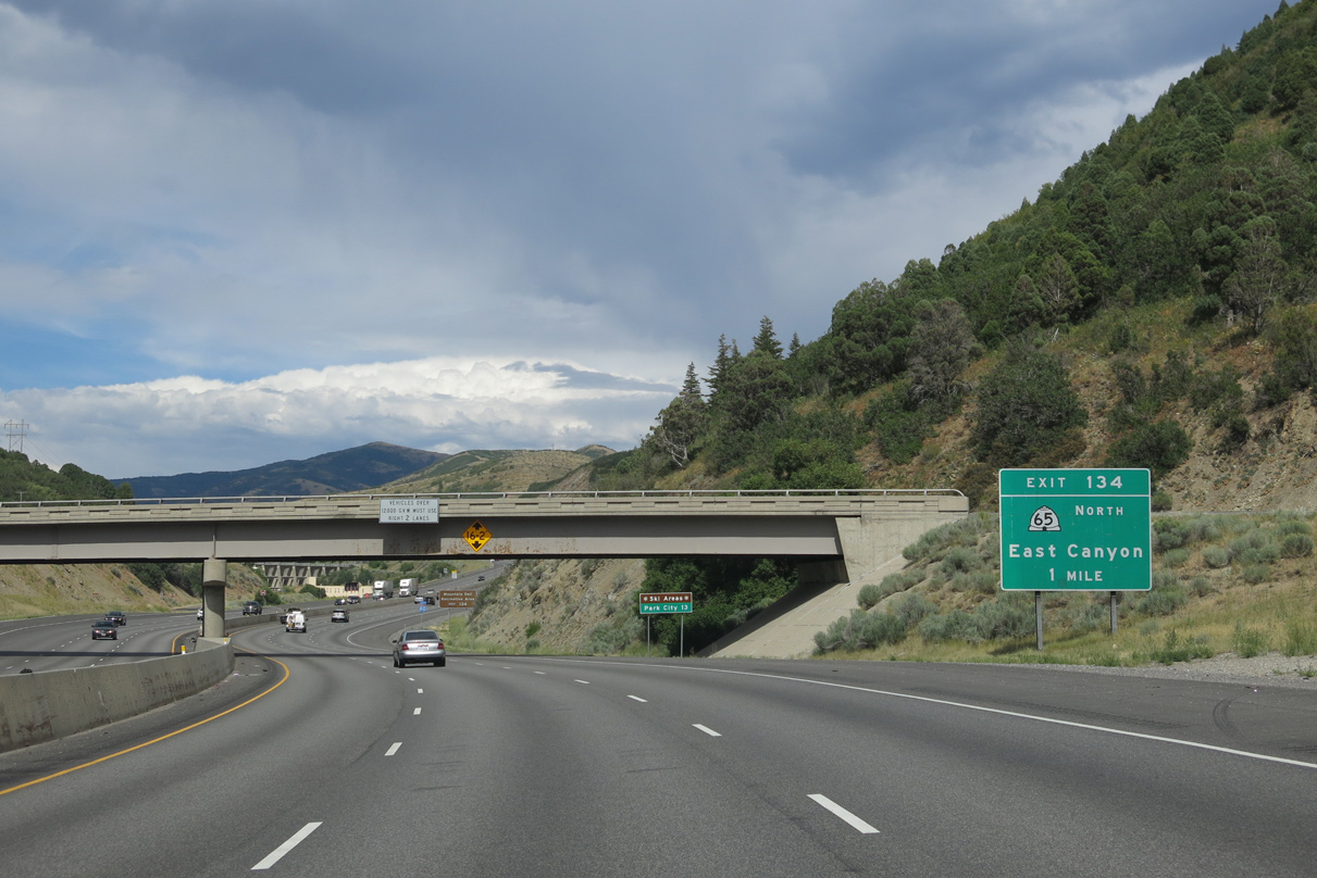
| SR 65 begins a 28.32 mile trek to Henefer from Exit 134 in one mile. 08/05/13 |
|
| Confirming marker for Interstate 80 posted ahead of Mountain Dell Recreation Area at Exit 134. 08/05/13 |
|
| SR 65 winds northward to Little Dell Reservoir and through Mountain Dell Canyon to Big Mountain Pass into Morgan County. The state route is closed in winter. 08/05/13 |
|
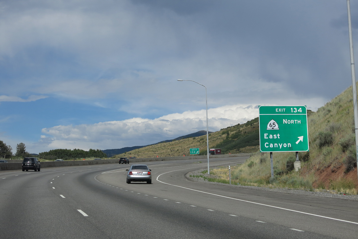
| Eastbound Interstate 80 reaches the diamond interchange (Exit 134) with SR 65 north. SR 65 connects the Salt Lake Valley with East Canyon and SR 66 to Porterville. The state route ends at Intestate 84 (Exit 115). 08/05/13 |
|
| Gun Range Road spurs south from SR 65 and Exit 134 to a nearby range. SR 65 runs north 15 miles to East Canyon Reservoir. 08/05/13 |
|
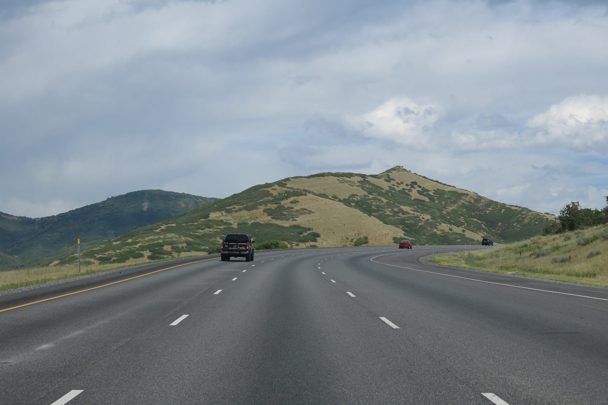
| Passing to the south of Mountain View Golf Course, a wide median ensues along I-80 between Exits 134 and 137 along the north slope of Mount Aire. Old U.S. 40 roughly traveled between the two roadways along this stretch. 08/05/13 |
|
| The separate roadways of Interstate 80 converge at a diamond interchange (Exit 137) with Lambs Canyon Road in one mile. 08/05/13 |
|
| Lambs Canyon Road meanders southeast from Exit 137 through Lambs Canyon to Lake Salamander near Murdock Peak (el. 9,602 ft). 08/05/13 |
|
| A frontage road also spurs east from Exit 137 and Lambs Canyon along the north side of I-80. 08/05/13 |
|
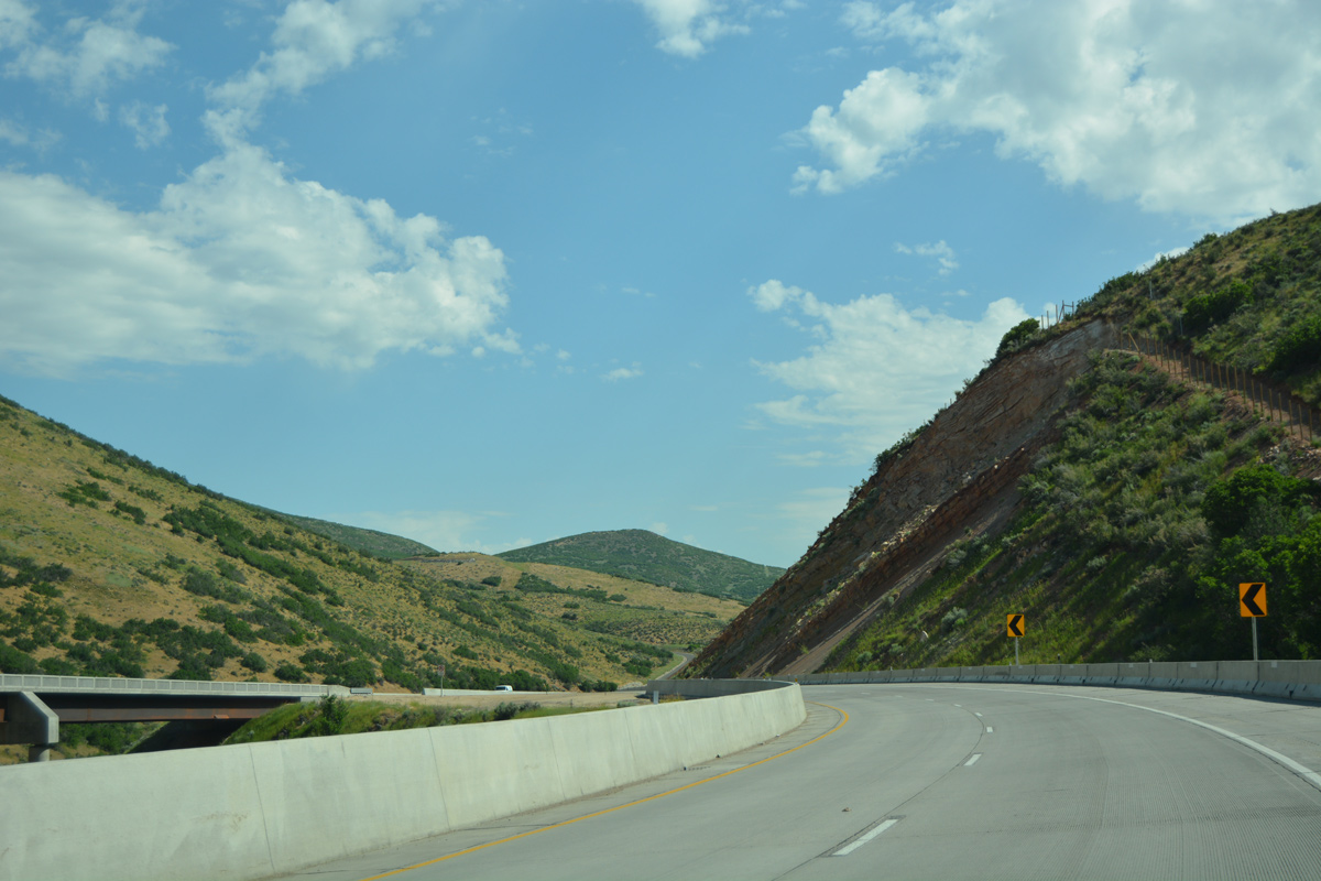
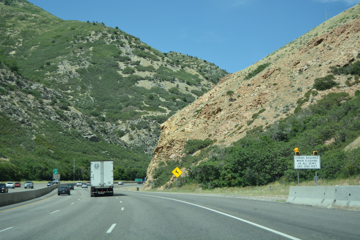
| Travelers are advised to use caution for slow moving trucks as Interstate 80 continues ascending toward Parleys Summit. 08/05/13 |
|
| Wanship, where U.S. 189 Alternate historically ended at I-80, is an 18 mile drive ahead. Coalville follows in 26 miles while Evanston represents the first city along Interstate 80 in Wyoming in 61 miles. 08/05/13 |
|
| Interstate 80 east tops out at 7,016 feet above sea level at Parleys Summit and Exit 140 in one mile. 08/05/13 |
|
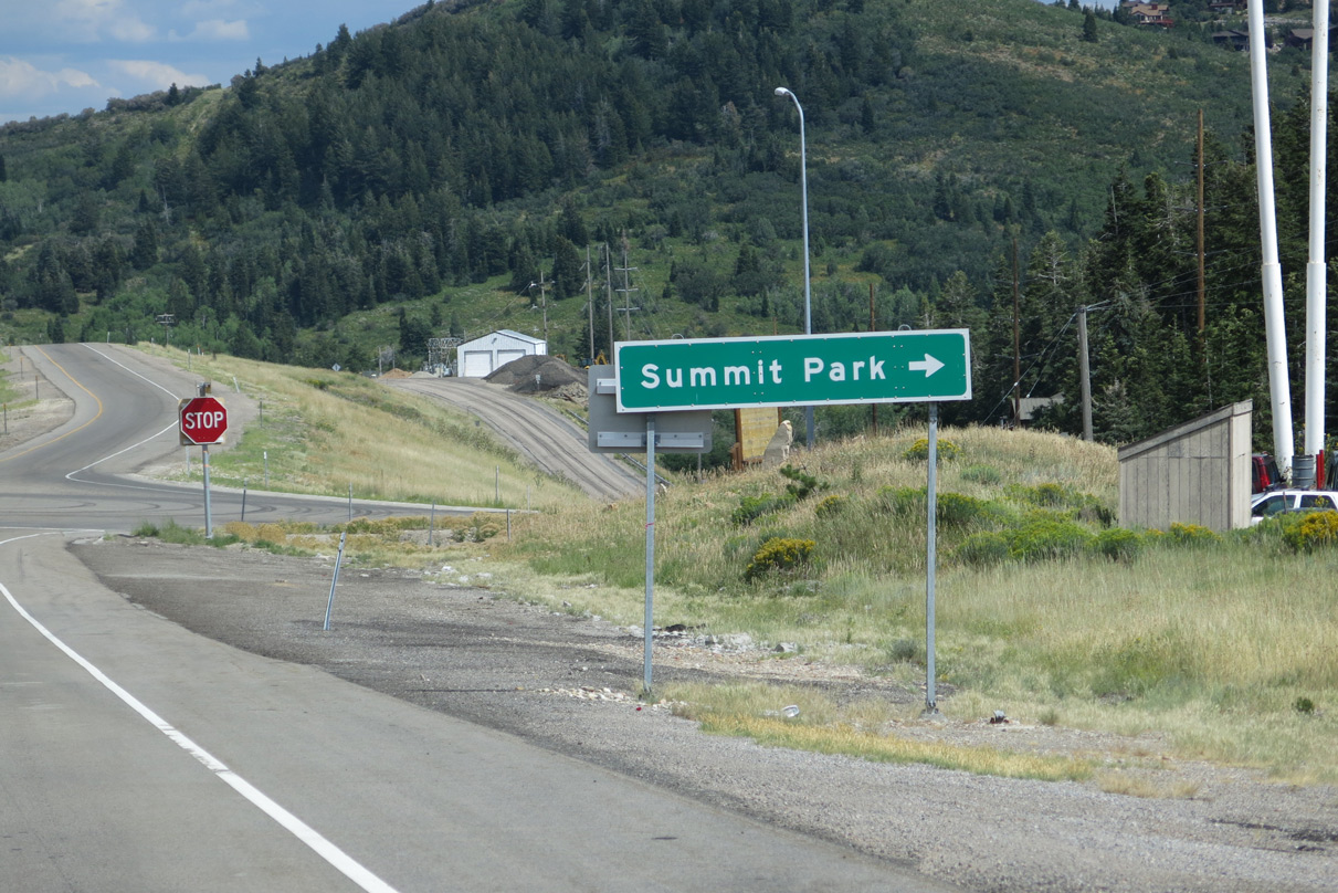
| Exit 140 consists of a diamond interchange with Parleys Lane. Parleys Lane meanders northeast to connect with northern areas of Summit Park. 08/05/13 |
|
| Exit 140 departs I-80 east for Parleys Lane and Summit Park. Summit Park is a suburban community spreading both north and south of Parleys Canyon on the adjacent mountain side. 08/05/13 |
|
| Interstate 80 formally crosses the Summit County (Parleys Summit) at the gore point for Exit 140. A brake test area follows for truckers for the adjacent descent to Parleys Park. 08/05/13 |
|
| Parleys Lane south links Interstate 80 with Aspen Drive, a loop south into Summit Park. Kilby Road forms a south side frontage road for I-80 to eastern reaches of Summit Park. 08/05/13 |
|
| Interstate 80 winds east from Exit 140 into Toll Canyon. 08/05/13 |
|
| Next along I-80 east is the diamond interchange (Exit 141) for Jeremy Ranch in east Summit Park. 08/05/13 |
|
| Pinebrook Boulevard ties into Exit 141 from the community of Pinebrook to the south. 08/05/13 |
|
| Homestead Road circles northward from I-80 and the adjacent Rasmussen Road service road to Jeremy Ranch Golf & Country Club. 08/05/13 |
|
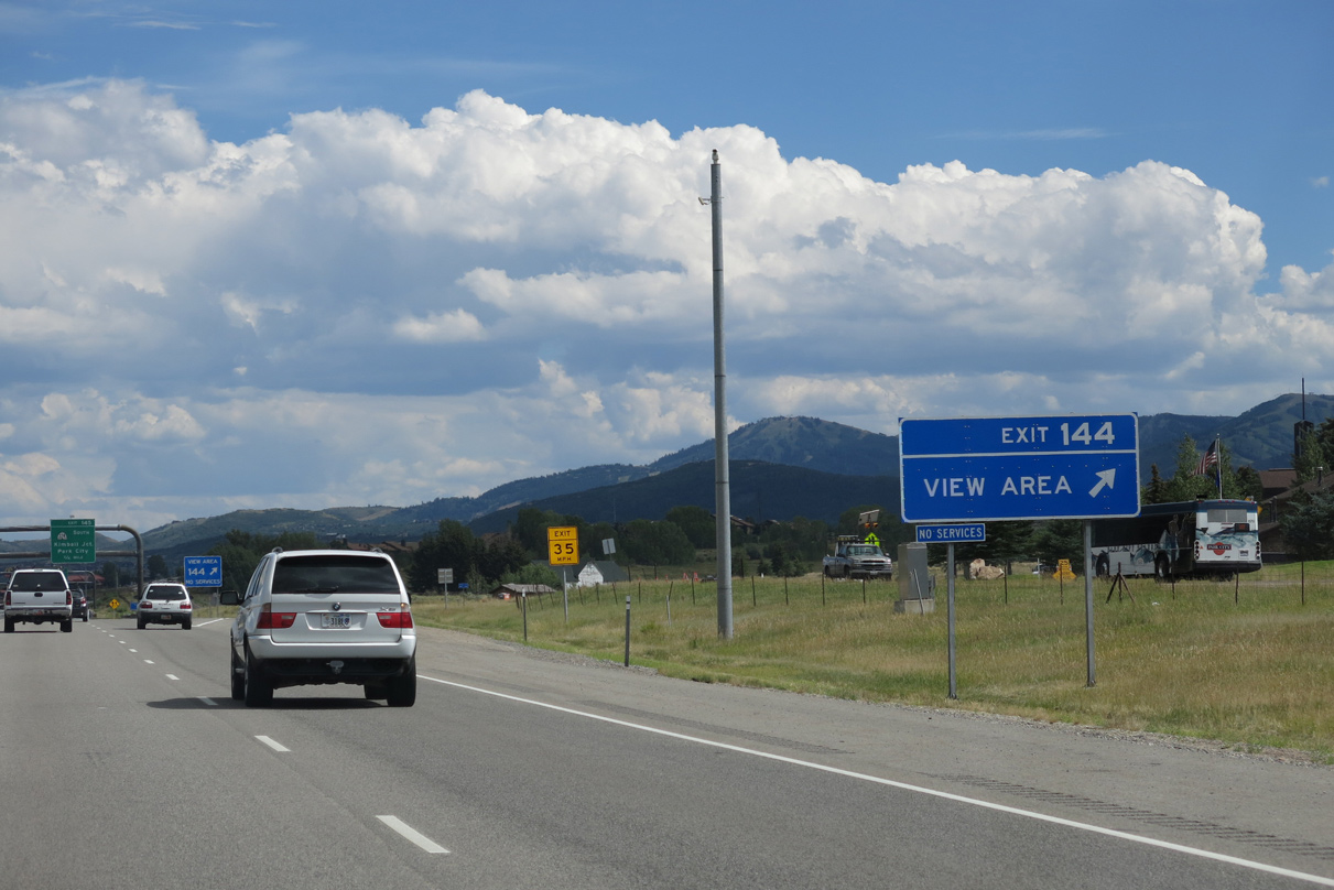
| An eastbound view area lines Interstate 80 at milepost 143 as the freeway turns southeast alongside East Canyon Creek. 08/05/13 |
|
| Signed as Exit 144, the view area lies east of Ecker Hill. 08/05/13 |
|
| Advancing eastward, Interstate 80 enters Parley Park, a wide valley to the north of Quarry Mountain. Commercialized Kimball Junction lies 0.75 miles ahead at Exit 145. 08/05/13 |
|
| SR 224 commences a 11.60 mile trek south from Kimball Junction to the Summit / Wasatch County line at Guardsman Pass Road from I-80 at Exit 145. The state route serves Canyons, Deer Valley and Park City ski areas. 08/05/13 |
|
| Increasing commuter traffic to Park City and Kimball Junction led to an expansion of Exit 145 from one two two lanes. The single point urban interchange (SPUI) for SR 224 south upgraded a diamond interchange in preparation for the 2002 Winter Olympic Games. 08/05/13 |
|
| A pedestrian bridge spans I-80 from residential areas to the north and sprawling retail areas, including Tanger Outlet Park City and Newport Town Center, to the south. 08/05/13 |
|
| Highland Drive and Bitner Road accompany Interstate 80 as frontage roads east toward Silver Creek Junction. 08/05/13 |
|
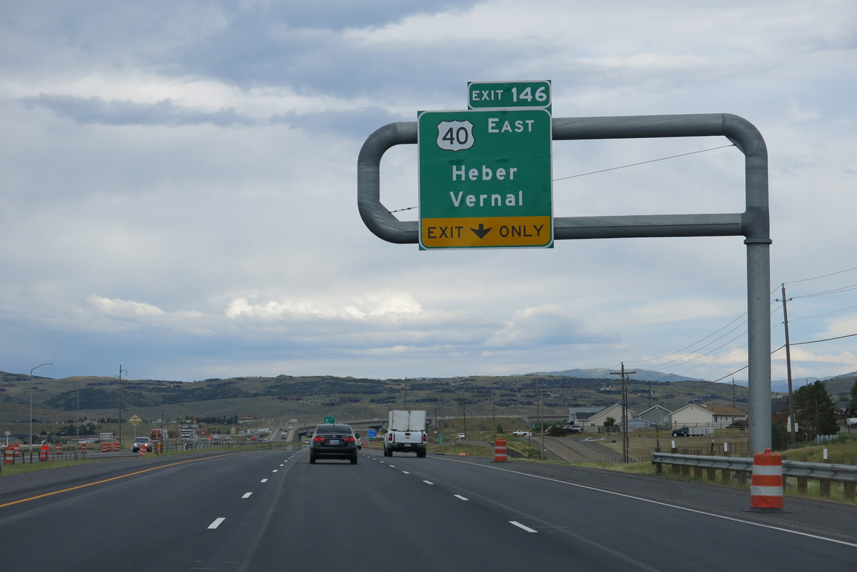
| Interstate 80 arcs northeast across Kimball Creek on the one mile approach to Exit 146 with the western terminus of U.S. 40. U.S. 40 west of Silver Creek Junction was truncated in 1975. 08/05/13 |
|
| U.S. 40 emerges from the Interstate 80 corridor at Silver Creek Junction to run south along a freeway to Jordanelle Reservoir and Heber City. The remainder of the cross country route travels east to Atlantic City, New Jersey, mostly along the I-70 corridor between Denver and Baltimore, Maryland. 08/05/13 |
|
| A SPUI joins Interstate 80 with U.S. 40 (and unsigned U.S. 189) east and Silver Creek Road north at Exit 146. The exchange was upgraded from a parclo interchange in 2001. 08/05/13 |
|
| Part of the upgrade at Exit 146 made for the 2002 Winter Olympic Games was the addition of a flyover ramp for U.S. 40 west to I-80 west. 08/05/13 |
|
| A lane drop occurs for I-80 east at Exit 146. Pictured here is the signalized ramp point between the ending U.S. 40 and Silver Creek Road north to the Silver Summit suburban community. 08/05/13 |
|
| U.S. 189 accompanies Interstate 80 east in an implied overlap between Silver Creek Junction and the Wyoming state line. Officially U.S. 189 travels just 28.90 miles in Utah between Provo and Heber City. The route is considered discontinuous between U.S. 40 at Heber City and the state line along I-80. 07/05/16 |
|
| Interstate 80 turns northward along The West Hills seven miles to Wanship. The northward trek continues from there another eight miles to Coalville. 07/05/16 |
|
| A Renovate I-80 Projects underway between June 2014 and October 2015 upgraded Interstate 80 between Silver Creek Junction and Wanship with a new concrete roadway and improved grading and drainage. 07/05/16 |
|
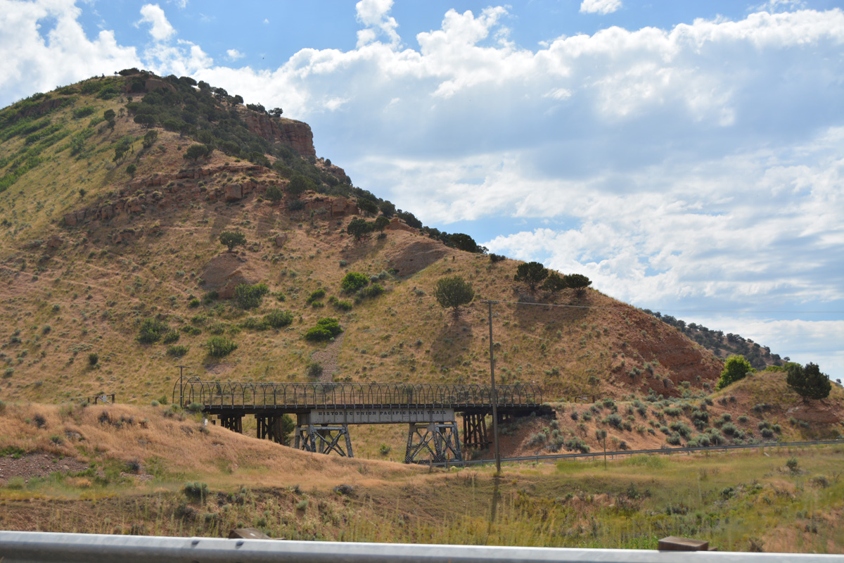
| The freeway turns northward beyond a crossing of both Silver Creek and the Historic Union Pacific Rail Trail. 07/05/16 |
|
| Roadways of Interstate 80 separate above the parallel Silver Creek to milepost 152. 07/05/16 |
|
| A diamond interchange (Exit 150) lies one mile ahead with Tollgate Canyon Road west and Promontory Ranch Road east. 07/05/16 |
|
| Tollgate Canyon Road meanders northwest through Tollgate Canyon along the northern periphery of Silver Summit. Promontory Ranch Road extends the road southeast to the Promontory Ranch golf course community. 07/05/16 |
|
| Exit 150 consists of a ranch exit with no traveler services. 07/05/16 |
|
| Confirming marker for I-80 east posted after Exit 150. 07/05/16 |
|
| Motorists are cautioned about frequent wildlife crossing along Interstate 80 east to the city of Coalville. 07/05/16 |
|
| The westbound lanes travel above the eastbound lanes to the roadway merge ahead of Alexander Canyon. 07/05/16 |
|
| Interstate 80 shifts to run entirely south of Silver Creek to Wanship. 07/05/16 |
|
| Truckers can increase back to 65 miles per hour as Interstate 80 straightens out. The speed limit was previously set at 55 MPH. 07/05/16 |
|
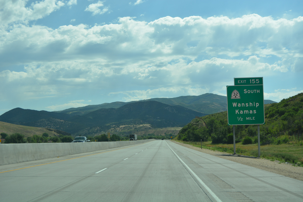
| SR 32 replaced U.S. 189 Alternate south from Wanship to Francis. The state route forms a 29.05 mile loop from I-80 south to U.S. 40 (and U.S. 189) outside Heber City. 07/05/16 |
|
| Leading south from Exit 155, SR 32 runs along the west side of Rockport Lake to SR 302 and Rockport State Park. Hoytsville lies north of Exit 155 via Old Lincoln Highway (historic U.S. 189). 07/05/16 |
|
| One half mile ahead of the split diamond interchange (Exit 155) SR 32 on Interstate 80 east. Kamas, the Summit County seat, is 15 miles to the south. 07/05/16 |
|
| Entering the community of Wanship along I-80 east at Exit 155. SR 32 extends north to overtake Old Lincoln Highway (old U.S. 189) east to its underpass at Interstate 80 nearby. 07/05/16 |
|
| Continuing east, drivers pass by this reassurance marker at the Old Lincoln Highway. 07/05/16 |
|
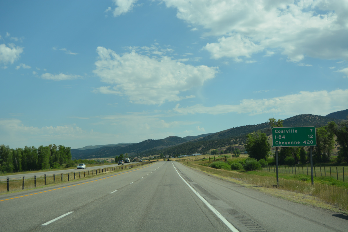
| Interstate 80 runs north to south between Wanship and the east end of I-84 at Echo (12 miles). Distance to Cheyenne is listed a 420 miles, nine miles higher than the previous sign posted at Silver Creek Junction. 07/05/16 |
|
| Hoytsville Road parallels I-80 to the west from Wanship to a decorative overpass near milepost 157. 07/05/16 |
|
| An S-curve takes I-80 over the Historic Union Pacific Rail Trail at milepost 158. 07/05/16 |
|
| Interstate 80 wedges between the Weber River and Historic Union Pacific Rail Trail to Coalville. 07/05/16 |
|
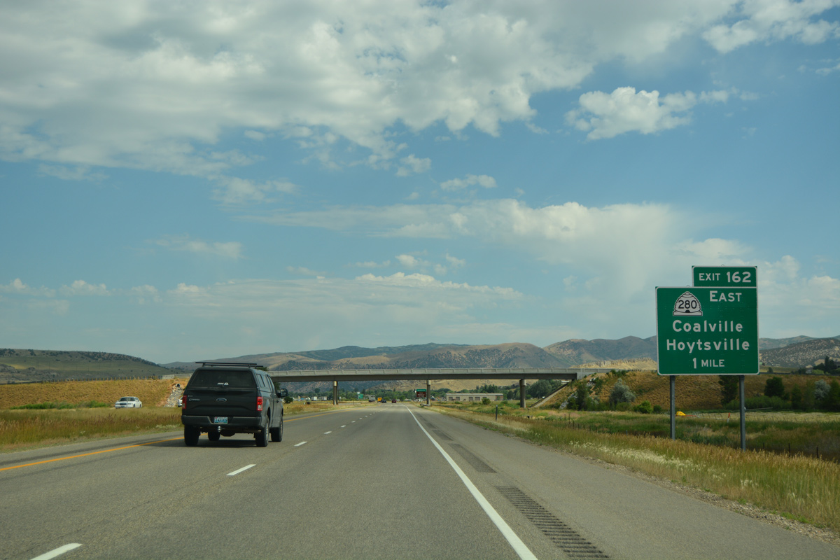
| Interstate 80 east crosses the Coalville city line at the Hobson Lane overpass. A diamond interchange (Exit 162) follows with SR 280 (100 South). 07/05/16 |
|
| SR 280 east to South Main Street leads motorists back south to Hoytsville via old U.S. 189. Recreational interests to Echo Reservoir should follow Main Street north. 07/05/16 |
|
| SR 280 constitutes just the 0.399 mile link between Exit 162 and Main Street (old U.S. 189) in Coalville. 07/05/16 |
|
| Exit 162 leaves I-80 east for SR 280 (100 South) east into Coalville and Icy Springs Road west into Lewis Canyon. 07/05/16 |
|
| Confirming marker for I-80 east posted as the freeway spans the Weber River as it flows northward into Echo Reservoir. 07/05/16 |
|
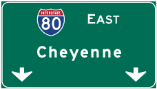
| Evanston, Wyoming debuts on eastbound distance signage for I-80 at 38 miles out. Long distance travelers bound for Cheyenne will reach I-25 at the capital city in 392 miles. 07/05/16 |
|
| Echo Reservoir spreads into view as Interstate 80 climbs onto an adjacent hill to the west. 07/05/16 |
|
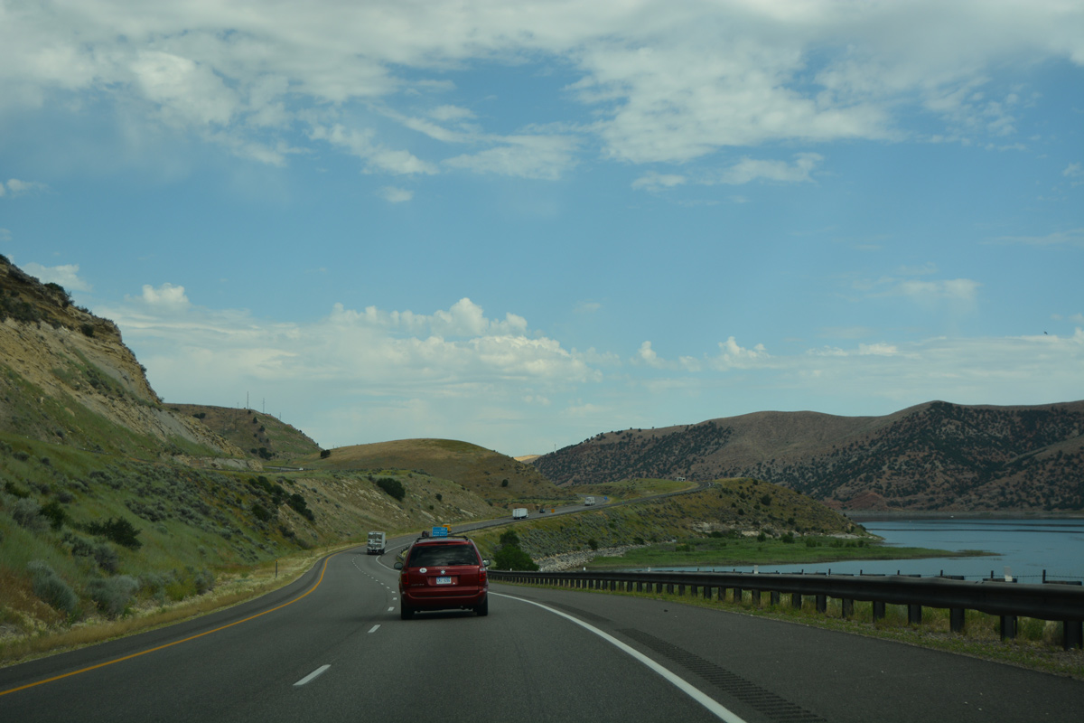
| Eastbound motorists are provided with a view area for Echo Reservoir at milepost 165. 07/05/16 |
|
| The normal pool elevation of Echo Reservoir is 5,560 feet. The view area is located some 200 feet above the lake. 07/05/16 |
|
| Exit 166 is assigned to the Echo Reservoir view area along I-80 eastbound. Milepost 166 however lies another mile ahead. 07/05/16 |
|
| Peering at Echo Reservoir from the I-80 view area. The reservoir was formed in 1931 with construction of Echo Dam. 07/05/16 |
|
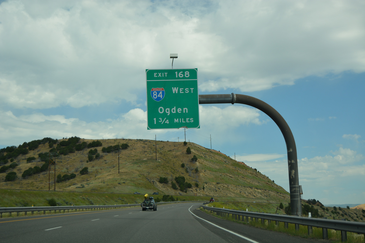
| Interstate 84 commences a 1,002 mile route to Portland, Oregon from Interstate 80 at Echo in two miles. 07/05/16 |
|
| A semi directional T interchange (Exit 168) joins Interstate 80 with I-84 west in one mile. I-84 connects the I-80 corridor with Ogden, 41 miles to the northwest. 07/05/16 |
|
| Interstate 80 passes just west of the earthen Echo Dam on the approach to Exit 168. In the distance is Henefer Valley, which I-84 traverses en route to Morgan County. 08/05/13 |
|
| Leading northwest from Echo, I-84 parallels the Weber River to the town of Henefer and city of Morgan over the initial 20 miles. 07/05/16 |
|
| I-84 was designated in 1977 over Interstate 80N to reduce motorist confusion from the I-80 mainline west to Salt Lake City. The freeway mostly serves long distance truckers west to Ogden, Twin Falls and Boise, Idaho. 07/05/16 |
|
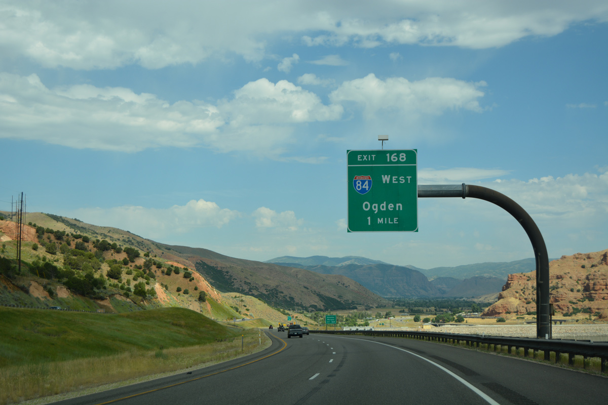
| A sharp curve precedes Exit 168, as I-80 turns east into Echo Canyon. 07/05/16 |
|
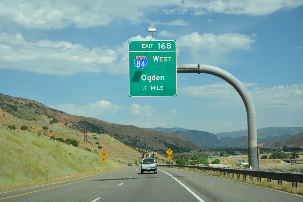
| Exit 168 parts ways with Interstate 80 east for I-84 west to Ogden, Brigham City and Tremonton. The freeway replaced U.S. 30S from Echo to Rupert, Idaho. 07/05/16 |
|
| The Historic Union Pacific Rail Trail spans adjacent Echo Dam Road (old U.S. 189) just east of the I-80/84 exchange. 07/05/16 |
Page Updated 08-01-2016.

 East
East


 North
North