|
| Welcome sign posted ahead of the rest area and tourist information center. Six lane expansion along I-81 at Bristol occurred between 1998 and 1999. 05/26/21 |
|
| Entering the rest area along Interstate 81 north at Bristol. 05/26/21 |
|
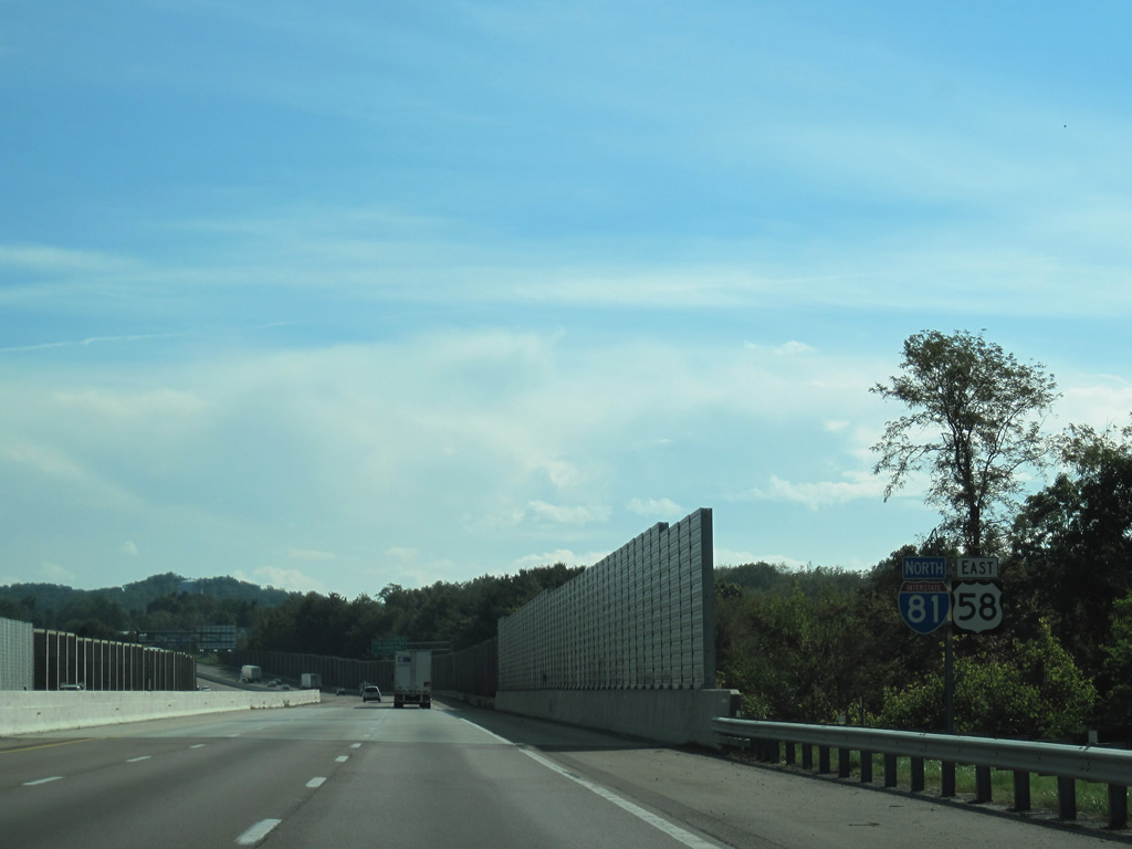
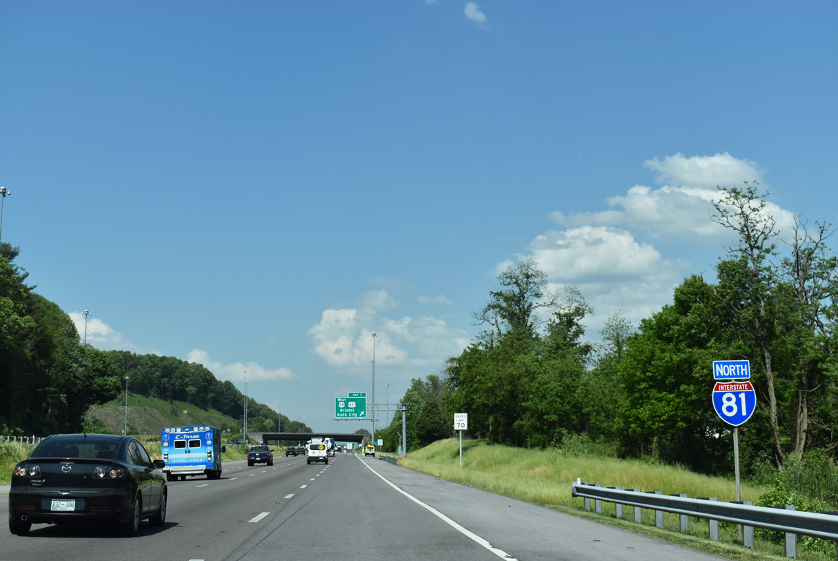
| U.S. 58/421 (Gate City Highway) travels east 24.48 miles from U.S. 23 at Weber City to meet I-81 at Exit 1 along the Bristol city line. U.S. 58 east combines with I-81 north for 18.28 miles to the city of Abington. 05/26/21 |
|
| The first reassurance shield posted for Interstate 81 north along the 325.04 mile course through Virginia. 05/26/21 |
|
| U.S. 421 (Gate City Highway) continues 1.01 miles southeast from I-81/U.S. 58 to combine with U.S. 11W (Euclid Avenue) at State Street. State Street leads east to Downtown Bristol while U.S. 11W/421 overlap northeast to U.S. 11/11E/19 and SR 381 at Commonwealth Avenue. 05/26/21 |
|
| A parclo interchange joins Interstate 81 with U.S. 58/421 (Gate City Highway) at Exit 1. 05/26/21 |
|
| Continuing northeast, I-81/U.S. 58 straddle the boundary between the city of Bristol and Washington County to Exit 5. 05/26/21 |
|
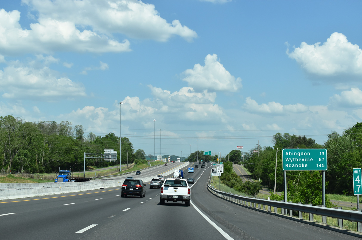
| Abingdon, the Washington County seat, lies 15 miles to the northeast. Roanoke is the main control city for Interstate 81 south of Staunton. 05/26/21 |
|
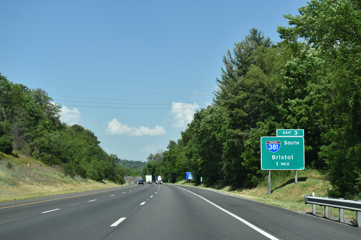
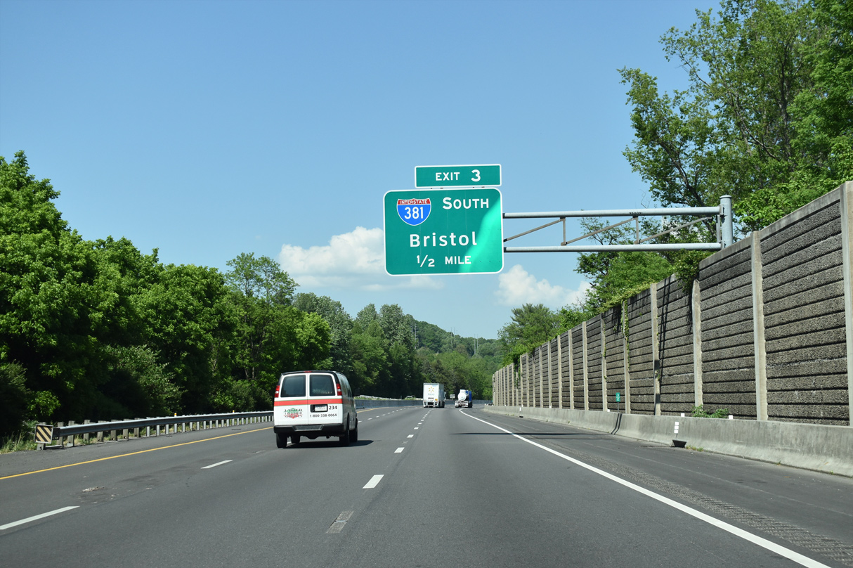
| Forthcoming Interstate 381 constitutes a 1.67 mile long spur south from Exit 3 onto Commonwealth Avenue in Bristol. The freeway connects I-81/U.S. 58 with U.S. 11/11E/11W, U.S. 19 and U.S. 421 at Euclid Avenue north of Downtown. 05/26/21 |
|
| Interstate 381 is a four lane freeway with no exits between I-81 and Commonwealth Avenue (unsigned SR 381) at Keys Street. Commonwealth Avenue leads directly to the central business district as a part of U.S. 11E-19-421. 05/26/21 |
|
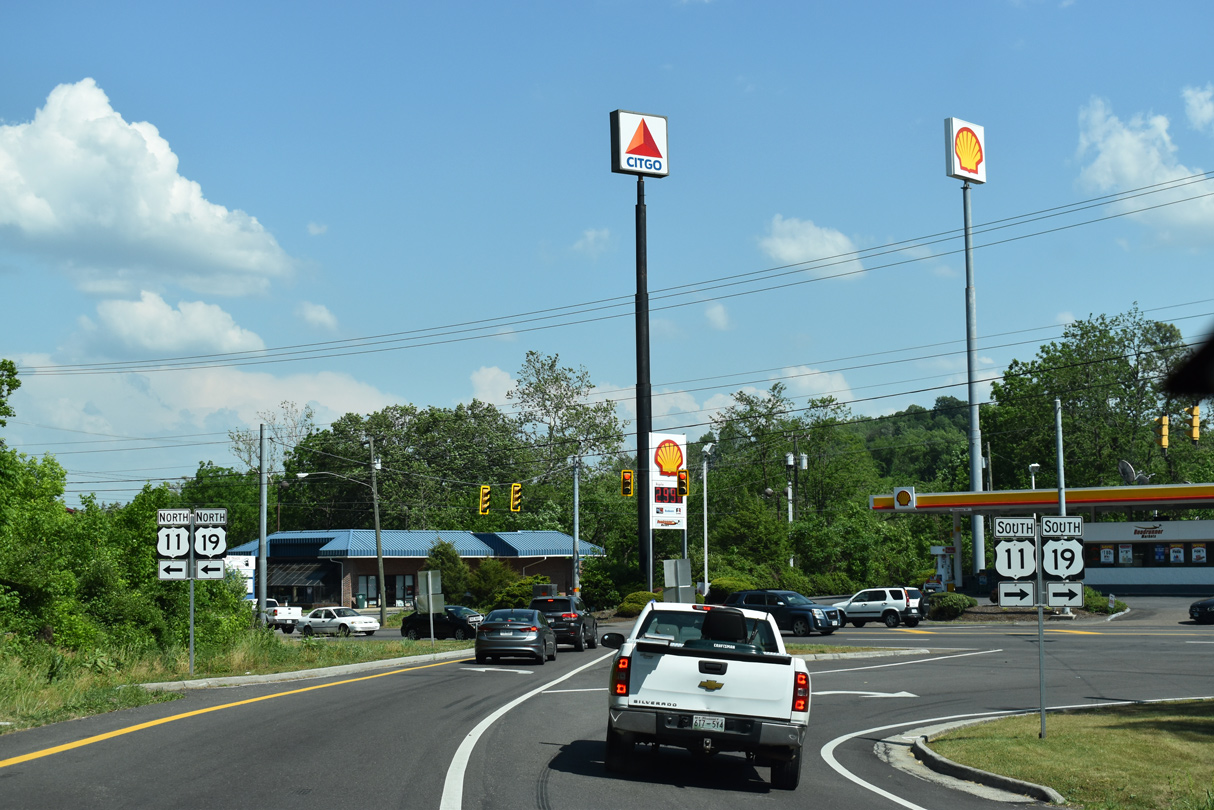
| A directional T interchange joins I-81/381 at Exit 3. Euclid Avenue (U.S. 11/19) travels northeast from Commonwealth Avenue to the succeeding exit. U.S. 11E-19-421 south follow Commonwealth Avenue onto Volunteer Parkway in Bristol, Tennessee. 05/26/21 |
|
| Passing under the ramps with Interstate 381 on I-81 north / U.S. 58 east. The freeway spur opened to traffic along with I-81 bypassing Bristol in November 1961. 05/26/21 |
|
| Turning eastward into Bristol, I-81/U.S. 58 advance to a diamond interchange (Exit 5) with U.S. 11/19 (Lee Highway). 05/26/21 |
|
| Long Crescent Road accompanies the south side of I-81/U.S. 58 from Virginia Heights to Lee Highway by these shields. 05/26/21 |
|
| Wytheville appears for the first time on distance signs at 67 miles out. 05/26/21 |
|
| Exit 5 descends from I-81/U.S. 58 north to U.S. 11/19 (Lee Highway). U.S. 11/19 parallel Interstate 81 eastward to their split at Abingdon. 05/26/21 |
|
| U.S. 11/19 shields posted along the off-ramp at Exit 5. U.S. 58 followed Lee Highway from Bristol to Abingdon until 1966. 05/26/21 |
|
| I-81/U.S. 58 run along the south side of The Falls retail complex ahead of Beaver Creek. This shield assembly was no longer in place by the end of 2015. 09/29/10 |
|
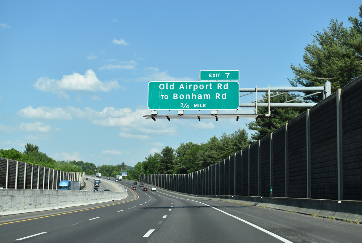
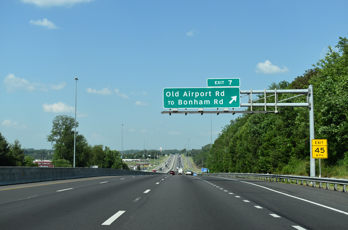
| Old Airport Road links I-81/U.S. 58 with adjacent U.S. 11/19 (Lee Highway) via a diamond interchange (Exit 7) in 0.75 miles. 05/26/21 |
|
| Old Airport Road arcs 0.79 miles southwest from I-81/U.S. 58 to Bonham Road near in Shakesville Bristol. Clear Creek Road (SR 659) extends northward from U.S. 11/19 to Wallace. 05/26/21 |
|
| Interstate 81 north / U.S. 58 east exit the city of Bristol en route to Abingdon in Washington County. 05/26/21 |
|
| I-77 joins I-81 at Wytheville for an overlap to Fort Chiswell. 05/26/21 |
|
| Interstate 81 and parallel U.S. 11/19 (Lee Highway) continue from Colonial Heights and Preston Hills to Hilander Park. Exit 10 connects the two via SR F310. 05/26/21 |
|
| Exit 10 departs the northbound freeway for U.S. 11/19 (Lee Highway) at Hilander Park. Majestic Drive extends east from the 0.18 mile long route of SR F310 to Evergreen Hills along the south side of I-81. 05/26/21 |
|
| I-81/U.S. 58 lower toward Sinking Creek near Evergreen Hills, 61 miles from Wytheville. 05/26/21 |
|
| A commercial truck only rest and parking area follows upcoming Exit 13 (SR 611). 05/26/21 |
|
| SR 611 (Spring Creek Road) crosses paths with I-81/U.S. 58 at a diamond interchange (Exit 13) in one mile. 05/26/21 |
|
| Like Exit 10, Exit 13 acts to connects I-81/U.S. 58 with parallel U.S. 11/19 (Lee Highway) to the north near Virginia Highlands Airport (VJI). SR 611 south links with SR 647 (Old Jonesboro Road) in 0.48 miles. 05/26/21 |
|
| A truck rest area lies a short distance east of Exit 13. 05/26/21 |
|
| The parclo interchange (Exit 14) with SR 140 (Old Jonesboro Road) north to U.S. 11/19 (Lee Highway) west of Virginia Highlands Community College and their split at Porterfield Memorial Highway is the first of three Abingdon area exits. 05/26/21 |
|
| SR 140 (Jonesboro Road) is a 0.38 mile long arterial north from I-81/U.S. 58 to U.S. 11/19 (Lee Highway). SR 647 (Old Jonesboro Road) extends 10.25 miles southwest from Exit 14 to the Bristol city line. 05/26/21 |
|
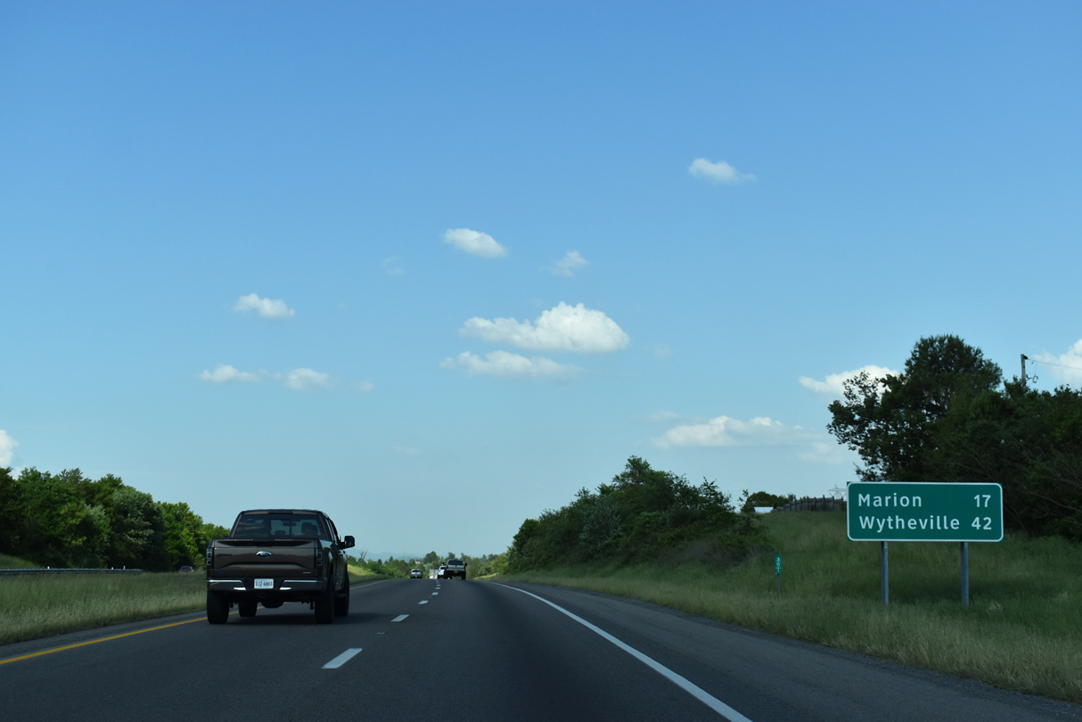
| Marion, the Smyth County seat, lies 32 miles east of Abingdon along Interstate 81. 05/26/21 |
|
| A diamond interchange (Exit 17) follows with U.S. 58 Alternate west and SR 75 (Cummings Street) in Abingdon. SR 75 travels 9.73 miles southwest from Abingdon to Tennessee State Route 44 by South Holston Lake. 05/26/21 |
|
| U.S. 58 Alternate measures 87.60 miles in length between I-81 and U.S. 58 at Jonesville. U.S. 58 Alternate heads west to Norton and Wise. Cummings Street north to Downtown Abindgon leads to Barter Theatre and the William King Regional Arts Center. 05/26/21 |
|
| Interstate 81 advances from the south side of Abingdon 30 miles to Marion and 132 miles to Roanoke. 05/26/21 |
|
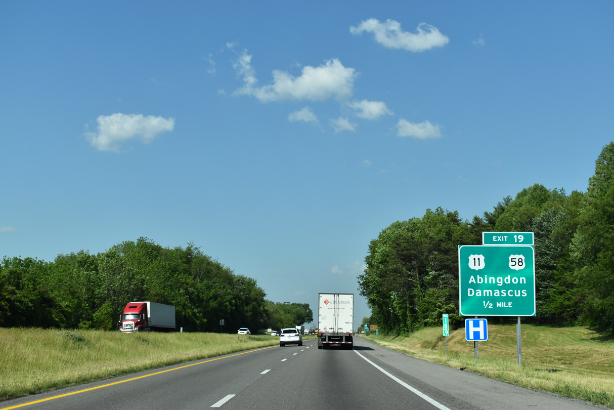
| U.S. 58 parts ways with Interstate 81 north at Exit 19. U.S. 58 joins U.S. 11 (Lee Highway) for 0.27 miles before turning southeast along Jeb Stuart Highway to Damascus. 05/26/21 |
|
| U.S. 11 ties into the six-ramp parclo interchange (Exit 19) with I-81/U.S. 58 from Main Street in Abingdon. U.S. 58 travels ten miles to Damascus and 75 miles to Galax. 05/26/21 |
|
| Interstate 81 continues 27 miles toward Marion and 52 miles to Wytheville. 05/26/21 |
|
| The diamond interchange (Exit 22) with SR 704 (Enterprise Road) was added after the original completion of Interstate 81. Enterprise Road serves an industrial park area 0.43 miles north at SR 609 (Hillman Highway). 05/26/21 |
|
| SR 704 (Enterprise Road) links Exit 22 with U.S. 11 (Lee Highway) 0.67 miles to the south. 05/26/21 |
|
| Northbound confirming marker posted for Interstate 81 ahead of Greenway Creek and the Stonybrook Road (SR 694) underpass. 05/26/21 |
|
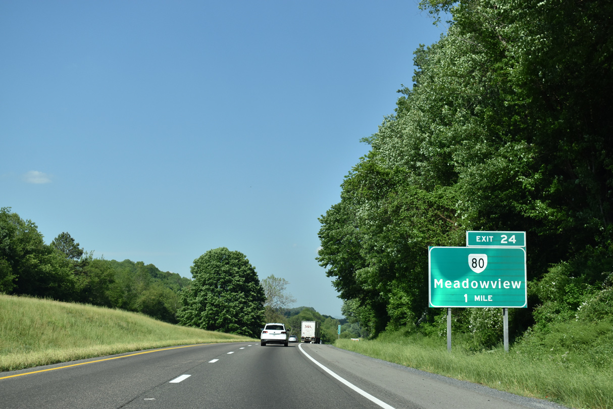
| SR 80 (Glenbrook Avenue) stems 0.78 miles north from U.S. 11 (Lee Highway) to a diamond interchange (Exit 24) with Interstate 81 at Meadowbrook. 05/26/21 |
|
| SR 80 travels 67.37 miles northwest to the Kentucky line near Breaks. SR 80 is part of a multi state highway across the Bluegrass State to KY 123 near Columbus and the Mississippi River. 05/26/21 |
|
| Exit 24 and Exit 26 previously consisted of two half diamond interchanges. 05/26/21 |
|
| SR 737 (College Drive) runs 1.15 miles between U.S. 11 (Lee Highway) west of Blacksburg and SR 609 (Hillman Highway) at Emory. 09/29/10 |
|
| Exit 26 leaves Interstate 81 north for SR 737 (College Drive). Emory is home to Emory & Henry College. 05/26/21 |
|
| Progressing east from Emory, I-81 reaches the town of Marion in 20 miles and the town of Wytheville in 45 miles. 05/26/21 |
|
| SR 91 (Maple Street) crosses paths with Interstate 81 at a diamond interchange (Exit 29) south of the town of Glade Spring. 05/26/21 |
|
| Forming a multi state highway with Tennessee State Route 91, SR 91 leads south to Damascus and north into Glade Spring and Saltville. The 55.15 mile long route in Virginia concludes at U.S. 19-460 Business in Tazewell. A portion of the route through Jeffersson National Forest is unpaved. 05/26/21 |
|
| U.S. 11 and Interstate 81 parallel one another closely on the succeeding 17 miles leading east into Marion. 05/26/21 |
|
| Shifting from the south side of Interstate 81 to the north, U.S. 11 converges with the freeway at a diamond interchange (Exit 32) at Hutton Creek. 05/26/21 |
|
| U.S. 11 (Lee Highway) continues east from Fleet Road (SR 751) at Exit 32 along the north side of I-81 into Chilhowie. SR 751 extends north 1.40 miles to Fleet and connects Exit 32 with SR 609 (Blue Hill Road) at Plum Creek. 05/26/21 |
|
| Faris Drive (SR F034) appears along the south side of Interstate 81 beyond this reassurance shield. 05/26/21 |
|
| Approaching the town of Chilhowie along Interstate 81 north, travelers enter Smyth County. 07/16/05, 05/26/21 |
Page Updated 06-20-2021.

 North
North


 East
East