
 North
North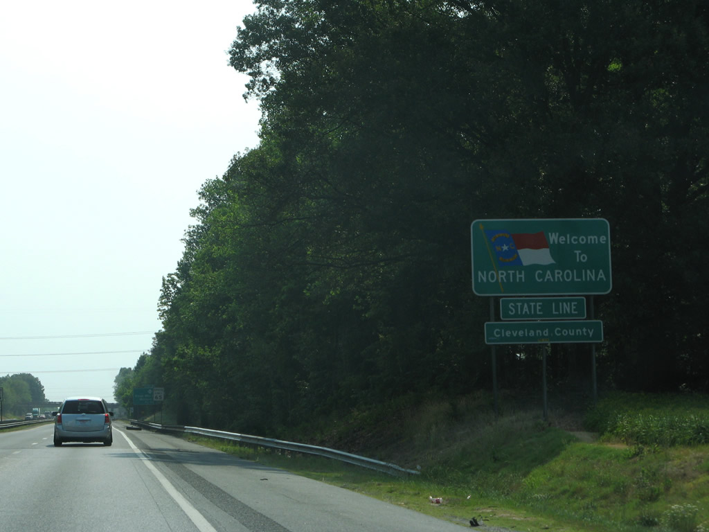
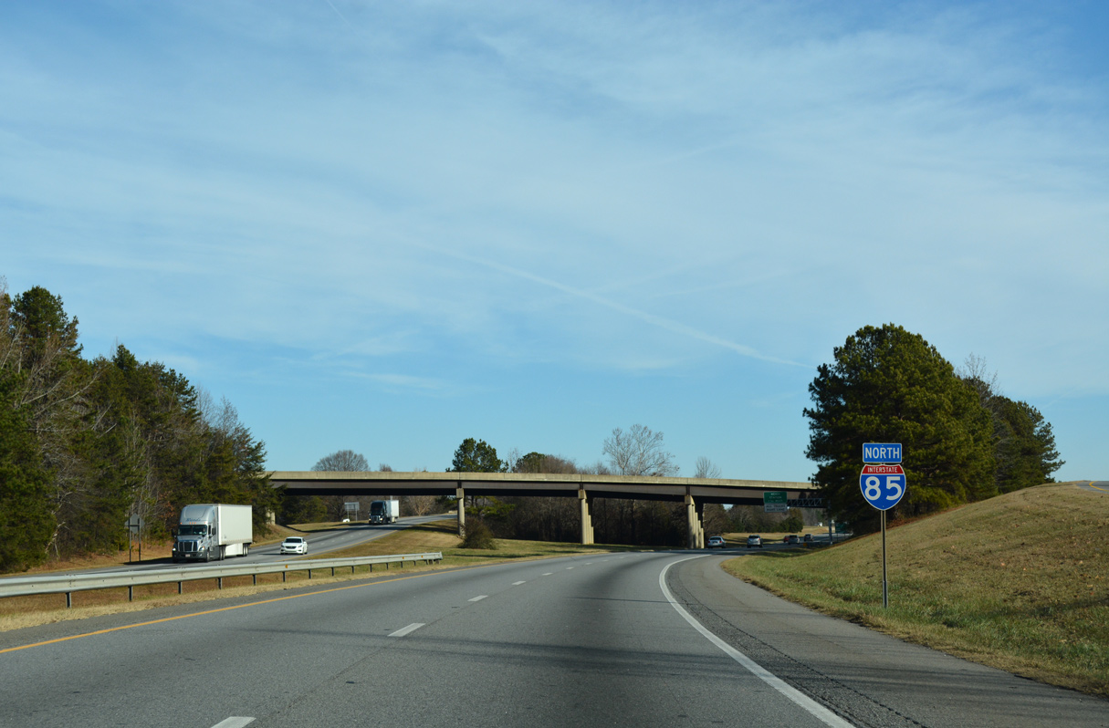
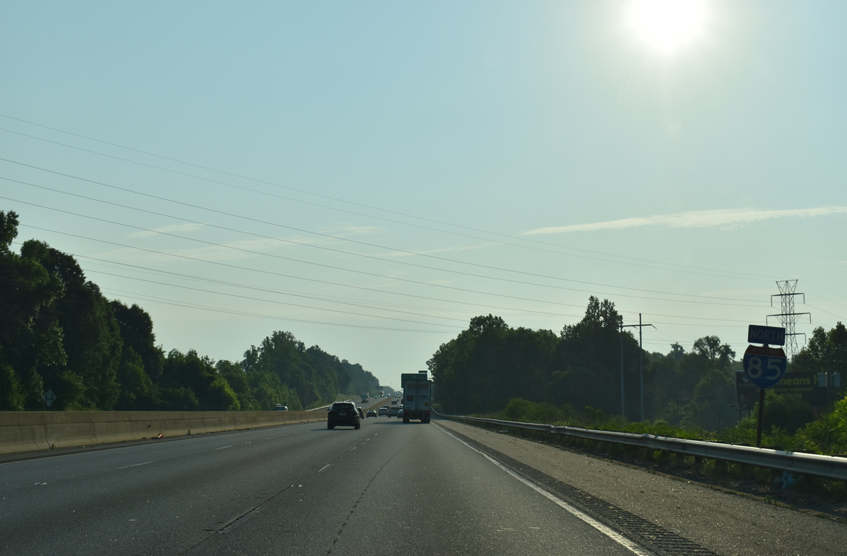
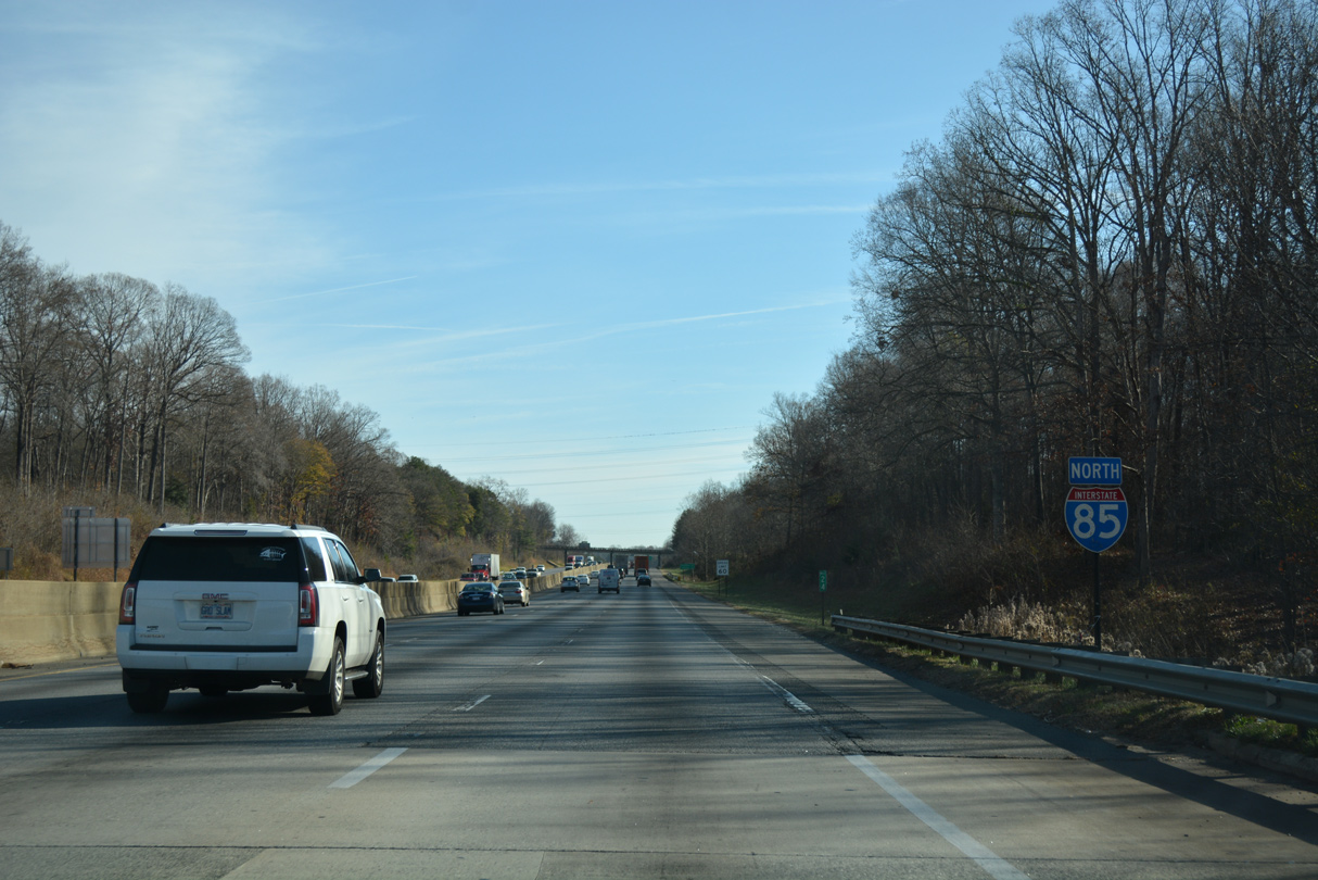
Interstate 85 crosses into Cleveland County from South Carolina. I-85 travels 236 miles through the Tar Heel State from Grover northeast to Norlina.
06/01/07

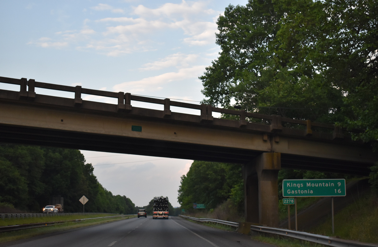
Interstate 85 advances 1.5 miles to a diamond interchange with NC 216 (Battleground Road) at Exit 2. NC 216 extends S.C. 216 north from Kings Mountain National Military Park.
05/25/21
05/25/21
05/25/21

NC 216 (Battleground Road) combines with U.S. 29 along Battleground Avenue nearby through Archdale. U.S. 29 joins NC 216 northeast from the town of Grover.
05/25/21

12/15/16

NC 216 follows Battleground Avenue northeast from U.S. 29 to Downtown Kings Mountain. The portion of the route north to King Street (U.S. 74 Business) follows old U.S. 29.
05/25/21

A tourist information center and rest area lie just east of Exit 2 along Interstate 85 north.
05/25/21
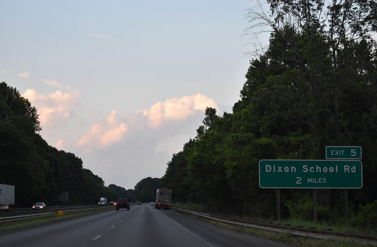
A diamond interchange (Exit 5) joins I-85/U.S. 29 with Dixon School Road (SR 2283) in two miles.
05/25/21

U.S. 29 northbound merges onto Interstate 85 via a wye interchange one mile west of Dixon School Road (Exit 5).
05/25/21
 North
North
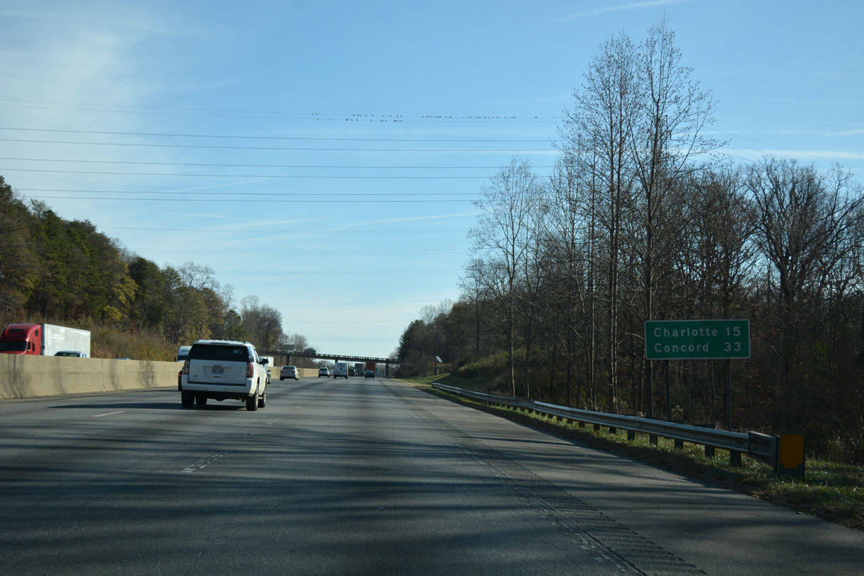
U.S. 29 splits with NC 216 (Battleground Avenue) nearby and combines with I-85 for six miles around Kings Mountain. Bethlehem Road (SR 2245) passes over the freeway just beyond the left side merge with U.S. 29 north.
05/25/21

The Boulders Access Area at Crowders Mountain State Park lies southeast of Exit 5 along Bethlehem Road.
05/25/21
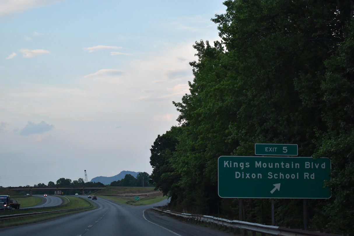
Dixon School Road loops northeast from NC 216 (Battleground Road) to Exit 5 and NC 216 again near Midpine. Kings Mountain Boulevard (SR 2705) overtakes Dixon School Road nearby on a newer alignment to U.S. 74 Business (Shelby Road) on the west side of Kings Mountain.
05/25/21
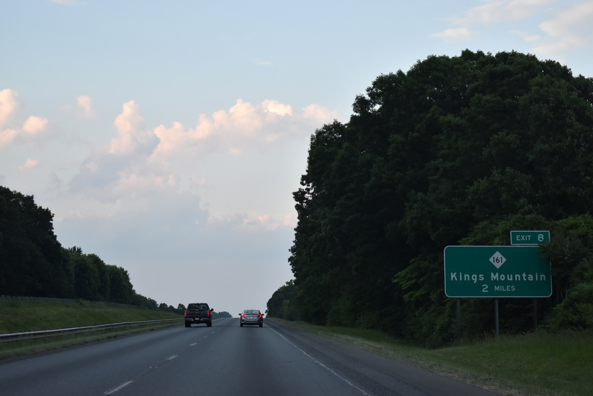
The final Cleveland County interchange is two miles ahead with NC 161 (York Road).
05/25/21
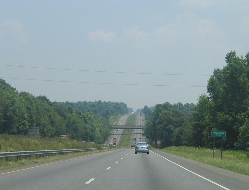
Entering the city limits of Kings Mountain along Interstate 85 north. The freeway remains within the municipality to Exit 10A.
06/22/05

I-85/U.S. 29 northbound reassurance markers posted at Kings Mountain. U.S. 29 follows much the Interstate 85 corridor from Auburn, Alabama northeast to Greensboro.
12/15/16

05/25/21
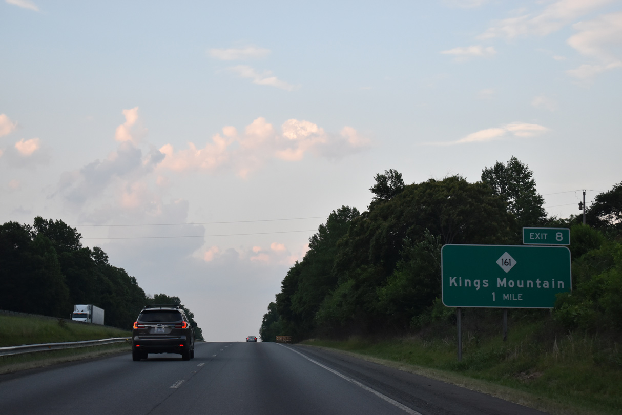
NC 161 follows York Road south from Exit 8 across Stepps Gap over Kings Mountain to Bethany, South Carolina. S.C. 161 continues the route 13 miles from the state line to Filbert and U.S. 321 at York.
05/25/21

NC 161 south to S.C. 161 connects I-85/U.S. 29 with Park Road west into both Kings Mountain State Park and Kings Mountain National Military Park. The Battle of Kings Mountain took place within the park grounds on October 7, 1780. The event was a turning point in the Revolutionary War, halting the British advance into North Carolina
05/25/21

NC 161 (York Road) intersects U.S. 74 Business (King Street) 1.2 miles north of the parclo interchange at Exit 8 in Kings Mountain.
05/25/21

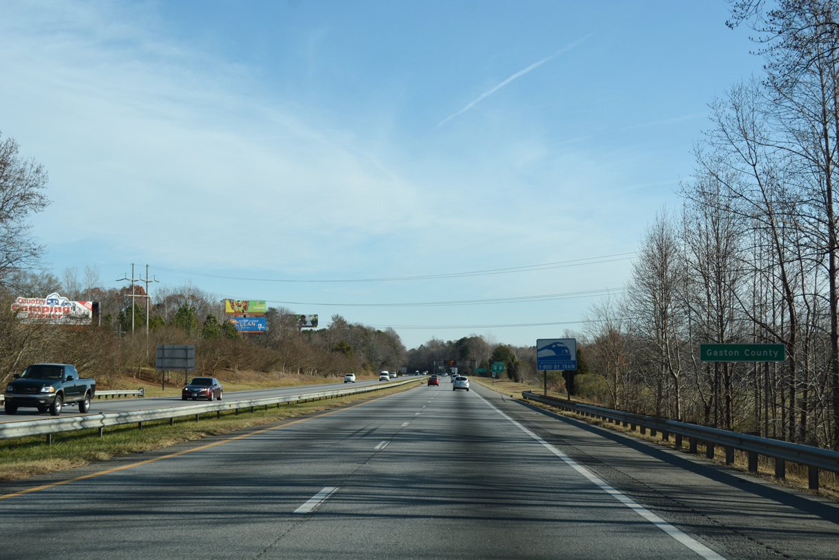
North from U.S. 74 Business (King Street), NC 161 follows Cleveland Avenue across the Gaston County line en route to NC 274 in Bessemer City.
05/25/21

A set of I-85/U.S. 29 north reassurance markers precede the Gaston County line.
05/26/21
12/15/16
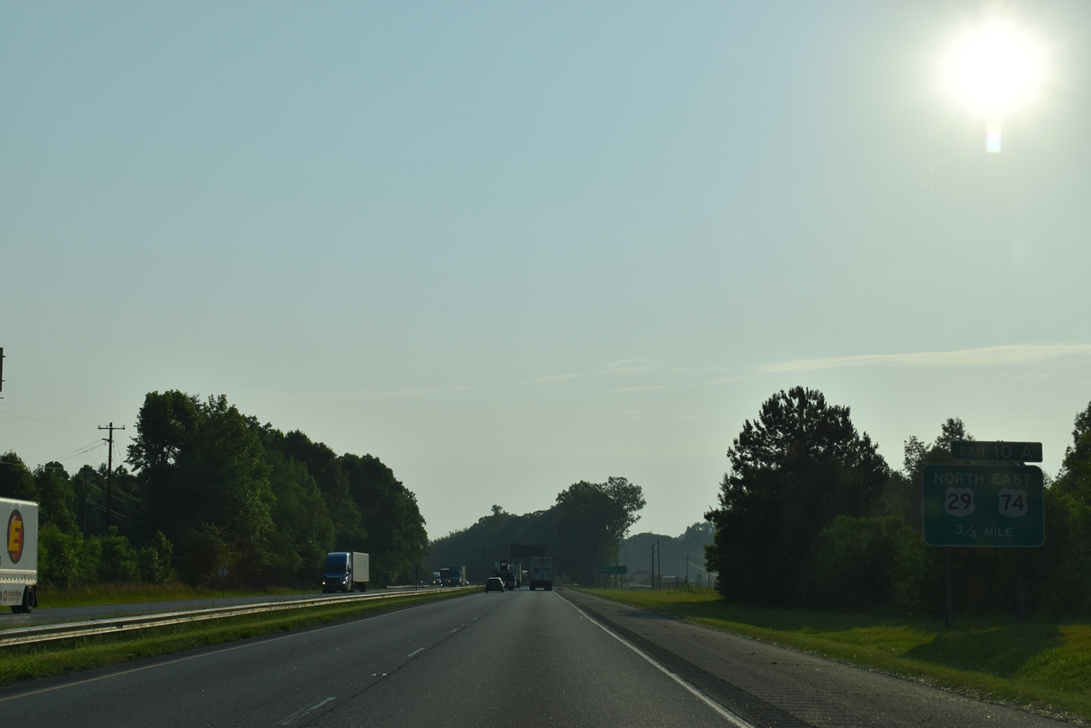
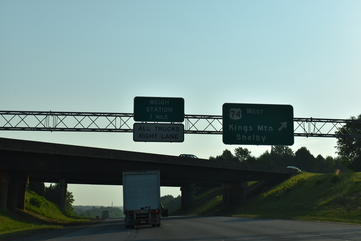
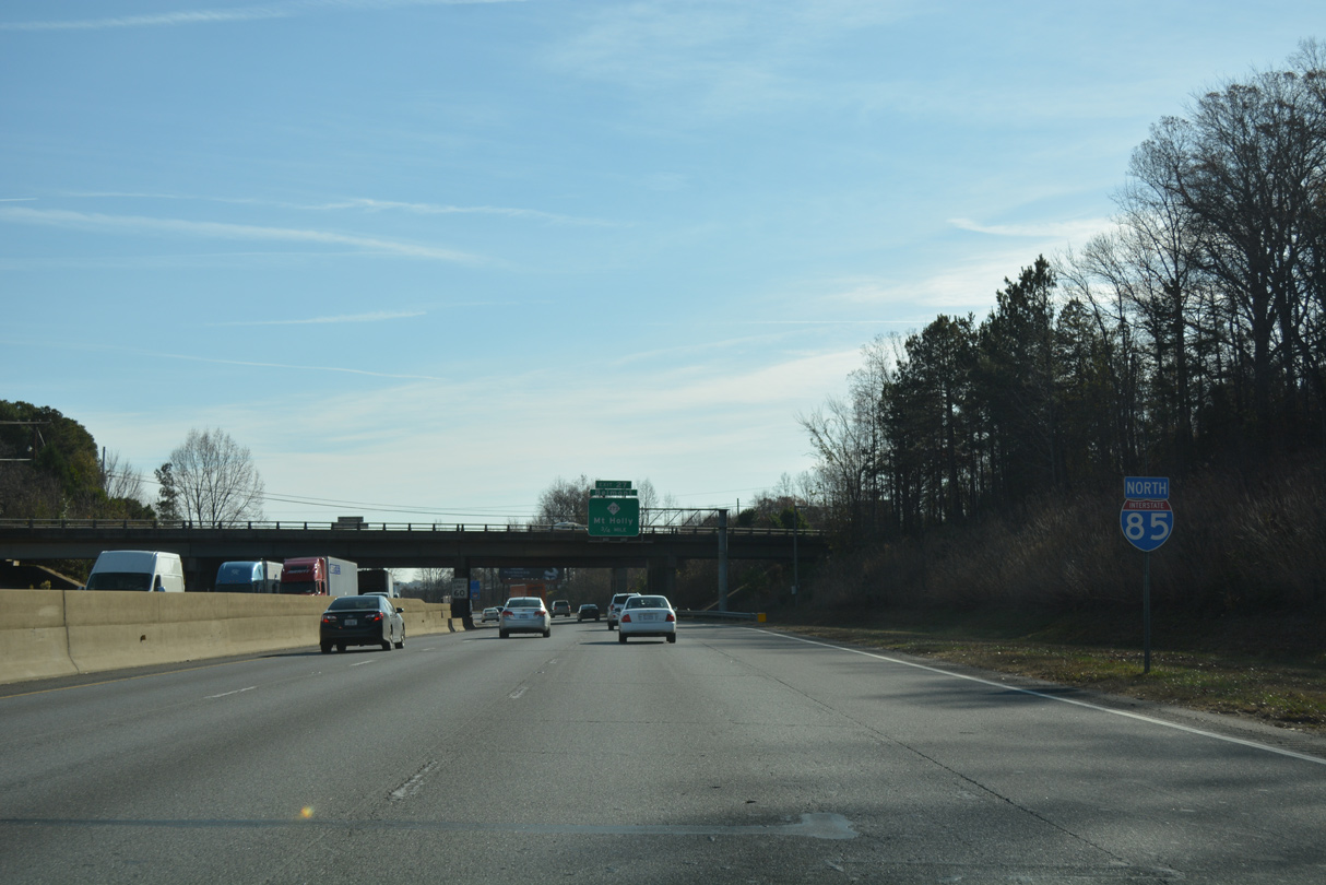
Interstate 85 north progresses toward the directional cloverleaf interchanges (Exits 10A/B) with U.S. 74 and the U.S. 29 split. Woodlake Parkway and a few distribution centers line the freeway along this stretch.
05/26/21
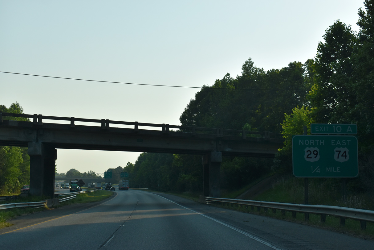
Canterbury Road (SR 1118) passes overhead one quarter mile from the separation with U.S. 29 at Exit 10A. U.S. 29 combines with U.S. 74 east along Kings Mountain Highway to Franklin Boulevard through the city of Gastonia.
05/26/21

U.S. 74 follows a freeway bypass around the north side of Kings Mountain to I-85 at Exit 10A. U.S. 29/74 east combine between the I-85 north and southbound roadways to Exit 10B while westbound U.S. 74 runs on a separate roadway along the north side.
05/26/21
North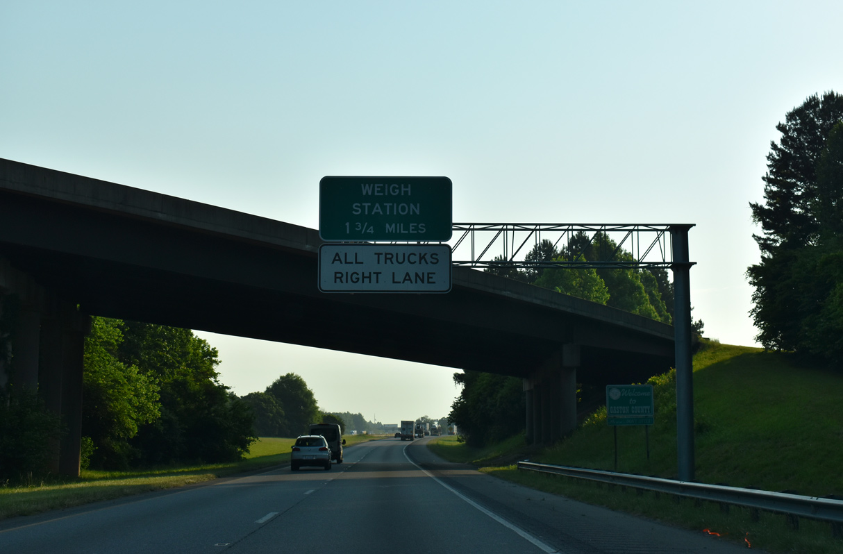
05/26/21
Reassurance marker posted for Interstate 85 north ahead of the U.S. 74 eastbound overpass.
12/15/16

U.S. 29 north / U.S. 74 east appear alongside I-85 north ahead of Exit 10B for U.S. 74 west. U.S. 74 partitions with U.S. 74 Business (King Street) for a freeway freeway traveling four miles along the northern periphery of the Kings Mountain. King Street leads directly to Downtown.
05/26/21
U.S. 74 travels 16 miles west from Exit 10B to the Cleveland County seat of Shelby. Construction through 2026 completes the freeway along U.S. 74 west to Forest City, Rutherfordton and Interstate 26 at Columbus.
05/26/21

Interstate 85 expands to six overall lanes from Exit 10 eastward into the greater Charlotte metropolitan area.
12/15/16

Widening of Interstate 85 across Gaston County was completed in the late 1990s and early 2000s.
05/26/21

05/26/21

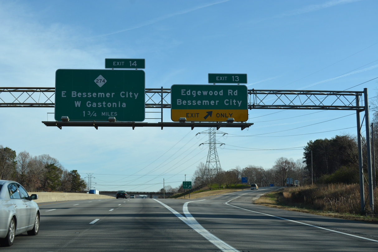
Interstate 85 turns easterly toward the city of Gastonia. Forthcoming Exit 13 with Edgewood Road (SR 1307) connects the freeway with Bessemer City to the north.
05/26/21

05/26/21

Edgewood Road (SR 1307) runs south from Exit 13 to U.S. 29/74 (Franklin Boulevard) at Archie Whiteside Road (SR 1122) in west Gastonia. Northward from I-85, SR 1307 leads to Athenia Place at the Dover Heights community of Bessemer City.
05/26/21
Exit 13 departs Interstate 85 north for Edgewood Road (SR 1307). SR 1307 overlays Athenia Place and Alabama Avenue west from Edgewood Avenue into the Bessemer City business district.
12/15/16
The 21.9 mile long Garden Parkway was once proposed to tie into I-85 along the stretch preceding Exit 14. Had it been built, the toll road would encircle Gastonia and Belmont to the to the south en route to I-485 (Exit 6) and NC 160.
05/26/21

NC 274 leads east from the Bessemer City center to West Gastonia and a folded diamond interchange with Interstate 85 at Exit 14.
12/15/16

NC 274 (Bessemer City Road) connects with NC 275 (Dallas Bessemer City Highway) 1.15 miles to the northwest of Exit 14. NC 275 leads northeast from there to U.S. 321 at Dallas and NC 27 at Stanley.
12/15/16

NC 274 (Bessemer City Road) continues 1.47 miles southeast from Exit 14 to U.S. 29/74 (Franklin Boulevard). NC 274 overlaps with U.S. 29/74, 2.1 miles east through Downtown Gastonia to Broad Street. Overall NC 274 travels 35 miles from NC 27 at Hulls Crossroads southeast to Cherryville and Rock Hill as S.C. 274.
12/15/16

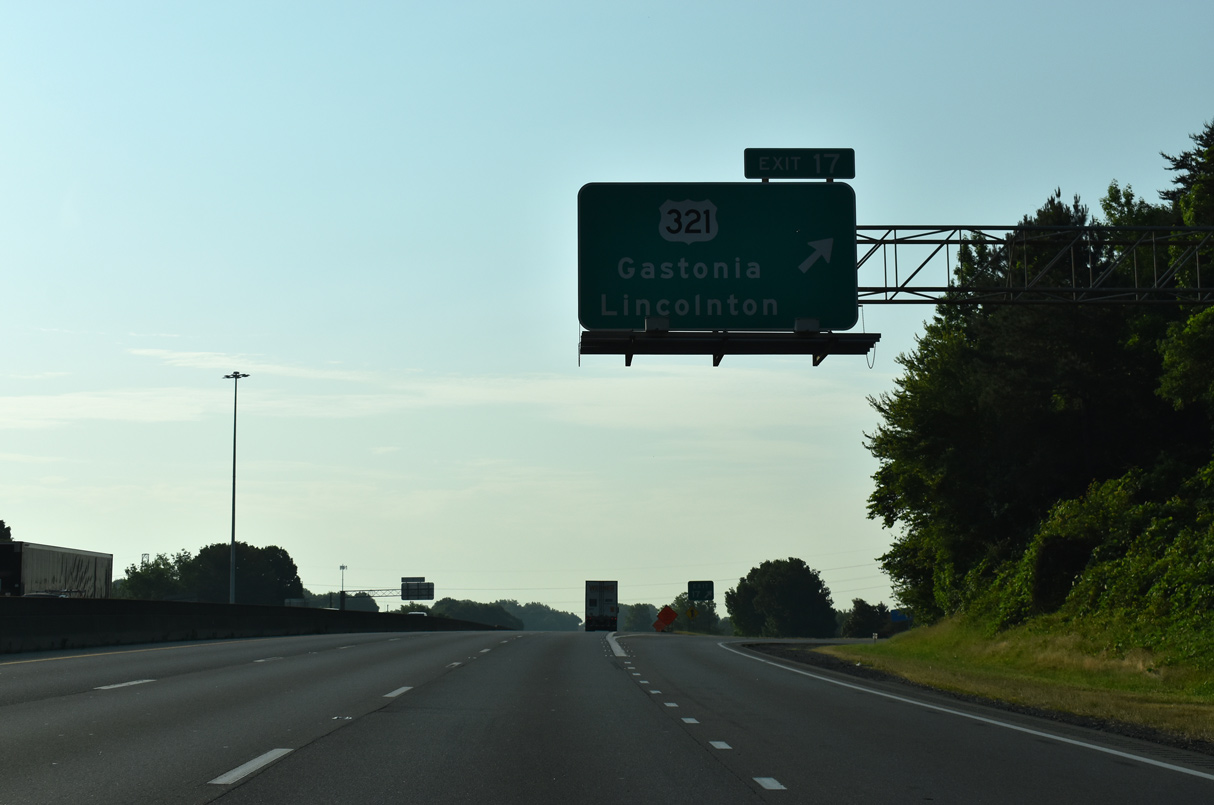
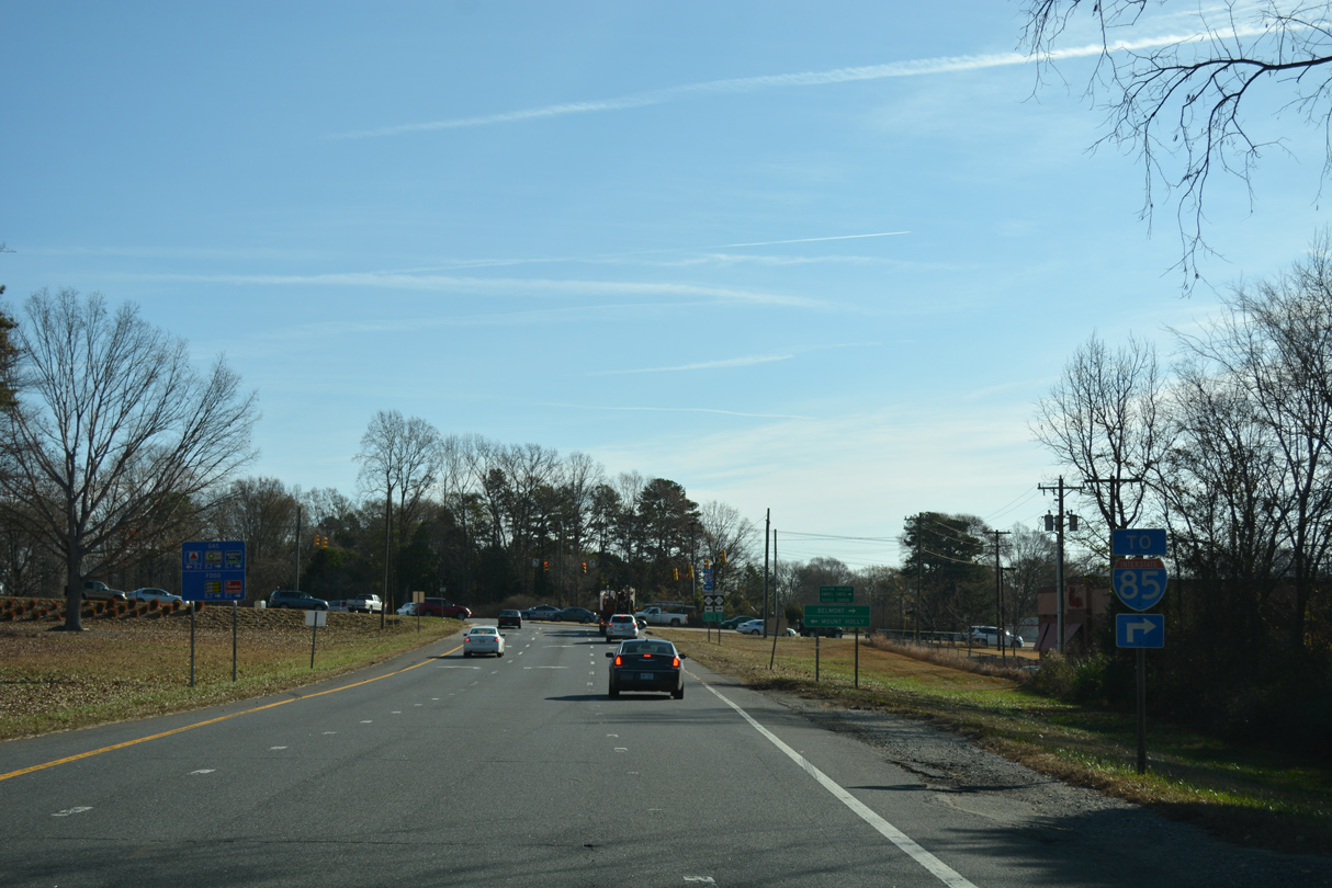
U.S. 321 (Chester Street) runs north from Downtown Gastonia to I-85 at Exit 17 by Sims Legion Park. Construction completed on February 26, 20211 added new ramps from U.S. 321 south to I-85 north and from I-85 south to U.S. 321 north.
12/15/16
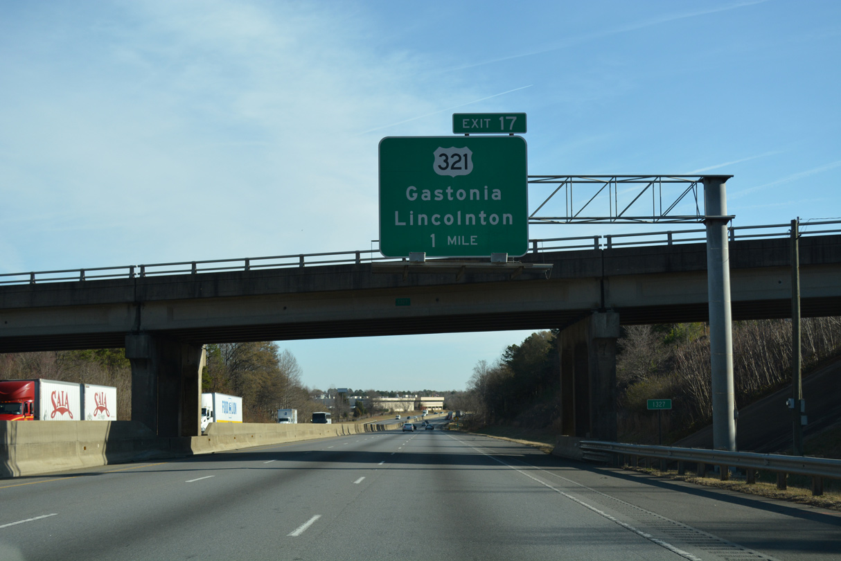
U.S. 321 continues north from I-85 along a commercial arterial 1.12 miles to Roechling Street (SR 1367), where the freeway to Lincolnton and Hickory begins.
12/15/16
U.S. 321 splits into a one way couplet through Downtown Gastonia along Chester Street south and York Street north in 1.1 miles. Points of interest for Exit 17 include the Gaston County Museum and Gaston College in nearby Dallas.
05/26/21
Future widening will expand I-85 from six to eight overall lanes for approximately ten miles from U.S. 321 to NC 273 (Exit 27) in Mount Holly. Estimated to cost $262.78 million, work is projected to run from 2024 to
03/12/22

NC 7 (Ozark Avenue) connects with Interstate 85 at the first of three meetings at Exit 19 in East Gastonia.
03/12/22

NC 7 runs east from U.S. 321 (Chester / York Streets) along Long and Ozark Avenues to meet Interstate 85 at Exit 19 in one half mile.
03/12/22

A parclo B2 interchange (Exit 19) joins I-85 with NC 7 (Ozark Avenue) in East Gastonia. The state route parallels a Norfolk-Southern Railroad east from Exit 19 to Ranlo and Lowell. Representing an original alignment of U.S. 74,2 NC 7 travels 12.08 miles.
05/26/21

Interstate 85 next meets NC 279 (New Hope Road) at a diamond interchange (Exit 20) by Eastridge Mall.
05/26/21
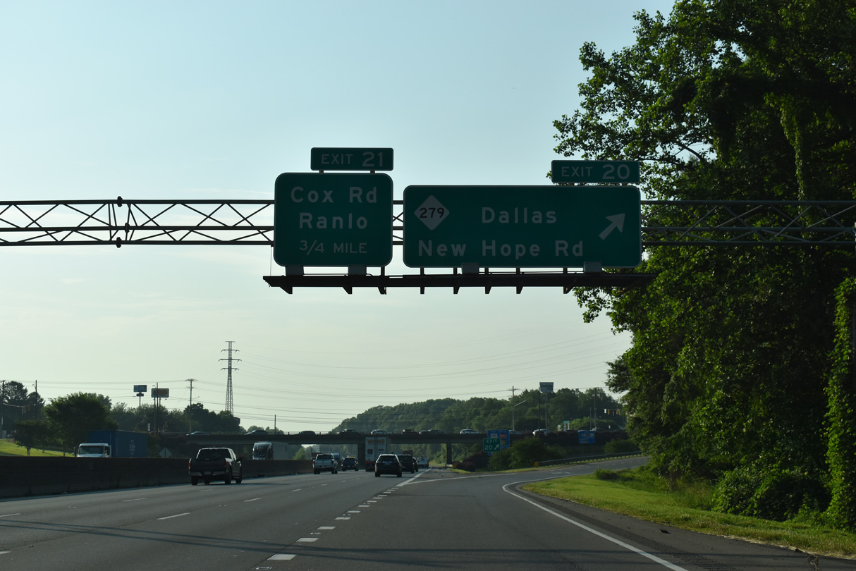
NC 279 (New Hope Road) travels 4.5 miles north to Dallas and 11.4 miles south to S.C. 177 at Lake Wylie.
05/26/21

The sixth exit for the city of Gastonia joins I-85 with Cox Road (SR 2200). Preceding Exit 21 is a former wye interchange that once served as the temporary beginning of I-85 north from parallel U.S. 29/74 (Franklin Boulevard).
03/12/22

Cox Road (SR 2200) connects Interstate 85 with U.S. 29/74 opposite Armstrong Park Road. Northward from Exit 21, SR 2200 heads north to the towns of Ranlo and Spencer Mountain.
12/15/16

03/12/22

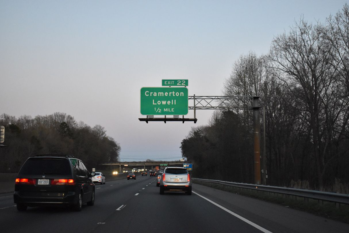
Commercial development envelopes the area between I-85 and parallel U.S. 29/74 (Franklin Boulevard) east to the folded diamond interchange (Exit 22) with S Main Street (SR 2329) in Lowell.
03/12/22
SR 2329 extends southwest from U.S. 29/74 along Redbud Drive by a series of leafy subdivisions in Lowell to NC 279 (New Hope Road) in east Gastonia.
03/12/22
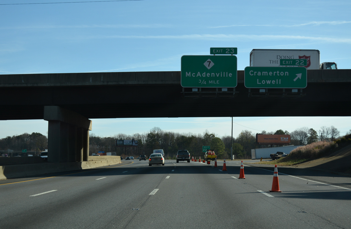
Exit 22 departs Interstate 85 north for S Main Street (SR 2329). NC 7 overtakes two blocks of Main Street through the Lowell city center before turning east onto McAdenville Road to Exit 23.
12/15/16

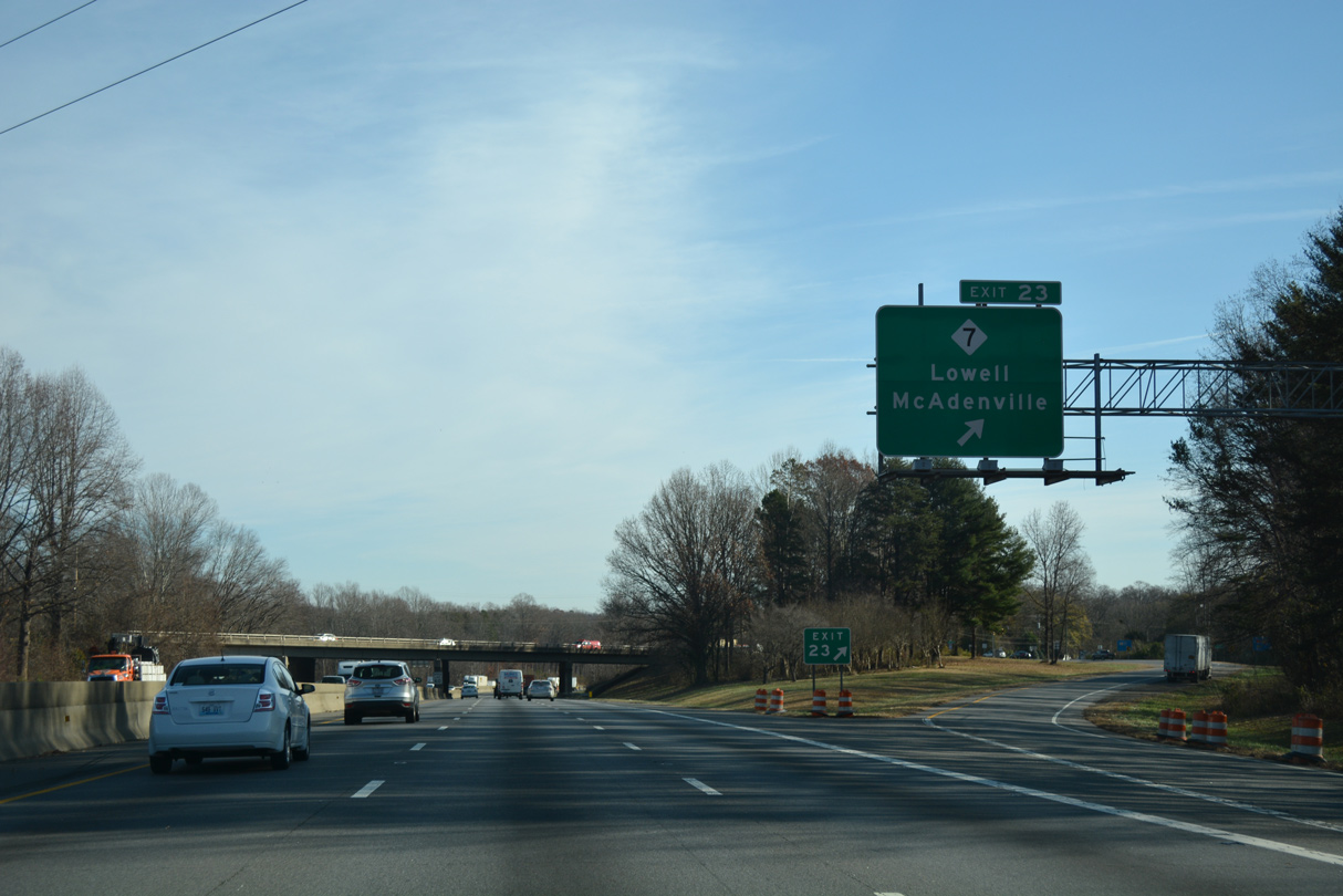
Grove Street (SR 2213) and a parallel Norfolk Southern Railroad pass over Interstate 85 one half mile west of the diamond interchange (Exit 23) with NC 7.
12/15/16

Leaving Lowell just east of Exit 23, NC 7 (McAdenville Road) becomes Main Street through the town of McAdenville.
12/15/16
NC 7 takes a convoluted path through McAdenville, using Main Street east to cross the Catawba River South Fork to Riverside Drive into north Cramerton.
12/15/16

12/15/16
12/15/16
12/15/16

NC 7 again interacts with Interstate 85 at Exit 26 in the city of Belmont. The state route parallels I-85 east along McAdenville Road before turning south onto Main Street to Belmont City Hall and Catawba Street east.
03/12/22

Belmont-Mt. Holly Road (SR 2093) extends north from Main Street (NC 7) to Belmont Abbey College and NC 273 (Main Street) in the city of Mount Holly. The folded diamond interchange at Exit 26 utilizes adjacent NC 7 east to Main Street south and SR 2093 north.
03/12/22
12/15/16

NC 273 branches southward from Main Street in Mount Holly to a diamond interchange (Exit 27) with Interstate 85 in 0.75 miles.
12/15/16

An 18.74 mile long route, NC 273 travels north from NC 279 at Lake Wyle through Beltmont and Mount Holly to NC 16 Business at Lucia.
03/12/22

Exit 27 leaves I-85 north for NC 273 (Park Street) south through the commercial north side of Belmont and Beatty Drive north through the Catawba Heights community of Mt. Holly.
12/15/16
12/15/16

12/15/16

Truck weigh stations line both sides of the freeway along the ensuing stretch.
03/12/22

Interstate 85 sinks east of Belmont to cross the Catawba River on the Cameron Morrison Bridge into Mecklenburg County.
03/12/22

Sources:
- "Contractors Complete New Interchange at I-85 and U.S. 321 in Gaston County." North Carolina Department of Transportation (NCDOT), press release. February 25, 2021.
- NCRoads.com: N.C. 7.
Photo Credits:
06/22/05, 06/01/07, 12/15/16, 05/25/21, 05/26/21, 03/12/22 by AARoads
Connect with:
U.S. 29
U.S. 74
U.S. 321
Highway 273
Page Updated 02-02-2023.