|
| Interstate 85 navigates through an S-curve east from Uphapee Creek to Choctahatchee Creek and Exit 42 for Wire Road. 04/13/12 |
|
| SR 186 west and Wire Road (CR 53) north come together at a diamond interchange (Exit 42) with I-85 in one mile. 04/13/12 |
|
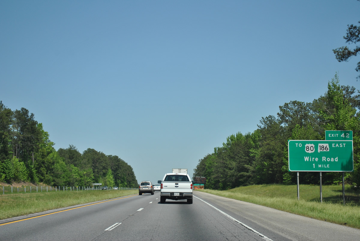
| SR 186 and U.S. 80 east from Tuskegee National Forest provides the most direct route from I-85 to Phenix City, located 37 miles to the east across the Chattahoochee River from Columbus, Georgia. 04/13/12 |
|
| A 3.83 mile long route, SR 186 ties into U.S. 29/80 at a parclo interchange where the two part ways for Auburn and Society Hill respectively. 04/13/12 |
|
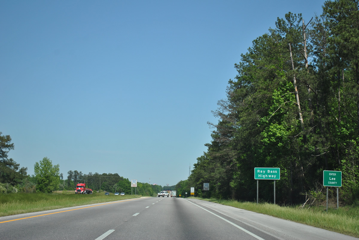
| Wire Road (Macon County Route 53 / Lee County Route 137) continues ten miles northeast into Auburn. CR 53 arcs 3.6 miles southwest from SR 186 to U.S. 80 near Tuskegee. 04/13/12 |
|
| Advancing north over Miles Creek, Interstate 85 continues one mile to the first rest area northbound. 04/13/12 |
|
| Interstate 85 straddles the boundary of Tuskegee National Forest northeast to the Macon County Rest Area northbound. This vintage reassurance marker was removed by 2007 and replaced with a new assembly by 2011. 06/21/05 |
|
| The next rest area beyond the Macon County facility along Interstate 85 north is the Georgia Welcome Center. 04/13/12 |
|
| Interstate 85 enters Lee County 47.47 miles northeast of I-65/U.S. 82 in Montgomery. 04/13/12 |
|
| Auburn Technology Park was established in 2008 between I-85, Beehive Road (CR 10) and U.S. 29. Opened on November 29, 2012, a diamond interchange with Cox Road was constructed to serve the development starting in January 2011. 04/13/12 |
|
| A previous button copy sign for Exit 51 / U.S. 29 in the city of Auburn. U.S. 29 converges with I-85 from the southwest and overlaps with I-85 northward by both Auburn and Opelika. Old U.S. 29 follows College Street north to the University of Auburn campus and Downtown Auburn. 01/16/04 |
|
| The diamond interchange at Exit 51 was reconstructed in 2005 and again in conjunction with work adding Exit 50 to the southwest. Sign changes made between 2005 and 2012 reflect SR 147, a state route following College Street north to Shug Jordan Parkway, an arterial bypass of Auburn to the west. SR 147 combines with SR 269 along the parkway to U.S. 280 at The Bottle. 04/13/12 |
|
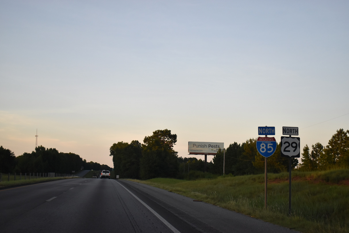
| Interstate 85 remains within the city of Auburn north to Exit 57. U.S. 29 combines with I-85 for 12.83 miles to Exit 64. 06/21/05 |
|
| A replacement of this distance sign posted after mile marker 52 added Bent Creek Road at six miles and revised Opelika to eight miles and Atlanta to 108 miles. 06/21/05 |
|
| Bent Creek Road meets I-85/U.S. 29 at a diamond interchange (Exit 57) in one mile. Older signs for Exit 57 referenced Glenn Avenue and Auburn/Opelika Airport. Located nearby, the airport was renamed in November 2009 to Auburn University Regional Airport (AUO). 06/21/05 |
|
| Bent Creek Road comprises a 1.2 mile long connector within the city of Auburn from I-85 north to Glenn Avenue and south to Hamilton Road. 04/13/12 |
|
| Exit 57 leaves I-85/U.S. 29 north for Bent Creek Road. Glenn Avenue extends west to Downtown Auburn and northeast as Frederick Road through Opelika. Hamilton Road meanders through suburban areas of south Auburn from Tiger Town Shopping Center by Exit 58. 04/13/12 |
|
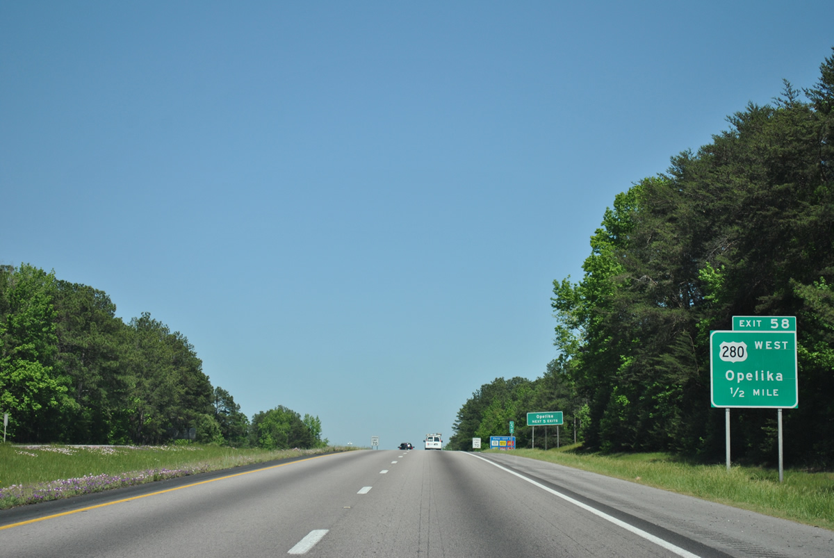
| The forthcoming diamond interchange joining I-85/U.S. 29 with U.S. 280 west along Gateway Drive opened in 1999. U.S. 280 (Birmingham Highway) enters the Auburn-Opelika area southeast from Dadeville. Gateway Drive leads U.S. 280 south from Pepperell Parkway to Exit 58. 04/13/12 |
|
| I-85/U.S. 29 runs north of Hamilton Lake and Saugahatchee Country Club on the ensuing stretch. 04/13/12 |
|
| This older button copy sign is incorrect as Downtown Opelika lies 4.4 miles to the north from I-85/U.S. 29 via Exit 60. Atlanta, Georgia is 103 miles to the northeast. 04/13/12 |
|
| U.S. 280 was realigned to bypass Opelika with approval from AASHTO on April 8, 2000. U.S. 280 previously combined with U.S. 29 eastward along Pepperell Parkway and 2nd Street to 7th Street (U.S. 431) and Columbus Parkway. 04/13/12 |
|
| The sprawling Tiger Town Shopping Center occupies land to the northwest of Exit 58 along U.S. 280 (Gateway Drive). Initially constructed to I-85 in 1998, Gateway Drive was eventually extended eastward to CR 54 (Capps Way) and SR 51 (Marvyn Parkway). 04/13/12 |
|
| U.S. 280 east combines with I-85/U.S. 29 for 3.45 miles from Gateway Drive to Exit 62. 04/13/12 |
|
| The folded diamond interchange at Exit 60 connects I-85 with SR 51 (Marvyn Parkway) south to SR 169 (Crawford Road). Hurtsboro is a small town 28 miles to the south along SR 51. Providing an alternate Route to the Phenix City area, SR 169 travels southeast to Crawford and U.S. 80. 04/13/12 |
|
| Exit 60 departs I-85/U.S. 29-280 for SR 51 (Marvyn Parkway) south and Geneva Street north to Downtown Opelika. SR 169 travels 26.33 miles overall between SR 51 and U.S. 431 outside Seale. SR 51 measures 113.60 miles in length from I-85 to New Brockton. 04/13/12 |
|
| U.S. 280 separates with I-85/U.S. 29 north at the upcoming diamond interchange (Exit 60) with U.S. 431 (Columbus Parkway). U.S. 280/431 combine for 25.17 miles southeast to Smiths Station and Phenix City. Changes made to the sign revised the distance from one to a half mile and added East in front of U.S. 280. 04/13/12 |
|
| Like U.S. 280, U.S. 431 was realigned out from Downtown Opelika in 1991. U.S. 431 turns northward onto Fox Run Parkway from just west of Exit 62. The two lane bypass route encircles the city to the east between Columbus Parkway and West Point Parkway (former U.S. 29), where U.S. 431 resumes along its original course to Lafayette. 04/13/12 |
|
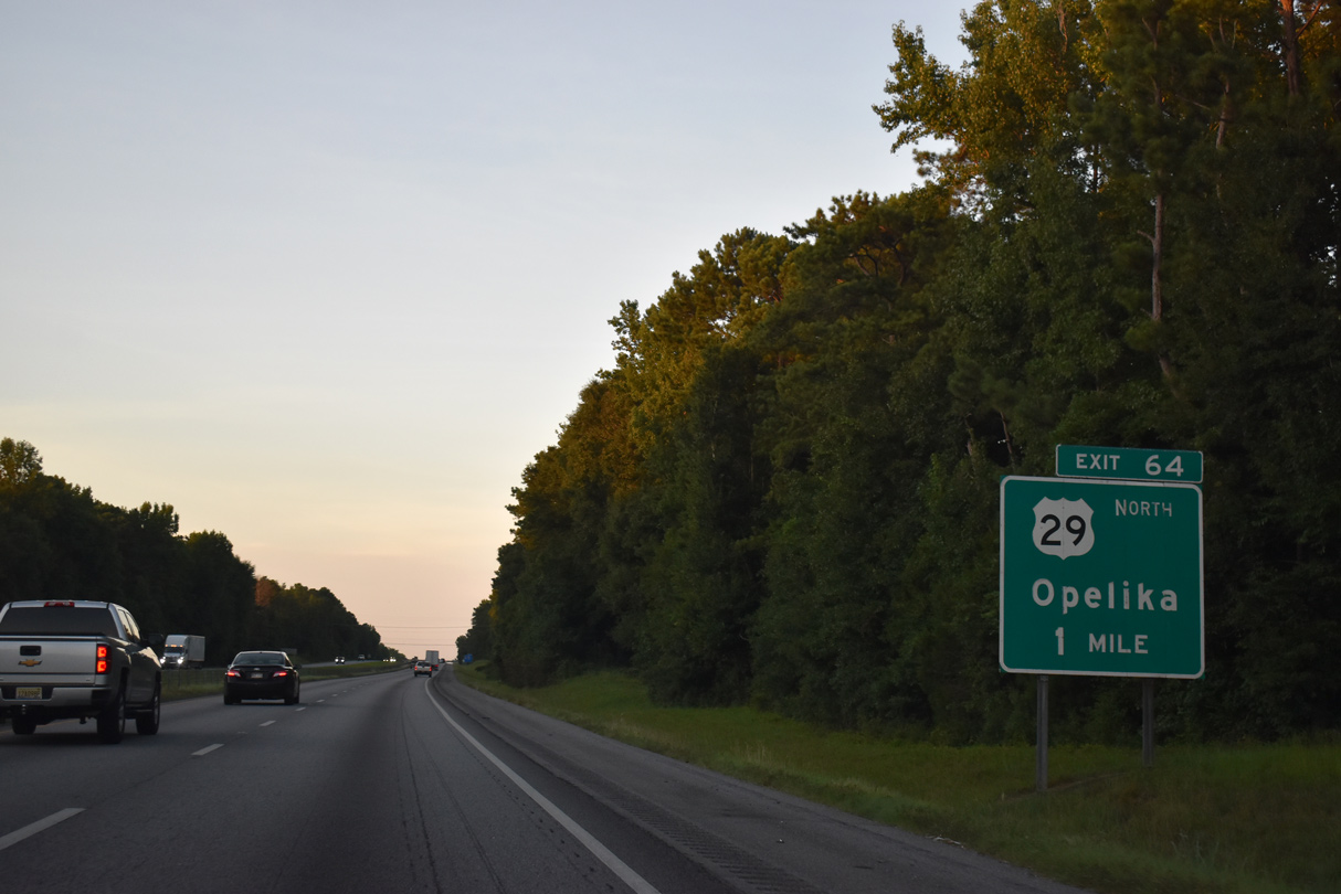
| I-85/U.S. 29 north split 2.35 miles beyond U.S. 280/431 at Exit 64 for West Point Parkway. 07/26/22 |
|
| Referenced for the third time on distance signs, Opelika appears for the diamond interchange with West Point Parkway. Downtown Atlanta, Georgia is 98 miles to the north. 07/26/22 |
|
| Beyond Exit 64, U.S. 29 continues northeast 11 miles to the Valley city limits. West Point Parkway leads 2.2 miles west to U.S. 431 (Lafayette Parkway north / Fox Run Parkway south) at Southern Union State Community College. 07/26/22 |
|
| Greenouts were added on signs for Exit 64 when U.S. 29 was realigned northward to bypass Auburn and Opelika. No control point is used for the rural highway leading east through Pine Grove and southern Chambers County. 07/26/22 |
|
| The relocation of U.S. 29 to bypass both Auburn and Opelika along I-85 was approved by AASHTO on April 8, 2000. 07/26/22 |
|
| The remainder of Interstate 85 in Alabama travels independent of another route to West Point, Georgia. 07/26/22 |
|
| Similar to Exit 50 on the southwest side of Auburn, the exchange at Exit 66 on the northeast side of Opelika was built to enhance access to a new industrial park. 07/26/22 |
|
| Cusseta, a town in southern Chambers County, is the next destination of Interstate 85 north. The design of this distance sign preceded 2001-03 construction for Exit 66 with Andrews Road. 07/26/22 |
|
| Andrews Road was extended east across Interstate 85 to U.S. 29 (West Point Parkway) in conjunction with construction of the parclo interchange at Exit 66. 07/26/22 |
|
| Exit 66 leaves Interstate 85 north for Andrews Road to Northeast Opelika Industrial Park and several distribution centers in northeast Opelika. 07/26/22 |
|
| Interstate 85 straddles the Opelika city limits north to the Chambers County line. 07/26/22 |
|
| Despite what this distance sign displays, Interstate 85 reaches Downtown Atlanta, Georgia in 94 miles. 07/26/22 |
|
| County Road 177 crosses Interstate 85 at a corner of Chambers County. The freeway reenters Lee County briefly ahead of Exit 70. 04/13/12 |
|
| The first of three exits along Interstate 85 north in Chambers County is the diamond interchange with CR 388. The town of Cusseta lies 3.7 miles to the northwest via CR 388 west and CR 83 north. 07/26/22 |
|
| Westward from Exit 70, CR 388 becomes unpaved beyond CR 83. CR 83 connects Interstate 85 with SR 50 in the county seat of Lafayette, 12.5 miles to the northwest. 07/26/22 |
|
| Interstate 85 advances northeast into the city limits of Valley. The city center is seven miles to the northeast. 07/26/22 |
|
| CR 388 runs 4.1 miles east from Interstate 85 to U.S. 29 outside Valley. 07/26/22 |
|
| Atlanta, Georgia is 90 miles from southern Chambers County. This distance sign carbon copied 97 miles from the previous assembly. 07/26/22 |
|
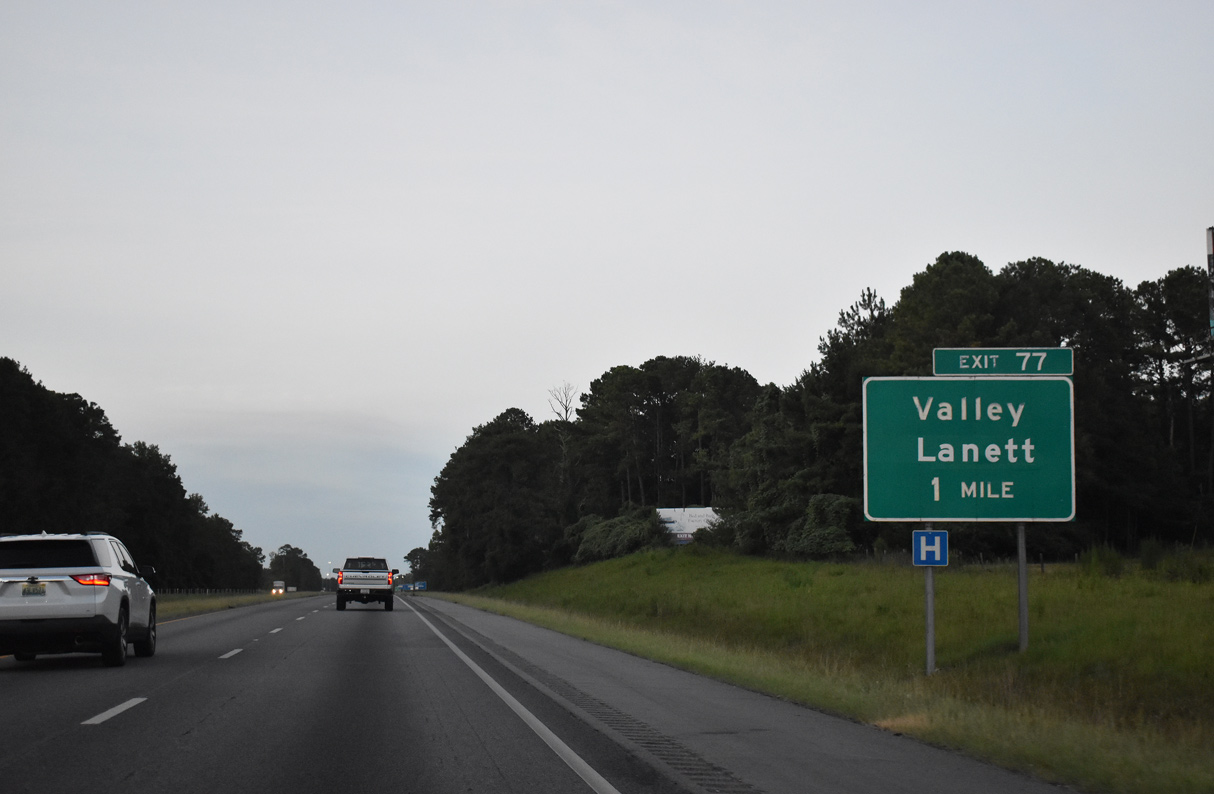
| CR 208 (Phillips Road west / Fob James Drive east) converges with Interstate 85 at a diamond interchange (Exit 77) in one mile. A sign replacement made after 2005 omitted the CR 208 shield. Huguley was greened out with Lanett by 2016. 07/26/22 |
|
| Phillips Road (CR 208) arcs northwest from Exit 77 to Huguley and the west side of Lanett. Fob James Drive continues the roadway east from I-85 to the Valley Campus of Southern Union State Community College and U.S. 29 (20th Avenue) at Langdale in Valley. 07/26/22 |
|
| ALDOT recorded 40,419 vehicles per day along Interstate 85 north between Exits 77 and 79 in 2021. 07/26/22 |
|
| Lanett, located just north of Exit 79 along the Chattahoochee River, is the final city along Interstate 85 north in Alabama. 07/26/22 |
|
| U.S. 29 constitutes the main commercial boulevard through the cities of Lanett and Valley. U.S. 29 follows Broad Avenue north from Exit 79 to SR 50 (Veterans Memorial Parkway) and Gilmer Avenue to West Point, Georgia. 20th Avenue leads U.S. 29 south through Valley. 07/26/22 |
|
| Entering the diamond interchange (Exit 79) with U.S. 29 (Broad Avenue north / 20th Avenue south) on I-85 north. Staying north of Interstate 85 to Exit 35 at Granville, Georgia, U.S. 29 passes by West Point Lake en route to LaGrange. 07/26/22 |
|
| The Georgia Welcome Center and rest area lies just beyond the state line north of Exit 79. 07/26/22 |
|
| The FHWA October 31, 2002 Interstate Route Log and Finders List inventoried I-85 at 80.00 miles in length within Alabama. Posted by GDOT, the last confirming marker in the Heart of Dixie appears by mile marker 80 and the Chattahoochee River. 07/26/22 |
|
| The state line follows the west banks of the Chattahoochee River at Interstate 85. This border doubles as the separation of Central and Eastern Time Zones. A sign indicating that was posted in 2005 but gone by 2012. 07/26/22 |
Page Updated 08-02-2022.

 North
North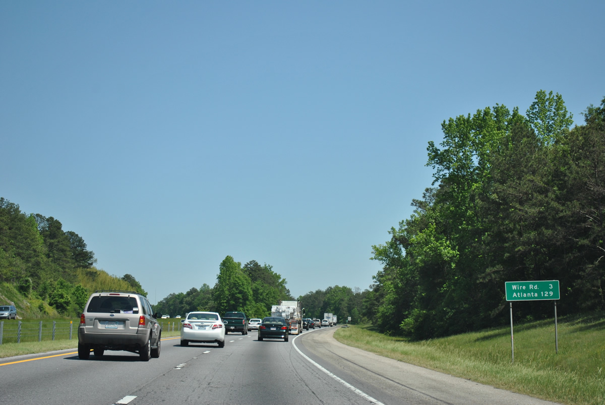


 North
North


 East
East