|
| IL 5/92 angle northeast from Silvis through eastern reaches of East Moline to meet I-80, I-88 east and IL 110 (Chicago Kansas City Expressway) at a cloverleaf interchange (Exits 1 A/B) in one mile. 06/21/22 |
|
| The expressway along IL 5/92 transitions into Interstate 88 beyond the at-grade intersection with Hubbard Road and 193rd Street N. Exit 1 A for I-80 east and IL 110 west follows in a half mile. 06/21/22 |
|
| Hubbard Road and 193rd Street North accompany the freeway east as the 15.73 mile long route of IL 5 from U.S. 67 in Rock Island concludes. I-88 replaced IL 5 from East Moline to Chicago in 1987. 06/21/22 |
|
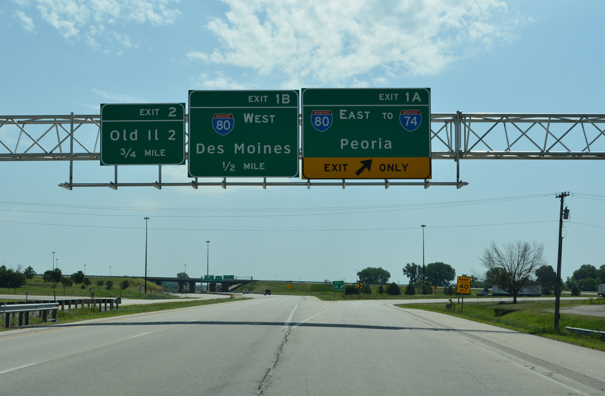
| Exit 1 A departs for Interstate 80 east and IL 110 (CKC) west to Colona and the Big X Interchange with I-74/280. I-80 continues to Joliet and Chicago from the Quad Cities while I-74 turns south to Galesburg and Peoria. 06/21/22 |
|
| Exit 1 B loops onto I-80 west to Rapids City, Le Claire and Des Moines, Iowa. I-80 travels through northern reaches of Bettendorf and Davenport over the next 21 miles. 06/23/22 |
|
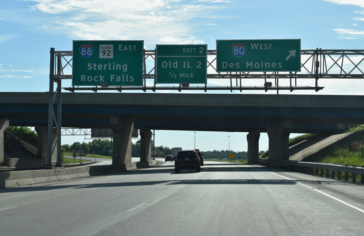
| I-88/IL 110 east enter a diamond interchange (Exit 2) with Old IL 2 to the immediate east of I-80. IL 2 was decommissioned in 1974 when the East-West Tollway was constructed.1 Old IL 2 also doubled as IL 92 from East Moline to 38th Avenue N. The former state route serves agricultural areas east from the nearby Falcon Farms mobile home park northeast to Hillsdale. 06/23/22 |
|
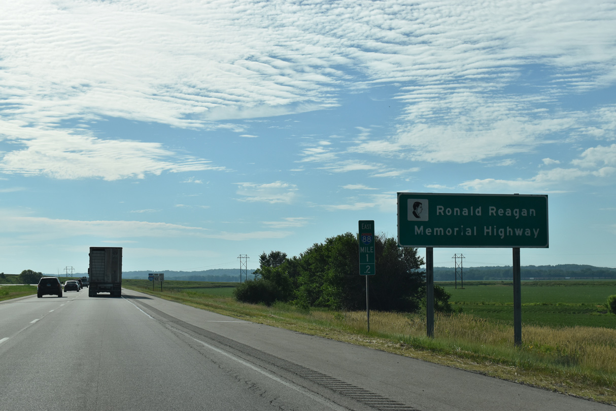
| Interstate 88 doubles as the Ronald Reagan Memorial Highway on the toll free portion of the route in northwest Illinois. Ronald Reagan grew up in Dixon, which lies just north of the I-88 Tollway section on U.S. 52. 06/23/22 |
|
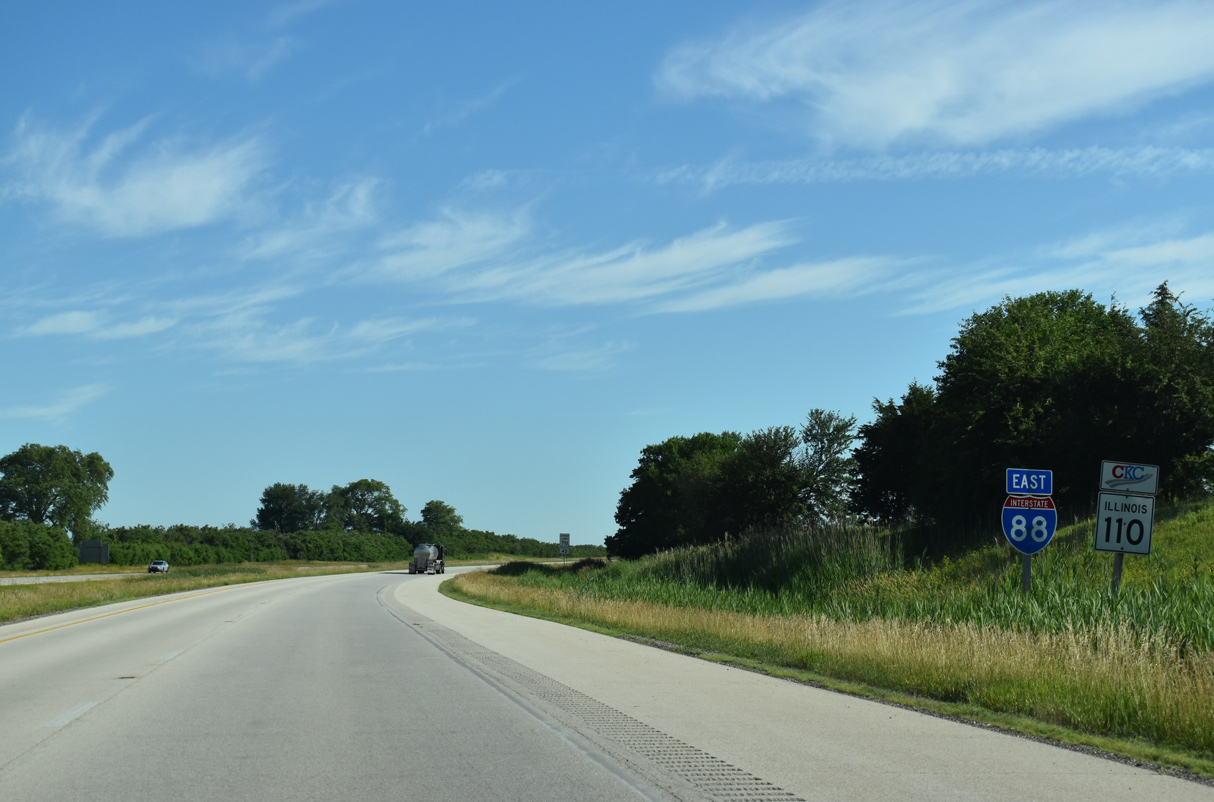
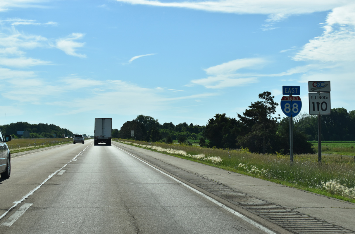
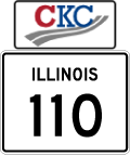
| Providing an alternate to I-55 and I-70 between Kansas City and Chicago, IL 110 (Chicago Kansas City Expressway) was designated in 2010 along a collection of routes. The multi state highway runs along all of I-88 east from I-80 to I-290 (Eisenhower Expressway). 06/23/22 |
|
| I-88/IL 110 travel 41 miles east to Rock Falls, which marks the end of Ronald Reagan Memorial Highway. Advancing east from there, I-88/IL 110 follow the Reagan Memorial (East-West) Tollway on the 155 miles leading to Chicago. 06/23/22 |
|
| I-88/IL-92-110 pass under County Route GG (256th Street N) one mile ahead of their separation at Exit 6 with 38th Avenue N. 06/23/22 |
|
| IL 92 is part of a multi state highway originating to the west in Torrington, Wyoming. Within the Prairie State, IL 92 travels 100 miles east to U.S. 34 west of Mendota. 06/23/22 |
|
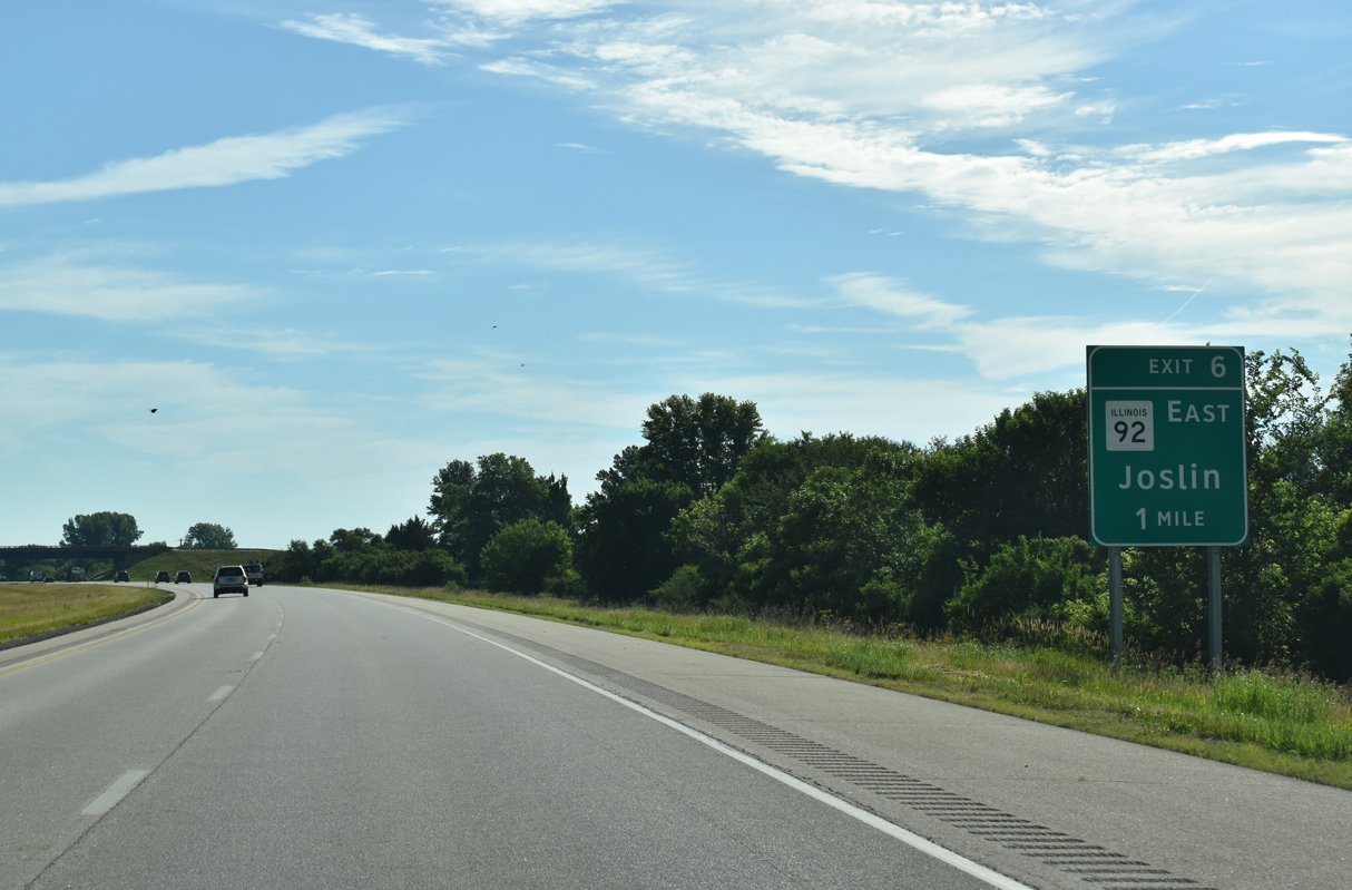
| IL 92 leaves Interstate 88 east at a diamond interchange (Exit 6) near the settlement of Joslin. 06/23/22, 04/08/13 |
|
| IL 92 runs eastward across the Rock River to IL 82 south to Geneseo, Walnut and Mendota while I-88 curves northeasterly, mirroring the course of the Rock River to Dixon. 03/12/17 |
|
| Angling northeast from Joslin, I-88/IL 110 (CKC) run between Moline Road (former IL 2) and a Burlington Northern Railroad line. 06/23/22 |
|
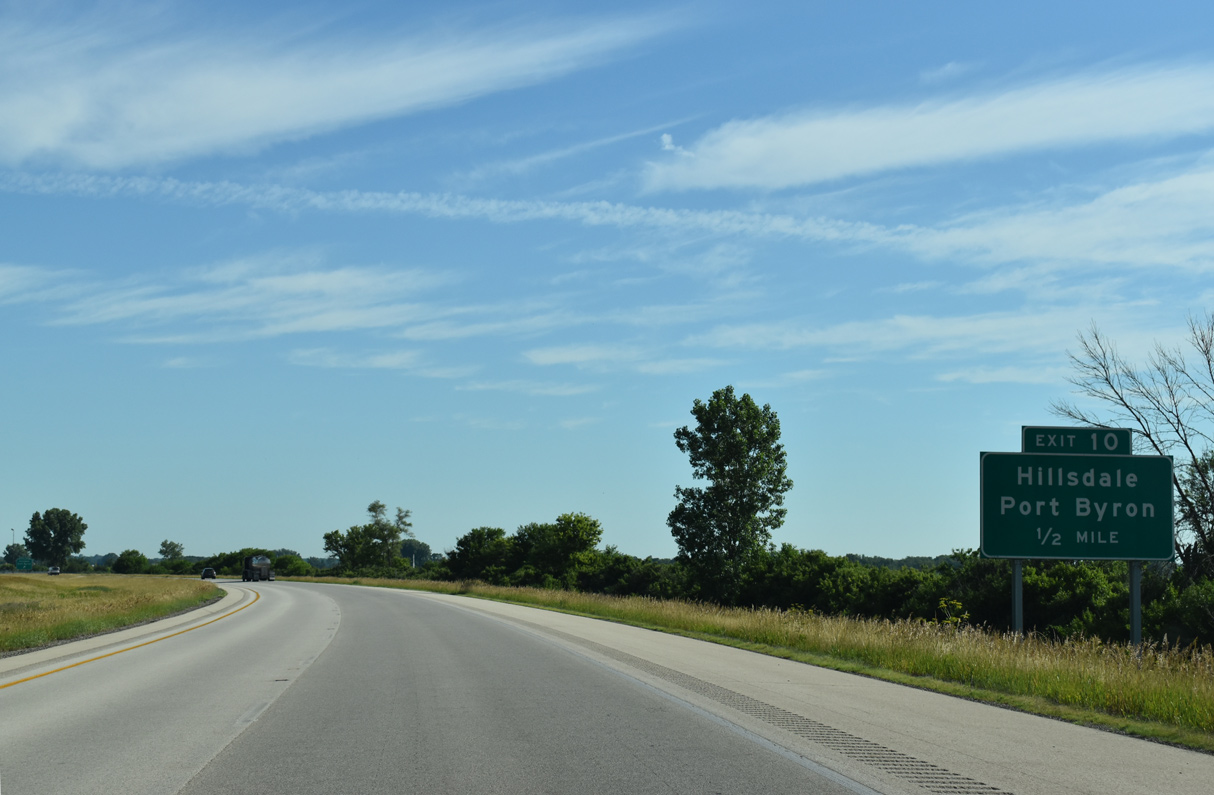
| Moline Road (Old IL 2) returns to Interstate 88 at forthcoming Exit 10 outside the village of Hillsdale. 06/23/22 |
|
| Moline Road converges with CR 2 and Main Street 0.30 miles northeast of Exit 10 in Hillsdale. 06/23/22 |
|
| County Route 2 leads 6.20 miles west from Moline Road and Main Street to IL 84 (High Street) in the village of Port Byron. 06/23/22 |
|
| I-88/IL 110 (CKC) loop northward around Hillsdale on the ensuing stretch. 06/23/22 |
|
| Interstate 88 crosses Meredosa Ditch and the Whiteside County line 13.51 miles east from I-80/IL 5 in East Moline. 06/23/22 |
|
| Interstate 88 passes well west and north of Erie across open agricultural areas in southern Whiteside County. 06/23/22 |
|
| CR 13 (Albany Road) leads 1.67 miles north from Albany Street and the Erie village line to I-88/IL 110 (CKC) at Exit 18. 06/23/22 |
|
| Northwest from Interstate 88, CR 13 (Albany Road) continues 9.56 miles to 5th Avenue S at the Albany village line. 06/23/22 |
|
| I-88/IL 110 (CKC) turn east to the diamond interchange (Exit 18) with Whiteside County Route 13 (Albany Road). 06/23/22 |
|
| Interstate 88 shifts northeast through a broad S-curve between South Branch Ditch and Rock Creek. 06/23/22 |
|
| The Chicago Loop is 135 miles to the east via I-88 and I-290 (Eisenhower Expressway). 06/23/22 |
|
| IL 78 dog legs west from the Lyndon village line 1.72 miles to Hamilton Corners, where the route turns north 1.05 miles to I-88/IL 110 (CKC) at Exit 26. 06/23/22 |
|
| The city of Prophetstown lies 2.08 miles south from Commercial Street into Lyndon along IL 78. 06/23/22 |
|
| Lyndon lies south of Interstate 88 along former IL 2 and the Rock River. 06/23/22 |
|
| IL 78 travels 6.14 miles north from the diamond interchange at Exit 26 to U.S. 30 (Lincoln Way) in Downtown Morrison. 06/23/22 |
|
| Illinois Route 78 measures 215.5 miles in length from Jacksonville north to the Wisconsin state line near Warren. 06/23/22 |
|
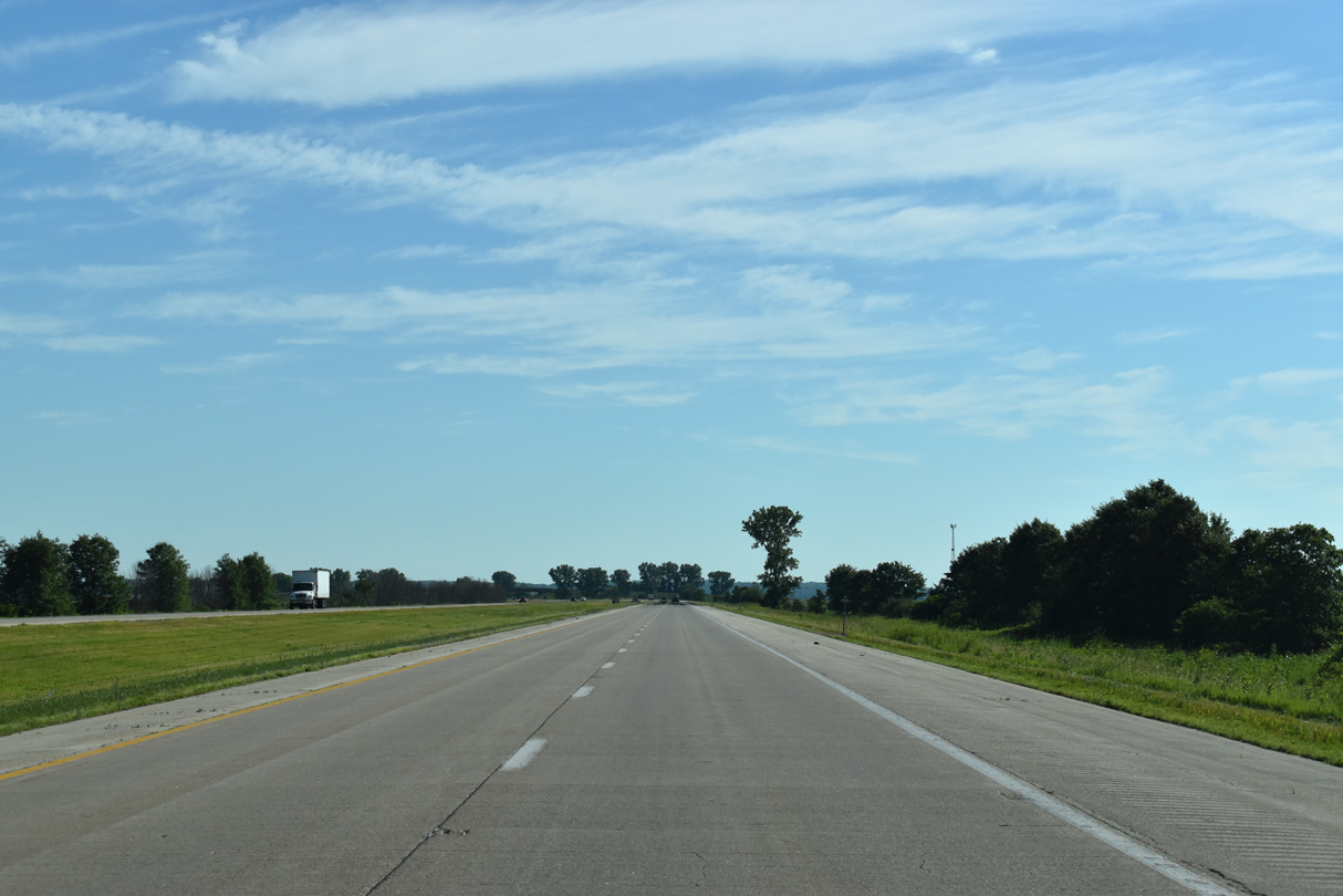
| 12,400 vehicles per day were recorded by IDOT along Interstate 88 north of Lyndon in 2017. 06/23/22 |
|
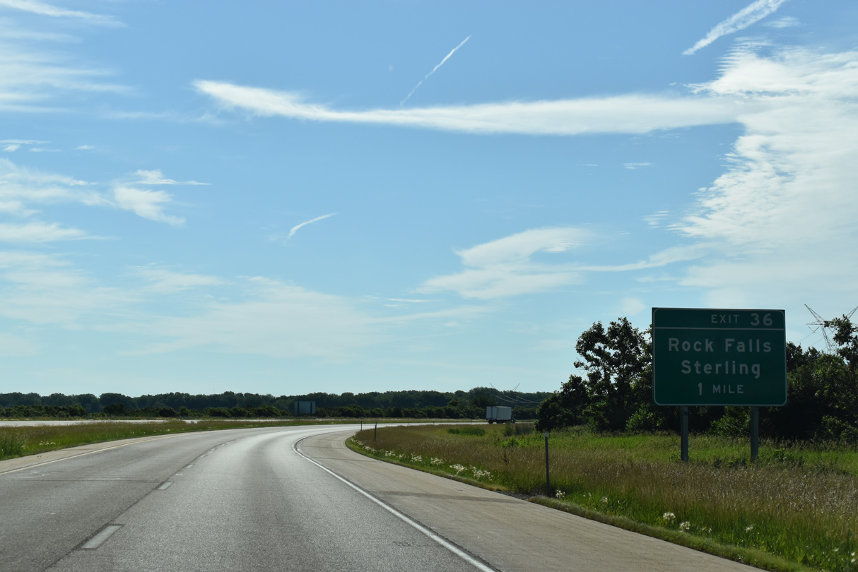
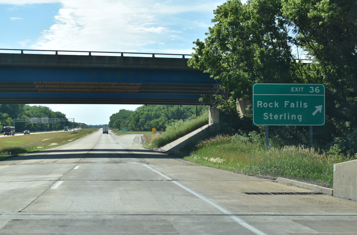
| I-88/IL 110 (CKC) turn eastward beyond Deer Creek and ahead of the census designated place of Como and Exit 36 for U.S. 30 to Rock Falls and Sterling. 06/23/22 |
|
| The trumpet interchange at Exit 36 joins Interstate 88 with an unnumbered connector road linking Ronald Reagan Memorial Highway with U.S. 30, 0.86 miles to the north. 06/23/22 |
|
| U.S. 30 (Lincoln Highway) parallels I-88 east to Como and into the city of Rock Falls. Sterling lies north of the Rock River via the continuation of Lincoln Highway from U.S. 30. 06/23/22 |
|
| Exit 36 parts ways with I-88/IL 110 (CKC) east across Elkhorn Creek. The city centers of both Rock Falls and Sterling are located north of Exit 41 on opposite sides of the Rock River. 06/23/22 |
|
| I-88/IL 110 (CKC) span the Rock River by Lake Como State Natural Area. 06/23/22 |
|
| Interstate 88 passes just south of the Rock Falls city limits on the succeeding stretch. IL 40 is the second of three area exits from Ronald Reagan Memorial Highway. 06/23/22 |
|
| IL 40 (Hoover Road) leads north from the diamond interchange at Exit 41 onto 1st Avenue en route to Downtown Rock Falls. 06/23/22 |
|
| IL 40 north spans the Rock River between Downtown Rock Falls and Downtown Sterling 2.2 miles north of I-88/IL 110. 06/23/22 |
|
| South from Exit 41, IL 40 connects with Whiteside County Airport (SQI) nearby and continues to the village of Deer Grove. 06/23/22 |
|
| The Birthplace of President Ronald Reagan is 13.1 miles to the south via IL 40 and IL 172 in the village of Tampico. 06/23/22 |
|
| Overall IL 40 travels 112.05 miles between I-74 in East Peoria and IL 78 at Mt. Carroll. IL 40 replaced IL 88 in 1995 to eliminate confusion with Interstate 88.2 06/23/22 |
|
| Confirming markers for I-88/IL 110 (CKC) posted east of Exit 41 and north of Whiteside County Airport (SQI). 06/23/22 |
|
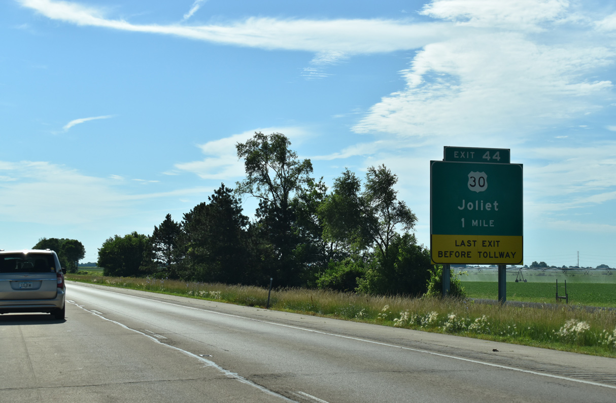
| U.S. 30 (Rock Falls Road) converges with I-88/IL 110 (CKC) at a diamond interchange (Exit 44) 2.8 miles east of IL 40 (1st Avenue) in Rock Falls. 06/23/22 |
|
| All electric toll (AET) collection commences along Interstate 88 east of the exchange with U.S. 30. U.S. 30 parallels Ronald Reagan Memorial Tollway to the south from Exit 44 to Sugar Grove. 06/23/22 |
|
| U.S. 30 bee lines east from the Rock Falls area along a rural course to the village of Shabbona. U.S. 30 eventually turns southeast, circumventing Aurora to Plainfield and Joliet. 06/23/22 |
Page Updated 12-09-2023.


 East
East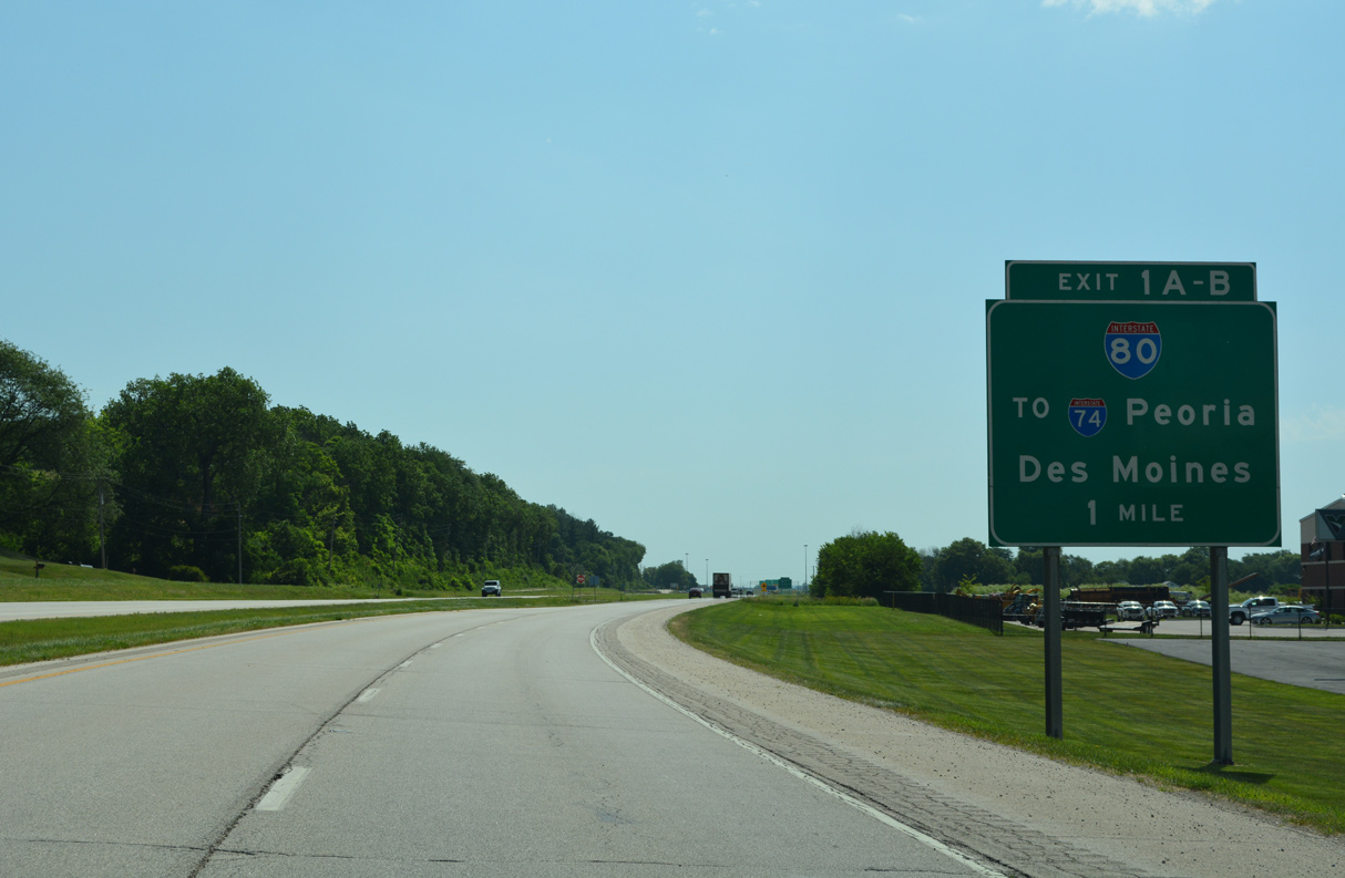


 East
East