|
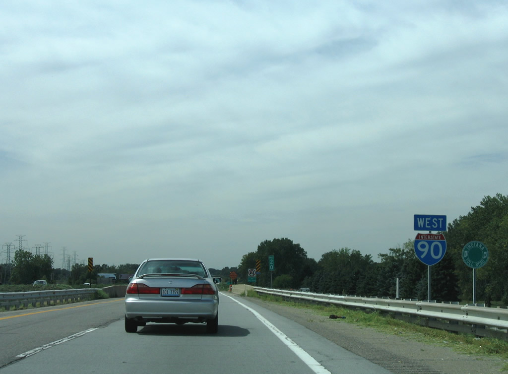
| Posted immediately after the Exit 21 ramp departure of Interstate 80 west is this warning sign advising motorists to continue west to Interstate 65 south in lieu of a missed opportunity to join I-80/94 (Frank Borman Expressway) west.
The closure of the westbound ramp to the Borman Expressway at Exit 21 following the events of November 1, 2010, where a truck damaged a parapet wall, necessitated all traffic bound for Interstates 80 west & 94 remain along Interstate 90 to Interstate 65 south. This detour was removed by November 2011. 09/02/05 |
|
| A directional interchange shuttled vehicles between I-80/94 and the Indiana East West Toll Road main line in place of a standard trumpet interchange. 09/02/05 |
|
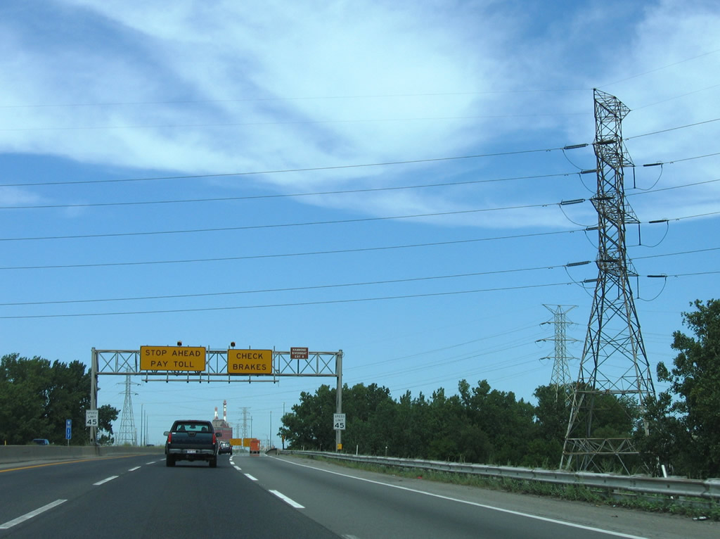
| Drivers entering Interstate 90 west from Exit 21 must stop and pay a toll before joining the turnpike main line. 09/02/05 |
|
| Westbound reassurance shield posted for Interstate 90 at the Old Hobart Road underpass. The toll road was widened to six lanes between 2005 and 2010, resulting in a sign replacement and removal of the Indiana East West Toll Road trailblazer. 09/02/05, 05/09/10 |
|
| Gary lies five miles ahead, though the next four interchanges serve the industrial city. 09/02/05 |
|
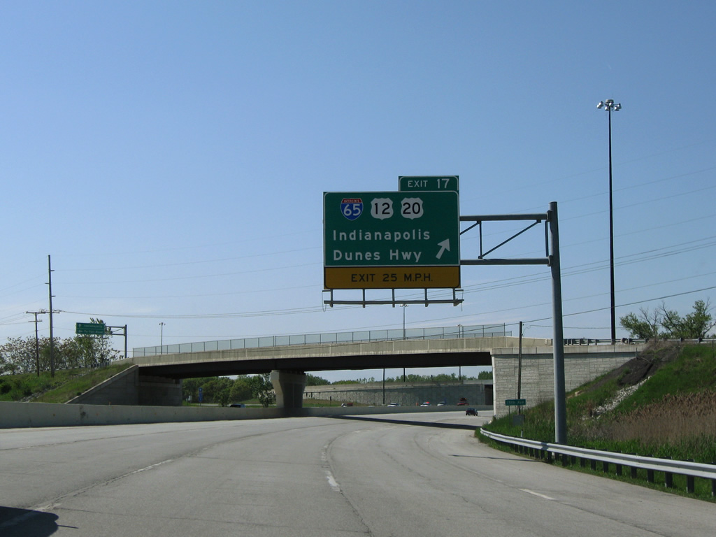
| Next in line for westbound motorists is the trumpet interchange (Exit 17) and connecting ramps to Interstate 65 south and U.S. 12/20 (Dunes Highway). Interstate 65 begins at a traffic light with Dunes Highway and Taylor Road adjacent to Exit 17. Motorists originally were required to make a left turn onto Interstate 65 at an at-grade intersection that lied along the route between East 15th Avenue and Dunes Highway. That intersection was replaced by two wye interchanges in 2003-04. 09/02/05 |
|
| Interstate 65 joins northwest Indiana and Gary with Indianapolis and Louisville, Kentucky along a 887 mile routing to Mobile, Alabama. 09/02/05 |
|
| U.S. 12/20 combine along the Dunes Highway from the Aetna community west to downtown Gary. The four lane arterial mainly serves industrial areas through northern reaches of the city. 09/02/05 |
|
| Exit 17 leaves Interstate 90 (Indiana East West Toll Road) west at the East 15th Avenue overpass. Interstate 65 travels south from its beginning to interchange with I-80-94/U.S. 6. The freeway continues south 87 miles to Lafayette and 261 miles overall within Indiana. Interstate 65 was completed by 1976.1 05/09/10 |
|
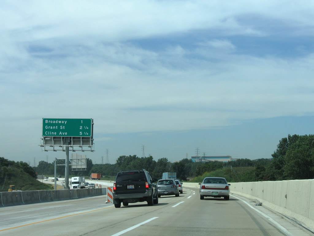
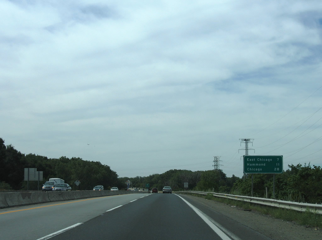
| Interstate 90 curves west across U.S. 12/20 (Dunes Highway) and parallels the Grand Calumet River by a bevy of steel plants and oil refineries. Broadway (Exit 14B) and Grant Street (Exit 14A) depart next for downtown Gary. 09/02/05 |
|
| SR 53 begins at a diamond interchange (Exit 14B) with Interstate 90 (Indiana East West Toll Road) and bisects Downtown Gary to Exit 10 with the Borman Expressway. 05/09/10 |
|
| Westbound at the Exit 14B off-ramp to SR 53 (Broadway). The state road continues to Merrillville from Gary on a 14.1 mile path. Broadway north continues across the Grand Calumet River to the Gary Works U.S. Steel plant. 09/02/05 |
|
| A plethora of railroad lines parallel Interstate 90 at Exit 14B. They include the Chicago, South Shore & South Bend (Northern Indiana Commuter Rail), the Elgin Joliet and Eastern, CSX Transportation, Norfolk Southern among others. 09/02/05 |
|
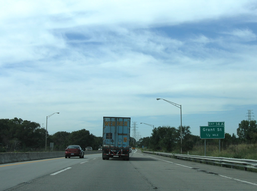
| Exit 14A provides access to U.S. 12/20 (4th & 5th Avenues) and Grant Street leading south to the Telleston section of Gary from Interstate 90 west. A pair of trumpet interchanges and a connecting access road join the toll road with Buchanan Street south of the U.S. Steel plant and north of the Grand Calumet River. 09/02/05 |
|
| This interchange sequence sign highlights the final three Indiana East West Toll Road interchanges of Interstate 90 west. 09/02/05 |
|
| Drivers bound for Grant Street south to Methodist Hospital Northlake or the U.S. Steel plant depart Interstate 90 west at Exit 14B. U.S. 12/20 parallel nearby along a one way street couplet between downtown Gary and SR 912 (Cline Avenue). 09/02/05 |
|
| Interstate 90 again parallels the Grand Calumet River closely on the departure from Exit 14A. Westbound drivers enter the city of East Chicago in four miles. 09/02/05 |
|
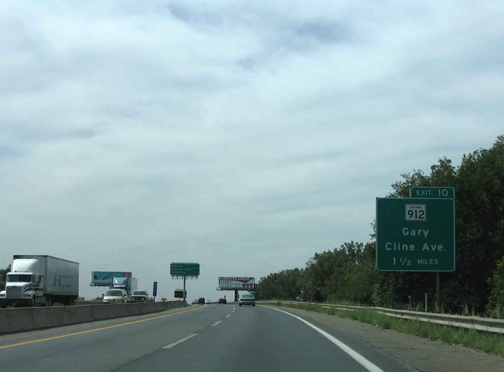
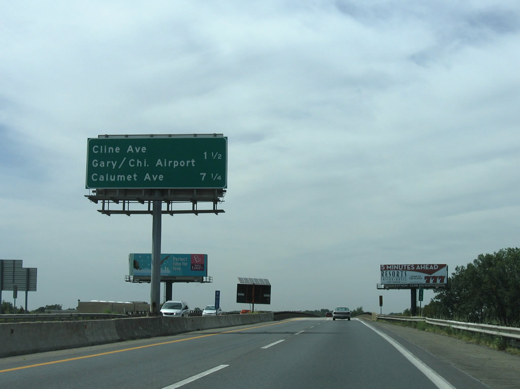
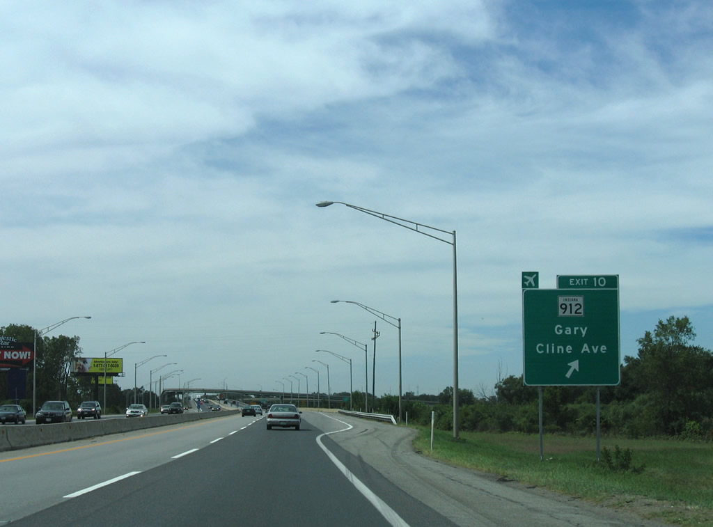
| 1.50 miles east of the tri-level stack interchange (Exit 10) with Gary Avenue west to U.S. 12 & SR 912 (Cline Avenue). 09/02/05 |
|
| Gary/Chicago International Airport (GYY) occupies land north of the Grand Calumet River and east of Gary Avenue. Drivers are required to take Cline Avenue north from Gary Avenue to Chicago Avenue (former SR 312) east to reach the airport via Industrial Drive (former U.S. 12). SR 312 travels 5.7 miles west from U.S. 12 & SR 912 to the Illinois state line, but was truncated on the portion east to Industrial Highway (U.S. 12 until 2004) recently. 09/02/05 |
|
| A long viaduct carries Interstate 90 over the Great Calumet River, two Norfolk Southern Railroads, and Industrial Highway (former U.S. 12). 09/02/05 |
|
| SR 912 constitutes a 12 mile "L" shaped route from Ridge Road (U.S. 6 Business) at Highland to Interstate 90 near in Hammond. Much of the route is freeway, as SR 912 leads north from I-80-94/U.S. 6 from Exit 5 to the industrial peninsula at Indiana Harbor. 09/02/05 |
|
| Exit 10 departs Interstate 90 (Indiana East West Toll Road) west for Gary Avenue north. Gary Avenue meets the Cline Avenue frontage roads at Exits 7A/B to provide the connection to U.S. 12 & SR 912. SR 912 travels north through East Chicago to Whiting and Hammond and south along the Hammond / Gary city line to Highland and Griffith.
U.S. 12 was relocated from its alignment along the Industrial Highway in northwest Gary to a longer overlap with U.S. 20 on West 5th Avenue and a shared alignment with SR 912 north to Columbus Drive in 2004.2 09/02/05, 05/09/10 |
|
| Low mast lighting is used at the stack interchange between Interstate 90 and Gary Avenue due to a Gary/Chicago International Airport runway. 09/02/05 |
|
| Passing by U.S. 12 & SR 912 (Cline Avenue), Interstate 90 again parallels the Chicago, South Shore & South Bend Railroad (Northern Indiana Commuter Rail). 09/02/05 |
|
| Interstate 90 skims southern reaches of East Chicago. Downtown Hammond is seven miles out via Exit 5 to U.S. 41 (Calumet Avenue) south. Several power lines join the Indiana Toll Road and commuter rail corridor... 09/02/05 |
|
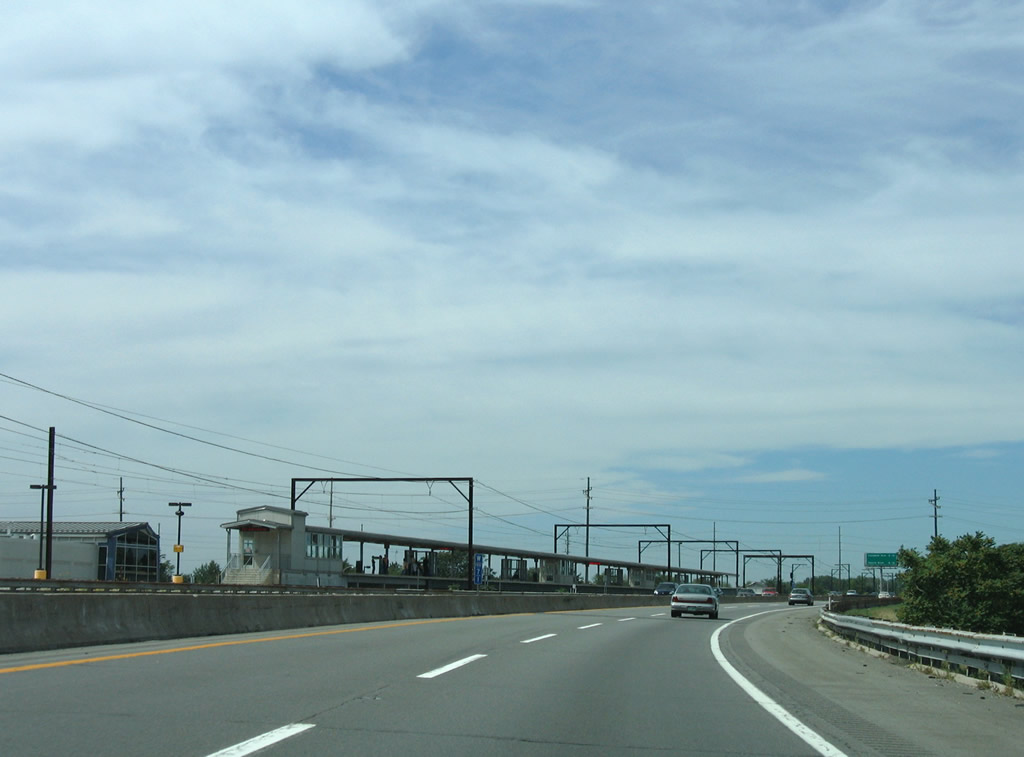
| A Northern Indiana Commuter Rail station lies adjacent to Interstate 90 by the intersection of U.S. 20 (Indianapolis Boulevard north / Michigan Street east) with SR 152 (Indianapolis Boulevard south) in Hammond. 09/02/05 |
|
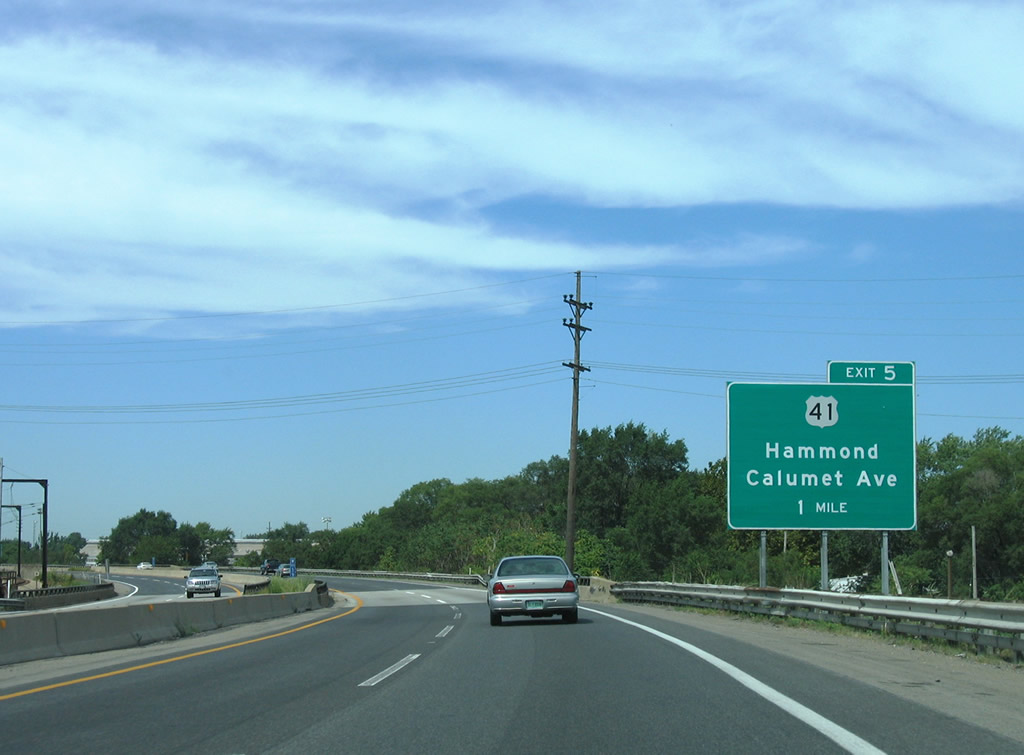
| 2.25 miles southeast of the parclo interchange with East 141st Street to U.S. 41 (Calumet Avenue) in Hammond. The final Indiana off-ramp connects with U.S. 12-20-41 (Indianapolis Boulevard) near the state line in 6.5 miles. 09/02/05 |
|
| Westbound Interstate 90 spans the Grand Calumet River for the final time. Knights of Columbus Drive also passes under the freeway viaduct from East Chicago west to Roosevelt Street. 09/02/05 |
|
| One mile south of the Exit 5 loop ramp to East 141st Street for U.S. 41 on Interstate 90 at the East 150th Street under crossing. U.S. 41 follows Calumet Avenue north from its brief merge with the Frank Borman Expressway to Indianapolis Boulevard (U.S. 12/20) west of Whiting. 09/02/05 |
|
| A gratuitous amount of power lines continue along both Interstate 90 and the South Shore & South Bend Railroad (Northern Indiana Commuter Rail). 09/02/05 |
|
| This diagrammatic overhead for Exit 5 alludes to the Interstate 90 connection with the Chicago Skyway. East 141st Street meanwhile intersects U.S. 41 (Calumet Avenue) just west of the Indiana East West Toll Road. The east-west street spurs into a residential area west of Calumet Avenue and to petroleum storage sites east of Interstate 90. 09/02/05 |
|
| Exit 5 parts ways with Interstate 90 (Indiana Toll Road) west for East 141st Street to U.S. 41 (Calumet Avenue). U.S. 41 travels a 280 mile path from the Kentucky state line south of Evansville to south Chicago, Illinois with U.S. 12/20. 05/09/10 |
|
| Drivers departing via Exit 5 immediately enter a two lane toll booth. 09/02/05 |
|
| Interstate 90 continues northwest, passing over U.S. 41 (Calumet Avenue) ahead of the wye interchange with SR 912's western terminus. 09/02/05 |
|
| The easterly view from Interstate 90 (Indiana Toll Road) west (north) after SR 912. 09/02/05 |
|
| A six lane causeway carries drivers along Interstate 90 across Wolf Lake in northern Hammond. 05/09/10, 09/02/05 |
|
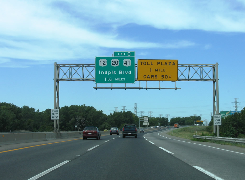
| Paralleling the Illinois state line, Interstate 90 approaches West Point Plaza 1 of the Indiana Toll Road. Exit 0 follows the toll barrier as a half diamond interchange with U.S. 12-20-41 (Indianapolis Boulevard). A wye interchange provides return access to the Chicago Skyway in south Chicago, Illinois. 09/02/05, 05/09/10 |
|
| A final toll is collected for Interstate 90 westbound drivers on the Indiana Toll Road. Another main line toll plaza awaits motorists continuing west onto the Chicago Skyway. 09/02/05 |
|
| Four lanes of Interstate 90 depart the toll plaza and approach the Exit 0 two lane off-ramp to U.S. 12-20-41 (Indianapolis Boulevard). The trio merge at Calumet Avenue in at the Robertsdale section of Hammond and continue alongside Interstate 90 through the East Side section of south Chicago. 09/02/05 |
|
| Exit 0 leaves Interstate 90 west 0.6 miles from the Illinois state line. Technically, the Chicago Skyway is no longer part of the Interstate system and reassurance shields on the toll road act as trailblazers. Like the Indiana Toll Road, the Skyway is maintained by a private group under a multi-year lease. 09/02/05 |
|
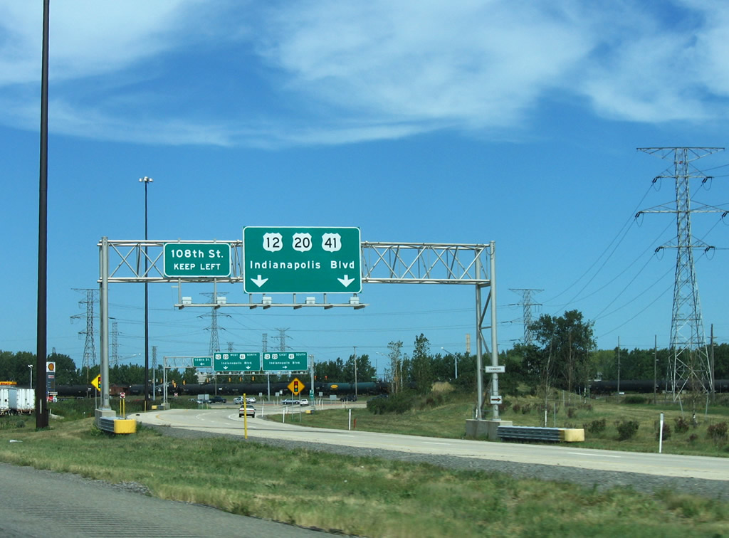
| Motorists departing via Exit 0 reach a signalized intersection with U.S. 12-20-41 at East 108th Street. East 108th Street stems west into a densely population street grid of south Chicago, Illinois. 09/02/05 |
Page Updated 11-02-2011.

 West
West