
 West
West
08/12/16

08/12/16

08/12/16

08/12/16

08/12/16

08/12/16

08/12/16

08/12/16

08/12/16

08/12/16

Exit 402 was converted to a SPUI as part of work upgrading 478th Avenue to SD 100 (Veterans Parkway).
08/12/16

08/12/16

Confirming marker for I-90 west posted between Timberline Avenue (Exit 402) and Slip-up Creek.
06/17/15

A community interchanges identification sign outlines three of the four ensuing westbound exits along Interstate 90 for Sioux Falls. I-29 is omitted, but the route serves the west side of the city with eight interchanges.
06/17/15

Sioux Falls incorporated as a town in 1877 and a city in 1889. The area was established as a military post previously with agriculture fueling economic growth of the city into the 20th century. Today the largest city in South Dakota is a regional service and retail center with a growing healthcare industry.1
06/17/15

Interstate 229 begins and loops south from I-90 in one mile at Exit 400. The freeway runs 12 miles south to I-29 for Sioux City, Iowa.
08/12/16

A half cloverleaf interchange provides access to Interstate 229 south toward Downtown Sioux Falls from I-90. County Road 125 (476th Avenue) ties into the exchange from the north, but is not accessible from I-90.
08/12/16

Construction completed on November 8, 2013 reconfigured adjacent Exit 399 into a single point urban interchange while adding auxiliary lanes in both directions between I-229 and SD 115 (Cliff Avenue). The project cost $17.4 million.2
06/17/15
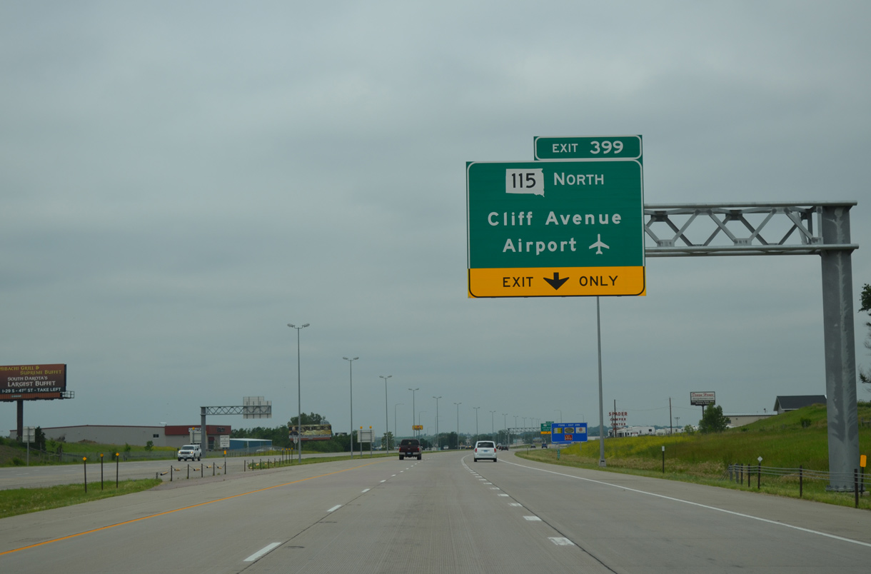
SD 115 consists of a two-segment route following old U.S. 77 both south of 85th Street to U.S. 18 and north from 72nd Street N to Dell Rapids and I-29 (Exit 98). Cliff Avenue is locally maintained south from Interstate 90 to Benson Road. The route is also posted as Business Spur I-90 and SD 115.
06/17/15

Westbound Interstate 90 at Exit 399 for SD 115 and Cliff Avenue. Business Spur I-90/SD 115 turn west onto Benson Road and south along Minnesota Avenue to Sioux Falls Regional Airport (FSD) and Downtown near Falls Park.
06/17/15

Confirming marker posted west of Cliff Avenue for Interstate 90.
06/17/15

A cloverleaf interchange (Exits 396B/A) joins I-90 and I-29 in two miles.
06/17/15
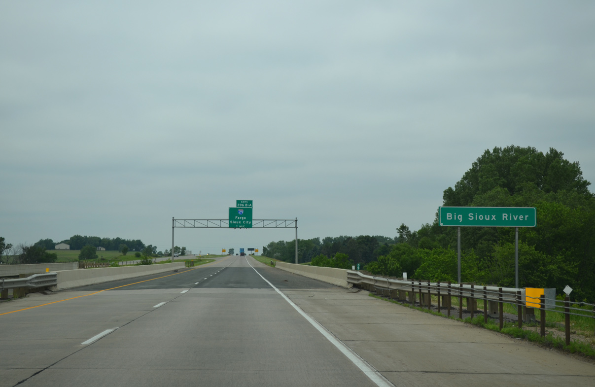
Travelers along I-90 span the Big Sioux River on the one mile approach to Interstate 29. A tributary of the Missouri River, the Big Sioux flows 419 miles south from Roberts County to Sioux City, Iowa. The waterfall in Falls Park gave Sioux Falls its name.
06/17/15

Interstate 29 runs through the eastern counties of South Dakota to join Sioux Falls with Sioux City, Iowa to the south and Brookings, Watertown and Fargo, North Dakota to the north.
08/12/16

Crossing over a spur of the South Dakota Railroad, drivers are alerted to potential closures of Interstate 29 north of Sioux Falls during inclement weather.
06/17/15

Flashers on this sign will illuminate when SDDOT closes I-29 north of Interstate 90 during snowstorms. Accompanying barricades will lower along the respective on-ramps as well.
06/17/15

Drivers taking Exit 396B will reach the Fargo area in 229 miles via Interstate 29 north. The bulk of the route is rural with 80 mile per hour speed limits in South Dakota.
06/17/15

Exit 396A loops away from I-90 west for Interstate 29 south through Sioux Falls to Vermillion, Elk Point and Sioux City. The freeway reaches Council Bluffs, Iowa in 179 miles.
06/17/15

A final community interchanges identification sign outlines just the Marion Road exit as I-90 continues beyond Interstate 29.
06/17/15
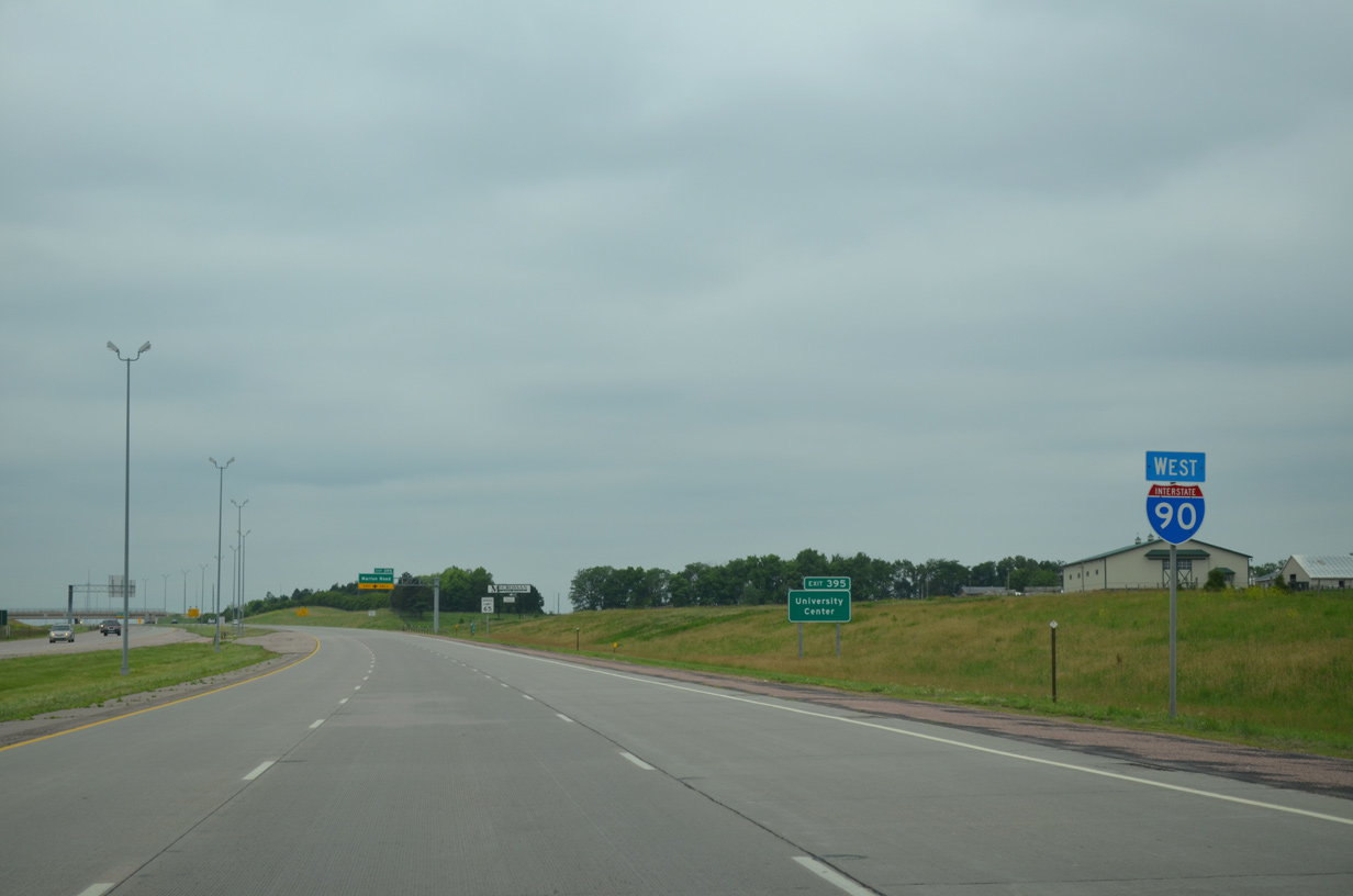
The folded diamond interchange (Exit 395) with Marion Road opened to traffic on November 20, 2010. Associated work included the addition of auxiliary lanes between I-20 and Exit 395.
06/17/15
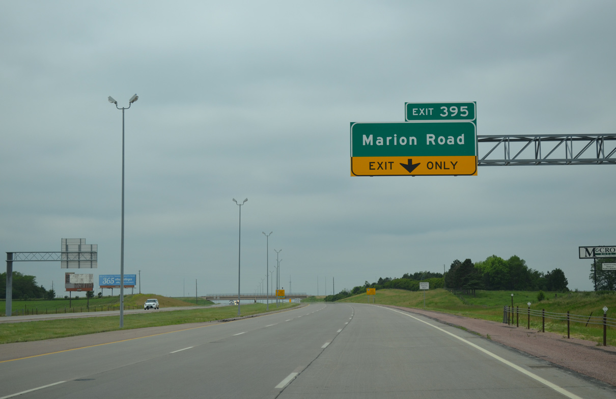
Marion Road serves growing areas of northwest Sioux Falls including big box retail and University Center, the S.D. Public University Research Center.
06/17/15

Similar to snow related closures on I-29 north of Sioux Falls, I-90 west of the city may also be closed periodically.
06/17/15
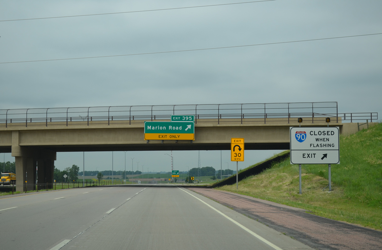
When SDDOT closes I-90, all remaining traffic along the freeway defaults onto Marion Road.
06/17/15

Marion Road constitutes a five lane arterial south from Exit 395 to SD 38 (60th Street N). SD 38 parallels I-90 west to Ellis and Buffalo Ridge while Marion Road serves a number of subdivisions southward next to I-29.
06/17/15

Sources:
- Sioux Falls: History, City-Data.com.
- "I-90 and Cliff Avenue Interchange In Sioux Falls Opening To Traffic." South Dakota DOT, press release. November 7, 2013.
- "I-90 & Marion Road Interchange Opening." South Dakota DOT, press release. November 19, 2010.
Photo Credits:
06/17/15, 08/12/16 by AARoads
Connect with:
Interstate 29
Interstate 229
Business Spur I-90 - Sioux Falls
Page Updated 02-18-2020.