|
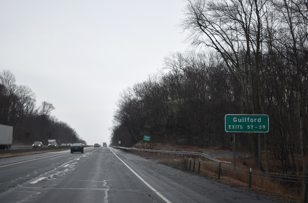
| Interstate 95 advances east from Leetes Island Road (Exit 56) into the town of Guilford. Exit 57 (U.S. 1), Exit 58 (Route 77), and Exit 59 (Goose Lane) all serve Guilford Center. 03/23/23 |
|
| The Connecticut Turnpike remains between 80 and 100 feet in elevation on the ensuing stretch between Wolf and Towner Swamps. U.S. 1 returns to I-95 next. 03/23/23 |
|
| U.S. 1 (Boston Post Road) arcs north from Exit 55 to meet Route 22 at the Branford, North Branford, and Guilford town lines, returning to the freeway in one mile at a parclo interchange (Exit 57). 03/23/23 |
|
| U.S. 1 joins I-95 with Guilford Center, located at the crossroads between Boston Post Road and Route 77 (Church Street). U.S. 1 (Boston Post Road) remains south of I-95 between Exit 57 and Old Saybrook Center, 18.6 miles to the east. 03/23/23 |
|
| The Connecticut Turnpike continues one half mile to a diamond interchange with Route 77 (Exit 58). Route 77 extends north from Route 146 in Guilford Center along a 13.85 mile course to Durham. 03/23/23 |
|
| Route 77 follows Whitfield, Broad, and Church Streets north from Guilford Center to I-95. Durham Road continues Route 77 to North Guilford, Quonnipaug Lake, and Route 17 at Durham. 03/23/23 |
|
| Guilford is home to Henry Whitfield State Museum and Guilford Art Center among other points of interest. 03/23/23 |
|
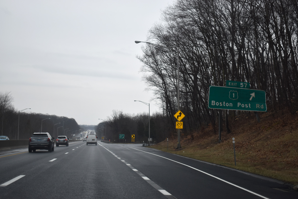
| The freeway meets Goose Lane at a parclo interchange (Exit 59) east of central Guilford. Goose Lane links I-95 with U.S. 1 (Boston Post Road), Route 146 (Boston Street), Soundview Road and Clapboard Hill Road. 03/23/23 |
|
| Interstate 95 passes over State Street ahead of Goose Lane (Exit 59). 03/23/23 |
|
| Goose Lane intersects U.S. 1 (Boston Post Road) west of its intersection with the east end of Route 146 (Boston Street). Route 146 angles southwest along Boston and Water Streets through central Guilford to Leetes Island. U.S. 1 continues east to the community of East River. 03/23/23 |
|
| Exit 59 leaves Interstate 95 northbound for Goose Lane. Goose Lane leads north to Nut Plains Road and Nut Plains. Clapboard Hill Road travels northeast from the freeway to Podunk Road and the community of Podunk. 03/23/23 |
|
| A rural stretch of Interstate 95 leads east into the Town of Madison. 03/23/23 |
|
| I-95 spans the East River ahead of a half diamond interchange (Exit 60 from I-95 south) with Nortontown and Mungertown Road and Route 79 (Durham Road) at Exit 61. 03/23/23 |
|
| Route 79 runs 14.34 miles between U.S. 1 (Boston Post Road) in Madison and Route 17 (New Haven Road / Main Street) at Durham Center. The state route intersects Route 80 (Old Toll Road) at a traffic circle at the community of North Madison. 03/23/23 |
|
| Route 79 (Durham Road) ends at U.S. 1 (Boston Post Road) just east of Island Avenue, which leads south to Middle Beach on Long Island Sound. 03/23/23 |
|
| The Madison Service Plazas line both sides of I-95 one mile east of Route 79 at Exit 61. 03/23/23 |
|
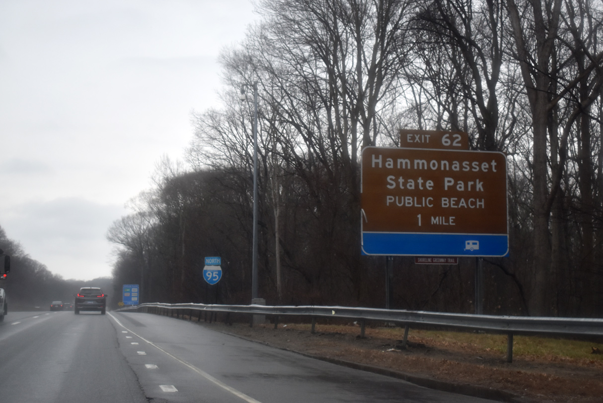
| Inventoried as SSR 450 but not signed, Hammonasset Connector joins Interstate 95 with Hammonasset Beach State Park. 03/23/23 |
|
| The Madison Service Plaza represents the final service plaza along I-95 northbound in the Constitution State. 03/23/23 |
|
| Unsigned Route 450 constitutes a 4.46 mile long roadway between U.S. 1 (Boston Post Road) and Route 79 (Durham Road). Duck Hole and Horse Pond Roads takes the state route northwest to Durham Road and North Madison. 03/23/23 |
|
| The Hammonasset Connector is an expressway between Exit 62 and U.S. 1 (Boston Post Road) to the south. Continuing north, Duck Hole Road leads to Madison and Route 79. 03/23/23 |
|
| I-95 (Connecticut Turnpike) crosses the Hammonasset River and Middlesex County line into Clinton ahead of the parclo interchange (Exit 63) with Route 81 (High Street). 03/23/23 |
|
| Route 81 follows Killingworth Turnpike north from I-95 at Kelseytown en route to Killingworth, meeting Route 80 (Branford / Deep Water Roads) at a roundabout. 03/23/23 |
|
| Route 81 originates from U.S. 1 (Main Street) along Hull Street in Clinton before shifting onto High Street north to I-95. Overall, Route 81 travels 15.75 miles north to Route 154 at Higganum. The state route also serves interests to Chatfield Hollow State Park and Route 9 to Middletown. 03/23/23 |
|
| Several subdivisions abut the Connecticut Turnpike between northern reaches of Indian Lake and the Hammock River. 03/23/23 |
|
| I-95 north travels under Long Hill Road 1.25 miles out from Route 145 (Horse Hill Road) at Exit 64. Route 145 straddles western reaches of Westbrook from Chapman Hill Pond northward to Winthrop. 03/23/23 |
|
| Route 145 follows Horse Hill Road north from Old Clinton Road to Stevenstown Road and Route 80 (Winthrop Road) at Winthrop. 03/23/23 |
|
| The Connecticut Turnpike enters the town of Westbrook ahead of Chapman Mill Pond Road and Route 145 (Exit 64). 03/23/23 |
|
| Route 145 follows a 9.91 mile course from U.S. 1 (East Main Street) in Clinton to Route 148 near Cedar Lake in the town of Chester. Within Westbrook, Route 145 overlays Old Post Road. 03/23/23 |
|
| Interstate 95 continues east to the north of Murdock Hill beyond this shield assembly. 50,800 vehicles per day (vpd) were recorded on this stretch in 2020 during the Covid-19 outbreak. 03/23/23 |
|
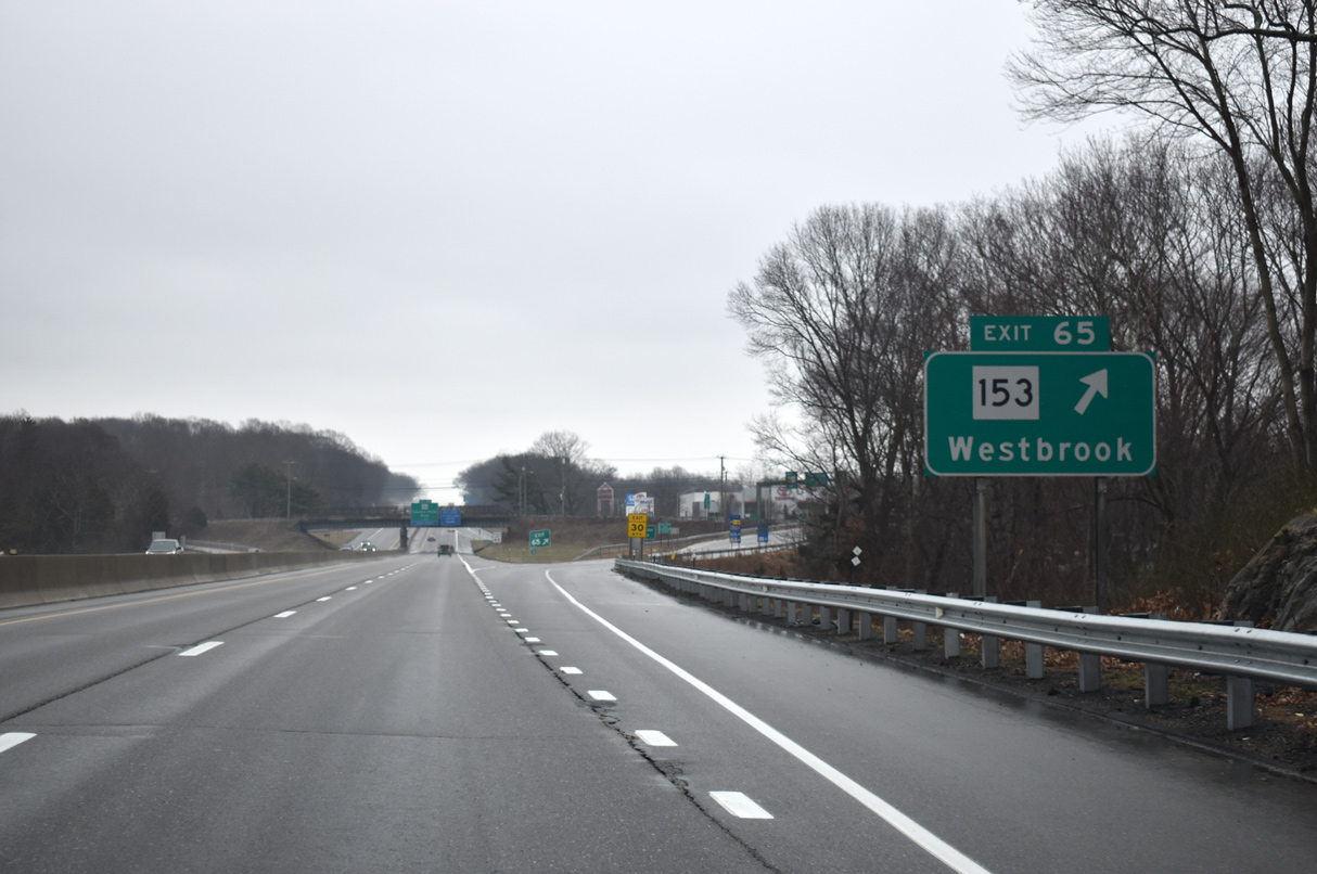
| The second Westbrook interchange (Exit 65) joins the Connecticut Turnpike with Route 153 (Essex Road) to Westbrook Center. 03/23/23 |
|
| Interstate 95 spans Pond Meadow Road one half mile from Route 153 at Exit 65. Route 153 extends 5.27 miles between U.S. 1 (Boston Post Road) in Westbrook and Route 154 (Middlesex Turnpike) at Essex. 03/23/23 |
|
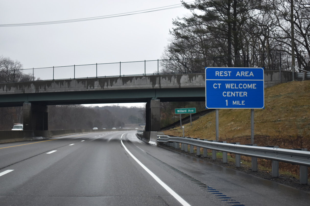
| A Connecticut Welcome Center and rest area are located east of the diamond interchange at Exit 65 along Interstate 95 north. 03/23/23 |
|
| Route 153 (Essex Road) originates one half mile to the south of I-95 at U.S. 1 (Boston Post Road) at Westbrook Center. Exit 65 departs Interstate 95 northbound for Route 153 (Essex Road). Route 166 (Spencer Plains Road) ties into Route 153 north of the diamond interchange. 03/23/23 |
|
| Route 166 (Spencer Plains Road) meets Interstate 95 beyond the welcome center at a parclo interchange (Exit 66). 03/23/23 |
|
| The welcome center / rest area facility typically operates seasonally between mid-May and mid-September. 03/23/23 |
|
| Route 166 (Spencer Plains Road) branches 1.62 miles eastward from Route 153 to U.S. 1 (Boston Post Road) at Saybrook Manor. 03/23/23 |
|
| Route 166 angles 0.30 miles southeast from I-95 over an AMTRAK line to its conclusion at U.S. 1 (Boston Post Road). 03/23/23 |
|
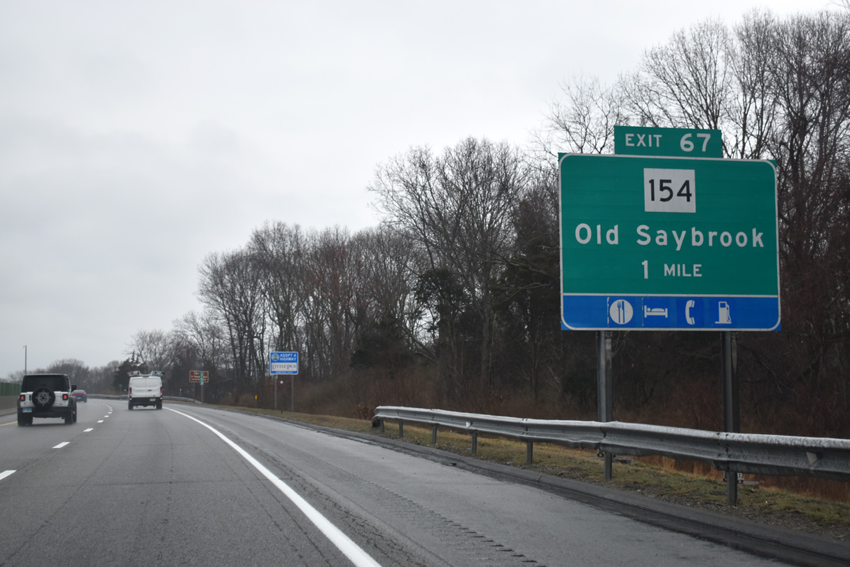
| Elm Street / Ingham Hill Road meet I-95 at a southbound half diamond interchange (Exit 67) one mile ahead of Route 154 to U.S. 1 and Route 9.
Route 154 (Middlesex Turnpike) serves Old Saybrook Center. 03/23/23 |
|
| Continuing east through Old Saybrook, Interstate 95 straddles northern reaches of Beacon Hill beyond this shield marker. 03/23/23 |
|
| To the south of U.S. 1, Route 154 comprises a loop through Old Saybrook Center, Fenwick, and Saybrook Manor. Overall, Route 154 runs 28.24 miles northward to a trumpet interchange with Route 9 in south Middletown. 03/23/23 |
|
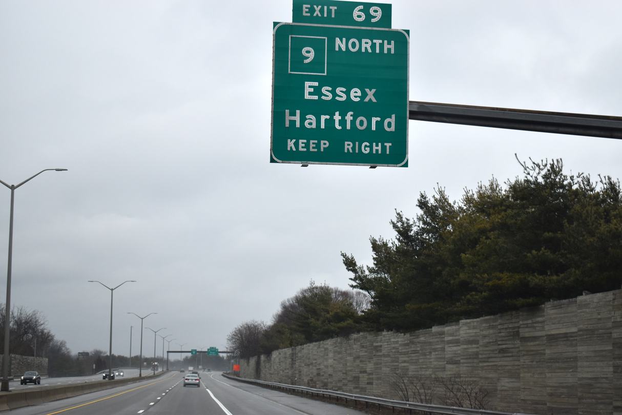
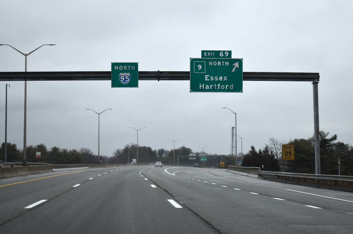
| Interstate 95 meets Route 9 north at a trumpet interchange (Exit 69) next. Route 9 constitutes a freeway joining I-95 at Old Saybrook with I-91 near Berlin and I-84/U.S. 6 in Farmington. 03/23/23 |
|
| Route 9 serves as a primary connection between this region of Connecticut with the capital city of Hartford. The freeway also serves the towns of Essex, Deep River and Middletown along its 40.85 mile course. 03/23/23 |
|
| U.S. 1 north ties into I-95 ahead of the exchange with Route 9 (Exit 69). U.S. 1 shifted from Boston Post Road onto the freeway when the Baldwin Bridge crossing over the Connecticut River was completed in 1948. The original freeway included interchanges at each end that later became Exits 69 and 70 of I-95 in 1958.1 03/23/23 |
|
| A loop ramps leaves I-95 / U.S. 1 north for Route 9 to Essex, Higganum, and Middletown. All of Route 9, with the exception of two signalized intersections in downtown Middletown, was completed by 1969.2 03/23/23 |
|
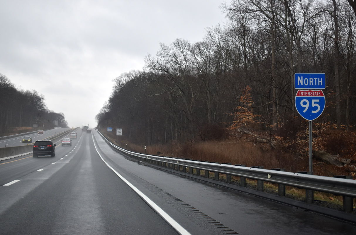
| I-95 / U.S. 1 (Connecticut Turnpike) advances from Route 9 (Exit 69) across the Raymond E. Baldwin Bridge to Old Lyme. The span replaced a 1911 draw bridge that U.S. 1 used between Old Saybrook and Old Lyme until 1948. In 1993, a major widening and modernization project was completed.3 03/23/23 |
|
| U.S. 1 north leaves the Connecticut Turnpike for Old Lyme at a half diamond interchange (Exit 70) with Route 156 (Neck Road). Route 156 overlays Neck Road south from the Lyme town line to I-95 at Old Lyme. 03/23/23 |
|
| I-95/U.S. 1 enters Old Lyme midway across the Connecticut River. South of I-95, Route 156 follows Shore Road through Old Lyme before turning east for South Lyme and Rocky Neck State Park. 03/23/23 |
|
| U.S. 1 leaves for Route 156 north at Exit 70, following the state route one block north to Halls Road. U.S. 1 continues along Halls Road east to Lyme Street while Route 156 advances north to Lyme. Overall, Route 156 follows an L-shape course 22.76 miles south and east from Route 82 at East Haddam to U.S. 1 at Waterford. 03/23/23 |
|
| A lane drop occurs along Interstate 95 north ahead of the Lieutenant River. 03/23/23 |
|
| Interstate 95 reduces to four overall lanes on the ensuing stretch to the East Lyme town line. 03/23/23 |
|
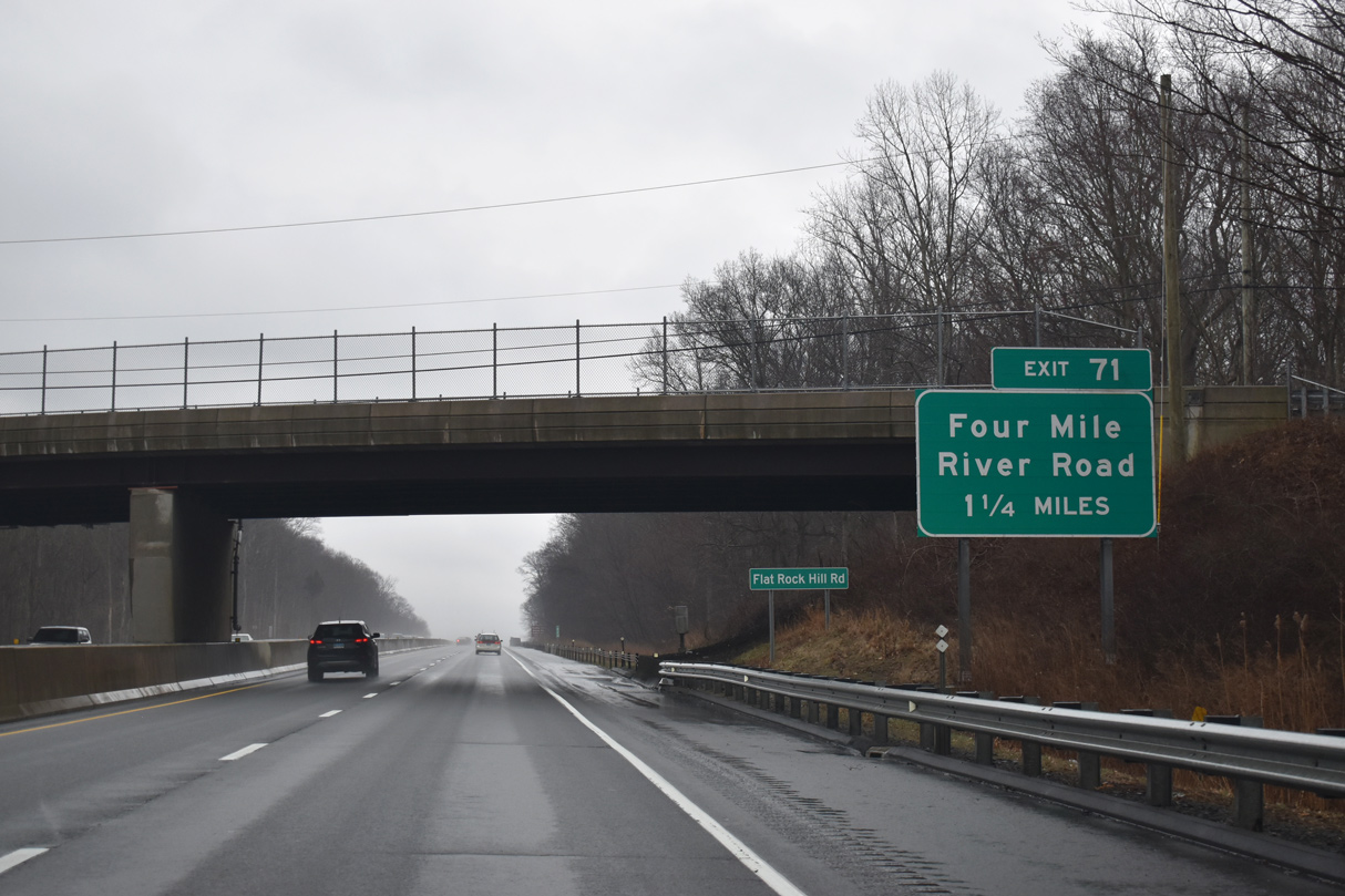
| 1.25 miles out from back to back interchanges with Four Mile River Road (Exit 71) and the Rocky Neck State Park connector (Exit 72). 03/23/23 |
|
| Four Mile River Road branches north from Route 156 west of Rocky Neck State Park to I-95. 03/23/23 |
|
| A trumpet interchange joins I-95 with Rocky Neck Connector (unsigned SSR 449) to Route 156 west of the entrance to Rocky Neck State Park in one half mile. Route 156 (W Main Street) lines the north boundary of the park en route east to Niantic. 03/23/23 |
|
| Four Mile River Road continues north 1.40 miles from I-95 to an end at U.S. 1 (Boston Post Road) near Goodwins Pond along the Four Mile River. 03/23/23 |
|
| The interchange (Exit 72) with Rocky Neck Connector to Route 156 immediately follows Exit 71. The connector route extends 1.07 miles south to Route 156 (W Main Street). 03/23/23 |
|
| Interstate 95 (Governor Lodge Turnpike) enters the town of East Lyme on the ensuing segment to Society Road (Exit 73). 03/23/23 |
|
| A right-in right-out (RIRO) interchange joins I-95 north with Society Road (Exit 73) in one mile. Society Road winds east from Dean Road to Route 161 (Flanders Road) near Gorton Pond. 03/23/23 |
|
| Dean Road extends northwest from Society Road to U.S. 1 (Boston Post Road). 03/23/23 |
|
| Society Road leads one mile east from I-95 north to Route 161 (Flanders Road), meeting Riverview Road between the two. 03/23/23 |
Page Updated 04-28-2023.

 North
North


 North
North