|
| The midpoint of the Savannah River represents the state boundary between South Carolina and Georgia. I-95 expands to six overall lanes across an area of wetlands beyond the 1976-built bridge. 10/15/23 |
|
| Acknowledging the state slogan in place of the 1996 Atlanta Summer Olympic Games, Georgia Welcome signs changed in 2016. 10/15/23 |
|
| Interstate 95 is the Tom Coleman Highway in Georgia. 12/30/20 |
|
| A weigh station lies 0.75 miles south of Knoxboro Creek. The facility precedes the state welcome center. 09/25/22 |
|
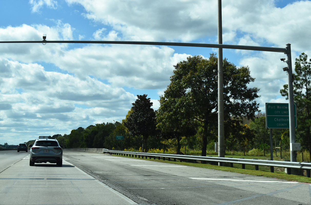
| Interstate 95 measures just 0.62 miles through the eastern sliver of Effingham County. Crossing Knoxboro Creek, I-95 enters Chatham County and the Port Wentworth city limits. 10/15/23 |
|
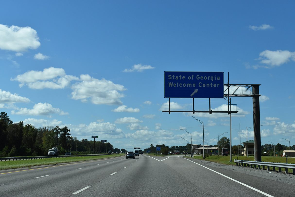
| The off-ramp to the Georgia Welcome Center departs a quarter mile beyond the weigh station. 09/25/22 |
|
| Located near the Rice Hope community in Port Wentworth, the tourist information center provides copies of the GDOT Georgia State Map for free. The second rest area in Georgia is 70 miles to the south near Brunswick. 09/25/22 |
|
| SR 21/30 (Augusta Road) meet I-95 in one mile. Costing $6 million, nearly two years of construction rebuilt the exchange at Exit 209 into a diverging diamond interchange (DDI). The new ramp configuration debuted to motorists on January 15, 2017.1 09/25/22 |
|
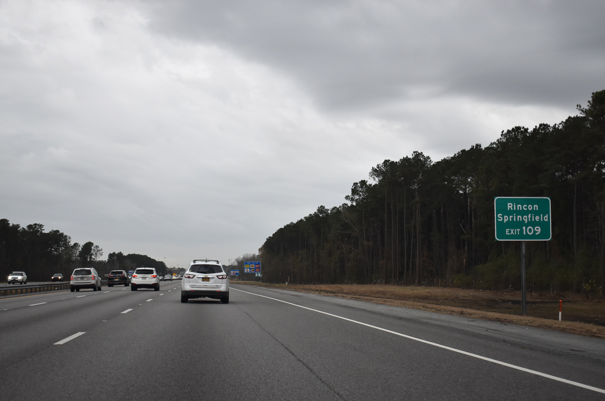
| SR 21 is an 84.39 mile long route from Millen southeast to Savannah. North into Effingham County, SR 21 connects I-95 with the city of Rincon and the county seat of Springfield. 12/30/20 |
|
| SR 30 ties into SR 21 for a 3.26 mile overlap between Piedmont Avenue and Bonny Bridge Road. The cross state route stretches 229.58 miles west from SR 25 (Coastal Highway) in Port Wentworth to SR 41 near Draneville. 09/25/22 |
|
| Exit 109 leaves I-95 south for SR 21/30 (Augusta Road) at Monteith in Port Wentworth. SR 21 provides a direct route to the Georgia Ports Authority and Garden City. 09/25/22 |
|
| SR 21 is part a four lane corridor with U.S. 25/SR 121 northwest from Savannah to Augusta. Known as the Savannah River Parkway (SR 555/SR 565), the corridor was part of the proposed concept for Interstate 3 in 2004 between Savannah and Knoxville, Tennessee. 09/25/22 |
|
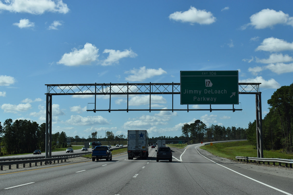
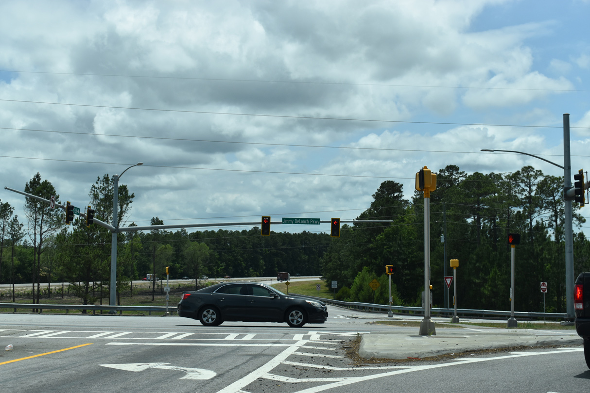
| Continuing southwest, Interstate 95 next meets SR 17 (Jimmy DeLoach Parkway) at a diamond interchange (Exit 106). SR 17 was extended 8.86 miles east along the previously unnumbered parkway in 2020. 09/25/22 |
|
| The first distance sign for I-95 south in Georgia precedes Pooler by six miles and Interstate 16 by eight miles. Brunswick lies 76 miles to the south. 09/25/22 |
|
| Jimmy DeLoach Parkway was constructed by Chatham County to improve access between Port Wentworth, the Port of Savannah, I-95 and Bloomingdale. The parkway was extended south from SR 21/30 (Augusta Road) to SR 307 on May 27, 2016. Opening then was the $73 million Jimmy DeLoach Connector (SR 21 Spur), a limited access highway to the port.2 09/25/22 |
|
| Interstate 95 passes over both a CSX and Norfolk Southern Railroad line south ahead of Exit 106 to SR 17 (Jimmy DeLoach Parkway). 09/25/22 |
|
| A controlled access arterial, Jimmy DeLoach Parkway (SR 17) winds west to U.S. 80/SR 261-17CO in Bloomingdale while serving a number of newer subdivisions along the way. 06/01/21 |
|
| The first reassurance marker for Interstate 95 south posted in Georgia. The freeway travels through the outskirts of the Savannah city limits between Exits 106 and 104. 12/30/20 |
|
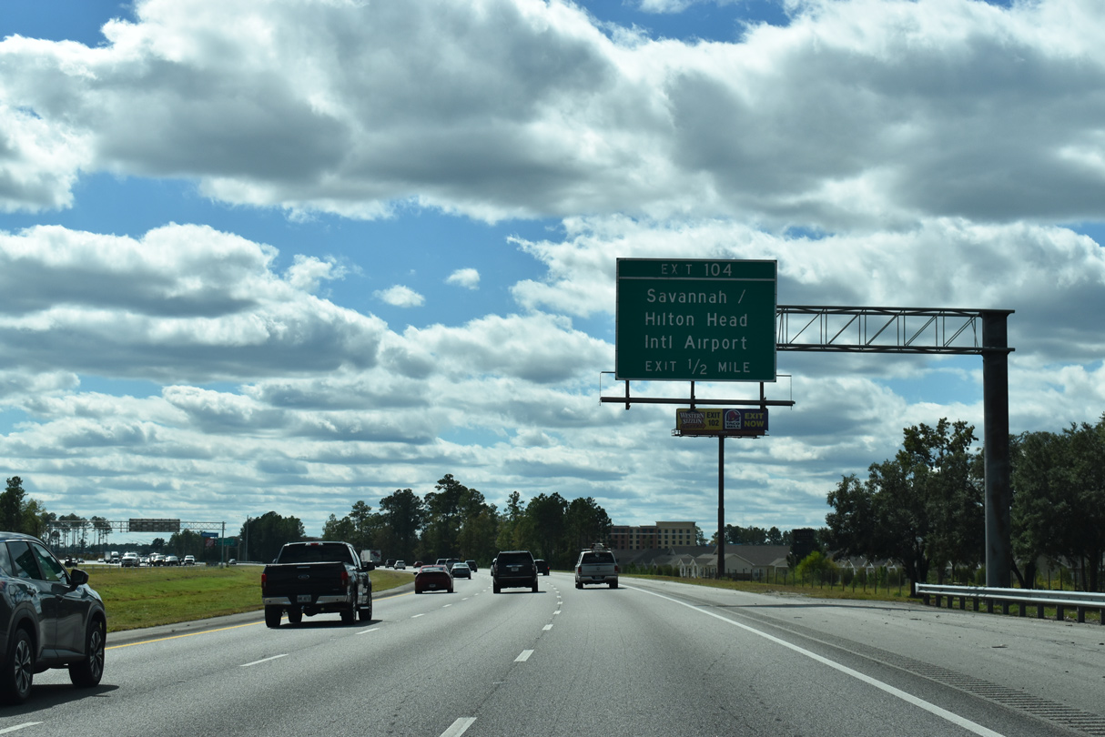
| Curving more southerly, Interstate 95 advances to the diamond interchange (Exit 104) with both Pooler Parkway south and Airways Avenue east. 10/15/23 |
|
| Airways Avenue was constructed in 2004 to serve the new terminal of Savannah / Hilton Head International Airport (SAV). Pooler Parkway, a county maintained arterial leading south to Interstate 16, ties into Exit 104 from a retail area to the west. 10/15/23 |
|
| Exit 104 leaves Interstate 95 south for Savannah / Hilton Head International Airport (SAV). The original airport terminal was located off SR 307 (Dean Forest Road) on the east side of the facility. 10/15/23 |
|
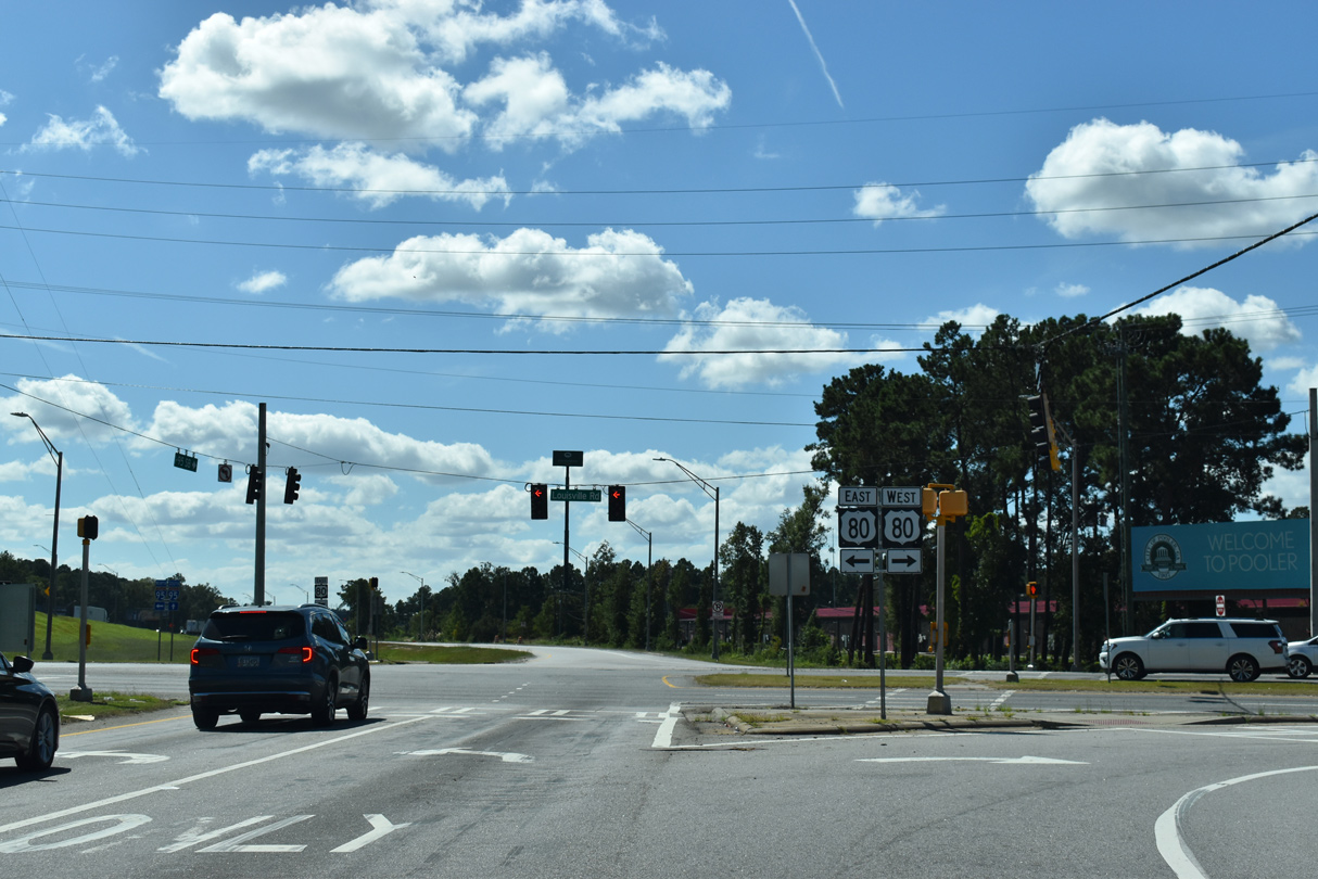
| Interstate 95 wholly enters the city of Pooler ahead of the diamond interchange (Exit 102) with U.S. 80/SR 26 (Louisville Road). 10/15/23 |
|
| U.S. 80 joins Interstate 95 with the Pooler city center to the west and Garden City to the east. Formerly a transcontinental route, U.S. 80 stretches 1,032 miles from Mesquite, Texas to Tybee Island, 30.7 miles to the east. 10/15/23 |
|
| U.S. 80/SR 26 run concurrent from Tybee Island to Dudley, generally following the corridor of I-16 from Savannah westward. 10/15/23 |
|
| East from Exit 102, U.S. 80/SR 26 intermingle with I-516 before following Ogeechee Road and Victory Drive east through Midtown Savannah. 09/25/22 |
|
| West from Interstate 95, U.S. 80 (Louisville Road) partitions into a one-way couplet through the Pooler city center en route to Bloomingdale. 09/25/22 |
|
| I-95 converges with I-16 at a half turbine interchange (Exit 99) in two miles. A 165.71 mile long route, Interstate 16 links Savannah and the Golden Isles with Macon and Atlanta. 10/15/23 |
|
| Interstate 16 replaced U.S. 80 as the main route west to Macon. The freeway concludes at Interstate 75 in 157 miles. 08/28/21 |
|
| Exit 99 departs for I-16 west to suburban areas of Pooler and Bloomingdale and a rural course west to Statesboro, Dublin and Macon, and east to downtown Savannah. Prior to 1999, the exit number for I-16 was Exit 17. 10/15/23 |
|
| Construction from the first quarter of 2020 to the fourth quarter of 2023 replaces the cloverleaf at I-16/95 with a half turbine interchange. Work was originally anticipated for completion in 2022.3 09/25/22 |
|
| Interstate 16 extends 8.8 miles east to Montgomery Street north and the Savannah National Historic District. U.S. 17 combines with I-16 ahead of the Talmadge Bridge (SR 404 Spur) north across the Savannah River. 10/15/23 |
|
| Heading south from I-16, Interstate 95 runs along the Pooler city line and by a handful of subdivisions to Culvert Swamp. 12/30/20 |
|
| Jacksonville debuts on southbound distance signs at 127 miles. The last Chatham County exit is in four miles. 10/15/23 |
|
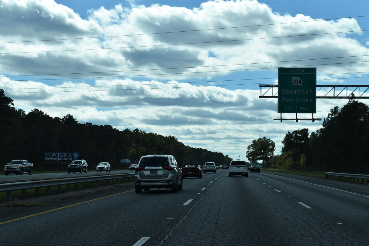
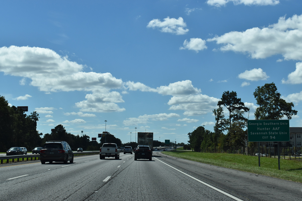
| A diamond interchange (Exit 94) joins Interstate 95 with SR 204 (Fort Argyle Road west / Abercorn Street Extension east) in one mile. 10/15/23 |
|
| SR 204 (Abercorn Street) constitutes the primary commercial arterial south from Midtown to Southside Savannah. Abercorn Street Extension takes the route west across the Little Ogeechee River to I-95. Prior to 2020, SR 204 extended northwest to I-16 along the 37th Street Connector. 10/15/23 |
|
| Hunter Army Airfield (AAF) lies west of SR 204 (Abercorn Street) and south of I-516/SR 21 (W.F. Lynes Parkway) within the Savannah city limits. 09/25/22 |
|
| SR 204 comprises a 32.47 mile long route from U.S. 280/SR 30 at Lanier in Bryan County to a shared end point with SR 21 (DeRenne Avenue) along Abercorn Street in Savannah. 10/15/23 |
|
| A number of traveler services abut Exit 94, concluding a busy stretch of SR 204 from the east. SR 204 becomes more rural on the northwesterly course to Ellabelle, Lanier and U.S. 280 east of Pembroke. 01/20/19 |
|
| Interstate 95 passes between the Ogeechee Trail Nature Preserve and Bungard Conservation Area from Exit 94 south to the Ogeechee River. Areas to the west fall within the city of Savannah. 10/15/23 |
|
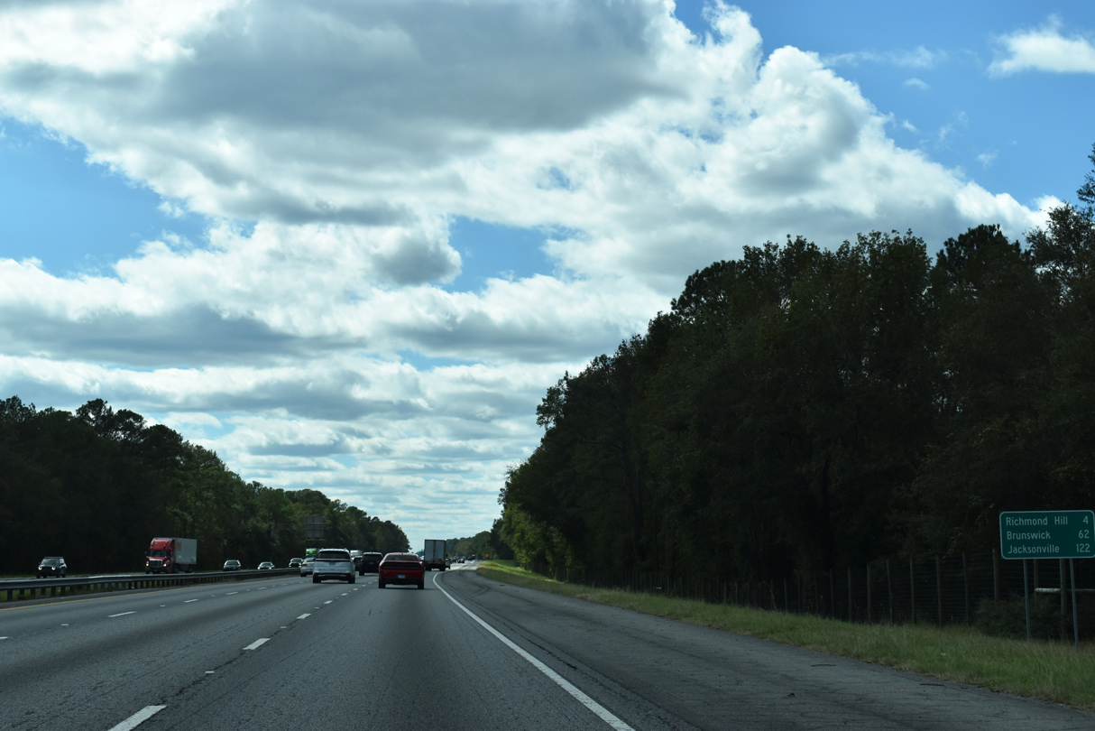
| The city of Richmond Hill is next along I-95 south in four miles. Brunswick follows in an hour. 10/15/23 |
|
| The Ogeechee River separates Chatham and Bryan Counties as part of its 294 mile course from Greene County, south of Union Point, into the Atlantic Ocean at Ossabaw Island. 10/15/23 |
Page Updated 10-20-2023.

 South
South