|
| An auxiliary lane accompanies the NJ Turnpike southbound between on and off-ramps for the Vince Lombardi Service Area. This the first of several service areas along the 122 mile long toll road. 08/29/05 |
|
| Leaving the service area, Interstate 95W ascends to cross the Hackensack River. 08/29/05 |
|
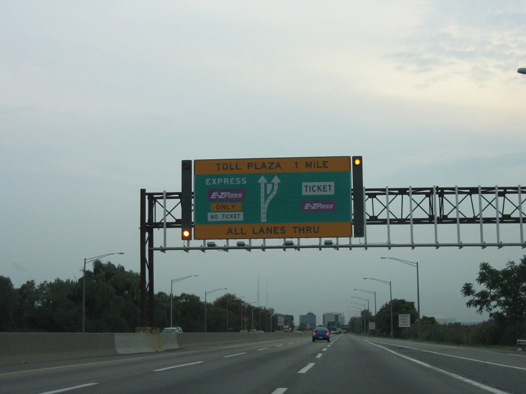
| A maintenance road loops from north to southbound I-95W at the south end of the Hackensack River bridge. A changeable overhead directs motorists toward Exit 16W for the Meadowlands. Depending upon event, a separate wye interchange will open ahead of the forthcoming toll plaza for the sports complex. 08/29/05 |
|
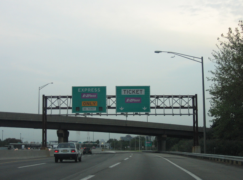
| The gateway toll plaza for the New Jersey Turnpike lies one mile ahead at Bashes Creek. The turnpike utilizes a ticketed system where rates are charged based upon distance traveled. E-ZPass account holders do not collect a ticket. 08/29/05 |
|
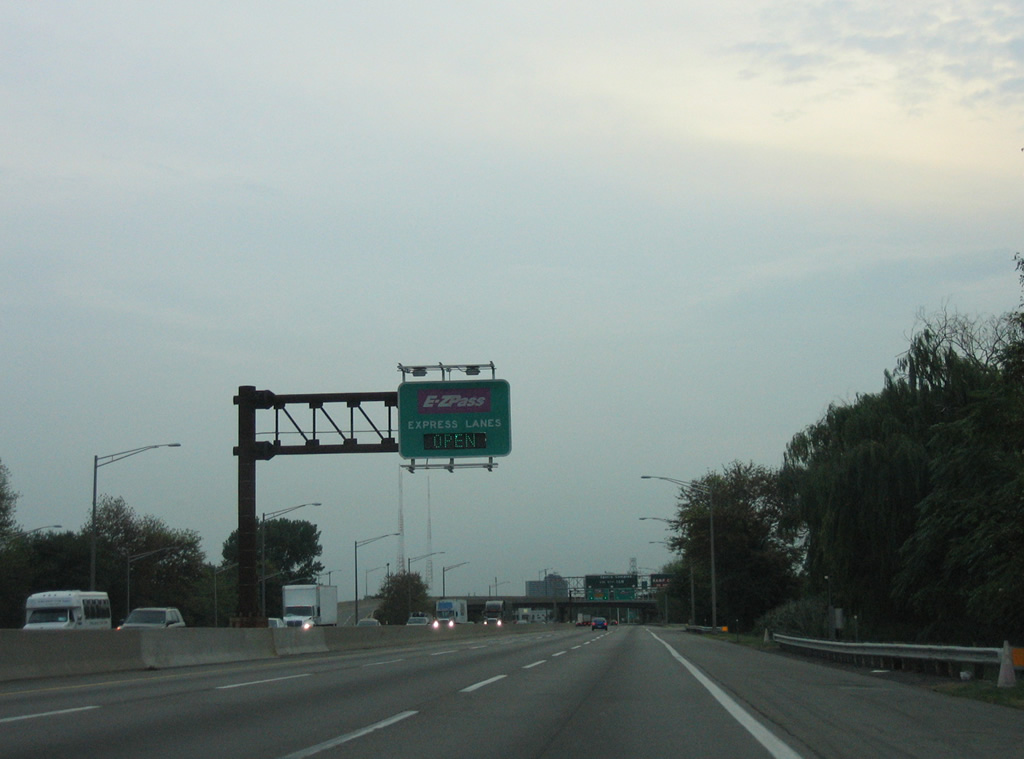
| Open road tolling allows drivers with E-ZPass to maintain speed through a toll collection point. 08/29/05 |
|
| The aforementioned wye interchange, open during select sporting events, departs the NJ Turnpike directly to the IZOD Center (home of the NHL New Jersey Devils) and MetLife Stadium (home of the NFL N.Y. Giants and Jets franchises). 08/29/05 |
|
| Two E-ZPass lanes separate ahead of the main line toll plaza with a 55 mile per hour speed limit. Conventional toll booths occupy the outside lanes. 08/29/05 |
|
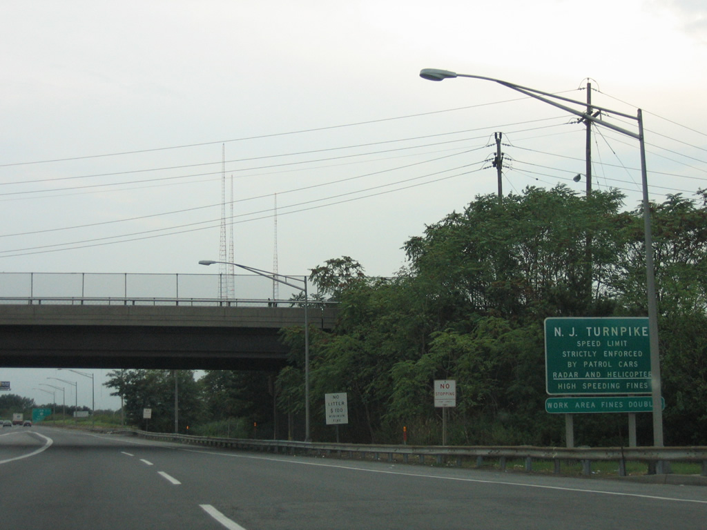
| Paterson Plank Road passes over the NJ Turnpike west branch as drivers see this speed limit sign. 08/29/05 |
|
| Route 3 constitutes a 10.84 mile route between U.S. 1/9 at North Bergen township and U.S. 46 in west Clifton. Route 3 is a freeway through Secaucus, East Rutherford and Rutherford. 08/29/05 |
|
| Entering the trumpet interchange (Exit 16W) with Route 3 and Inner Loop Road of the Meadowlands sports complex. Route 3 bisects Secaucus southeast to the Route 495 freeway through Union City. 08/29/05 |
|
| Gore point signs on the NJ Turnpike are generally signed on their own overhead. Exit 16W includes access to adjacent Route 120, a 2.65 mile loop north from Route 3 to Route 17 through East Rutherford borough. 08/29/05 |
|
| Leaving Exit 16W, Interstate 95W continues parallel to the Hackensack River through wetlands areas and Saw Mill Creek Wildlife Management Area. A pair of NJ Transit lines pass under the Turnpike along this stretch. 08/29/05 |
|
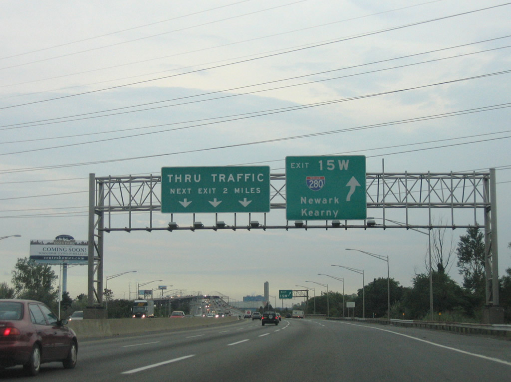
| Interstate 95W travels a causeway through the Saw Mill Creek WMA on the two mile approach to Exit 15W with Interstate 280 west. I-280 joins the Turnpike with Kearny, Newark, and the Oranges. 08/29/05 |
|
| Interests to Downtown Newark and the New Jersey Performing Arts Center should use Exit 15W to Interstate 280. Motorists bound for the South Kearny industrial area should remain on the N.J. Turnpike south to Exit 15E. Interstate 280 otherwise departs via a trumpet interchange for Hudson County 508 and Harrison. 08/29/05 |
|
| Interstate 95W reconvenes with the NJ Turnpike East Spur at a high level bridge over the Passaic River beyond Exit 15W. Interstate 280 originates here and travels 17.85 miles west to I-80 near Parsippany. 08/29/05 |
|
| The Newark skyline from the high level bridge across the Passaic River. 06/13/05 |
|
| Interstate 95W continues its descent from the Passaic River bridge toward Exit 15E for Newark and Jersey City. Appearing overhead is the Pulaski Skyway, a historic bridge system carrying U.S. 1/9 over the Passaic and Hackensack Rivers to Jersey City. 06/13/05 |
|
| Exit 15E connects the Turnpike with U.S. 1/9 Truck (Raymond Boulevard) in eastern reaches of Newark. U.S. 1/9 Truck follow a surface routing through Kearny and Jersey City for commercial trucks prohibited along the Pulaski Skyway. Raymond Boulevard splits onto a couplet with Ferry Street west of Interstate 95 en route to Downtown Newark. Doremus Avenue travels south to the Newark port facilities from the interchange complex. 06/13/05 |
|
| The East and West Spurs of the New Jersey Turnpike converge just ahead of Exit 14 with Interstate 78. The Turnpike transitions into four overall roadways, with the inside lanes dedicated to cars only. Trucks from both Turnpike spurs must use the Outer Roadway from Newark southward to Trenton. The next two interchanges serve Newark Liberty International Airport (EWR). 06/13/05 |
|
| Elevating to pass over another railroad line, I-95W south sees the first guide sign for Exit 14 with Interstate 78 (New Jersey Turnpike Extension), U.S. 1/9, and U.S. 22 west. A complex series of ramps joins the three freeways together in southeast Newark. Interstate 78 follows the New Jersey Turnpike Extension east to Exits 14A, 14B, and 14C, serving Jersey City, Bayonne, and the Holland Tunnel into Lower Manhattan. Interstate 78 west ventures through Newark, Irvington, Springfield, Pluckemin, and Easton, Pennsylvania. U.S. 1/9 follow a freeway south from the Pulaski Skyway to Newark Airport (EWR) and U.S. 22 west. 06/13/05 |
|
| Exit 14 departs Interstate 95W (New Jersey Turnpike) southbound well ahead of the interchange complex with Interstate 78 (New Jersey Turnpike Extension). I-78 provides access to the adjacent U.S. 1/9 freeway for Newark Airport (EWR) and U.S. 22 west for its expressway to Hillside and Union. 06/13/05 |
|
| Interstate 95W southbound at the departure of Exit 14 for Interstate 78, U.S. 1/9, and U.S. 22 west. U.S. 1/9 provide connections with New Jersey 21 (McCarter Highway) north for Downtown Newark and south alongside Newark Airport to Elizabeth. Interstate 78 east crosses the Newark Bay Bridge into Bayonne and Jersey City. The New Jersey Turnpike Extension is part of the turnpike ticket system with tolls levied for each of the three exits and the transition to 12th Street ahead of the Holland Tunnel. 06/13/05 |
|
| Changeable message boards at the off-ramp (Exit 14) for Interstate 78 and U.S. 1, 9, and 22. Normally trucks must shift from the Turnpike West Spur south onto the Turnpike Outer Roadway. However in instances of construction, accident closures, or congestion, turnpike operators may opt to direct all motorists onto the Inner Roadway. 06/13/05 |
|
| A parting shot of the Exit 14 partition with ramps for I-78 west to U.S. 1, 9, and 22 and I-78 east to Bayonne and Jersey City. The original control point for I-78 west was Clinton. a town located midway along the freeway between I-287 and the Pennsylvania state line. Sign changes made in the 1990s onward replaced Clinton with Easton throughout much of North Jersey. 06/13/05 |
Page Updated 04-16-2014.


 South
South