|
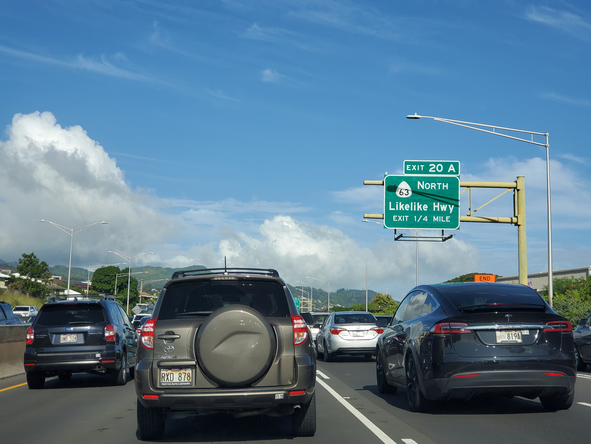
| Traffic from IH-201 (Moanalua Road) converges with I-H1 (Lunalilo Freeway) at a wye interchange one half mile from Exit 20 A to Route 63 (Likelike Highway) north. 08/15/19 |
|
| A lane drop previously resulted in a weaving traffic pattern between the end of I-H201 and Exit 20 A for Route 63 (Likelike Highway). A fourth eastbound lane for I-H1 was added by 2019. 08/15/19 |
|
| Route 63 (Likelike Highway) originates to the southwest of I-H1 along Kalihi Street at Route 92 (Nimitz Highway). The state route travels 8.30 miles northeast to Route 83 at Kaneohe. 02/04/24 |
|
| Exit 20 A connects I-H1 with Route 63 (Likelike Highway) northbound only. Route 63 comprises one of three routes across the Koolau Range to the Kaneohe area from Honolulu. 02/04/24 |
|
| Leaving the Kalihi neighborhood, Interstate H1 next meets Vineyard Boulevard (Route 98) at a wye interchange (Exit 20 B). 02/04/24 |
|
| Confirming marker posted east of the entrance ramp from Route 63 (Kalihi Street). Hawaii DOT recorded 144,400 vehicles per day on this section of H1 in 2020. 02/07/24 |
|
| The succeeding three exits serve the Honolulu central business district. Vineyard Boulevard passes by Downtown to the northeast, while Pali Highway and Punchbowl Street lead west from I-H1 to Route 92 (Ala Moana Boulevard). 02/04/24 |
|
| Route 98 (Vineyard Boulevard) branches south from I-H1 beyond the Kapalama Drainage Canal at Chinatown. Route 98 parallels I-H1 southeast 1.76 miles between Exit 20 B and Exit 22. 02/04/24 |
|
| Since removed, this reassurance marker appeared beside mile marker 20, where I-H1 passes over Halona and Palama Streets. Exit 20 C connects I-H1 westbound with Palama Street. 01/17/11 |
|
| Dropping below grade, Interstate H1 (Lunalilo Freeway) next meets Route 61 (Pali Highway) at Exit 21 A. 02/04/24 |
|
| Confirming marker posted east of the Liliha Street entrance ramp between the Aala Street and Nuuanu Avenue overpasses. Foster Botantical Garden lines the south side of I-H1 here. 02/04/24 |
|
| Measuring 10.59 miles in length, Route 61 (Pali Highway) runs northeast from adjacent Route 98 (Vineyard Boulevard) across the Koolau Range to Hamakua Drive (Route 6010) at Kailua. 02/04/24 |
|
| Route 61 extends 0.18 miles south from I-H1 along Pali Highway to parallel Route 98 (Vineyard Boulevard). This section of Route 61 is unmarked. 08/16/19 |
|
| Route 61 (Pali Highway) north to Route 83 (Kamehameha Highway) north joins Honolulu with the census designated place of Kaneohe. 08/16/19 |
|
| Exit 21 B forms a c/d roadway from below Route 61 (Pali Highway) to Punchbowl Street. Punchbowl Street (Route 7516) leads 0.92 miles southwest from Interstate H1 to Route 92 (Ala Moana Boulevard) at Honolulu Harbor. 02/04/24 |
|
| A wye interchange joins the c/d roadways at Exit 21 B with Punchbowl Street. Lusitana Street spurs south from Punchbowl Street to areas bound by the Lunalilo Freeway and Route 98 (Vineyard Boulevard). 02/04/24 |
|
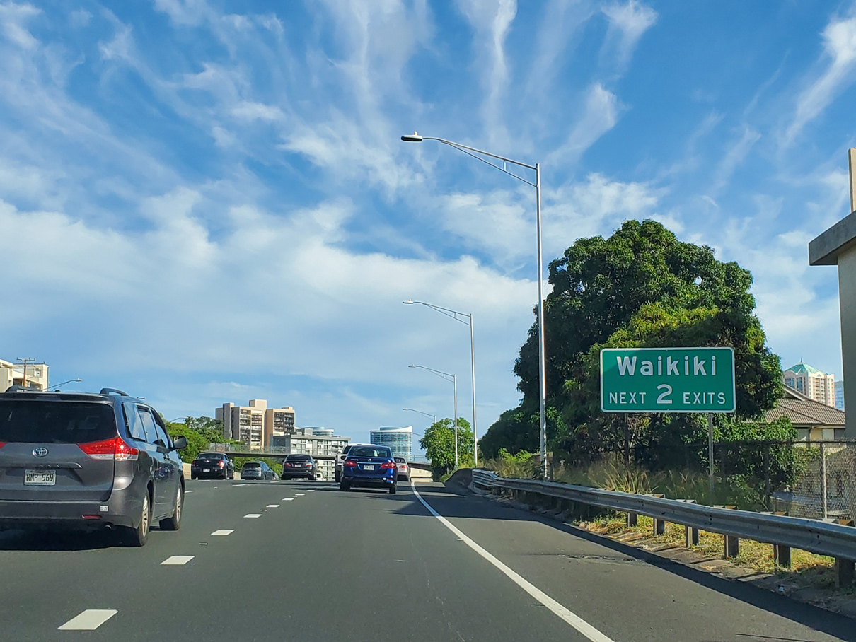
| Exit 22 is the first of two exits from Interstate H1 for the Waikiki area. 08/15/19 |
|
| Exit 22 connects Interstate H1 with parallel Kinau Street (Route 7519) just south of the wye interchange bringing Route 98 (Vineyard Boulevard) east onto the Lunalilo Freeway. 08/15/19 |
|
| Pi'ikoi Street (Route 7513) south from Kinau Street links with Route 92 (Ala Moana Boulevard) by the Ala Moana Center retail complex. 02/04/24 |
|
| A pedestrian bridge spans Interstate H1 (Lunalilo Freeway) east at the entrance ramp from Route 98 (Vineyard Boulevard). 08/08/10 |
|
| Interstate H1 east at the Ward Avenue on-ramp near Thomas Square. 01/17/11 |
|
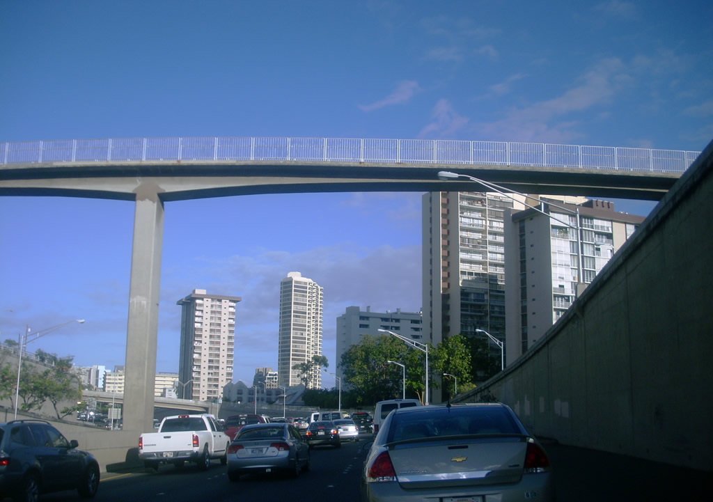
| High rises at Waikiki rise to the south of the elevated lanes along Interstate H1. 01/17/11 |
|
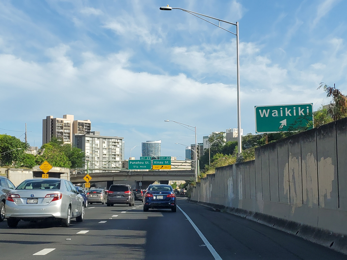
| Providing a main access point from H-1 into Waikiki, the forthcoming exit for Punahou Street (Route 7614) was expanded in 2003 to two lanes. 02/04/24 |
|
| Entering the half diamond interchange (Exit 23) with Punahou Street on Interstate H1 east. 02/04/24 |
|
| Beyond Exit 23 / Punahou Street, the Lunalilo Freeway drops below grade along a stretch prone to flooding. This is the second-oldest section of H-1. 01/17/11 |
|
| Bingham Street constitutes a service road along the south side of Interstate H1 east from Exit 23 and Punahou Street to Kaialu Street near Exit 24 B. Exit 24 A links with Bingham Street north of the Mo'ili'ili neighborhood. 02/04/24 |
|
| A three quarter cloverleaf interchange joins University Avenue with Interstate H1 at Exit 24 B. 02/04/24 |
|
| University Avenue heads north from Kapiolani Boulevard to the University of Hawaii and Manoa Valley. 02/04/24 |
|
| Interstate H1 next meets King Street at a modified diamond interchange (Exit 25 A). The oldest stretch of H-1, this short section of H-1 is extremely narrow with substandard, sharp curves. 02/04/24 |
|
| King Street (Route 7402) joins I-H1 with Kapiolani Boulevard (Route 7503) west to Waikiki and Mo'ili'ili. Kapahulu Avenue (Route 7810) stems south from near nearby to Kapahulu and the Honolulu Zoo. 02/04/24 |
|
| Flyover ramps connect Interstate H1 with Kapiolani Boulevard ahead of Exit 25 B for 6th Avenue. 02/04/24 |
|
| Continuing beyond the east end of Waikiki, Interstate H1 advances to the first of two exits for the Kaimuki business district. 02/04/24 |
|
| 6th Avenue (Route 7852) heads 0.52 miles south from Exit 25 B to Kapahulu and Alohea Avenue north of Diamondhead. Northward, 6th Avenue (Route 7813) leads 0.158 miles to Palolo Avenue for Palolo Valley. 02/04/24 |
|
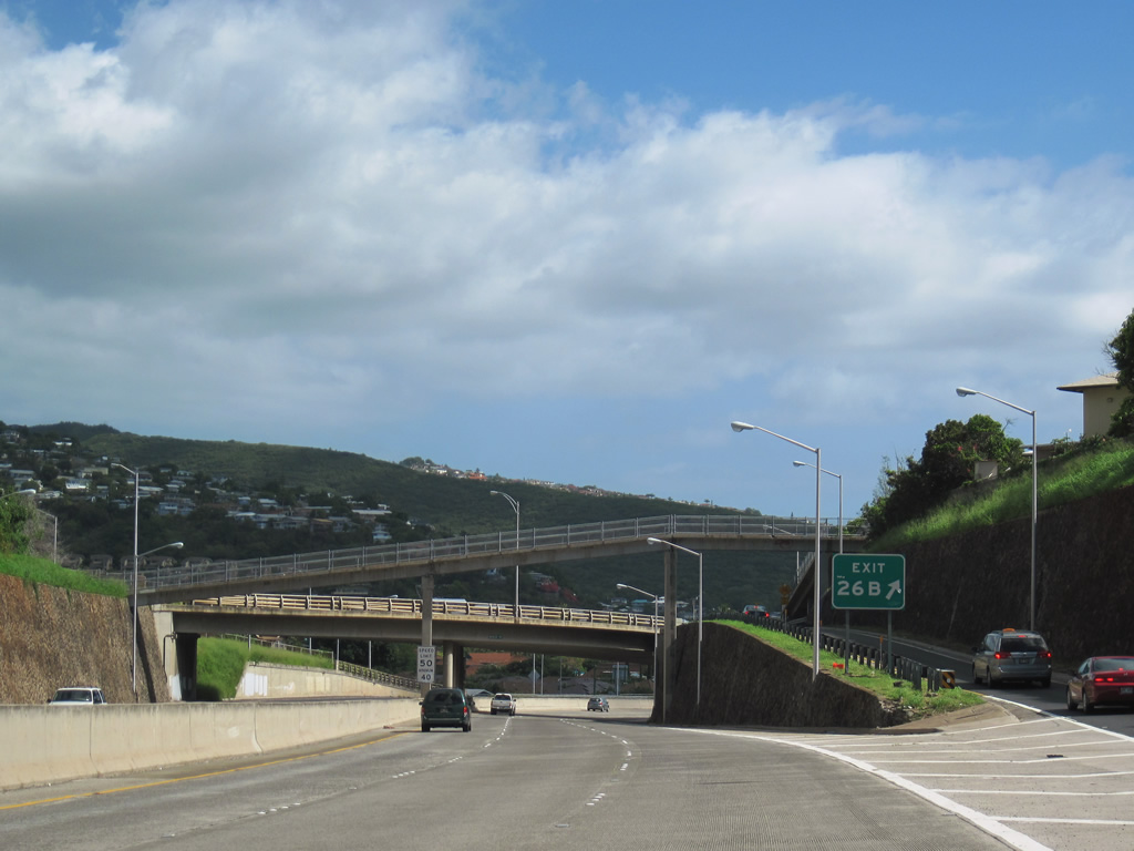
| Interstate H1 maintains eight overall lanes east to Exit 26 A for Koko Head Avenue. 02/04/24 |
|
| Koko Head Avenue heads south from Exit 26 A to 12th Avenue and north to Kaimuki, Wilhelmina Rise and Maunalani Heights. 02/04/24 |
|
| The last exit from Interstate H1 east is for Waialae Avenue and Waialae-Kahala Business District. 02/04/24 |
|
| The Waialae Interchange (Exit 26 B) connects Interstate H1 with Hunakai Street and Kilauea Avenue south to Wai'alae and Kahala. 02/04/24 |
|
| Overlapping wye interchanges link Interstate H1 and Waialae Avenue (Route 7801) at Exit 26 B. 01/17/11 |
|
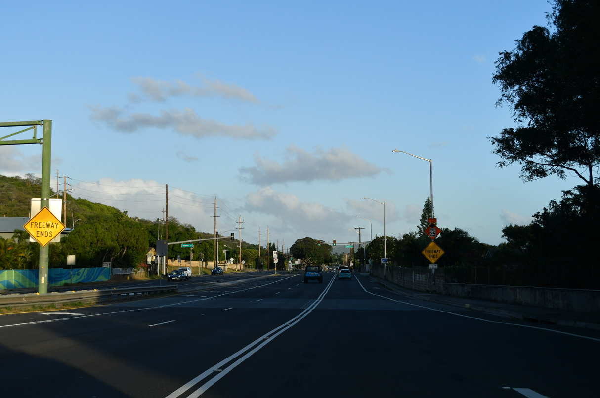
| End freeway signs stand along the viaduct above Kalanianaole Highway. 02/04/24 |
|
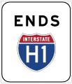
| Interstate H1 transitions into Route 72 (Kalanianaole Highway) ahead of Ainakoa Avenue (Route 7941). Route 72 encircles southeastern Oahu along a 18.43 mile long course to Route 61 at Maunawili. 02/04/24 |
Page Updated 02-23-2024.

 East
East