|
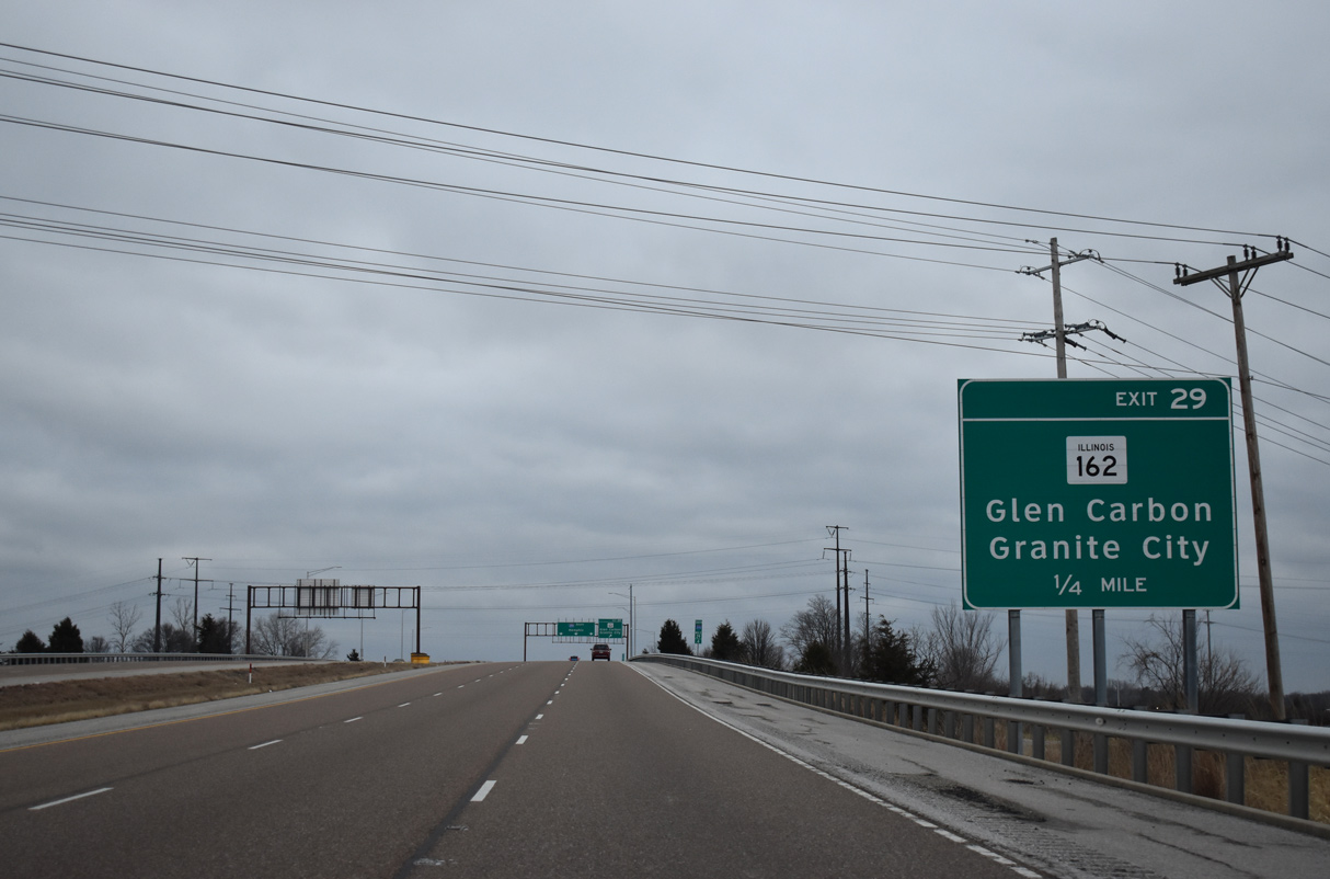
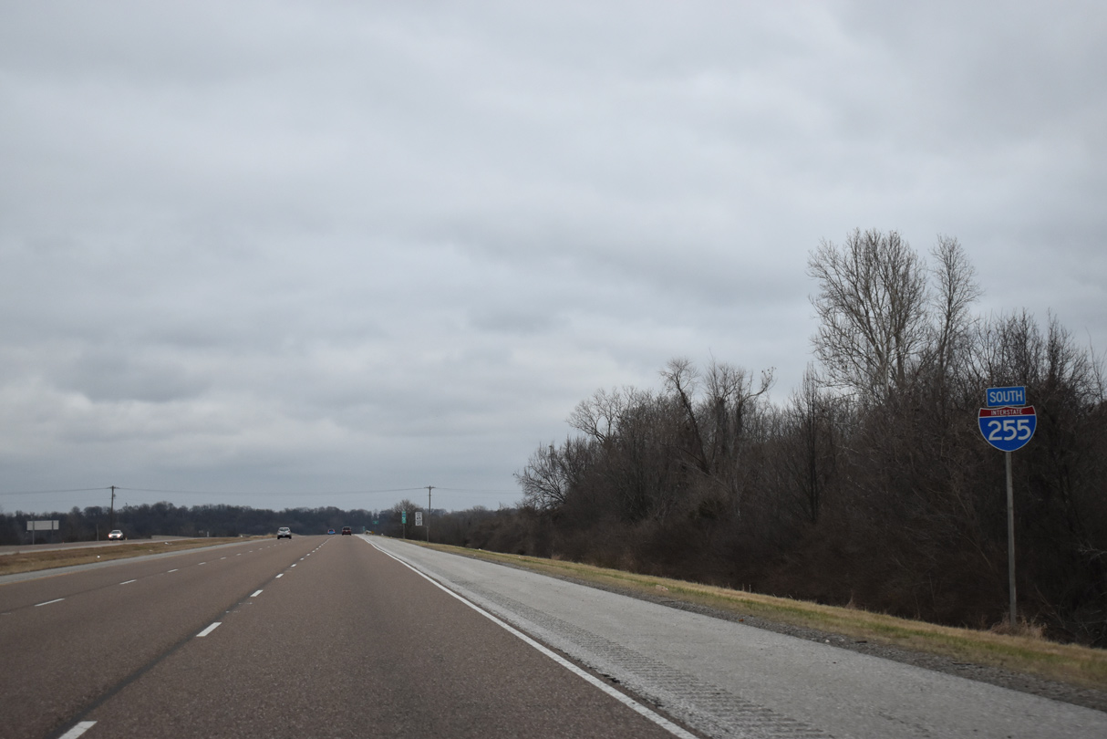
| Interstate 255 bends southeast from I-270/IL 255 to a folded diamond interchange (Exit 29) with IL 162 (Stallings Road). 12/31/23 |
|
| Interstate 255 south reenters the village of Pontoon Beach at the exchange with IL 162 (Stallings Road). 12/31/23 |
|
| IL 162 forms a 15 mile long arc between Granite City to the west and Troy to the east. 12/31/23 |
|
| I-255 spans over an abandoned railroad line and the MCT Nickel Plate Trail at the loop ramp (Exit 29) for IL 162. IL 162 follows Stallings Road west to Stallings and IL 111 in Pontoon Beach and east to Glen Carbon at IL 157. 12/31/23 |
|
| The first confirming marker for I-255 south precedes the crossing over Cahokia Canal. 12/31/23 |
|
| Cahokia Canal leads southwest from Pontoon Beach to Fairmont City and north to Cahokia Creek in Glen Carbon. 12/31/23 |
|
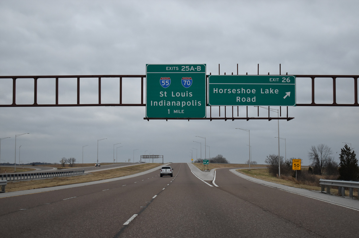
| Interstate 255 shifts southward alongside Cahokia Canal to Exit 26 with Horseshoe Lake Road. Incorrectly signed as Exits 25 A/B, the exchange with I-55/70 at Exits 25 B/A follows. 12/31/23 |
|
| Horseshoe Lake Road parallels the MCT Schoolhouse Trail (rail trail) west to Horseshoe Lake and IL 162 within the village of Pontoon Beach. East of Exit 26, Horseshoe Lake Road ties into IL 157 across from Woodland Trails Drive in Collinsville. 12/31/23 |
|
| The folded diamond interchange (Exit 26) joining I-255 with Horseshoe Lake Road straddles the Collinsville city limits. Forthcoming I-55/70 was the north end of I-255 from 1986 to 1988. 12/31/23 |
|
| Fairmont Avenue crosses over Interstate 255 just ahead of Exit 25 B to I-55/70 west to Fairmont City, East St. Louis and St. Louis, Missouri. 12/31/23 |
|
| I-55/70 continue 6.7 miles west to I-64, where I-70 separates north to the Stan Musial Veterans Memorial Bridge. I-55 combines with I-64/U.S. 40 west through East St. Louis to the Poplar Street Bridge leading toward Downtown St. Louis. 12/31/23 |
|
| I-55/70 angle nine miles northeast from Exit 25 A through Collinsville to Maryville and Troy. 12/31/23 |
|
| Interstate 55 leads north from the St. Louis area to Springfield, Bloomington-Normal and ultimately Chicago. I-70 turns east from I-55 near Troy along the U.S. 40 corridor to Effingham and Indianapolis, Indiana. 12/31/23 |
|
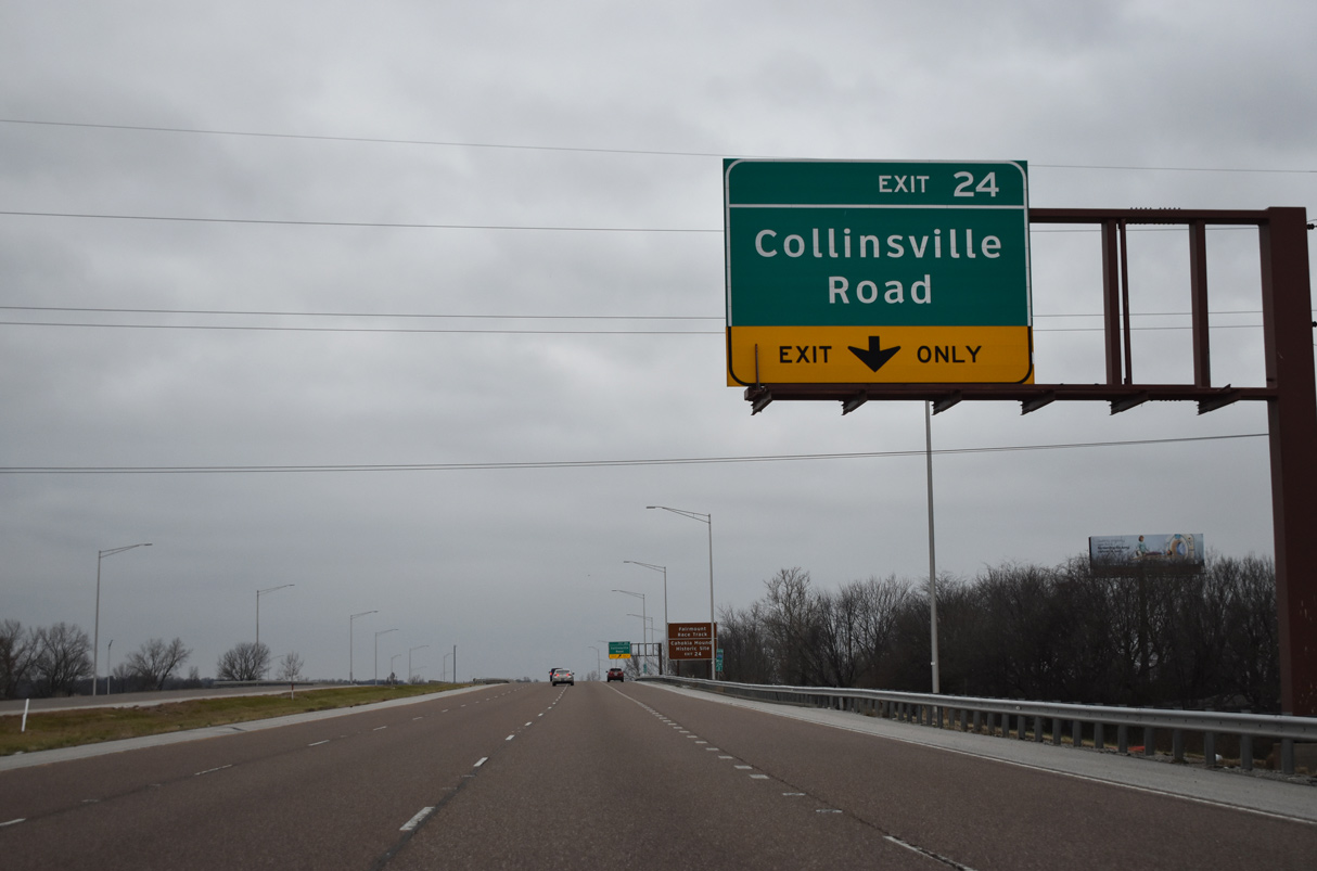
| Meeting I-255 at the succeeding exit, Collinsville Road represents a historic alignment of U.S. 40/66 (National Road) west to 9th Street in East St. Louis and east to Bluff Road (IL 157) within Collinsville. 12/31/23 |
|
| An auxiliary lane accompanies I-255 south from the I-55/70 on-ramps to the parclo interchange (Exit 24) with Collinsville Road. 12/31/23 |
|
| Collinsville Road and I-255 meet beside Fairmount Park Racetrack and the State Park Place community. 12/31/23 |
|
| Interstate 255 travels 16.34 miles south across St. Clair County from Exit 24 to the Columbia city and Dupo village line. 12/31/23 |
|
| Angling southwest from Exit 24, Interstate 255 continues across a mixture of farm land and wetland areas east of Cahokia Mounds Historic Site and the Washington Park community. 12/31/23 |
|
| A viaduct spans two railroad lines and Black Lane, two miles north of Exit 20 for Interstate 64 and U.S. 50 east in southwest Caseyville. 12/31/23 |
|
| Interstate 64 enters the St. Louis metropolitan area with U.S. 50 west from Shiloh, O'Fallon and Fairview Heights. U.S. 50 turns southwest alongside I-255 from Exit 20 to the Jefferson Barracks Bridge into Missouri. 12/31/23 |
|
| A cloverleaf interchange with c/d roadways joins I-255 and Interstate 64 at Exit 20. 12/31/23 |
|
| Interstate 64 continues west through Washington Park to East St. Louis and I-55/70 at their west split at what was originally known as the Tri-Level Interchange. 12/31/23 |
|
| Tulsa appears as a control city for I-255 south and U.S. 50 west for the connection with Interstate 44 via I-270 north. A two lane collector distributor roadway separates at Exit 20 for I-64 and U.S. 50 east. 12/31/23 |
|
| Interstate 64 combines with I-55/U.S. 40 west from East St. Louis across the Poplar Street Bridge to I-44. The freeway crosses St. Louis westward en route to Chesterfield and the St. Charles County suburbs. I-64 concludes 40.5 miles west of the state line at I-70 in Wentzville, Missouri. 12/31/23 |
|
| Interstate 64 and U.S. 50 east separate at O'Fallon with the freeway shifting southward to Mount Vernon and Louisville, Kentucky while U.S. 50 maintains an eastern heading to Vincennes, Indiana. 05/03/12 |
|
| U.S. 50 combines with I-255 south from the c/d roadway system at Exit 20. I-255/U.S. 50 proceed south across Harding Ditch near the Carmel Terrace community. Exit 19 follows with State Street. 05/03/12 |
|
| Passing over St. Clair Avenue, the former route of U.S. 50, I-255 enters the East St. Louis city limits. State Street runs northwest toward Downtown East St. Louis while meeting IL 157 and Main Street south into Belleville. 05/03/12 |
|
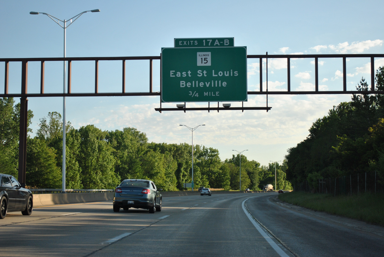
| Exit 19 is a folded diamond interchange joining I-255/U.S. 50 south with State Street. State Street represents the former alignment of IL 15 east to Main Street through Belleville. 05/03/12 |
|
| I-255/U.S. 50 continue with six overall lanes below the Lake Drive overpass and through Frank Holten State Park. 05/03/12 |
|
| IL 15 converges with I-255/U.S. 50 along an expressway at the village of Alorton. The state route travels 148 miles overall across southern reaches of the state east to the Indiana state line at Mt. Carmel. 05/03/12 |
|
| A cloverleaf interchange (Exits 17 B/A) connects I-255 with IL 15. IL 15 takes Missouri Avenue west from Alorton to Downtown East St. Louis. IL 15 concludes at Main and 4th Streets where they connect with I-55/64-U.S. 40 at Exit 1. 05/03/12 |
|
| IL 15 (Missouri Avenue) replaced the final alignment of U.S. 460 between Belleville and East St. Louis while also supplanting nearby IL 13 along Bond Avenue. U.S. 460 was truncated from St. Louis to the Indiana state line in 1975. 05/03/12 |
|
| The New Missouri Avenue expressway runs southeast along the Alorton and Centreville city line to a diamond interchange with IL 157. The controlled access route extends east along the south side of Belleville to combine with IL 13 north of Freeburg. 05/03/12 |
|
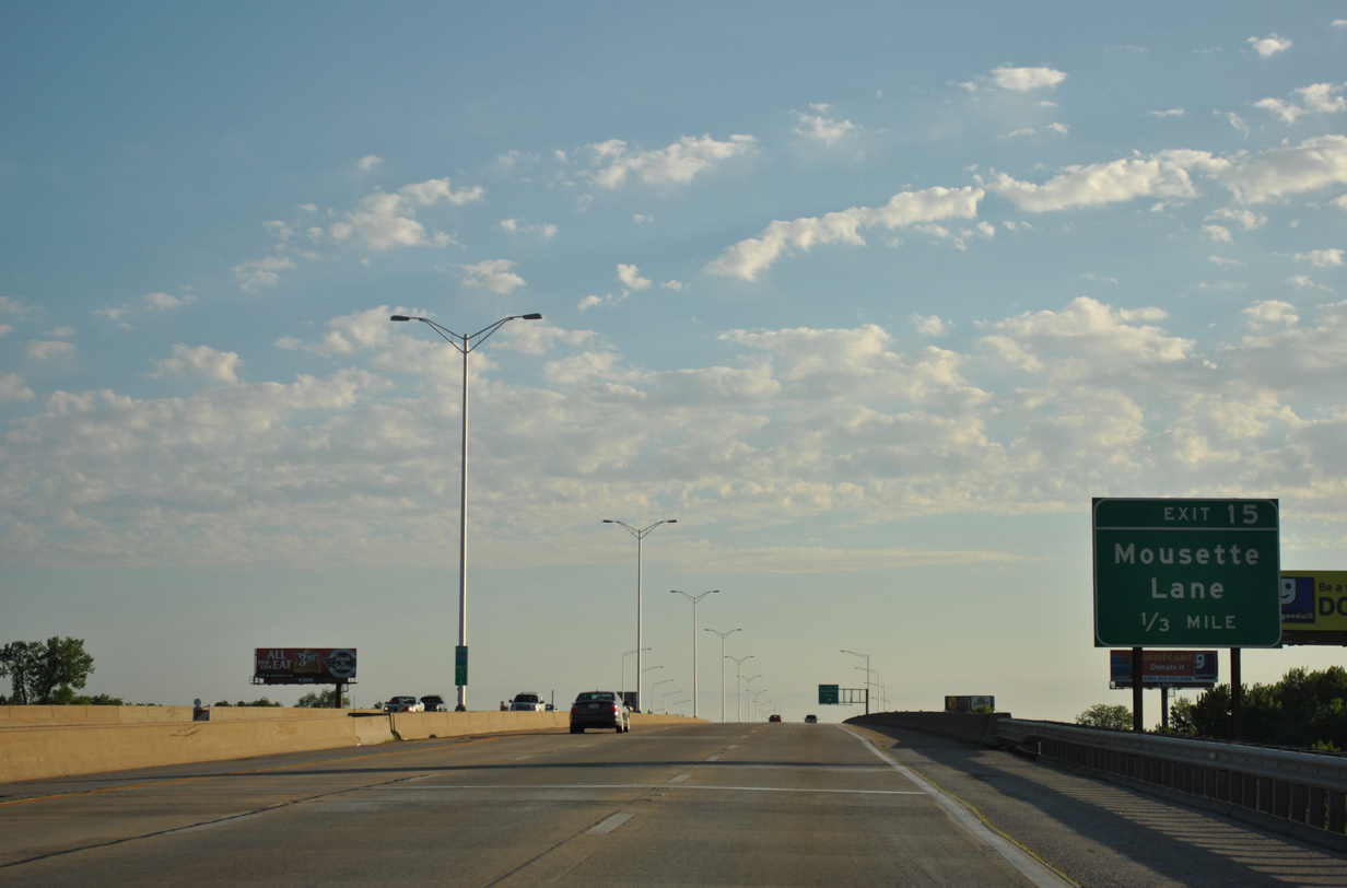
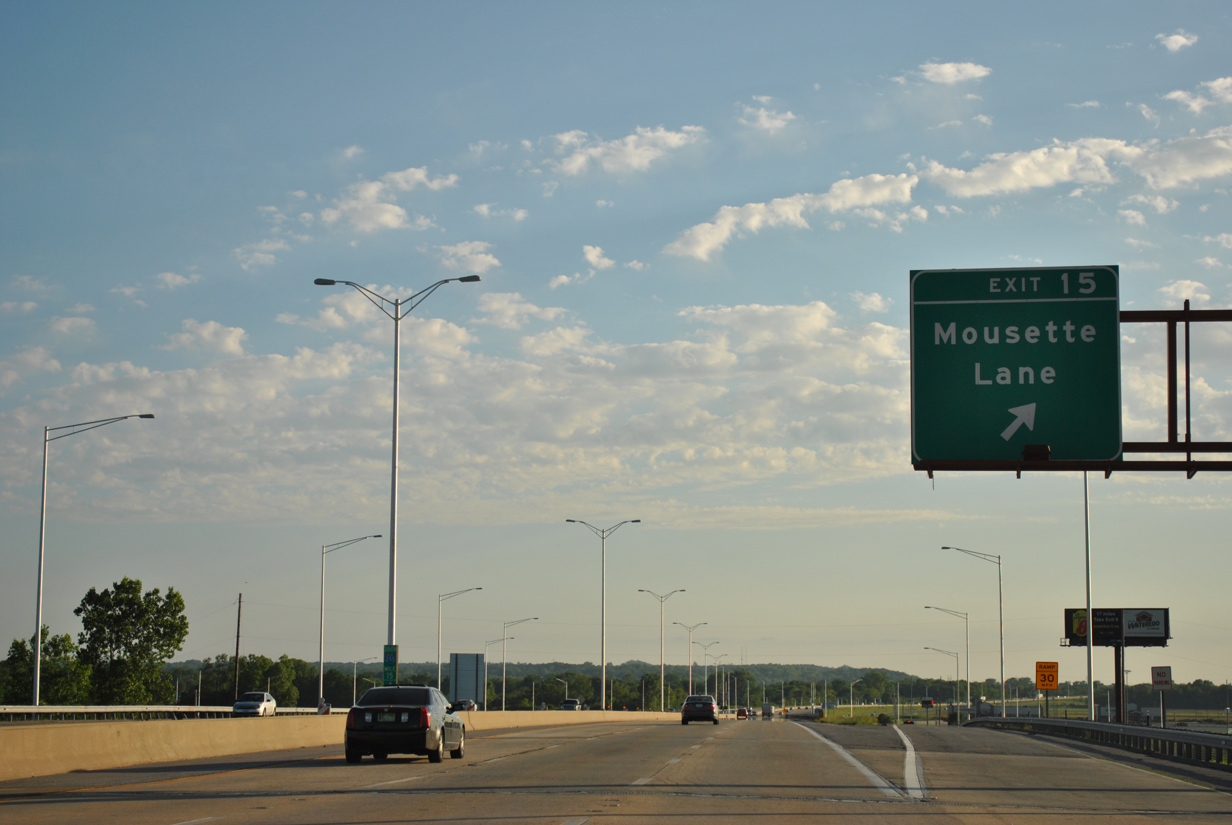
| A partially elevated stretch of Interstate 255 takes the freeway into the city of Centreville between Bond Avenue and Exit 15 with Mousette Lane. 05/03/12 |
|
| Established in the mid 1990s, Exit 15 serves Sauget Business Park located adjacent to St. Louis Downtown Airport (CPS). GCS Ballpark, home of the Frontier League (baseball) Gateway Grizzlies, lies just west of I-255 along Goose Lake Road. 05/03/12 |
|
| One third of a mile ahead of the diamond interchange (Exit 15) with Mousette Lane on I-255/U.S. 50 west. 05/03/12 |
|
| Exit 15 departs the freeway for Mousette Lane (County Route 19). Mousette Lane parallels I-255 northeast into Centreville and southwest to Jerome Lane in the village of Cahokia. 05/03/12 |
|
| The St. Louis skyline spreads into view beyond adjacent Sauget Business Park. 05/03/12 |
|
| I-255/U.S. 50 west enter the village of Cahokia beyond Carol Street. 05/03/12 |
|
| A folded diamond interchange (Exit 13) with an additional loop ramp onto northbound lies one mile ahead with IL 157 (Camp Jackson Road) in Cahokia. 05/03/12 |
|
| IL 157 hooks southeast from Cahokia to eastern reaches of Centreville and Fairview Heights as part of a 40 mile route to Hamel. 05/03/12 |
|
| Exit 13 loops away from I-255/U.S. 50 west for IL 157 (Camp Jackson Road). IL 157 takes a commercialized route northwest to IL 3 that was once a part of U.S. 50 Bypass. 05/03/12 |
|
| Spanning Prairie Du Pont Canal, I-255/U.S. 50 leave Cahokia and pass by unincorporated Stolle. 05/03/12 |
|
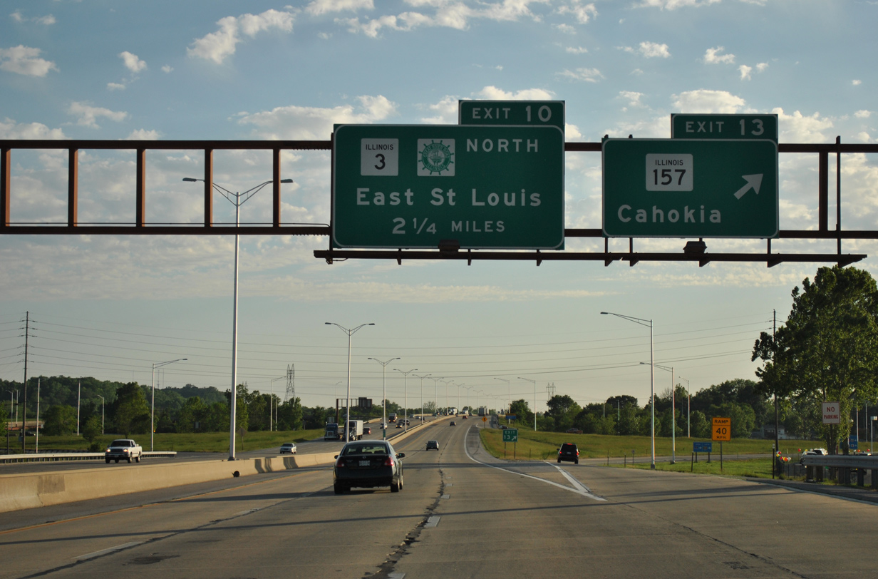
| The freeway bee lines southwest to a trumpet interchange (Exit 10) with IL 3 (Mississippi Avenue) north to Cahokia, Sauget and East St. Louis. 05/03/12 |
|
| IL 3, a 189 mile long highway from Cairo at the southern tip of the state to Grafton, doubles as a Great River Road north to Wood River. 05/03/12 |
|
| I-255/U.S. 50 south enter the village of Dupo at Exit 10 to IL 3 (Mississippi Avenue) north. Historically the former alignment of IL 3 north along Water Street from Dupo to Cahokia was a part of U.S. 50 Bypass. 05/03/12 |
|
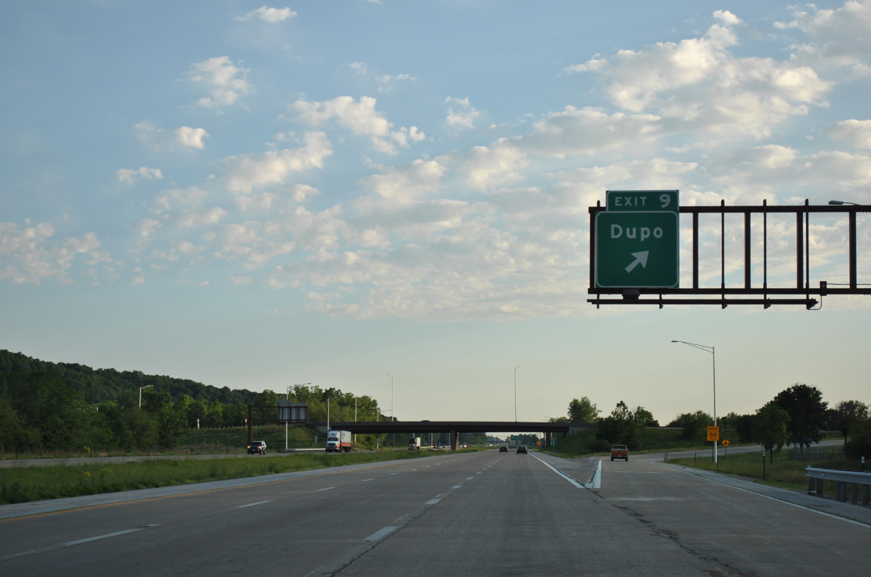
| Construction of Interstate 255 overtook the original alignment of IL 3 beyond forthcoming Exit 9 with S Main Street in Dupo. 05/03/12 |
|
| IL 3 is omitted from this shield assembly posted for I-255/U.S. 50. The state route combines with the freeway for 3.5 miles. 05/03/12 |
|
| S Main Street was extended to meet I-255 at Exit 9 and provide a new link to Old Route 3 leading south to Columbia. Main Street represents former IL 3 north from Bluffview Drive to North Dupo. 05/03/12 |
|
| Entering the parclo interchange (Exit 9) with S Main Street in Dupo on I-255/U.S. 50-IL 3 south. 05/03/12 |
|
| Interstate 255, U.S. 50 and IL 3 parallel Old Route 3 to their separation at a three-wye interchange (Exit 6) in the city of Columbia. 05/03/12 |
|
| IL 3 takes an expressway bypass of Columbia southeast from Exit 6 toward Waterloo while I-255/U.S. 50 turn west. 05/03/12 |
|
| I-255/U.S. 50 south nip the northern corner of Monroe County. 05/03/12 |
|
| IL 3 parts ways with I-255/U.S. 50 west at Left Exit 6. The state route remains a Great River Road southward to Cairo, where the Mississippi combines with the Ohio River. 05/03/12 |
|
| Two lanes depart from I-255 south / U.S. 50 west for IL 3 south to Columbia. IL 3 follows a rural course south from Waterloo to Chester and Shawnee National Forest. 05/03/12 |
Page Updated 01-06-2024.

 South
South


 West
West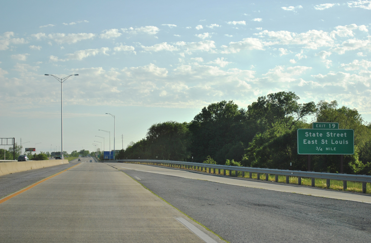


 South
South