|
| Lowering from the apex of the Howard Frankland Bridge over Old Tampa Bay, I-275 travels 23.2 miles through Pinellas County. 08/22/15 |
|
| Interstate 275 transitions from the Howard Frankland Bridge onto both St. Petersburg Parkway and William C. Kramer Highway. These designations overlay all of the freeway on peninsular Pinellas County. 03/04/16 |
|
| I-275 makes a gradual southwesterly turn into the city of St. Petersburg. Three wye interchanges line this stretch, the first connecting with SR 687 (4th Street N) south to U.S. 92 (Gandy Boulevard) at the Gateway area. 08/30/14 |
|
| 4th Street N stems south to Gandy Boulevard, where U.S. 92 turns southward alongside SR 687 through the 4th Street Business District to Downtown St. Petersburg. 03/04/16 |
|
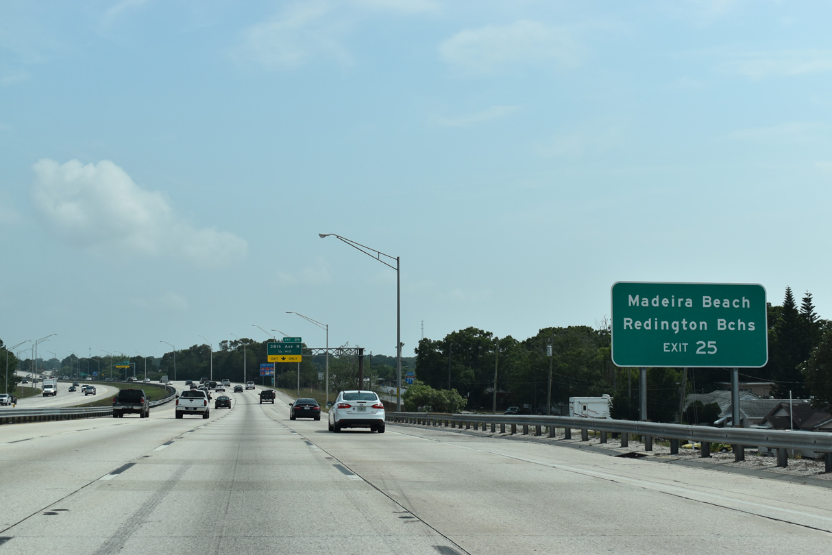
| A portion of the traffic headed south from Tampa along I-275 continues west to the various beach communities on the Gulf of Mexico. An assortment of arterial routes cross the width of Pinellas County, including SR 688 (Ulmerton Road) west to Indian Rocks Beach, CR 296 (Bryan Dairy Road) west toward Indian Shores and CR 184 (38th Avenue N) to U.S. 19 Alternate for the Redington Beaches. 08/30/14 |
|
| The South Beach exits sign follows with distances to Madeira Beach (via 38th Avenue N), Treasure Island (via SR 595 west), and St. Pete Beach (via SR 682 west). 08/30/14 |
|
| A 75-foot decorative monument welcomes drivers along I-275 to St. Petersburg. Maintained by the city of St. Petersburg, the monument was erected by August 2012 at a cost of $600,000 from donated funds.1 08/30/14 |
|
| Exit 32 departs Interstate 275 south for the SR 687 (4th Street N). The urban state road measures 9.45 miles in length from the Howard Frankland Bridge approach to I-175 and SR 594 (5th Avenue S) south of Downtown St. Petersburg. 08/30/14 |
|
| Ramps for both SR 688 (Ulmerton Road) west and CR 803 (Martin Luther King, Jr. Street) south partition from I-275 south in 0.6 miles. SR 688 commences a 13.4 mile route across Pinellas County to SR 699 (Gulf Boulevard) at Exit 31. SR 686 overlaps with SR 688 between Feather Sound and St. Petersburg-Clearwater International Airport (PIE). 08/30/14 |
|
| Largo lies west along SR 686 (East Bay Drive) and SR 688 (Ulmerton Road) roughly between U.S. 19 and U.S. 19 Alternate (Seminole Boulevard). 03/04/16 |
|
| Martin Luther King Jr. Street (9th Street N) comprises a four lane boulevard leading south between the Meadowlawn and Fossil Park neighborhoods to Historic Uptown in St. Petersburg. Shields for CR 803 appear along northern reaches of the route. 08/30/14 |
|
| A two lane ramp leaves Interstate 275 south at Exit 31. SR 688 provides connections to SR 686 (Roosevelt Boulevard) west for PIE Airport and both the Bayside Bridge (CR 611) and U.S. 19 north to Clearwater. 03/04/16 |
|
| Exit 31 partitions for ramps to SR 688 (Ulmerton Road) westbound for Largo, Pinellas Park and Indian Rocks Beach and to Martin Luther King Jr. Street (CR 803) south to St. Petersburg. 03/06/19 |
|
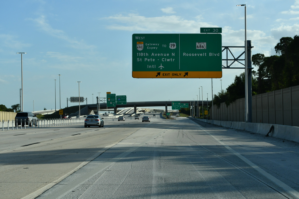
| Interstate 275 angles southwest from SR 688 one mile to a diamond and two-wye interchange (Exit 30) with SR 686 (Roosevelt Boulevard) and CR 296 (118th Avenue North / Bryan Dairy Road) west. 08/30/14 |
|
| State Road 686 branches three miles northwest from SR 694 (Gandy Freeway) in the Gateway area of St. Petersburg to SR 688 (Ulmerton Road) by Feather Sound. County Road 296 comprises a short freeway spur linking I-275 with 118th Avenue N. 08/30/14 |
|
| Underway from August 2017 to Summer 2021 early 2023 Spring 2024, the Gateway Expressway Project constructs an elevated toll road system for SR 690 west along 118th Avenue N to U.S. 19 and SR 686A northwest from 40th Street N to PIE Airport and the Bayside Bridge (CR 611). 12/24/21 |
|
| Exit 30 partitions into ramps for SR 686 (Roosevelt Boulevard) to Largo and the Gateway area in St. Petersburg and CR 296 (118th Avenue N) west to Pinellas Park. 08/22/15 |
|
| Interstate 275 turns southward ahead of Exit 28 with State Road 694 (Gandy Boulevard) west. SR 694 continues Gandy Boulevard west from U.S. 92 along an elevated freeway between 4th Street N and 16th Street N. 05/28/14 |
|
| SR 694 transitions onto Park Boulevard, a commercial arterial west from U.S. 19 to SR 693 at 66th Street N. CR 694 extends Park Boulevard west to Seminole and SR 699 at Indian Shores. 05/28/14 |
|
| Exit 28 defaults onto SR 694 (Gandy Boulevard) westbound ahead of the signalized intersection with Grand Boulevard / 28th Street North. A SPUI with U.S. 19 follows by the Shoppes of Park Place. 08/30/14 |
|
| A distance sign stands along the ramp to SR 694 west for the cities of Pinellas Park and Seminole and town of Indian Shores. 05/28/14 |
|
| Interstate 275 runs along the west side of Sawgrass Lake Park, a county facility featuring hiking trails, a boardwalk and viewing areas for turtles and alligators in their natural habitat. 05/28/14 |
|
| Interstate 275 makes the first of several S-curves through the city of St. Petersburg ahead of the exchange (Exit 26) with 54th Avenue N (CR 202). 05/28/14 |
|
| 54th Avenue N (County Road 202) travels west from Interstate 275 through unincorporated Lealman to the town of Kenneth City. 08/30/14 |
|
| Signed in unincorporated areas of Pinellas County, CR 202 overlays 54th Avenue N west to CR 1 (Park Street) at Seminole and east to U.S. 92/SR 687 (4th Street N) at Edgemoor in St. Petersburg. 05/28/14 |
|
| A six-ramp parclo interchange joins Interstate 275 and 54th Avenue N at Exit 26. 05/18/19 |
|
| 54th Avenue N (CR 202) west through Lealman connects with Haines Avenue (CR 691), a former route of U.S. 19 southeast from Pinellas Park into St. Petersburg. 12/21/21 |
|
| 54th Avenue N runs 2.51 miles between U.S. 19 (34th Street N) and U.S. 92 (4th Street N) in St. Petersburg. 12/21/21 |
|
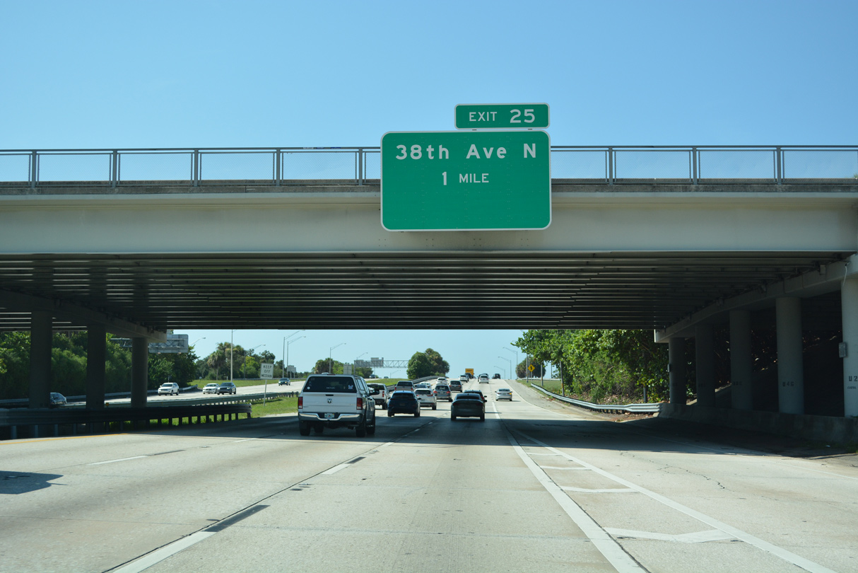
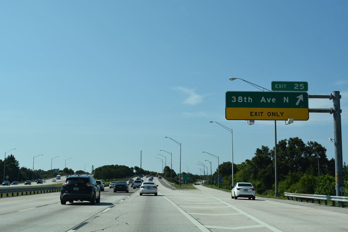
| Straddling the St. Petersburg city line east of Lealman, I-275 advances one mile south to a diamond interchange (Exit 25) with 38th Avenue N (CR 184). 05/18/19 |
|
| County Road 184 (38th Avenue N) west connects I-275 with U.S. 19 Alternate (Tyrone Boulevard) north to SR 666 (Tom Stuart Causeway) at Bay Pines area. SR 666 spans the Intracoastal Waterway southwest to SR 699 (Gulf Boulevard) for Madeira and Redington Beaches. 08/30/14 |
|
| 38th Avenue N serves the St. Pete Heights and Station View neighborhoods to the west and Oakwood Gardens and Harris Park to the east The urban arterial forms part of the St. Petersburg street grid system, where numbered avenues decrease southward to Central Avenue. 05/18/19 |
|
| A lane drop occurs at Exit 25 for 38th Avenue N. 38th Avenue N leads east to U.S. 92 (4th Street N) at the Northeast shopping center and west from U.S. 19 (34th Street N) through the Disston Heights and Jungle Terrace communities in west St. Petersburg. 05/18/19 |
|
| U.S. 19/92 trailblazers stand along off-ramps for both 38th and 22nd Avenue N from I-275. The parallel US highways represent the main retail corridors through St. Petersburg. 02/21/06 |
|
| 22nd Avenue N joins Interstate 275 with the Ponce DeLeon, Woodlawn, and Euclid neighborhoods in one mile. 05/28/14, 05/18/19 |
|
| A series of S-curves precede the exchanges with SR 595 (5th Avenue N), I-375 (North Bay Drive) and I-175 (South Bay Drive) for Downtown St. Petersburg. 05/18/19 |
|
| Exit 24 parts ways with I-275 south beyond the pedestrian bridge at 27th Avenue N. 22nd Street N east passes between the Crescent Lake and Crescent Heights neighborhoods to meet U.S. 92 (4th Street N) across from Historic Old Northeast. 22nd Avenue N (CR 690) west extends to U.S. 19 Alternate (Tyrone Boulevard) and SR 693 (66th Street N) at Tyrone Square Mall. 05/18/19 |
|
| Southbound I-275 expands to four lanes from the 22nd Avenue N entrance ramp and Left Exit 23A for Interstate 375 (North Bay Drive). I-375 comprises a 1.34 mile long freeway spur between the Historic Uptown neighborhood and Downtown St. Petersburg. 05/18/19 |
|
| I-275 crosses over a CSX Railroad line beyond this confirming marker by the North Kenwood neighborhood. 05/18/19 |
|
| Exit 23B follows for SR 595 & U.S. 19 Alternate (5th Avenue N) at Historic Kenwood. 05/18/19 |
|
| Continuing south by Booker Creek Park, two lanes depart I-275 south in a third of a mile for I-375 (North Bay Drive). North Bay Drive is signed as the most direct route to both Sundial, a retail complex Downtown, and The Pier, St. Petersburg's municipal slip into Tampa Bay. 05/18/19 |
|
| A half diamond interchange (Exit 23B) joins I-275 with SR 595 (5th Avenue N) ahead of the multi level exchange (Exit 23A) with Interstate 375. 05/18/19 |
|
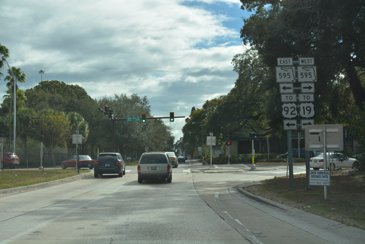
| Although not acknowledged from I-275, SR 595 doubles as U.S. 19 Alternate. SR 595 is the hidden counterpart of U.S. 19 Alternate from SR 687 (4th Street N) and U.S. 92 at Downtown St. Petersburg north to Seminole and Largo. The state road is partially signed along 4th/5th Avenue N by I-275. 01/13/17 |
|
| U.S. 19 Alternate/SR 595 follow 5th Avenue N west to Tyrone Boulevard. 5th Avenue N continues to SR 693 (66th Street), which connects Pinellas Park with South Pasadena, St. Pete Beach and Treasure Island via Central Avenue west. 01/13/17 |
|
| Interstate 275 south arrives at Left Exit 23A for I-375 (North Bay Drive) east. I-375 (unsigned SR 592) winds east between the couplet of 4th and 5th Avenues N (SR 595) to St. Petersburg Coliseum at 5th Street N. Interstate 175 (South Bay Drive) spurs east from the ensuing left exit by Tropicana Field to 4th Street S (SR 687) by USF St. Petersburg. 05/18/19 |
|
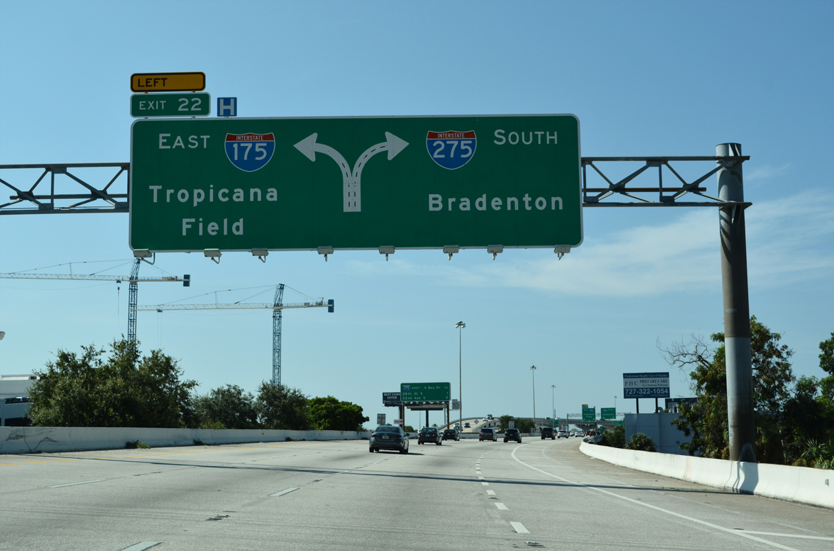
| Interstate 275 elevates southward across Central Avenue and the St. Petersburg street grid to the three wye interchange (Exit 22) with I-175 (South Bay Drive) east. I-175 is just a tenth of a mile longer than I-375. 05/18/19 |
|
| Interstate 175 (SR 594) provides a high speed route east to the south end of Downtown and the St. Petersburg waterfront for Al Lang Stadium, Duke Energy Center for the Arts - Mahaffey Theater and the Dali Museum. 05/18/19 |
|
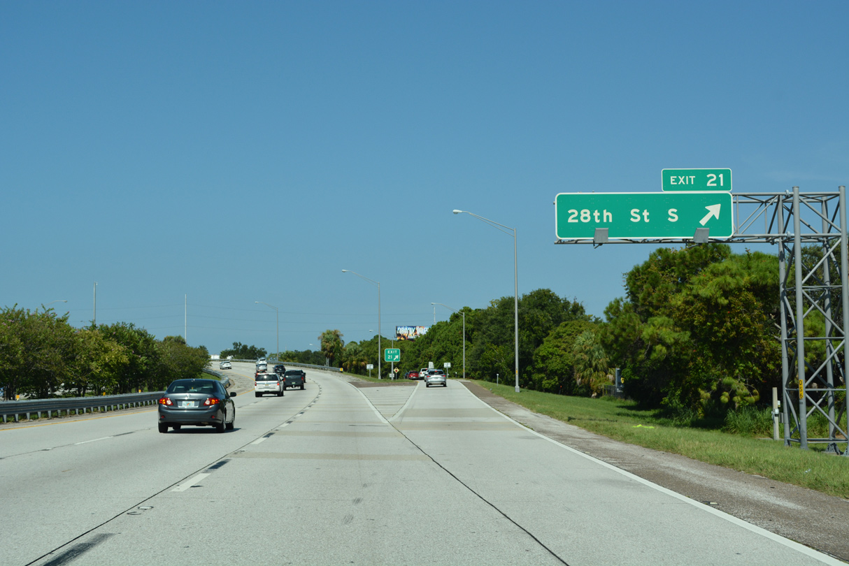
| Interstate 275 arcs southwest from I-175 to the Palmetto Park neighborhood at 28th Street S (Exit 21). 05/18/19 |
|
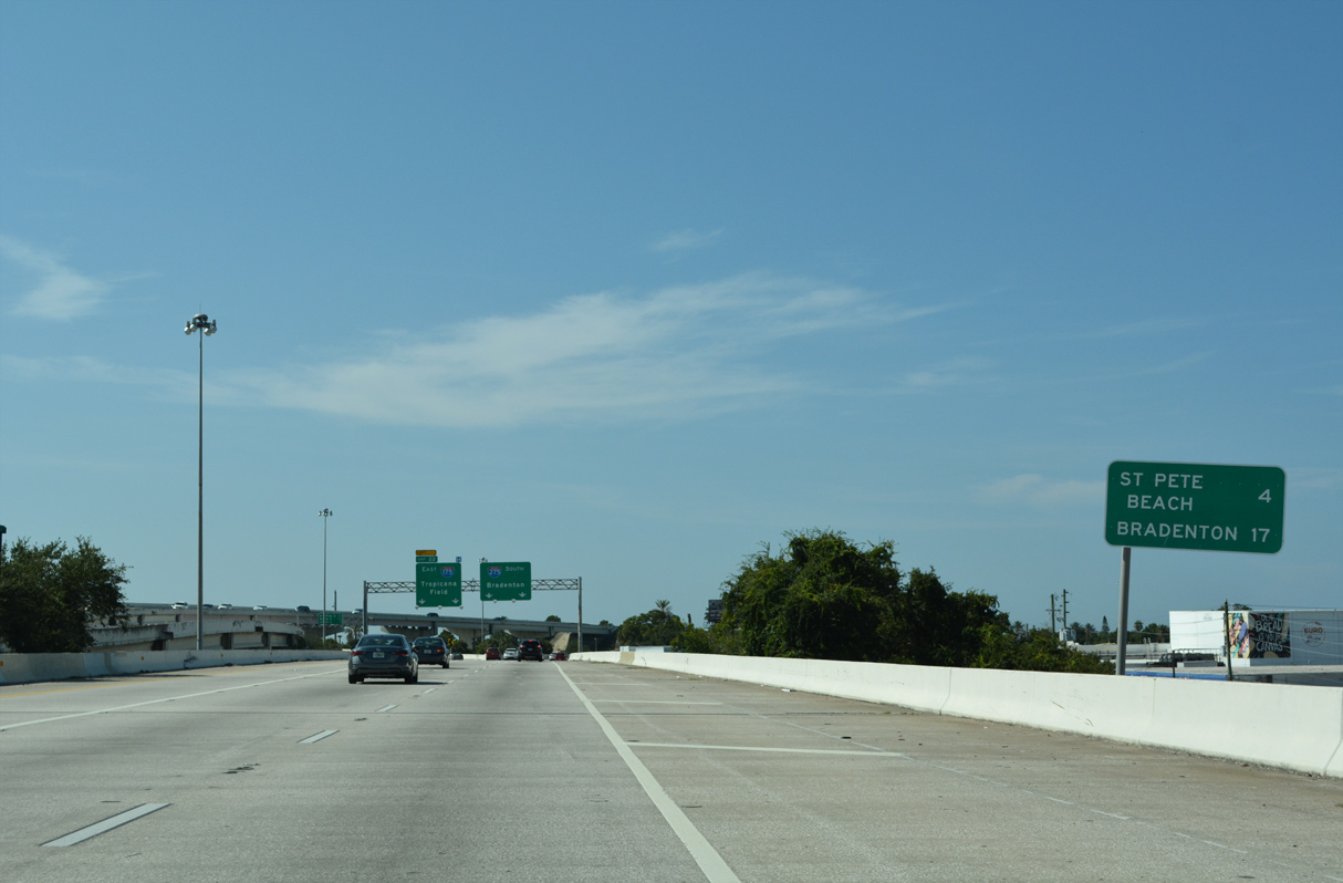
| A small distance sign preceding Exit 22 references St. Pete Beach (4 miles) via SR 682 (Pinellas Bayway) west from Exit 17 and the Manatee County seat of Bradenton (17 miles) via U.S. 19 and U.S. 41 south. 05/18/19 |
|
| Southbound traffic bottlenecks to two lanes at Left Exit 22 for Interstate 175. Ramps along South Bay Drive connect with the couplet of Dr. Martin Luther King, Jr. and 8th Street S at Campbell Park and Tropicana Field (home of the MLB Tampa Bay Rays). 05/18/19 |
|
| A half diamond interchange (Exit 21) joins southbound Interstate 275 with 28th Street S in a half mile. 05/18/19 |
|
| Reassurance shield posted for Interstate 275 between the west end of I-175 and the 22nd Street S underpass. 05/18/19 |
|
| 28th Street S leads south from the Central Avenue Business District to Del Holmes Park on Lake Maggiore. Serving a variety of residential, commercial, and industrial areas, 28th Street extends north to 62nd Avenue N at Lealman. 05/18/19 |
|
| The split diamond interchange (Exit 19) with 22nd Avenue S (CR 138) is the third to last exit for St. Petersburg along southbound I-275. 05/18/19 |
|
| 22nd Avenue S (CR 138) leads west from Highland Oaks in South St. Petersburg to the cities of Gulfport and South Pasadena. 05/18/19 |
|
| A ramp stub precedes the 18th Avenue S underpass and departure of Exit 19 for 22nd Avenue S. The stub was built for the unconstructed St. Petersburg-Clearwater Expressway. 22nd Avenue S east extends to the Tropical Shores community on Tampa Bay and west to SR 693 (Pasadena Avenue) for St. Pete Beach. 05/18/19 |
|
| A wide outside shoulder at 22nd Avenue S alludes to the unbuilt St. Petersburg-Clearwater Expressway, which would have connected U.S. 19 Alternate/SR 666 at Bay Pines with I-275 at 31st Street S. 08/05/14 |
|
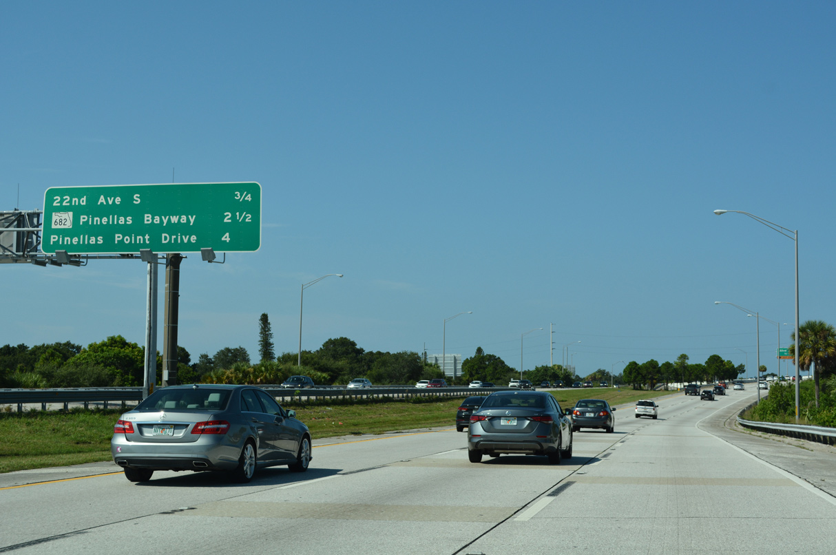
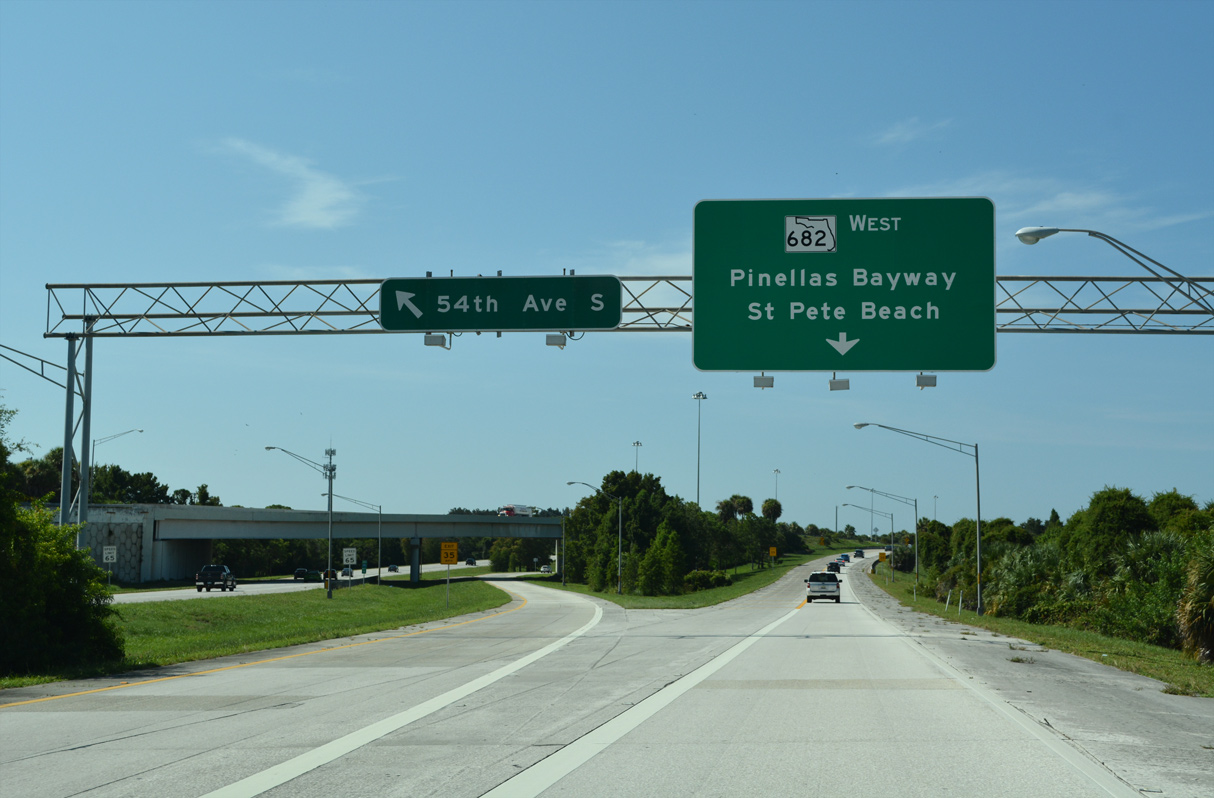
| Forthcoming SR 682 travels 3.72 miles west from I-275 across the Pinellas Bayway to St. Pete Beach and Pass-A-Grille. 05/18/19 |
|
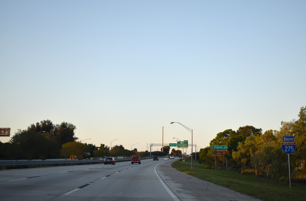
| Interstate 275 shifts eastward between parallel U.S. 19 (34th Street S) and 31st Street S on the approach to Exit 17 with SR 682. The Pinellas Bayway connects the freeway with adjacent Eckerd College and Fort DeSoto Park, a county maintained facility on the islands protruding outward into Tampa Bay, via SR 679 (Pinellas Bayway South). 05/18/19 |
|
| Pinellas Bayway is a tolled bridge system spanning waters of Boca Ciega Bay west across Bayway Isle and Isla del Sol and south to Tierra Verde and Mullet Key. 05/18/19 |
|
| Southbound Interstate 275 reaches Exit 17 for SR 682 (Pinellas Bayway) west and SR 699 (Gulf Boulevard) at St. Pete Beach and 54th Avenue S east to the Lakewood Estates and Bayou Highlands neighborhoods in South St. Petersburg. 05/18/19 |
|
| The roadways along Interstate 275 invert as they cross over 54th Avenue S. The configuration was a compromise made to reduce effects of the freeway on adjacent land owned by Eckerd College. 05/18/19 |
|
| Exit 17 splits into separate ramps to SR 682 west at U.S. 19 and Eckerd College and 54th Avenue S east to Arlington Park. 05/25/19 |
|
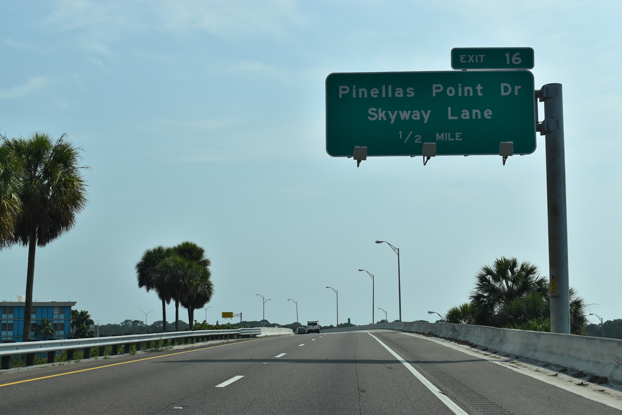
| Pinellas Point Drive ties into Interstate 275 at Exit 16. Leading east from Maximo Park, Pinellas Point Drive meanders along the Maximo Point and Pinellas Point areas on Tampa Bay. 05/18/19 |
|
| The Interstate 275 roadways shift back ahead of Exit 16, the last departure point before the Sunshine Skyway Bridge toll plaza. 08/05/14 |
|
| Exit 16 is a diamond interchange with Pinellas Point Drive at Skyway Lane, a east side frontage road serving several condominium complexes on Tampa Bay. 05/18/19 |
|
| The off-ramp at Exit 16 descends between the mainline of I-275 and the entrance ramp for U.S. 19 (34th Street S) south. Maximo Park lies along the west side of the exchange with Pinellas Point Drive. 08/05/14 |
|
| U.S. 19 combines with I-275 south across the Sunshine Skyway Bridge to Tierra Ceia in Manatee County. 08/05/14 |
|
| Omitting U.S. 19, this southbound reassurance shield for I-275 precedes the Dick Misener Bridge spanning a spur of the Intracoastal Waterway. 05/18/19 |
|
| The Sunshine Skyway Bridge main line toll plaza along I-275 south lies beyond the Dick Misener Bridge. 05/18/19 |
|
| The Sunshine Skyway comes into view along I-275/U.S. 19 south on the Dick Misener Bridge. The cable-stayed bridge opened in 1987. 05/18/19, 08/30/14 |
|
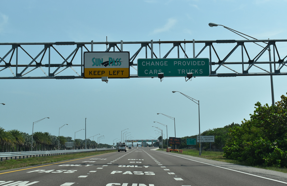
| Tolls for the Sunshine Skyway are collected at a six lane plaza with a two all electronic tolling (AET) lanes for Sunpass account holders. 05/18/19 |
|
| Continuing from the toll collection point, I-275/U.S. 19 advance one mile to the north Skyway rest area. The rest area is home to Blackthorn Memorial Park, a monument commemorating the largest peacetime loss of life in United States Coast Guard History, the 1980 collision of the CGC Blackthorn (WLB-391) with the oil tanker S.S. Capricorn. The tragedy took place west of the former Sunshine Skyway crossing and North Skyway Fishing Pier. 05/18/19 |
|
| Entering the unnumbered diamond interchange for the North Skyway Fishing Pier and rest area on I-275/U.S. 19 south. Extending 0.6 miles out into Tampa Bay, the fee-based North Skyway Fishing Pier consists of part of the original Sunshine Skyway Bridge. 05/18/19 |
|
| The Bob Graham Sunshine Skyway Bridge stretches 4.1 miles across Tampa Bay. Graham was instrumental in the design and construction for the replacement of the prior cantilever spans. The span was officially renamed in 2005 after the former Florida Governor and U.S. Senator. 05/18/19 |
|
| I-275/U.S. 19 proceed five miles southeast to the diamond interchange with the access roads for the South Skyway Fishing Pier and rest area. 10/08/16 |
|
| The apex of the Sunshine Skyway falls within a 3.2 mile section of I-275/U.S. 19 through Hillsborough County. 05/18/19 |
|
| A ship sailing through the main channel is a common site for motorists crossing the Sunshine Skyway. With a maximum vertical clearance of 193 feet, the cable-stayed bridge is tall enough to accommodate most ocean going vessels and cruise ships. 08/24/13, 05/18/19 |
|
| Anchored by 42 steel cables, two 435-foot high towers support the Skyway bridge deck over the Tampa Bay shipping channel. A lighting system illuminates the cables. 08/24/13 |
|
| Descending from the apex of the main span of the Sunshine Skyway Bridge, the South Skyway Fishing Pier comes into view. Extending 1.6 miles into south Tampa Bay, the pier makes up the southern portion of the former crossing. 05/18/19, 10/08/16 |
|
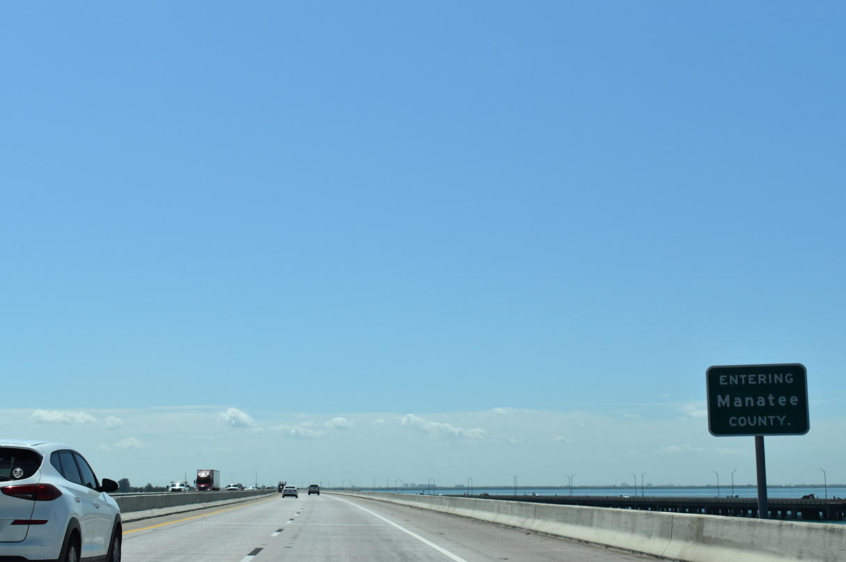
| I-275/U.S. 19 arc southeast into Manatee County near the end of the Sunshine Skyway bridge. 10/08/16 |
|
| The exit for the South Skyway Fishing Pier departs in one mile. Like its northern counterpart, a fee is accessed for use of the pier and its facilities. 10/08/16 |
|
| The south Skyway rest area lies on the north side of I-275/U.S. 19 while the access road to the fishing pier runs 1.25 miles west to the entrance. 10/08/16 |
|
| Interstate 275 south passes by the northbound toll plaza 0.75 miles ahead of the split with U.S. 19 south to Palmetto. 08/05/14 |
|
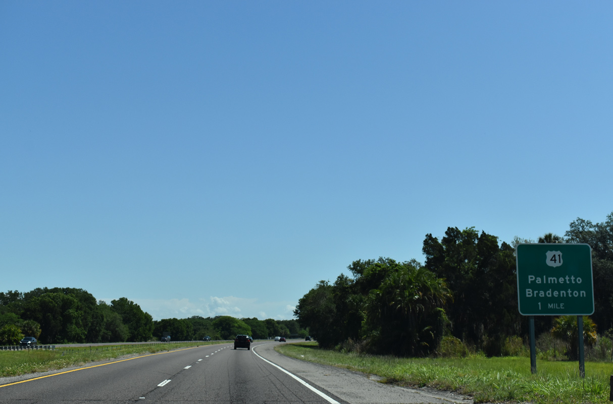
| U.S. 19 branches 2.8 miles south from I-275 to conclude at an exchange with U.S. 41 north at Memphis. U.S. 41 south partitions with U.S. 41 Business to Palmetto en route to Bradenton. 08/05/14 |
|
| Two lanes separate from I-275 south for U.S. 19 at a wye interchange (Exit 5). 08/05/14 |
|
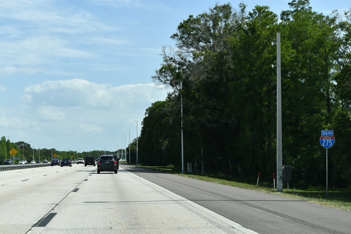
| I-275 south continues 5.23 miles to converge with Interstate 75 ahead of Sarasota and Fort Myers. 05/18/19 |
|
| Two miles out from a diamond interchange (Exit 2) with U.S. 41 along Interstate 275 south. The freeway crosses over the Terra Ceia river in 0.7 miles. 12/24/16 |
|
| U.S. 41 (Tamiami Trail) heads southwest from I-275 to Palmetto in 5.3 miles and Bradenton in 7.2 miles. 05/18/19 |
|
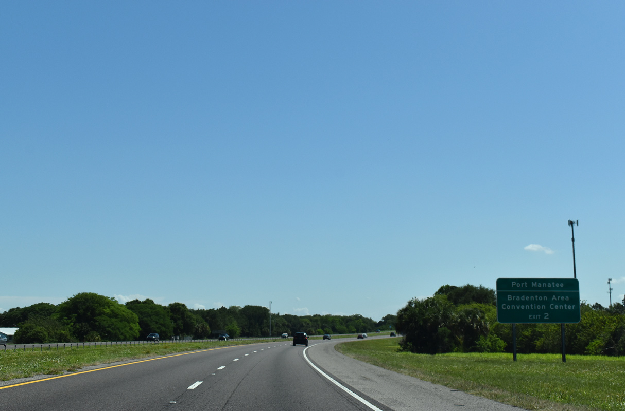
| Exit 2 for U.S. 41 leaves I-275 south beyond a CSX Railroad underpass. U.S. 41 remains a rural highway north to Port Manatee and Ruskin in neighboring Hillsborough County. 08/05/14 |
|
| Interstate 275 southbound separates with the flyover for I-75 north back to Tampa in one mile. 08/05/14 |
|
| The entrance ramp from U.S. 41 adds an auxiliary lane from Frog Creek east to the unnumbered exit for Interstate 75 north. The mainline defaults onto I-75 south ahead of Ellenton. 08/05/14 |
|
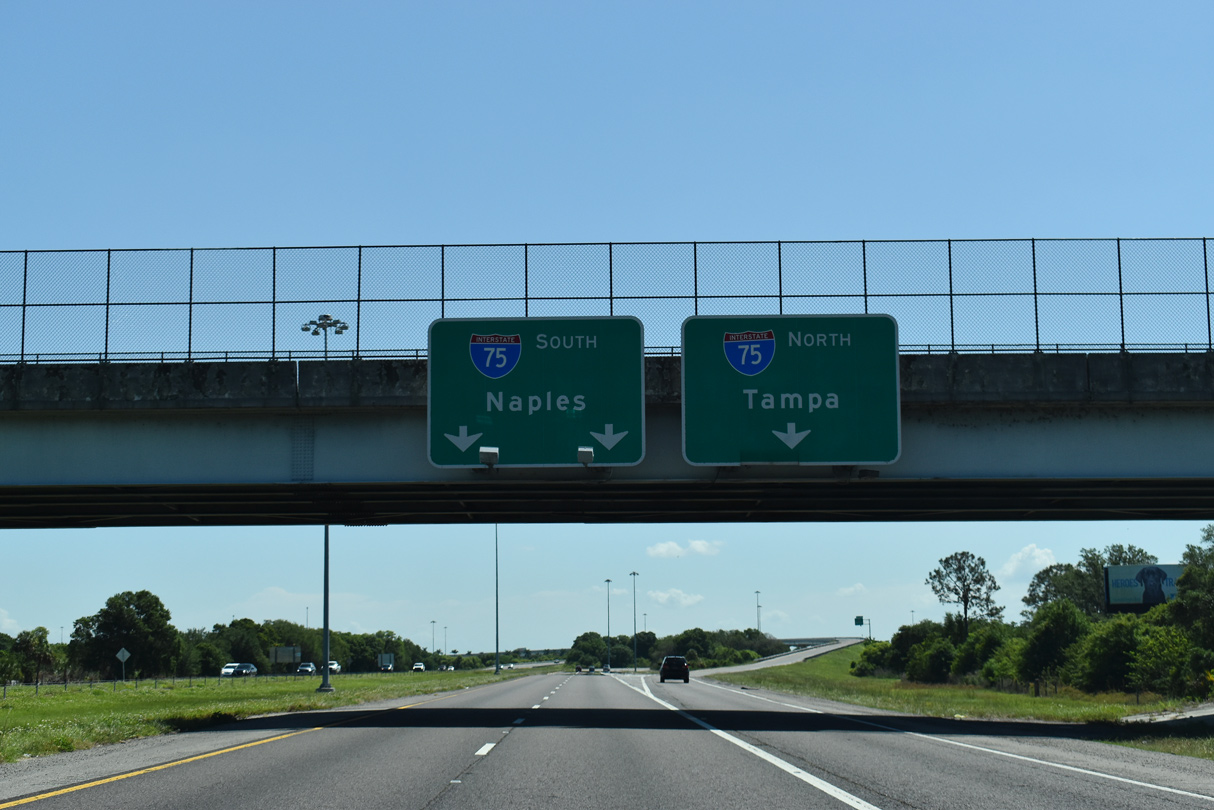
| 36th Avenue E (Ellenton-Gillette Road) spans I-275 south at the three-wye interchange with Interstate 75. I-75 travels south from the Tampa Bay area through Sarasota, Fort Myers and Naples to Alligator Alley across the Everglades. 08/05/14 |
|
| The flyover to I-75 north merges with the freeway mainline ahead of Exit 229 with Moccasin Wallow Road (CR 683) to adjacent suburban development and the community of Parrish. 08/30/14 |
02/21/06, 08/24/13, 05/28/14, 08/05/14, 08/30/14, 08/22/15, 03/04/16, 10/08/16, 12/24/16, 01/13/17, 03/06/19, 05/18/19, 05/25/19, 12/21/21, 12/24/21 by AARoads
Page Updated 12-27-2021.

 South
South