|
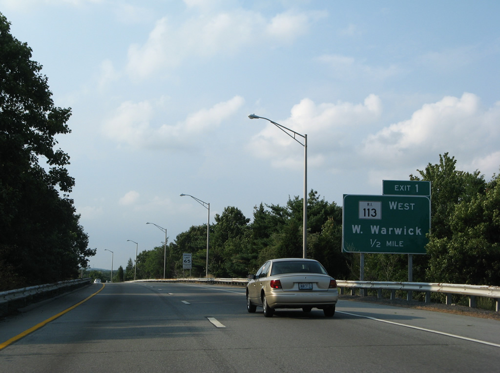
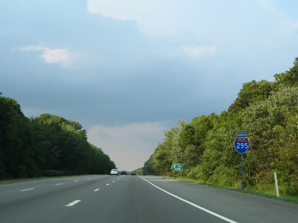
| Interstate 295 northbound peels away from the left lanes of Interstate 95 northbound at West Warwick via a wye ramps with Route 113 (East Avenue). 07/28/07 |
|
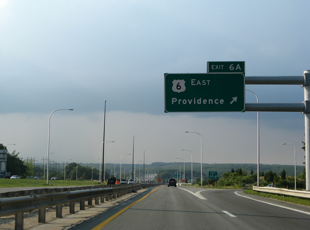
| The first three interchanges of Interstate 295 join the freeway with Rhode Island state highways in the West Warwick and Cranston vicinity. A distance sign featuring just the state route shields appeared shortly after the partition with Interstate 95 north; it was replaced with an advance sign for R.I. 113 (East Avenue) by 2007. 06/26/05, 07/28/07 |
|
| Route 113 (East Avenue) travels across Interstates 95 and 295 between Route 2 (Bald Hill Road) and Route 5 (Greenwich Avenue). Exit 1 serves the westbound direction of East Avenue toward West Warwick. Drivers bound for Route 113 eastbound should use Interstate 95 north's Exit 12 for Warwick. 07/28/07 |
|
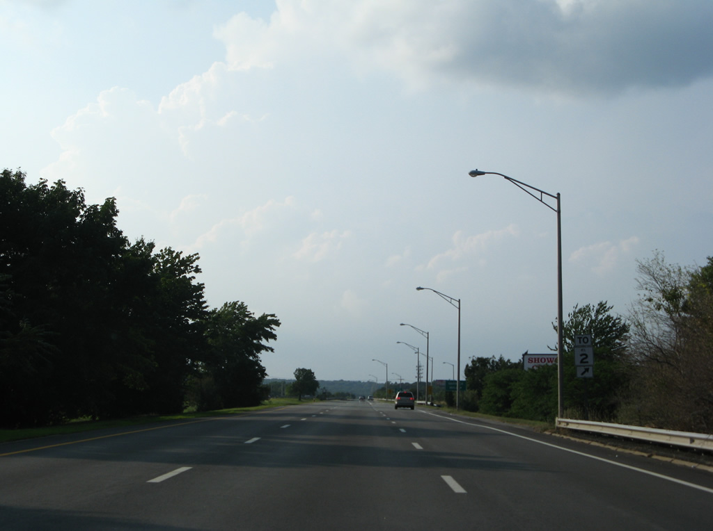
| Interstate 295 spans the Pawtucket River between Route 113 (Exit 1) and Route 2 (Bald Hill Road) at Exit 2. Route 2 parallels Interstate 95 northward from Frenchtown to Cranston. The freeway locally serves the city of Cranston via New London Avenue. 07/28/07 |
|
| A Route 2 trailblazer directs motorists to the Exit 2 parclo interchange situated east of Natick and west of Pontiac with Bald Hill Road. 07/28/07 |
|
| Exit 2 splits into separate ramps for Route 2 (Bald Hill Road) north to Moonscut and for the adjacent Warwick Mall east of R.I. 2 and west of R.I. 5 (Greenwich Avenue). 07/28/07 |
|
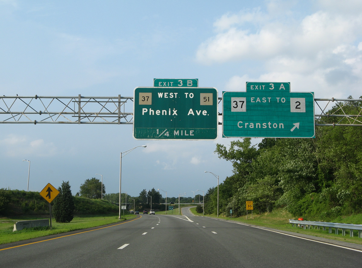
| Interstate 295 enters Providence County ahead of the Exits 3A/B three-quarter cloverleaf interchange with Route 37. 07/28/07 |
|
| Route 37 comprises an east-west freeway between nearby Phenix Avenue and U.S. 1 near T.F. Green State Airport. The limited access highway was once considered for the eastern extent of unconstructed Interstate 84 from Connecticut and also as part of the Interstate 895 Providence bypass. 06/26/05, 07/28/07 |
|
| One quarter mile south of the Exit 3 interchange at the Wilbur Avenue under crossing in Cranston. The Route 37 freeway ends just west of Interstate 295 at Natlick Avenue, midway between its intersections with Phenix and Wilbur Avenues. Phenix Avenue meanders southwest from Meshanticut to Phenix locally in Cranston. 06/26/05 |
|
| Exit 3A departs Interstate 295 northbound onto Route 37 eastbound for Route 2 (New London Avenue) and Warwick. Route 37 meets Interstate 95 in two miles. Meanwhile an original button copy overhead advised motorists of the upcoming Exit 3B loop ramp onto Route 37 west to Route 51 and Phenix Avenue. A left side on-ramp brings traffic onto northbound from Route 37 east. 07/28/07 |
|
| The Route 37 freeway passes overhead Interstate 295 northbound. Devoid was the Exit 3B guide sign for the westbound off-ramp to Phenix Avenue. Route 37 officially ends at its interchange with Interstate 295. Route 51 represents a non-state maintained roadway following Phenix Avenue through West Warwick and Cranston.1 06/26/05 |
|
| Interstate 295 passes through several rock cuts on its 22.35 mile routing through the Ocean State. Meshanticut State Park in Cranston lies to the east and a rock quarry to the west. 07/28/07 |
|
| Route 12 (Scituate Avenue) crosses over Interstate 295 on the half mile approach to the parclo interchange (Exit 4) with Route 14 (Plainfield Pike). Original button copy was replaced in 2007. 07/28/07 |
|
| A ground level button copy sign was replaced with a new overhead by 2007 to direct motorists onto the Exit 4 off-ramp to Route 14 (Plainfield Pike). Route 14 travels in an east-west fashion from the Connecticut state line near Rice City to the city of Providence. Plainfield Pike locally serves the Thornton and north Cranston areas. 06/26/05, 07/28/07 |
|
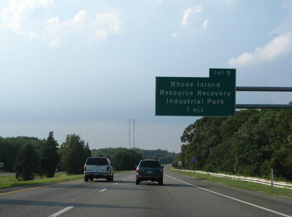
| Exit 5 serves the Rhode Island Resource Recovery Industrial Park in Johnston. The forthcoming diamond interchange joins Interstate 295 with a disjointed section of Scituate Avenue. Scituate Avenue was severed at the east end of the interchange, likely to discourage truck traffic from using the road to reach Route 5 (Atwood Avenue) to the east. 07/28/07 |
|
| Now one half mile south of the Exit 5 off-ramp to Scituate Avenue westbound to the Rhode Island Resource Recovery Industrial Park. The industrial park is run by the Rhode Island Resource Recovery Corporation, a state environmental agency that deals with waste management and materials recycling. 07/28/07 |
|
| Northbound at the Exit 5 ramp departure to Scituate Avenue west. Scituate Avenue meets Shun Pike and a disjointed section of Old Pocasset Road to the west. Shun Pike serves industrial areas west and south to Route 14 (Plainfield Avenue) and Peck Hill Road in west Johnston. 07/28/07 |
|
| Interstate 295 next meets the U.S. 6 freeway leading west from Providence at Exit 6 in one half mile. 07/28/07 |
|
| Interstate 295 reassurance shield posted at the curve between Sutamachute and Suckatunkanuc Hills. The freeway spans Dry Brook in the valley. 07/28/07 |
|
| A lengthy collector distributor roadway system joins Interstate 295 to both U.S. 6 and adjacent U.S. 6A (Hartford Avenue) at the Exits 6A/B/C complex. Exit 6B consists of a loop ramp onto the ending U.S. 6 freeway ramp to Interstate 295 south. 07/28/07 |
|
| All traffic to U.S. 6 east to Providence or west to Hartford, Connecticut should branch away from the Interstate 295 mainline at the Exit 6 c/d roadway. U.S. 6 utilizes the c/d roadway to make the jump between the freeway and Hartford Avenue (U.S. 6A), an east-west arterial out of Johnston. 07/28/07 |
|
| The east-west U.S. 6 freeway was built in anticipation of Interstate 84, and the directional cloverleaf interchange between Interstate 295 and U.S. 6 includes provisions for the unconstructed freeway west toward Hartford. Interstate 84 was never built between Manchester and Providence with the exception of the Willimantic Bypass in Connecticut. 07/28/07 |
|
| Sign changes made between 2005 and 2007 assigned Exit suffixes to the three ramps from Interstate 295 north. This view looks at a replaced sign bridge at Exit 6A. 06/26/05 |
|
| U.S. 6 follows a freeway east to Route 10 (Huntington Expressway), merging with the state highway on the approach to downtown Providence and Interstate 95. U.S. 6A parallels the freeway along Hartford Avenue, the original routing of U.S. 6. 06/26/05 |
|
| Exit 6B joins the ending U.S. 6 westbound freeway at its loop ramp onto Interstate 295 south. Stubs are present west of I-295 that were intended for Interstate 84 west to Scituate Reservoir. 06/26/05 |
|
| U.S. 6 resumes its westward course via Exit 6C for South Foster and Danielson, Willimantic, Manchester, and ultimately Hartford, Connecticut. 07/28/07 |
|
| Exit 6C consists of a folded diamond interchange with U.S. 6 (Hartford Avenue) west and U.S. 6A (Hartford Avenue) east in Johnston. 07/28/07 |
|
| Continuing west from Interstate 295, U.S. 6 crosses the Connecticut state line in 15 miles. Overall the US highway stretches 3,205 miles from Provincetown, Massachusetts to Bishop, California. 07/28/07 |
|
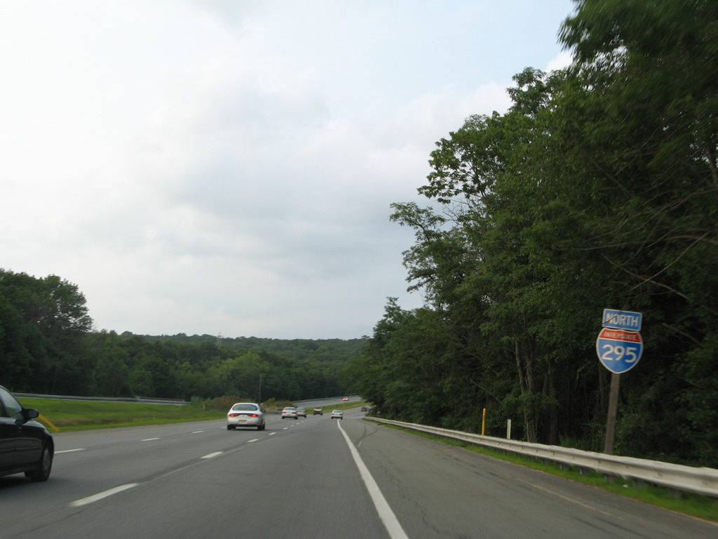
| Interstate 295 carries six lanes overall from U.S. 6 northward to Massachusetts. 07/28/07 |
|
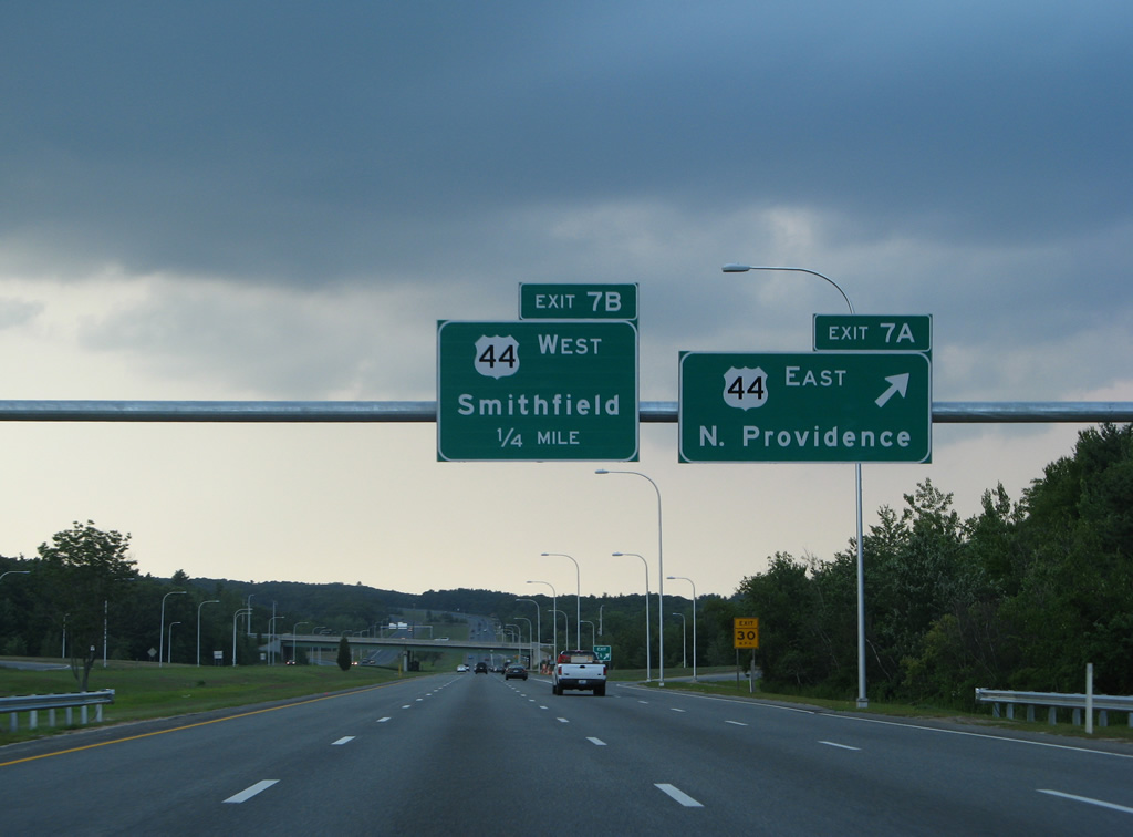
| Next in line for northbound motorists is the cloverleaf interchange (Exits 7A/B) with U.S. 44 (Putnam Pike) in two miles. 07/28/07 |
|
| U.S. 44 travels 26.2 miles across Rhode Island from West Glocester to East Providence. The US highway meets Interstate 295 within the Town of Smithfield, east of Greenville. 07/28/07 |
|
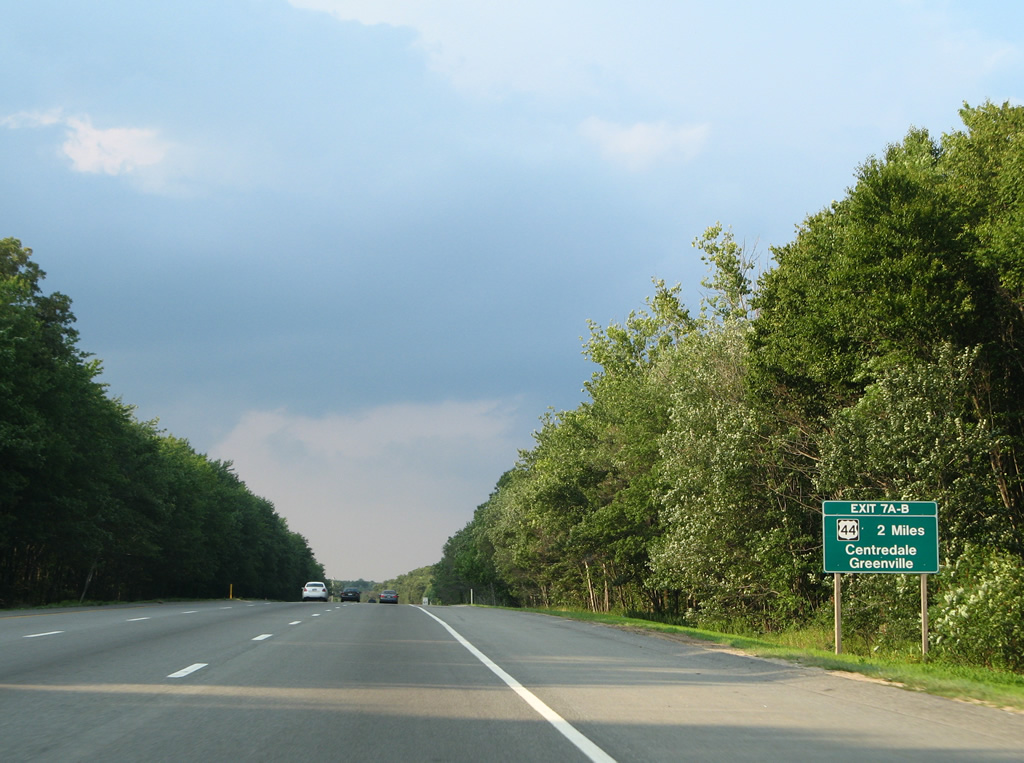
| One half mile south of the Exit 7A off-ramp to U.S. 44 (Putnam Pike) east to Graniteville and Centredale, in the Town of North Providence. 07/28/07 |
|
| Exit 7A departs Interstate 295 north for U.S. 44 (Putnam Pike) east. U.S. 44 continues into downtown Providence from Centredale. Overall the US route totals 238 miles from Kerhonkson, New York east to Plymouth, Massachusetts. 07/28/07 |
|
| Roadways of Interstate 295 separate as the freeway winds northward through Smithfield near Georgiaville Pond. 07/28/07 |
|
| Turning eastward across the Blackstone River valley, Interstate 295 enters the Blackstone Valley National Corridor, a National Park Service designated area encompassing areas surrounding the river between Worcester, Massachusetts and Providence. The Blackstone River played an important role in the industrial revolution powering such sites as the Slater Mill in Pawtucket, where the first cotton-spinning factory began operation in 1790. 07/28/07 |
|
| Route 7 (Douglas Pike) crosses paths with Interstate 295 at the next interchange (Exits 8A/B) near Stillwater in Smithfield. 07/28/07 |
|
| Rock cuts are present throughout the cloverleaf interchange with Route 7 at Exit 8 of Interstate 295. R.I. 7 follows Douglas Pike south to North Providence and Route 246 (Charles Street) near the Rhode Island State House. 07/28/07 |
|
| Heading northwest, Route 7 (Douglas Pike) concludes a 15 mile long course at Mohgan (Joslin Road) within the Town of Burrillville. The state route joins I-295 with North Smithfield in three miles. 07/28/07 |
|
| Interstate 295 shield posted west of North Central State Airport in Smithfield. 07/28/07 |
|
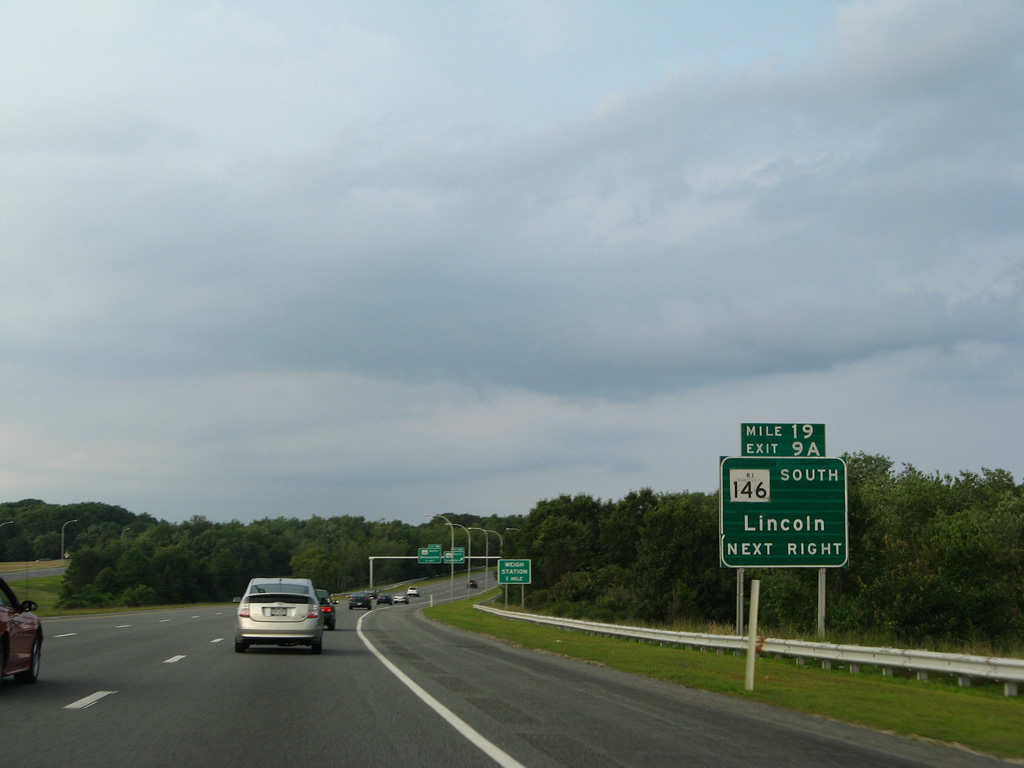
| One mile west of the cloverleaf interchange (Exits 9A/B) with Route 146 on Interstate 295 north near Woonsocket Reservoir Number 3. Route 146 constitutes a 16.2 mile route from Interstate 95 in Providence to the Massachusetts state line. Along with Massachussetts 146, R.I. 146 provides a direct route to Worcester, most of which is a freeway. 07/28/07 |
|
| Interstate 295 enters the Town of Lincoln one half mile west of Exit 8 with Route 146. R.I. 146 interchanges with R.I. 116 (Washington Highway) nearby before reaching Lime Rock. 07/28/07 |
|
| Older style guide signs posted along Interstate 295 included the mile marker location in addition to the sequential exit number. 07/28/07 |
|
| Exit 9A departs Interstate 295 north for Route 146 south through Lincoln, North Providence and Exit 23 of Interstate 95 in Providence. 07/28/07 |
|
| Route 146 north bypasses the west side of Woonsocket en route to Interstate 290 in Worcester, Massachusetts. The freeway (Smithfield Expressway) provides several interchanges to Woonsocket area roads, including the Route 99 (Woonsocket Industrial Highway) freeway spur. 07/28/07 |
|
| A rest area and tourist information center follow the Route 126 (Old River Road) overpass along Interstate 295 north. A weigh station precedes it. 07/28/07 |
|
| Route 122 (Mendon Road) sees a folded diamond interchange (Exit 10) with Interstate 295 just east of the Blackstone River in one mile. 07/28/07 |
|
| Interstate 295 northbound reaches the rest area and tourist information center, formally named the Blackstone River Visitor Center and Service Plaza. The facility is unique in that food is available, an aspect normally reserved for service plazas along tolled facilities. 07/28/07 |
|
| Resuming along Interstate 295 northbound beyond the rest area, travelers meet Route 122 in one half mile. R.I. 122 constitutes a 14.2 mile route from U.S. 1 in Providence to the state line at Woonsocket where it continues as Massachusetts 122. 07/28/07 |
|
| Drivers bound for Route 122 (Mendon Road) loop away from Interstate 295 north at Ashton within the Town of Cumberland. Route 122 ventures north to Cumberland Hill and south to Berkeley nearby. 07/28/07 |
|
| Curving eastward, Interstate 295 passes south of Hunting Hill toward Abott Run beyond this reassurance marker. 07/28/07 |
|
| Route 114, a 45.7 mile route between Woonsocket and Middletown, sees a diamond interchange (Exit 11) with Interstate 295 in one mile. 07/28/07 |
|
| One half mile west of the Exit 11 off-ramp to Route 114 (Diamond Hill Road). R.I. 114 leads north to Diamond Hill and Grant Mills (junction R.I. 121) before turning west to Woonsocket. 07/28/07 |
|
| Leading south from Exit 11, Route 114 follows Diamond Hill Road through Cumberland to High Street at Valley Falls. 07/28/07 |
|
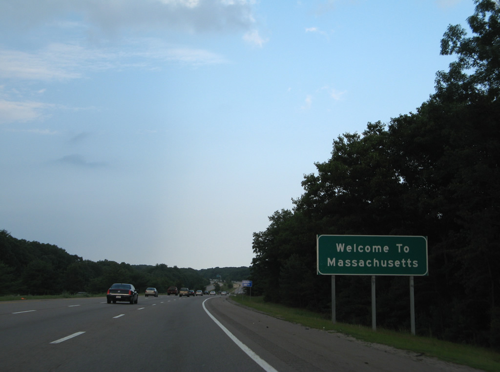
| Interstate 295 enters Bristol County and the Town of North Attleborough, Massachusetts a short distance east of Route 114 (Exit 11). The freeway ends in 4.23 miles. 07/28/07 |
Page Updated 08-14-2012.

 North
North