|
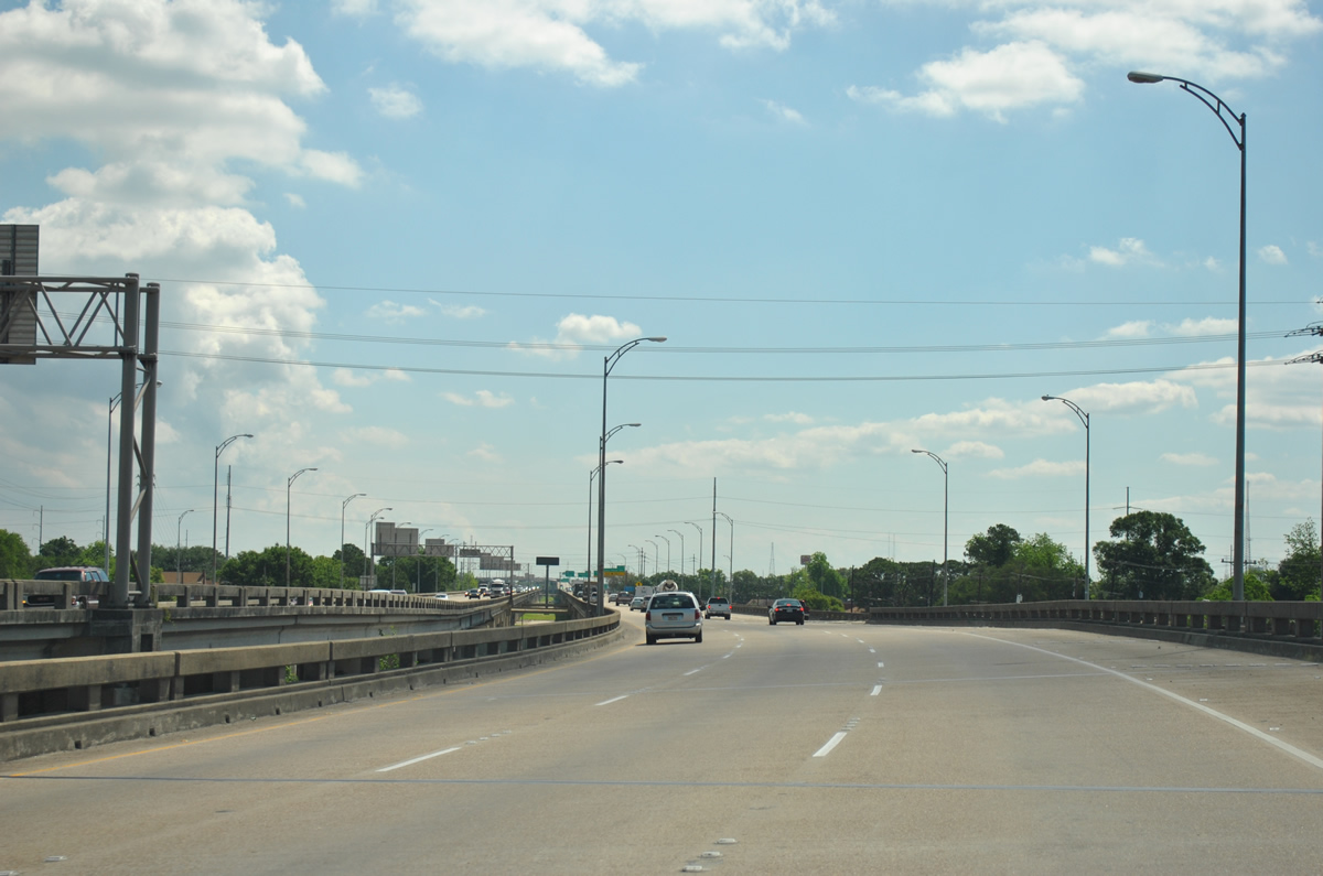
| Interstate 610 splits from Interstate 10 eastbound via a left exit at the Orleans Parish / New Orleans city line. The wye interchange lies just west of the three quarter cloverleaf interchange joining I-610 with Pontchartrain and West End Boulevards. As it was submerged under water at the time, this exchange was featured prominently in post Hurricane Katrina aerial photos. 06/10/06 |
|
| The first reassurance shield lies above a screen along the left side of Interstate 610 as it passes over Interstate 10 westbound. A collector distributor roadway (Exit 1A) prepares to depart for West End Boulevard north and Canal Boulevard. West End and Pontchartrain Boulevards extend northward from the Pontchartrain Expressway (Interstate 10) to the Lakeview and Lakeshore West communities of New Orleans. 06/10/06 |
|
| Eastbound drivers touch down from the Interstate 10 westbound under crossing ahead of the West End Boulevard interchange (Exit 1A). West End and Pontchartrain Boulevards constitutes a one way couplet north from Pontchartrain Expressway to Lakeshore Drive at Robert E. Lee Boulevard. Use West End Boulevard north to Harrison Avenue east for City Park. 06/10/06 |
|
| The loop ramp onto West End Boulevard north departs the adjacent Exit 1A c/d roadway of Interstate 610 eastbound. The c/d roadway continues to the split diamond interchange with Canal Boulevard amid the Lakeview street grid. 04/20/12 |
|
| A ground level sign partitions traffic between the Canal Boulevard off-ramp and return ramp for I-610 east for motorists entering the freeway from Pontchartrain Boulevard south. I-610 ended here between 1964 and 1973-75. 04/20/12 |
|
| A second reassurance marker lies at the Canal Boulevard under crossing of Interstate 610 east. Canal Boulevard travels north from City Park Avenue near Canal Street to Lakeshore Drive. 04/20/12 |
|
| Eastbound Interstate 610 enters New Orleans City Park one mile to the west of Exit 2A (Saint Bernard Street). Saint Bernard Street comprises a divided surface boulevard between Interstate 10 at Claiborne Avenue and the Gentilly neighborhood. A split diamond interchange facilitates movements to St. Bernard Street with return access available from Gentilly Boulevard nearby. 04/20/12 |
|
| Interstate 610 eastbound at the Wisner Boulevard overpass near Bayou St. John, one half mile west of Exit 2A. St. Bernard Avenue intersects Gentilly Boulevard, Paris Avenue, and U.S. 90 (Broad Avenue) just south of the ramps with Interstate 610. These boulevards serve Dillard University, the Fair Grounds Race Course, and the Gentilly and Spanish Fort neighborhoods. 04/20/12 |
|
| Interstate 610 eastbound at the St. Bernard Avenue (Exit 2A) off-ramp. The freeway elevates onto a six lane viaduct between here and the merge with Interstate 10 east. 04/20/12 |
|
| The viaduct passes over Paris Avenue three fourths of a mile west of the Elysian Fields Avenue off-ramp (Exit 3) as drivers are advised of the forthcoming merge onto Interstate 10 east. Elysian Fields Avenue (LA 3021) represents a main through route between Gentilly and Vieux Carre. A diamond interchange with the avenue lies east of the Broad Avenue (U.S. 90 east) on-ramp. 04/20/12 |
|
| The twin viaduct of Interstate 610 between Benefit and Humanity Streets was constructed between 1973 and 1975. This view looks at the straight shot of I-610 east from London Avenue Canal to Interstate 10. 04/20/12 |
|
| The U.S. 90 eastbound on-ramp to Interstate 610 east forms an auxiliary lane to Exit 3 (Elysian Fields Avenue). Elysian Fields Avenue is part of LA 3021, a short state highway traveling between LA 39 (Claiborne Avenue) and U.S. 90 (Gentilly Boulevard). The designation is sporadically signed along Elysian Fields Avenue. 04/20/12 |
|
| Exit 3 descends from the Interstate 610 viaduct to Elysian Fields Avenue (LA 3021). Elysian Fields Avenue leads south to the intersection of Esplanade Avenue and Peters Street at the Vieux Carre. Northward the divided boulevard ends at Lakeshore Drive in Pontchartrain Beach. 04/20/12 |
|
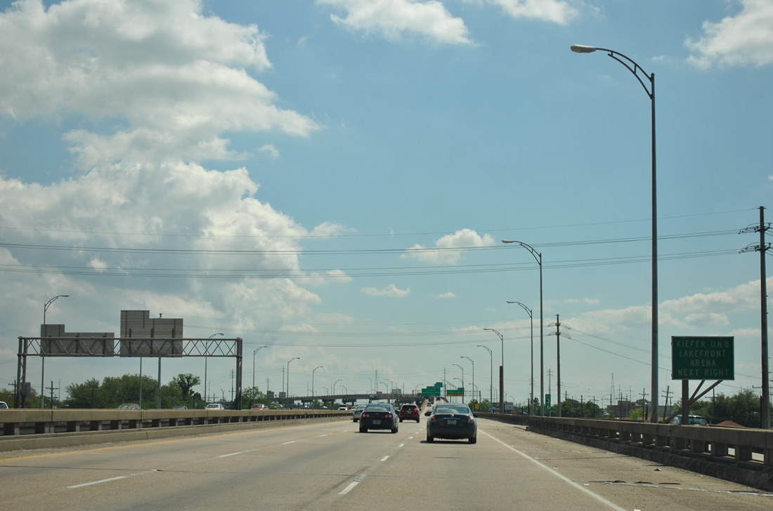
| An original guide sign directs drivers bound for Kiefer Lakefront Arena to Franklin Avenue. The venue resides on the University of New Orleans campus at Franklin Avenue and Leon C. Simon Drive. 04/20/12 |
|
| Interstate 610 eastbound at its final exit, the Exit 4 off-ramp to Franklin Avenue. The two lane freeway mainline defaults onto Interstate 10 eastbound beyond the Exit 4 half diamond interchange. Below the elevated roadway is Franklin Avenue, a north-south through route serving industrial areas southeast of the Gentilly community. 04/20/12 |
|
| There is no access to Interstate 10 westbound from Interstate 610. Drivers destined for downtown should use Elysian Fields Avenue south to its diamond interchange with Interstate 10.
Louisa Street is the last exit of Interstate 10 before it crosses over the High Bridge into New Orleans East. Traffic from I-610 east forms an auxiliary lane to Exit 239A. 06/10/06 |
|
| Passing over the Interstate 10 viaduct at the east end of I-610. Per official mileage from LADOTD, Interstate 610 formally ends over Franklin Avenue with this ramp considered part of the Interstate 10 system. 12/28/02 |
Page Updated 09-08-2012.

 East
East