|
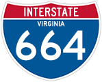
| The first confirming marker for Interstate 664 south. 10/12/14 |
|
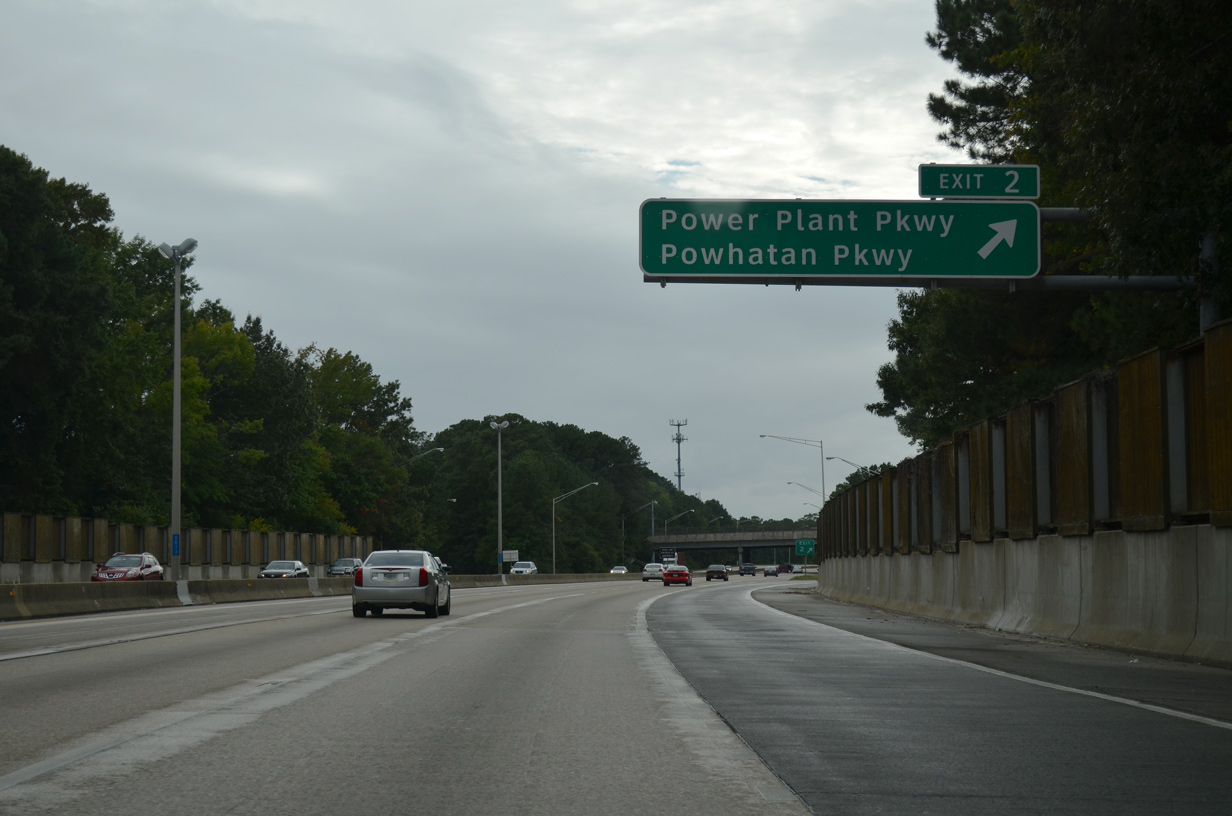
| I-664 crosses over SR 415 (Queen Street) by West Hampton ahead of the diamond interchange (Exit 2) with Powhatan Parkway. Power Plant Parkway extends north from Powhatan Parkway as SR 415 from Briarfield Road to U.S. 258 (Mercury Boulevard). 10/12/14 |
|
| Powhatan Parkway continues south from I-664 to the Wythe neighborhood in Hampton to Chesapeake Avenue along Hampton Flats. SR 415 constitutes a 2.59 mile long route east to SR 351 (Pembroke Avenue) and north from Power Plant Parkway along Todds Lane to SR 152 (Cunningham Drive) 10/12/14 |
|
| The Newport News Tunnel Connector initially spurred southwest from I-64 to Aberdeen Road / Buxton Avenue south to SR 143 (27th Street). These ramps were replaced with a diamond interchange (Exit 3) joining the completed I-664 with a realignment of Aberdeen Road. 09/05/10 |
|
| A 6.2 mile long crossing of the James River, the Monitor-Merrimac Memorial Bridge Tunnel lies five miles south of the entrance ramp from Powhatan Parkway. 10/12/14 |
|
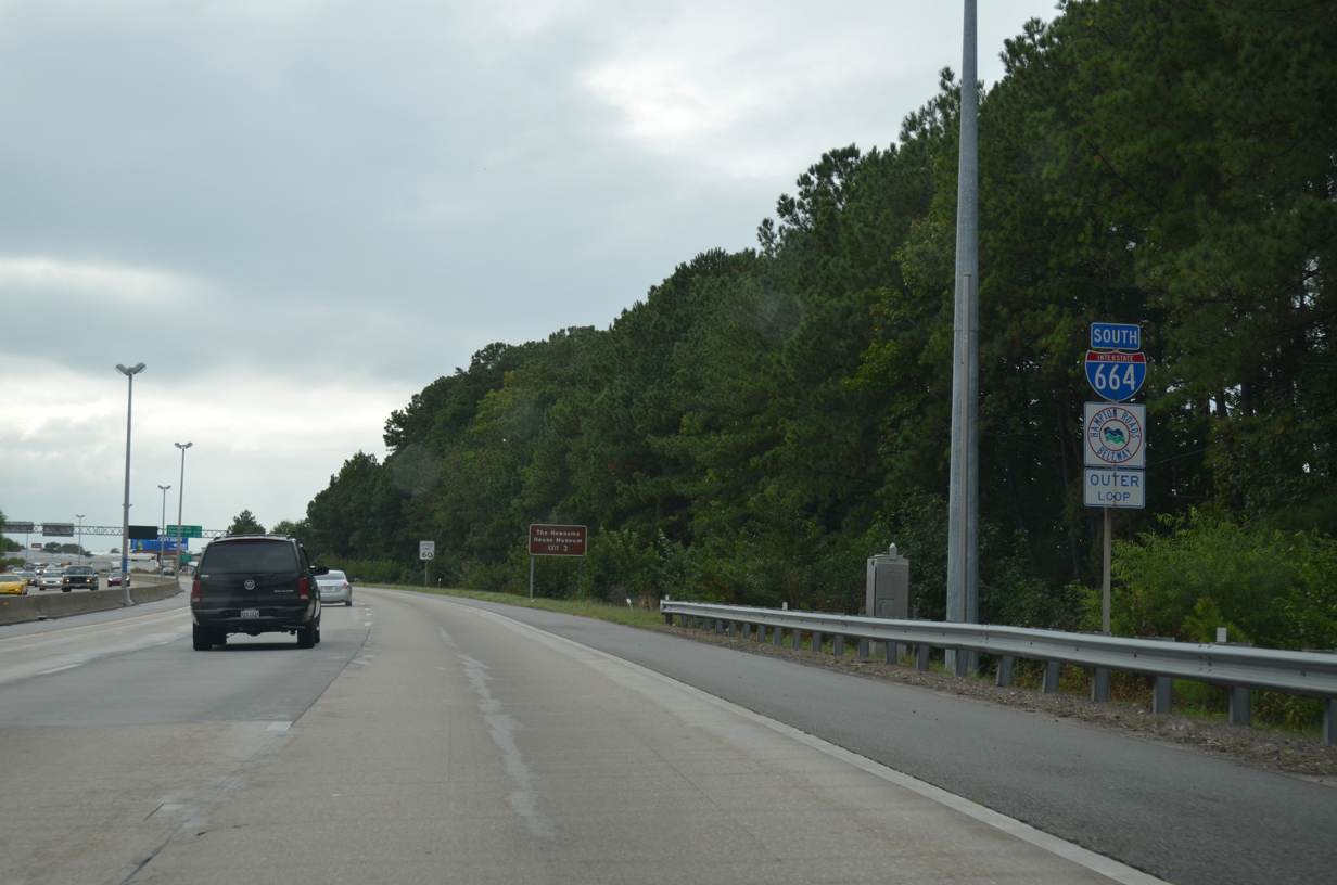
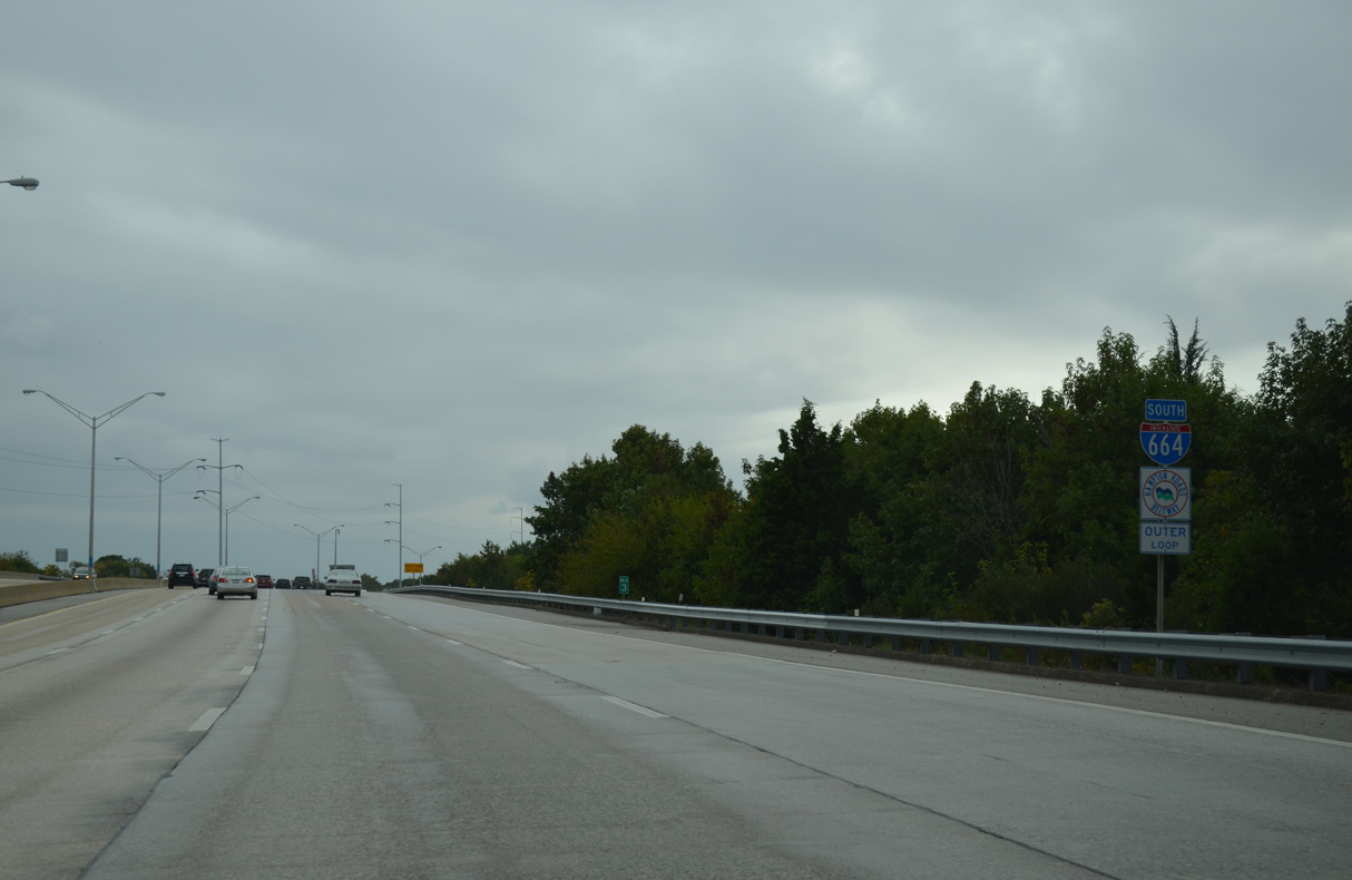
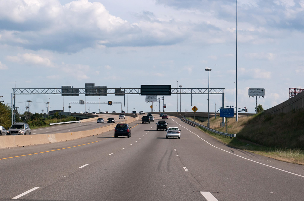
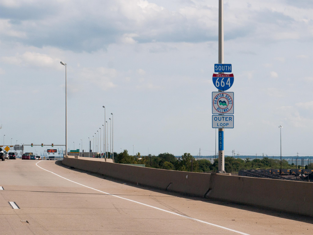
| The Outer Loop of the Hampton Roads Beltway arcs eastward from the south end of I-664 to U.S. 13 (Northampton Boulevard) in Norfolk to the Chesapeake Bay Bridge Tunnel. 10/12/14 |
|
| Continuing south, I-664 runs alongside Copeland Industrial Park. 10/12/14 |
|
| The succeeding southbound exits beyond Aberdeen Road fall withing the city of Newport News. 10/12/14 |
|
| Exit 3 leaves I-664 south for Aberdeen Road north to U.S. 258 (Mercury Boulevard) at the Greenwood Farms neighborhood and Buxton Avenue south to SR 143 in Newport News. 10/12/14 |
|
| One half mile north of the split diamond interchange with Chestnut and Roanoke Avenues at Exit 4. 10/12/14 |
|
| Interstate 664 enters the Newport News city limits south of mile marker 3. 10/12/14 |
|
| Parallel Chestnut and Roanoke Avenues lead north from Interstate 664 to Newmarket and U.S. 258 (Mercury Boulevard) and south to 16th Street (SR 167) at Stuart Gardens. 10/12/14 |
|
| The Newport News Marine Terminal lies along the James River west of I-664 and south of U.S. 60 at 23rd Street. 10/12/14 |
|
| The ensuing three exits precede the Monitor-Merrimac Memorial Bridge Tunnel. 10/12/14 |
|
| Exit 5 links I-664 south with a viaduct west to U.S. 60 (Warwick Boulevard) west and 35th Street at U.S. 60 (Huntington Avenue) east. 10/12/14 |
|
| Interstate 664 spans Marshall Avenue and parallel SR 351 (39th Street) along a viaduct preceding Exit 5. 10/12/14 |
|
| Guide signs at Exit 5 and 6 omit U.S. 60. U.S. 60 parallels the James River south along the couplet of Huntington Avenue and Warwick Boulevard to the couplet of 23rd/26th Streets by Newport News City Hall. 10/12/14 |
|
| U.S. 60 travels to the north end of Newport News beyond Lee Hall. 10/12/14 |
|
| Interstate 664 curves southward along CSX Railroad lines beyond the separation of Exit 5 for U.S. 60 and 35th Street by the Newport News Shipbuilding facility. 10/12/14 |
|
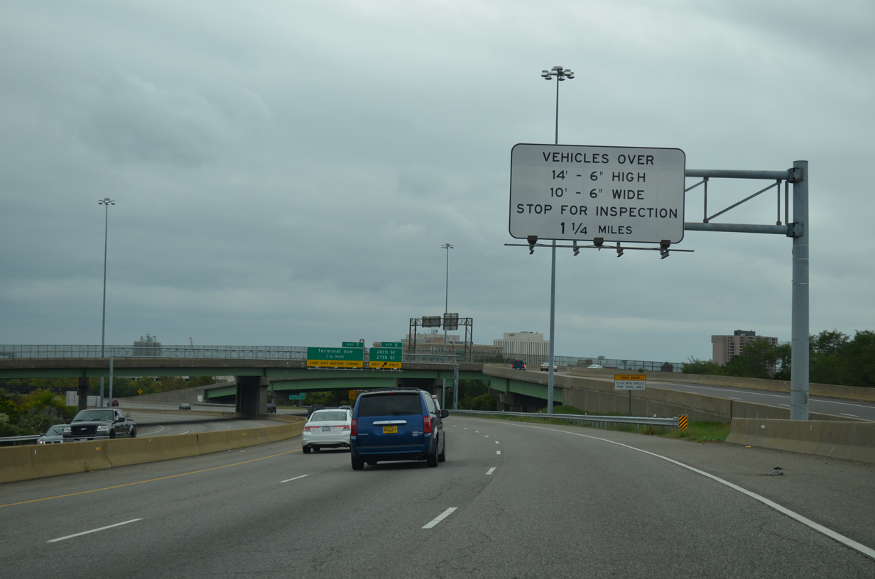
| An inspection station for the Monitor-Merrimac Memorial Bridge-Tunnel precedes Exit 7 in 1.25 miles. 10/12/14 |
|
| A series of ramps connect I-664 with the Newport News street grid between 27th and 23rd Streets. Exit 6 links with 26th Street west to U.S. 60 (Huntington Avenue) east and 27th Street east at SR 143 (Jefferson Avenue). 10/12/14 |
|
| 27th Street east from Jefferson Avenue is part of a couplet for SR 143 with 28th Street west. U.S. 60 parallels along the couplet of 25th/26th Streets to the south. 10/12/14 |
|
| Interstate 664 ascends onto a viaduct at 21st Street ahead of the entrance ramp from U.S. 60 (23rd/26th Streets). The elevated roadway extends south to the Monitor Merrimac Memorial Bridge Tunnel. 09/05/10 |
|
| The Newport News Marine Terminal facility comes into view adjacent to this southbound shield assembly. 09/05/10 |
|
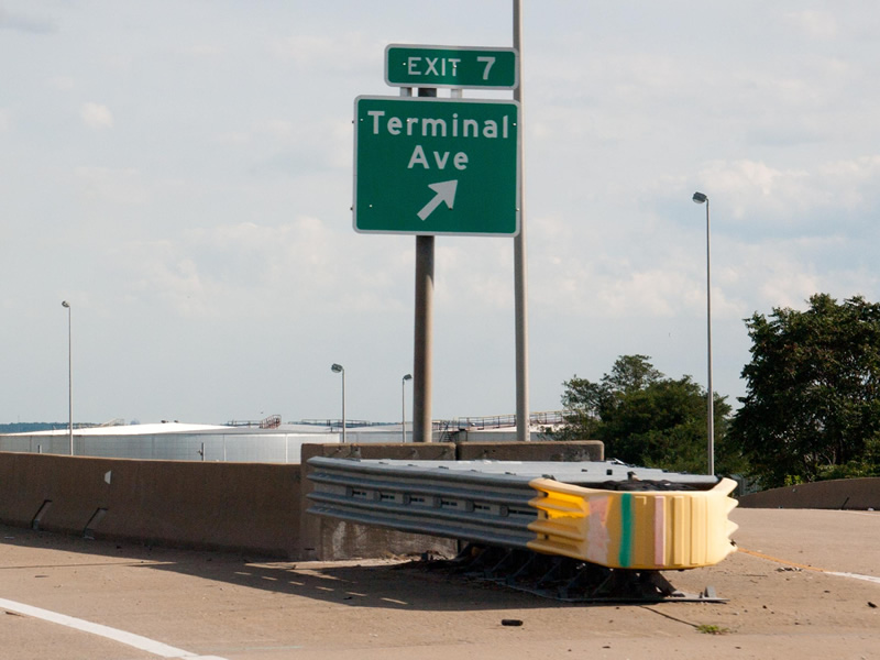
| The Monitor Merrimac Memorial Bridge Tunnel inspection station for trucks lines the viaduct ahead of Exit 7 to Terminal Avenue. 09/05/10 |
|
| Terminal Avenue travels alongside or below the I-664 viaduct from 21st Street south to Newport News Creek. A modified trumpet interchange joins the freeway with the industrial road at Exit 7. 09/05/10 |
|
| Terminal Avenue spurs south to Harbor Road by the Newport News Marine Terminal and north to a dead end beyond 21st Street. The street originally continued north to 36th Street, but construction of I-664 overtook all of it except four blocks between 29th and 33rd Streets. 09/05/10 |
|
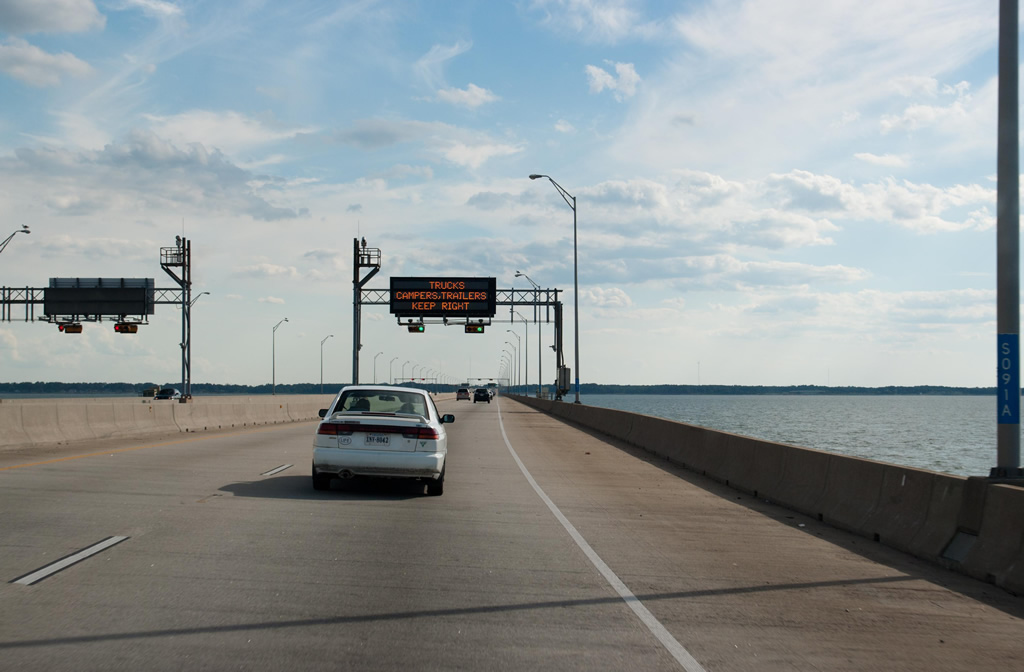
| Interstate 664 lowers into the tunnel portion of the Monitor Merrimac Memorial Bridge Tunnel south of Newport News Point. Completed in April 30, 1992, the bridge tunnel system travels 4.6 miles across the James River.1 09/05/10 |
|
| Dropping 45 feet below the low tide level of the James River, I-664 passes through a pair of 4,800 foot long tunnels.1 09/05/10 |
|
| Southwesterly view of the Nansemond River from Interstate 664. U.S. 17 spans the Nansemond River between Cedar and Town Points in north Suffolk. 09/05/10 |
|
| Costing $400 million to build1 the bridge tunnel system across the James River honors the battle between the ironclads CSS Virginia (ex-USS Merrimack) and USS Monitor, which took place March 8–9, 1862 during the Civil War.2 09/05/10 |
|
| The James River Bridge connecting U.S. 17/258 with Carrollton in Isle of Wight County and Newport News appears on the northwestern horizon. 09/05/10 |
|
| The twin spans along Interstate 664 cross the Suffolk city limits city near the James River south shoreline between Pig Point and Streeter Creek. 09/05/10 |
|
| Virginia Department of Transportation (VDOT) recorded 56,000 vehicles per day (vpd) on the Monitor Merrimac Memorial Bridge Tunnel in 2009 and 70,000 vpd in 2019. 09/05/10 |
|
| A cloverleaf interchange (Exit 8) joins I-664 with SR 135 (College Drive) in northern Suffolk. The 2.20 mile long route runs north to a roundabout with Harbour View Boulevard west and Armstead Road east and south to U.S. 17 (Bridge Road). 09/05/10 |
|
| Exit 8A departs I-664 south for College Drive north to the Tidewater Community College - Center for Workforce Solutions. Since relocated to Victory Boulevard (SR 239) south of I-264, the Portsmouth Campus of Tidewater Community College was formerly located at the end of SR 135. 09/05/10 |
|
| Exit 8B follows onto SR 135 (College Drive) south to Huntersville and U.S. 17 (Bridge Road) near Churchland. There is no direct access from I-664 south to U.S. 17 (Western Branch Boulevard) southbound into Portsmouth. 09/05/10 |
|
| Advancing south, I-664 meets SR 164 (Western Freeway) at a directional cloverleaf interchange (Exit 9). Completed by 1992, the Western Freeway provides a high speed route to U.S. 58 (Midtown Tunnel) and the M.L. King Expressway northwest of Downtown Portsmouth. 09/05/10 |
|
| SR 164 (Western Freeway) concludes west of Exit 9 at a wye interchange with U.S. 17 (Bridge Road) at Belleville. U.S. 17 continues west to Bennett Creek and north across the Nansemond River to Crittenden in Suffolk. 09/05/10 |
|
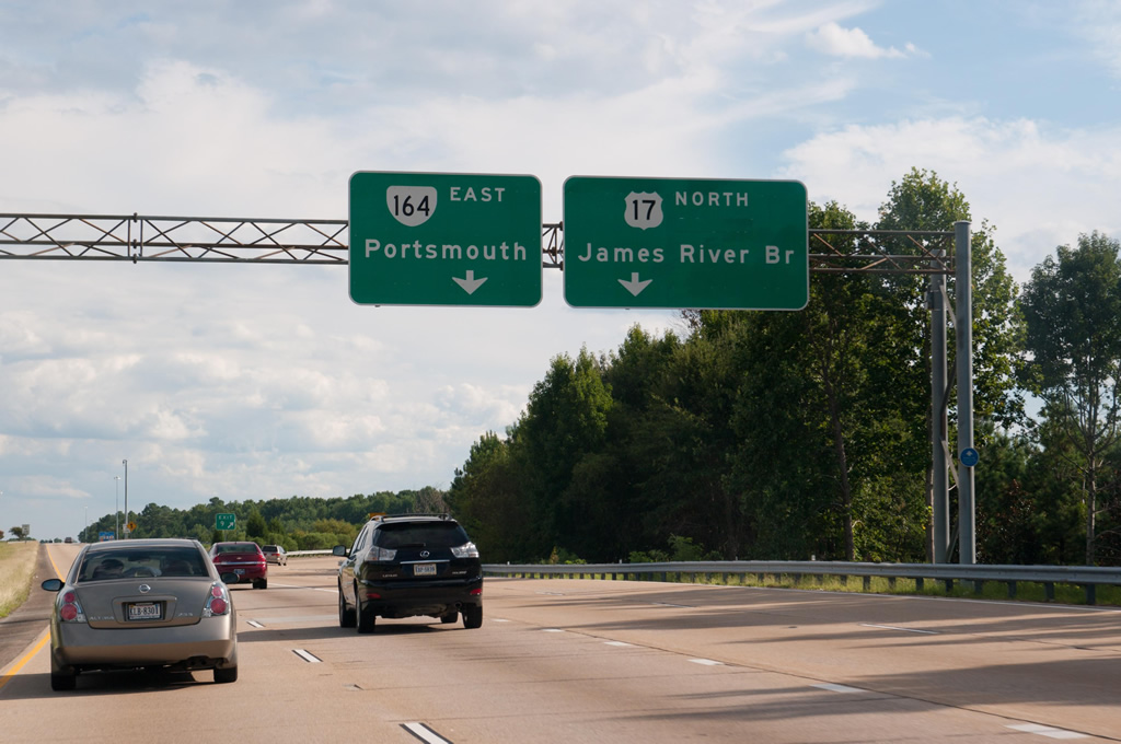
| Exit 9 carries all traffic in unison to both SR 164 (Western Freeway) east to Portsmouth and SR 164 west to U.S. 17 north for Isle of Wight County and the James River Bridge to Newport News. 09/05/10 |
|
| Continuing south from U.S. 17 (Bridge Road), the succeeding exit on I-664 south is with Pughsville Road (SR 659). 12/14/17 |
|
| Interstate 664 south enters the city of Chesapeake east of Pughsville. 09/05/10 |
|
| Pughsville Road is a minor arterial measuring 3.75 miles in length west from Exit 10 to SR 626 (Shoulders Hill Road) at Deanes in Suffolk and east to Taylor Road where it intersects Lynnhurst Boulevard to the Wellington subdivision in Chesapeake. 12/14/17 |
|
| South of the parclo interchange (Exit 10) with Pughsville Road, I-664 spans a Norfolk Southern Railroad line by Gateway Commerce Park. 12/14/17 |
|
| A cloverleaf interchange joins I-664 with SR 337 (Portsmouth Boulevard) at Exit 11. 12/14/17 |
|
| SR 337 travels west from Exit 11A to Driver in Suffolk and east along Portsmouth Boulevard to Jester Gardens and Hodges Ferry before spanning the Western Branch of the Elizabeth River into Portsmouth. 12/14/17 |
|
| SR 337 constitutes a 35.93 mile long route across Hampton Roads from U.S. 58 Business (Washington Street) west of the Suffolk city center to I-564 (Admiral Taussig Boulevard) at Naval Station Norfolk (NSN). 12/14/17 |
|
| SR 337 follows Portsmouth Boulevard east from Exit 11B to Chesapeake Square Mall and Elm Avnenue at the Brighton neighborhood in the city of Portsmouth. 12/14/17 |
|
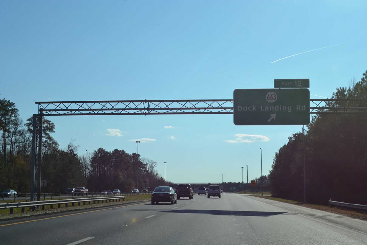
| Dock Landing Road (SR 663) stems east from parallel SR 191 (Joliff Road) to the diamond interchange with Interstate 664 at Exit 12. 12/14/17 |
|
| The Hampton Roads Beltway crosses Baily Creek south of SR 337. Construction of I-664 severed Woodland Drive on the ensuing stretch. 12/14/17 |
|
| Dock Landing Road (SR 663) comprises a 3.63 mile long loop east from Joliff to the Riverbend subdivision and north to Raleigh Place and SR 337 (Portsmouth Boulevard) at Hodges Ferry. 12/14/17 |
|
| Interstate 664 converges with U.S. 13-58-460 (Military Highway) in one mile south of Goose Creek, 12/14/17 |
|
| Travel times are provided for the outer loop of the Hampton Roads Beltway (I-64) and I-264 east across Portsmouth and Norfolk to the Virginia Beach Oceanfront. 12/14/17 |
|
| U.S. 13-58-460 combine west from Bowers Hill in Chesapeake to Hampton Roads Executive Airport (PVG) and Suffolk. Beyond a bypass of the city center, U.S. 460 travels northwest to Petersburg, U.S. 58 west to Franklin and U.S. 13 southwest to Ahoskie, North Carolina. 12/14/17 |
|
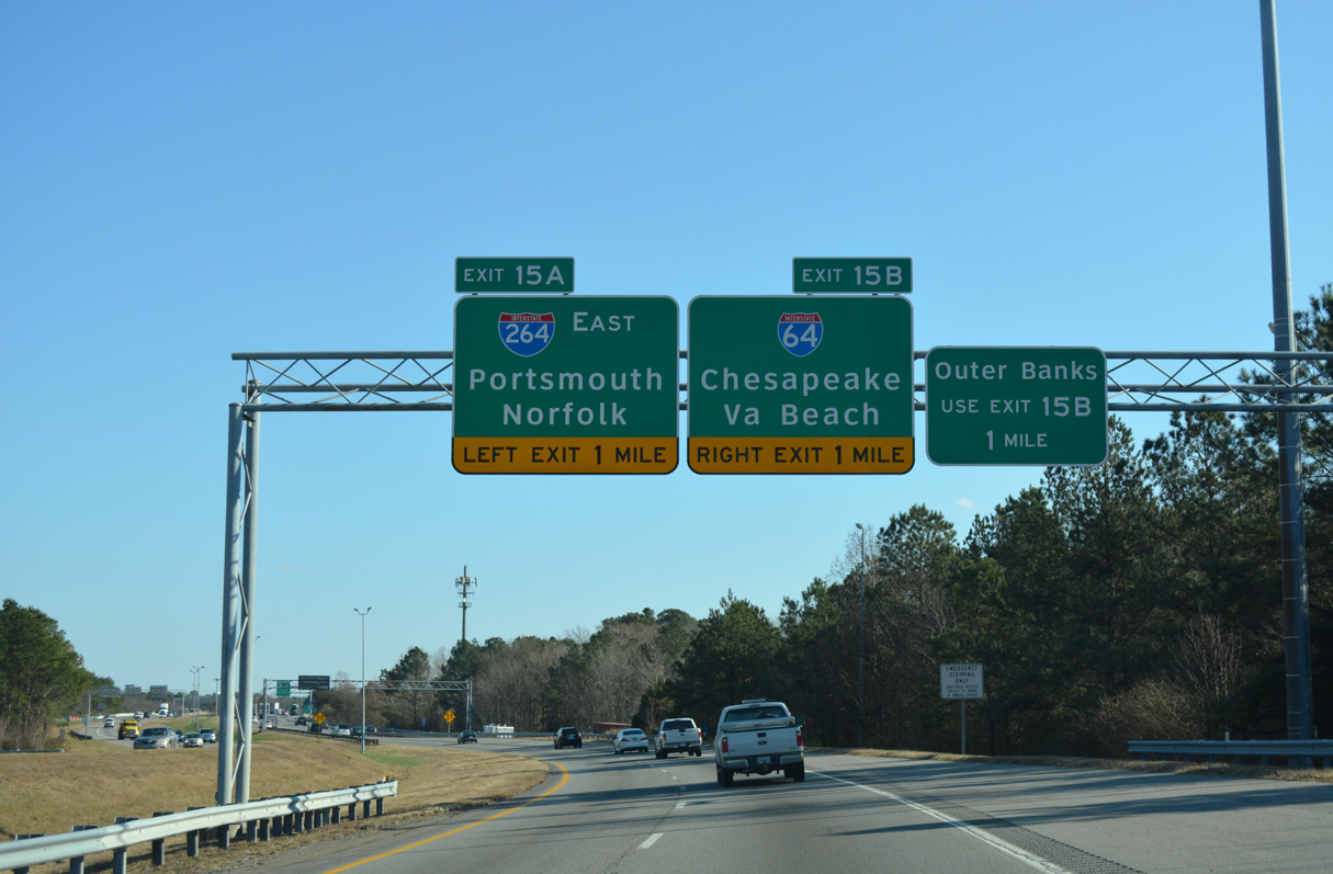
| The cloverleaf interchange (Exit 13) with U.S. 13/58/460 (Military Highway) precedes the south end of I-664 where traffic partitions for I-264 east to Portsmouth and Norfolk and I-64 across Chesapeake to Virginia Beach. 12/14/17 |
|
| Exit 13A connects with U.S. 13 south and U.S. 58-460 west to Suffolk. U.S. 13/460 continue along Military Highway east from Bowers Hill while U.S. 58 overlaps with U.S. 460 ALT east on Airline Boulevard. 12/14/17 |
|
| U.S. 58/460 Alternate (Airline Boulevard) overlap east to Alexander Corner in Portsmouth, where U.S. 460 ALT joins SR 337 to I-264 at Exit 4. U.S. 13/460 (Military Highway) continue 7.65 miles east from U.S. 58 to SR 166 (Bainbridge Boulevard). 12/14/17 |
|
| Turning east at Bowers Hill, I-664 continues one mile to Exit 15A for I-264 east and Exit 15B for I-64 to SR 168 (Chesapeake Expressway) south toward the Outer Banks of North Carolina. 12/14/17 |
|
| Interstate 264 runs east from I-664 at Chesapeake to the tolled Downtown Tunnel from near Downtown Portsmouth to Berkley in Norfolk. A 25.07 mile long route, I-264 extends to 21st Street at the Virginia Beach Oceanfront. 12/14/17 |
|
| U.S. 13/460 (Military Highway) shifts south from U.S. 58 and SR 191 (Joliff Road) to the south side of I-664 at Exit 14. 12/14/17 |
|
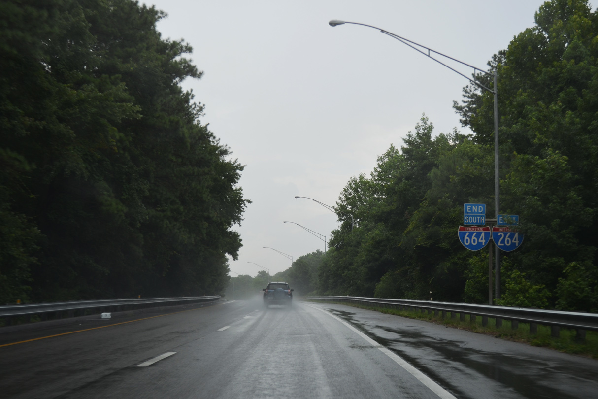
| Traffic partitions to I-264 east and the outer loop for I-64 at a three-wye interchange (Exit 15). The two routes meet again in eastern Norfolk at Exits 14 and Exit 284 respectively. 12/14/17 |
|
| An end shield stands along the ramp from I-664 south to I-264 east. 07/28/13 |
|
| An end shield also appears along the ramp linking I-664 south with Interstate 64. I-64 travels 973 miles west from Hampton Roads to I-70 at Wentzville, Missouri. 12/14/17 |
Page Updated 04-12-2021.

 South
South