|
| A decorative overpass carries State Line Road across I-39/90 northbound into the Badger state. 05/09/10 |
|
| A rest area and tourist information center lie just north of the state line. There are four rest area facilities along the entire stretch of Interstate 90 in Wisconsin. 05/09/10 |
|
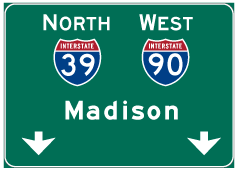
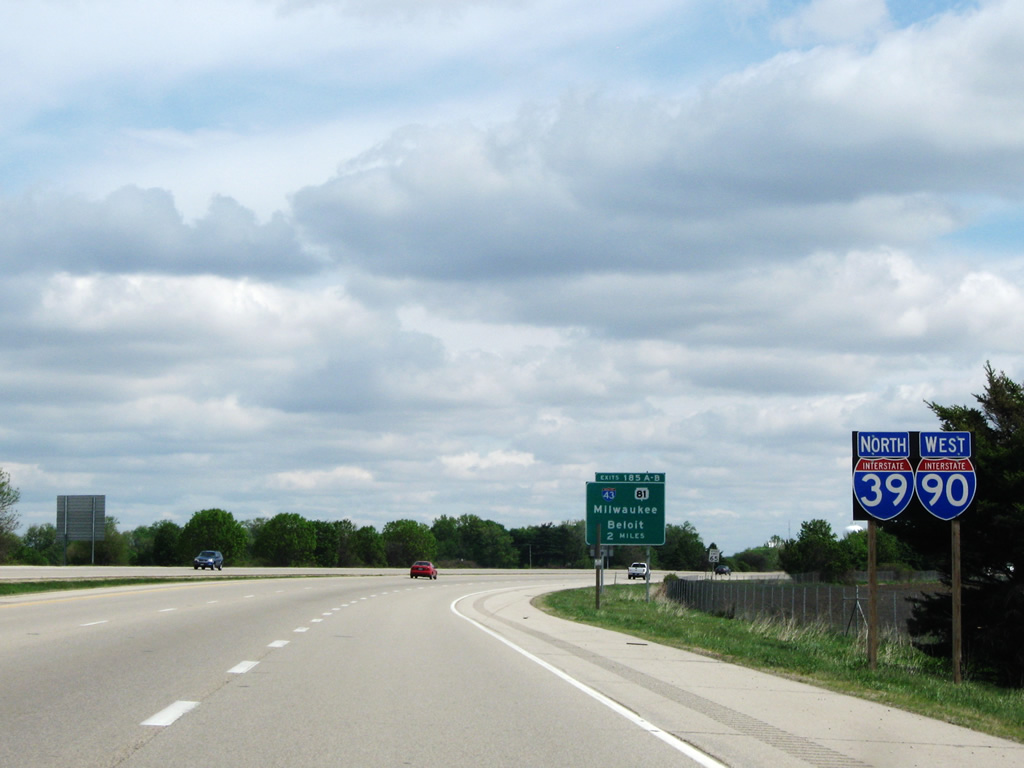
| I-39 north and I-90 west combine for 78.4 miles from the Illinois state line to Beloit, Janesville and the capital city of Madison before separating south of Portage. 05/09/10 |
|
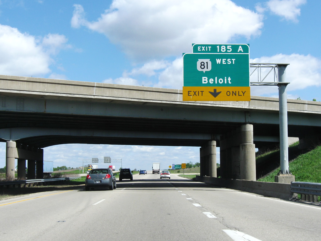
| Exits 185A/B join I-39/90 with Interstate 43 and Wis 81 in two miles. A cloverleaf interchange previously joined the two freeways. 05/09/10 |
|
| The northbound freeway enters the city limits of Beloit at the Wisconsin welcome center. 05/09/10 |
|
| I-39/90 curve northeast alongside Spring Brook and an industrial park to encounter Interstate 43 north and Wis 81 west in one mile. I-43 angles northeast to Elkhorn and Milwaukee. The 123.8 mile long Wis 81 begins west at the forthcoming interchange. The state trunk highway passes through Monroe, Plattesville and Lancaster before ending at Wis 133 and Cassville along the Mississippi River. 05/09/10 |
|
| Interstate 43 travels a rural route by the village of Clinton and city of Delavan over the initial 25 miles to Elkhorn. 05/09/10 |
|
| Exit 185B departs I-39/90 for Interstate 43 north. Until late 1987, Wis 15 was the designation for the freeway between Beloit and Milwaukee. Prior to that time I-43 existed between Green Bay and Milwaukee over the original routing of U.S. 141.
During extreme winter conditions, Interstate 43 can also be used as an alternative to I-39/90 and vice versa. Reassurance shields for the detour are sporadically placed along both freeways to aid motorists. 05/09/10 |
|
| Wis 81 stems west from Exit 185A along Milwaukee Road and White Avenue to the Beloit city center. Beloit was founded in 1836 and incorporated as a city in 1856. The city is home to a few large industrial plants for name-brand companies, including Hormel and Frito Lay.
Prior to its current route, Wis 81 existed as a north-south route from the village of Argyle (where current Wis 81 passes through) in LaFayette County to the west of Mt. Horeb, located in Dane County. 05/09/10 |
|
| Construction from summer 2020 to fall 2022 rebuilds I-39/90 north from the state line to the West Hart Road overpass. 05/30/11 |
|
| The freeway advances toward Madison, lying 53 miles to the north. Janesville, the county seat of Rock County, is situated 16 miles ahead along the east banks of the Rock River. 05/09/10 |
|
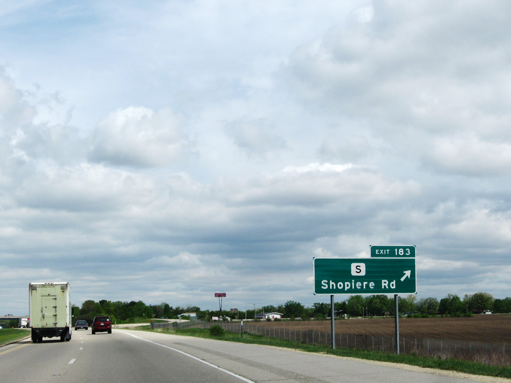
| Approaching Rock County S (Shopiere Road) and Exit 183 on I-39/90 north. CTH-S branches northeast from CTH-G (Prairie Avenue) in Beloit to the community of Shopiere. 05/09/10 |
|
| The diamond interchange (Exit 183) with County S (Shopiere Road) was reconstructed from April to November 2015 as part of the I-39/90 Expansion Project. Work improved the ramp geometry at the rural exit. 05/09/10 |
|
| CTH-S east travels a rural route 2.1 miles east to end at Shopiere and Rock County J. 05/09/10 |
|
| I-39/90 north span Turtle Creek and pass below Creek Road ahead this shield assembly. 05/30/11 |
|
| I-39/90 progresses 4.5 miles north to Wis 11 at the first of four Janesville interchanges. Madison is 50 miles to the north. 05/30/11 |
|
| A north side weigh station operates along I-39/90 between Town Line and Woodman Roads. 05/30/11 |
|
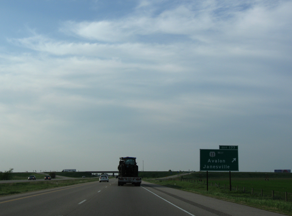
| I-39/90 elevate over a Union Pacific Railroad line on the one mile approach to Exit 177 with Wis 11 west and Avalon Road east. Wis 11 forms a southwestern bypass of Janesville to County B (Court Street). The six mile long expressway opened on November 11, 2002.1 05/30/11 |
|
| Exit 177 departs I-39/90 for STH-11 west to south Janesville, the University of Wisconsin - Rock County, Brodhead and Monroe. Avalon Road extends east from the trunk highway six miles to the settlement of Avalon.
Construction from September 21, 2015 to Fall 2016 redesigned Exit 177 into a diverging diamond interchange (DDI). 05/30/11 |
|
| STH-11 east combines with I-39/90 for 2.6 miles to rejoin its original alignment east to Delavan. 05/30/11 |
|
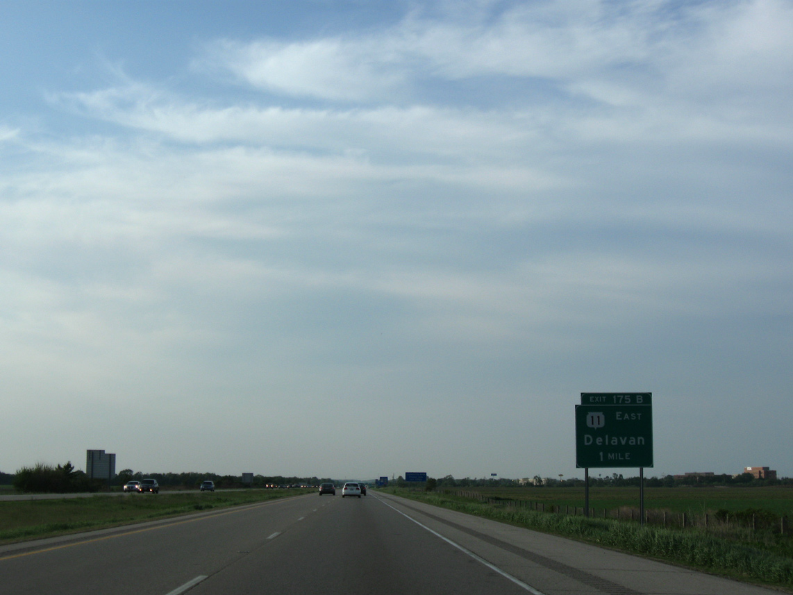
| Agricultural lands spread alongside the freeway one mile ahead of Exit 175 with Racine Street west and Wis 11 east. Wis 11 east links I-39/90 with U.S. 14, 1.5 miles to the east. The two routes combine from there 4.1 miles to Emerald Grove and 11.1 miles overall to Walworth County. 05/30/11 |
|
| I-39/90 cross over a WSOR Railroad and County O just ahead of the ramp departure (Exit 185) for Wis 11 east and Racine Street west. 05/30/11 |
|
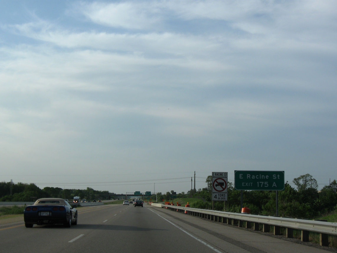
| Construction in 2013 redesigned the former cloverleaf interchange with Racine Street into a dumbbell interchange. This consolidated ramp movements to both Wis 11 east and Racine Street west from both directions of I-39/90. 05/30/11 |
|
| Looking at the former loop ramp (Exit 175A) for Racine Street west. Racine Street doubles as the locally maintained U.S. 14 Business. The auxiliary route of U.S. 14 is sparsely signed within Janesville and not at all outside the city limits. 05/30/11 |
|
| I-39/90 lead due north through residential areas of east Janesville over the next two miles. 05/30/11 |
|
| A six-ramp parclo interchange formerly joined I-39/90 with U.S. 14 (Humes Road) in one mile at Exits 171C/B. Bridge widening for the freeway above the arterial route in 2016 coincided with the 2015 removal of the loop ramps in both directions. Long term work scheduled for spring 2019 to fall 2021 rebuilds the exchange into a diamond interchange. 05/30/11 |
|
| Exit 171C was renumbered to Exit 171B and now carries all traffic in unison to U.S. 14 (Humes Road). U.S. 14 east curves southward around the east side of Janesville to Wis 11. The route west intersects Wis 26 (Milton Avenue) nearby amid several shopping centers and big box retail. 05/30/11 |
|
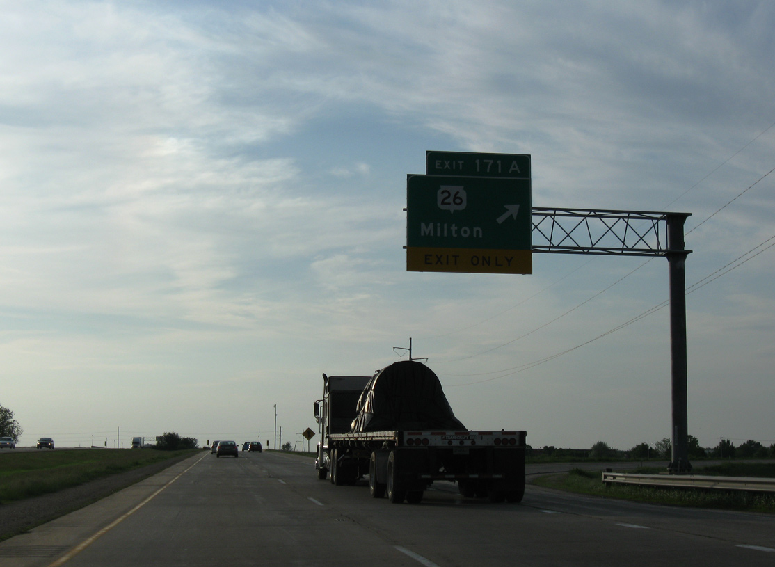
| Button copy signs were posted at the loop ramp (Exit 171B) for U.S. 14 west to Wis 26 south to Downtown Janesville. Exit 171A connects I-39/90 with Wis 26 (Milton Avenue) directly in one half mile. 05/30/11 |
|
| Exit 171A formerly consisted of a six-ramp parclo interchange. The loop ramps were removed in 2016 and construction from spring 2019 to fall 2021 redesigns the exit into a DDI. 05/30/11 |
|
| Wis 26 joins Janesville with Milton, Fort Atkinson and Jefferson along a freeway starting just outside of the city. The trunk highway goes for 98 miles overall from U.S. 51 in Janesville to I-41 outside Oshkosh. 05/30/11 |
|
| A mostly rural 7.7 mile exit less stretch ensues on the drive northward out of Janesville. A westbound rest area was once located on I-90 just south of the Townline Road underpass. 05/30/11 |
|
| Wis 59 represents the final Rock County interchange in five miles. La Crosse, the westbound destination of I-90 in the state, debuts at 168 miles out on distance signage. 05/30/11 |
|
| I-39/90 shift northwest from near Milton toward Newville to next meet Wis 59 at Exit 163. STH-59 meanders 116 miles across southern Wisconsin from Monroe east to Milwaukee. 05/30/11 |
|
| Northbound travelers span the Rock River just west of Newville and Lake Koshkonong. The 299 mile river flows southwest from Horicon Marsh in Dodge County to the Mississippi River at the Quad Cities.
Road work expands and rebuilds the Rock River bridges from spring 2016 to summer 2018. 05/30/11 |
|
| Construction from spring 2016 to fall 2016 also rebuilds the folded diamond (Exit 163) with Wis 59 into a dumbbell interchange. Wis 59 otherwise arcs southeast to the city of Milton and follows Fulton Street west to the Edgerton city center. 05/30/11 |
|
| I-39 north / I-90 west bypass northern reaches of Edgerton. 05/30/11 |
|
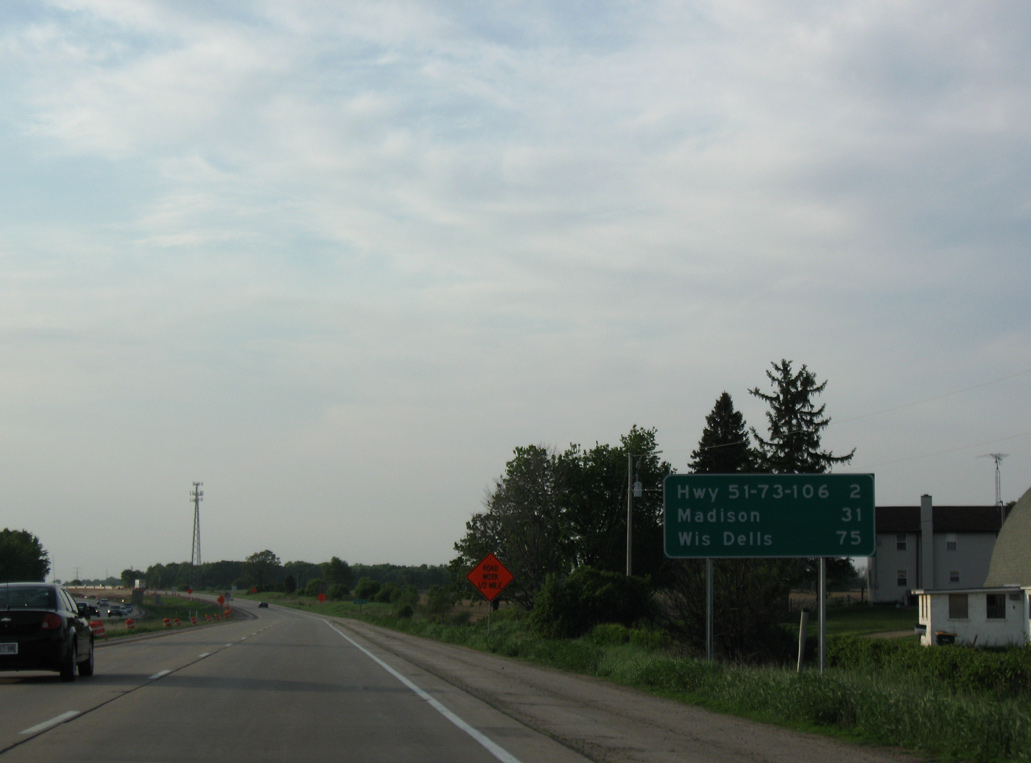
| Madison is now a half hour away while Wis Dells appears for the first time on distance signs at 75 miles out. 05/30/11 |
|
| I-39/90 enter the southeastern corner of Dane County west of Lake Koshkonong. 05/30/11 |
Page Updated 04-26-2016.

 North
North  West
West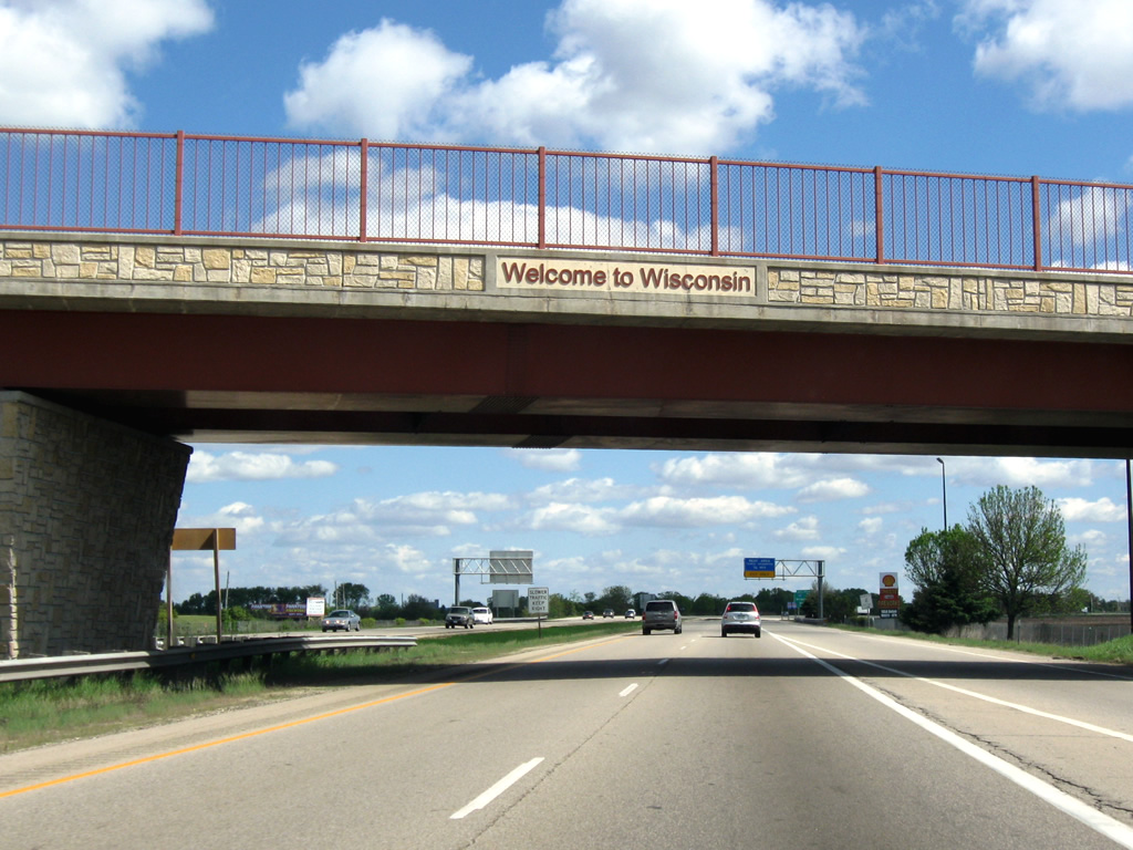


 East
East