|
| I-80/90 combine ahead of Burns Ditch and the George Ade Service Area. 11/04/11 |
|
| A lone Indiana East West Toll Road remains in place along eastbound I-80/90 ahead of the Interstate 94 over crossing. 11/04/11 |
|
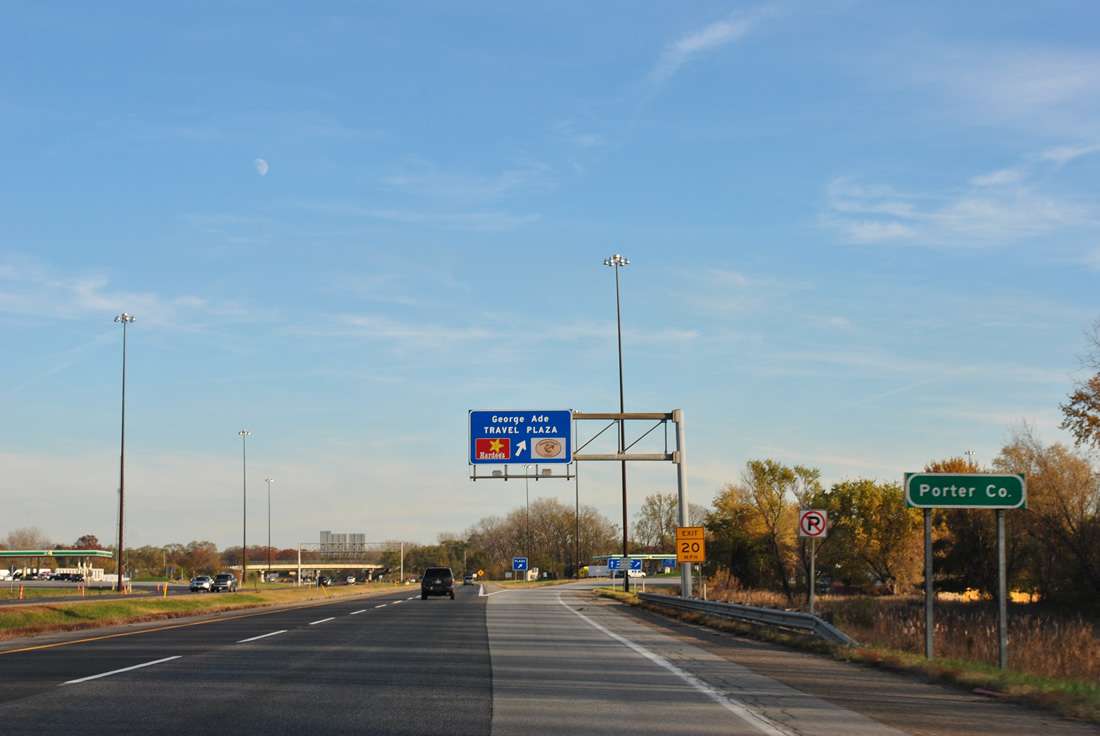
| Eastbound travelers enter Porter County, and the city of Portage, just beyond the crossing under Interstate 94. 11/04/11 |
|
| George Ade Travel Plaza is the first of five service plazas situation along the Indiana Toll Road. Traveler services including food, gas, and tourist information are found at the facility. 11/04/11 |
|
| Leaving the service area, a set of reassurance shields are posted for Interstates 80-90 and the Indiana Toll Road. Residential areas of Portage abut the toll road along this stretch. 11/04/11 |
|
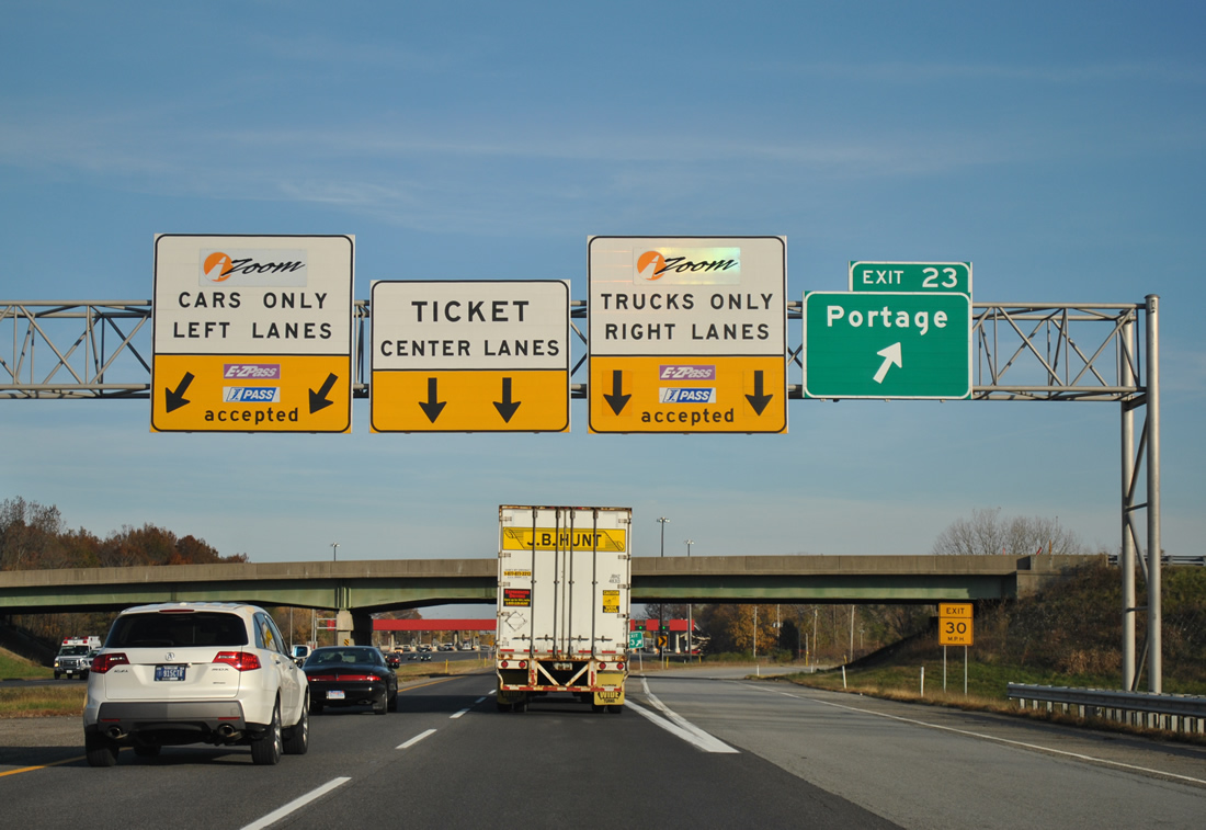
| Willowcreek Road meets I-80/90 at the next trumpet interchange (Exit 23) in one mile. Willowcreek Road travels south to U.S. 6 and County Road 700 outside Portage. 11/04/11 |
|
| A main line toll plaza follows the Exit 23 loop ramp to Willowcreek Road. Thus starts the ticketed system of the Indiana Toll Road. Motorists using i-Zoom or E-ZPass pass through without stopping. 11/04/11 |
|
| Willowcreek Road passes over the toll road at Exit 23. Willow Creek Road heads north to end at U.S. 20 (Melton Road). Willowcreek Parkway veers northeast from nearby to SR 249 (Crisman Road), a 2.4 mile route to U.S. 12 near Port of Indiana Burns Harbor. 11/04/11 |
|
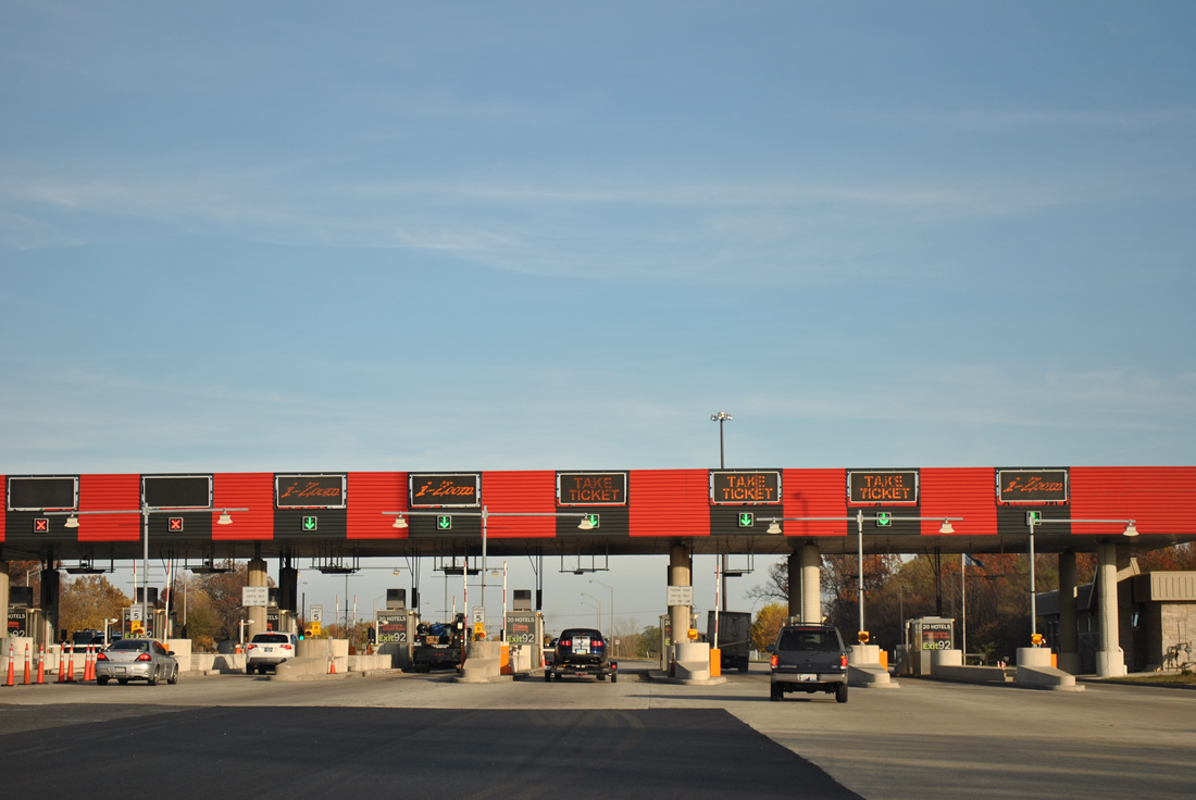
| Motorists immediately enter a set of toll booths east of the Exit 23 on-ramp. There are no high-speed ETC lanes, instead motorists may opt for one of the through lanes at 5 miles per hour. 11/04/11 |
|
| I-80/90 return to four overall lanes as the toll road passes over Central Avenue and County Road 450 West. 11/04/11 |
|
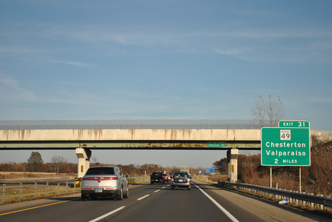
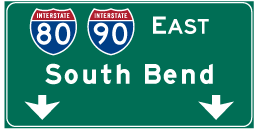
| Chesterton is the second and last Porter County exit, found nine miles to the east. South Bend and Toledo follow at 55 and 201 miles respectively. 11/04/11 |
|
| The second service plaza is 28 miles to the east at La Porte County. 11/04/11 |
|
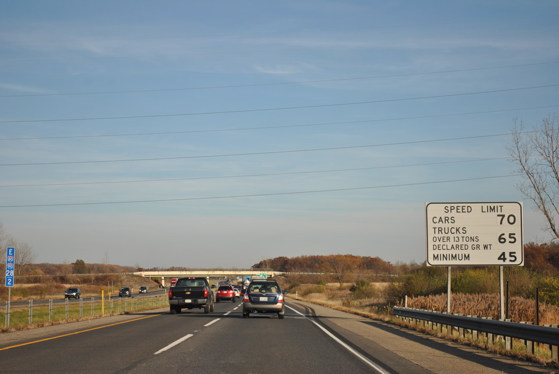
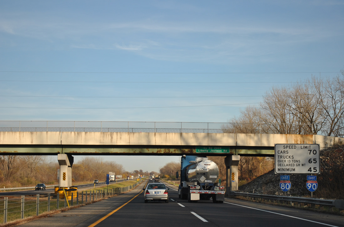
| Standard speed limit sign posted along the Indiana Toll Road. Signs set different limits for cars and trucks and also impose a minimum speed limit for all vehicles. 11/04/11 |
|
| SR 49 meets the Indiana Toll Road two miles east of the Swanson / County Road 150 West overpass near Chesterton at Exit 31. 11/04/11 |
|
| State Road 49 totals 44.2 miles, south from Exit 31 to Valparaiso, Wheatfield and Lewiston, and north to Chesterton and U.S. 12 within Indiana Dunes State Park. 11/04/11 |
|
| Eastbound at the Exit 31 trumpet interchange and access road to SR 49. SR 49 constitutes an expressway leading north to Interstate 94 at Chesterton and south to U.S. 30 and SR 2 at Valparaiso. 11/04/11 |
|
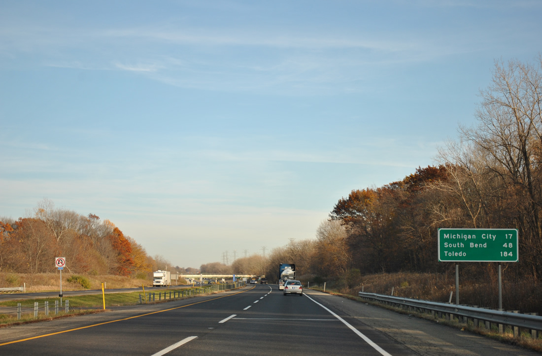
| I-80/90 become vastly more rural on the 48 mile drive to South Bend. Michigan City is listed first on this distance sign for the connection with U.S. 421 north at Exit 39. 11/04/11 |
|
| County Road 200 East crosses over I-80/90 at a set of reassurance shields and speed limit sign assembly. This is a typical combination used on the Indiana East West Toll Road. 11/04/11 |
|
| The Indiana Toll Road begins a northeasterly curve, eventually making it to just south of the Michigan state line, from the crossing here at Sand Creek. 11/04/11 |
|
| A set of truck only rest areas are reached next near the County Road 700 East overpass. 11/04/11 |
|
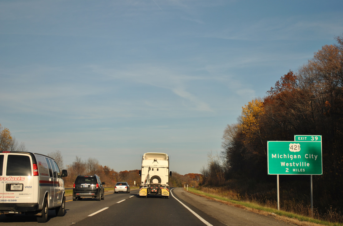
| The first sign posted for the Exit 39 trumpet interchange and access road linking I-80/90 with U.S. 421 near Otis. U.S. 421 joins the toll road with Michigan City to the north and Westville to the south. 11/04/11 |
|
| Eastbound at the truck only rest area just past milepost 37 of I-80/90. There are motorists amenities here, but toll road maintenance facilities are located along the south side. 11/04/11 |
|
| County Road 700 East lines the La Porte County line across I-80/90. The county line sign follows the overpass. 11/04/11 |
Page Updated 01-20-2012.


 East
East