|
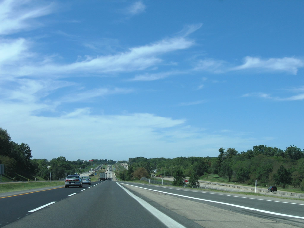
| Two miles east of the trumpet interchange at Exit 84 for SR 331 (Capital Avenue) by the suburban community of Granger on I-80/90 west. 09/02/05 |
|
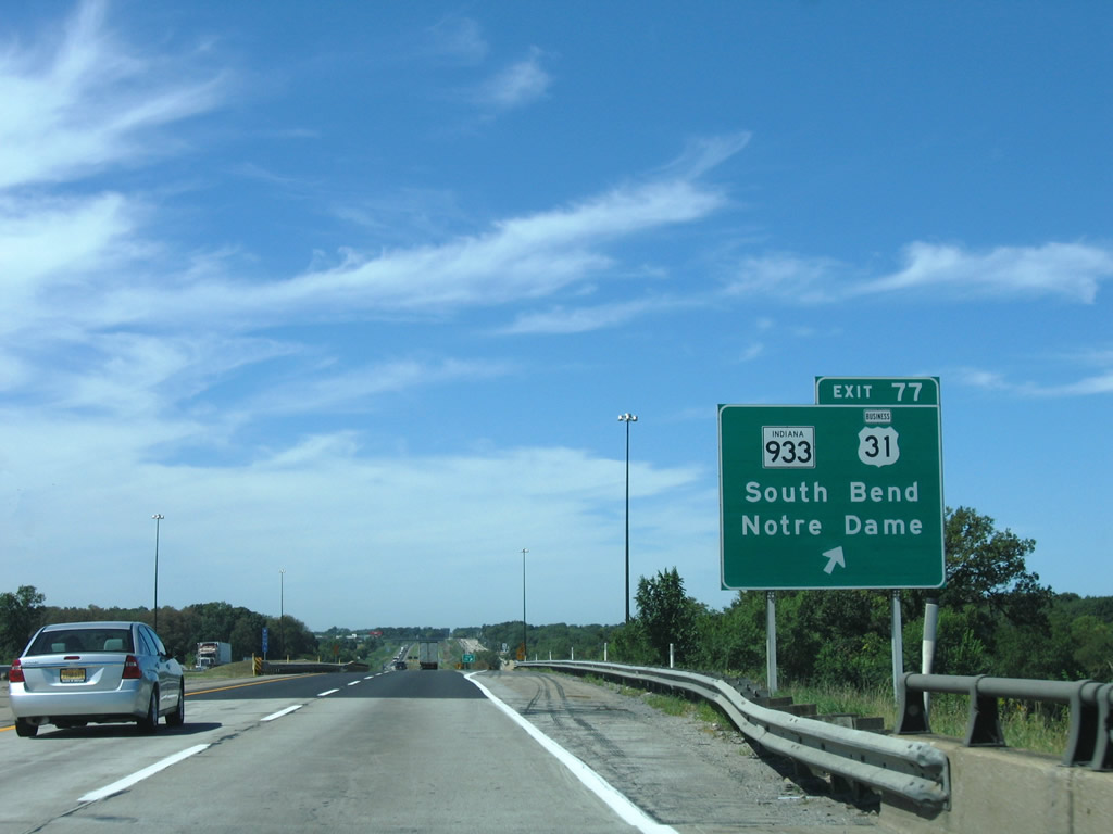
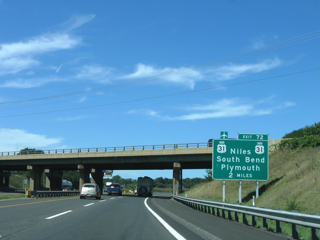
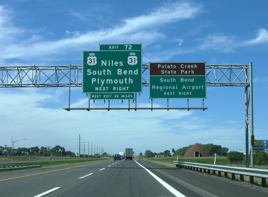
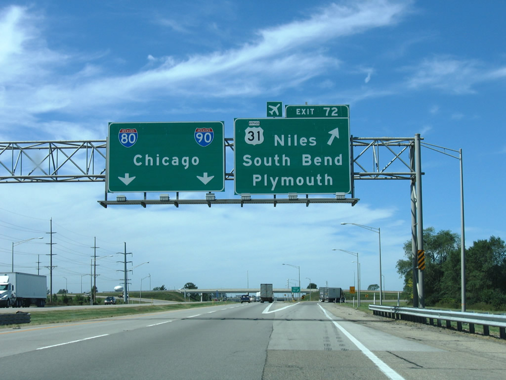
| The next three exits serve the great Mishawaka and South Bend urban area. Exit 77 should be used for South Bend and Notre Dame University; Exit 72 provides access to the South Bend freeway bypass for interests south to Plymouth and north to Niles, Michigan. 09/02/05 |
|
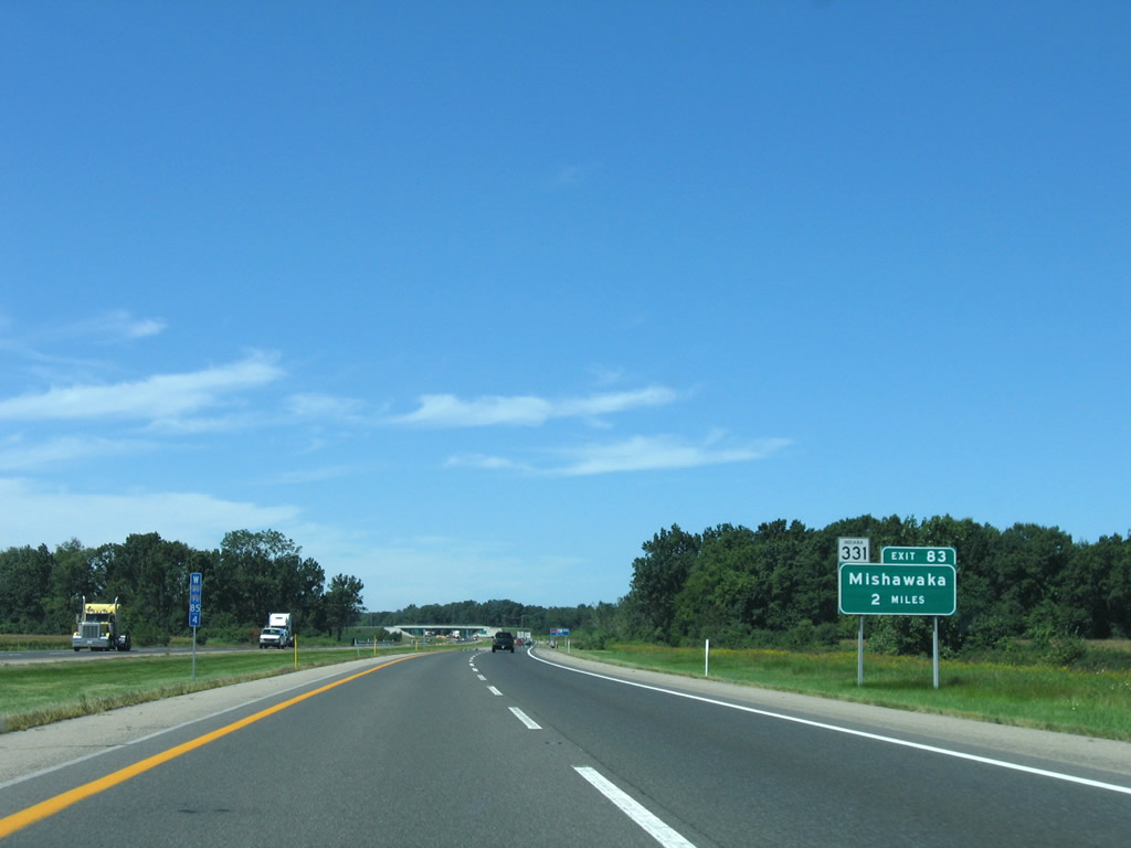
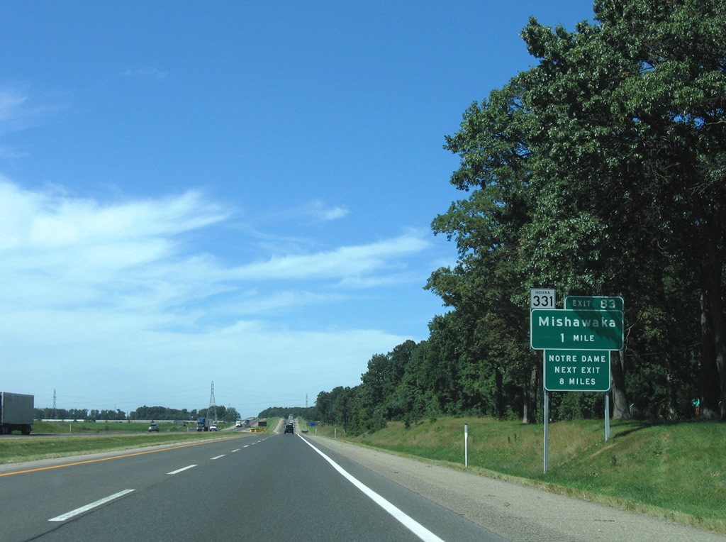
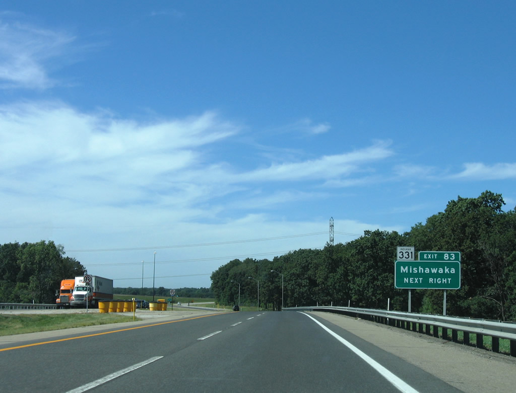
| SR 331 north provides the connection to SR 23 (Edwardsburg Highway) midway between Granger and Indian Village. SR 331 (Capital Avenue) south comprises a four lane route to SR 933 (Lincoln Way / old U.S. 33) on the east side of Mishawaka. 09/02/05 |
|
| Entering the interchange (Exit 83) with SR 331 (Capital Avenue). SR 331 travels 35.1 miles south from SR 23 to Tippecanoe. SR 23 angles southwest from M-62 near Granger through South Bend to SR 10 south of Ober. M-62 arcs northwest 28.29 miles from the state line to Eau Claire. 09/02/05 |
|
| I-80/90 slice through the northern suburbs of South Bend, including Indian Village and Roseland on the 67 mile drive to Gary. Downtown South Bend is a nine mile drive west and south via SR 933 from Exit 77. 09/02/05 |
|
| SR 933 and U.S. 31 Business (Dixie Way) interchange with the Indiana East West Toll Road at Roseland and Exit 77. The tandem provide a direct route to the University of Notre Dame campus and downtown South Bend from I-80/90. 09/02/05 |
|
| The College Football of Hall of Fame lies south from Exit 77 via SR 933 (Michigan Street) to the St. Joseph Street tourist attraction. 09/02/05 |
|
| One mile east of the trumpet interchange (Exit 77) and access road south to SR 933 & U.S. 31 Business (Dixie Way) on the westbound Indiana Toll Road. SR 933 follows an "L" shape route between M-51 and Osceola. The 17 mile route represents the pre-1988 route of U.S. 33 on its east-west portion and the pre-1982 route of U.S. 31 on its north-south path. 09/02/05 |
|
| Exit 77 loops southward from I-80/90 west after the McCombs Street underpass. U.S. 31 Business follows SR 933 southward along Michigan Street and its one way couplet split along Main Street too. The route is under local control outside of the SR 933 overlap and somewhat signed. Northward, the SR 933 (Dixie Way) transition to M-51 occurs at State Line and Bertrand, Michigan. M-51 continues through Niles on its 40.33 mile route to Exit 56 of Interstate 94. 09/02/05 |
|
| Cleveland Road carries U.S. 31 Business back to U.S. 31 as a four lane divided highway parallels the Indiana East West Toll Road closely from SR 933 west across the St. Joseph River in these scenes. For an excellent series of photos and commentary following old U.S. 31 (U.S. 31 Business) through South Bend, see Jim Grey's US 31 in Northern Indiana series, more specifically pages one, two and three covering the drive south from Michigan to the bypass. 09/02/05 |
|
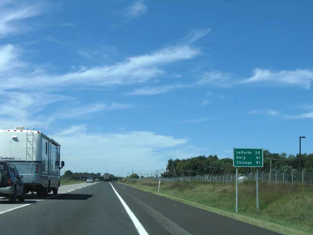
| LaPorte is the next city of interest along I-80/90 west after they depart the South Bend area. Chicago is now 91 miles away. 09/02/05 |
|
| U.S. 31, signed here as U.S. 31 Bypass, utilizes a freeway bypass of South Bend from Michigan Street northwest to Exit 72 and the Michigan state line. 09/02/05 |
|
| U.S. 31 constitutes a full freeway northward to Niles, Michigan and the Benton Harbor area near Interstates 94 & 196. Southward U.S. 31 merges with U.S. 20 at the Lincolnway West cloverleaf interchange by South Bend Regional Airport (SBN). 09/02/05 |
|
| Heading south from South Bend, U.S. 31 travels to Lakeville east of Potato Creek State Park and the Marshall County seat of Plymouth. Construction to upgrade the U.S. 31 corridor between the South Bend bypass and the Indianapolis Beltway is already underway or set to begin. Various projects will be completed in the coming years, with the portion between South Bend and Plymouth slated for completion in 2015. 09/02/05 |
|
| A trumpet to trumpet interchange connection joins I-80/90 with U.S. 31 at Exit 72. U.S. 31 travels 258 miles throughout the state, exiting at Clarksville for Louisville, Kentucky. Northward U.S. 31 continues another 356.04 miles to Interstate 75 near Mackinaw City. 09/02/05 |
|
| Following the access road from Exit 72 to the South Bend bypass and the ramp partition to U.S. 31 north for Niles, Michigan and U.S. 31 south to U.S. 20. U.S. 31 was rerouted onto the bypass in 1980. 09/02/05 |
|
| Drivers utilizing the ramps to U.S. 31 north and south are provided with a third option to join Nimitz Parkway east or Cleveland Road west. Nimitz Parkway winds eastward, replacing the route of Cleveland Road, to North Bendix Drive. The road serves a cluster of industrial parks on the northeast side of South Bend Regional Airport (SBN). 09/02/05 |
|
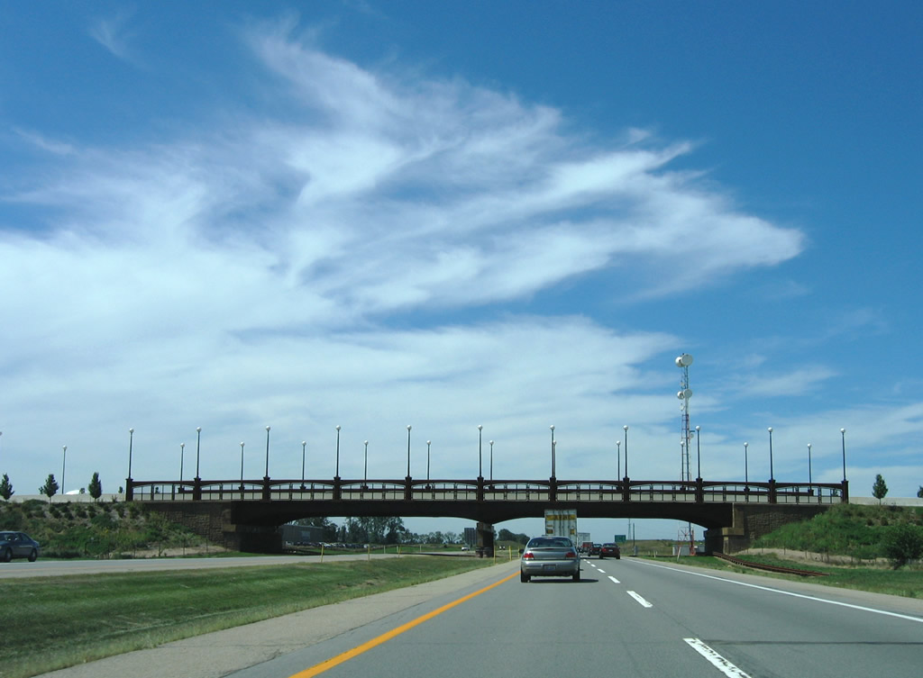
| Olive Road passes over I-80/90 with ornamental light fixtures as it links industrial parks between nearby Brick and Cleveland Roads. 09/02/05 |
|
| I-80/90 continue west and depart St. Joseph County on the 27 mile drive to LaPorte in the county by the same name. 09/02/05 |
|
| Westbound shields and speed limit sign posted at the Primrose Road over crossing. The toll road leaves the final suburbs of South Bend and just ahead of the Michigan state line along a 23 mile exit less stretch. 09/02/05 |
|
| Now within LaPorte County, drivers approach the Wilber Shaw Travel Plaza near Hog Lake. 09/02/05 |
|
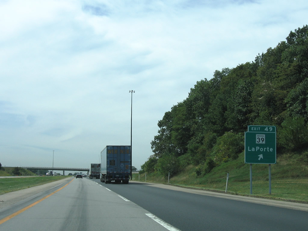
| SR 39 meets I-80/90 at the first of two LaPorte County interchanges (Exit 49), 2.2 miles north of LaPorte itself. 09/02/05 |
|
| U.S. 20 and 35 cross the Indiana East West Toll Road without access near Exit 49. SR 39 north intersects U.S. 20 at Springville 1.6 miles northward. U.S. 35 angles northwest from LaPorte to a merge with U.S. 20 near Exit 40 of Interstate 94 and Michigan City. 09/02/05 |
|
| Westbound I-80/90 at Exit 49 to SR 39. SR 39 consists of two segments within the state. The northern portion ends at M-239 seven miles out; the south end is located 179.2 miles away at Martinsville. M-239 continues the route just 1.14 miles to Interstate 94 (Exit 1) near New Buffalo. The connection between Exit 1 and the Indiana Toll Road carried Interstate 94 traffic during the 1960s until 1972, as Michigan completed their stretch of the freeway well ahead of Indiana.2 09/02/05 |
|
| Traveling south from its beginning in Michigan City, U.S. 421 interchanges with Interstate 94 (Exit 34) and continues 6.2 miles south to Exit 39 of I-80/90 near Westville. 09/02/05 |
|
| U.S. 421 travels 232 miles from Michigan City to the Kentucky state line at Madison and 941 miles overall to Fort Fisher, North Carolina. The US route travels almost due south from Exit 39 to Reynolds (SR 43), 16 miles north of Interstate 65 outside Lafayette. 09/02/05 |
|
| U.S. 421 crosses over I-80/90 ahead of the trumpet interchange and access road at Exit 39. U.S. 421 used to end in Downtown Michigan City at U.S. 12 (Michigan Boulevard), but that northernmost stretch was decommissioned. The route utilized Franklin Street north to a one way street couplet of 9th, Pine, and Washington Streets. 09/02/05 |
|
| The next exit joins the Indiana East West Toll Road with SR 49 two miles south of Chestertown. Gary lies 23 miles ahead. 09/02/05 |
|
| Another trucks only rest area lies along I-80/90 westbound ahead of the Porter County line. 09/02/05 |
|
| Jardine Road straddles the LaPorte and Porter County line beyond the truck only rest area on I-80/90. 09/02/05 |
Page Updated 11-01-2011.


 West
West