The Muncie Bypass is a 13 mile expressway that surrounds the city of Muncie, Indiana on the south and east sides. Indiana 67 follows the bypass for the majority of its length, while U.S. 35 and Indiana 3 follow it for about halfway. Indiana 67 is the highway at the southwest part of the bypass while U.S. 35/Indiana 3 marks the northern end of the bypass. The bypass contains a mixture of interchanges, overpasses/underpasses, and at-grade intersections (including two stoplights.) Despite this, the bypass is still an efficient way of going around Muncie for those coming in from the north, east, and south of the city. The Muncie Bypass was first constructed in the 1970s as an expressway bypass for U.S. 35, which went through the town from northwest to southeast. Soon after, the section in the southern end, which was primarily Indiana 67, was added on with the expansion of Indiana 67 to five lanes. From the southwest end of the bypass to Interstate 69 not done until the late 1990s.
The Muncie Bypass is an important highway within the East Central Indiana region (Delaware, Blackford, Jay, Randolph, and Henry Counties). The bypass provides a quick way for the residents of Blackford, Jay, Randolph, and Henry Counties to bypass Muncie and make their way to Interstate 69 in Daleville to better get to Indianapolis. The bypass also keeps most through traffic out of Muncie, with only Indiana 32 and Indiana 332 providing access directly into the city. Unlike with Kokomo and Marion, whose bypasses have since become congested, commercialized highways, the Muncie Bypass has seen little development and remains rural for its run. Because of that, the highway remains lightly traveled with traffic counts ranging from 6,000 to 20,000 VPD. The Muncie Bypass officially refers only to the section of highway from Hoyt Avenue interchange southwest of Muncie to the Old State Road 3 interchange north of Muncie. This set of pictures alsos include the Indiana 67 connector highway between the Bypass and Interstate 69.
|
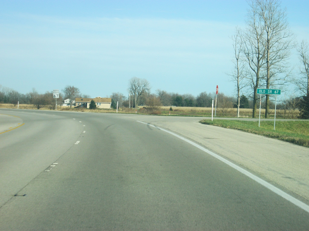
| SR 67 enters the southwestern corner of Delaware County (population 117,671) along Interstate 69 before breaking off at Exit 34. The road that meets SR 67 at the exit is County Road 550 South, which is known as Old State Road 67 west of the county line in Madison County where it follows the old path of the highway before it was multiplexed with Interstate 69 around Anderson. Interstate 69 traffic north to Fort Wayne is directed to the exit ramp that is part of the diamond/folded diamond interchange combination that is Exit 34. North of here, the folded interchange portion connects with SR 32, a two lane highway that links Anderson with Muncie via Daleville and Yorktown. SR 32 heads toward the northeast toward central Muncie while SR 67 stays to the south. The two highways will meet again east of Muncie. SR 67 early in its history followed the path of SR 32 up through Muncie. It was soon rerouted to a new alignment, which this current SR 67 generally follows. With the exception of a half mile section a few miles out, SR 67 has followed the same path since its realignment. 11/03/10 |
|
| SR 67 enters Daleville (population 1,647), a small town in southwest Delaware County. The area around Exit 34, primarily Daleville, contains a concentration of truck stops and restaurants for motorists along Interstate 69. Daleville is known by those in Muncie as being home to three national restaurant chains (Denny's, Waffle House, and White Castle) that are located in this small time but not present in the larger Muncie, one of the byproducts of being located next to the interstate. The highway is also named the Phil Sharp Highway, but as with most Indiana highways the name is rarely used and it is generally just called "67". 11/03/10 |
|
| SR 67 east of the Interstate 69 interchange is a five lane highway with a center turn lane. This section of highway is the busiest along all of SR 67 (and the Bypass) in Delaware County. This concentration of motorist's services is not only utilized by Interstate 69 travelers, but also by those coming from throughout East Central Indiana who use SR 67 and the Muncie Bypass to get to Indianapolis. 11/03/10 |
|
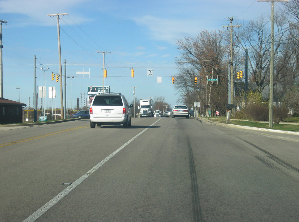
| At the intersection of SR 67 and Innovation Drive, a distance sign announces that the center of Muncie is only 13 miles away. SR 67, along with the Muncie Bypass, provide the best way to the south and east sides of Muncie. Traffic wanting to head toward Ball State University and the north and west sides of Muncie should use Interstate 69 north to the SR 332 expressway. 11/03/10 |
|
| SR 67 approaches the signalized intersection with Walnut Street, the main north-south road through Daleville. Both of Daleville's schools are also located down this way. The road also provides a secondary link with SR 32, where the downtown part of the town is located. To the south of SR 67, the road becomes County Road 900 West. 11/03/10 |
|
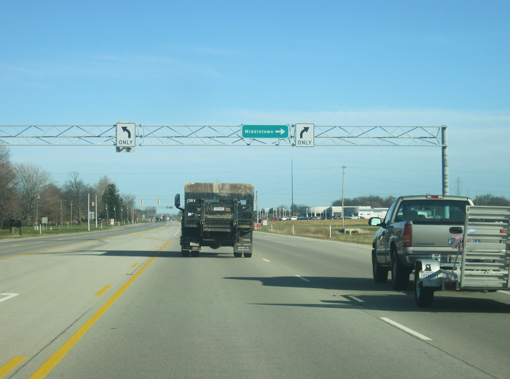
| The next signalized intersection is with County Road 800 West, which provides a link to the community of Middletown, located nine miles to the south in adjacent Henry County. 11/03/10 |
|
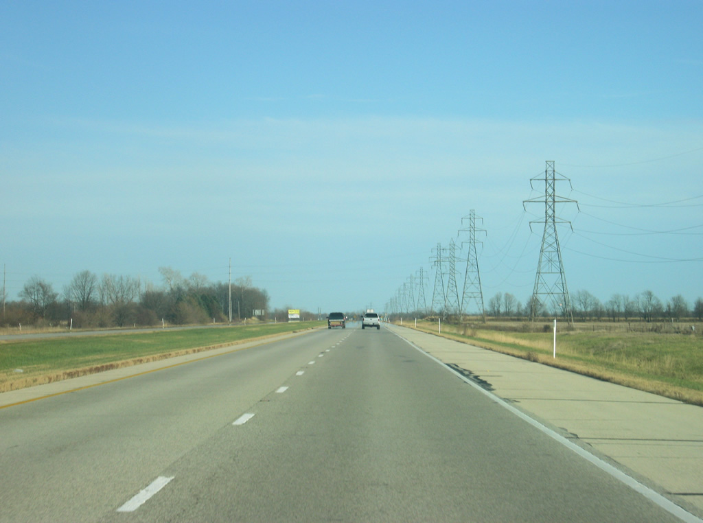
| Now east of the County Road 800 West intersection, the highway is marked as going north even though it is traveling due east at this moment. The highway now enters its rural stretch that will dominate the landscape from between Daleville and Muncie. The speed limit along this stretch of highway becomes 55 miles per hour. The highway remains five lanes all the way to the Muncie Bypass, with these sign bridge structures located throughout the highway, announcing the fact that the middle lane is for left turns (even though there are few driveways to actually turn in). 11/03/10 |
|
| The sign bridge structures get a little more utilization as SR 67 approaches the intersection of County Road 600 West. This county road provides a link to the town of Yorktown. Yorktown is the main western suburb of Muncie, and unlike the majority of East Central Indiana, is a growing community. 11/03/10 |
|
| The five lane section of SR 67 generally follows the original alignment, with an exception where it bypasses Old State Road 67 and a collection of houses that prevented road widening. 11/03/10 |
|
| Now passing the other end of the Old State Road 67 road, SR 67 follows once again the original alignment of State Road 67 straight toward the beginning of the Muncie Bypass. This section does have a few more homes and driveways, making the center turn lane a bit more practical. At the intersection with County Road 400 South up ahead, the only gas station along the highway exists. 11/03/10 |
|
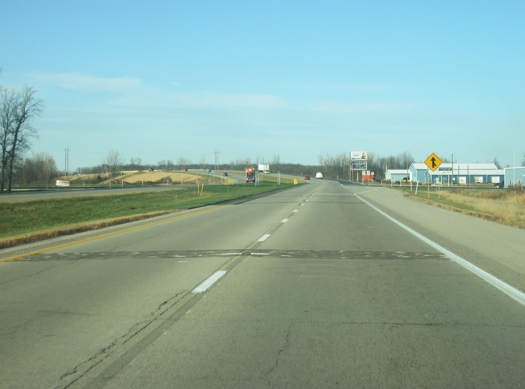
| Up ahead is the city of Muncie (population 70,085), the county seat of Delaware County. Muncie is best known for as the home of Ball State University and the home of Jim Davis, the creator of the Garfield comics. Muncie is the primary business and service hub of the East Central Indiana region, which brings people from the surrounding counties to it. As previously stated, this highway does not go into Muncie but circles it from the south and east. Up ahead, the next five interchanges, and several intersections, provide access to various parts of Muncie. 11/03/10 |
|
| The first exit going north, Hoyt Avenue is a half mile away. Hoyt Avenue represents the original routing of SR 67 through the heart of Muncie. Before this bypass, this highway was aligned to go straight into Hoyt Avenue. Now traffic has to exit off to access Hoyt. 11/03/10 |
|
| A business SR 67 shield is visible approaching the Hoyt Avenue interchange. When one gets off at the Hoyt Avenue interchange the road starts off as Hoyt Avenue, but less than a quarter mile from the interchange, Hoyt Avenue turns off to the west where it follows its original alignment while the road that continues straight becomes Fusion Road, which was known as Old State Road 67. Fusion Road represents the first bypass that SR 67 used as a bypass of Hoyt Avenue. The road continues to the east, following the current Muncie Bypass for a couple of miles before the road turns north and becomes Madison Street, the primary north-south road across the south side of Muncie. 11/03/10 |
|
| Here, Hoyt Avenue exits off of SR 67. As with any non-interstate, freeway-like highway, the exits do not have numbers. A trumpet interchange facilitates the movements between Hoyt and SR 67 as the Muncie Bypass officially begins. The Muncie Bypass carries a speed limit of 55 miles per hour throughout. 11/03/10 |
|
| The Muncie Bypass heads east along the southern fringes of Muncie. Transmission lines follow the bypass along the southern segment of the route. While the bypass serves the south and east sides of Muncie well, the north and west sides are under-served, and it is these areas that are the growing parts of the city. So, unlike many bypasses in Indiana where the development follows the bypass route, in Muncie, the development is the opposite direction. There have been discussions about finishing the bypass by providing a western alignment that would connect the north end of the bypass to the area around the Hoyt Avenue interchange, but nothing has resulted of those discussions. 11/03/10 |
|
| The Muncie Bypass approaches the first of two signalized intersections, Cowan Road. Cowan Road is a minor county road to the south where it connects with the small town of Cowan, a few miles to the south. To the north, it is a four lane boulevard that links the bypass with the industrial complexes along the southwestern side of the city. North of the industrial complex, the road connects back up with Hoyt Avenue. 11/03/10 |
|
| A sign points travelers toward the Ivy Tech Community College, which has its main campus within the industrial complex to the north. 11/03/10 |
|
| The Muncie Bypass crosses the Cowan Road intersection. Cowan Road is one of two potential locations for a new interchange along the bypass. If viewed from the air though, the right of way is already set aside for a diamond interchange. Largely because of a lack of funding and a low traffic count in the area, the interchange has not been built and no timeline is in place for it being built in the future. 11/03/10 |
|
| East of the Cowan Road intersection, the Muncie Bypass approaches the intersection with SR 3 South. 11/03/10 |
|
| The Muncie Bypass crosses the Norfolk Southern Railroad tracks with an at-grade crossing. Muncie is at the center of a network of railroads and has plenty of trains running through, so there are decent chances of being stopped along the bypass by trains crossing. Fortunately, this is the only at-grade railroad crossing along the bypass. 11/03/10 |
|
| SR 3 is a major north-south highway across Eastern Indiana, going for 224 miles. The highway was continuous until 1972 where it was divided into two segments. The main segment starts in Charlestown (north of Louisville) before going through North Vernon, Greensburg, Rushville, and New Castle. South of the Muncie Bypass, SR 3 is a four lane expressway south into Henry County and New Castle, providing access to Interstate 70. The SR 3/Interstate 70 combination provides an alternative route from Indianapolis to Muncie. North of this interchange, the four lane expressway becomes the local Macedonia Avenue, which was the original route for SR 3. 11/03/10 |
|
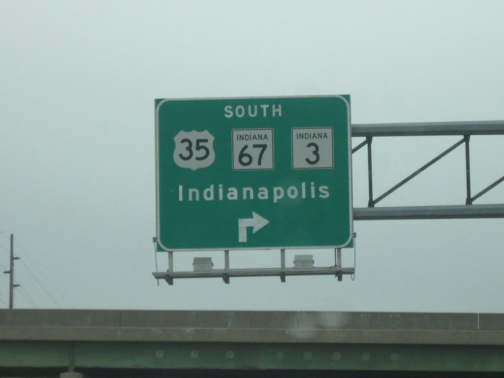
| Now at the interchange with SR 3 South. SR 3 continues north along the Muncie Bypass, and an additional sign directs traffic heading for U.S. 35 south to exit at this interchange. The U.S. 35 interchange with the bypass is a half diamond that the northbound lanes of the bypass do not access. Therefore, traffic wanting to go south on U.S. 35 must utilize Macedonia Avenue (Old SR 3) north to at right at the first stoplight (29th Street). 29th Street becomes a part of U.S. 35 east of there.
U.S. 35 to the southeast of Muncie provides a two lane highway to Richmond before heading into Ohio. 11/03/10 |
|
| Past the SR 3 South interchange, SR 3 is now signed alongside SR 67. SR 3 follow the Muncie Bypass for the rest of its route as it bypasses Muncie to the east on its way north toward Hartford City. 11/03/10 |
|
| The Muncie Bypass turns toward the northeast as it approaches the half interchange with U.S. 35. From the Meeker Road intersection (around this photo) up north to the McGalliard Road intersection, the road has no other at-grade crossings, making this the only true freeway section of bypass. 11/03/10 |
|
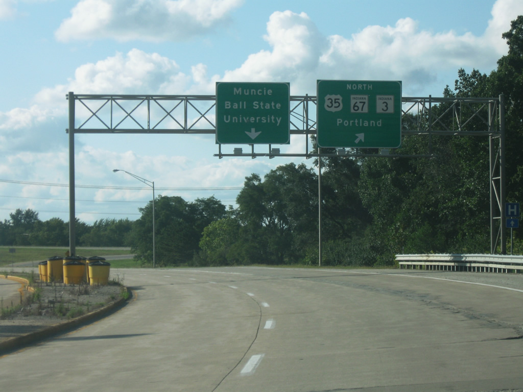
| U.S. 35 now joins SR 3/SR 67. U.S. 35 follows SR 3 the rest of the way along the Muncie Bypass. The stretch of the Muncie Bypass from the U.S. 35 half diamond interchange north to the SR 67 North interchange is the busiest stretch of the bypass.
The stretch of the Muncie Bypass from this point northward to the northern end was the first part built. Originally, the Muncie Bypass was conceived as an expressway bypass of U.S. 35. Later on, the rest of the bypass along the south side was constructed.
The five lane section of SR 67 to Daleville wasn't finished until the late 1990s. 11/03/10 |
|
| The next interchange, with Memorial Drive approaches on the Muncie Bypass. 11/03/10 |
|
| The Burlington Drive Bridge passes over the Muncie Bypass. Burlington Drive represents the original routing of U.S. 35 southeast of Muncie. It is one of a few local streets to have a grade separation with the bypass. 11/03/10 |
|
| Another guide sign for Memorial Drive. Memorial Drive is a four lane arterial route that is the main west-east road across the south side of Muncie, providing access to various routes into downtown Muncie. The positioning of the interchanges and grade separations along this part of the bypass is a byproduct of when the bypass was built, back when the south side had a higher population and factories. 11/03/10 |
|
| A folded diamond interchange facilitates movements between the Muncie Bypass and Memorial Drive. To the east of the interchange is the AMA (Academy of Model Aeronautics) National Model Aviation Museum, one of the main attractions in the Muncie area. 11/03/10 |
|
| North of the Memorial Drive, the interchange with SR 32 appears. SR 32 is a 157 mile highway that stretches from the Illinois state line to the Ohio state line, going through the communities of Crawfordsville, Lebanon, Noblesville, Anderson, Daleville and Yorkton to the west and Selma, Parker City, Farmland, Winchester and Union City to the east. 11/03/10 |
|
| SR 32 crosses underneath the Muncie Bypass with access directed via a folded diamond interchange. Within Muncie, SR 32 is known as Jackson Street, the primary west-east road across the city. Within town, Jackson Street carries the eastbound lanes for SR 32, with Main Street carrying the westbound lanes, but east of the White River, Jackson Street carries both directions of the road which varies from two to four lanes. East of the Muncie Bypass, the road becomes a four lane highway for a few miles out to Selma before going back to two lanes. Winchester, the county seat of Randolph County, is 23 miles to the east. 11/03/10 |
|
| Reassurance shields for U.S. 35/SR 3/SR 67 north of the SR 32 interchange. Up ahead is the intersection with Centennial Avenue, which until 2011 was an at-grade intersection. Now the crossover has been removed with right in/right out ramps providing access to Centennial Avenue only to the east of the bypass. This has been indicated as a potential location for an overpass, but for now no bridge is planned. Traffic desiring to go west on Centennial should use either SR 32 or McGalliard Road up ahead. 11/03/10 |
|
| Old rumble strips indicate the location where the Centennial Avenue crossover was located. This intersection had the highest amount of crashes along the Muncie Bypass, prompting INDOT to remove the crossover all together and allowing only right hand turns onto Centennial to the east and from Centennial going west to the bypass going north. 11/03/10 |
|
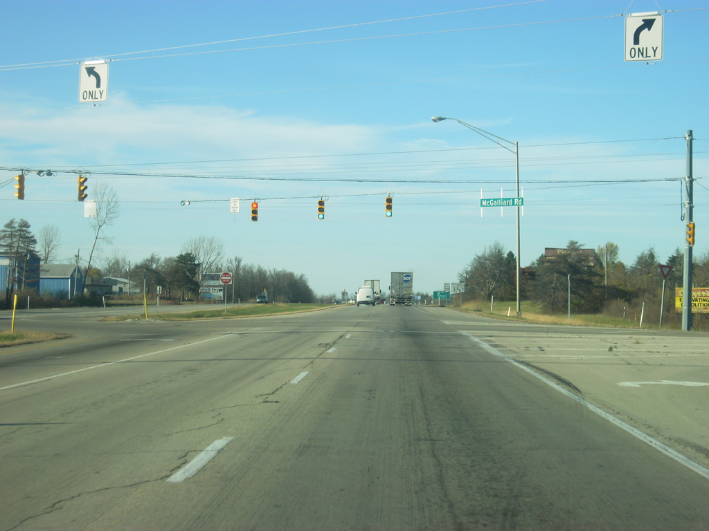
| North of Centennial Avenue, the second stoplight along the Muncie Bypass appears, for McGalliard Road. McGalliard Road is the most important west-east road across the north side of Muncie and is the main commercial strip for the East Central Indiana region. Along this road, one can access the Muncie Mall shopping center and numerous shops and restaurants along the way. The road also provides the best access to Ball State University. 11/03/10 |
|
| The Muncie Bypass crosses the McGalliard Road intersection. McGalliard is a five lane road from the Muncie Bypass all the way across Muncie to Tilliotson Avenue, where it becomes a four lane expressway, SR 332. SR 332 goes west from there and provides a direct connection with Interstate 69, roughly 15 miles west of this intersection. This is the location of a potential new interchange with the Muncie Bypass, but funding issues have since put this on the back burner. Unlike the Cowan Road intersection, which sees smaller traffic counts, the intersection with McGalliard is busier, prompting INDOT to lengthen the left turn lanes at this stoplight in lieu of not building the interchange. 11/03/10 |
|
| Now on the northeast side of Muncie and after being a divided highway since Daleville, SR 67 prepares to exit off the Muncie Bypass. Southwest of the interchange with the Muncie Bypass, the road that used to carry SR 67 is called Broadway Avenue as it provides a link to Muncie Mall and downtown Muncie. South of McGalliard Road, the road is known as Martin Luther King, Jr. Boulevard and Wysor Street. 11/03/10 |
|
| SR 67 North is now a half mile away from this location. SR 67 is a major diagonal route that begins outside of Vincennes in southwest Indiana, and proceeded northeast through Spencer, Martinsville, Indianapolis, Pendleton, Anderson and Daleville and continues northeast from here through Albany, Redkey, and Portland, ending at the Ohio state line northeast of Portland. In total, the highway is nearly 200 miles in length. 11/03/10 |
|
| No guide sign directs traffic off the Muncie Bypass onto SR 67 North, with only a gore sign indicating the exit. From this point northward, SR 67 is a two lane highway to its end at the Ohio state line. Portland lies 30 miles northeast of the Muncie Bypass, linking the county seat of Jay County to Muncie. 11/03/10 |
|
| North of the SR 67 North interchange, U.S. 35/SR 3 become the only highways along the bypass as it turns toward the north for its final alignment. 11/03/10 |
|
| The Muncie Bypass heads north as the ramp from Old State Road 3 northbound approaches the highway. The road connects with Broadway Avenue and follows the original routing of SR 3 before it was rerouted via the bypass. 11/03/10 |
|
| The Muncie Bypass officially ends as the four lane divided highway comes down to two lanes. 11/03/10 |
|
| The small town of Royerton appears along north U.S. 35/SR 3. 11/03/10 |
|
| U.S. 35/SR 3 at the intersection with County Road 500 North. This is in the "heart" of Royerton. The highway through this stretch still carries heavy traffic from U.S. 35. 11/03/10 |
|
| North of County Road 500 North, U.S. 35/SR 3 still carries a decent amount of traffic, largely from the U.S. 35 routing of the highway through here. At one time, U.S. 35 took a different path across Delaware County, going from the northwest corner of the county, through the town of Wheeling, and down Wheeling Pike all the way into Muncie, before continuing on Burlington Pike toward the southeast. The routing has since been changed so that it follows Interstate 69 from Grant County to the interchange with SR 28 and follows that road toward SR 3. 11/03/10 |
|
| The intersection of U.S. 35/SR 3 and SR 28 is up ahead. SR 28 is a 153 mile highway that stretches across the state from Illinois to Ohio. The highway goes through Attica, Frankfort, Tipton, Elwood and Alexandria to the west and through Albany and Union City to the east. U.S. 35 follows SR 28 from the upcoming intersection to Interstate 69 before continuing its path toward Gas City, Kokomo, Logansport, LaPorte, before ending in Michigan City. 11/03/10 |
|
| Now at the intersection with SR 28, with control cities of Alexandria and Albany mentioned. This is also the location with U.S. 35 turns west, which is why the left turn lane exists to carry that traffic. From this point north, SR 3 is the sole highway. 11/03/10 |
|
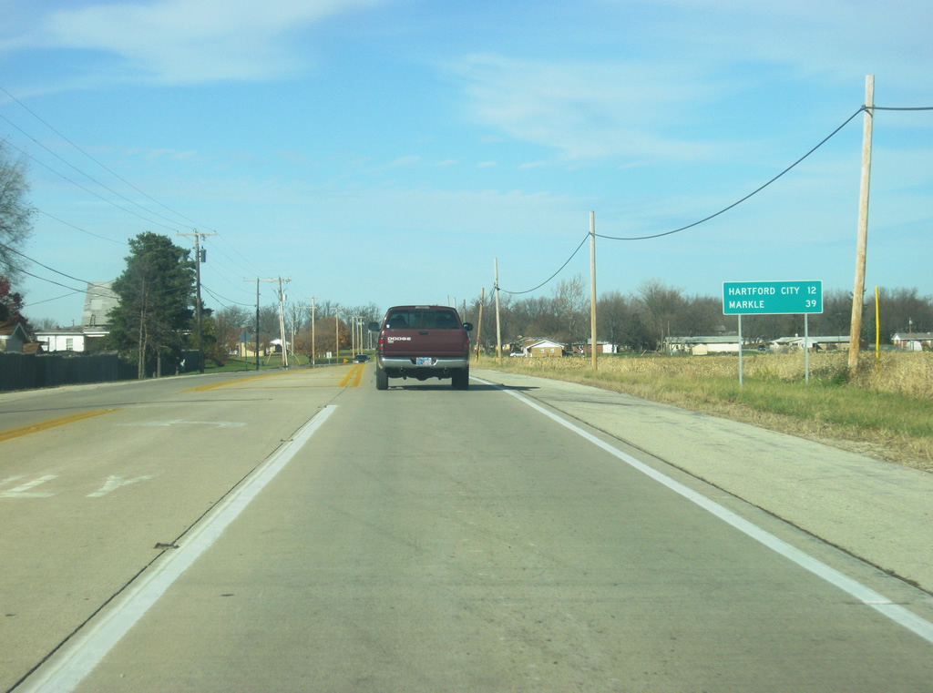
| North of the SR 35 North/SR 28 intersection, the next distance sign for SR 3 appears with the Blackford County seat of Hartford City placed at 12 miles from this location and Markle, located at SR 3's northern terminus near Interstate 69 at 39 miles. From this location northward, SR 3 provides the main highway between Muncie and Blackford County, while also connecting with the northern Delaware County community of Eaton. 11/03/10 |
|
| Southbound at the Hoyt Avenue interchange approaching the Muncie Bypass. The signs use the control cities for SR 67 with Portland for northbound and Indianapolis for southbound. Straight ahead is SR 67 south which is in perfect alignment with the southbound Hoyt Avenue interchange, a vestige to when Hoyt Avenue was SR 67. 05/03/09 |
|
| U.S. 35 northbound at the Muncie Bypass interchange. Here, U.S. 35 is directed north onto the bypass as the road continues west to become 29th Street. The northbound control city is Portland, which is where SR 67 ends up, but not U.S. 35 or SR 3. The sign for through traffic mentions both Muncie and Ball State University as destinations. At one time, this sign likely directed traffic ahead for U.S. 35, SR 3, and SR 67 before the entire bypass was finished. 08/29/09 |
|
| Close-up of the highway shields for SR 32 and the Muncie Bypass (with the same shape of an Indiana highway shield). This is located at the intersection of Jackson Street and Madison Street in downtown Muncie. Jackson Street is the eastbound one way pair for SR 32 and Madison Street was the original routing for U.S. 35/SR 3/SR 67 before the bypass. 12/13/08 |
|
| Guide sign at the SR 32 (Jackson Street) interchange with the Muncie Bypass for northbound bypass traffic via U.S. 35/SR 3/SR 67 with control city of Hartford City. 12/13/08 |
|
| Close-up of the highway shields for U.S. 35/SR 3/SR 67 at the SR 32 (Jackson Street) interchange with the Muncie Bypass. 08/29/09 |
|
| Guide sign at SR 32 (Jackson Street) interchange with the Muncie Bypass for southbound bypass traffic via U.S. 35/SR 3/SR 67 with control city of Indianapolis. 12/13/08 |
|
| Approaching north on Broadway Avenue (the old SR 67) to the Muncie Bypass. The control cities of Hartford City and Indianapolis are listed, since SR 3 continues to the north and SR 67 continues to the south. Indianapolis is the control city for all southbound guide signs approaching the bypass, but northbound alternates between Hartford City and Portland. 12/13/08 |
|
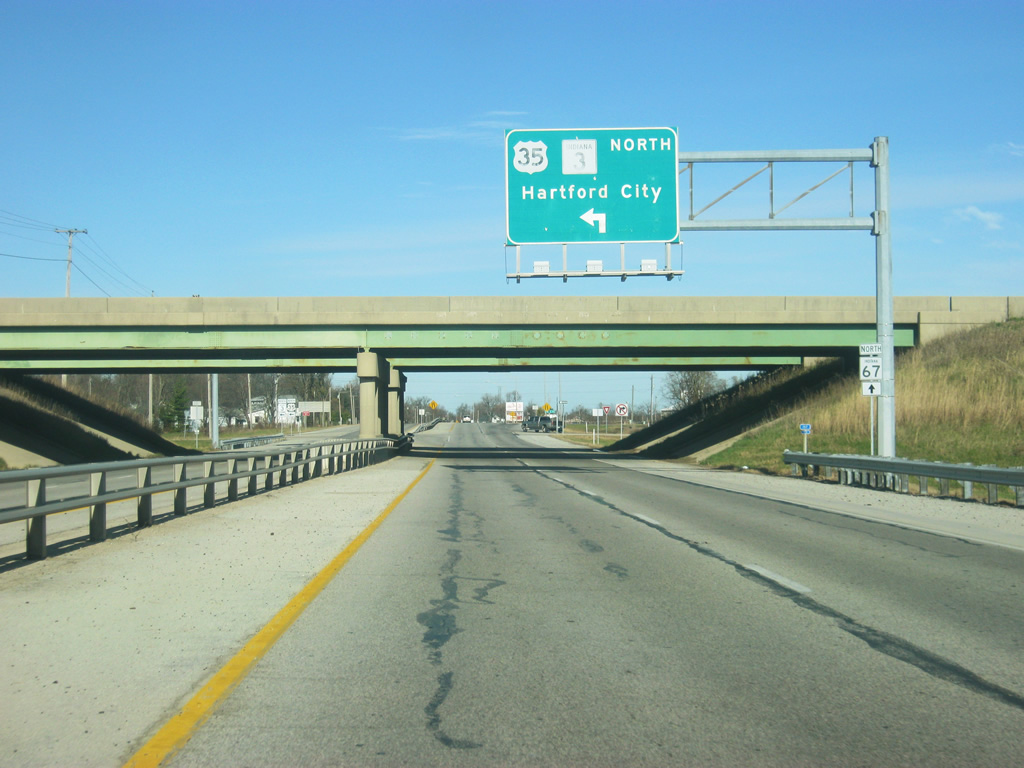
| At the same interchange, a button-copy sign directs northbound traffic on the Muncie Bypass (U.S. 35 / SR 3) in the direction of Hartford City. 10/03/10 |
Photo Credits:12/13/08, 05/03/09, 08/29/09, 10/03/10, 11/03/10 by Thomas Decker
Connect with:
Interstate 69
Page Updated 12-10-2011.