|
| SR 9 (Main Street) proceeds north from Port Mahon Road in Little Creek. Port Mahon Road spurs east from the state route to Port Mahon on Delaware Bay. 01/15/17 |
|
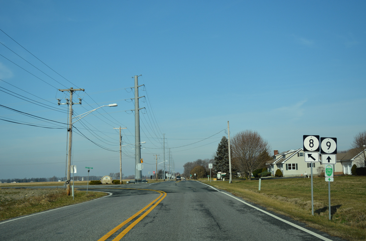
| Nearing the north end of Little Creek, SR 9 (Main Street) meets the east end of SR 8 (North Little Creek Road). 01/15/17 |
|
| A two-wye intersection connects SR 9 (Bayside Drive) with SR 8 west to Downtown Dover. 01/15/17 |
|
| SR 8 crosses Kent County along a 17.15 mile course to Pearsons Corner and Marydel. The route ends as MD 454 north begins. 01/15/17 |
|
| Nearing the westbound beginning of SR 299 on SR 9 (Taylors Bridge Road) north at Mathews Corner. 01/15/17 |
|
| SR 299 extends Taylors Bridge Road west to Old State Road as it heads northwest toward the town of Odessa. Interests to Wilmington are directed to remain along SR 9 north, perhaps to Reedy Point Bridge. 01/15/17 |
|
| Thomas Landing Road angles SR 9 northeast from SR 299 (Taylors Bridge Road) by the Cantwell Ridge subdivision. SR 299 meets U.S. 13 (5th Street) north in 1.69 miles. 01/15/17 |
|
| SR 9 progresses north from suburban areas east of Odessa toward Augustine Wildlife Area. 01/15/17 |
|
| SR 9 (St. Augustine Road) runs directly alongside the Delaware River at Augustine Beach. Visible to the southeast is Hope Creek Generating Station in Salem County, New Jersey. 12/15/17 |
|
| Entering the unincorporated community of Port Penn, SR 9 transitions from St. Augustine Road onto Congress Street. 12/15/17 |
|
| Port Penn occupies one block formed by Congress Street (SR 9) to the east and Merchant Street to the south. 12/15/17 |
|
| SR 9 dog legs west two blocks on Market Street through Port Penn. 12/15/17 |
|
| Market Street extends west from the turn of SR 9 north onto Liberty Street to become Port Penn Road. Port Penn Road splits with Pole Bridge Road to SR 1 at Boyds Corner ahead of U.S. 13 at Biddles Corner. 12/15/17 |
|
| Advancing north from Port Penn, SR 9 traverses a waterway alongside Augustine Wildlife Area. 12/15/17 |
|
| Heading north from Thorntown Road toward the Reedy Point Bridge, SR 9 plies across wetland areas and farmland through Augustine Wildlife Area. 04/04/04 |
|
| South Reedy Point Road separates from SR 9 and runs along the west side of the Reedy Point Bridge approach to Dutch Neck Road. Dutch Neck Road parallels the Chesapeake and Delaware Canal west through the C & D Canal Wildlife Area to Ice House Point. 04/04/04 |
|
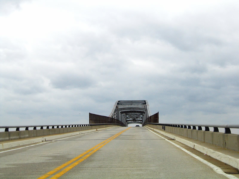
| Ascending onto the Reedy Point Bridge, motorists pass by a reassurance marker. The continuous steel thru truss bridge is named after Reedy Point, where the C & D Canal opens into the Delaware River. 04/04/04 |
|
| Maintained by the Philadelphia District of the Army Corps,1 the cantilever span for SR 9 carries two lanes and opened in 1968 as the fourth crossing of the Chesapeake & Delaware Canal. 12/16/17 |
|
| Passing below the Reedy Point Bridge superstructure on SR 9 north. A $2.5 million project in 1995 repaired anchor and deck spans and repainted the bridge. Subsequent work took place in 1999 for miscellaneous steel work and again in April 2012 for repairs. An $8 million contract from October to December 2014 made final steel repairs and painting.1 04/04/04, 12/16/17 |
|
| Lowering over Dutch Neck and Fort DuPont State Park, the bend of the Delaware River at Hamburg Cove comes into view. 12/16/17 |
|
| Polktown Place north and New Castle Avenue west converge at the north end of Reedy Point Bridge in Delaware City. Polktown Place parallels the span to Fort DuPont State Park and the Grass Dale Center. 12/16/17 |
|
| Returning to grade, SR 9 follows Fifth Street through the Delaware City limits. The state route spans the Delaware City Branch Canal between Old Elm Avenue and Canal Street beyond this welcome sign. 12/16/17 |
|
| The original draw bridge across the Delaware City Branch Canal was built in 1933, and fused shut in 1971. The 177-foot long crossing was replaced during a $3 million project from September 6, 2016 to February 2017.2 12/16/17 |
|
| Fifth Street advances north from the Delaware City Branch Canal through the Delaware City street grid. An SR 9 reassurance marker appears at Hamilton Street. 12/16/17 |
|
| The lone traffic light in Delaware City operates at Clinton Street. Clinton Street west becomes Cox Neck Road, which extends along the C & D Wildlife Area to U.S. 13 at North St. Georges. 12/16/17 |
Page Updated 11-30-2018.


 North
North