|
| North of the county line, SR 9 works its way north toward the southern limits of the next community of Greenfield. 12/19/11 |
|
| SR 9 enters the city of Greenfield (population 20,602) which is the county seat of Hancock County and the home of famous Hoosier Poet James Whitcomb Riley. In SR 9, the highway takes on the local name of State Street. 12/19/11 |
|
| SR 9 (State Street) turns toward the northwest as it approaches its first stoplight intersection with County Road 100 South. The top of the Hancock County courthouse looms in the distance. 12/19/11 |
|
| SR 9 (State Street) heads into some residential neighborhoods on the south side of Greenfield. 12/19/11 |
|
| SR 9 (State Street) kinks to the west at the intersection with Tague Street. 12/19/11 |
|
| From Tague Street, SR 9 (State Street) heads toward the north through the older part of Greenfield. 12/19/11 |
|
| The Hancock County courthouse appears to the right as SR 9 (State Street) heads into Downtown Greenfield. 12/19/11 |
|
| SR 9 (State Street) crosses the Pennsy Trail as it enters the downtown district of Greenfield. The Hancock County courthouse looms large on the eastern side of the highway nearby. 12/19/11 |
|
| Passing the Hancock County courthouse, SR 9 (State Street) approaches U.S. 40 (Main Street). U.S. 40 once traveled from San Francisco, California east to Atlantic City, New Jersey. Today it goes for 2,285.7 miles from Park City, Utah to Atlantic City. 12/19/11 |
|
| Now at the intersection between SR 9 (State Street) and U.S. 40 (Main Street), the historic National Road. U.S. 40 travels the Hoosier State for 144 miles from Terre Haute in the west, through Brazil, Plainfield, Indianapolis, and Greenfield to Richmond in the east. The intersection between the two roads is the heart of the community of Greenfield. 12/19/11 |
|
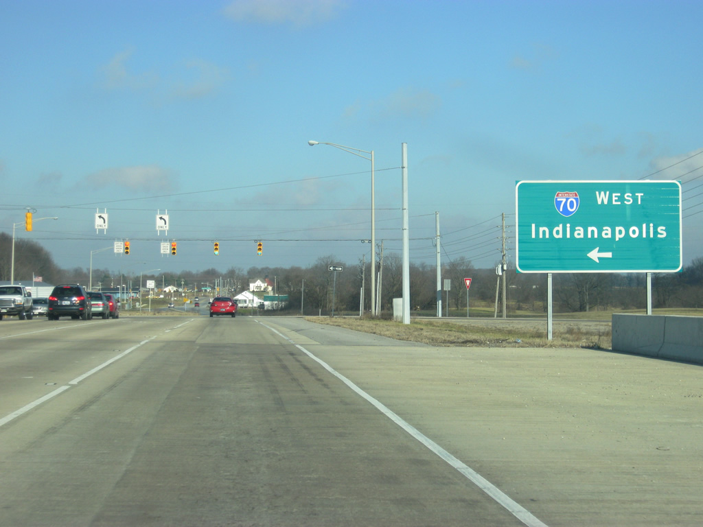
| North of the U.S. 40 (Main Street), SR 9 (Main Street) heads out of Downtown Greenfield toward Interstate 70. 12/19/11 |
|
| SR 9 (State Street) heads north from Downtown Greenfield through a residential neighborhood that transitions into a commercial zone, passing by Hancock Regional Hospital. SR 9 (State Street) is the busiest road in Hancock County, connecting the heart of Greenfield with Interstate 70 and Indianapolis. 12/19/11 |
|
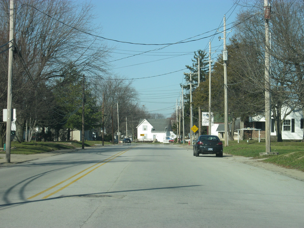
| At the intersection with McKenzie Road, SR 9 (State Street) expands to four lanes as it enters a commercial-oriented corridor north to Interstate 70. 12/19/11 |
|
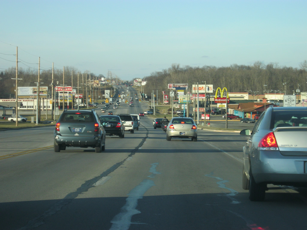
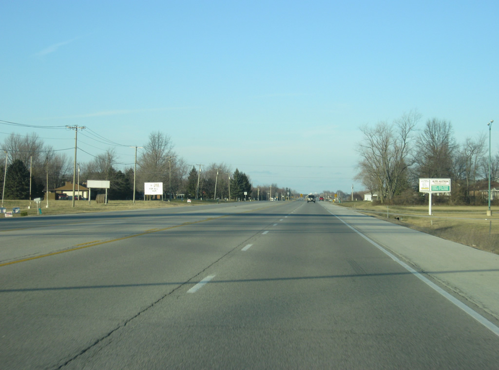
| North of McKenzie Road, SR 9 (State Street) passes by an assortment of shopping centers, restaurants, and other businesses en route to Interstate 70. The trip of SR 9 through Greenfield can be slow-going for those heading thru and there have been talks of a potential bypass around the city, but nothing has come to fruition. 12/19/11 |
|
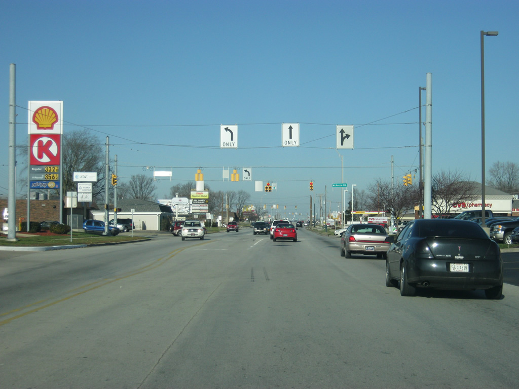
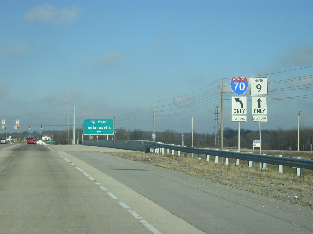
| On the far north side of Greenfield, the interchange with Interstate 70 is next along SR 9 (State Street). The junction between the two highways consists of a diamond interchange. Interstate 70 travels from Cove Fort, Utah to Baltimore, Maryland for 2,153 miles. In Indiana, the highway goes for 156 miles from Terre Haute east through Indianapolis and east toward Richmond. 12/19/11 |
|
| The left lane for SR 9 northbound traffic will default into a pair of left turn lanes for Interstate 70 while the right lane continues the state highway to the north of the interchange. Eastbound traffic for Interstate 70 towards New Castle, Richmond and Dayton, Ohio turns off to the right ahead. 12/19/11 |
|
| Another pair of shields directs travelers across the widened SR 9 bridge over Interstate 70. 12/19/11 |
|
| The interchange between SR 9 and Interstate 70 was rebuilt to handle the additional commuter traffic that travels from Greenfield to Indianapolis, hence the two left turn lanes for traffic heading westbound on Interstate 70. 12/19/11 |
|
| SR 9 goes down to two lanes to the north of the interchange with Interstate 70. 12/19/11 |
|
| An SR 9 reassurance shields greets travelers heading north past the Opportunity Parkway intersection. 12/19/11 |
|
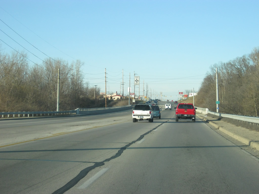
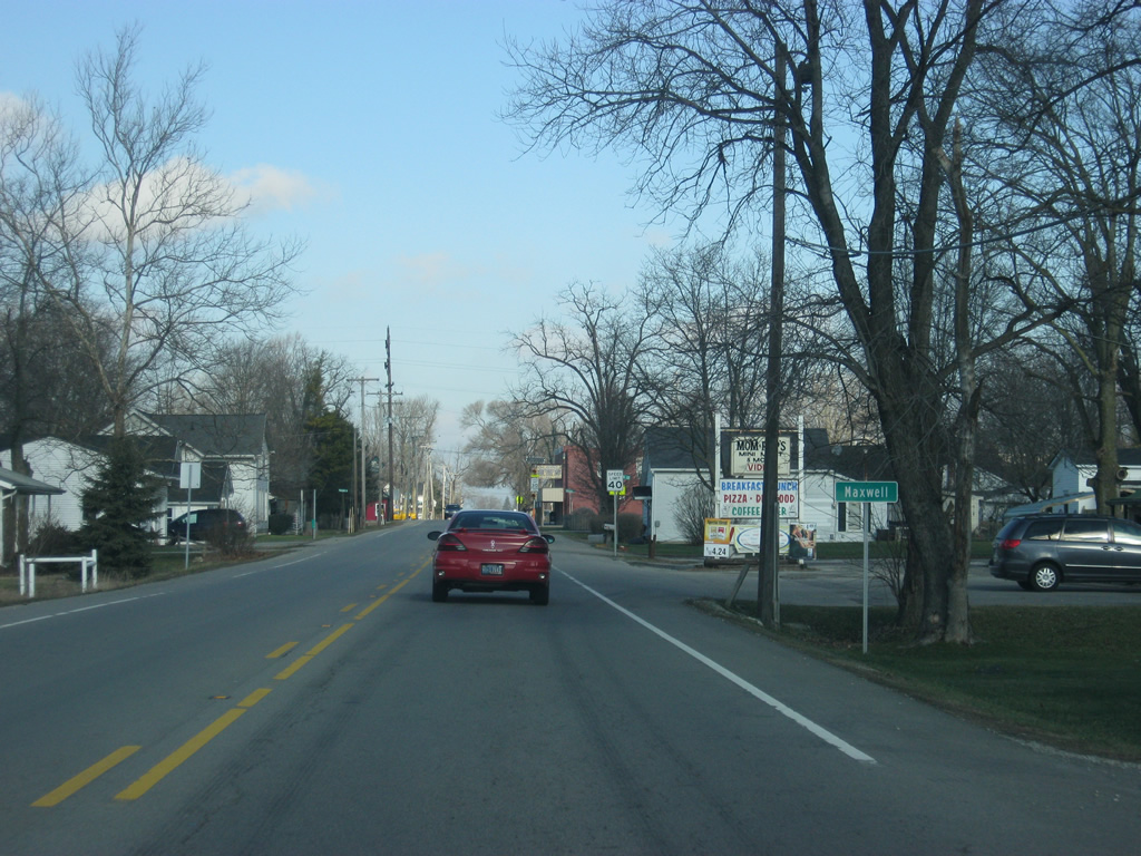
| North of Interstate 70, SR 9 remains a well-traveled highway toward the town of Maxwell. 12/19/11 |
|
| About three miles north of Interstate 70, SR 9 goes through the town of Maxwell. 12/19/11 |
|
| North of Maxwell, SR 9 continues in a due-north trajectory toward the junction with SR 234. 12/19/11 |
|
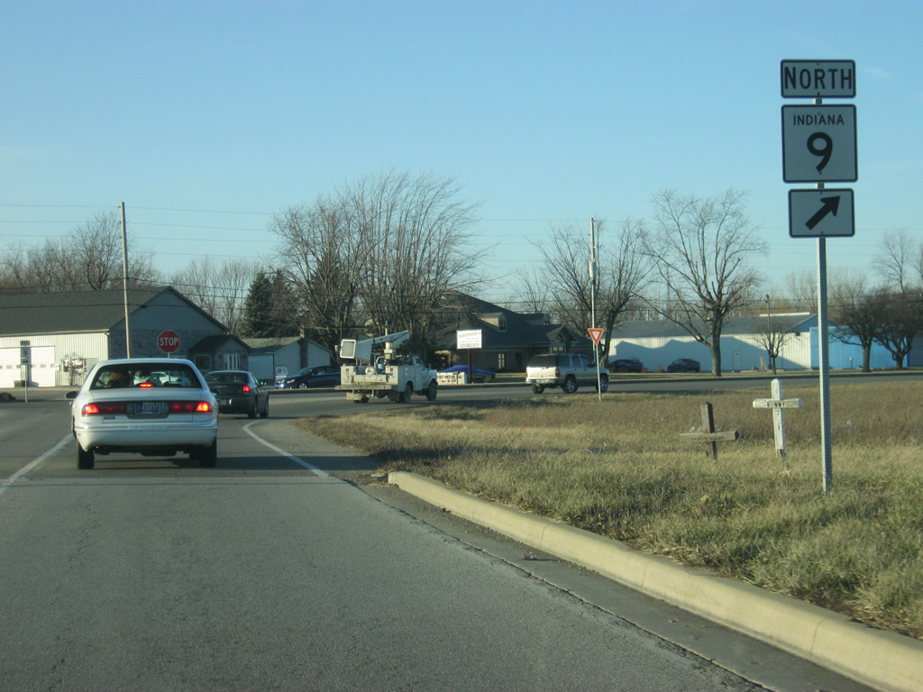
| Up ahead, SR 9 has its intersection with SR 234. SR 234 exists in two segments, the first out west going for nearly 54 miles from the Illinois state line near Cayuga toward the east to its terminus at U.S. 136/SR 75 in Jamestown. The eastern segment goes from U.S. 36/SR 67 in McCordsville eastward for 26.4 miles to SR 38 west of New Castle. 12/19/11 |
|
| The two primary control cites for SR 234 are McCordsville and New Castle. 12/19/11 |
|
| A four-way stop marks the intersection between SR 9 and SR 234. 12/19/11 |
|
| Just north of the junction between SR 9 and SR 234, SR 9 goes through the small town of Eden. 12/19/11 |
|
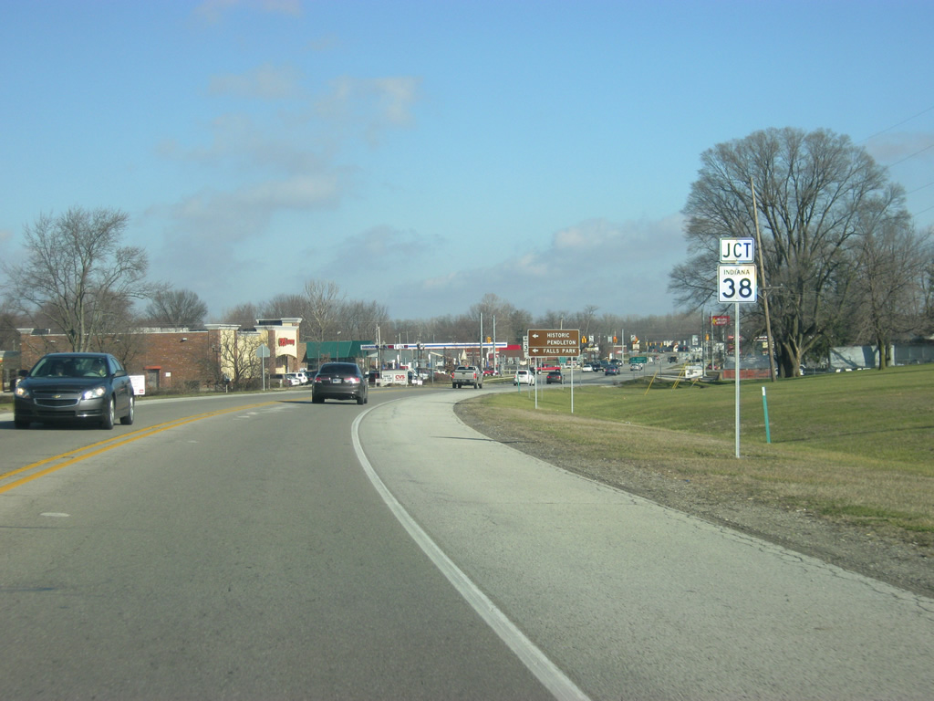
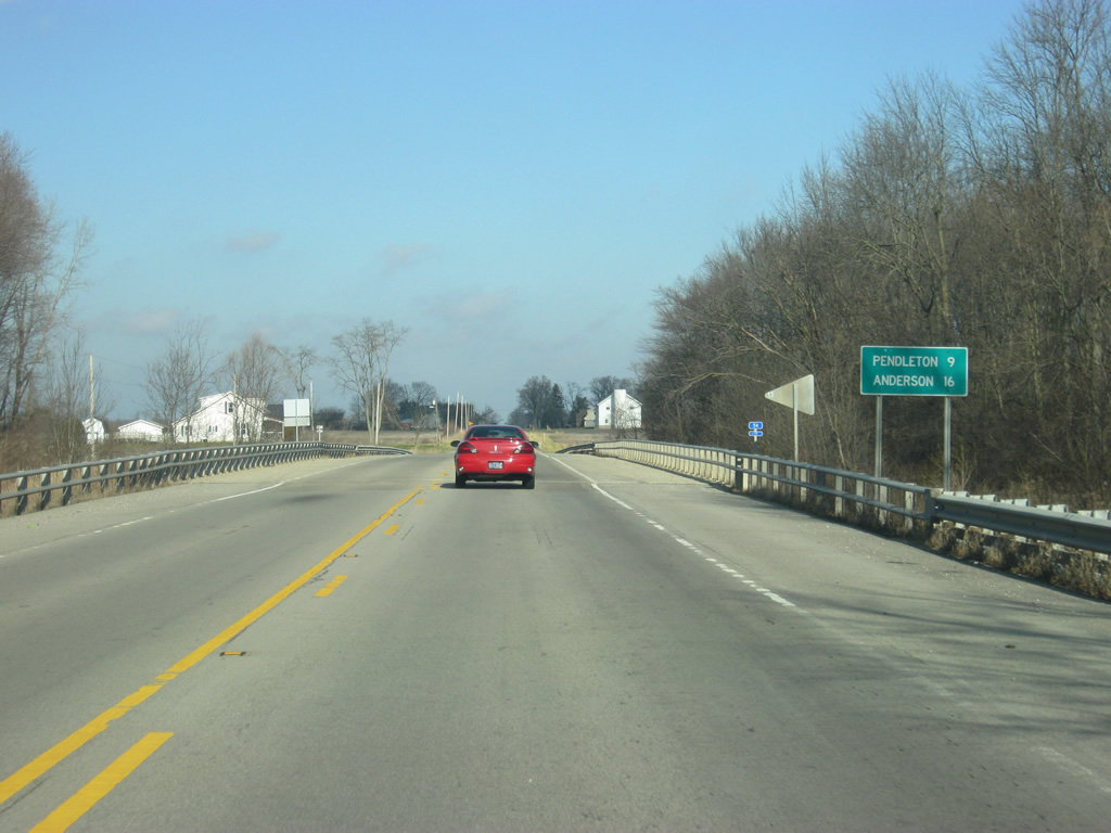
| For the first time since the intersection with SR 252 in southern Shelby County, a distance sign announces the distances to the next two communities along SR 9, Pendleton (nine miles away) and Anderson (16 miles away). 12/19/11 |
|
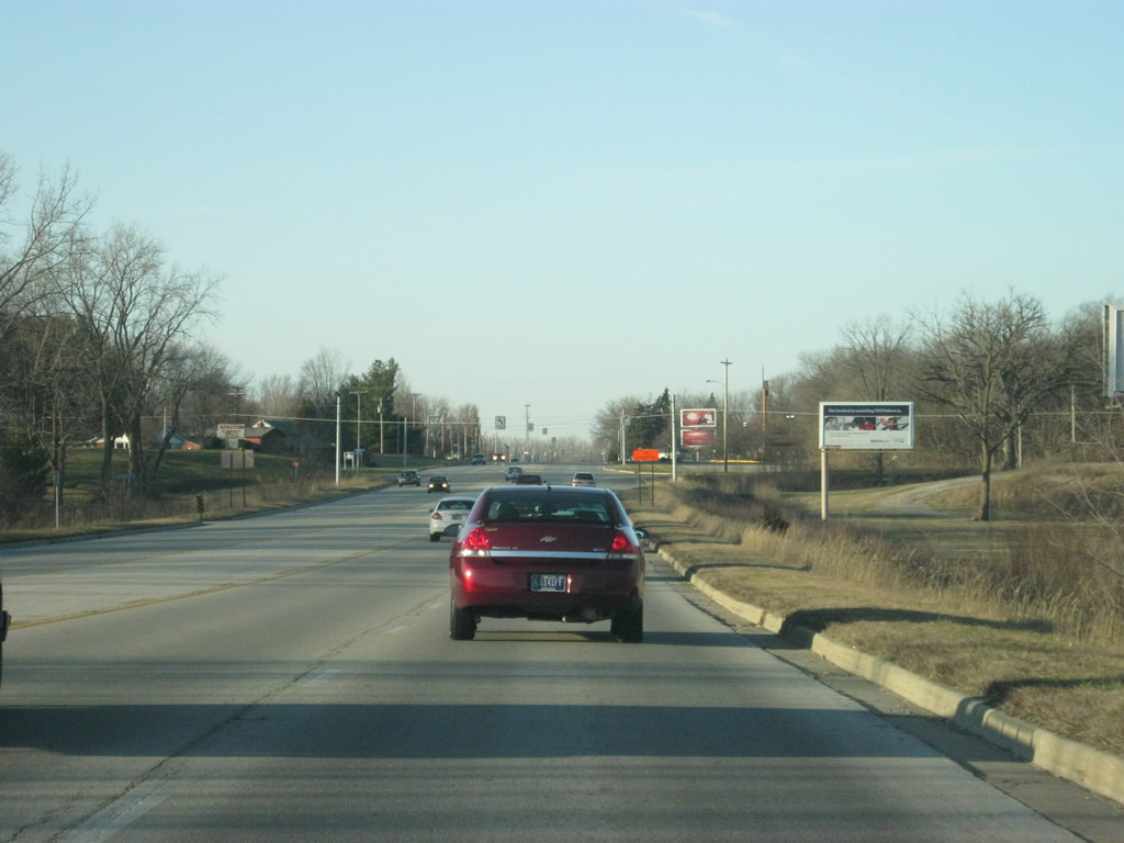
| A view of SR 9 in northern Hancock County with another reminder of the highway's commemorative name. 12/19/11 |
|
| SR 9 enters Madison County (population 131,636). 12/19/11 |
|
| SR 9 angles toward the northeast as it heads across far southern Madison County. 12/19/11 |
|
| SR 9 northbound advances to U.S. 36/SR 67. U.S. 36 goes for 1,414 miles from the Rocky Mountain National Park to Uhrichsville, Ohio and for 139 miles across Indiana from the Illinois line, through Rockville, Danville, Indianapolis, and Pendleton before leaving into Ohio. SR 67 travels for 199 miles from Vincennes to the southwest north through Indianapolis and Muncie before ending at the Ohio border near Bryant. 12/19/11 |
|
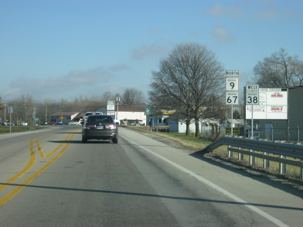
| Although the highway will bypass Pendleton (population 4,253) the town limits have been expanded further south and east of the bypass. Pendleton has been viewed as a suburb for both Anderson and Indianapolis and southern Madison County is the fastest growing part of the county. 12/19/11 |
|
| Indianapolis lies about 30 miles to the southeast along U.S. 36/SR 67, while Anderson can be reached toward the northeast. At one time, SR 9 was routed through into the city of Pendleton where it followed Pendleton Avenue town, but today it follows the bypass to the east alongside U.S. 36 and SR 67. 12/19/11 |
|
| Now on the SR 9/U.S. 36/SR 67 bypass, Anderson is up ahead at ten miles away while Muncie, accessed via SR 67, is 29 miles away. 12/19/11 |
|
| Less than a mile after the SR 9/U.S. 36/SR 67 merge, the intersection with SR 38 east appears. SR 38 runs for just over 116 miles from Lafayette at U.S. 52 southeast through Frankfort, Noblesville and New Castle before ending at U.S. 35 northwest of Richmond. Until 2004, SR 38 ran through Pendleton via State Street. But the creation of the historic district around Downtown Pendleton prompted INDOT to eliminate the stretch town. For a brief period, SR 38 was discontinuous from Interstate 69 to SR 9/U.S. 36/SR 67, but the highway was soon rerouted around Pendleton along Interstate 69 and SR 9/SR 67. 12/19/11 |
|
| Now nearing the intersection with SR 38 east. From this intersection, SR 38 will follow SR 9 to the north. Beyond the intersection with State Avenue/SR 38 east is the intersection with U.S. 36 east. New Castle is about 20 miles to the east, while State Street heads into Downtown Pendleton and connects with Interstate 69 on the west side at the interchange with SR 38 west. 12/19/11 |
|
| For a very brief distance, SR 9 is routed with U.S. 36, SR 38 and SR 67, marking a four-route multiplex, a rarity outside of the Indianapolis and Fort Wayne beltways. But just as soon as the multiplex begins, U.S. 36 turns off toward the east toward Mount Summit. 12/19/11 |
|
| SR 9-38-67 continues off toward the north as U.S. 36 heads east to continue its trajectory toward the state of Ohio. 12/19/11 |
|
| Reassurance shields highlight the traditional multiplex of SR 9 and SR 67 along with SR 38 west, which was added after the 2004 decommissioning of SR 38 thru Pendleton. 12/19/11 |
|
| North of the junction with U.S. 36 east, Anderson is the next point of interest along SR 9, at eight miles away. SR 67's next main community is Muncie at 26 miles. 12/19/11 |
|
| At the intersection with Huntsville Road, SR 9/SR 38/SR 67 expands to four lanes. 08/23/09 |
|
| Views of SR 9/SR 38/SR 67 as a four lane highway that connects Pendleton to Interstate 69 to the north and the city of Anderson. 08/23/09 |
|
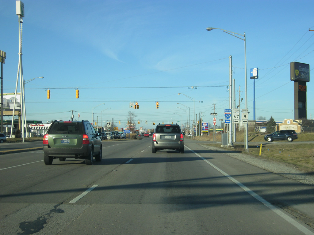
| Entering SR 9-38-67 diamond interchange with Interstate 69. Interstate 69 travels for 157 miles across Indiana from Indianapolis north past Anderson, Muncie, Marion, Fort Wayne, Auburn and Angola. From there the highway travels north to Lansing, Flint and Port Huron, Michigan. Eventually, the highway will be extended southwest from Indianapolis to Bloomington and Evansville, eventually reaching the Mexican border in Texas. SR 9 and SR 67 follow the highway to the north while SR 38 travels the highway to the south to bypass Pendleton. Originally, SR 9 continued north along Martin Luther King, Jr. Boulevard (former Pendleton Avenue) town to Broadway Street, which took the highway to the north. Today, it follows the interstate to the south to Exit 26 where it picks up at Scatterfield Road. 08/23/09 |
|
| We pick up the highway at Exit 26 heading north along Scatterfield Road within the diamond interchange with Interstate 69. SR 9 meets up with SR 109 here. SR 109 travels south from the exit to U.S. 40 for 20 miles. A second SR 109 exists in Whitley County. 03/19/11 |
|
| Emerging from under the freeway, the exit ramp to Interstate 69/SR 67 south departs. SR 9 heads south from here back to Pendleton while SR 9 continues north along Scatterfield Road. 03/19/11 |
|
| North of Interstate 69/SR 67, SR 9 (Scatterfield Road) enters the city of Anderson (population 56,129), the county seat of Madison County. Anderson is best known as the headquarters for the Church of God (Anderson) and Anderson University. The Training Camp for the Indianapolis Colts has been held at Anderson University since 2011. Anderson is the largest community that SR 9 goes through. 03/19/11 |
|
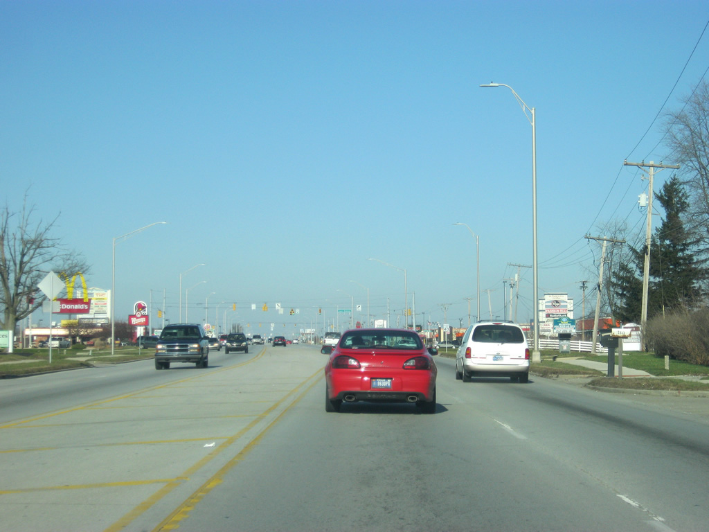
| The next few miles of SR 9 along Scatterfield Road are quite congested at times, as SR 9 (Scatterfield Road) has become the main commercial artery for the Anderson area. Originally, the road was conceived as a bypass for Anderson, bypassing the older routing of SR 9 along Martin Luther King, Jr. Boulevard (former Pendleton Avenue) and Broadway Street. But as with many bypasses, retail businesses soon opened up along the route to turn SR 9 (Scatterfield Road) into more of the main street for Anderson than anything else. 03/19/11 |
|
| Less than a mile to the north of Interstate 69, SR 9 (Scatterfield Road) approaches its intersection with SR 236 east/53rd Street. SR 236 exists in two segments; the longer western segment goes from U.S. 41 to SR 39 in western Indiana, while the eastern segment goes for only six miles from SR 9 to the town of Middletown in northwestern Henry County. 03/19/11 |
|
| SR 236 heads off to the east toward the town of Middletown, while 53rd Street continues west across the south side of Anderson. SR 67 followed 53rd Street at one time as it bypassed Anderson via Martin Luther King, Jr. Boulevard (former Pendleton Avenue) to 53rd Street and east to Old State Road 67 to Chesterfield before meeting up with the original routing in Daleville at Interstate 69. 03/19/11 |
|
| North of SR 236 east/53rd Street, SR 9 (Scatterfield Road) comes up to the intersection with Charles Street, which heads east to the Hoosier Park horse racing track and Casino. The casino has become arguably the largest attraction in Anderson since opening in 2008. It is the second casino to serve the Central Indiana region. 03/19/11 |
|
| North of Charles Street, SR 9 (Scatterfield Road) continues north as the four lane bypass for Anderson, passing by a mix of commercial and residential areas on the east side of Anderson. The area from 38th Street north to SR 32 west/SR 232 east used to hold some of the General Motors (GM) factories. GM has since moved out of Anderson, contributing to the declining population of the city. As with other cities in East Central Indiana and throughout the Rust Belt, Anderson has been coping with a post-factory world and is trying to reinvent itself, hence the new casino. 03/19/11 |
|
| Next is the intersection with SR 32 west/SR 232 east. SR 32 travels for 157 miles across the state from Illinois eastward through Crawfordsville, Lebanon, Noblesville, Anderson, Muncie and Winchester, leaving the state at Union City. SR 232 follows Mounds Road for two miles and is primarily a spur to connect with Mounds State Park. 03/19/11 |
|
| Crossing Mounds Road (SR 32 west and SR 232 east) along SR 9 north. To the west, SR 32 follows Ohio Avenue toward Downtown Anderson. Mounds Road takes SR 232 east toward Mounds State Park. 03/19/11 |
|
| SR 32 east follows SR 9 for about a mile to the north as it passes by the Mounds Mall to the left. More commercial businesses abut the SR 9 (Scatterfield Road) corridor. 03/19/11 |
|
| On the east side of Anderson, SR 9/SR 32 (Scatterfield Road) cross the West Fork of the White River. 03/19/11 |
|
| Now at the intersection with SR 9/SR 32 (Scatterfield Road) and 8th Street, which provides the closest access to Downtown Anderson from the bypass highway. 03/19/11 |
|
| Coming up to the point where SR 32 breaks off toward the east at University Boulevard. 03/19/11 |
|
| SR 32 follows University Boulevard to the east toward the communities of Chesterfield, Daleville and Muncie. To the west, University Boulevard heads toward Anderson University and Downtown Anderson via Main Street. 03/19/11 |
|
| North of SR 32 east/University Boulevard, SR 9 (Scatterfield Road) bypasses the northeast side of Anderson. This stretch of SR 9 (Scatterfield Road) doesn't get as much traffic and is less developed than on the south side toward Interstate 69. 03/19/11 |
|
| SR 9 northbound prepares to depart the Scatterfield Road bypass end for Broadway Street. Broadway Street used to carry SR 9 north from Downtown Anderson. The street will carry the state road beyond Scatterfield Road. 03/19/11 |
|
| SR 9 northbound traffic must turn right onto Broadway Street as the left lane turns onto Broadway Street (old SR 9) back toward the south. 03/19/11 |
|
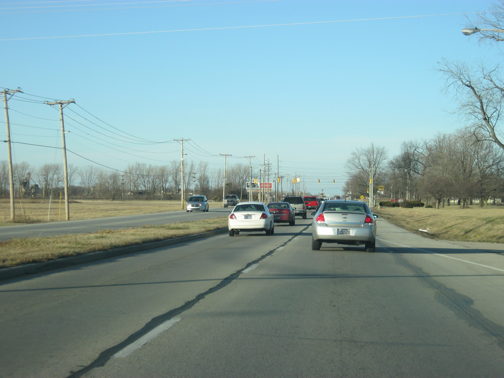
| North of Anderson, SR 9 remains a four lane undivided highway for a couple of miles before it gains a grassy median. SR 9 is the main corridor connection Anderson with the community of Alexandria to the north, which is why the highway is four lanes in width. 03/19/11 |
|
| SR 128 west/County Road 800 North and SR 9 come together at a next traffic light. SR 128 goes for 11 miles from SR 9 to the west through the town of Frankton and out to SR 13/SR 37 at the western end of the county. 03/19/11 |
|
| The town of Frankton is five miles to the west along SR 128. County Road 800 North continues to the east for six miles to an interchange with Interstate 69. From there, the road becomes the SR 332 expressway to Muncie. Despite SR 128 and SR 332 sharing the same road, the two highways have never been connected. 03/19/11 |
|
| Now at the intersection with SR 9 and SR 128 west/County Road 800 North. 03/19/11 |
|
| North of the intersection with SR 128 west/County Road 800 North, SR 9 is three miles away from Alexandria and 24 miles from the Grant County seat of Marion. 03/19/11 |
|
| North of the intersection with SR 128 west/County Road 800 North, SR 9 reduces to two lanes as it approaches the community of Alexandria. 03/19/11 |
|
| Coming up to the intersection with Gilman Road, which leads to the small community of Gilman to the east, as well as Alexandria Airport. 03/19/11 |
|
| North of Gilman, SR 9 enters the city of Alexandria (population 6,260). 03/19/11 |
|
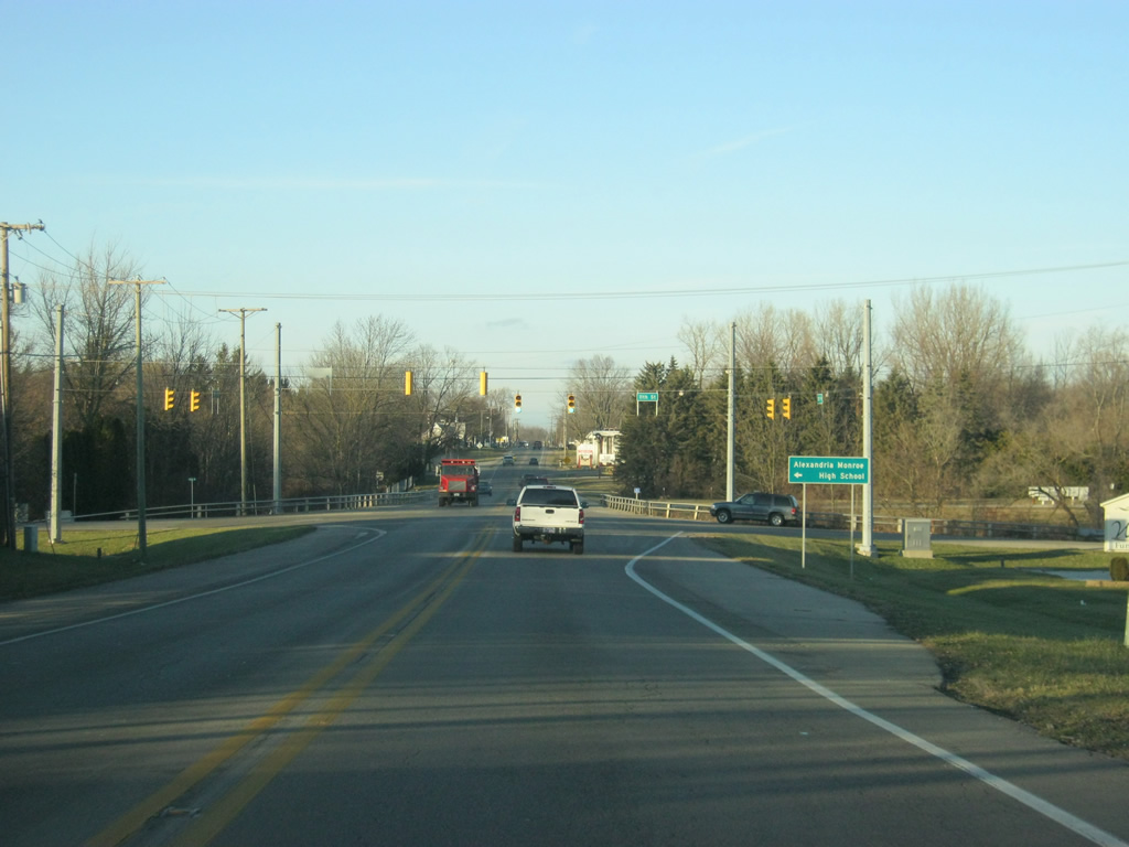
| The first stoplight intersection to serve Alexandria is with 11th Street/County Road 1000 North, which provides access to Alexandria-Monroe High School. 03/19/11 |
|
| SR 9 passes by a couple of cemeteries and approaches the intersection with 4th Street, which connects the state highway with the Madison County 4-H Fairgrounds. 03/19/11 |
|
| SR 9 crosses the Norfolk Southern railroad track as it enters the heart of Alexandria. SR 9 actually bypasses the main part of the city to the east, which is why the road turns toward the east past the railroad crossing. 03/19/11 |
|
| Now heading northeast on SR 9 approaching the intersection with Washington Street, which leads into Downtown Alexandria. 03/19/11 |
|
| Two views of SR 9 north of Washington Street as the state road curves toward the northwest before heading north and finishing the bypass of Alexandria. As with Anderson, some of the retail serving the city has positioned itself along the SR 9 bypass. 03/19/11 |
|
| Now on the north side of Alexandria, SR 9 approaches the intersection with SR 28. SR 28 goes for 153 miles across the state from the Illinois state line east through Attica, Frankfort, Tipton, Elwood, Alexandria and Albany before ending in Union City at the Ohio state line. 03/19/11 |
|
| SR 9 crosses the Norfolk Southern railroad track (which runs north-south as opposed to the earlier one which ran east-west) on the approach to SR 28. 03/19/11 |
|
| Elwood is about nine miles to the west from Alexandria while Albany is 23 miles to the east in Delaware County. 03/19/11 |
|
| Now at the stoplight intersection between SR 9 and SR 28. Interstate 69 is six miles to the east from here. 03/19/11 |
|
| North of SR 28, SR 9 is 19 miles from Marion and the next community of Huntington appears at a distance of 45 miles. 03/19/11 |
|
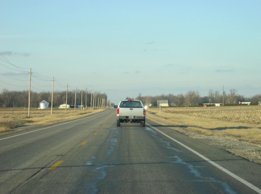
| SR 9 quickly becomes a rural highway north of Alexandria as it traverses the agricultural fields of northern Madison County. 03/19/11 |
|
| Summitville Road (County Road 1650 North) leads east from SR 9 to the town of Summitville a mile to the east. 03/19/11 |
|
| A view of SR 9 north of the Coffman Road/County Road 1800 North intersection in far northern Madison County. 03/19/11 |
|
| SR 9 enters Grant County (population 70,061). 03/19/11 |
Page Updated 04-22-2012.


 east & SR 9-67 north