State Route 34 (Faulkland Road) connected areas of northwest Wilmington and the town of Elsmere. The minor arterial runs west from SR 100 (South Dupont Road) by the Oak Hill and Willow Run communities to Delledonne Corporate Center and SR 141 (Centre Road). West of Ferris School to Centre Road, Faukland Road travels through the residential areas of Woodland Park, Brookland Terrace and Faulkand Heights before descending into a steep valley fed by Red Clay Creek.
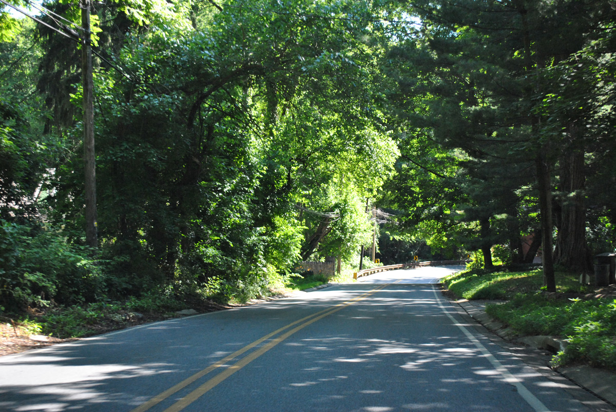
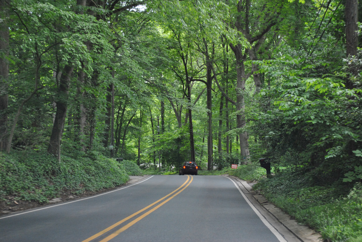
The winding and scenic stretch passes through Brandywine Springs County Park between the Wilmington & Western Railroad and SR 41 (Newport Gap Pike). The state route concluded at Duncan Road by the Hyde Park subdivision. Duncan Road leads south to SR 2 (Kirkwood Highway) and north to Decastle County Park.
Faulkland Road and SR 41 (Newport Gap Pike) converge by Historic Brandywine Springs Park. Photo taken 06/05/12.
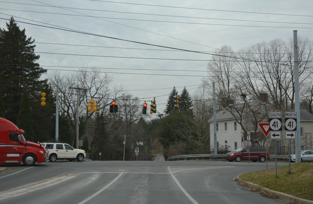
Started in Spring 2019, a Hazard Elimination Program (HEP) project improved the intersection of Faulkland Road and SR 41 (Newport Gap Pike). Addressing a large number of accidents, work lengthened the left turn lane from SR 41 south to Faulkland Road east by 400 feet. Concrete medians were removed and traffic signals upgraded to mast arms. Construction ran approximately six months.
A 1974 resolution established SR 34 following a study that acknowledged Faulkland Road as an important connector. The state route provided an alternate to SR 2 (Kirkwood Highway) east from Milltown Road and SR 41 (Newport Gap Pike) to the city of Wilmington. The Delaware Department of Transportation (DelDOT) proposed the declassification of the state route by Summer 2019. Citing the desire to reduce cut-through and heavy truck traffic along Faulkland Road, signs were removed by August 2019 as there was no major opposition to the proposal.1
Delaware State Route 34 - 2017 Annual Average Daily Traffic (AADT)
- 3,673 - Duncan Road to SR 41
- 5,968 - SR 41 to Centerville Road
- 10,830 - Centerville Road to SR 100
|
| Duncan Road north links Milltown Road with the former eastbound beginning of SR 34 (Faulkland Road). 12/20/17 |
|
| Duncan Road branches southeast from McKennan Church Road to intersect Faulkland Road (former SR 34) east midway between Delcastle County Park and SR 2 (Kirkwood Highway). 12/20/17 |
|
| Faulkland Road lowers by the Hyde Park subdivision to cross Hyde Run on the initial stretch east from Duncan Road. 12/20/17 |
|
| Faulkland Road crosses Hyde Run ahead of SR 41 (Newport Gap Pike). The 26.9 foot span here dates back to 1922.1 12/20/17 |
|
| 0.23 miles east from Duncan Road, Faulkland Road intersects SR 41 (Newport Gap Pike). SR 41 originates 1.01 miles to the south at SR 2 (Kirkwood Highway) and SR 62. 12/20/17 |
|
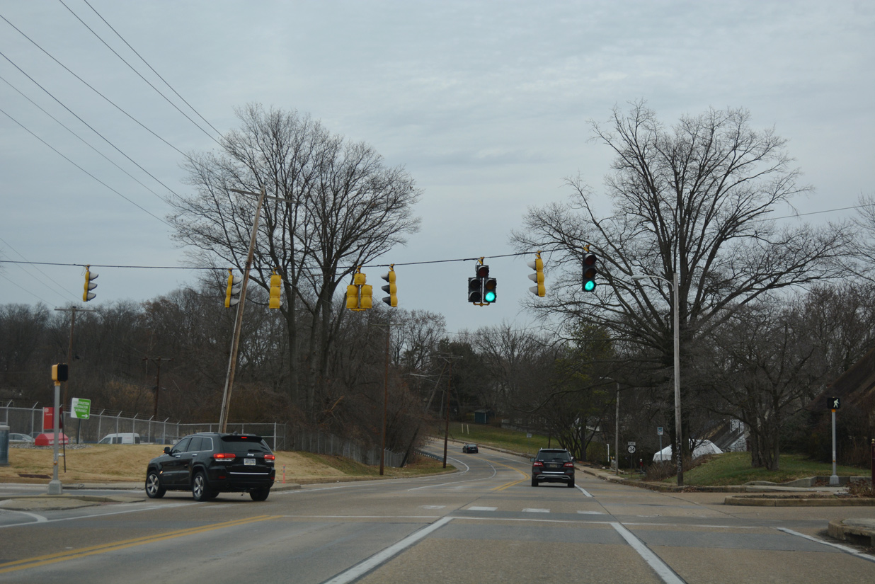
| Prior to 2018/19 intersection reconstruction, Econolite traffic lights operated at Faulkland Road and SR 41 (Newport Gap Pike) and the northwest corner of Brandywine Springs County Park. SR 41 forms a multi state route with PA 41 north from Prices Corner to Gap, Pennsylvania. 06/23/12 |
|
| Reassurance marker for SR 34 east previously posted between SR 41 and the parking lot for Brandywine Springs Park. 12/20/17 |
|
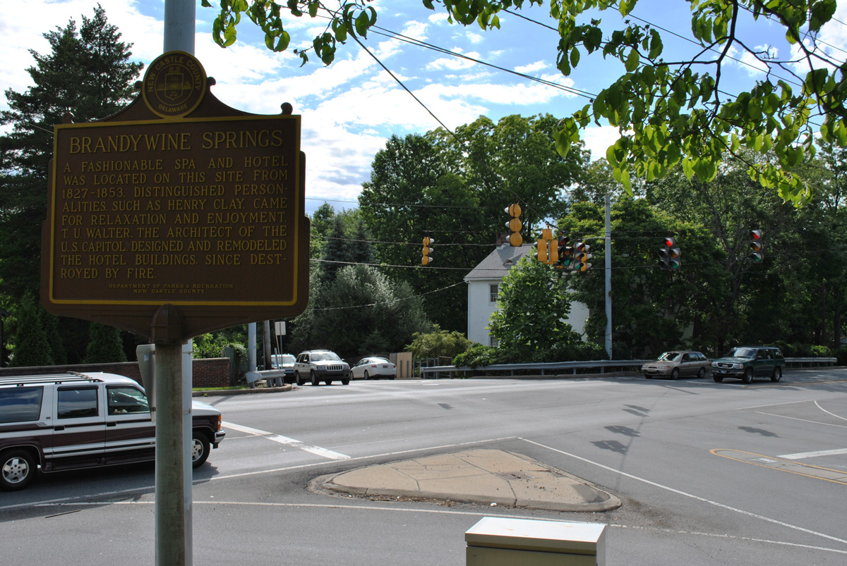
| Brandywine Springs Park was once the site of a spa and hotel from 1827-53. Park amenities include baseball fields, a basketball court, a playground, picnic pavilions and hiking trails to the historic sites along Red Clay Creek. 06/05/12 |
|
| Faulkland Road descends over 100 feet in elevation along Brandywine Springs Park. 12/20/17, 06/23/12 |
|
| Faulkland Road crosses Red Clay Creek and the Wilmington & Western Railroad at the base of the valley between the Brandywine Springs Manor and Faulkland Heights subdivisions. 12/20/17 |
|
| Faulkland Road emerges from the Red Clay Creek valley ahead of the signalized intersection with Centerville Road by the Tybrook and Brookland Terrace communities. Centerville Road leads south to Prices Corner and north to SR 48 (Lancaster Pike) by the Little Falls Centre business park. 12/20/17 |
|
| Faulkland Road has a concrete roadway east of Centerville Road. An SR 34 trailblazer appeared at Woodland Park, just ahead of Little Mill Creek. 12/23/18 |
|
| Kendall Road north and Wagoner Drive south tie into Faulkland Road from the Woodland Heights subdivision at succeeding eastbound signal. The driveway to the Delaware Youth and Family Center connects from the north. 12/23/18 |
|
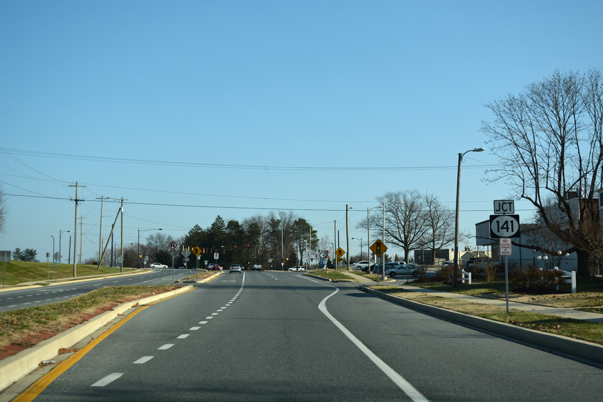
| Faulkland Road widens to four lanes through the intersection with SR 141 (Centre Road) by Chestnut Run Shopping Center. SR 141 angles southwest to SR 2 (Kirkwood Highway) and Prices Corner. Centre Road south to the interchange with SR 2 was expanded to include a raised median and wider travel lanes by November 2010. 12/23/18 |
|
| SR 141 (Centre Road) continues north by Delledonne Corporate Center as a controlled access arterial to Barley Mill Plaza, and a short freeway from there to Greenville. The belt route around Wilmington was previously proposed as a full freeway, with an interchange planned at Faulkland Road. 12/23/18 |
|
| Faulkland Road continues east from SR 141 by Delledonne Corporate Center and the Willow Run neighborhood. Expansion of SR 34 in 2010 extended to just beyond Willow Run Drive. 12/20/17 |
|
| Faulkland Road crosses Chestnut Run beyond this reassurance marker after Montgomery Road. 12/20/17 |
|
| Faulkland Road east at the signalized entrance to Delledonne Corporate Center and Montgomery Road south into the Willow Run community. 12/20/17 |
|
| Oak Hill Road north and the east access road to the Deledonne Corporate Center come together at this traffic light in the Oak Hill community. 12/20/17 |
|
| SR 34 advanced east from Oak Hill Drive to an at-grade crossing with the Delaware Valley Railroad. 12/20/17 |
|
| Faulkland Road expands to four lanes on the approach to SR 100 (South Dupont Road) between Beth Emeth Memorial Park and Silverbrook Cemetery. 12/20/17 |
|
| Faulkland Road curves southward to end at SR 100 (South Dupont Road). SR 100 travels 0.68 miles south to intersect SR 2 (Kirkwood Highway) in the town of Elsmere. 12/20/17 |
|
| South Dupont Road leads SR 100 east 0.23 miles to SR 48 (Lancaster Avenue) by the Greenhill neighborhood of Wilmington. 12/20/17 |
|
| SR 34 (Faulkland Road) branched west from SR 100 (South Dupont Road) at Lancaster Village and Silverbrook Cemetery. 12/20/16 |
|
| This confirming marker for SR 34 west was removed during expansion of Faulkland Road ahead and after SR 141 (Centre Road) in 2010. 03/20/04 |
|
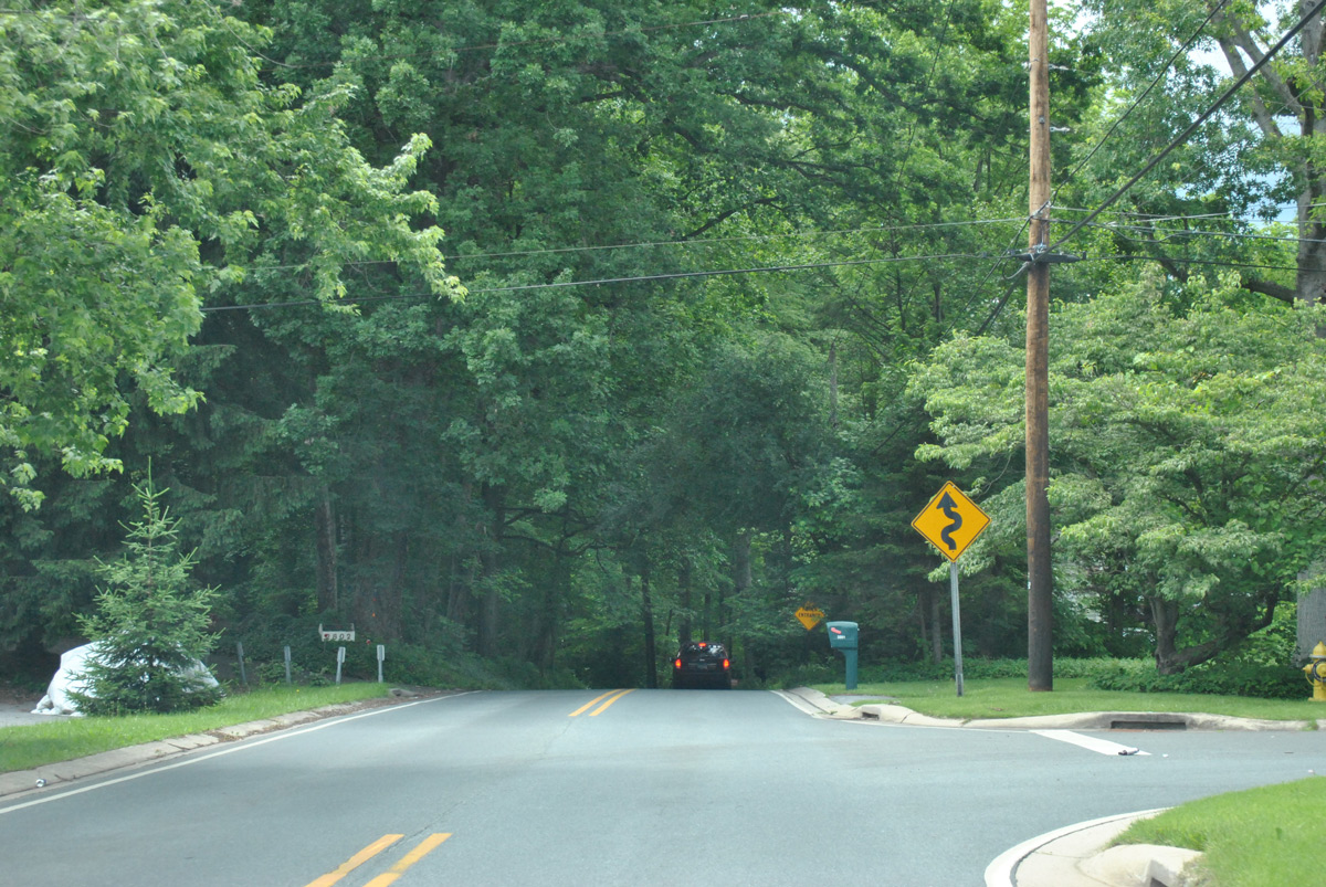
| The ensuing westbound signal operates at the entrance to the Delaware Youth and Family Center and Wagoner Drive south into the Woodland Heights subdivision. Faulkland Road reverts to a concrete roadway from this point west to Centerville Road. 06/05/12 |
|
| Centerville Road heads northward from SR 62 (Boxwood Road) and SR 2 (Kirkwood Highway) at Prices Corner to intersect Faulkland Road en route to SR 82 (Campbell Road) at Hoopes Reservoir. Frontage streets accompany Faulkland Road west for the Tybrook and Faulkland Heights neighborhoods. 06/05/12 |
|
| Faulkland Road drops around 100 feet in elevation from Marlyn Drive into a valley fed by Red Clay Creek. 06/05/12 |
|
| Faulkland Road crosses both the Wilmington and Western Railroad and Red Clay Creek at the base of the valley. 08/05/07 |
|
| Faulkland Road climbs westward to Brandywine Springs County Park ahead of SR 41 (Newport Gap Pike). 12/21/17 |
|
| Faulkland Road and SR 41 come together northwest of Brandywine Springs Park. Following Newport Gap Pike, SR 41 travels south to SR 2 and SR 62 at Prices Corner and north to Hockessin and Chester County, Pennsylvania. 12/20/17 |
|
| Faulkland Road lowers to cross Hyde Run on the 0.23 mile segment between SR 41 (Newport Gap Pike) and Duncan Road. 12/20/17 |
|
| An end SR 34 shield appeared at the intersection of Faulkland Road and Duncan Road. Duncan Road connects the state route with Milltown Road to the south and McKennans Church Road to the north. 12/23/18, 06/05/12 |
|
| A trailblazer for SR 141 precedes the intersection with Faulkland Road (former SR 34) on Centerville Road northbound. 12/21/17 |
|
| SR 34 shield assembly posted southbound along Centerville Road. 12/21/17 |
|
| Faulkland Road heads east to Woodland Park, SR 141 (Centre Road) and Elsmere from Centerville Road. Frontage streets accompany the state route west at Faulkland Heights and Tybrook before the descent into Brandywine Springs Park. 12/21/17 |
Photo Credits:03/20/04, 08/05/07, 06/05/12, 06/23/12, 12/20/16, 12/20/17, 12/21/17, 12/23/18 by AARoads
Connect with:
State Route 41
State Route 100
State Route 141
Page Updated 06-19-2020.


 East
East