A commuter route for northern New Castle County, SR 41 travels southeast from PA 41 along a 6.2 mile route along Lancaster Pike and Newport Gap Pike to SR 2 (Kirkwood Highway) at Prices Corner. Previously the state route represented the southern leg of a truck route between Newport and Lancaster, Pennsylvania (via PA 41 and U.S. 30 west). Through traffic is advised to take SR 48 (Lancaster Pike) from SR 141 (Centre Road) to SR 41 near Hockessin due to better grades and more capacity.
The SR 41 corridor overlays an early 1800s trade route between Lancaster County, Pennsylvania and the docks along the Christina River at Newport.1 Designated by 1936, the state route extended south from the Pennsylvania state line near Hockessin to Brandywine Springs, Newport and New Castle. The state route ended at the intersection of Washington Avenue and Seventh Street, just north of the Delaware River.
SR 141 was posted alongside SR 41 from New Castle north to Centerville Road at Belvedere by 1952, while the section along Washington Avenue in New Castle dropped from the alignment. With construction of the Newport Freeway for SR 141, SR 41 was truncated from New Castle to SR 2 at Prices Corner in 1971.
SR 41 remained paired with SR 2 between Newport Gap Pike and the Kirkwood Highway interchange with SR 141 (Newport Freeway). The concurrency provided route continuity for long distance travelers between Interstates 95, 295 and 495 and Lancaster, Pennsylvania. This changed by September 2015 with DelDOT eliminating the overlap and extending SR 62 north from Old Capitol Trail to SR 2 and 41 at Kirkwood Highway. The renumbering also reinforced SR 48 (Lancaster Pike) as the preferred route for truck traffic headed north from I-95 and SR 141 to Chester County, Pennsylvania.2
Delaware State Route 41 - 2015 Annual Average Daily Traffic (AADT)
- 19,129 - SR 2 to Greenbank Road
- 12,641 - Milltown Road to Faulkland Road (former SR 34)
- 10,278 - Hercules Road to McKennans Church Road
- 22,531 - SR 48 to Old Lancaster Pike south end
- 18,479 - Yorklyn Road to Old Lancaster Pike north end
- 13,979 - Old Lancaster Road to Pennsylvania line
|
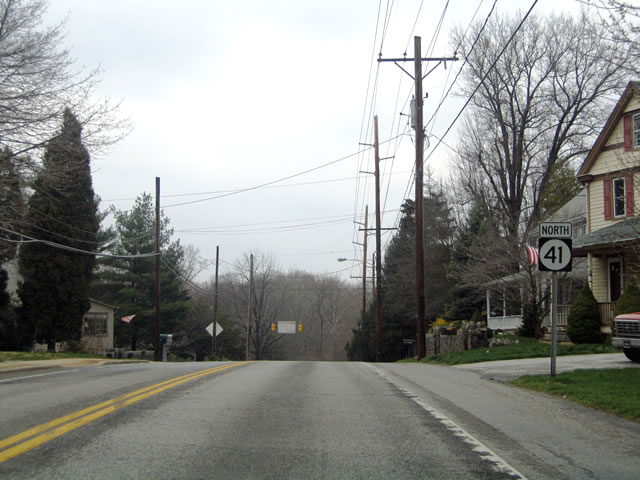
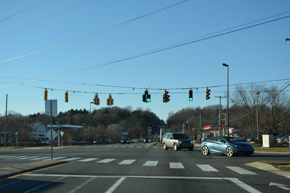
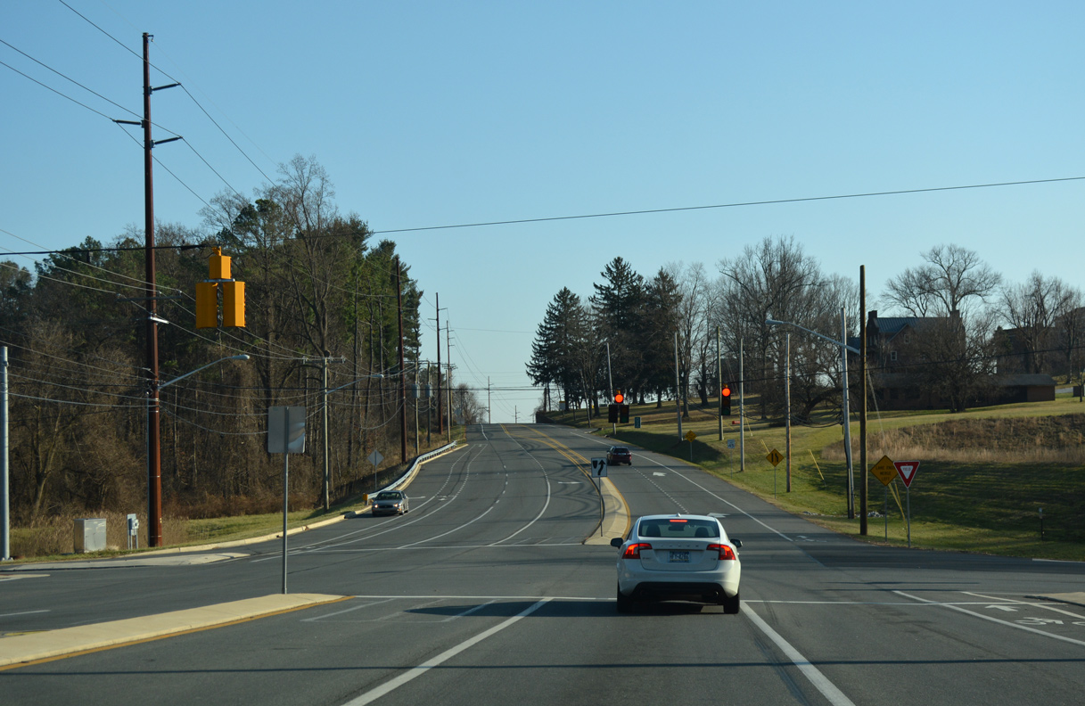
| SR 41 (Newport Gap Pike) begins and lowers from SR 2 (Kirkwood Highway) and 62 at Prices Corner to the Wilmington & Western Railroad station, a crossing of Red Clay Creek and Greenbank Road. 12/20/17 |
|
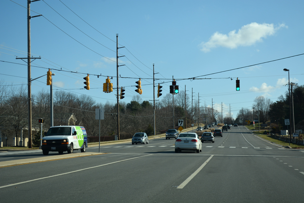
| Milltown Road branches west from SR 41 (Newport Gap Pike) and Jackson Avenue at the Cedars community. Milltown Road provides an alternate route to SR 7 (Limestone Road) and the Pike Creek Valley from Prices Corner and Elsmere. 12/20/17 |
|
| SR 41 undulates between Prices Corner and Hockessin through eastern reaches of the Appalachian Piedmont. The reassurance marker posted after Milltown Road was removed by 2012. 04/03/04 |
|
| Beyond Milltown Road, Newport Gap Pike lowers to cross Hyde Run, a tributary of the Red Clay Creek, at historic Brandywine Springs State Park. 12/20/16 |
|
| Approaching Faulkland Road (former SR 34) on SR 41 (Newport Gap Pike) at Brandywine Springs State Park. Lake Washington lies just east of this stretch within the park. The man made lake was part of an early 20th century pavilion and amusement park along the Hyde Run. The area was abandoned in the 1930s and nature has taken its course in reclaiming the land since. 12/20/17 |
|
| Decommissioned in 2019, SR 34 constituted a short state route along Faulkland Road west to nearby Duncan Road and east to SR 100 (Dupont Road) near the Wilmington city line. The SR 41 intersection at Faulkland Road was reconstructed in 2019 to include longer turn lanes, protected left turns and new mast arm signal assemblies. 12/20/17 |
|
| Replaced shields for SR 34 north on SR 41 at Faulkland Road. Faulkland Road winds through a scenic valley across Red Clay Creek by Brandywine Springs State Park to the east to connect with residential areas north of Prices Corner along Centerville Road. 06/05/12 |
|
| SR 41 (Newport Gap Pike) bee lines northwest from Brandywine Springs Park toward Hockessin. 12/20/17 |
|
| A set of flashers operate at the entrance road to Emily P. Bissell Hospital. The medical center lies north of the Hyde Park subdivision. 12/20/16 |
|
| Mill Creek Road east and Hercules Road west come together as a local commuter route joining SR 41 (Newport Gap Pike) with SR 7 (Limestone Road) to the west and SR 48 (Lancaster Pike) to the east. The intersection was expanded in 2015 to accommodate a new subdivision built by Toll Brothers nearby.3 12/20/16 |
|
| SR 41 (Newport Gap Pike) briefly expands to four lanes through the intersection with Mill Creek and Hercules Roads. The road reduces back to two lanes ahead of the Westminster subdivision. 12/20/16 |
|
| McKennans Church Road originates from SR 7 (Limestone Road) at Milltown Road in the Pike Creek Valley. The through road leads north to become Loveville Road at SR 41 (Newport Gap Pike) ahead of Hockessin. Loveville Road extends north to SR 48 (Lancaster Pike) and Old Wilmington Road. 12/20/16 |
|
| The ensuing northbound signal operates at Graves Road. Graves Road winds west from Loveville Road to a handful of forested neighborhoods to Mill Creek Road. 12/20/16 |
|
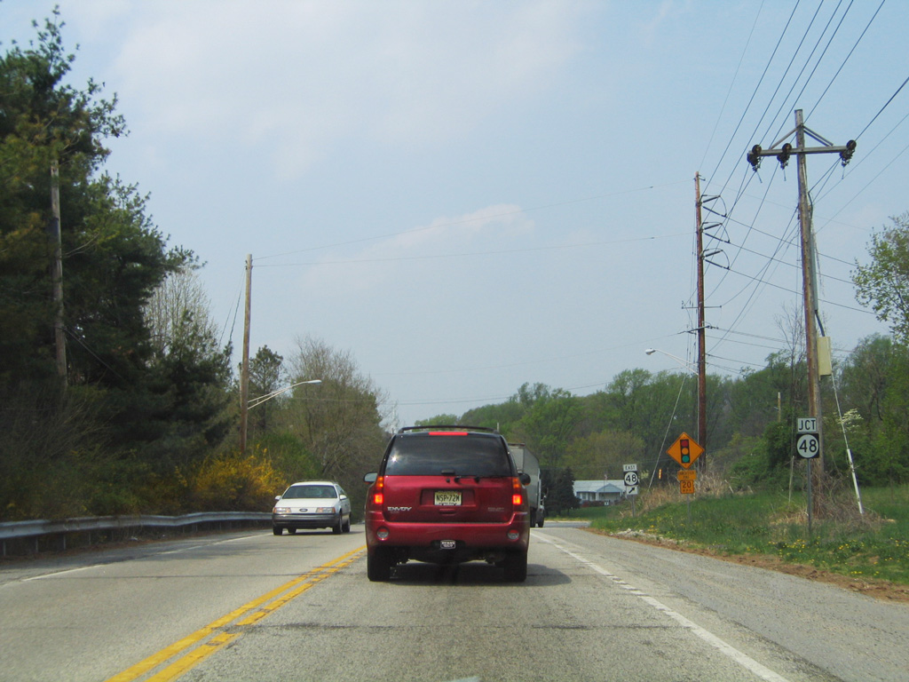
| Nearing the merge with SR 48 west (Lancaster Pike) on SR 41 north near Brackenville. The junction shield for SR 48 fell off by 2012, with the remainder of the assembly taken down by 2015. 04/23/04 |
|
| SR 48 (Lancaster Pike) takes motorists back to the southeast to SR 141 at Barley Mill Plaza and north Wilmington. 12/20/16 |
|
| SR 48 shuttles commuters to Hockessin and through traffic bound for Lancaster, Pennsylvania from SR 141 and Wilmington. 12/20/16 |
|
| Continuing north, SR 41 (Lancaster Pike) meets the entrance to Sanford School. A rare tornado caused major damaged to the Sanford School gymnasium on June 9, 1989. 12/23/18 |
|
| Withers Way represents the entrance to the Sanford Ridge subdivision and a second access point to Sanford School from SR 41 at the adjacent stoplight. 12/23/18 |
|
| A new mast arm traffic light assembly was installed at SR 41 and Brackenville Road between 2001 and 2004. Brackenville Road meanders north to SR 82 at Ashland and southwest to SR 7 (Limestone Road) in the Upper Pike Creek Valley. 12/20/16 |
|
| SR 41 (Lancaster Pike) meets Hockessin Park in this scene as it passes through the heart of Hockessin. The state route north of Mitchell Road to north of Valley Road was redesigned during a $6.5 million Safety Improvements Project completed on November 15, 2006. Construction addressed an array of closely spaced commercial driveways and the lack of left turn lanes along the corridor.4 12/20/16 |
|
| The Wilmington & Western Railroad concludes its ten mile route from Greenbank to just west of this grade crossing with SR 41 in Hockessin. 12/20/16 |
|
| Yorklyn Road ties into SR 41 (Lancaster Pike) from the community of Yorklyn and SR 82 (Creek Road) to the northeast. 12/20/16 |
|
| Yorklyn Road ends just west of Lancaster Pike at Old Lancaster Pike. Mill Creek Road stems south from there to the Upper Pike Creek Valley. 12/20/16 |
|
| The final SR 41 shield was previously located north of Yorklyn Road. This scene looks at Lancaster Pike prior to the Safety Improvement Project of 2004-06. 04/23/04 |
|
| The Route 41/Lancaster Pike Safety Improvements Project added a signal at Valley Road while adjacent Old Lancaster Pike was restriped to one way southbound to prevent motorists from bypassing the new stoplight.4 Valley Road angles southwest from Hockessin to SR 7 and North Star Road through the Upper Pike Creek Valley. 12/20/16 |
|
| A truck climbing lane accompanies SR 41 (Lancaster Pike) north on the 100 feet elevation gain from Hockessin to McGovern Road. 12/20/16 |
|
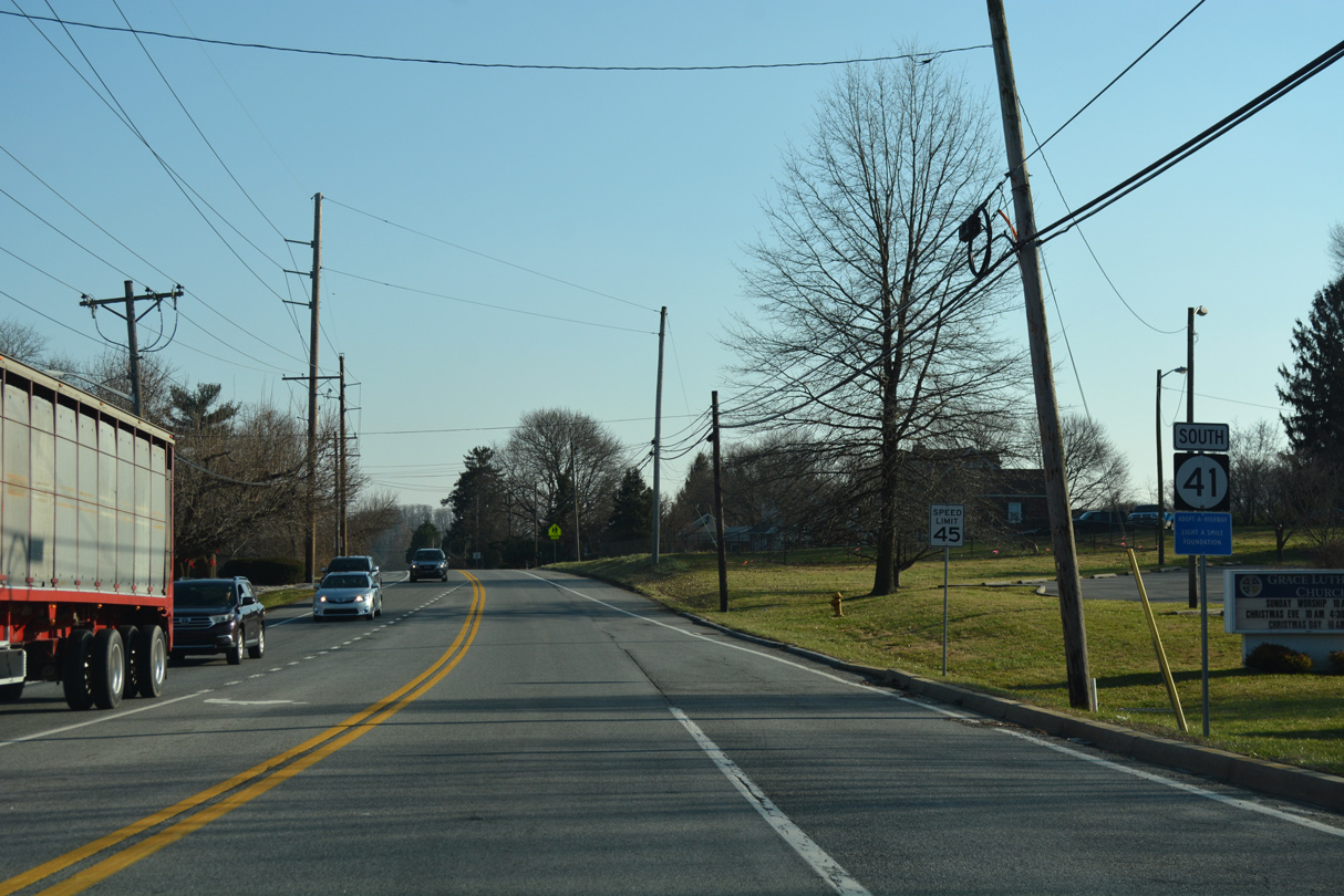
| A large welcome sign marks the transition of SR 41 (Lancaster Pike) to PA 41 en route to New Garden and Avondale. An old state line monument also stands at the border. 12/20/16 |
|
| A Delaware welcome sign was posted just beyond the state line by Lora Lane. The assembly was taken down in 2019. 12/24/18 |
|
| SR 41 (Lancaster Pike) enters the First State by the Deerfield subdivision in unincorporated Hockessin. 12/24/18 |
|
| SR 41 (Lancaster Pike) drops 100 feet in elevation into the heart of Hockessin Village. Old Lancaster Pike splits with the state route just ahead of the signal with Valley Road. 12/24/18 |
|
| Valley Road provides one of two through routes linking SR 41 (Lancaster Pike) in Hockessin with SR 7 along Limestone Road. 12/24/18 |
|
| Yorklyn Road stems northeast from parallel Old Lancaster Pike to SR 82 (Creek Road) at the community of Yorklyn. 12/24/18 |
|
| Reassurance marker posted southbound along Lancaster Pike after Yorklyn Road. 12/24/18 |
|
| SR 41 meets the Wilmington and Western Railroad at grade in Hockessin Village. 12/24/18 |
|
| The signalized entrance for Hockessin Park follows the Wilmington and Western Railroad on SR 41 south. 12/24/18 |
|
| Brackenville Road crosses SR 41 (Lancaster Pike) northeast en route to the Ashland Nature Center and Barley Mill Road to SR 82 at Ashland. 12/24/18 |
|
| SR 41 converges with Old Lancaster Pike again beyond Brackenville Road. A short section of the road continues along the east side of SR 41. 04/17/04 |
|
| Withers Way intersects SR 41 from the Sanford Ridge subdivisions adjacent to the Sanford School. 04/17/04 |
|
| SR 41 (Lancaster Pike) south at Sanford School Lane. This intersection was fully signalized after 2007. 12/23/18 |
|
| Southbound SR 41 (Lancaster Pike) reaches the split with SR 48 (Lancaster Pike) east. The junction shield here was removed by 2007. 04/17/04 |
|
| The wye intersection at the SR 41/48 split was considered innovative at the time of its completion in the 1920s. 12/23/18 |
|
| SR 41 shifts southward onto Newport Gap Pike to SR 2 (Kirkwood Highway) and SR 62 at Prices Corner while SR 48 extends Lancaster Pike east to Wilmington. 12/23/18 |
|
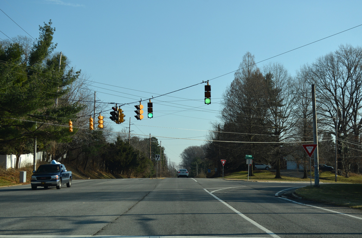
| The succeeding traffic light along SR 41 (Newport Gap Pike) is with Graves Road west to Mill Creek Road and east to Loveville Road. 12/23/18 |
|
| Loveville Road leads south to SR 41 by the Westgate Farms subdivision. McKennans Church Road extends southward from the signal here to Delcastle Park and Milltown Road by SR 7 (Limestone Road). 12/23/18 |
|
| Reassurance marker posted south of McKennans Church Road / Loveville Road. 12/23/18 |
|
| Hercules Road south from SR 48 (Lancaster Pike) and Millcreek Road east come together at the ensuing signal along southbound SR 41 (Newport Gap Pike). 12/23/18 |
|
| SR 41 south at the entrance to Emily P. Bissell Hospital. 12/23/18 |
|
| SR 41 (Newport Gap Pike) gains elevation southeast to Faulkland Road (former SR 34). 12/23/18 |
|
| Decommission in 2019, SR 34 followed Faulkland Road west to Duncan Road near Delcastle Park nearby. The state route extended east to SR 100 (S Dupont Road) on the north side of Wilmington. 12/23/18 |
|
| SR 41 intersects Faulkland Road adjacent to Brandywine Springs Park. The intersection was reconstructed in 2019 with longer turn lanes. Mast arm signals replaced a span wire array with older Econolite signals. 12/23/18 |
|
| Running alongside Brandywine Springs Park, SR 41 (Newport Gap Pike) lowers to cross Hyde Run. 12/23/18 |
|
| Milltown Road angles east to merge with SR 41 south at Jackson Avenue at the Cedars community. 12/23/18 |
|
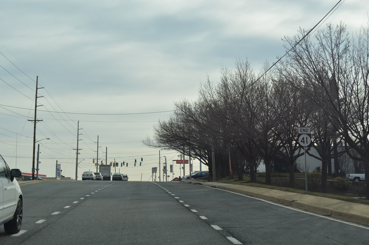
| An end sign for SR 41 was added to the Newport Gap Pike approach for SR 2 (Kirkwood Highway), reflecting the 2015 truncation of the route west from SR 141 (Newport Freeway). 12/21/16 |
|
| Kirkwood Highway (SR 2) constitutes a well traveled commercial arterial east from Prices Corner into the town of Elsmere and west to the Pike Creek Valley and Newark. SR 62 begins and takes over for SR 41 along Newport Gap Pike south to the Newport Freeway at Belvedere. 12/21/16 |
|
| Hercules Road branches southwest from SR 48 (Lancaster Pike) and intersects SR 41 (Newport Gap Pike) west across from Millcreek Road. 07/31/13 |
|
| Approaching SR 41 (Newport Gap Pike) on McKennans Church Road north. McKennans Church Road links SR 7 (Limestone Road) and the Pike Creek Valley with Hockessin and Loveville Road north to SR 48 (Lancaster Pike). 04/22/04 |
Sources:
- "Town Down Under - As traffic hurtles on 'the asphalt monster' overhead, a 300-year-old town inches toward the future." The News Journal (DE), July 16, 2001.
- Proposed Route Designation Changes - DE Route 41 and DE Route 2. Delaware Department of Transportation, project web site.
- "Public Workshop Route 41/Hercules Road Intersection Improvements." Delaware Department of Transportation, press release. April 28, 2008.
- "REVISED - Flag-raising to Mark Completion of Route 41/Lancaster Pike Safety Improvements." Delaware Department of Transportation, press release. November 8, 2008.
04/03/04, 04/17/04, 04/22/04, 04/23/04, 06/05/12, 07/31/13, 12/20/16, 12/21/16, 12/20/17, 12/23/18, 12/24/18 by AARoads
Connect with:
State Route 2
Former State Route 34
Route 41
State Route 48
State Route 62
Page Updated 06-19-2020.


 North
North