SR 52 forms a multi state route with PA 52 as it links Wilmington with U.S. 1 near Longwood, Pennsylvania. The state route originates in Downtown Wilmington along a one-way couplet of 11th Street (southbound) and 12th Street (northbound). Traffic combines along Delaware Avenue north ahead of Interstate 95 by the Trinity Vicinity neighborhood. North from the Happy Valley neighborhood, SR 52 shifts onto Pennsylvania Avenue through northwest Wilmington, leaving the city by the Highlands community as Kennett Pike.
Kennett Pike extends SR 52 north as a four-lane arterial through a parclo interchange with SR 100/141 (Barley Mill Road) and the upscale community of Greenville. Further north, SR 52 transitions into a rural type, two-lane road west of Winterthur to Centerville through the Appalachian Piedmont. Kennett Pike crosses the state line south of Fairville and Mendenhall.
Delaware State Route 52 Guides
SR 52 was one of three multi-state routes connecting southeastern Pennsylvania with northern Delaware by 1936. The alignment along Kennett Pike and Pennsylvania Avenue south to the Wilmington city line remains the same. Some changes however took place between Midtown Brandywine and Downtown in Wilmington. 11th Street originally carried two-way traffic for SR 52 to an end at U.S. 13 on French Street. SR 52 later shifted onto a couplet using 10th Street east and 11th Street west by 1971, before switching to the couplet of 11th and 12th in the 1980s.
North from Wilmington, SR 52 passes through a region known widely as 'chateau country', an area marked with large estates and rolling open fields. The state route was previously designated by the national 'Last Chance Landscapes' land preservation group as one of the twelve most endangered scenic roadways in the nation. Construction and safety improvements were made along Kennett Pike at the Powder Mill Square Shopping Center in Greenville by the early 2000s.1
Kennett Pike History1
The road was started in 1811 when citizens of Christiana Hundred obtained a charter from the Delaware state government to build what was then a seven mile toll road. Some one hundred and seventy five individuals served as investors into the Wilmington and Kennett Turnpike Company, including members of prominent Delaware families such as the du Ponts, Rodneys, Tatnalls and Bayards. Construction of the road took two years and required $30,000 in funding. As a privately operated turnpike, two tollhouses were constructed alongside the route -- one of which is located at what is today part of the Winterthur museum complex.
Tolls were collected from 1813 until 1919. The income from tolls sustained the families who lived in the tollhouses. Drivers paid tolls based on the number of cattle, pigs or sheep they were carrying. Travelers and wagon drivers paid a toll proportionate to carriage width, the number of passengers in their party as well as the number of horses towing the carriage. People attending funerals or regular church services were not charged any toll.
By 1919 public sentiment for better, free roads led to the end of the privately owned road. Pierre S. du Pont (not the one who built Dupont Highway along U.S. 13) proposed to the state that his family company be allowed to buy the turnpike and convert it to a modern concrete roadway at 24 feet in width. In his proposal, du Pont wrote:
"This should provide plenty of room for the normal growth of this road for generations to come."
The state agreed to the proposal and du Pont bought the turnpike for $60,000. A 200 member crew began paving the route from the Pennsylvania state line to Breck's Lane on May 5, 1919. It required 137 days for 5.5 miles to be resurfaced, at a cost of $125,000. After work was completed, du Pont sold the road back to the state for the sum of $1, but made several stipulations as part of the sale.
It was specified that the sale would only take place if the highway department, "not authorize, suffer or permit the laying of rails or the operation of trolley cars, street cars or similar cars upon or along said road."
du Pont also stipulated that no advertising billboards or signs be erected without the consent of every landowner on both sides of the road. Additionally, du Pont wanted the highway department to "protect and preserve by every practical means, the ancient Colonial pear tree at or near the entrance of the private road of Eugene E. du Pont."
The tree in question no longer exists. It died in 1979 when it was hit by a truck. An offshoot of the now deceased tree thrives in that location. The importance of the original tree is not clear, but legend suggests that George Washington and his troops rested beneath it in the midst of the Revolutionary War, making use of the adjacent artesian wells as a source of clean drinking water.
Delaware State Route 52 - 2015 Annual Average Daily Traffic (AADT)
- 7,084 - Walnut Street (U.S. 13 Business north) to King Street (U.S. 13 Business south)
- 11,273 - King Street to Tatnall Street
- 27,958 - Jefferson Street to I-95
- 23,986 - Van Buren Street to SR 2
- 19,650 - SR 2 to Greenhill Avenue
- 16,748 - SR 141 to Buck Road
- 13,335 - SR 82 to Old Kennett Road
- 9,677 - Old Kennett Road to Owls Nest Road
 scenes scenes |
| Adams Street connects the northbound off-ramp from Interstate 95 in Wilmington with SR 52 (Delaware Avenue), three blocks to the north. 12/20/17 |
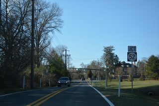
| Kirk Road leads west from SR 100 and Montchanin to connect with SR 52 (Kennett Pike) at SR 82 (Campbell Road). 12/22/16 |
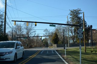
| Mast arm traffic lights were added at Kirk Road, Kennett Pike and Campbell Road during reconstruction of the intersection in 2013-14. SR 52 leads north to Centreville and south to Greenville. 12/22/16 |
- Wickes, Rush, email. "A History of Kennett Pike."
Photo Credits:
12/22/16, 12/20/17 by AARoads
Connect with:
Interstate 95
U.S. 13 Business - Wilmington to Claymont
State Route 2
State Route 82
State Route 100
State Route 141
Page Updated 08-24-2019.


