SR 56 travels 60.87 miles between U.S. 11 (Lee Highway) at Steeles Tavern and U.S. 60 (James Madison Highway) at Dentons Corner. The state route initially climbs into the Blue Ridge Mountains along Tye River Turnpike, from Vesuvius to Tye River Gap along the Rockbridge and Nelson County line. Continuing south through Montebello, SR 56 (Crabtree Falls Highway) converges with the South Fork of the Tye River within George Washington National Forest.
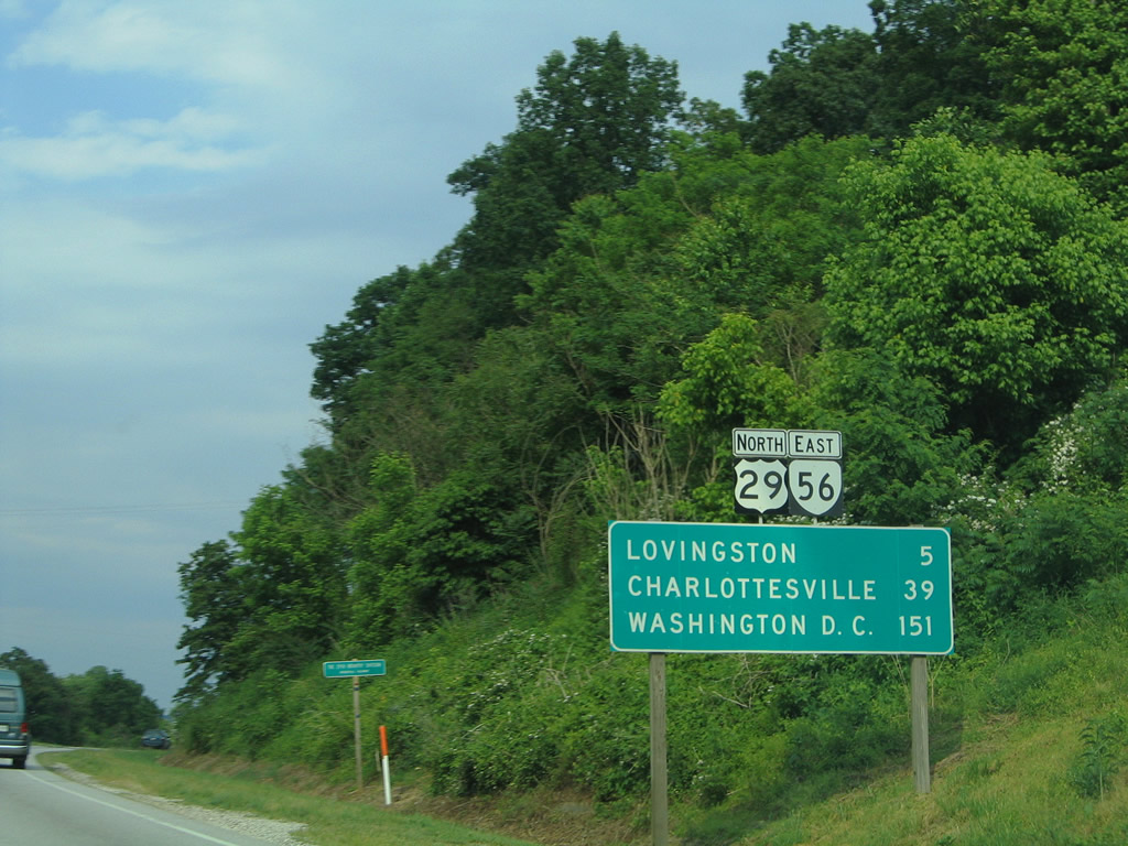
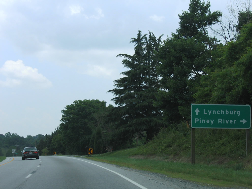
SR 56 parallels the Tye River southeast from Nash to Tyro, Massies Mill and SR 151 (Patrick Henry Highway) near Roseland. Angling southwest toward Piney River, SR 56 joins SR 151 for 2.27 miles. SR 56 then turns east across Hubbard Hill, 5.03 miles to U.S. 29 (Thomas Nelson Highway).
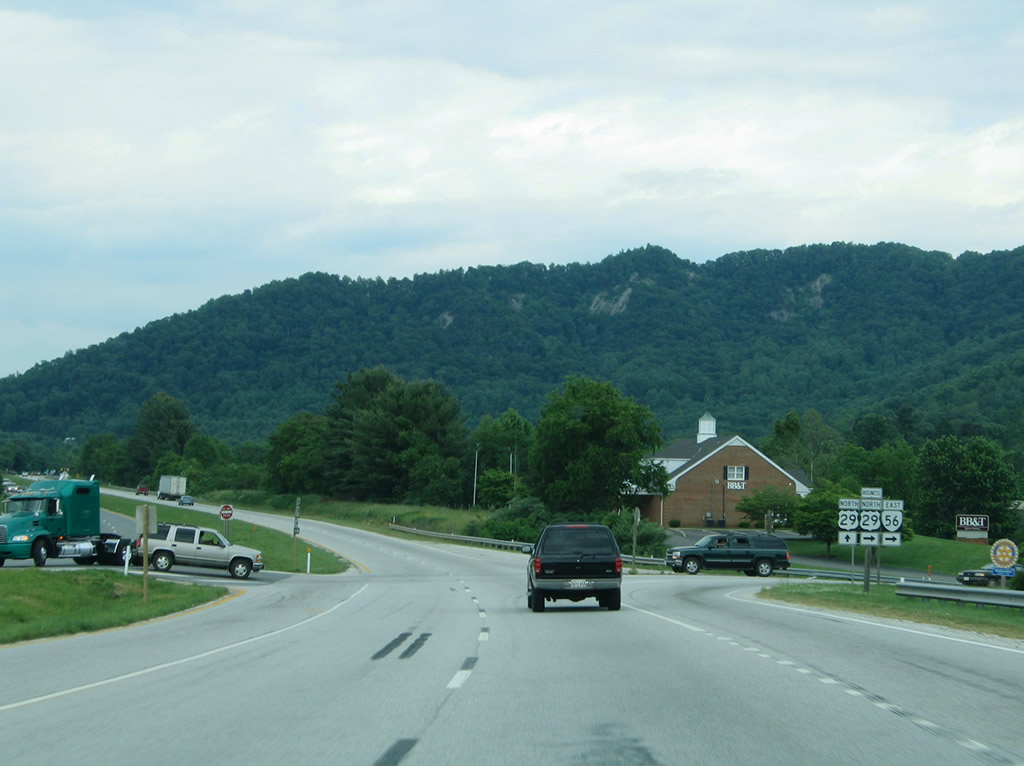
Circumventing Cabell Mountain, SR 56 combines with U.S. 29 northeast 4.28 miles to Lovingston. Following a 0.30 mile overlap with U.S. 29 Business (Front Street), SR 56 resumes a southward course along James River Road. Passing south of Naked Mountain, SR 56 reaches Shipman. The state route proceeds from there between Findlay and Thomas Mountains to Red Apple Orchard and across the James River at Wingina. Through Buckingham County, SR 56 is the James River Highway southeast to Woods Corner and U.S. 60 west of Buckingham.
|
| U.S. 29/SR 56 overlap for four miles between Colleen and U.S. 29 Business at Lovingston. 05/30/05 |
|
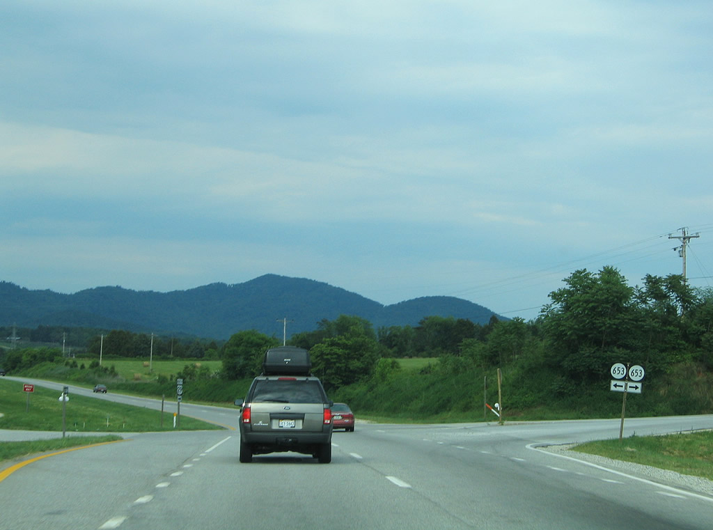
| SR 653 intersects U.S. 29/SR 56 (Thomas Nelson Highway) next. SR 653 spurs northward along Freshwater Cove Lane to Poplar Flats. Eastward SR 653 follows Oak Ridge Road toward SR 655 near Canada Gap between Turner and Findlay Mountains. 05/30/05 |
|
| SR 56 separates from U.S. 29 (Thomas Nelson Highway) for a short overlap with U.S. 29 Business (Front Street) at Lovingston before turning south along James River Road to Lakeview Heights. SR 56 circumvents Edge Hill on the four mile drive to Shipman. 05/30/05 |
|
| U.S. 29 Business follows Front Street through the Nelson County seat of Lovingston. The route emerges from near Ridge Street. 05/30/05 |
|
| South of Lovingston and U.S. 29 Business (Front Street), U.S. 29/SR 56 (Thomas Nelson Highway) meet SR 651 (Stevens Cove Road) north. SR 651 spurs to Fortunes Cove near Mills and Woods Mountains. 06/05/05 |
|
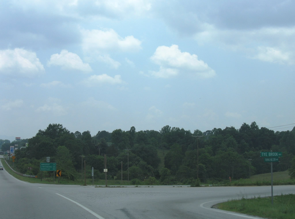
| SR 56 (Tye Brook Highway) branches westward from U.S. 29 (Thomas Nelson Highway) at Colleen five miles west to SR 161 north at Piney River. SR 56 concludes at U.S. 11 and Steeles Tavern. 06/05/05 |
|
| U.S. 29 south at the split with SR 56 (Tye Brook Highway) west. 06/05/05 |
Photo Credits:05/30/05, 06/05/05 by AARoads
Connect with:
U.S. 11
U.S. 29
U.S. 60
Page Updated 05-08-2021.


 North
North  East
East