Rhode Island Route 114 stretches north from Newport to Portsmouth and across the Mt. Hope Bridge to Bristol and Warren. The state route becomes the East Shore Expressway from north Barrington into East Providence before resuming as a surface route to Pawtucket and Woonsocket. The 1929-opened Mt. Hope Bridge was considered for possible inclusion into the Interstate 895 corridor in 1971 along with the East Shore Expressway.1
|
| Northbound Route 114 (West Main Road) prepares to split with the northbound beginning of Route 24, a 7.7 mile route to Tiverton and Fall River, Massachusetts. A sign mentions that there is no exit 1 for R.I. 24 as the nearby Turnpike Avenue interchange provides southbound access only. 07/28/07 |
|
| Route 114 enters the wye interchange with Route 24 north. Route 24 comprises a full freeway north to Interstate 195 in Massachusetts. Along the route is the Sakonnet River Bridge, which is being replaced with a toll bridge slated for completion in 2013. 07/28/07 |
|
| Travelers bound for Providence are directed onto Route 24 north to Interstate 195 west in lieu of Route 114 north through Bristol, Warren and Barrington. 07/28/07 |
|
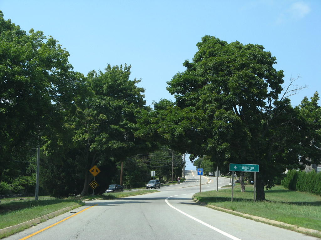
| Separate directions of travel for Route 114 recombine north of R.I. 24 and south of Freeborn Street. Bristol lies three miles ahead. 07/28/07 |
|
| Four lanes of Route 114 (West Main Road) wind northeast across Lehigh Hill in this scene. Waters of Narragansett Bay appear beyond the tree line to the west. 07/28/07 |
|
| Route 114 turns left from West Main Road onto Bristol Ferry Road at Turnpike Avenue. Turnpike Avenue enters from the Portsmouth town center to the southeast. 07/28/07 |
|
| Bristol Ferry Road carries Route 114 northbound to the foot of the Mt. Hope Bridge. R.I. 114 turns left onto the bridge at Boyds Lane. 07/28/07 |
|
| Boyds Lane leads motorists southeast to Route 24 (Fall River Expressway) and Route 138 south into Portsmouth. 07/28/07 |
|
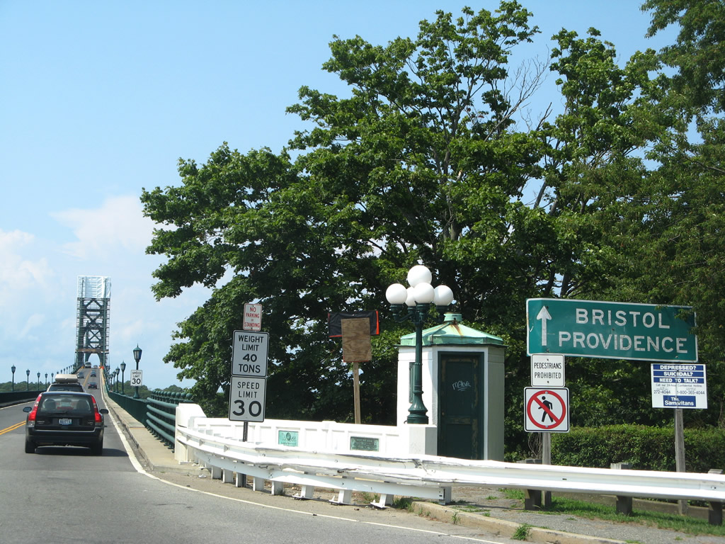
| Route 114 leaves Bristol Ferry Road for the two lane Mt. Hope Bridge across Mt. Hope Bay to the Town of Bristol. 07/28/07 |
|
| A southbound Route 114 trailblazer posted just north of Boyds Lane directs motorists under Mt. Hope Bridge to Mussel Bed Shoal Road east from Bristol Ferry Road north. 07/28/07 |
|
| Route 114 constitutes a surface route from Mt. Hope Bridge northward through Bristol, Warren, Barrington and East Providence to Interstate 195 west into Providence. 07/28/07 |
|
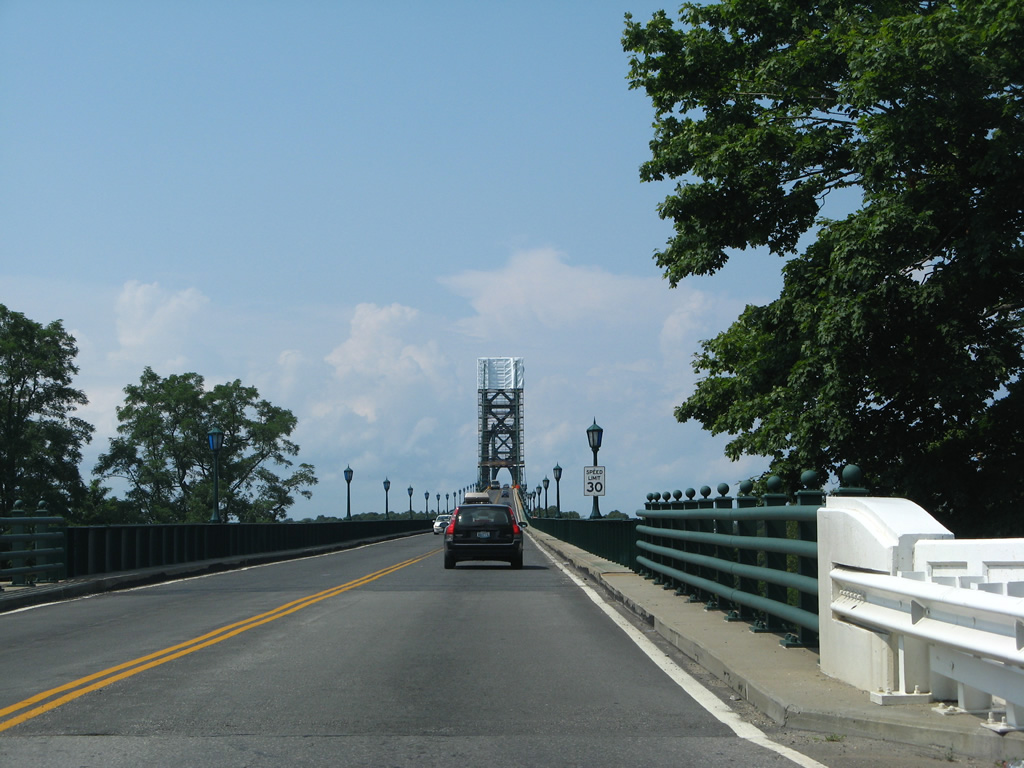
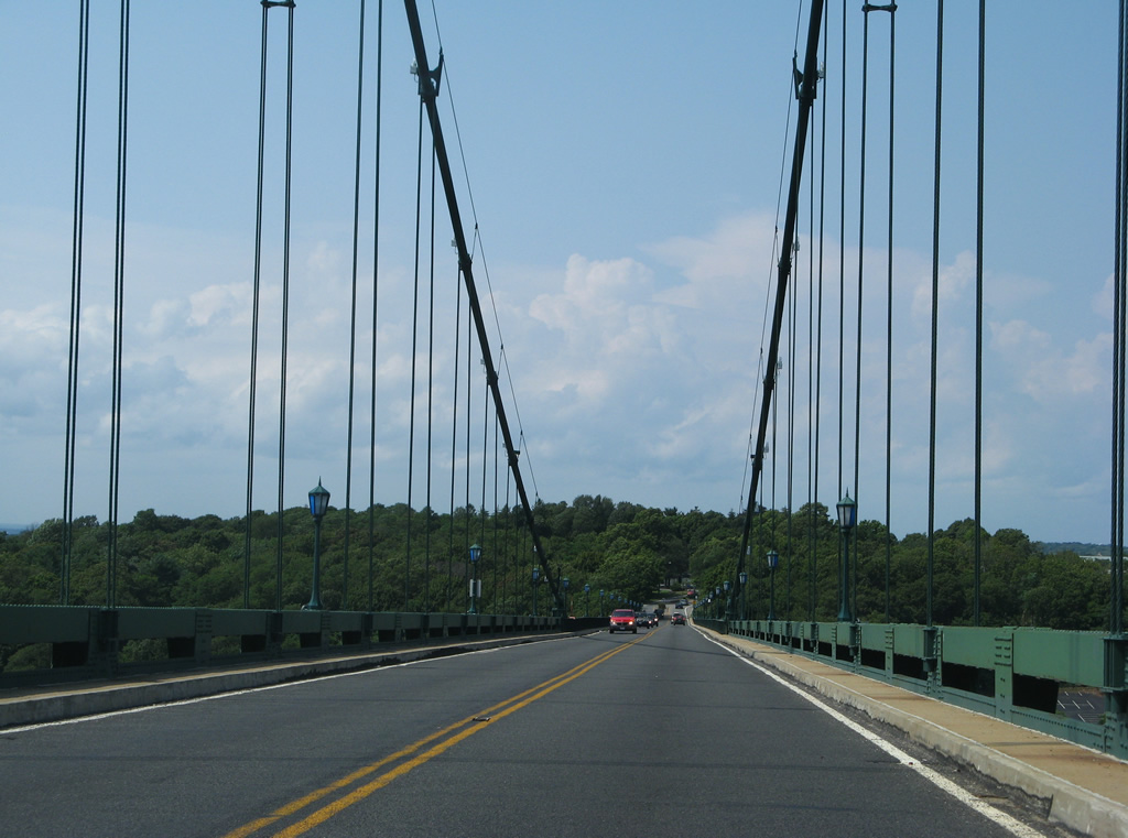
| Traveling northbound across the Mt. Hope Bridge on Route 114. The two lane span sees a 30 mile per hour speed and travels a distance of 6,130 feet. It is one of two crossings between Rhode (Aquidneck) Island and the mainland to the north. The suspension bridge is closed to pedestrians with a width of only 28 feet.2 07/28/07 |
|
| The Mt. Hope Bridge travels 285 feet above the waters of Mt. Hope Bay and opened on October 24, 1929. The span was tolled until 1998, a one way collection at the cost of 30 cents.2 The Rhode Island Turnpike and Bridge Authority (RITBA) oversees the Mount Hope Bridge and has indicated a desire to reinstitute tolls for the two lane bridge. 07/28/07 |
|
| Route 114 touches down from the Mt. Hope Bridge onto Ferry Hill at the south end of Bristol Neck. 07/28/07 |
|
| The two lane highway sees a narrow landscaped median from the bridge end to Old Ferry Road. The separation is remnant from when the Mt. Hope Bridge toll plaza collected tolls here. 07/28/07 |
|
| Old Ferry Road spurs south through southern reaches of Roger Williams University to Bristol Point on Mount Hope Bay. 07/28/07 |
|
| Route 114 partitions with the northbound beginning of Route 136 (Metacom Avenue) at the main entrance to Roger Williams University. Route 136 ventures 7.4 miles north through Bristol to Warren and Swansea, Massachusetts. The state route provides a direct route to Interstate 195. 07/28/07 |
|
| Route 24 southbound ends and merges from the left onto Route 114 at Turkey Hill. Route 114 (West Main Road) continues south from there to a signalized intersection with Corys Lane. 07/28/07 |
Page Updated 08-15-2012.