Colorado State Highway 115 connects Cañon City with Colorado Springs via Florence, Penrose and Fort Carson. The road is fairly well traveled, and there are frequent passing lanes and four lane sections. Much of the route is rural, with some intervening development. Part of the rural character is due to the sprawling Fort Carson, which lies generally between SH 115 and Interstate 25 and U.S. 85-87 through central El Paso County and northwestern Pueblo County.
|
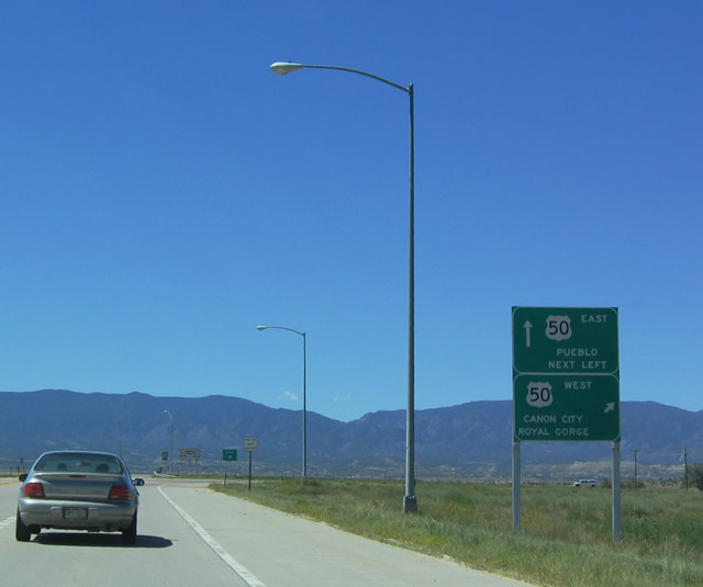
| SH 115 begins as an east-west route connecting Cañon City, Lincoln Park and Florence (via an old alignment of U.S. 50). East of Florence, SH 115 turns north and meets U.S. 50 again at this diamond interchange. As the most direct route from eastbound U.S. 50 to I-25 north to Colorado Springs and Denver, SH 115 sees a great deal of recreational and long distance traffic by offering a route that avoids urban Pueblo. 08/27/04 |
|
| Entering Penrose, this is the first reassurance shield on northbound SH 115 after U.S. 50. Penrose is an unincorporated area within Fremont County that is home to around 3,500. 08/27/04 |
|
| Beyond Penrose, SH 115 travels northeast along the boundary with Fort Carson, a large military reservation that covers hundreds of square miles in northwestern Pueblo and southwestern El Paso County. The ride along SH 115 is scenic, with rolling foothills and frequent passing lanes. 08/27/04 |
|
| SH 115 leaves Fremont County and enters El Paso County. It narrowly avoids nicking the extreme northwestern corner of Pueblo County. 08/27/04 |
|
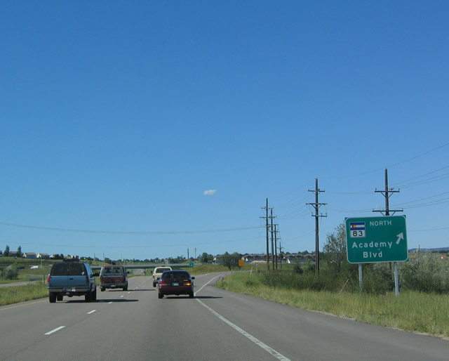
| Northbound SH 115 at the diamond interchange with Academy Boulevard (former SH 83) east and Broadmoor Bluffs Drive west. Academy Boulevard constitutes an expressway to Interstate 25 and Milton E. Proby Parkway in eastern Colorado Springs. 08/27/04 |
|
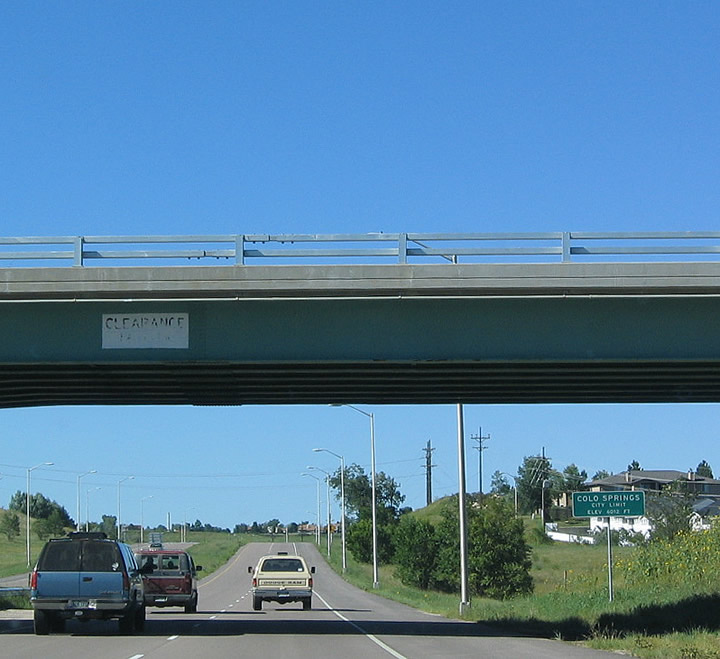
| After crossing under the Academy Boulevard overpass, northbound SH 115 enters the city of Colorado Springs. At an elevation of 6,035 feet, Colorado Springs receives only about 15-16 inches of precipitation annually. An estimated 450,000 people call Colorado Springs home, including many who work for the various military installations around town (including Fort Carson, Air Force Academy and Cheyenne Mountain). 08/27/04 |
|
| Continuing north, SH 115 passes a few intersections ahead of Cheyenne Mountain Boulevard. SH 115 then meets the former route of U.S. 85/87 (Lake Avenue) at a diamond interchange. Lake Avenue leads southeast to Security-Widefield. 08/27/04 |
|
| Cheyenne Mountain Boulevard winds west to residential areas and east to office parks and retail along Venetucci Boulevard. 08/27/04 |
|
| SH 115 overtook old U.S. 85 north along Nevada Avenue from Lake Avenue to Interstate 25. U.S. 85 was shifted east to remain along I-25 in an unsigned overlap. 08/27/04 |
|
| Heading south from Interstate 25 along Nevada Avenue, SH 115 formerly split with U.S. 85/87 at the diamond interchange with Lake Avenue. Both US Highways were relocated onto I-25. 08/29/04 |
|
| Sign changes made by October 2011 replaced the U.S. 85 south sign with Exit 46 for Lake Avenue and removed the pull through panel for SH 115 altogether. Lake Avenue forms a controlled access arterial east to Interstate 25. 08/29/04 |
|
| Just south of Lake Avenue (old U.S. 85), SH 115 proceeds to Cheyenne Mountain Boulevard, a major thoroughfare in southwestern Colorado Springs. The boulevard travels west toward the Cheyenne Mountain Zoo and Seven Falls. 08/29/04 |
|
| Although SH 115 is mostly a primary arterial, it has certain expressway characteristics, including a southbound off-ramp to Clubhouse Drive. 08/29/04 |
|
| Clubhouse Drive loops south from Broadmoor Valley Road to the Country Club of Colorado golf course. There is no return access from the southbound exit to SH 115. 08/29/04 |
|
| Advancing through southwest Colorado Springs, SH 115 nears Academy Boulevard, the former route of SH 83 east to Interstate 25 and Milton E. Proby Parkway east to Colorado Springs Airport and Peterson Air Force Base. 08/29/04 |
|
| The diamond interchange with Academy Boulevard was numbered Exit 44 by 2011. 08/29/04 |
|
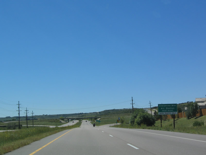
| Entering the cloverleaf interchange with O'Connell Boulevard east and NORAD Road west to Cheyenne Mountain. Cheyenne Mountain is a military installation formally known as Cheyenne Mountain Air Force Station (CMAFS) or Cheyenne Mountain Operations Center. Several defense and aerospace commands are located here, including NORAD, which stands for "North American Aerospace Defense Command." The installation is located some 2,000 feet below the surface of the mountain, and technology within the mountain enables the United States and Canada to identify incoming missile strikes. Coupled with the nearby Air Force Academy and Fort Carson, Cheyenne Mountain adds to the strong military presence in greater Colorado Springs. 08/29/04 |
|
| Beyond the Cheyenne Mountain interchange, an at-grade intersection along SH 115 provides access to Nelson Boulevard and the main gate of Fort Carson. 08/29/04 |
|
| Between Colorado Springs and Penrose, SH 115 reduces to two lanes, with provisions for passing on upgrades, downgrades and near certain intersections. East of SH 115 is Fort Carson, and to the west is the foothills. 08/29/04 |
|
| A four lane stretch along southbound SH 115 as it travels alongside the western border of Fort Carson. 08/29/04 |
|
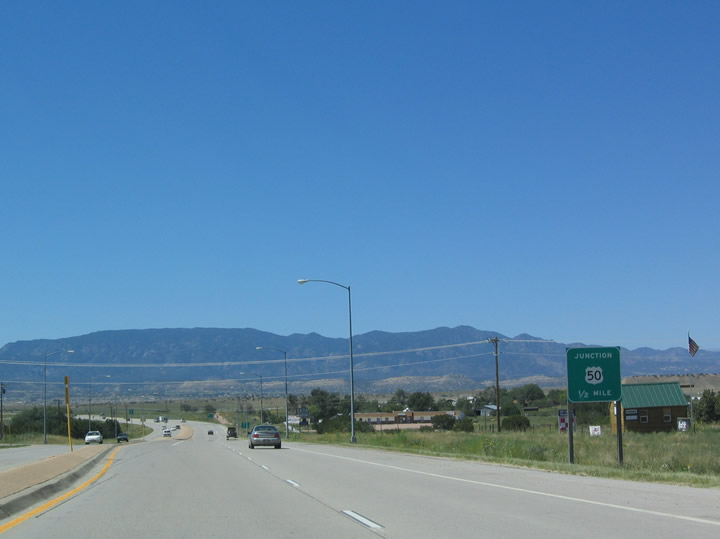
| Continuing into Penrose, southbound SH 115 converges with U.S. 50. Through this part of Fremont County, U.S. 50 is an expressway. 08/29/04 |
|
| U.S. 50 west leads motorist to the Royal Gorge of the Arkansas River and Cañon City, the gateway to this tourist attraction. The Royal Gorge is home to the world's tallest suspension bridge, as it crosses over the narrow and deep gorge. Train rides through the gorge originate in Cañon City. Other attractions at Royal Gorge include an incline train to the bottom of the gorge, a zoo, a gondola over the gorge and several other activities. 08/29/04 |
|
| East from SH 115, U.S. 50 ventures to Pueblo, Rocky Ford, La Junta, Las Animas and Lamar. U.S. 50 follows the Arkansas River as it flows into Kansas near the town of Holly (home of former Colorado Governor Roy Roemer), picking up U.S. 400 in Granada. 08/29/04 |
|
| A lane drop occurs at the diamond interchange with U.S. 50. 08/29/04 |
|
| Southbound Colorado 115 reaches the transition ramp onto U.S. 50 west Cañon City, Gunison and Delta. 08/29/04 |
Page Updated 05-04-2017.

 North
North