One of the shorter trunk highways within the Badger State, Wis 160 links Wis 29 at the town of Angelica with the village of Pulaski. 3.44 miles in length, Wis 160 spans a portion of Shawano and Brown Counties. As part of the 1998 state bill, STH 160 was named the "Polish Veterans Memorial Highway"1, in honor of area war veterans of Polish descent.
|
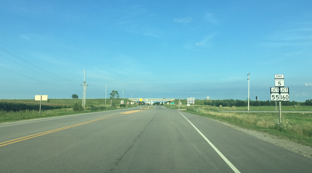
| Shawano County S concludes an 8.4 mile route at the T intersection with STH 55 and STH 160. STH 55 stems south to the city of Seymour in neighboring Outagamie County while STH 160 begins eastbound toward Brown County and Pulaski. 08/01/16 |
|
| Wis 55 dog legs east from CTH S alongside Wis 160 to Wis 29. Wis 55 was extended along County C north of Seymour to Bonduel when the Wis 29 expressway opened in 1996. 08/01/16 |
|
| Wis 55/160 enter a diamond interchange with Wis 29 east of Angelica. The 1996 opened expressway bypasses the town as Wis 29 continues southeast toward Pittsfield and the city of Green Bay. 08/01/16 |
|
| The entrance ramp for STH 29 west and STH 55 north leads motorists toward Bonduel and Shawano. STH 29/55 part ways to the east of Shawano at Exit 227, with STH 29 continuing toward Wittenberg and STH 55 extending north to Keshena. 08/01/16 |
|
| The lone confirming marker for Wis 160 stands east of the exchange with Wis 29/55. 08/01/16 |
|
| STH 160 runs three miles east to STH 32 (St. Augustine Street) at the village of Pulaski. 08/01/16 |
|
| Crop fields and farms line the landscape of Wis 160 between Angelica and Pulaski. 08/01/16 |
|
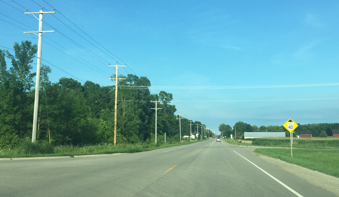
| The speed limit drops from 55 to 40 mph beyond the staggered intersection with Green Valley Road. 08/01/16 |
|
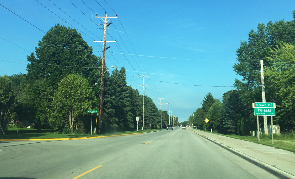
| STH 160 follows Pulaski Street as it formally enters the village of Pulaski and Brown County. 08/01/16 |
|
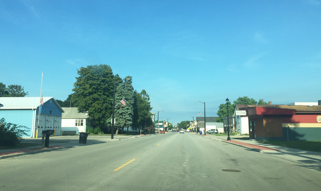
| Pulaski Street serves as the primary business corridor within Pulaski. 08/01/16 |
|
| Main Street stems north two blocks from Wis 160 on the final approach to Wis 32 (St. Augustine Street). Connecting with Green Bay and Milwaukee on its course through the eastern side of the state, Wis 32 overall travels 325.7 miles between the Illinois and Michigan state lines. 08/01/16 |
|
| Wis 160 (Pulaski Street) ends at a four-way stop with Wis 32. St. Augustine Street leads Wis 32 north toward the Wisconsin Northwoods while Wis 32 south continues along Pulaski Street 0.4 miles to Wisconsin Street south en route to Wis 29 and Green Bay. 08/01/16 |
Page Updated 09-01-2016.