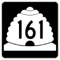
SR 161 loops 3.084 miles northwest from Interstate 70 at Exit 2 to I-15 at Exit 135. Unmarked on guide signs along both I-15 and I-70, the state route follows a portion of old U.S. 91 through historic Cove Fort.
|
| SR 161 begins as old U.S. 91 north enters a diamond interchange with Interstate 70. 10/18/04 |
|
| SR 161 (former U.S. 91) north links Interstate 70 with historic Cove Fort. Cove Fort was settled in 1867 as an outpost for travelers between Beaver and Fillmore. 10/18/04 |
|
| Interstate 70 leads west one mile from SR 161 to end at Interstate 15. 10/18/04 |
|
| The first northbound SR 161 reassurance shield appears just north of I-70. 10/18/04 |
|
| Less than a mile separates historic Cove Fort from Interstate 70 along SR 161 (former U.S. 91) south. 10/18/04 |
|
| A guide sign directs motorists onto the respective on-ramps to Interstate 70 and for the continuation of old U.S. 91 south to Sulphurville. 10/18/04 |
|
| SR 161 ends as does I-70, one mile to the west at I-15. Interstate 70 east meanwhile climbs to a summit of 7,076 feet between here and Exit 7. 10/18/04 |
|
| Karl Forth Trailblazers direct motorists onto SR 161 (old U.S 91) from the Cove Fort Rest Stop. The Chevron Station outside Cove Fort serves as one of several public-private rest areas across the state. These facilities allow motorists access to restrooms and water without having to make a purchase. 04/30/11 |
Page Updated 06-30-2016.


