|
| The first confirming marker for Wis 190 east within the interchange with Wis 16 along Capitol Drive on the east side of Pewaukee. Downtown Oconomowoc lies 13.4 miles to the northwest along beyond the end of the freeway portion for Wis 16. 07/05/16 |
|
| Another marker stands east of the diamond interchange as Wis 190 enters an S-curve. 07/05/16 |
|
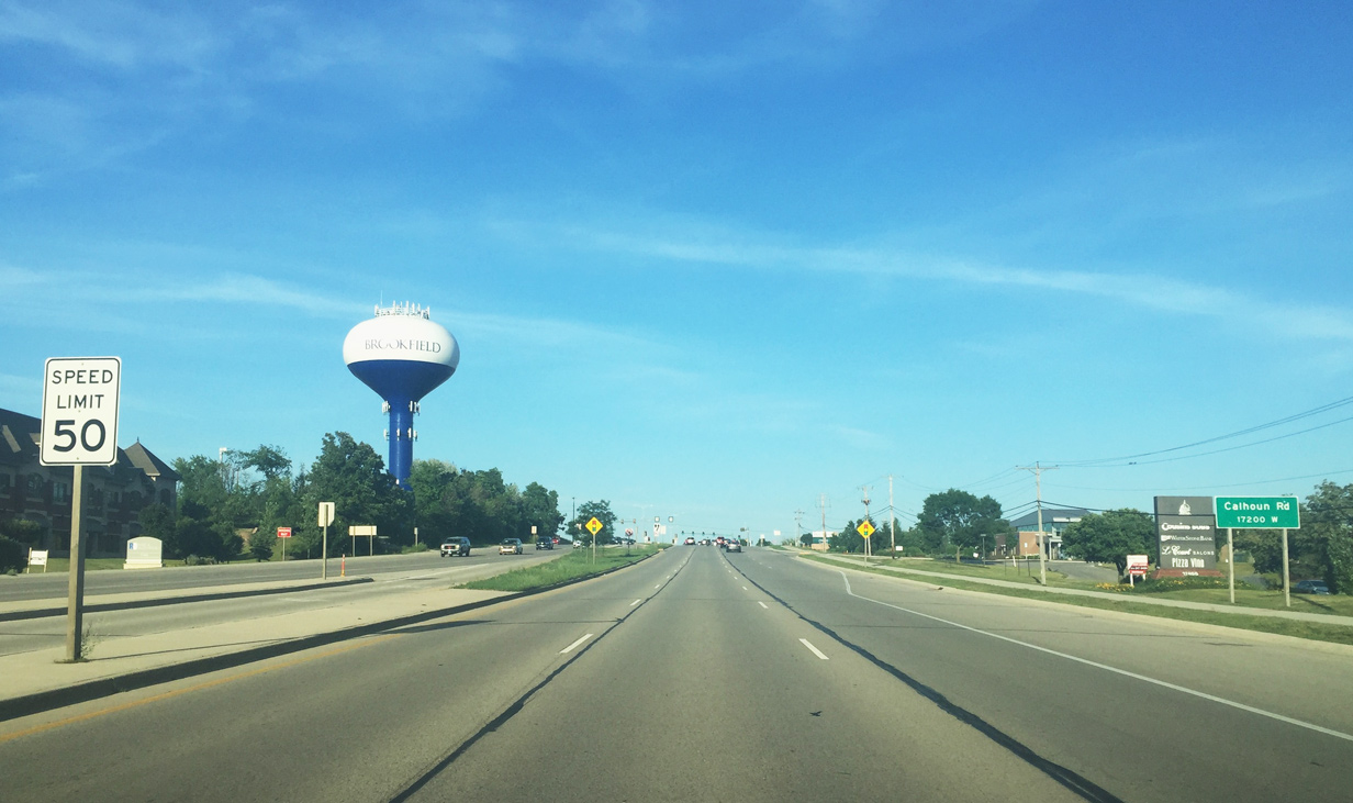
| Calhoun Road leads motorists to Brookfield in seven miles. Though it enters the city limits beyond Wis 100 (Mayfair Road), this distance sign indicates 13 miles remain to reach Milwaukee. 07/05/16 |
|
| Forest Grove Drive enters Wis 190 (Capitol Drive) at the signal ahead of Wis 164 (Pewaukee Road). The state trunk highway runs 43.5 miles between Waterford, Waukesha and Slinger and is a part of the National Highway System. 07/05/16 |
|
| STH-164 is a major north-south arterial connecting STH-190 with the western suburbs of Milwaukee. Portions of Wis 164 were added to the state trunkline system, following former County J north from Wis 190 to Wis 60 at Slinger. The state trunk highway once shared a concurrency with Wis 190 before a second realignment in 2004.1 07/05/16 |
|
| Due to high traffic volumes along both Wis 164/190, Wisconsin DOT previously proposed construction of an echelon intersection to minimize impacts associated with a typical grade separated interchange.2 A newer concept in transportation, this echelon intersection would have been the second of its type in the world, with the first being completed by 2000 in Aventura, Florida.3 07/05/16 |
|
| Beyond the intersection with STH-164 (Pewaukee Road) drivers see a speed increase along STH-190 (Capitol Drive) east. A 55-mph speed limit is enforced to Brookfield Road. 07/05/16 |
|
| Numerous trailblazers for area Interstates and U.S. highways are dotted along Wis 190 east between Pewaukee and Milwaukee. 07/05/16 |
|
| Traffic along Capitol Drive approaches a folded diamond interchange with Waukesha County F (Redford Boulevard) in this scene. County F follows Redford Boulevard south to Downtown Waukesha and north to near Sussex. 07/05/16 |
|
| CTH-F overtook all of former Wis 74 when the state trunk highway was decommissioned in November 2015. The village of Menomonee Falls was given local control of its portion of Wis 74 (Main Street) while the remainder of the highway was transferred to Waukesha County control.4 07/05/16 |
|
| Motorists prepare to depart for the CTH-F (Redford Boulevard) interchange as Wis 190 (Capitol Drive) continues east. The county trunk highway will meet Interstate 94 northeast of Waukesha 2.4 miles south of the interchange. 07/05/16 |
|
| A confirming marker rests atop this distance sign for those entering STH-190 east from County F. Brookfield (5 miles) is an unincorporated area lying west of the Interstate 41 corridor and Milwaukee (11 miles). 07/05/16 |
|
| County SR stems south from Capitol Drive, passing through several residential neighborhoods, before its end at U.S. 18 (Moreland Boulevard) in the northeast corner of Waukesha. 07/05/16 |
|
| Wis 190 east travels below Capitol Airport (02C) as the divided highway continues its trek east across Waukesha County. 07/05/16 |
|
| Drivers along Capitol Drive east next approach CTH-Y (Barker Road) south to Interstate 94. 07/05/16 |
|
| Barker Road leads County Y south through western Brookfield to Wis 59 (Greenfield Avenue) near Murphy Heights. 07/05/16 |
|
| Beyond CTH-Y, Wis 190 east spans the Fox River. Unlike its namesake river further to the north, this Fox River is a 202 mile tributary of the Illinois River. 07/05/16 |
|
| Motorists formally enter Brookfield in the vicinity of the Richland Parkway intersection. Commercial centers and residential neighborhoods become more abundant along this stretch of STH-190. 07/05/16 |
|
| Brookfield Road is a major north-south arterial connecting Wis 190 to the Brookhill View and Emerald Hills neighborhoods to the north and the Lothmoor, Woodmore, and Still Point neighborhoods to the south. 07/05/16 |
|
| The next major intersection along Wis 190 (Capitol Drive) east is at Calhoun Road. In the greater Milwaukee area, approaching guide signs include block numbers. 07/05/16 |
|
| Like Brookfield Road, Calhoun Road is another major north-south arterial in Brookfield. Calhoun Road travels north to County K (Lisbon Road) and south through several Brookfield neighborhoods. 07/05/16 |
|
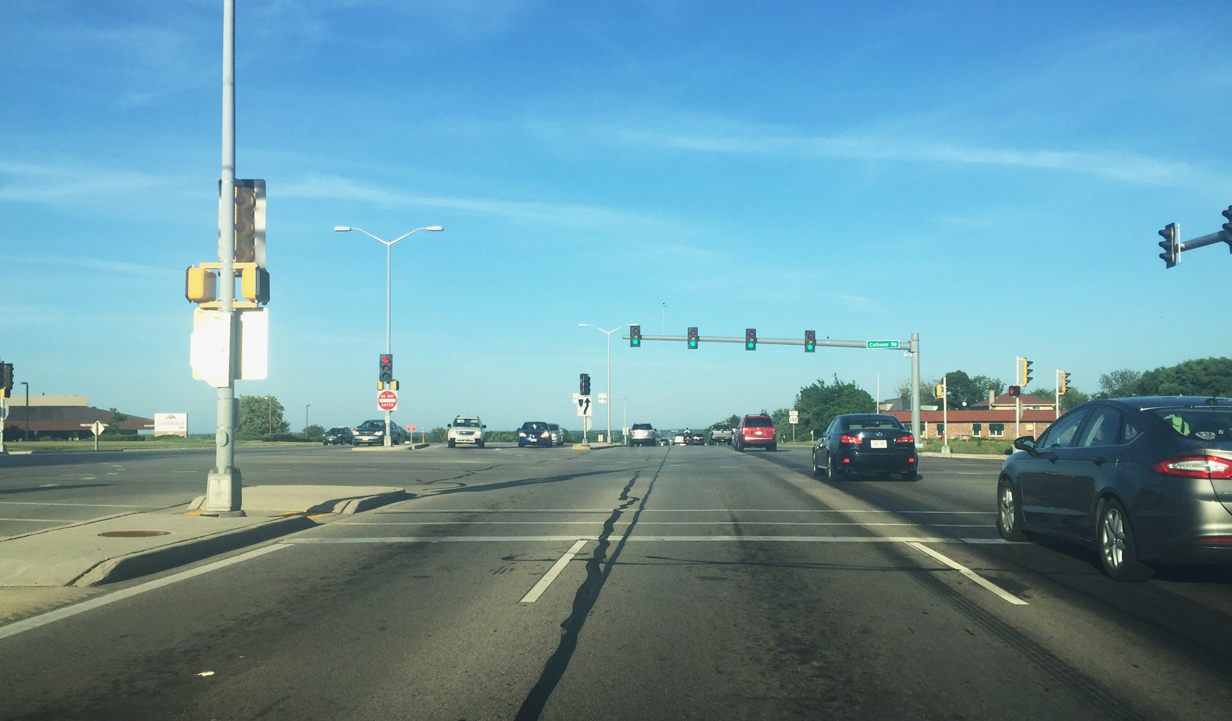
| Continuing east from Calhoun Road, STH-190 (Capitol Drive) traverses a hill line that generally separates the Lake Michigan and Mississippi River watersheds. 07/05/16 |
|
| Traffic along Wis 190 east reaches the jug handle interchange with Pilgrim Road. The arterial connects Wis 190 and Capitol Drive with central Brookfield and I-94 to the south and Menomonee Falls and I-41 to the north. 07/05/16 |
|
| Beyond the Pilgrim Road interchange motorists see a reduction in speed (45 mph) along Capitol Drive east. 07/05/16 |
|
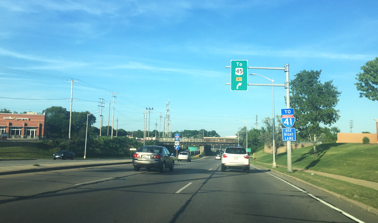
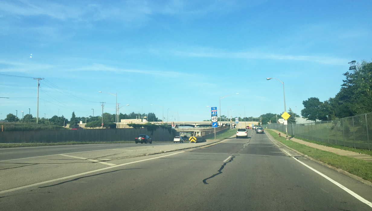
| 124th Street is a heavily laced big box commercial and industrial corridor between Burleigh Street and Silver Spring Drive that crosses Wis 190 ahead of the I-41/U.S. 45 interchange. 07/05/16 |
|
| Drivers bound for Interstate 41 and U.S. 45 are directed to the right for the approaching exchange. 07/05/16 |
|
| STH-190 (Capitol Drive) passes under railroad lines after entering Milwaukee County and the village of Wauwatosa. Capitol Drive will leave the village limits beyond Wis 100 (Mayfair Road) and enter Milwaukee proper. 07/05/16 |
|
| A three level interchange joins Wis 190 with I-41/U.S. 45. 07/05/16 |
|
| The collector distributor roadway reaches the signal for both the Harley-Davidson Product Development Center (north) and Penzeys Spices plant entrance (south). Penzeys is a retailer of various spices and operates 70 retail stores throughout the U.S.5 07/05/16 |
|
| I-41/U.S. 45 follow the Zoo Freeway south to I-94 and I-894 at the Zoo Interchange in west Milwaukee. I-41/U.S. 45 then proceed along side I-894 south and east on the Airport Freeway. 07/05/16 |
Page Updated 08-04-2016.