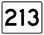
Massachusetts Route 213 connects I-93 and I-495 through the city of Methuen to the north of Lawrence. The suburban freeway travels 3.6 miles east from I-93, just south of the New Hampshire state line, to I-495 west of the Merrimack River. The state route was originally referenced as the relocated Route 113. It was open from I-93 east to a temporary end at Pleasant Valley Street on September 11, 1962. The trumpet interchange with I-495 opened in 1964 along with a new section of the beltway. It was renumbered as Route 213 at that time.1
|
| Ramps from I-93 combine east of the Spicket River at a begin shield for Route 213. The Loop Connector quickly approaches a parclo interchange (Exit 2) with Route 2 (Broadway). 07/30/07 |
|
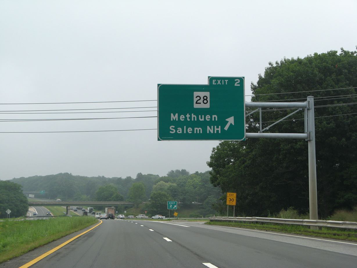
| Route 28 forms a multi state route with New Hampshire 28 north to Salem and south through Methuen toward Downtown Lawrence. The state route travels 152 miles to the southeast through Boston to end at U.S. 6 in Eastham. 07/30/07 |
|
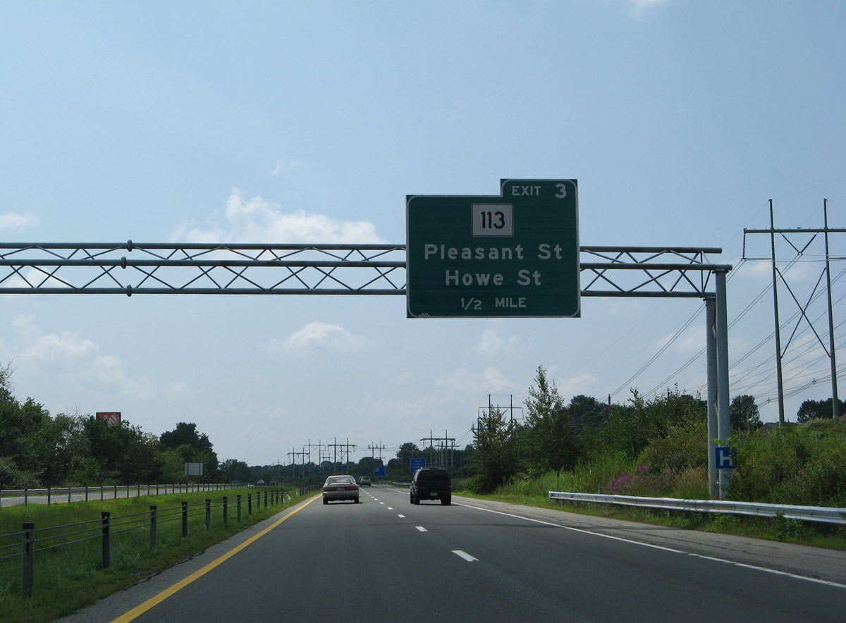
| Continuing east, the Loop Connector separates an area of wetlands by the New Hampshire State line from suburban areas along parallel Route 113 (Pleasant Street). Forthcoming Exit 3 provides the first of two connections between Route 213 east and Route 113. 07/30/07 |
|
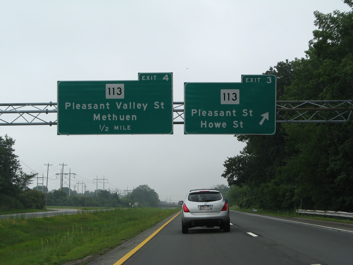
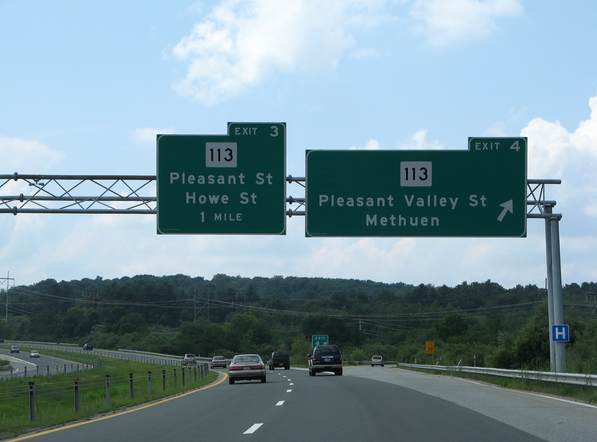
| Exit 3 is a folded diamond interchange with the eastbound ramps tying directly into Route 113 (Pleasant Street) and the westbound ramps meeting Howe Street. 07/30/07 |
|
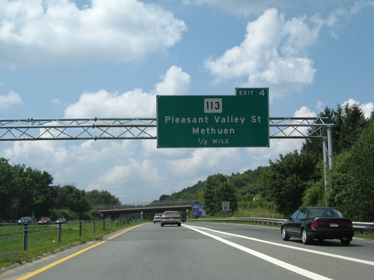
| Route 113 expands into a commercial arterial from Exit 3 east along Pleasant Valley Street to the access road from Exit 4. Howe Street stems north from residential areas along Jackson and Prospect Street toward Reservoir Hill and suburban areas of north Methuen. 07/30/07 |
|
| Big box retail lines the south side of the Route 213 freeway to the trumpet interchange (Exit 4) with the Route 113 access road. 07/30/07 |
|
| Route 213 makes a sweeping curve to the south of Reservoir Hill and west of Pie Hill. 07/30/07 |
|
| An end sign for Route 213 precedes the trumpet interchange (Exit 5) with Interstate 495. 07/30/07 |
|
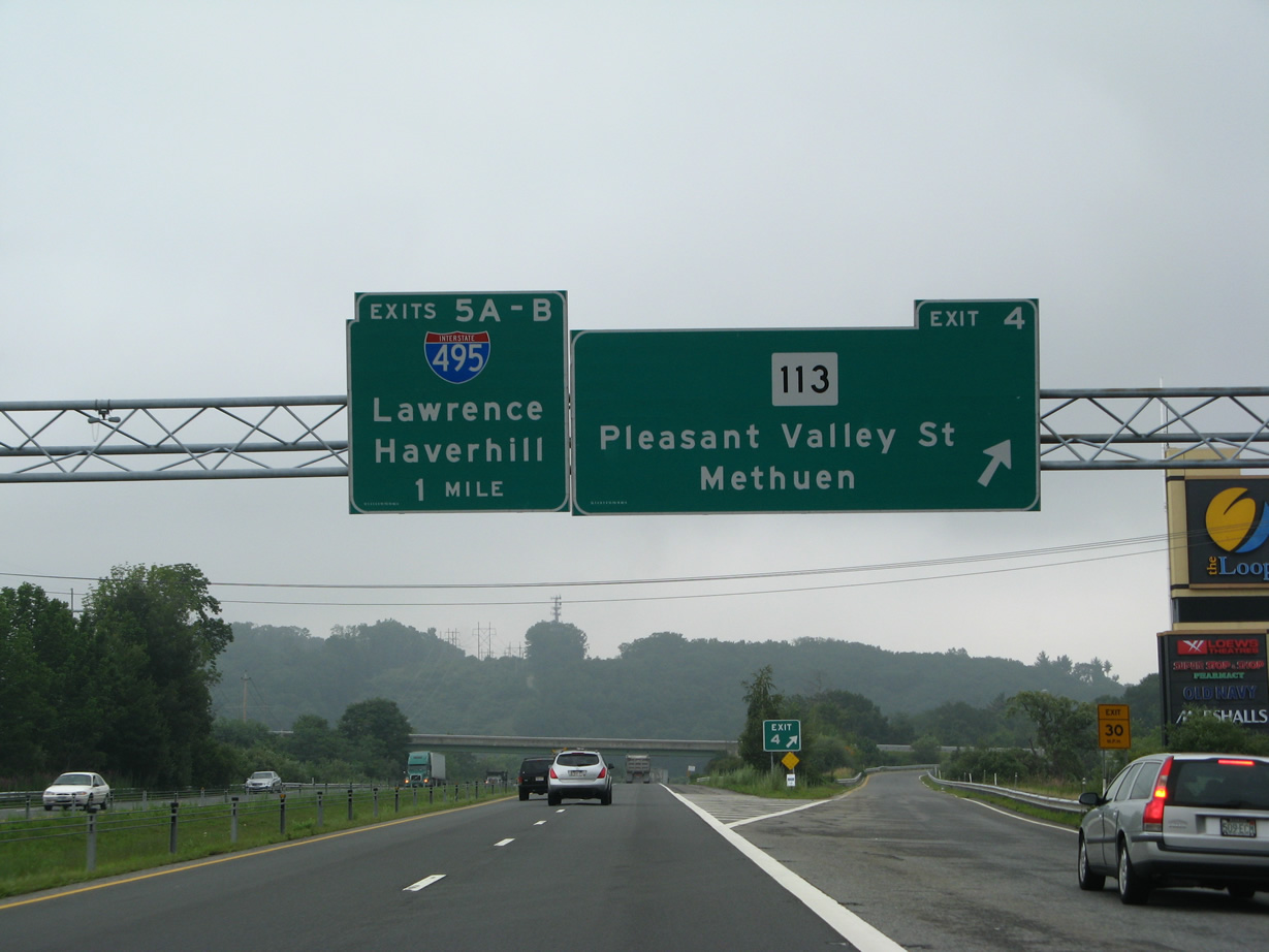
| Route 113 (Pleasant Valley Street) runs east from Exit 4 to Route 110 (Merrimack Street), where it turns north alongside the Merrimack River to Haverhill. 07/30/07 |
|
| The overpass at Exit 4 is named the Representative Nicholas J. Buglione Memorial Bridge. The interchange was a later addition to the Loop Connector. 07/30/07 |
|
| Turning southeast, Route 213 approaches Exits 5A/B for Interstate 495. The outer beltway for the Boston area connects Lawrence with Haverhill locally. 07/30/07 |
|
| Traffic separates into single lane ramps for Interstate 495 south to North Andover and Lowell and north to I-95 for Portsmouth, New Hampshire and Portland, Maine. 07/30/07 |
|
| Following Exit 5B as it loops onto I-495 north ahead of Haverhill and Amesbury. 07/30/07 |
|
| Route 213 stems west from a trumpet interchange with I-495 by Pie Hill. 07/29/07 |
|
| The freeway arcs west a half mile to Exit 4, which links Route 213 with adjacent Route 113 (Pleasant Valley Street) by The Loop big box retail center. 07/29/07 |
|
| A begin shield for Route 213 was formerly posted ahead of the Route 113 (Pleasant Valley Street) overpass. 07/29/07 |
|
| Reassurance markers for both Loop Connector and Route 213 followed the Pleasant Valley Street over crossing. The first Route 213 was eventually moved further east. 07/29/07 |
|
| Exit 4 departs as a sweeping off-ramp to an access road leading south to Route 113 (Pleasant Valley Street). Route 113 parallels the Loop Connector west to Route 28 (Broadway). 07/29/07 |
|
| The Loop Connector runs between apartments and town homes to the north and The Loop shopping center to the south to a folded diamond interchange (Exit 3) with Howe Street. 07/29/07 |
|
| Exit 3 loops away from Route 213 west for Howe Street north to north Methuen and south to adjacent Route 113 (Pleasant Street). 07/29/07 |
|
| Route 28 (Broadway) ventures north from Downtown Lawrence to cross the Methuen city line at Whitman Street. The state route crosses paths with the Loop Connector in one mile. 07/29/07 |
|
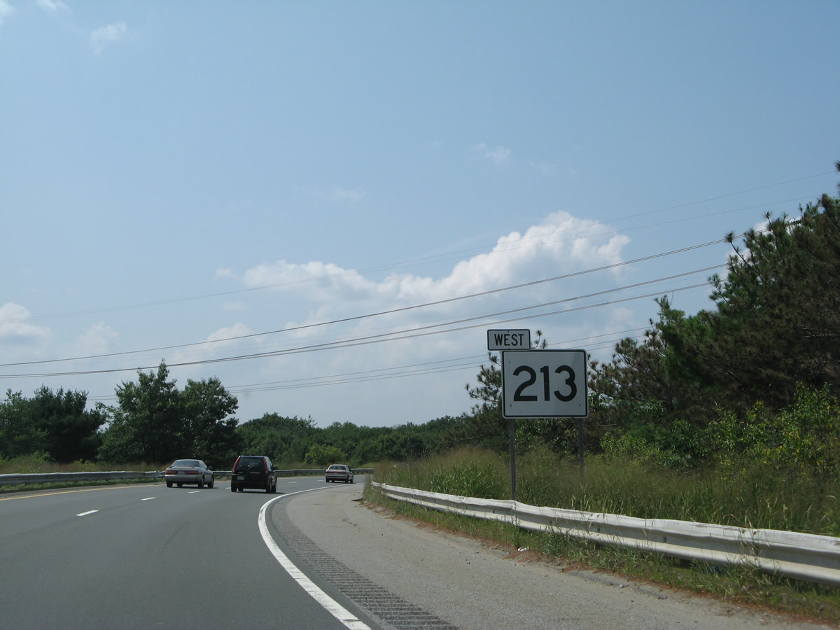
| Route 213 west passes just south of the New Hampshire state line midway between Exits 3 and 2. 07/29/07 |
|
| An end sign stands 1.5 miles ahead of the semi-directional T interchange with Interstate 93. 07/29/07 |
|
| North from Exit 2, Route 28 enters the town of Salem, New Hampshire. NH 28 extends north from there along the I-93 corridor to Derry, Manchester and Hooksett. 07/29/07 |
|
| Entering the parclo interchange (Exit 2) with Route 28 on the Loop Connector west. Collectively Route 28 and NH 28 form a 237 mile route between Chatham, out on Cape Cod, and Ossipee in east central New Hampshire. 07/29/07 |
|
| Route 213 partitions into single lane ramps for Interstate 93 a half mile west of the Broadway on-ramp. 07/29/07 |
|
| The final westbound confirming marker for Route 213 lines the northward curve across the Spicket River. 07/29/07 |
|
| Interstate 93 leaves Methuen, Massachusetts for Salem, Derry and Manchester, New Hampshire. The northbound control city is the state capital of Concord instead of the largest city in the Granite State. 07/29/07 |
|
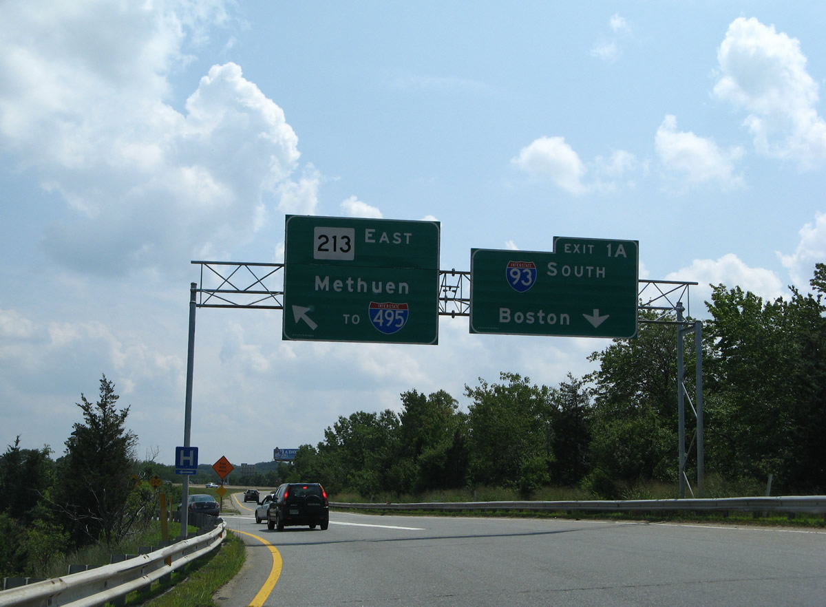
| Exit 1B departs for I-93 north ahead of the state line while Exit 1B sweeps southward toward I-93 and Boston. 07/29/07 |
|
| Drivers taking Exit 1A to I-93 south mingle with departing motorists from I-93 south to Route 213 east. This weaving traffic pattern is leftover from old engineering practices. 07/29/07 |
Page Updated 09-16-2016.