California 284 travels from Chilcoot north to Frenchman Lake, which was formed in 1961 as part of the State Water Project.1 Photo taken 09/04/10.
California 284 is Frenchman Lake Road. The state route leads about eight miles north from California 70 at Chilcoot to the recreation area at Frenchman Lake. The highway slowly ascends from the unincorporated community through Little Last Chance Canyon into the Plumas National Forest and the Frenchman Reservoir State Recreation Area.
|
| SR 284 starts out relatively straight in the Sierra Valley, but it quickly becomes winding and narrow. 01/20/03 |
|
| The lone reassurance marker route for SR 284 north appears as the highway heads out of Chilcoot. 09/04/10 |
|
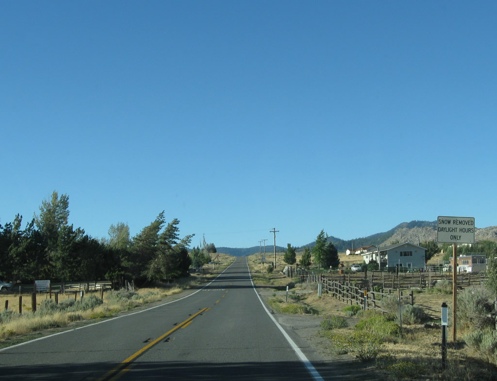
| Since SR 284 primarily exists to provide access to the recreational area at Frenchman Lake, snow is only plowed during daylight hours. 09/04/10 |
|
| Ranch homes are scattered on both sides of SR 284 it leaves Chilcoot. 09/04/10 |
|
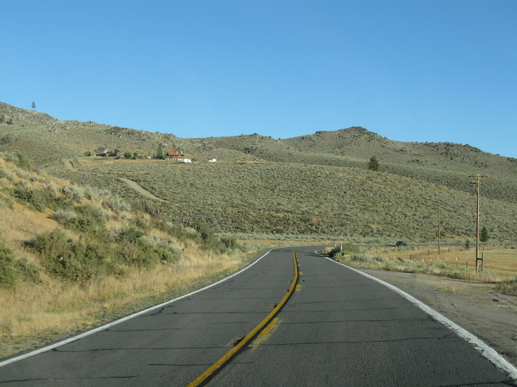
| SR 284 proceeds through the northern reaches of the Sierra Valley as it approaches the Diamond Mountains. Frenchman Lake is nestled inside the mountains. 09/04/10 |
|
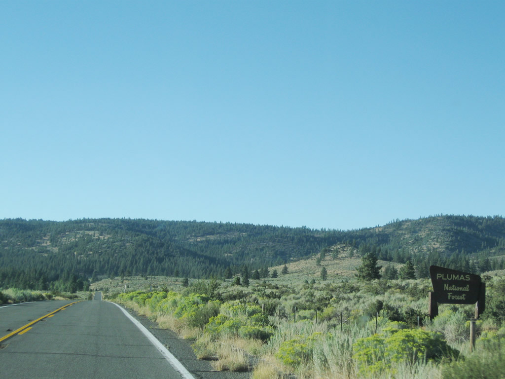
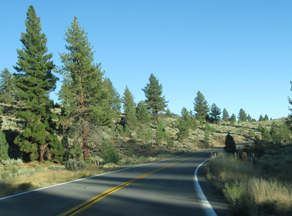
| Upon reaching the foothills, the state route curves with the terrain and enters Plumas National Forest. 09/04/10 |
|
| SR 284 navigates through the Little Last Chance Canyon and gains elevation to southern reaches of Frenchman Lake. 09/04/10 |
|
| SR 284 ends at the transition to Forest Service Route 11 by Frenchman Lake. 01/20/03 |
|
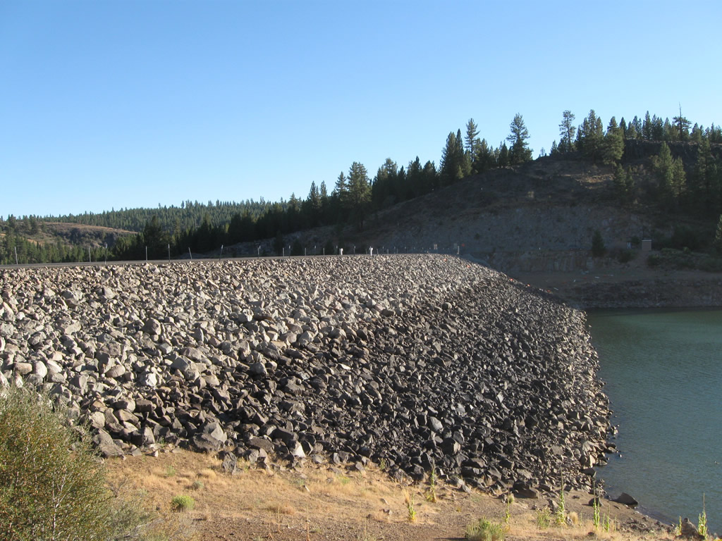
| An access road crosses the dam, joining Forest Service Route 11 with a small parking area that overlooks Frenchman Lake. 09/04/10 |
|
| State maintenance ends and Forest Service Route 11 begins just beyond the dam road intersection. 09/04/10 |
|
| Leaving Frenchman Lake. SR 284 begins and descends into Little Lost Chance Canyon. 09/04/10, 01/20/03 |
|
| SR 284 sees several sheer cliff walls along the course through Little Last Chance Canyon, 09/04/10 |
|
| Emerging from the narrowest portion of Little Last Chance Canyon, SR 284 pushes south toward Chilcoot. 09/04/10 |
|
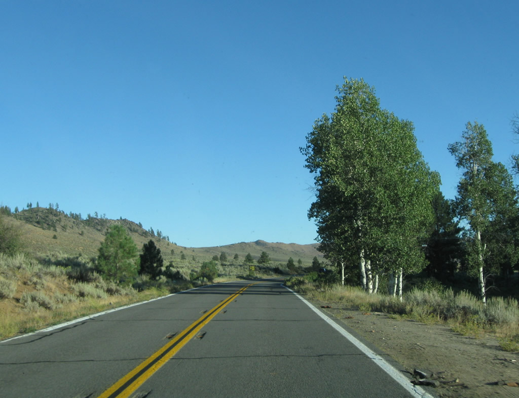
| SR 284 ventures southward from Plumas National Forest through northern reaches of the Sierra Valley. 09/04/10 |
|
| SR 284 reaches the unincorporated community of Chilcoot. 09/04/10 |
|
| Approaching the unmarked intersection with SR 70 (Feather River Highway) on SR 284 north. SR 70 heads east to Hallelujah Junction and U.S. 395 south to Reno, Nevada. 09/04/10 |
|
| West from the north end of SR 284, SR 70 continues to SR 49 south, Portola and Quincy. 09/04/10 |
|
| A narrow road connects SR 284 with a small parking area on the southeastern corner of the Frenchman Lake. A spillway flows into Little Last Chance Canyon from nearby. 09/04/10 |
|
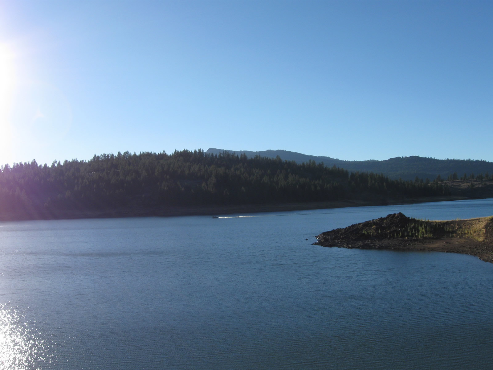
| A monument/plaque appears at the parking area on the southeast corner of. Formed along Little Last Chance Creek, when full the reservoir sits at an elevation of 5,588 feet above sea level. Construction on the dam was completed in 1961 as part of the California State Water Project.1 09/04/10 |
|
| Frenchman Lake is administered as part of the Plumas National Forest with recreational activities including camping, boating and hiking. 09/04/10 |
Page Updated 06-06-2017.