Virginia Route 337 connects Suffolk with Portsmouth and Norfolk in the Hampton Roads region. Originating west of Downtown Suffolk, SR 337 follows Washington Street east from U.S. 58 Business to combine with U.S. 13 Business at Carolina Road. This is the first of many overlaps along the 35.93 mile long route.
SR 337 loops north from U.S. 13-460 Business in Suffolk to the neighborhood of Driver and east into the city of Portsmouth. SR 337 converges with U.S. 58, and U.S. 460 ALT at a five point intersection where Portsmouth Boulevard, Airline Boulevard and McLean Street come together by the Oregon Acres neighborhood in Portsmouth. SR 337 ALT branchs east from there along Turnpike Road while SR 337 continue east on Portsmouth Boulevard to Elm Avenue at Brighton.
SR 337 crosses the Elizabeth River Southern Branch on the tolled South Norfolk Jordan Bridge between SR 239 (Victory Boulevard) at the Norfolk Navy Shipyard (NNSY) and I-464 and U.S. 460/SR 166 (Bainbridge Boulevard) at the Quincy neighborhood in Chesapeake. Constructed from 2009 to 2012, the high rise concrete segmental box girder bridge1 replaced a vertical lift bridge built in 1928. The former span closed in 2008 due to the need for more than $4 million in repairs. It was subsequently demolished.2
Beyond the cloverleaf interchange with I-464, SR 337 turns north along Bainbridge Boulevard from U.S. 460/SR 166 (Poindexter Street) to Main Street. SR 337 zigzags along S Main Street, W Liberty Street and W Berkley Avenue to combine with I-464 north to I-264. SR 337 continues east along an unmarked overlap with I-264 across the Berkley Bridge to Tidewater Drive at Downtown Norfolk.
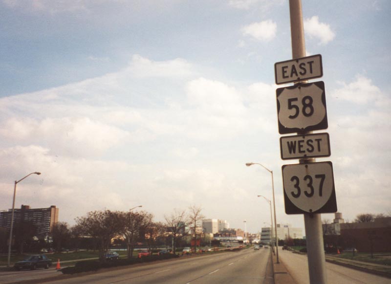
Following Tidewater Drive, SR 337 leads north from I-264 to U.S. 460 (Brambleton Avenue). SR 337 turns west along Brambleton Avenue alongside U.S. 460 to Church Street and U.S. 460 ALT to St. Paul's Boulevard. U.S. 58 combines with SR 337 (Brambleton Avenue) west from Duke Street to the exchange joining Hampton Boulevard with the Midtown Tunnel.
Hampton Boulevard leads SR 337 north 5.77 miles from U.S. 58 to Admiral Taussig Boulevard at Norfolk Naval Station. SR 337 concludes 0.91 miles east along Admiral Taussig Boulevard where Interstate 564 begins.
The Alternate route for SR 337 encircles Downtown Norfolk along Waterside Drive west from SR 337 (Tidewater Drive) to Boush Street and Boush Street north to SR 337 along Brambleton Avenue.
|
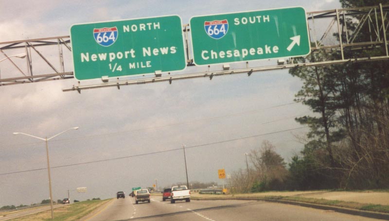
| SR 337 (Portsmouth Boulevard) heads east from Nansemond Parkway in Suffolk to a cloverleaf interchange (Exit 11) with Interstate 664. East of I-664, SR 337 continues to Chesapeake Square Mall and the city of Portsmouth. 03/17/01 |
|
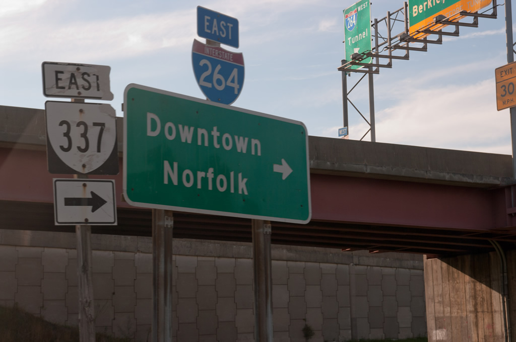
| SR 337 joins W Berkley Avenue from W Liberty Street to connect with I-464 north leading into the exchange with I-264 between the Downtown Tunnel and Berkley Bridge. 09/05/10 |
|
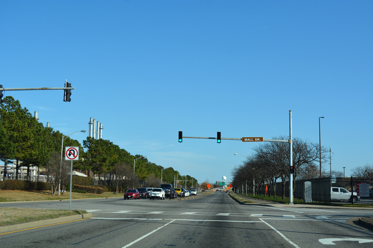
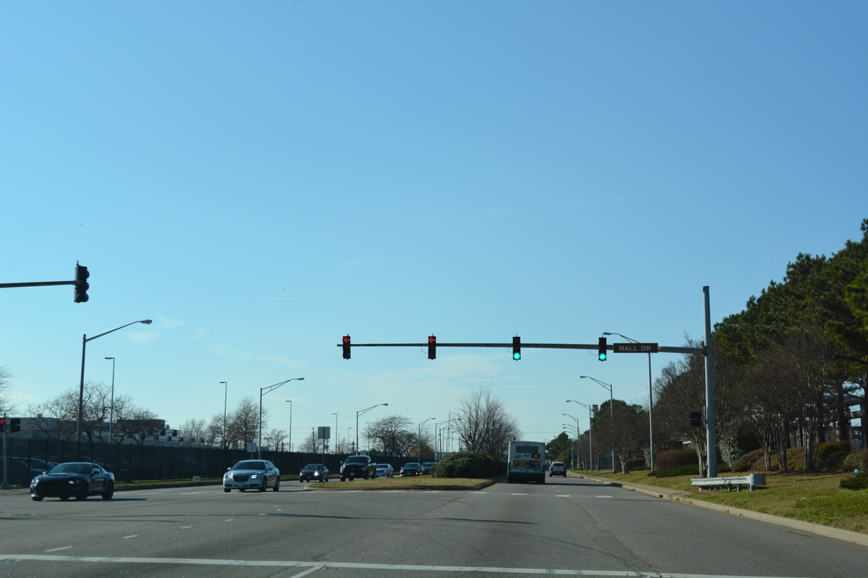
| SR 337 (Admiral Taussig Boulevard) intersects Mall Drive south to the Navy Exchange Commissary just beyond the eastern turn from Hampton Boulevard. 12/14/17 |
|
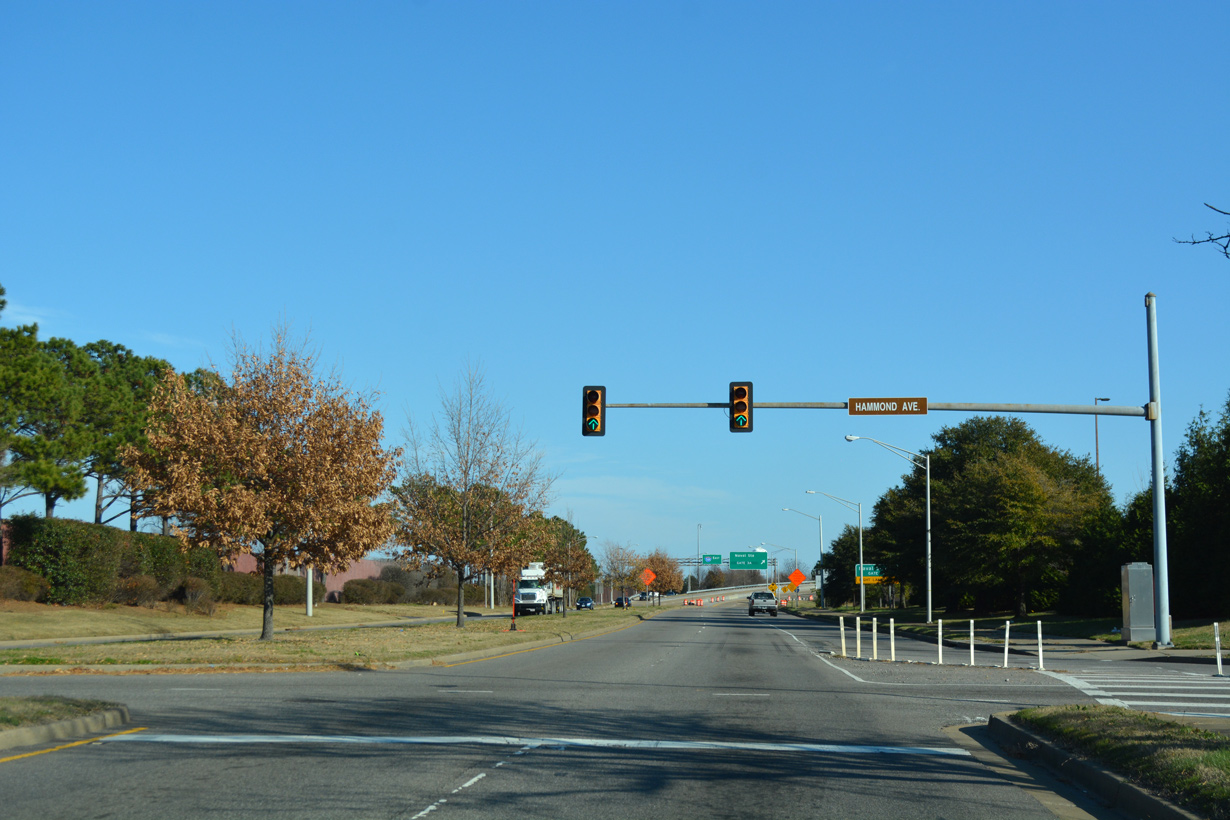
| Hammond Avenue flows north from the Navy Exchange Commissary to SR 337 at the freeway beginning of Interstate 564. 12/14/17 |
|
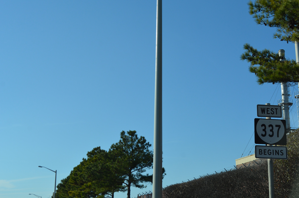
| SR 337 commences along Admiral Taussig Boulevard westbound from I-564 at Hammond Avenue and Naval Station Norfolk (NSN). 12/14/17 |
|
| Hammond Avenue north connects the Norfolk Main Navy Exchange commercial area with Admiral Taussig Boulevard. 12/14/17 |
|
| Mall Drive leads south from SR 337 (Admiral Taussig Boulevard) to the Naval Exchange Commissary. 12/14/17 |
|
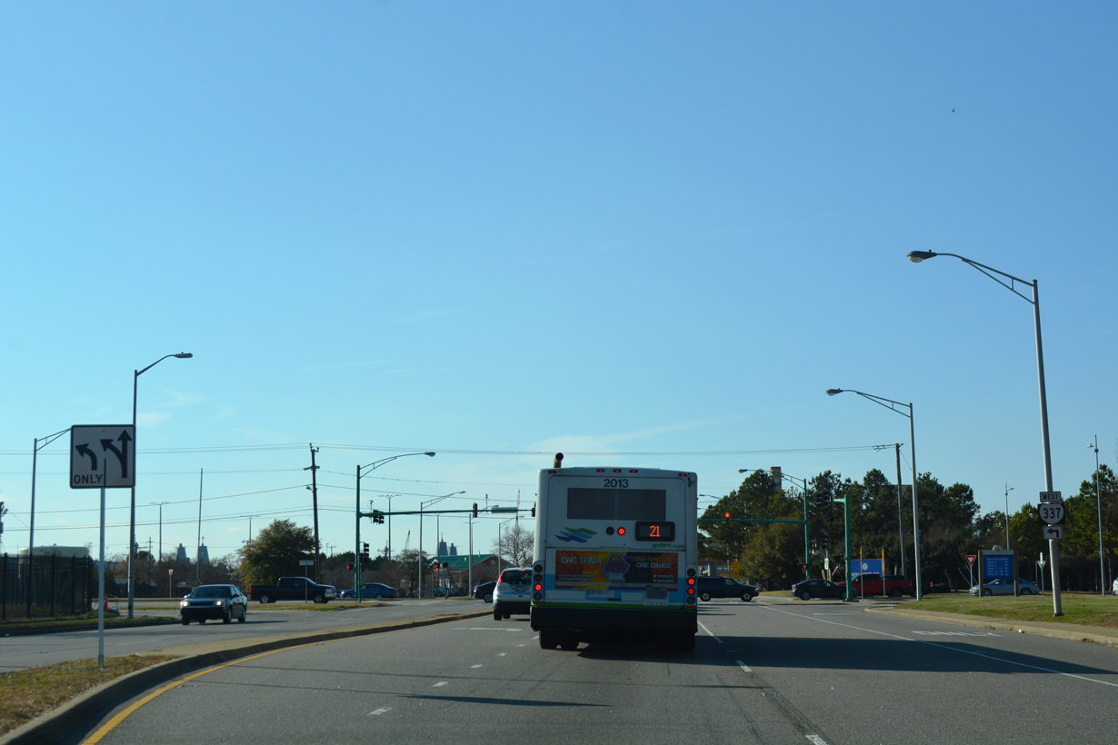
| SR 337 turns south onto Hampton Boulevard from NSN toward Downtown Norfolk. 12/14/17 |
|
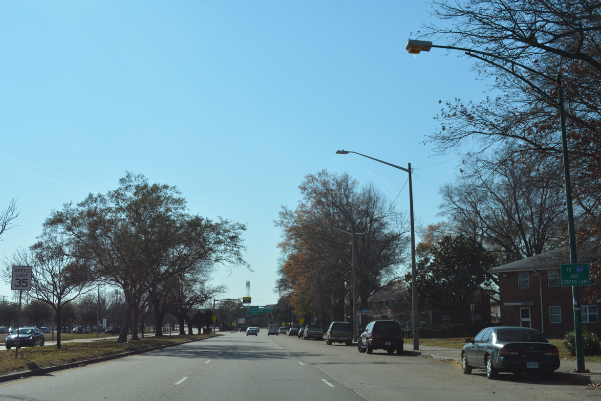
| Reassurance markers formerly posted east of Colley Avenue along Brambleton Avenue in Norfolk. These were removed after 2007 when the Tide light rail line was constructed along the south side of U.S. 58/SR 337. 03/17/01 |
|
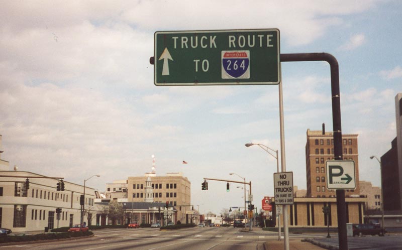
| U.S. 58 east splits with westbound SR 337 (Brambleton Avenue) for Duke Street north to Virginia Beach Boulevard outside Downtown Norfolk. Removed after 2007, this overhead directed trucks to remain along Brambleton Avenue to U.S. 460 ALT (St. Paul's Boulevard) south or SR 337 along Tidewater Drive south to I-264. 03/17/01 |
|
| SR 337 makes an unmarked turn from U.S. 460 (Brambleton Avenue) onto Tidewater Drive south at SR 168. 10/12/14 |
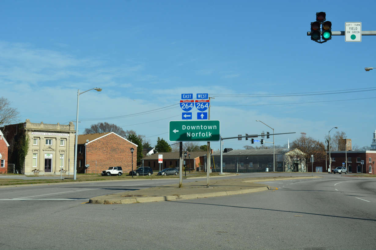
|
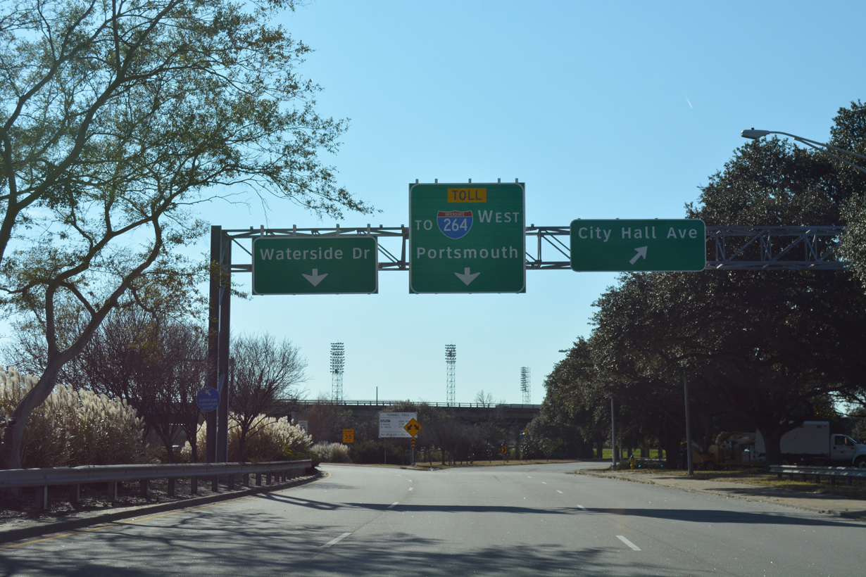
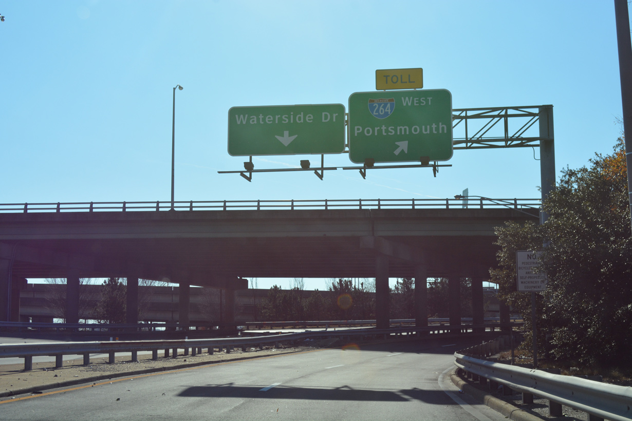
| SR 337 (Tidewater Drive) partitions into ramps for City Hall Avenue west, Waterside Drive (SR 337 ALT) and I-264 west across the Berkley Bridge. 10/12/14 |
|
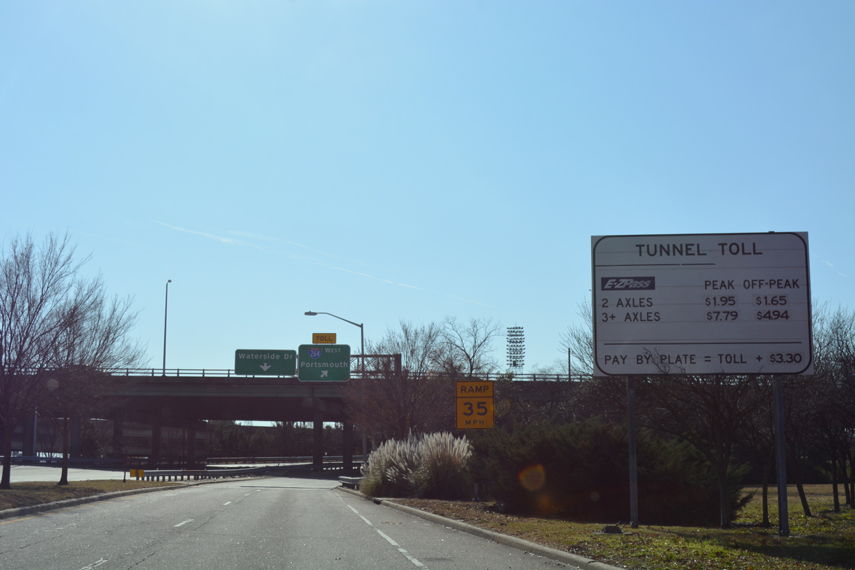
| A toll schedule sign references the Downtown Tunnel, located west of the Berkley Bridge on Interstate 264. 10/12/14 |
|
| Waterside Drive (SR 337 ALT) wraps around Downtown west to Bousch Street north. SR 337 combines with I-264 to I-464 south. 10/12/14 |
|
| SR 337 merges onto the left side of Interstate 264 ahead of the Berkley Bridge spanning the Elizabeth River Eastern Branch. 10/12/14 |
|
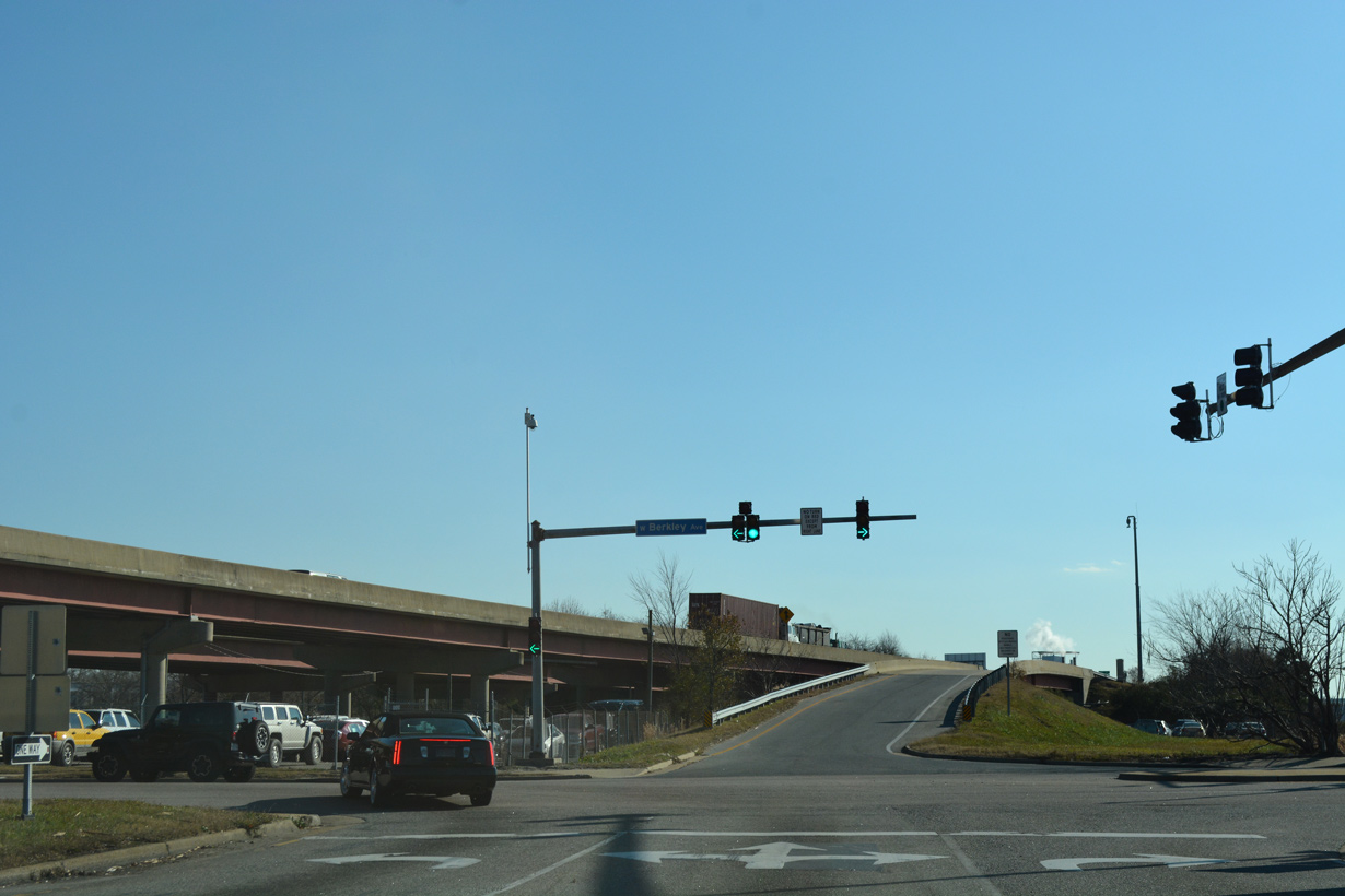
| SR 337 shifts east from I-464 along Berkley Avenue to State and Liberty Streets at Berkley in Norfolk. 12/14/17 |
|
| The northbound entrance ramp for I-464 takes SR 337 eastbound onto I-264 across the Berkley Bridge into Downtown Norfolk. Berkley Avenue continues east to State Street, where SR 337 turns south. 12/14/17 |
Photo Credits:- 03/17/01 by AARoads.
- 09/05/10 by Will Weaver.
- 10/12/14 by AARoads.
- 12/14/17 by AARoads.
Connect with:
Interstate 264
Interstate 464
Interstate 564 - Admiral Taussig Boulevard
Interstate 664
U.S. 13
U.S. 17
U.S. 58
U.S. 460
State Route 168 - Chesapeake Expressway
Page Updated 04-10-2021.