|
| A collector distributor roadway links the Garden State Parkway with I-195 west and Route 138 east at Exit 98. I-195 extends west from Route 34 to Freehold, Hamilton and Trenton. Connections with Route 34 south lead motorists to Point Pleasant and Route 35. 06/30/05 |
|
| A pair of toll booths line the Garden State Parkway in both directions north of the three quarter cloverleaf interchange (Exit 98) with Interstate 195 and Route 138. 06/30/05 |
|
| The Neptune Service Plaza lies within the median of the Garden State Parkway north of the Belmar Boulevard (CR 18) under crossing. Traveler services and information are available on site. 06/30/05 |
|
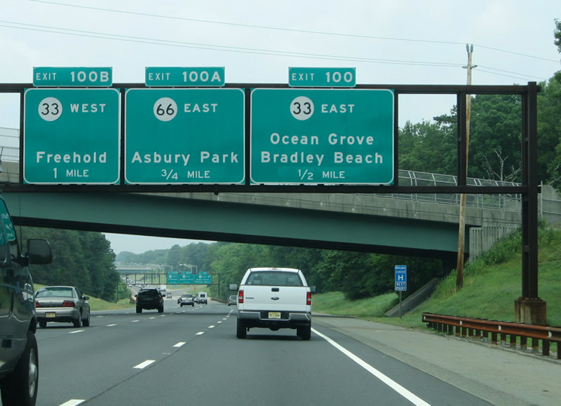
| The GSP advances north to the combination of Route 33 (Corlies Avenue) and Route 66 at the split cloverleaf interchange at Exits 100-100A-100B. 06/30/05 |
|
| Schoolhouse Road passes over the Garden State Parkway north between the service plaza and Exit 100 to Route 33 (Corlies Avenue) east. Route 33 travels to Route 35 at Neptune City and Route 71 at Ocean Grove. 06/30/05 |
|
| Exits 100-100A-100B all serve the borough of Tinton Falls. Leaving the parkway here is Exit 100 onto Route 33 (Corlies Avenue) east. The Route 33 east end lies just north of Bradley Beach and Avon-By-The-Sea and south of Asbury Park. Route 66 provides a direct route to Asbury Park from Exit 100A to Asbury Avenue. 06/30/05 |
|
| Exit 100A follows from the Garden State Parkway northbound onto Route 66 east to Wanamassa and Neptune Township. Route 66 ends at the Asbury Avenue intersection with Route 35 outside Asbury Park. 06/30/05 |
|
| Route 33 merges with the Route 66 west end nearby on the drive to Freehold and Hightstown. There is no direct access from the Garden State Parkway north onto Route 33 west; instead drivers must use the Exit 100B loop ramp onto Route 66 west. 06/30/05 |
|
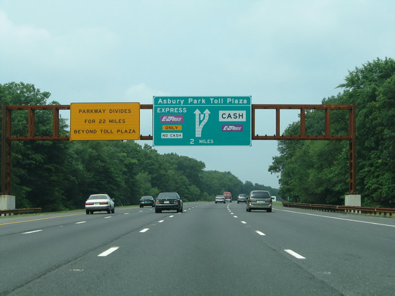
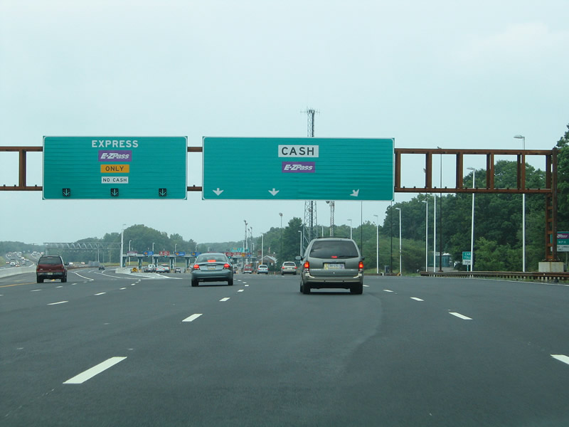
| Continue north, the GSP enters the Asbury Park main line toll plaza and the Parkway split into local and express roadways. A partial interchange (Exit 102 on south) joins the toll road with Asbury Avenue (CR 16) just south of the toll barrier. 06/30/05 |
|
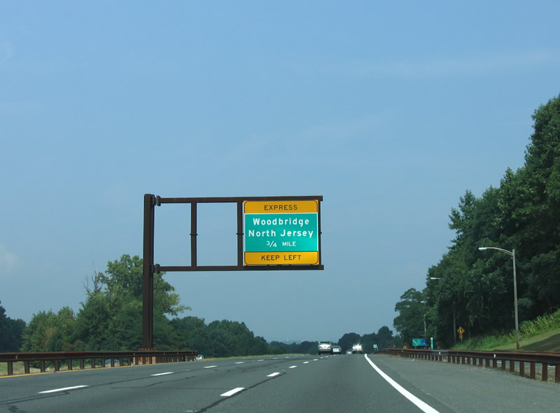
| Garden State Parkway northbound expands to four lanes ahead of the Asbury Park Toll Plaza and roadway split. 22 miles in length, the express lanes provide a relatively uninterrupted trip to Woodbridge. 06/30/05 |
|
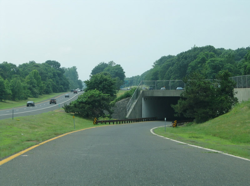
| The Express lanes travel the inside of the Garden State Parkway with limited departure points to the Raritan River. Local lanes provide access to all interchanges between here and Route 440. 06/30/05 |
|
| The Garden State Parkway roadway split is similar in design to those on I-80 at Patterson and I-76 at Camden. All trucks must use the local roadway in order to depart the Parkway at Exit 105. A restriction prohibits all trucks from using the Parkway north of Exit 105. 06/30/05 |
|
| Only E-ZPass account holders may access the Garden State Parkway Express lanes initially. Cash paying customers must use the conventional toll booth lanes on the Local roadway side and make a quick lane change to access the Express roadway. 06/30/05 |
|
| Garden State Parkway northbound travelers continue next to the Exit 105 confluence of Route 18, a north-south freeway between Robertsville and Wall Township, and the Eatontown Spur to Route 38 and Long Branch. 06/30/05 |
|
| Exit 105 consists of a loop ramp onto Route 18 north to Marlboro Township, Old Bridge, and New Brunswick and the Eatontown Connector east to the beginning of Route 36 at Hope Road (Monmouth County 51). 06/30/05 |
|
| Exit 105 departs the Garden State Parkway northbound for Route 18 north and Route 36 east. Route 36 consists of a loop east to Long Branch, north to Highlands, and west Keyport. 06/30/05 |
|
| Typical scene along the Garden State Parkway four roadway section at the Pine Brook Road under crossing. 06/30/05 |
|
| Two miles south of the parclo interchange (Exit 109) with Monmouth County Route 520 (Newman Springs Road) on Garden State Parkway north. CR 520 east leads to nearby Red Bank and Sea Bright on the coast. 08/29/05 |
|
| Monmouth County Route 520 (Newman Springs Road) west continues a short distance to Lincroft and Brookdale Community College. 08/29/05 |
|
| East from Exit 109, CR 520 (Newman Springs Road) leads to Shrewsbury, Little Silver, Fair Haven and Rumson. This is the last direct exit to the Atlantic beaches as the parkway turns northwest toward Raritan Bay. 08/29/05 |
|
| The first departure point from the Express Lanes lies midway between Exits 114 and 116. 06/30/05 |
|
| A parclo A2 interchange (Exit 114) joins the GSP with Red Hill Road (CR 52) north of Holmdel and south of Middletown. CR 52 follows Van Schoick Road and Laurel Avenue north from Red Hill Road into MIddletown. 06/30/05 |
|
| Monmouth County Route 52 (Red Hill Road) turns onto Crawfords Corner Road south toward CR 520 (Main Street). Both the county route and Middletown Road southwest lead toward Holmdel. 06/30/05 |
|
| One quarter mile south of the slip ramp between the Garden State Parkway northbound Express and Local roadways. The ramp facilitates access to Exits 116, 177, and 120 from the inside roadway. 08/29/05 |
|
| The aforementioned slip ramp descends under the Local roadway and emerges on the right side ahead of Exit 116 to Telegraph Hill Park. Exit 116 also serves the New Jersey Vietnam Veterans Memorial and Transit facilities for New York City. 08/29/05 |
|
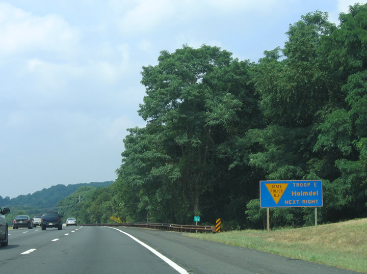
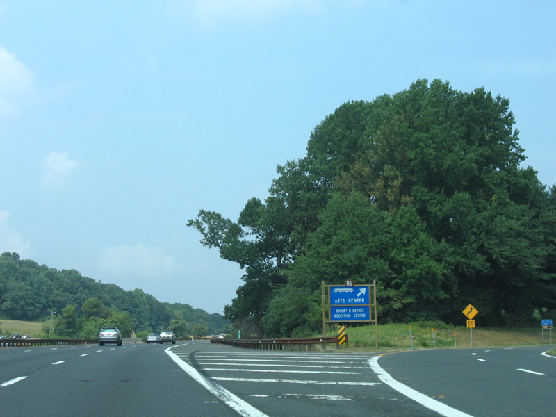
| Exit 116 serves the PNCBank Arts Center at Telegraph Hill Park. The parclo interchange provides the only access point to the concert and entertainment venue. 08/29/05 |
|
| New Jersey State Police Troop E is also located at Telegraph Hill Park and Exit 116 on the Garden State Parkway. 08/29/05 |
|
| In addition to representing the home of the PNCBank Arts Center, Telegraph Hill Park includes a nature area. 08/29/05 |
|
| Exit 116 departs Garden State Parkway northbound for Telegraph Hill Park. A short access road connects the Arts Center with facilities to the west, but no access to Crawfords Corner Road or other nearby streets is available. 08/29/05 |
|
| A second opportunity to access the 22 mile long Garden State Parkway Express roadway lies north of Telegraph Hill Park. 08/29/05 |
|
| A loop road encircles PNCBank Arts Center and provides return access to the Garden State Parkway north toward Keyport. 08/29/05 |
|
| Continuing northwest, the Garden State Parkway next meets the Keyport Connector to Route 35 and 36 east. Route 36 returns to the parkway by way of Highlands Beach at Gateway National Recreation Area and Sandy Hook. 08/29/05 |
|
| The Express roadway slip ramp from the Local roadway departs the Garden State Parkway northbound beyond the Holmdel Road overpass. This is the final high-speed opportunity to access the inside roadway on northbound. 08/29/05 |
|
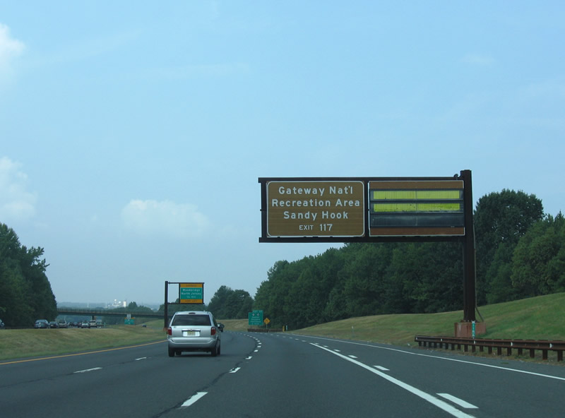
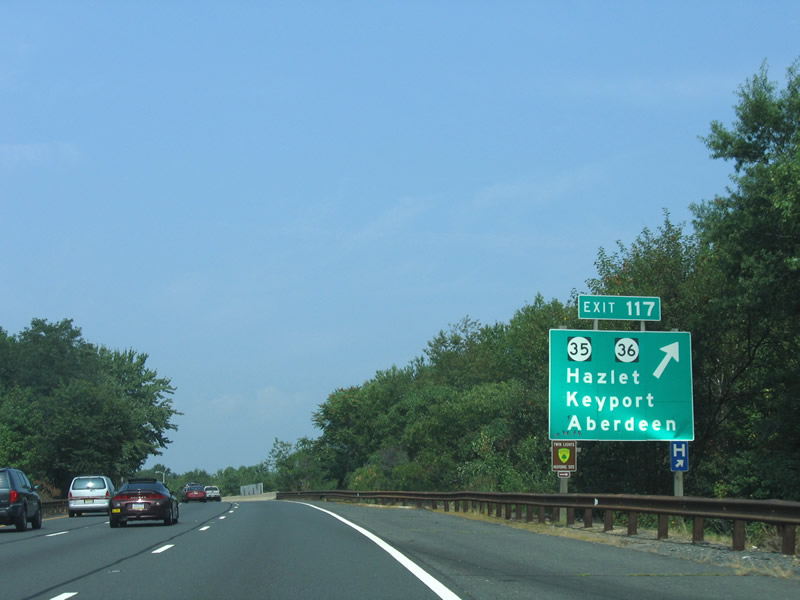
| Exit 117 departs Garden State Parkway northbound in one mile for the Keyport Connector north to Route 35/36 east at Keyport. The connector is a freeway spur north to an interchange with both state routes. Route 35 runs northwest from Middletown to Hazlet and Keyport; Route 36 stems east to Keansburg and Atlantic Highlands. 08/29/05 |
|
| Exit 117 leaves the GSP for Sandy Hook and the Raritan Bay communities of Keyport, Union Beach and Keansburg. Route 35 passes through west Keyport on a parallel alignment to the parkway and Raritan Bay to Laurence Harbor. Matawan and Aberdeen Township lie southwest of Exit 117 via Monmouth County Route 516 (Main Street). 08/29/05 |
|
| Turning more westward, the Garden State Parkway advances to Cheesequake State Park and Exit 120 for Matawan Road. 08/29/05 |
|
| Traveling through Cliffwood on the Parkway northbound. Passing overhead are Matawan Avenue and the New York and Long Branch Railroad. 08/29/05 |
|
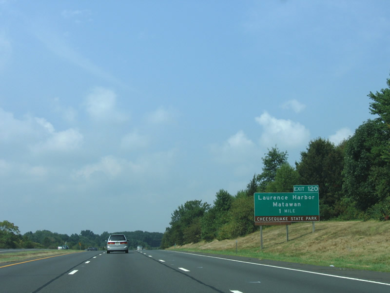
| Matawan Road travels north from Cheesequake Morristown Road near Cliffwood to meet the Garden State Parkway at a parclo interchange (Exit 120). Cheesequake State Park lies west of the road and southwest of Laurence Harbor. 08/29/05 |
|
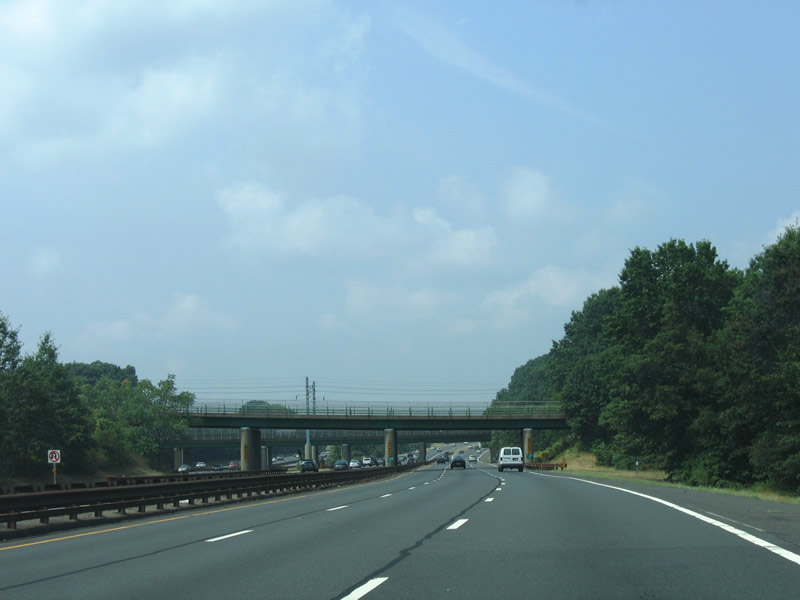
| Entering Middlesex County on Garden State Parkway northbound. 08/29/05 |
|
| Matawan Road (CR 689) continues a short distance north from Exit 120 to Laurence Parkway and Route 36 at Laurence Harbor. Southward, Matawan Road turns into Aberdeen Road en route to Matawan. 08/29/05 |
|
| The Garden State Parkway passes by Cheesequake State Park toward South Amboy. 08/29/05 |
|
| Two miles south of the Cheesequake Service Area. This facility offers a wider array of traveler services than those plazas to the south. 08/29/05 |
|
| An example of heavy southbound traffic along the GSP one mile from the Cheesequake Service Area along the Parkway northbound. 06/30/05 |
|
| Advance variable message and guide signs advise northbound motorists of the Route 440 connections to New York City well south of Exit 127. 08/29/05 |
|
| Right side ramps descend below the respective northbound roadways and emerge at the Cheesequake Service Area. 08/29/05 |
|
| Return access from the Cheesequake Service Area carries all drivers onto the Express roadway. It is irrelevant however as the Local and Express roadways converge north of the half diamond interchange at Main Street (Exit 124 on southbound). 08/29/05 |
|
| Four mile advisory / guide sign for the Exit 129 connection with the New Jersey Turnpike. On-ramps add traffic from both U.S. 9 (Upper Main Street) north and Main Street (Middlesex County 670) in Sayreville ahead. 08/29/05 |
|
| Route 35 joins U.S. 9 through South Amboy to the Raritan River approaches. U.S. 9 splits and follows the Ellis S. Vieser Memorial Bridge while Route 35 turns northeast over the Victory Bridge. A half diamond interchange (Exit 125) at Sayreville joins the Parkway with Chevalier Avenue, an east-west connector to Main Street Extension and the interchange of U.S. 9 and Route 35 opposite Main Street. 08/29/05 |
|
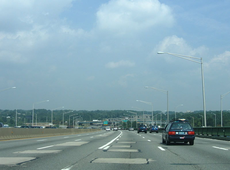
| U.S. 9 joins the Garden State Parkway corridor, but not the toll road itself, to cross the Raritan River between Sayreville and Perth Amboy. The parallel routes consist of the Alfred E. Driscoll Bridge for the parkway and the Ellis S. Viesser Memorial Bridge for U.S. 9. The Driscoll Bridge underwent construction between 2002 and 2006 to widen the crossing from ten to 15 overall lanes. Work first focused on expanding the southbound bridge from five to seven lanes, a project that was completed on May 3, 2006.1 Work shifted to rebuild the northbound span to eight overall lanes with completion by May 2009. Total costs of the replacement and expansion project is $260 million.2 The original Driscol Bridge carried just six overall lanes. 08/29/05 |
|
| Garden State Parkway northbound travelers meet Route 440 and U.S. 9 north at a complicated directional cloverleaf interchange north of the Driscol Bridge. Route 440 travels east-west from Interstate 287 at Interstate 95 (New Jersey Turnpike) to the Outerbridge Crossing onto Staten Island, New York. U.S. 9 departs its Raritan River crossing and briefly parallels the Parkway on a frontage freeway to Middlesex County 616 (New Brunswick Avenue). 08/29/05 |
|
| Ascending the Driscol Bridge northbound on the Garden State Parkway before reconstruction. Exit 127 leaves as a two lane off-ramp in one mile for Route 440 west to Interstate 287 and New Brunswick and east to Staten Island and the Verrazano Narrows Bridge. U.S. 9 continues to Fords and Woodbridge before merging with U.S. 1 ahead of Rahway. Note the close proximity of the U.S. 9 twin spans.
U.S. 9's bridges across the Raritan River were also the site of construction between 1999 and October 21, 2003. Crews first constructed a new span, the Ellis S. Vieser Memorial Bridge, between the existing bridge and the adjacent Driscoll Bridge. Upon completion of the new southbound span, work shifted on upgrading the old bridge (Edison Bridge) for its eventual northbound only role. The result are a pair of three-lane bridges for U.S. 9, an increase from the previous four lane crossing.3, 4 08/29/05 |
|
| Crossing the 1954-constructed Driscoll Bridge along the Garden State Parkway northbound. The bridge was originally called just the Raritan Bridge but was renamed in 1974 after former Governor Alfred E. Driscoll, a politician that helped get the Garden State Parkway constructed.1 08/29/05 |
|
| Descending into Woodbridge township, west of Perth Amboy, along the Driscoll Bridge north. Originally the 1954-span carried just four lanes overall. Addition of the southbound bridge occurred in 1972, bringing the Parkway up to ten overall lanes.1 08/29/05 |
|
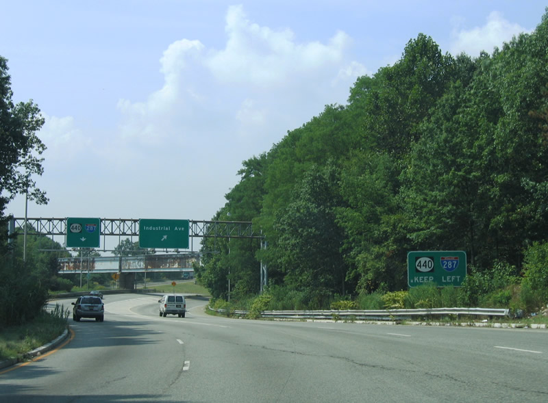
| Exit 127 carries all traffic to Route 440 and U.S. 9 north in unison from the Driscol Bridge descent. The east-west freeway passes over the Parkway in the foreground between Edison Township and Perth Amboy. 08/29/05 |
|
| Traveling along the Exit 127 ramp, an additional option to Industrial Avenue south to Keasbey appears. This exit splits from the Route 440 westbound ramp to join Industrial Avenue west to Raritan Center. 08/29/05 |
|
| A slip ramp joins the adjacent U.S. 9 freeway north to Fords and Woodbridge from Exit 127. The exit otherwise loops around toward the next departure point for Route 440 east to the Outerbridge Crossing. 08/29/05 |
|
| Exit 127 again splits with ramps to Route 440 east and the Ford Street Connector. The Ford Street Connector leads east to become CR 624 into the Perth Amboy street network and west to Smith Street (CR 626) to Keasbey. Route 440 east otherwise sees two interchanges with the bay side city before crossing Arthur Kill into New York. 08/29/05 |
|
| Drivers turn westward and pass over U.S. 9 and the Garden State Parkway ahead of he partition with ramps onto Route 440 and Industrial Avenue west. 08/29/05 |
|
| Two lanes continue from Exit 127 onto Route 440 west ahead of Edison Township and Metuchen. The state highway transitions into Interstate 287 beyond the interchange with Interstate 95 (New Jersey Turnpike). 08/29/05 |
|
| An abandoned railroad bridge crosses above Exit 127 at its final partition to Industrial Avenue and Route 440. Route 440 continues 2.5 miles to Interstates 95 and 287. Industrial Avenue (Riverside Drive) stems southwest from U.S. 9 to the Raritan Center industrial area. 08/29/05 |
Page Updated 04-29-2014.

 North
North