|
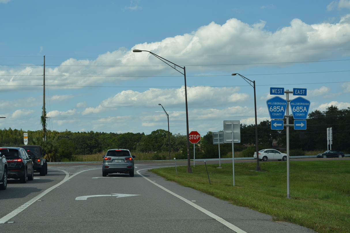
| A diamond interchange (Exit 14) joins the Suncoast Parkway with CR 685A (Van Dyke Road) immediately north of the split with the Veterans Expressway (SR 568). 09/27/21 |
|
| Van Dyke Road, sparsely signed as CR 685A, leads west to Gunn Highway (CR 587) and Keystone Lake and east to SR 597 (Dale Mabry Highway) and Simmons Road near Lutz. 09/27/21 |
|
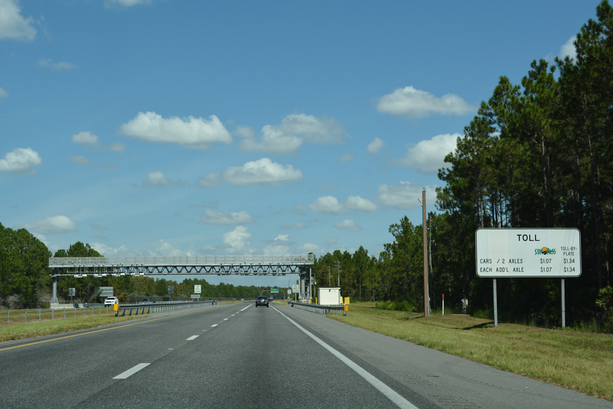
| Toll transponders accepted along the Suncoast Parkway included E-ZPass in 2021. 10/02/21 |
|
| The Suncoast Parkway winds northeast between Lake Carlton and Brooker Creek Reserve, passing over Ramblewood Road and TPC Boulevard. 10/02/21 |
|
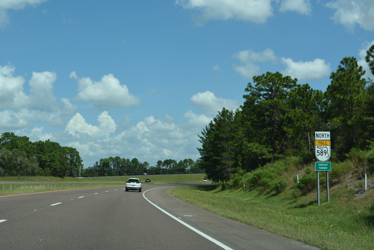
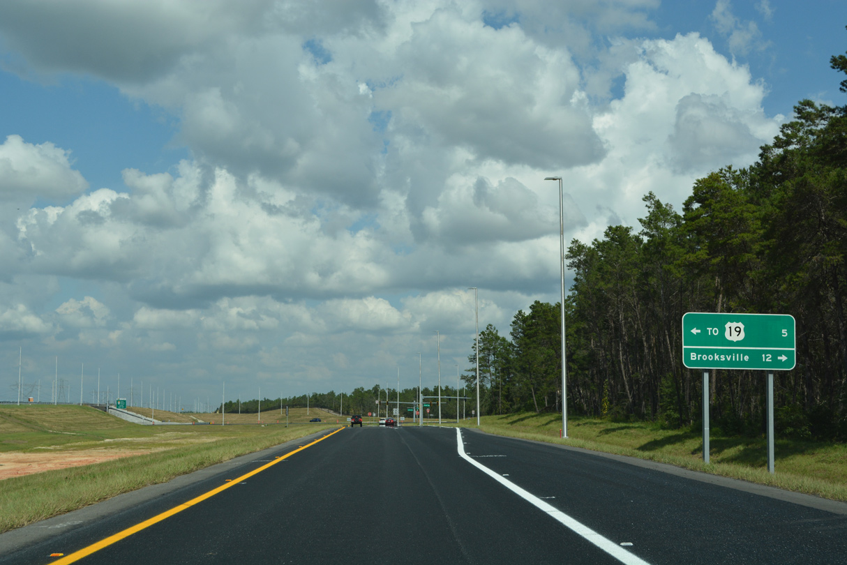
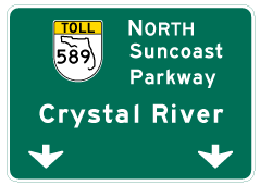
| The Hernando County seat of Brooksville is 36 miles north of the Ramblewood Road underpass via SR 589 north and SR 50 east. 56 miles away, Crystal River lies beyond the toll road end via U.S. 98 north. 10/02/21 |
|
| Costing $10 million and taking over a year and a half to design and construct, forthcoming Exit 16 with Lutz Lake Fern Road opened to traffic on August 14, 2009.1 10/02/21 |
|
| A sign formally identifies SR 589 as the Suncoast Parkway at the TPC Boulevard underpass. The toll road doubles as the 42 mile long Suncoast Scenic Parkway. 10/02/21 |
|
| A folded diamond interchange (Exit 16) links SR 589 north with Lutz-Lake Fern Road. Lutz-Lake Fern Road, formerly County Road 582, leads west to Gunn Highway (CR 587) at Lake Fern and east to U.S. 41 at Lutz. 10/02/21 |
|
| Lutz-Lake Fern Road runs east by the golf course communities of TPC Tampa Bay, Cheval and Heritage Harbor. Westward, Tarpon Springs Road travels west from CR 587 to the Pinellas County line, where CR 582 resumes through Brooker Creek Preserve. 10/02/21 |
|
| The speed limit increases to 70 miles per hour along the Suncoast Parkway north ahead of the Pasco County line. 10/02/21 |
|
| The Suncoast Parkway converges with SR 54 at a diamond interchange (Exit 19) between Odessa and Land O' Lakes. 10/02/21 |
|
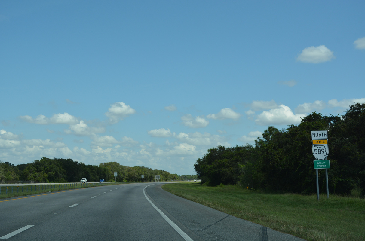
| SR 589 crosses into Pasco County Road 16.05 miles north from SR 60 (Memorial Highway) in Tampa. 10/02/21 |
|
| Connecting U.S. 19 on the Gulf Coast with I-75, SR 54 travels east from Elfers to SR 56/CR 54 (Wesley Chapel Boulevard) at Land O' Lakes. The eastern branch joins SR 581 at Wesley Chapel with U.S. 301 in Zephyrhills. 10/02/21 |
|
| Northbound SR 589 reaches Exit 19 for SR 54 east to Lutz and Wesley Chapel and west to Trinity, Seven Springs and New Port Richey. 10/02/21 |
|
| The Suncoast Parkway passes by Jay B. Starkey Wilderness Park and suburban development northward from SR 54 to Ridge Road. 10/02/21 |
|
| Brooksville is 31 miles to the north of the exchange with SR 54, followed by Crystal River in 52 miles. 10/02/21 |
|
| The third toll collection point for SR 589 north follows near Milepost 21. 10/02/21 |
|
| Suncoast Parkway toll plazas originally partitioned with attended toll booths to the left and open road tolling lanes to the right. 10/02/21 |
|
| SR 589 north spanned the Anclote River one half mile south of the former Anclote Toll Plaza. 10/02/21 |
|
| Cash toll collection ceased along the Suncoast Parkway on January 31, 2020. The former toll Anclote Toll Plaza was repurposed as the Suncoast Operations Center. 10/02/21 |
|
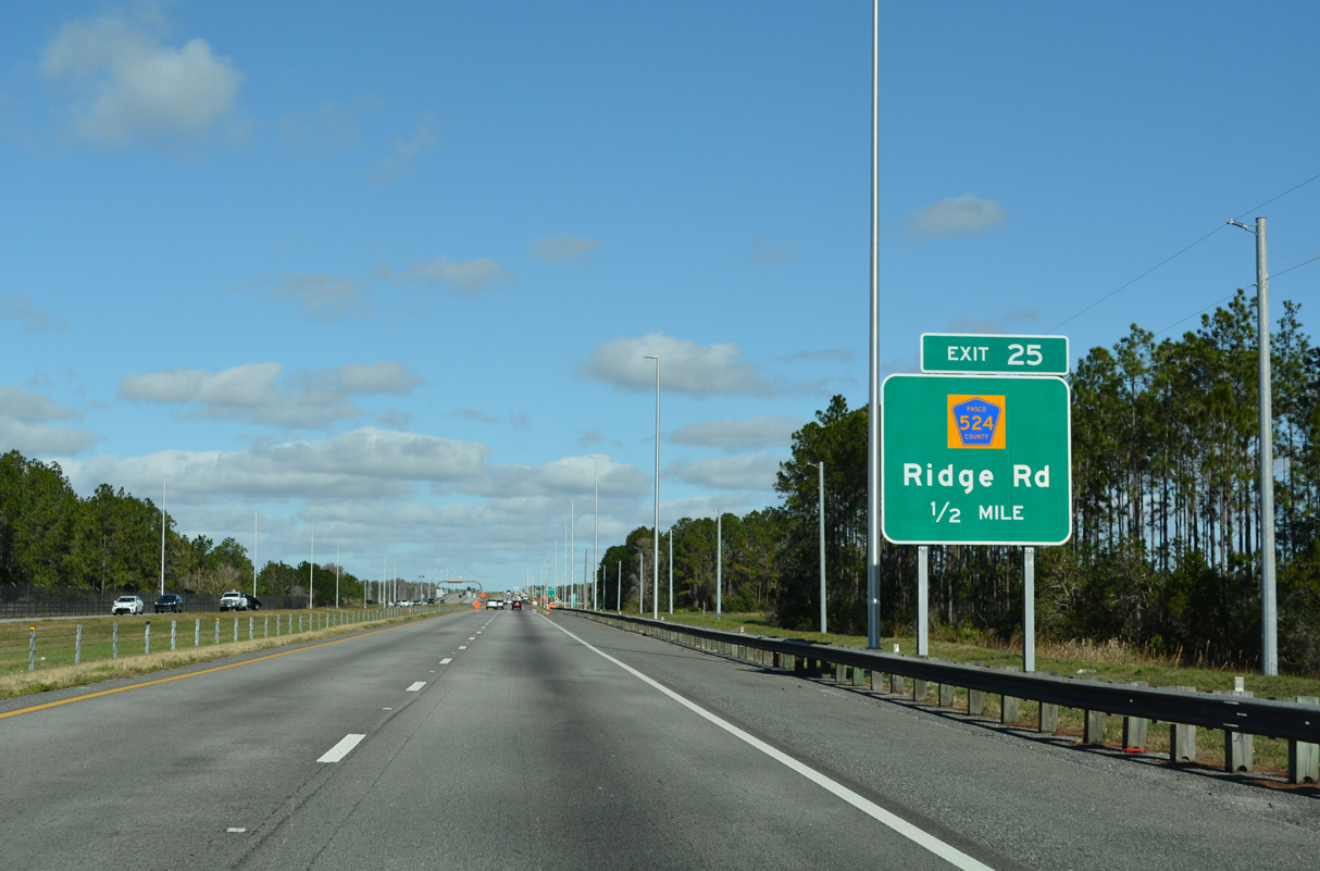
| A $15 million project underway through mid-2022 added the diamond interchange at Exit 25 CR 524 (Ridge Road). 01/03/22 |
|
| A reassurance marker stands where the ramp from the Suncoast Operations Center returns to the northbound roadway along SR 589. 10/02/21 |
|
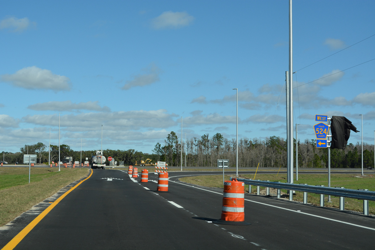
| An arterial road leading west to Port Richey, Ridge Road (CR 524) opened to traffic west from the Suncoast Parkway to Town Center Road near CR 587 (Moon Lake Road) on December 31, 2021. 01/03/22 |
|
| CR 524 (Ridge Road) runs west from Exit 25 to CR 1 (Little Road) at Jasmine Estates and U.S. 19 in the city of Port Richey. 01/03/22 |
|
| The Ridge Road Extension Phase 2 lengthens CR 524 east to U.S. 41 at Connerton. Opening up vast tracts of land for development, construction completing Ridge Road east runs through 2025. 01/03/22 |
|
| SR 589 (Suncoast Parkway) spans the Pithlachascotee River 1.25 miles south of Exit 27 with SR 52. 10/02/21 |
|
| SR 52 leads east from the Suncoast Parkway to Gowers Corner (U.S. 41) and San Antonio and west to Moon Lake and U.S. 19 south to New Port Richey. 10/02/21 |
|
| SR 52 covers 33.40 miles as it crosses Pasco County between Bayonet Point and Dade City. 10/02/21 |
|
| Leading north from the diamond interchange (Exit 27) with SR 52 on SR 589. 10/02/21 |
|
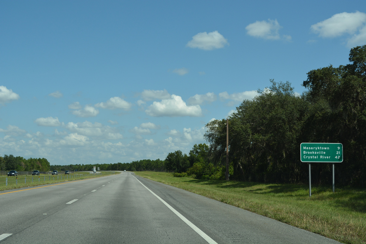
| Masaryktown appears at nine miles out on the next northbound distance sign. 10/02/21 |
|
| Bending eastward, the Suncoast Parkway passes by Crews Lake Wilderness Park ahead of the Spring Hill Plaza toll collection point at mile marker 31. 10/02/21 |
|
| Located between Shady Hills Road and Caldwell Lane, the Spring Hill Plaza AET gantry replaced a toll plaza further north on SR 589. Suncoast Parkway passes through a rural network of streets on this stretch. 10/02/21 |
|
| Lawless Road crosses over SR 589 beyond the former toll plaza and this shield assembly. 10/02/21 |
|
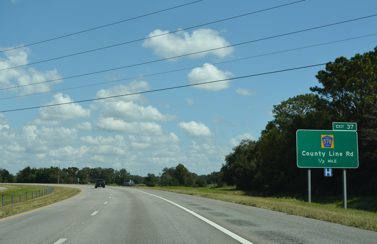
| SR 589 remains northeast to the Bowman Road overpass west of South Masaryktown. A diamond interchange (Exit 37) follows with CR 578 (County Line Road). 10/02/21 |
|
| CR 578 straddles the Pasco / Hernando County line 10.82 miles west from U.S. 41 at Masaryktown to Spring Hill and U.S. 19. 10/02/21 |
|
| CR 578 (County Line Road) varies between two lane stretches with rural design and four lane urban arterial west to Spring Hill. Future work will expand the remaining sections. 10/02/21 |
|
| Aripeka is referenced 11 miles to the west via CR 578. The community lies along Hammock Creek off the Gulf of Mexico along CR 595. 02/15/14 |
|
| Construction through Summer 2022 for the Ayers Road Extension (CR 576) realigned CR 578 (County Line Road) just east of Exit 37 directly onto the new four lane alignment bypassing Masarytown. The Ayers Road Extension opened to traffic on September 21, 2021. 02/15/14 |
|
| The final 17.73 miles of SR 589 north run through Hernando County. 10/02/21 |
|
| Continuing north from the county line, SR 589 (Suncoast Parkway) travels by Spring Hill and Brooksville. 10/02/21 |
|
| Crystal River is 34 miles away via U.S. 98 to U.S. 19. Crystal River is 36 miles via SR 589 north along Suncoast Parkway 2 and SR 44 west. 03/02/22 |
|
| CR 574 (Spring Hill Drive) joins the Suncoast Parkway with the unincorporated Spring Hill community to the west. 10/02/21 |
|
| Corporate Boulevard passes over SR 589 a half mile south of the diamond interchange (Exit 41) with CR 574. Corporate Boulevard spurs east from parallel CR 585 (Anderson Snow Road) to the Brooksville-Tampa Bay Regional Airport (BKV) area. 10/02/21 |
|
| The main arterial route across Spring Hill, CR 574 follows Spring Hill Drive for 12.46 miles from U.S. 19 (Commercial Way) east to U.S. 41 (Broad Street). 03/02/22 |
|
| SR 589 (Suncoast Parkway) navigates through an S-curve northward across CR 572 (Powell Road) and a series of subdivisions. 10/02/21 |
|
| The Hernando County seat of Brooksville lies nine miles north via SR 589 and SR 50 east. Crystal River is 30 miles away via U.S. 19/98 and 32 miles via SR 589 and SR 44 west. 03/02/22 |
|
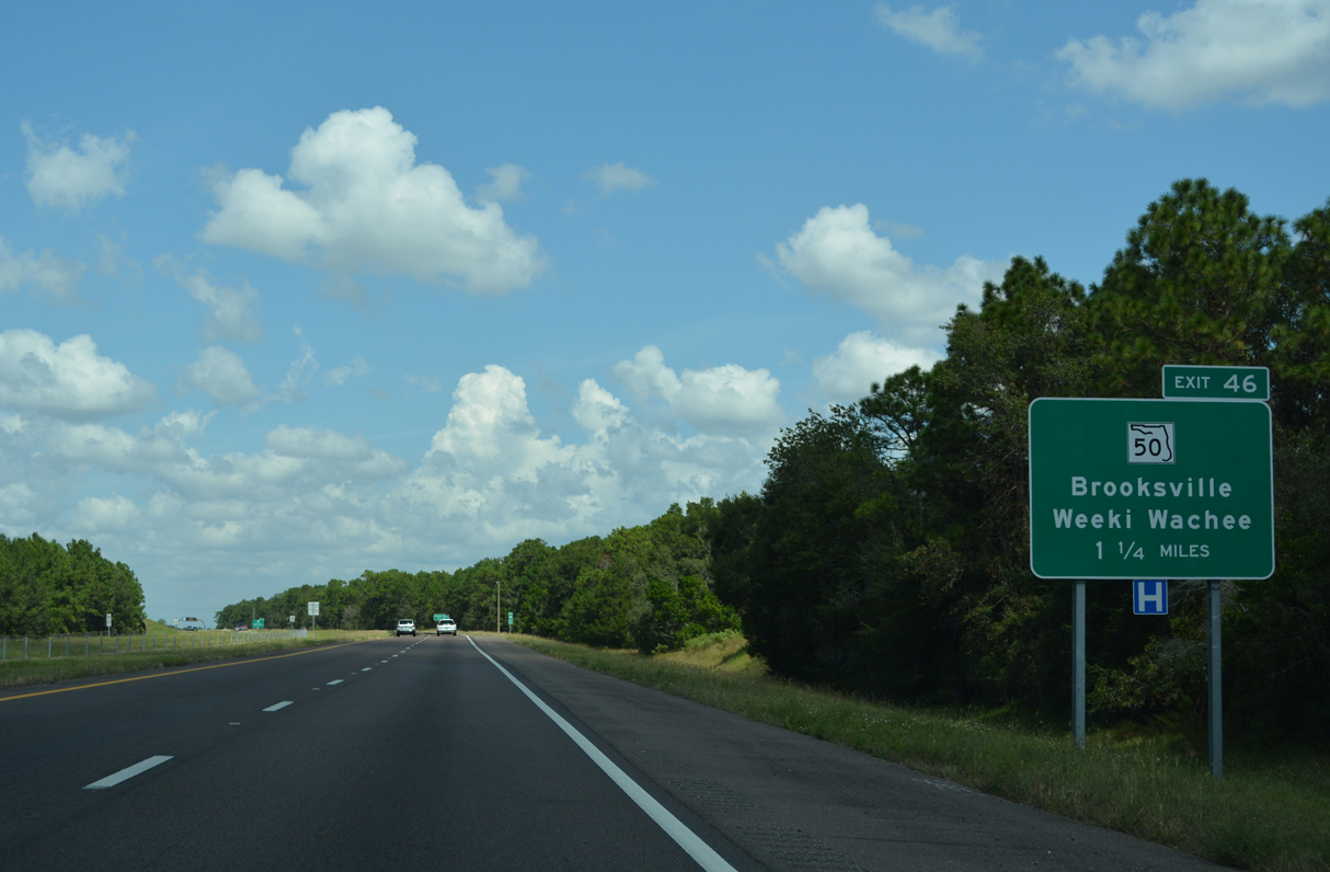
| A diamond interchange (Exit 46) links SR 589 (Suncoast Parkway) with SR 50 (Cortez Boulevard) in 1.25 miles. 10/02/21 |
|
| SR 50 leads west along what is mostly a commercial route to U.S. 19 at Weeki Wachee. East of Exit 46, SR 50 (Cortez Boulevard) travels four miles to SR 50A on the west side of Brooksville. 10/02/21 |
|
| SR 50 (Cortez Boulevard) constitutes a cross-peninsular route between U.S. 19 and U.S. 1 at Titusville on the Space Coast. 10/02/21 |
|
| The roadways of SR 589 separate just north of Exit 46. 10/02/21 |
|
| The Suncoast Parkway progresses ten miles north from SR 50 to U.S. 98 (Ponce De Leon Boulevard). Crystal River is another 16 miles beyond the end of SR 589. 03/02/22 |
|
| Leaving the Brookridge community, SR 589 (Suncoast Parkway) advances through a scenic rural area north of the Rester Drive overpass. 10/02/21 |
|
| The Suncoast Parkway shifts west ahead of the Oak Hammock Plaza AET gantry and crosses over CR 476 (Centralia Road) before kinking back to the east by Annuteliga Hammock. 10/02/21 |
|
| The former Oak Hammock Toll Plaza was located one mile south of the exchange with U.S. 98 (Ponce De Leon Boulevard). 03/02/22 |
|
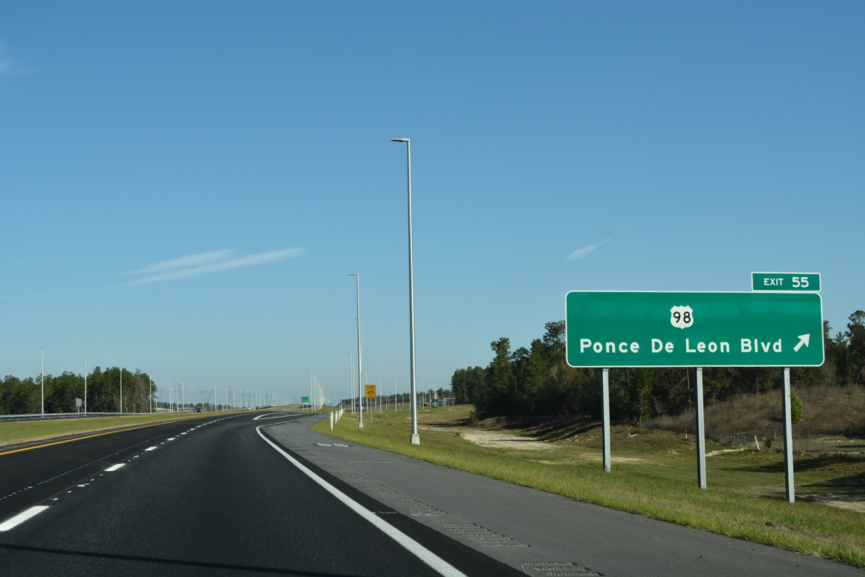
| The Suncoast Parkway meets U.S. 98 (Ponce De Leon Boulevard) at a diamond interchange (Exit 55) near Annutelliga Hammock. 03/02/22 |
|
| U.S. 98 (Ponce De Leon Boulevard) angles southeast from SR 589 (Suncoast Parkway) to Ringgold, Stafford and Brooksville. 03/02/22 |
|
| The Suncoast Parkway 2 extension of SR 589 north 13 miles to SR 44 at Lecanto opened to traffic no February 28, 2022. 03/02/22 |
|
| Northwest from the Suncoast Parkway, U.S. 98 combines with U.S. 19 in 4.4 miles at Sugarmill Woods north to Crystal River and Perry. 10/02/21 |
|
| U.S. 98 runs north through the Nature Coast to the Big Bend of Florida. 10/02/21 |
Page Updated 03-03-2022.

 North
North