|
| Pole Bridge Road (Road 420) links SR 1 with U.S. 13 (Dupont Parkway) at SR 896 (Boyds Corner Road) 0.19 miles west of the diamond interchange at Exit 142. 08/17/21 |
|
| SR 896 commences west from U.S. 13 (Dupont Parkway) at Boyds Corner. U.S. 13 heads north to St. Georges and south to Odessa. 08/17/21 |
|
| N and S Bayberry Parkway come together at a signalized intersection with SR 896 (Boyds Corner Road) north. The two roads form the main entrances to the Village of Bayberry North and South. 12/20/16 |
|
| An Alternate route for SR 896 was posted during construction of Summit Bridge. A remnant trailblazer appeared along Boyds Corner Road west ahead of Jamison Corner Road. 12/20/16 |
|
| Construction in 2018 realigned Jamison Corner Road westward to intersect SR 896 (Boyds Corner Road) opposite Cedar Lane Road south. Jamison Corner Road runs west of the Winchelsea and Bayberry North developments to Whitehall Village and Lorewood Grove Road. Cedar Lane Road heads south along the west side of Bayberry South to Middletown and SR 71 (Broad Street). 12/20/16 |
|
| SR 896 (Boyds Corner Road) curves northwesterly to Ratledge Road. Opened in January 2019, the U.S. 301 toll road crosses the state route on this stretch. 12/15/17 |
|
| Boyds Corner Road leads SR 896 west to the community of Mount Pleasant and SR 71 (Summit Bridge Road). SR 896 turns north as Churchtown Road begins west to MD 310 and St. Augustine. 12/15/17 |
|
| SR 71 takes Summit Bridge Road south to Broad Street into Middletown. U.S. 301 overlapped with the route as well, but shifted in January 2019 onto the new toll road around Middletown. Northward, SR 896 continues to U.S. 40 at Glasgow. 12/20/16 |
|
| SR 71/896 combine northward from Churchtown Road and expand to four lanes ahead of Summit Airport (EVY) and Summit Bridge. 12/29/17 |
|
| SR 896 was expanded to four overall lanes from Mount Pleasant to Interstate 95 at south Newark by 1996. U.S. 301 formerly overlapped with the route for seven miles to U.S. 40 at Glasgow.
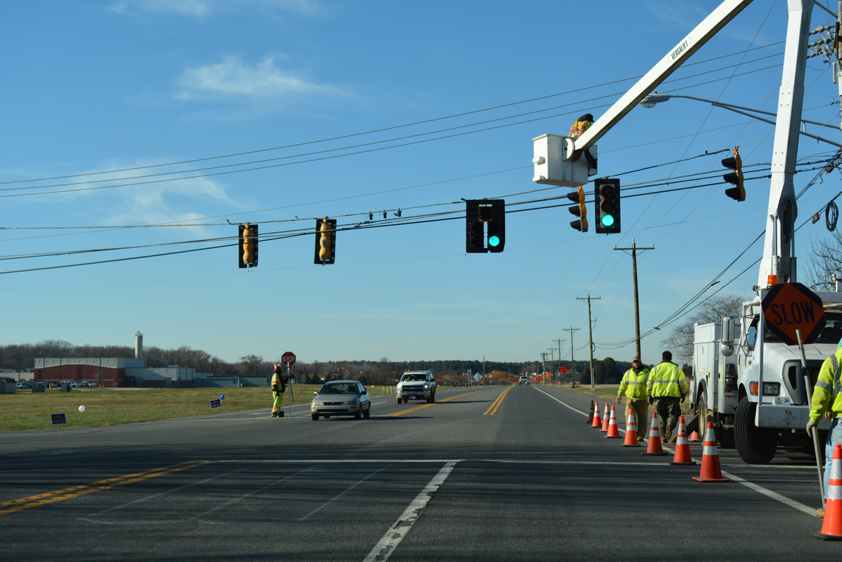
A signal added here in Spring 2008 serves adjacent service roads for businesses built along both sides of Summit Bridge Road. 12/29/17 |
|
| Victoria Drive ties into SR 71/896 (Summit Bridge Road) from the Summit Pond subdivision opposite the south end of Summit Airport (EVY). 12/29/17 |
|
| A lone reassurance marker follows as Summit Bridge Road advances north from Beaston Road by Summit Airport. 12/29/17 |
|
| Old Summit Bridge Road branches north from SR 71/896 to the community of Summit Bridge. Old Summit Bridge Road was the alignment of SR 71/896 until 1960. 12/29/17 |
|
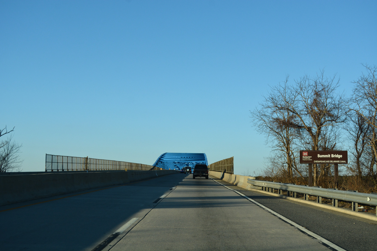
| SR 71/896 curve westward from Old Summit Bridge Road to Bethel Church Road (SR 15) ahead of the Summit Bridge across the Chesapeake and Delaware Canal. 12/29/17 |
|
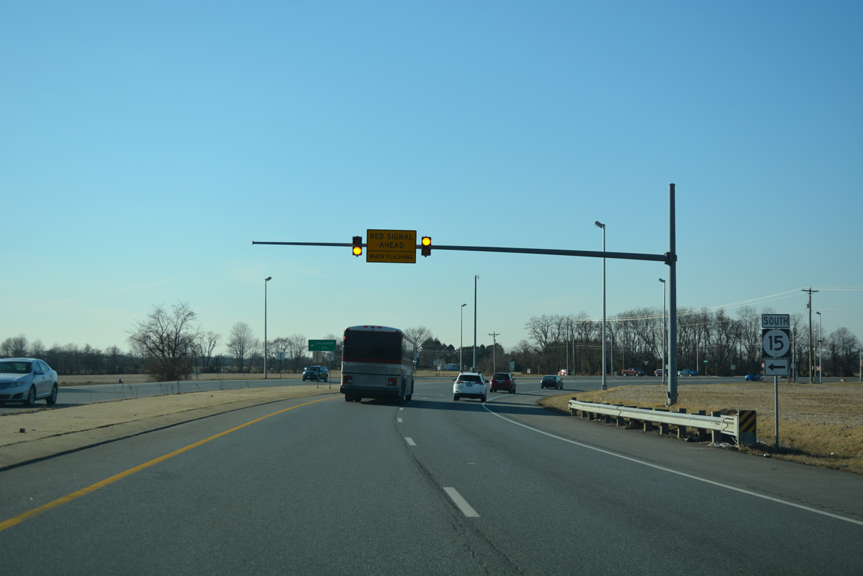
| Advancing to the north end of SR 15 (Bethel Church Road) on SR 71-896 northbound. SR 15 parallels Summit Bridge Road to the west from Middletown. 12/29/17 |
|
| Bethel Church Road leads SR 15 west to a roundabout with SR 286 at Choptank Road. SR 286 stems west from there to MD 286 and Chesapeake City. 12/29/17 |
|
| An additional section of Bethel Church Road angles west from Old Summit Bridge Road to SR 71/896 north across the Summit Bridge. 12/20/16 |
|
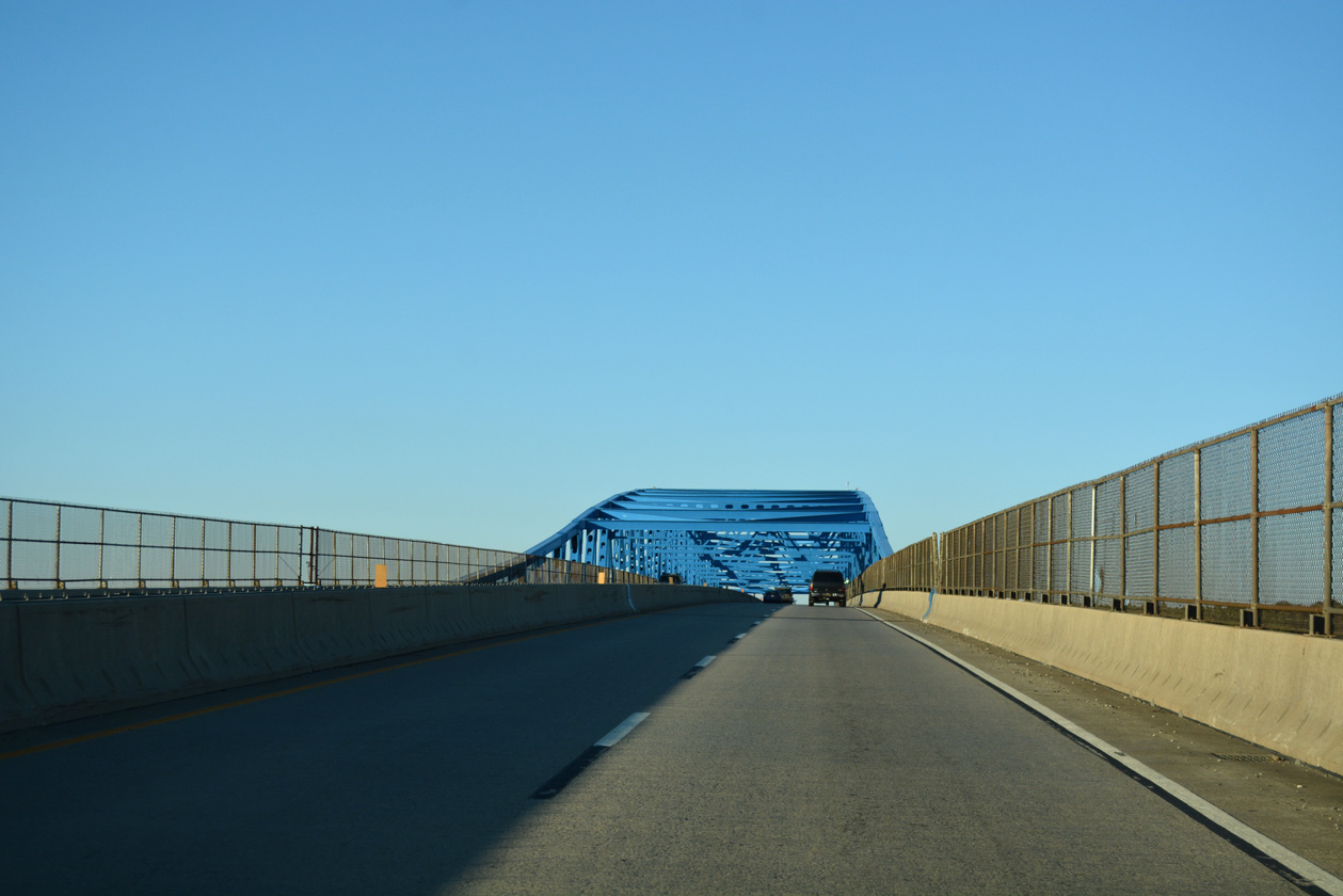
| SR 71/896 resume a northward heading from SR 15 onto the Summit Bridge. 12/29/17 |
|
| Steel support members of the Summit Bridge were repainted from gray to blue in 2012. The span accommodates four overall lanes and partial shoulders that are open to bicyclists. 06/10/12 |
|
| Maintained by the U.S. Army Corps of Engineers, the Summit Bridge is a continuous steel thru truss bridge. 12/27/17 |
|
| Spanning the Chesapeake and Delaware Canal, together with the approaches, the Summit Bridge comprises a two mile long limited access expressway. 12/26/17 |
|
| The Summit Bridge was completed in 1960 as part of a 1954 Canal authorization plan. 12/26/17 |
|
| An overpass separates Chesapeake City Road from SR 71/896 between Delaware Veterans Memorial Cemetery and the continuation of SR 71 along Red Lion Road. The rural road becomes MD 285 west into Chesapeake City. 12/26/17 |
|
| SR 71 (Red Lion Road) separates with SR 896 (Summit Bridge Road) at the north end of the Summit Bridge expressway. 12/26/17 |
|
| SR 896 continues northward to Glasgow and Newark while SR 71 turns northeast to Kirkwood and Red Lion. 12/20/16 |
|
| Brennan Boulevard winds west from SR 71 and SR 896 through the Brennan Estates subdivision to Denny Road. 12/20/16 |
|
| Summit Bridge Road expands to include a wide grassy median from Red Lion Road north to Glasgow. Newark is nine miles to the north, while Baltimore references U.S. 40 west from Glasgow. 12/20/16 |
|
| 2016-17 construction realigned Howell School Road northward to line up with Denny Road west to the Clairborne at Lexington Farms subdivision. The project eliminated the previous staggered intersection. 12/26/17 |
|
| SR 896 shifted east from Glasgow onto a controlled access bypass of the community by 1993. The former alignment was redesignated as a business route to U.S. 40 (Pulaski Highway). 12/26/17 |
|
| SR 896 Business lines Glasgow Avenue north to Hodgeson Vo-tech High School and Peoples Plaza shopping center. The state route northbound ends at a turnaround just ahead of the southbound off-ramp near Muddy Run. 12/20/16 |
|
| Porter Road extends northeast from SR 896 and SR 896 Business (Glasgow Avenue) by the Porter Square, Caravel Farms and Wrangle Hill Estates subdivisions to SR 72 (Wrangle Hill Road) and U.S. 40. 12/29/17 |
|
| SR 896 shifts onto the Glasgow bypass from Porter Road to U.S. 40 (Pulaski Highway). Plans call for upgrading the forthcoming traffic light with U.S. 40 to a grade separated interchange. 12/20/16 |
|
| U.S. 301 ended at the busy intersection with U.S. 40 (Pulaski Highway). Signs still reference Wilmington and U.S. 13 north via U.S. 40 east from when U.S. 301 turned east along Pulaski Highway to State Road. 12/29/17, 12/26/17 |
|
| U.S. 40 (Pulaski Highway) constitutes a congested route west through Glasgow to Elkton, Maryland and east to Bear and the merge with U.S. 13 north near Hares Corner. SR 896 advances three miles north to Interstate 95 on the south side of Newark. 12/29/17 |
Page Updated 11-02-2022.


 North
North