|
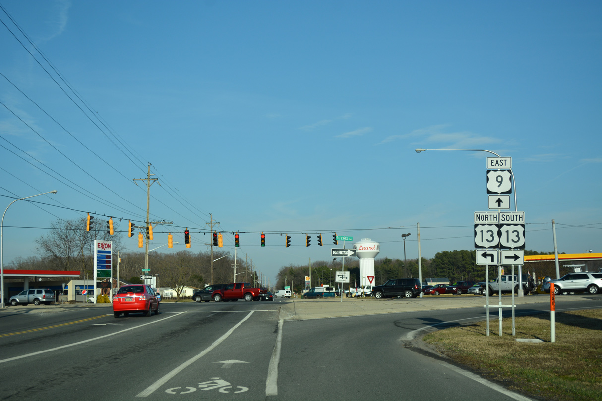
| Georgetown Road heads east from the five point intersection of Central Avenue, Seaford Road, Poplar Street and Woodland Road to the western terminus of U.S. 9 at U.S. 13 (Sussex Highway) in the town of Laurel. 01/15/17 |
|
| U.S. 13 (Sussex Highway) heads north from U.S. 9 and Georgetown Road 5.2 miles to combine with SR 20 by Blades and Seaford. Georgetown Road was formerly a part of SR 28 east from then U.S. 13 Alternate (Central Avenue). SR 28 continued to SR 18 at Georgetown. 01/15/17 |
|
| U.S. 9 commences a 30.89 mile route to the Cape May-Lewes Ferry from Georgetown Road east at U.S. 13 (Sussex Highway). 01/15/17 |
|
| County Seat Highway travels a rural route east 12 miles to Georgetown. Lewes follows along U.S. 9 east in 28 miles. 01/16/17 |
|
| The first confirming marker for the 523 mile route of U.S. 9 to Champlain, New York stands just east of U.S. 13 by the Laurel Junction flea market. 01/16/17 |
|
| U.S. 9/SR 404 (Lewes Georgetown Highway) advance east 1.5 miles from U.S. 9 Truck to Gravel Hill. A sand pit occupies the southwest corner of the forthcoming cross road with SR 30. 01/16/17 |
|
| SR 30 (Gravel Hill Road) travels north-south between Millsboro and Milford as part of a 45 mile route southwest at Bacons. 01/16/17 |
|
| The Sussex County Highway Safety Improvement Program (HSIP) underway from March 2014 to November 2015 redesigned three intersections along U.S. 9. Included was the junction with SR 30, where turn lanes were added in all directions and minor geometric improvements were made.1 01/16/17 |
|
| Lewes Georgetown Highway retains two lanes through increasingly suburban areas east from Gravel Hill to Harbeson. The Hawthorne subdivision broke ground in 2015 along the north side of U.S. 9/SR 404 just east of SR 30. 01/16/17 |
|
| Motorists along U.S. 9/SR 404 next approach the community of Harbeson, where SR 5 (Harbeson Road) meets Lewes Georgetown Highway. 01/16/17 |
|
| SR 5 constitutes a 19.48 mile route from Oak Orchard off Indian River Bay north to SR 1 beyond of Milton. 01/16/17 |
|
| Work in spring 2017 associated with the HSIP Project will add turn lanes in all directions of U.S. 9-SR 404 at SR 5 and make geometric shifts to both accommodate truck traffic and improve safety. Harbeson is home to a poultry plant just south of Georgetown Lewes Highway off SR 5. 01/16/17 |
|
| U.S. 9/SR 404 east leave the intersection with SR 5 at Harbeson. 06/18/12 |
|
| A railroad line angles across U.S. 9/SR 404 (Seashore Highway) at-grade within the intersection with Cool Spring Road. 06/18/12 |
|
| Advancing east from Cool Spring, drivers pass by these reassurance markers at Joseph Road. 06/18/12 |
|
| Dairy Farm Road north and Sweet Briar Road south come together at this traffic light along U.S. 9/SR 404. Construction started in March 2014 expanded this intersection to include left turn lanes. 06/18/12 |
|
| U.S. 9/SR 404 (Seashore Highway) continue east to Belltown, an unincorporated community ahead of Five Points. 06/18/12 |
|
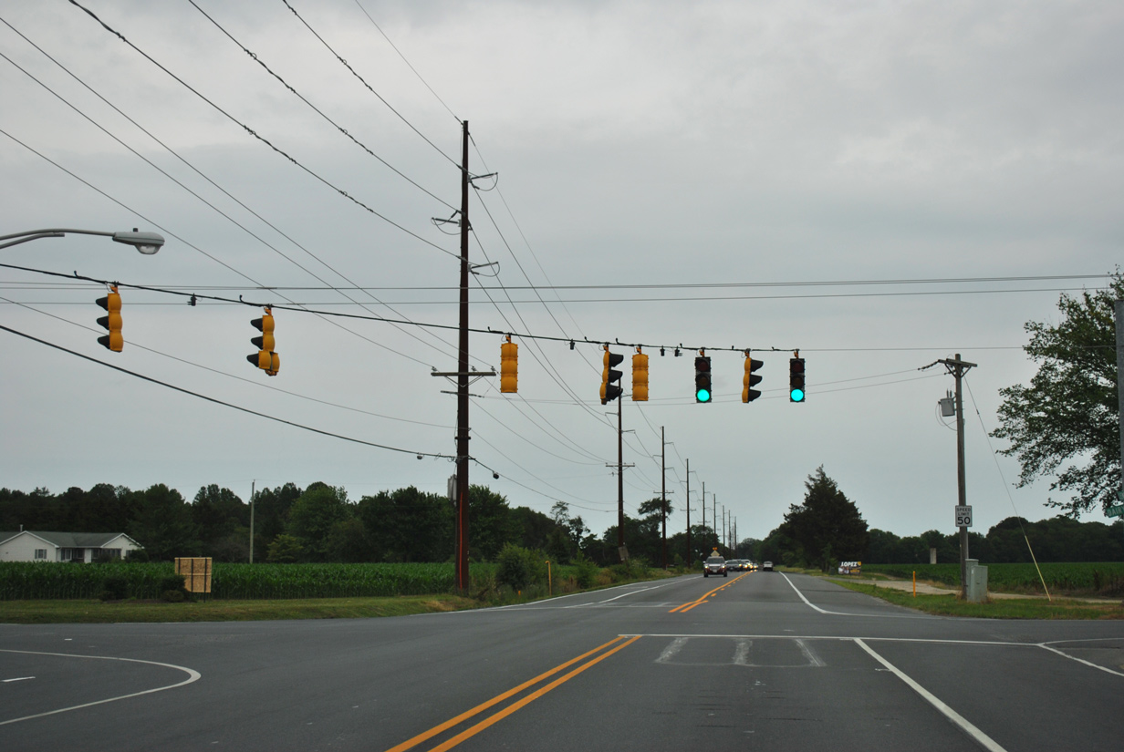
| Entering the Five Points area, U.S. 9/SR 404 intersect both SR 1 (Coastal Highway) and U.S. 9 Business (Savannah Road). 06/18/12 |
|
| Belltown Road links U.S. 9/SR 404 with adjacent SR 1D while doubling as the north end of SR 23. SR 1D follows Plantation Road southeast to SR 24 and Midway while SR 23 runs south 14.76 miles to Masseys Landing. 06/18/12 |
|
| Left turns at the forthcoming intersection with SR 1 are prohibited. Motorists bound for SR 1 north instead should continue across Coastal Highway to a jughandle to make the connection. U.S. 9 south otherwise combines with SR 1 for a 1.1 mile overlap to Kings Highway. 06/18/12 |
|
| An end shield for SR 404 concludes the nearly 60 mile course of the multi-state route from Wye Mills to Five Points. 06/18/12 |
|
| U.S. 9 Business stems northeast from U.S. 9 and SR 1 at Five Points along Savannah Road into Lewes. 06/18/12 |
|
| U.S. 9 expands to four lanes along Cape Henlopen Drive as the route approaches the Cape May Lewes Ferry. 06/18/12 |
|
| Historical look at the original sign bridge for the Cape May Lewes Ferry on U.S. 9 east. Similar structures were found at one time along U.S. 13 (Dupont Highway) in New Castle County as well. April 2000 |
|
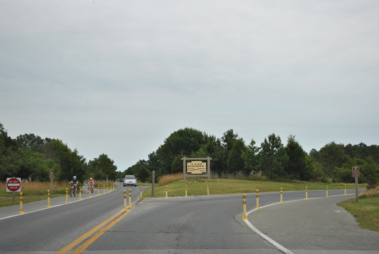
| Cape Henlopen Drive extends east from the ferry access road to Cape Henlopen State Park. 06/18/12 |
|
| Motorists headed to Cape May, New Jersey turn left from Cape Henlopen Drive to the fee booths for the ferry. 06/18/12 |
|
| Entering the Lewes Terminal of U.S. 9 for the ferry. 06/18/12 |
|
| A second left turn connects Cape Henlopen Drive with the foot passenger parking area for the ferry. 06/18/12 |
|
| Cape Henlopen Drive reaches the state park entrance 0.8 miles east of the U.S. 9 turn to the ferry. 06/18/12 |
Page Updated 02-06-2017.

 East
East


 East
East