|
| U.S. 40 (Orleans Street) west at Forest Street in Baltimore. Forest Street connects Orleans Street with what the site of Old Town Mall. 06/27/10 |
|
| Ensor Street curves northeast from U.S. 40 ahead of the Orleans Street Viaduct to Harford Avenue. Colvin Street angles southeast from the intersection to Fayette Street as well. 06/27/10 |
|
| Completed in 1936, the Orleans Street Viaduct passes over Hillen Street, Interstate 83 (Jones Falls Expressway) and MD 2 north (Calvert Street). 06/27/10 |
|
| U.S. 40 ascends onto the six lane Orleans Street Viaduct west from Ensor Street to St. Paul Place (MD 2 southbound). 06/27/10 |
|
| The Orleans Street Viaduct leads directly into Downtown Baltimore from Washington Hill and Johns Hopkins Hospital to the east. 06/27/10 |
|
| Shifting west onto Franklin Street from St. Paul Place, U.S. 40 next intersects Charles Street south of the Washington Monument. 06/27/10 |
|
| U.S. 40 partitions into a one way couplet of Franklin Street west and Mulberry Street east beyond the Orleans Street Viaduct. U.S. 40 next intersects St. Paul Place (MD 2) southbound. MD 2 stems south from U.S. 1 (North Avenue) along St. Paul Street onto Light Street to the Inner Harbor. 06/27/10 |
|
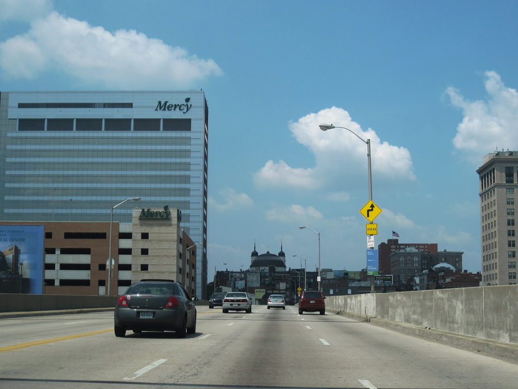
| Forthcoming Cathedral Street flows south from Martin Luther King, Jr. Boulevard and Mount Vernon to cross U.S. 40 two blocks north of Liberty Street at Charles Plaza. 06/27/10 |
|
| Park Avenue heads north from Royal Farms Arena at Baltimore Street to Mount Vernon and The University of Baltimore. 06/27/10 |
|
| U.S. 40 (Franklin Street) westbound at Howard Street and a Baltimore Transit Company street car line. 06/27/10 |
|
| U.S. 40 reassurance marker at Franklin and Eutaw Streets. The Baltimore Metro subway line travels underneath Eutaw Street from Baltimore Street north to Lanvale Street. 06/27/10 |
|
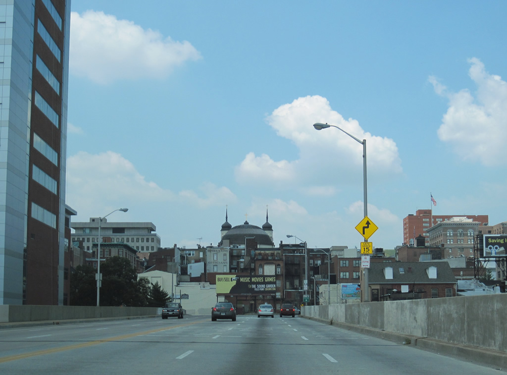
| Unsigned MD 295 north concludes at U.S. 40 (Franklin Street) along Paca Street. Paca Street north to McCulloh Street is part of unsigned MD 129 Segment B 0.27 miles to MD 129 northbound. 06/27/10 |
|
| MD 295 commences southbound along Greene Street from U.S. 40 (Franklin Street) west just ahead of the former Interstate 170. MD 295 follows Greene Street southward to the University of Maryland at Baltimore and onto Russell Street by Oriole Park at Camden Yards. 06/27/10 |
|
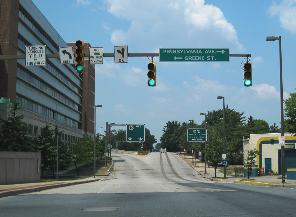
| Pennsylvania Avenue angles northwest from U.S. 40 (Franklin Street) at Greene Street to Upton. MD 295 south travels to M&T Bank Stadium at Martin Luther King, Jr. Boulevard and I-395 along Russell Street. MD 295 ultimately becomes Baltimore-Washington Parkway south from I-95. 06/27/10 |
|
| U.S. 40 shifts onto a freeway originally built for I-170 from west of Greene Street 1.34 miles to Pulaski Street. Franklin Street parallels the below grade freeway west from Martin Luther King, Jr. Boulevard. The button copy overhead here once referenced Interstate 170. 06/27/10 |
|
| A two lane ramp takes U.S. 40 west above Martin Luther King, Jr. Boulevard onto the freeway built for Interstate 170. 08/27/05 |
|
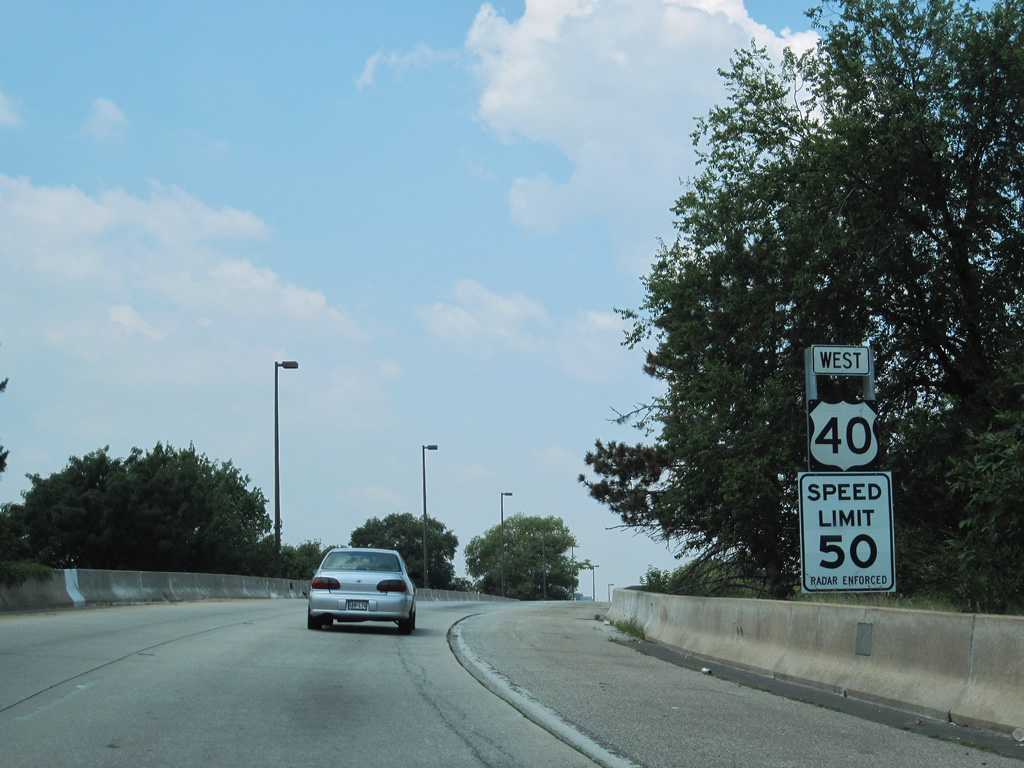
| The speed limit along the Franklin-Mulberry Expressway is 50 miles per hour. A reassurance marker for U.S. 40 stands ahead of the Martin Luther King, Jr. Boulevard under crossing 06/27/10 |
|
| A wide expanse of grass separates the two roadways along the Franklin-Muberry Expressway between Greene Street and Fremont Avenue. 06/27/10 |
|
| Traffic from Martin Luther King, Jr. Boulevard west to U.S. 40 utilizes Franklin Street to this freeway entrance ramp. 06/20/12 |
|
| U.S. 40 travels below grade west from Schroeder Street. Arlington Avenue is the second in a series of overpasses spanning the freeways. Pedestrian bridges link streets that were severed due to the construction of I-170, such as the one at forthcoming Carrollton Avenue. 06/27/10 |
|
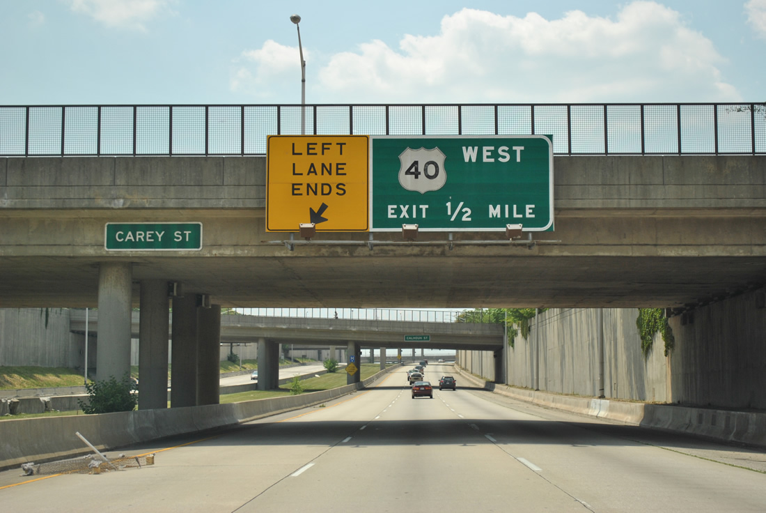
| A guide sign for what was to be the first exit connecting I-170 west with U.S. 40 appears at the Carey Street over crossing. U.S. 40 shifts off the Franklin-Mulberry Expressway in a half mile. 06/20/12 |
|
| U.S. 40 west at the Stricker Street pedestrian bridge. The grass median along the Franklin-Mulberry Expressway was reserved for an unconstructed line of the Baltimore Metro subway system. 06/20/12 |
|
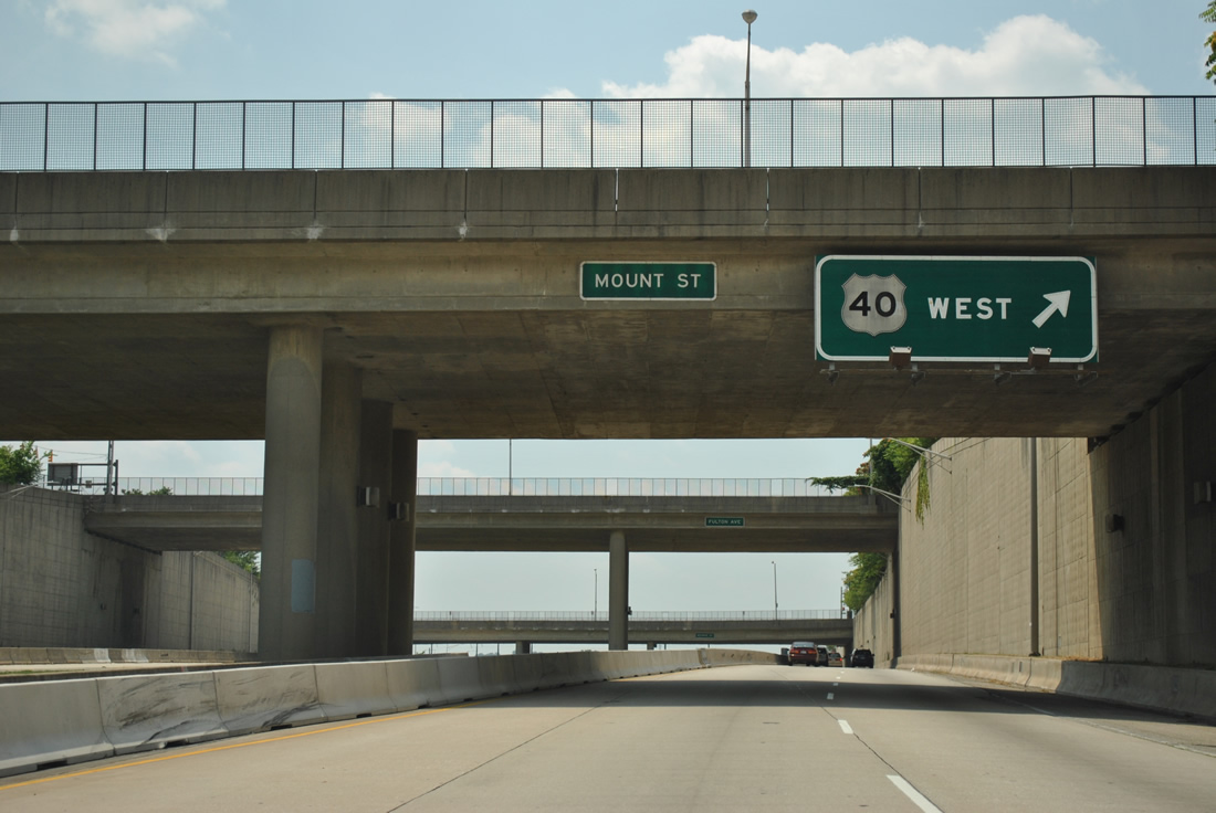
| U.S. 40 exits from the Franklin-Mulberry Expressway west ahead of overpasses for U.S. 1 (Monroe Street / Fulton Avenue). The remainder of the unused roadway for I-170 west of Mount Street was demolished. 06/20/12 |
|
| U.S. 40 returns to Franklin Street two blocks west of Fulton Avenue (U.S. 1 northbound). The original plans for Interstate 170 took the freeway southwest from the couplet of Franklin/Mulberry Streets to I-70 at Gwynns Falls. 06/27/10 |
|
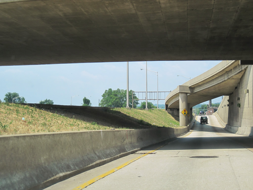
| Franklin Street (former U.S. 40 west) west intersects U.S. 1 (Monroe Street) south above the end of the Franklin-Mulberry Expressway. A button copy overhead for an unbuilt entrance ramp for Interstate 170 west remains. 01/02/01 |
|
| The flyover originally built to connect U.S. 1 with I-170 west was demolished by Summer 2011. The concrete roadway stubs between Franklin and Mulberry Street were also removed. 06/27/10, 06/20/12 |
|
| U.S. 40 west returns to Franklin Street at Payson Street, which was reconnected north from Mulberry Street with the removal of the unused roadway for I-170 by 2011. 06/27/10 |
|
| Franklin Street merges with the west end of the Franklin-Mulberry Expressway between Payson Street and Pulaski Street by the parking lots for the West Baltimore MARC Station. U.S. 40 continues west to Gwynns Falls Park south of Rosemont. 06/20/12 |
|
| The couplet along Franklin Street west and Mulberry Street east concludes at Wheeler Avenue. U.S. 40 advances west along a six lane boulevard from Warwick Avenue here to Edmondson Avenue. 10/13/04 |
|
| U.S. 40 shifts northward from Franklin Street onto Edmondson Avenue ahead of Gwynn Falls. This bridge was replaced during construction from 2017 to 2019 with a wider span accommodate six lanes, full shoulders and sidewalks in both directions. 10/13/04 |
|
| The button copy overhead at the cloverleaf interchange with Hilton Parkway was removed during work replacing the bridge over Gwynn Falls. Part of U.S. 1/40 Truck, Hilton Parkway weaves northward through Gwynns Falls Park to North Avenue at the Walbrook neighborhood. 10/13/04 |
|
| A sharp loop ramp links U.S. 40 (Edmondson Avenue) west with Hilton Parkway (U.S. 1 Truck) south. U.S. 1 Truck extends south onto Hilton Street and Caton Avenue to U.S. 1/1 ALT by the Saint Agnes neighborhood. 10/13/04 |
|
| Replaced with a no stopping sign by 2007, a reassurance marker for U.S. 40 west formerly appeared two blocks beyond Hilton Street at Edgewood Street and the Edmondson community. 10/13/04 |
|
| U.S. 40 (Edmondson Avenue) passes by Rognel Heights and intersects Nottingham Road near the Hunting Ridge and Ten Hills neighborhoods. 07/02/10 |
|
| Cooks Lane angles 0.68 miles northwest from U.S. 40 (Edmondson Avenue) at Old Orchard Road to the Baltimore County line at Hunting Ridge. Becoming MD 122, Cooks Lane ties into a parclo interchange joining MD 570 (old I-70) with Security Boulevard. U.S. 40 advances to the Baltimore city line and Westview Park beyond Cooks Lane. 07/02/10 |
Page Updated 11-04-2022.

 West
West


 West
West