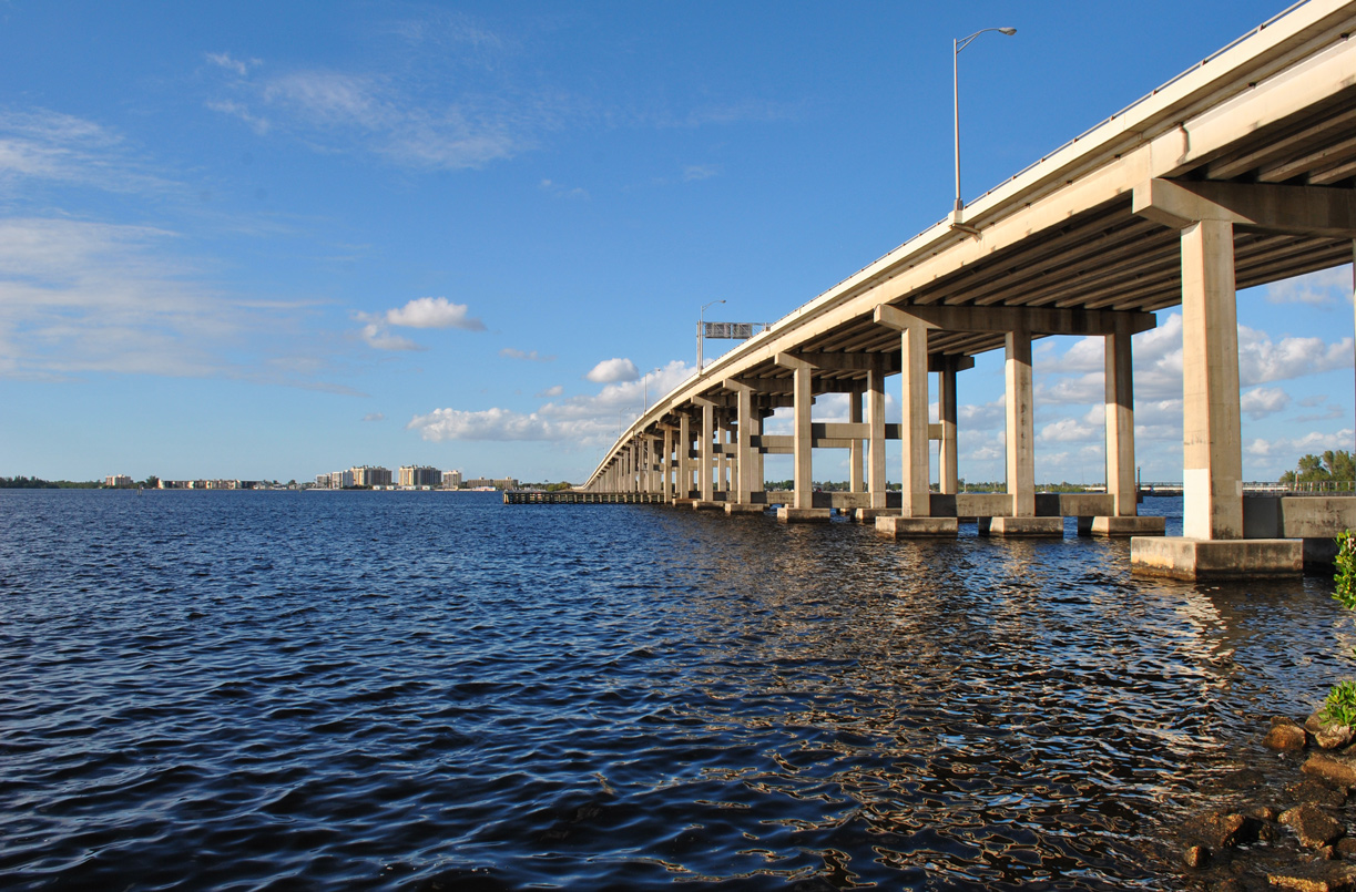
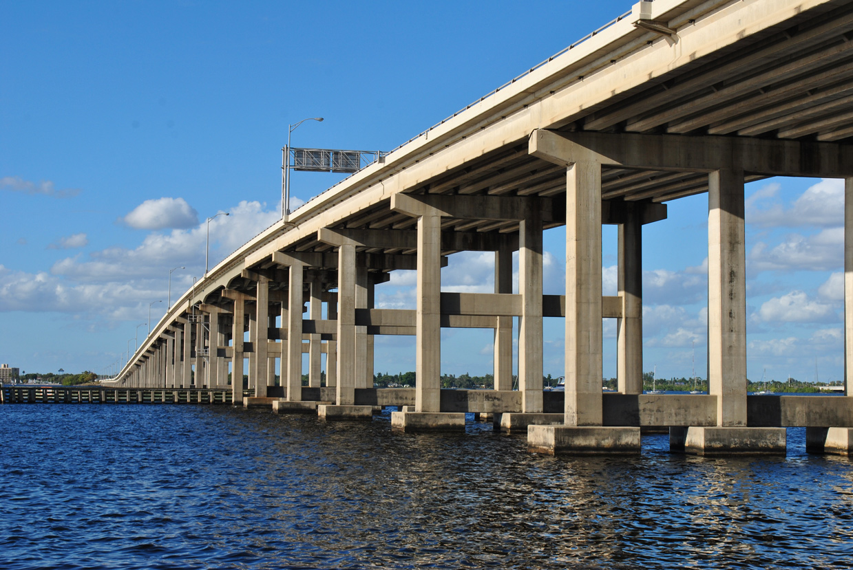
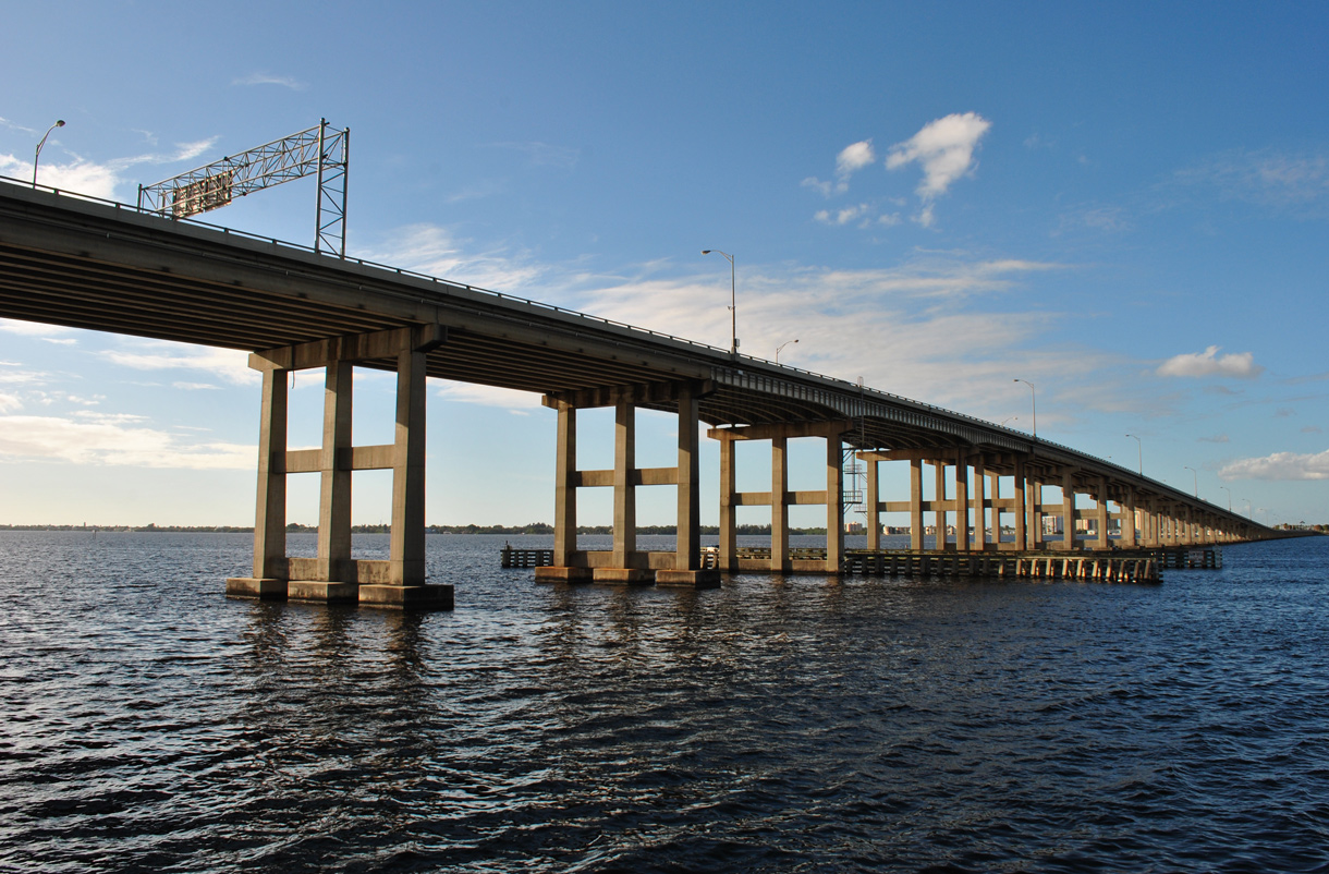
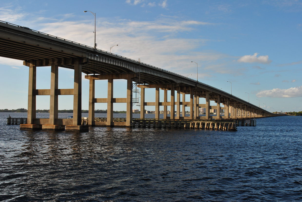
The Calooshatchee Bridge extends north from Downtown Fort Myers to North Fort Myers. 12/21/11
Traveling 479 miles in Florida, U.S. 41 originates in Miami and exits the state north of Jennings. The bulk of the route was replaced by Interstate 75 as a through route, which originally represented one of the main routes from Florida to Chicago and the Great Lakes. The 2,000 mile long route accompanies I-75 northward from Naples to Tampa before breaking away somewhat through Brooksville, Iverness and Williston. The route closely parallels I-75 northward again from Lake City to Forsyth, Georgia.
Known as Tamiami Trail from Miami to Tampa, U.S. 41 offers a slow go, traveling mostly as a four or six lane arterial between Naples and Downtown, Tampa. The route east from Naples, which replaced the U.S. 94 designation to Miami, travels a rural path through Collier-Seminole State Park, Big Cypress National Preserve and Everglades National Park, mostly as a two lane highway. East of the Everglades, U.S. 41 enters the Miami metropolitan area again as a slow moving arterial to its terminus near Downtown.
Historically, in addition to the replacing of U.S. 94 in 1950, U.S. 41 ended at Miami Beach. That alignment included an overlap with U.S. 1 north to MacArthur Causeway (State Road A1A) east.
U.S. 41 Florida Guides
U.S. 41 Business Routes
State Roads of U.S. 41
- State Road 90
SR 90 west from Brickell Avenue (former U.S. 1) to SR 45 in Naples
- State Road 45
SR 45 carries U.S. 41 north from Naples to SR 684 and U.S. 41 Business south of Bradenton, and again north from Palmetto.
- State Road 684
SR 45 follows U.S. 41 Business through Bradenton and Palmetto while SR 684 takes the U.S. 41 mainline to the east, where SR 55 takes over on the northward swing.
- State Road 55
SR 55 continues the U.S. 41 mainline north through both Bradenton and Palmetto before departing as the companion of U.S. 19 northward as SR 45 rejoins U.S. 41 from the business loop.
- State Road 599
Where SR 45 turns west along the Tampa Business Loop for U.S. 41, SR 599 takes over for U.S. 41 north to both U.S. 92 and SR 600.
- State Road 600
The overlap with U.S. 92 is handled by SR 600, SR 45 again joins U.S. 41 north from the split with U.S. 92.
- State Road 700
SR 700 briefly overlaps with U.S. 41 and SR 45 through Brooksville alongside U.S. 98.
- State Road 500
The overlap with U.S. 27 through Williston briefly sees U.S. 41 overlayed with SR 500.
- State Road 25
SR 45 ends at the merge of U.S. 41 with 441. SR 25 takes over for U.S. 41 northward from High Springs to the Georgia state line.
- State Road 100
SR 100 joins U.S. 41 and SR 25 northwest from Lake City to Jasper to make its connection with U.S. 129 north.
- State Road 51
SR 51 overlays both SR 25 and 100 into Jasper to end opposite SR 6.
- State Road 6
SR 6 shares a brief overlap with SR 25 and 100 from SR 51 in Jasper to its independent alignment west to Madison.
The majority of U.S. 41 through both Southwest Florida and the Tampa Bay Region consists of either a four to six lane arterial or divided highway. Through Pasco COunty, a $11.2 million project widened the US highway from two to six lanes between Bell Lake Road and Barcelona Road, and north from there to Tower Road from two to four lanes. Work here wrapped up in December 2002.1 Subsequent work from August 2009 to Spring 2011 lengthened the four-lane section of U.S. 41 from Tower Road to Connerton Road and added a 12 foot wide multi-use path along the east side of the divided highway.2
|
| Wiggins Pass Road west at U.S. 41 (Tamiami Trail) and Collier County Road 888 between Naples Park and Bonita Springs. 11/26/16 |
|
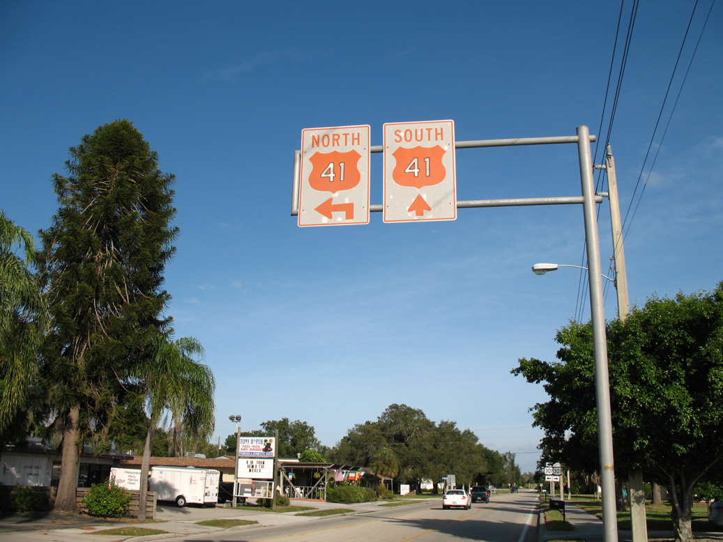
| Installed in September 1982, this overhead assembly preceded the 7th Street W intersection with U.S. 41/301 (Tamiami Trail) in the city of Palmetto. 10/28/06, 06/08/09 |
|
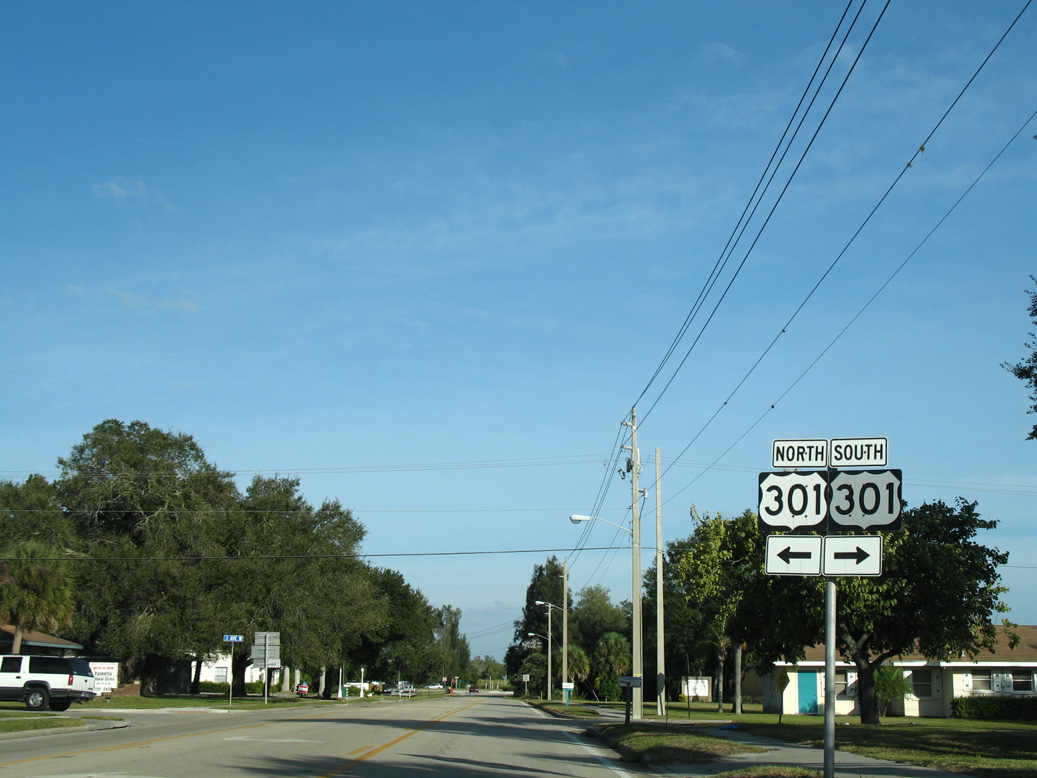
| U.S. 301 shields posted at 7th Street W and 3rd Avenue W in Palmetto. The intersection at U.S. 41/301 ahead utilizes J-turns, with no access to northbound from 7th Street W east. 10/28/06 |
|
| Gibsonton Drive heads 2.1 miles west from Interstate 75 and links the freeway with U.S. 41 and the Hillsborough County community of Gibsonton. 03/02/14 |
|
| Columbus Drive shifts southward through the split diamond interchange with I-4 to meet U.S. 41 a tenth of a mile from its original intersection with 50th Street. An I-4 directs motorists northward. 07/10/11 |
|
| U.S. 41 heads south from Columbus Drive to Palm River and north beyond I-4 to Melbourne Boulevard through Highland Pines in Tampa. Columbus Drive curves northeast back through industrial areas ahead of Broadway Avenue (CR 574) and Orient Park. 07/10/11 |
|
| Wilson Boulevard bisects the Masaryktown street grid to intersect U.S. 41 (Broad Street). The boulevard formerly carried County Road 578 east from Broad Street across both a CSX Railroad line and Masaryktown Canal to Benes Road, which turned CR 578 north to Benes Roush Road east. 02/17/14 |
|
| U.S. 41 between Marco Island and Miami passes through some of the most pristine wilderness through the Big Cypress National Preserve, Fakahatchee Strand State Preserve, and Everglades National Park. This series of photos profiles the Fakahatchee Strand as seen from the U.S. 41 parking area. 12/31/04 |
|
| Fakahatchee State Preserve has no entry fees, and it features a wooden boardwalk hike into the swamp. Winner of a gold medal award, the state preserve is a favorite stopping point for travelers crossing U.S. 41 en route to the Big Cypress and Everglades parks. 12/31/04 |
|
| Wildlife is quite common through the Fakahatchee Strand, including a multitude of birds, plants, and animals. The endangered Florida panther and the ever-present alligator may also be found throughout the swamp, including within the preserve. This sign warns hikers to be wary of alligators, as they can be dangerous and unpredictable. 12/31/04 |
|
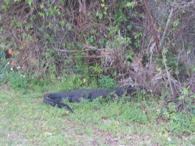
| Sure enough, a very large, live alligator was lounging on the bank of the swamp just beyond the alligator warning sign. 12/31/04 |
|
| A wooden boardwalk enters the swamp from the entry point, allowing walkers to stay above the water line. 12/31/04 |
|
| These swampy scenes show the Fakahatchee Strand, where a variety of plant and animal life abounds. Smaller alligators lounge on some of the larger pieces of wood and logs resting on top of the water. 12/31/04 |
|
| Between Collier-Seminole State Park and Fakahatchee Strand, sections of old U.S. 41/Tamiami Trail (former U.S. 94) may be found. This particular stretch includes one old bridge and an extant two lane segment that can be used for viewing wildlife from the banks of the swamp, including alligators. Note the year in which the bridge was constructed: 1952. 12/31/03 |
|
| Between SR 29 and just east of the Collier-Miami-Dade County Line, U.S. 41 travels through the Big Cypress National Preserve. Between Naples and SR 29, U.S. 41 travels northwest to southeast. After SR 29, U.S. 41 is mostly east-west, and signs show U.S. 41 as east-west through Miami-Dade County. A visitors center for the preserve is located on the north side of U.S. 41 near Ochopee (home to the nation's smallest post office). At this center, alligators wait in the lake adjacent to the visitor parking lot. 12/28/03 |
Sources:
- District Seven Construction - Pasco County.
http://www.dot.state.fl.us:80/ publicinformationoffice/construc/ district7pio/counties/pasco.htm FDOT web page. November 19, 2003.
- Pasco County Construction - August 4, 2010.
http://www.dot.state.fl.us/ publicinformationoffice/construc/ district7pio/pasco.shtm FDOT District 7 web page.
- 12/28/03 by AARoads.
- 12/31/03 by AARoads.
- 12/31/04 by AARoads.
- 10/28/06 by AARoads and Justin Cozart.
- 06/08/09 by AARoads.
- 07/10/11 by AARoads.
- 02/17/14 by AARoads.
- 03/02/14 by AARoads.
- 11/26/16 by AARoads.
Connect with:
Interstate 4
Interstate 10
Interstate 75
Interstate 95
U.S. 27
U.S. 90
U.S. 92
U.S. 98
U.S. 301
U.S. 441
State Road 50
Page Updated 04-09-2024.


 scenes